
ecosystem structure
Type of resources
Available actions
Topics
Keywords
Contact for the resource
Provided by
Years
Formats
Representation types
-
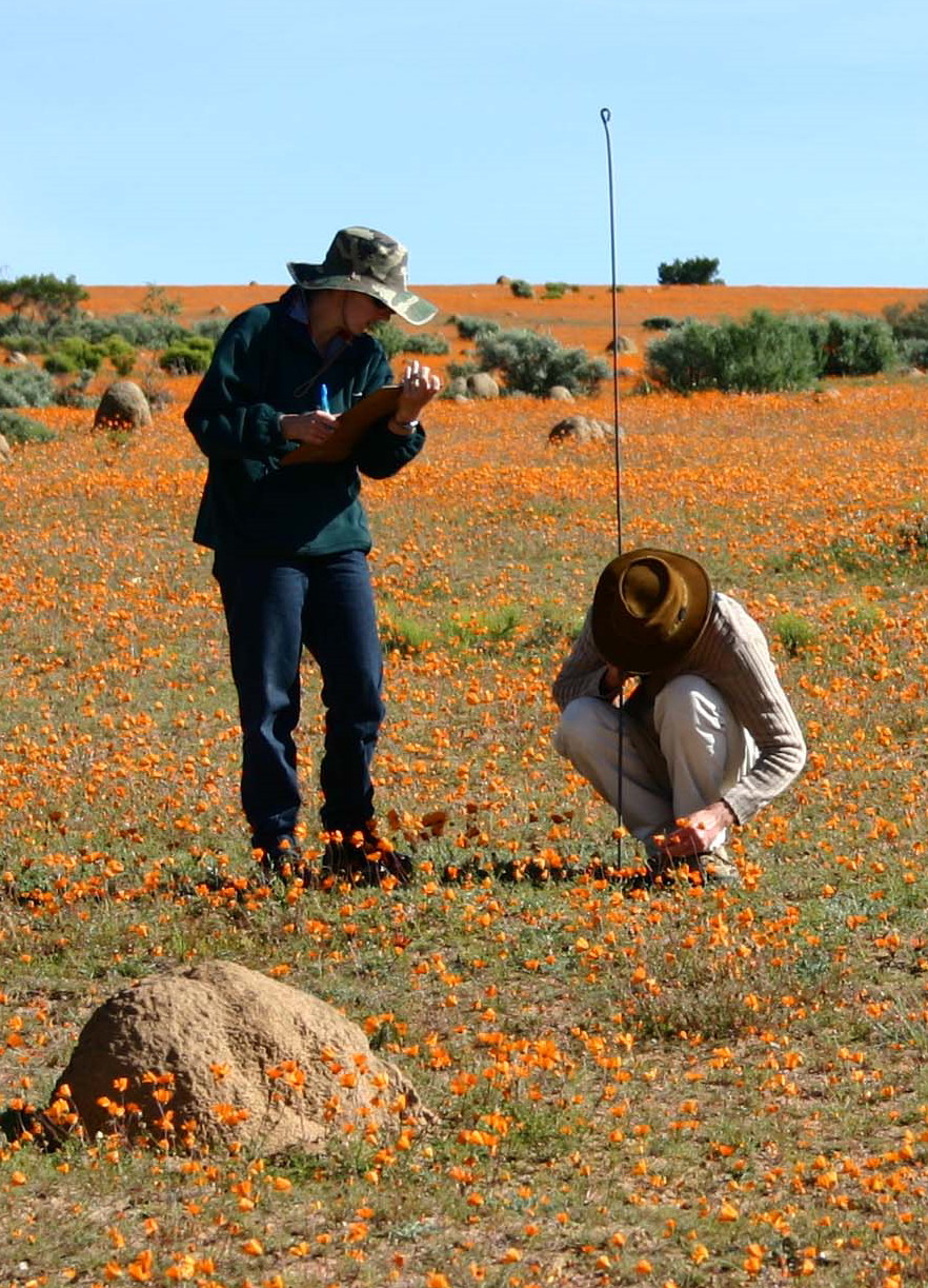
Namaqua National Park is situated in the Succulent Karoo Biome. The Skilpad Wildflower Reserve section of the Park is managed for mass flower displays while the remainder of the Park is managed as a conservation area.
-

Awajisima (Awaji Island) is located at eastern end of the Seto Inland Sea, facing Osaka Bay. Seto Inland Sea is located in the western part of Japan and is the largest enclosed coastal sea in Japan.
-
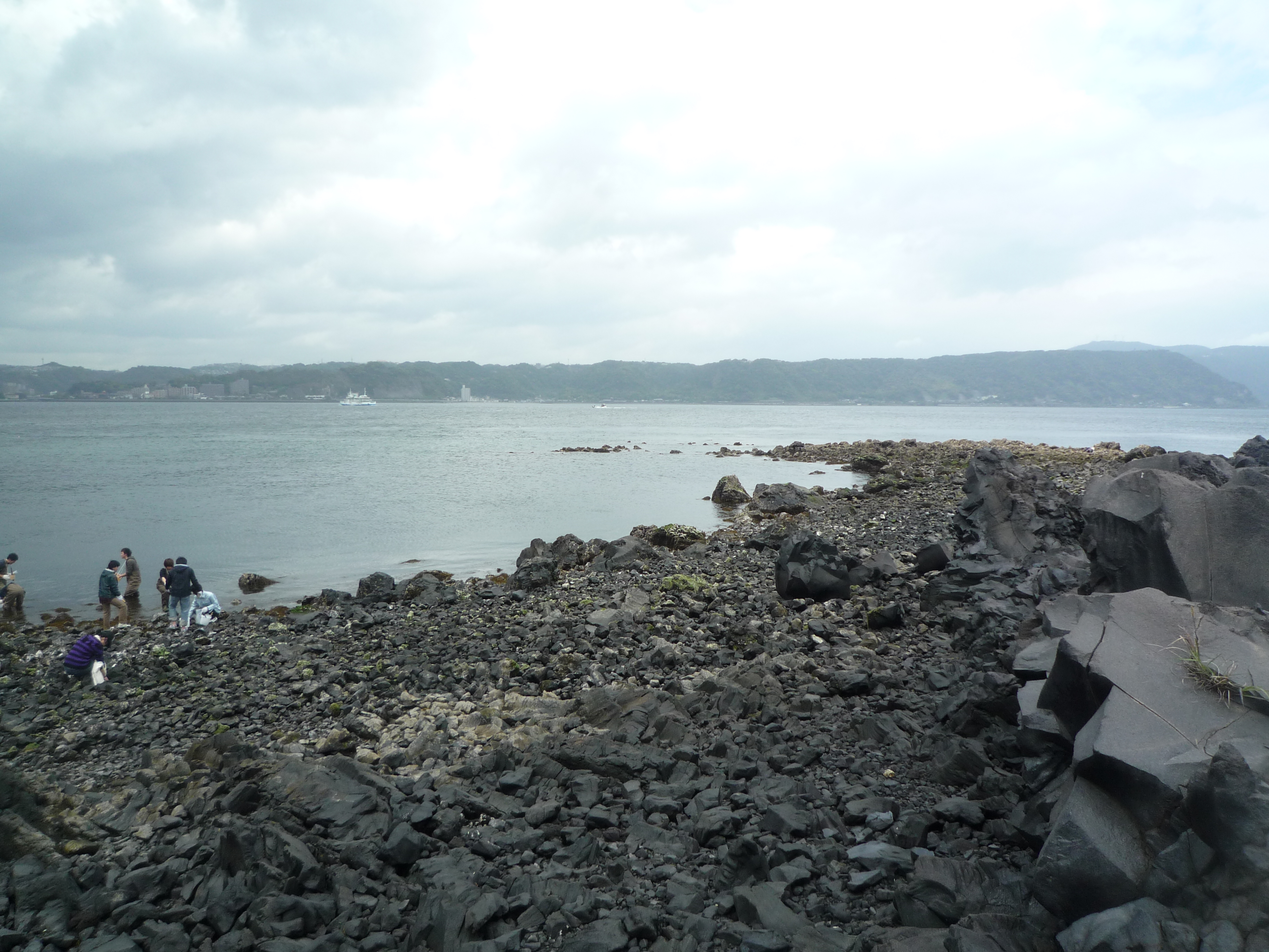
Kagoshima Bay is located at the south end of Kyushu Island. It is almost 80Km long (north and south), 20Km wide (east and west), and 1,130km2 in area. It is 117m depth on average and 237m depth at its deepest. Since it is only 100m depth at the mouth of the bay, Kagoshima Bay is considered a closed inner bay. A branch of the Kuroshio Current flows in to the bay and provides the right environment for corals, then we can find coral communities on the southern coast of Sakurajima Island. Seaweed beds composed by Sargassum algae are distributed in shallow areas and some pods of dolphin stay in the bay. We can also find benthic animals including some commercial species in the deep area and the shallowest species of vestimentifera (Lamellibrachia satsuma), a host of chemosynthetic bacterial symbionts. Thus, Kagoshima Bay has a variety of habitats and very unique environmental conditions.
-
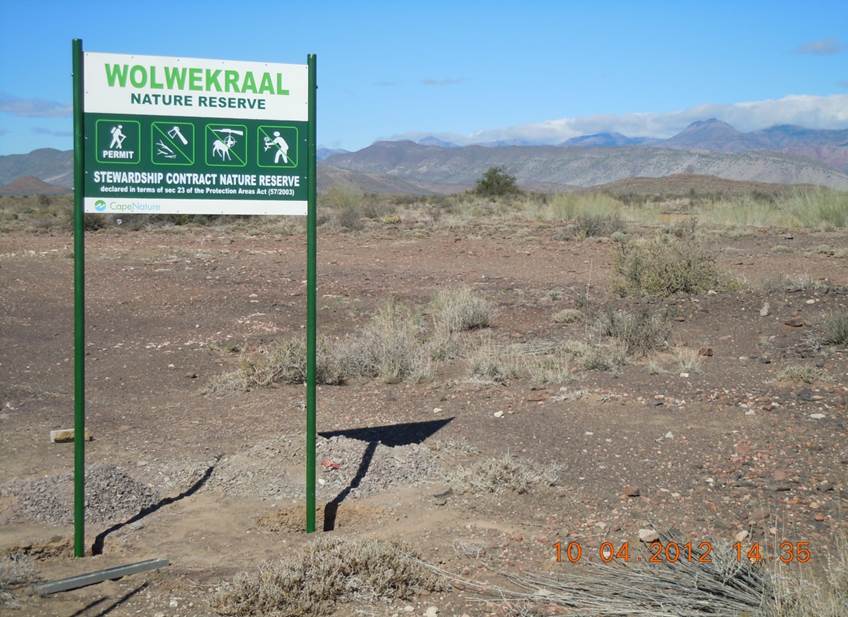
The field site comprises 123 ha of natural Karoo shrubland. The Dorpsrivier passes through the nature reserve. Habitats include exposed Ecca mudstone plains, a north-facing ridge, pockets of aolian sand, and quatzite pebble bed conglomerate along the levees of the Dorpsrivier. The field site has been fenced to exclude domestic livestock since the 1970s.
-
In spite of the fact that the area of Sagami Bay occupies only 0.05% of the total area of Japanese waters, the total species richness is 16.5% of the total Japanese species richness. This suggests high species richness due to the array of habitats present in Sagami Bay. The high species diversity of Sagami Bay has been recognized previously, and one of the proposed reasons for this degree of diversity is the influence of cold-water masses derived from the Oyashio Current, as well as tropical or subtropical water masses derived from the Kuroshio Current. Sagami Bay’s high reported diversity probably contains bias, because marine biologists have historically paid more attention to Sagami Bay.
-
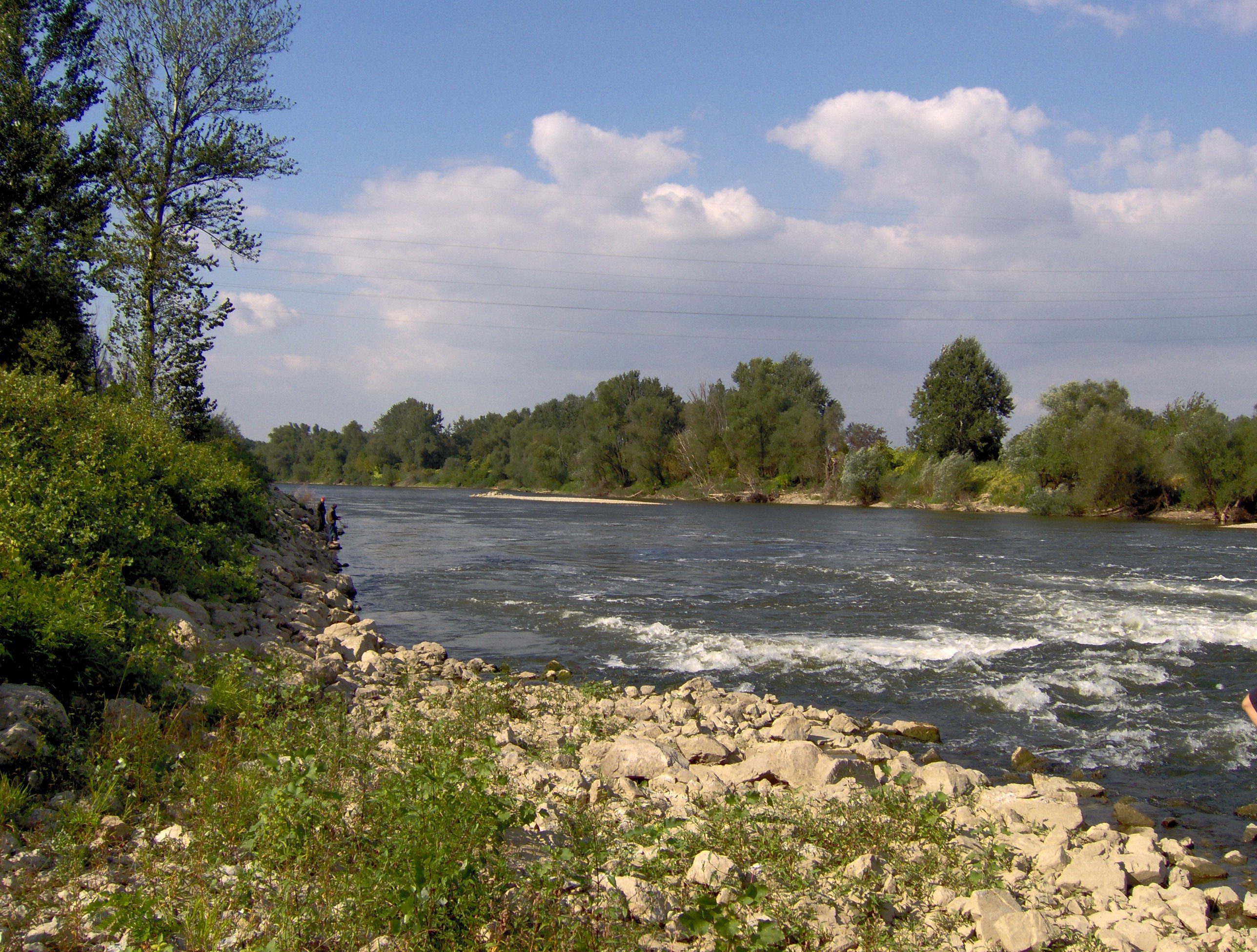
Velika Morava is 175 km long river originating from Western and Southern Morava Rivers. The whole catchment area (including Western and Southern Morava) is about 38.000 km², while the basin area of Velika Morava is 6.760 km². The mean annual flow is 245 m³ s-1 (gauge station Ljubicevo, near to the mouth of the Danube - Annual Water Quality Reports 1999-2008). Based on the size of catchments area and its flow, Velika Morava is one of the major tributaries of the Danube. Over 95% of the basin is located at the territory of the Republic Serbia. The water regime is unimodal, characterized by the prominent seasonal fluctuations. In the spring the river can be almost torrential (the mean flow near to the mouth 560 m³/s), while in the rest of the year there is a "low water" period, particularly in the autumn, when mean flow does not exceed 100 m³/s. The riverbed is 80-200 m wide, and up to 10 m deep, although average depth usually does not exceed 2 m. The silicates are the dominant geological substrate in entire catchment area. According to the main geographical features the river could be divided into two main parts. The lower one, from confluence with Dunav to the Resava River mouth (near Svilajnac), is 85 km long typical lowland watercourse (altitude lower the 100 m), with 0.35 ‰ declination, and with sand and mud/silt as dominant fractions of the riverbed. This part of the Velika Morava River belongs to Ecoregion 11 (ER11_Ser). The upper one, from the Resava river mouth to Stalac (the confluence of Southern and Western Morava Rivers), is 90 km long. The mean altitude is over 100 m a.s.l. (to 135 m), declination is 0.44 ‰ and in the riverbed the dominant part are sand and gravel fractions. Upper part belongs to Ecoregion 5 (ER5_Ser). Velika Morava river basin has four permanent monitoring sites. The area is densely populated and the river is under the influence of various pollution sources (organic, agricultural, industrial), as well as hydromorphological pressures (meander cutting, shortening, channeling, as well as gravel and send extraction).
-
In 1998 a permanent plot (50 x 50 m) was established at the height of 440 m asl in 80 year old spruce stand, where bulk deposition, throughfall and soil solution are collected. The investigations of health status of trees and floral characteristic have been carried out since 2001. The analyses are carried out in a certified laboratory of the Institute for Ecology of Industrial Areas, Katowice (Certificate No AB 325). The basic meteo data are taken from the monitoring station located 1 km from the plot).
-
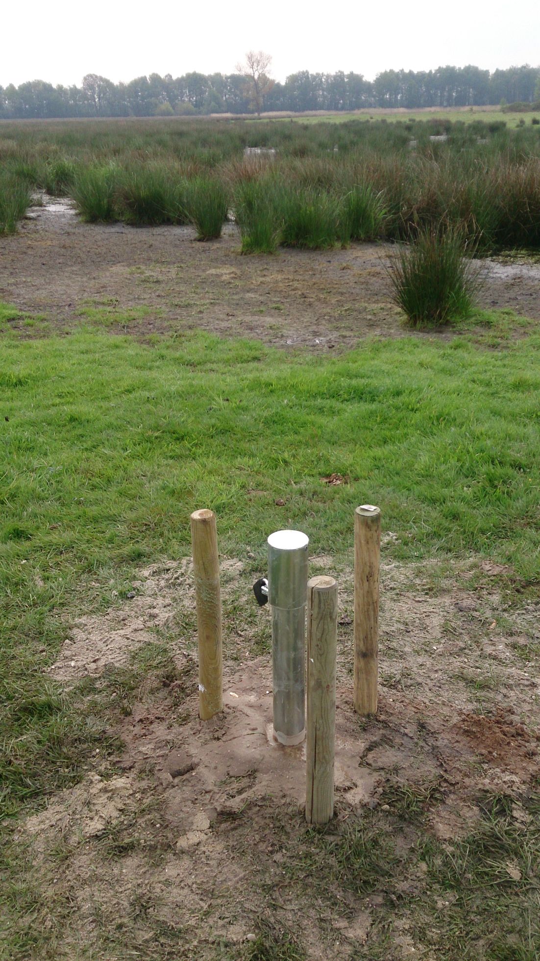
The site comprises 10 km stretch of a stream valley managed as a private nature/state reserve some 17 kilometer North of the city of Hasselt. Since 1995,the restoration projects are carried out aiming at restoring the fen/carr ecosystem. Monitoring of the ground- and surface water dynamics and chemistry, the vegetation evolution is carried out by INBO.
-
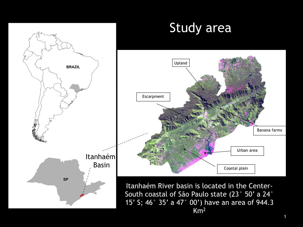
Itanhaém River basin is located in the Center-South coastal of São Paulo State, Brazil(23° 50’ a 24° 15’ S; 46° 35’ a 47° 00’) have an area of 944.3 Km2, and is the larger coastal basin exclusively of the state. Itanhaém River basin has a great diversity of natural characteristics and different land uses that determines the occurrence of rivers and streams with distinct limnological characteristics. Within the PELD-ITA we aim to study different aquatic communities (fish, aquatic macrophytes, macroinvertebrates and perifiton) with concomitant samples and within a georeferenced basin. We already have data about landscape, riparian zone, and limnological variables that allows us to monitor spatial and temporal changes in the land use and relate these changes with biotic and abiotic characteristics of water bodies. The data on fish and aquatic macrophytes distribution clearly show a mouth-headwater gradient in the watershed. Fish communities form four fish zones based in the dominance of families that are determined by the marine influence (salt and brackish water), declivity, barriers and food availability. Aquatic macrophytes also show a longitudinal gradient, with species tolerant to salinity in the lower portion of the watershed (Spartina alterniflora, Crinum procerum) and submersed species close to the headwaters (Egeria densa, Cabomba furcata). The spatial distribution of macrophytes is also related with water temperature, turbidity and nutrient concentrations, and canal characteristics (depth, margin declivity, riparian plant cover). The Itanhaém watershed has rivers with different water types (white, black and clear). Limnological characteristics of these rivers are distinct and black waters have low pH values (4 – 5), whereas white waters have higher turbidity and higher nitrogen and phosphorus concentrations. However, only the perifiton respond to different water types. In the white water, perifiton has higher values of biomass (2.5) than in black waters (1.8 µg.cm-2 chlorophyll a). Macroinvertebrates from headwater streams have characteristic taxa of coastal basins, such as shrimps and freshwater decapods, and characteristic groups of preserved streams with well-oxygenated water and rocky substratum, such as plecopterans and riffle beetles. Regarding the temporal scale, our analyses suggest that taxonomic composition of most groups remain constant throughout the year. It seems the rainy season only reduces species abundance but not species occurrence.
-
In 1998 a permanent plot (50 x 50 m) was established at the height of 505 m asl in 45 year old spruce stand, where in the 45-year-old spruce stand bulk deposition, throughfall and soil solution are collected. The investigations of health status of trees and floral characteristic have been carried out since 2001. The analyses are carried out in a certified laboratory of the Institute for Ecology of Industrial Areas, Katowice (Certificate No AB 325). The basic meteo data are taken from the monitoring station located about 1 kn from the plot.