
electrical conductivity
Type of resources
Available actions
Topics
Keywords
Contact for the resource
Provided by
Years
Formats
Representation types
-
The dataset provides information about the monthly water chemistry of two high-elevation lakes: Bowditch Lake (coordinates: 45°52'30.52"N, 7°52'15.51"E, elevation: 2900 m a.s.l., lake area: 2400 m2) and Cimalegna Lake (coordinates: 45°52'23.17"N, 7°52'37.60"E, elevation: 2800 m a.s.l., lake area: 2700 m2). The Bowditch and Cimalegna lakes are located in the uppermost area and in the middle of the Cimalegna plateau, respectively. The bedrock of both lake catchments is mainly characterised by metamorphic rocks with a predominance of rocks with acid composition, and displaying the secondary presence of basic and terrigenous-carbonatic rocks. Soil (often vegetated) is the main land cover type in the Cimalegna Lake catchment, while coarse sediment constitutes the main land cover type in the Bowditch Lake catchment. Lakes are sampled from 3 points on the shore with no vegetation, at ca. 10-cm depth. The analysed water chemical parameters are: N-NH4 and N-NO3 (period 2007-2020); dissolved organic carbon (DOC), total dissolved nitrogen (TDN), and dissolved organic nitrogen (DON) (period 2011-2020); pH and electrical conductivity (EC) (period 2015-2020).
-
The dataset contains monthly data, volume weighted average values for epilimnion (0-25 m) and hypolimnion (25-360 m), for the period 1988-2018 and 2019-2021 for the following variables: water temperature, pH, conductivity, Ntot, NH4N, NO3N, Ptot, PO4P, cation and anion concentrations
-
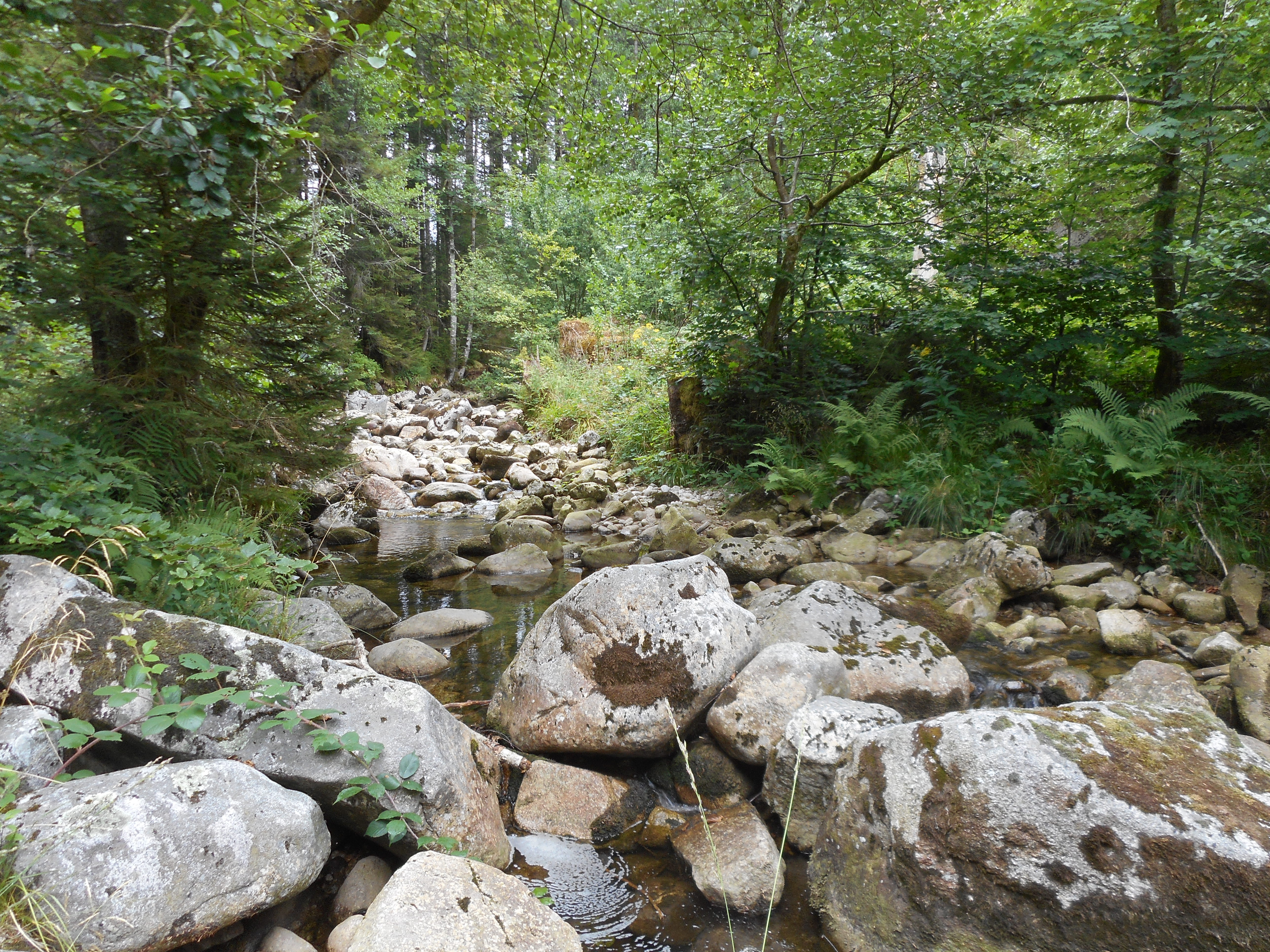
The observatory consists of 16 headstreams (15 in the Moselle River watershed, 1 in the Rhône River watershed), draining forest (mixed coniferous, beech) watersheds on sandstone and granites at very different altitudes.
-
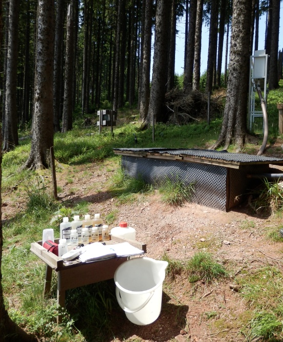
The Jurassic Karst scheme in place since 2009 aims to characterise the long-term evolution of the karst aquifer system of the Jura mountains. The specific topographical context of the Jura mountains allows the study of these aquifers at increasing altitudes along a climatic gradient. The plant cover and soil types vary along this gradient, thereby modulating the biogeochemical functioning of the infiltration zone of the karst hydrosystems. Four karst springs are monitored at sites of increasing altitude: Fourbanne site (Doubs valley, near Baume-les-Dames): altitude 330 m, catchment surface 30 km2; Lods site (upper Loue valley): altitude 380 m, approx. catchment surface 35 km2; Fertans (Amancy plateau): altitude 530 m, approx. catchment surface 1 km2; Mouthe (source of Doubs river): altitude 950 m, approx. catchment surface 50 km2. A number of physico-chemical parameters are monitored continuously on all sites, and supplemented weekly by automatic sampling at Fourbanne, Lods and Fertans. Contact : Marc Steinmann; Chrono-Environment Laboratory – University of Franche-Comté
-
The ENGAGE working group (Geomorphological Systems and Risk Research at the Institute for Geography and Regional Research) has been running a long-term monitoring project to investigate landslides in Lower Austria. Landslides (translational and rotational failures, debris flows, rock avalanches, rock falls, etc.) number among the most abundant natural hazards in Lower Austria. Resulting from sporadic phases of activity it is essential to generate specific long-term measurement series, enabling the analysis of changes in surface movements as well as underground in connection with triggering factors. Therefore, in 2014 the project “NoeSLIDE – Monitoring diverse types of landslides in Lower Austria” was initiated. The research sites are compiled under the parent site "LTER NoeSLIDE" which has three subsites, of which one is the Salcher Landslide Observatory. The Salcher landslide is located in the municipality of Gresten, Scheibbs district, Province of Lower Austria. It is located on an unwooded hillside area that slopes from west to east (at around 435 to 470 m above sea level / slope between 5 ° and max. 20 °) and is enclosed on three sides by anthropogenic features (streets / houses). The processes at the Salcher landslide are to be classified as rotational landslide, with more than one sliding surface being assumed. The currently active area is ~ 4,000 m², the area to be potentially activated is ~ 20,000 m². In addition to traditional methods such as the installation of a weather station, piezometers, inclinometers, TDR (time-domain reflectometry) probes, GNSS (global navigation satellite system), Tachymeters, methods such as continuous terrestrial laser scanning, UAV applications and permanent geoelectric are used.
-
The Strengbach Watershed is a granitic watershed (80ha) located in NE of France, in the Vosges Mountains at altitudes between 880 and 1150 m (omsl) and with highly incised side slopes (mean 15°). This catchment is situated in a remote area lacking human activities except forest management. The forest covers 90% of the area and corresponds about to 80% spruce (mainly Piceas Abies L.) and 20% beech (Fagus Sylvatica). The climate is temperate oceanic mountainous. The site is manage by Ecole et Observatoire des Sciences de la Terres (University of Strasbourg / CNRS-INSU-France).
-
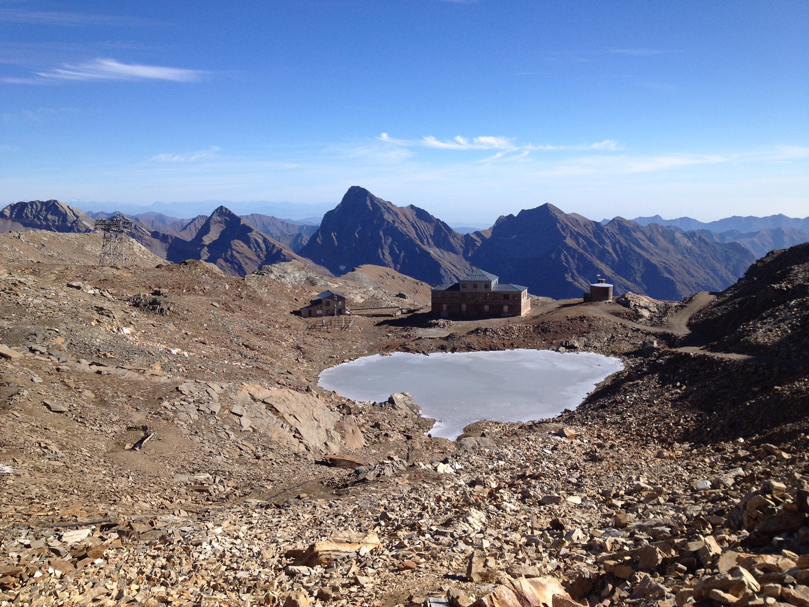
The "Istituto Scientifico Angelo Mosso" research site is located on the watershed between Piedmont and Valle d'Aosta (NW-Italy), in the Municipality of Alagna Valsesia (Monte Rosa massif). The Scientific Laboratories of the "Angelo Mosso Institute" at Col d’Olen (2901 m a.s.l.), the heart of this research site, were built between 1905 and 1907, when it became clear that the Capanna Regina Margherita on Monte Rosa (4554 m a.s.l.), as a high-elevation research centre, had become insufficient to the increasing number of requests for use by the international scientific community. From here the idea promoted by Angelo Mosso (1846-1910), professor of human physiology at the University of Turin, to add an additional structure to the Observatory of the Capanna Regina Margherita for make larger laboratories available to researchers and allow study stays at high elevation. This project soon became a reality thanks to the intervention of Queen Regina Margherita, Ministries of Education and Agriculture, the Italian Alpine Club and various personalities of the time. The research conducted at the Institute did not concern only human physiology, but also other disciplines, including alpine meteorology and glaciology, thanks also to the presence of the Meteorological Observatory that flanked the Institute, directed in the years 1925-40 by Umberto Monterin. It is now home to an automatic snow and weather station, managed by the Alpine Troops-Meteomont service. In addition to the University of Turin, the research groups that operate at the site and contribute to data collection and implementation are currently CNR-IRSA, Alpine Troops Command-Service Meteomont, Monterosa 2000 SpA and Monterosa SpA (Monterosa Ski), Protected areas of Valsesia, ARPA Piemonte, ARPA Valle d'Aosta and Sesia Val Grande Geopark. In addition to the valuable historical series of climate data, a series of research activities are devoted to the study of snow-soil-vegetation interactions, with particular reference to carbon dynamics e soil nitrogen (Magnani et al. 2017a,b; Freppaz et al. 2019). In addition, investigations are performed focusing on the chemical characteristics of high-elevation surface waters, fed by different cryospheric features such as rock glaciers, glaciers, and permafrost (Colombo et al. 2018a,b; 2019a,b; 2020; Vione et al., 2021). New research lines, aimed at investigating the most recent environmental challenges, have been added to the previous ones. For instance, investigations on sources and routes of atmospheric carbon and nitrogen species are ongoing. References: Colombo N. et al. (2018a), https://doi.org/10.1002/esp.4257. Colombo N. et al. (2018b), https://doi.org/10.1016/j.scitotenv.2018.05.098. Colombo N. et al. (2019a), https://doi.org/10.1016/j.scitotenv.2019.06.233. Colombo N. et al. (2019b), https://doi.org/10.1007/s00027-019-0670-z. Colombo N. et al. (2020), https://doi.org/10.1016/j.catena.2020.104700. Freppaz M. et al. (2019), https://doi.org/10.3897/natureconservation.34.30737. Magnani A. et al. (2017a), https://doi.org/10.1657/AAAR0016-037. Magnani A. et al. (2017b), https://doi.org/10.1016/j.catena.2017.03.007. Vione D. et al. (2021), https://doi.org/10.1016/j.scitotenv.2020.143464.
-
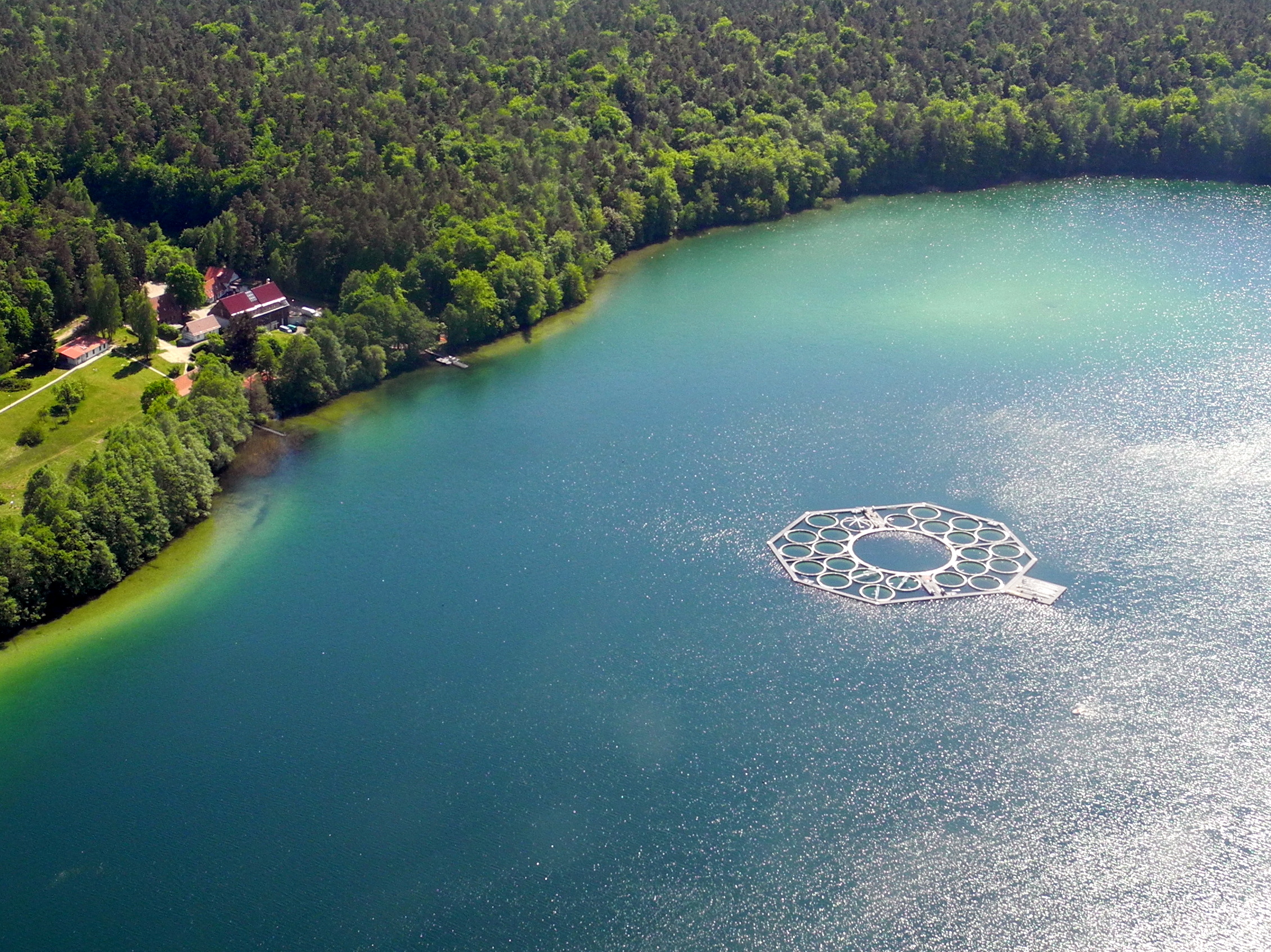
Lake Stechlin is a a deep clear-water lake located in a nature reserve approximately 80 km north of Berlin, Germany (53°10°N, 13°02° E), at 59 m elevation.The lake basin was formed during the last continental glaciation some 12,000 years ago and today is situated at the transition between temperate/maritime and temperate-continental climates.The drainage basin is almost completely covered by forest (95%), with the exception of the area of a former nuclear power plant and a small village, which diverts its wastewater into a different drainage basin. The shoreline of Lake Stechlin is largely undeveloped with no notable infrastructure. The seepage lake is essentially fed by precipitation and groundwater, resulting in a theoretical water retention time of greater than 40 years.
-
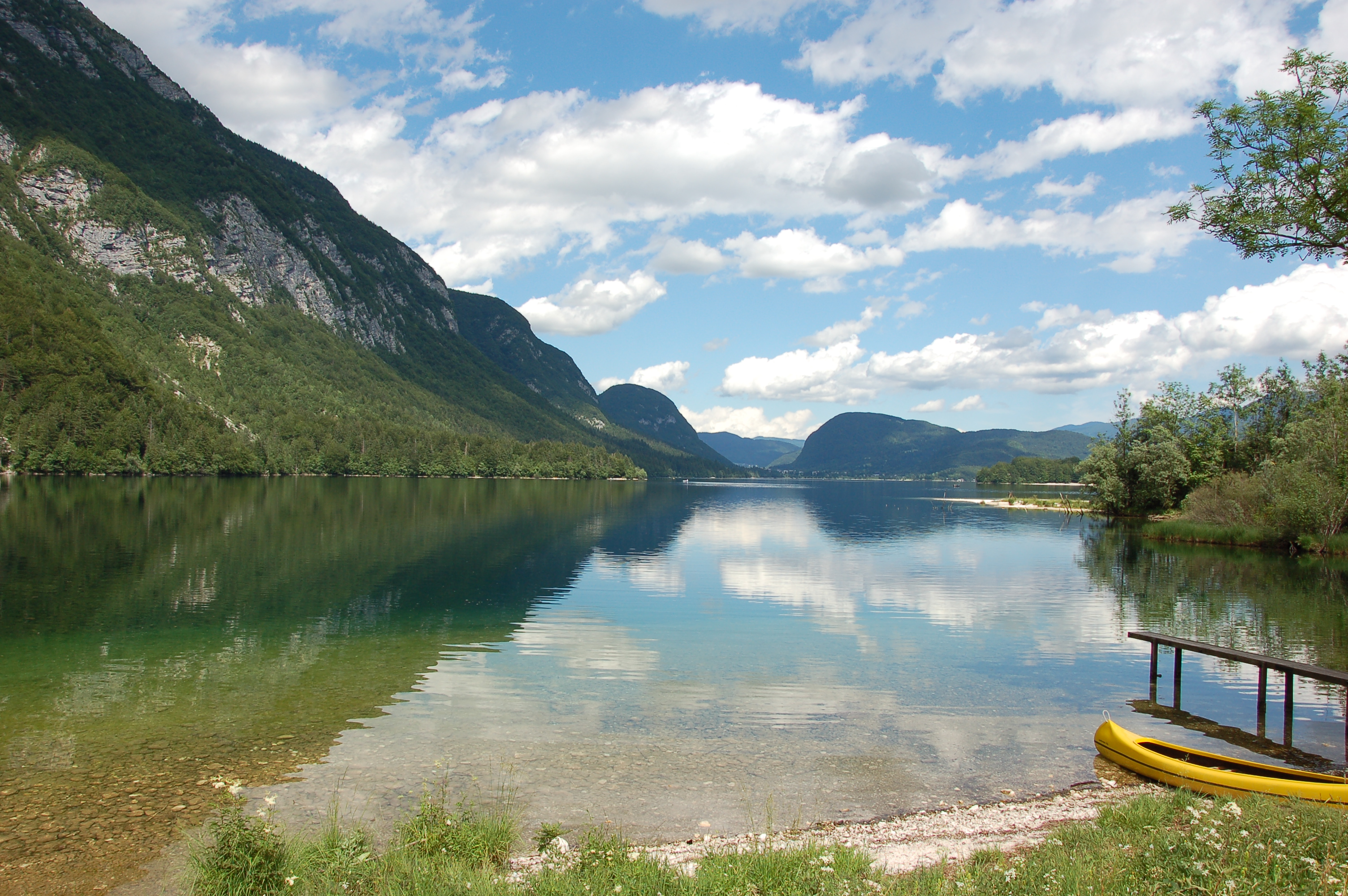
Lake Bohinj is of tectonic-glacial origin and was transformed by the Bohinj glacier. Its surface area is 3.28 km 2 , its volumeWeather conditions and chlorophyll concentrations determine long-term macrophyte community dynamics of Lake...92.5 × 10 6 m 3 and its maximum depth 45 m. It is located at an altitude of 525 m a.s.l. and issurrounded by mountains that are up to 2000 m high. Lake Bohinj is conditioned by the main inflow from River Savica and by several karst springs from the base of Mount Komarča and has a single outflow, River Sava Bohinjka. The residence time of the water in Lake Bohinj is about 4 months, which means that the total volume of the water in Lake Bohinj changes three times a year. The surrounding watershed comprises around 94.3 km2 and is mostly uninhabited, with a large portion extending above the tree line; therefore, the input of nutrients into Lake Bohinj is moderate. This watershed receives about 3300 mm of rainfall a year. Long-term temper-atures show a tendency to a rise. In winter, usually in January, the surface water cools and the lake can be frozen over. From 1961 to 1990, Lake Bohinj was frozen over for a mean of > 50 days/year, while in the decade from 1991 to 2000, the mean number of days with ice cover was reduced to 31 days/year. Since 1990, the lake did not freeze completely in individual years. The majority of the lake catchment area consists of carbon-ate rock, and therefore, the main lake sediment fraction is carbonate, while quartz and feldspar represent a minor part.
-
Hohe Tauern NP was established more than 40 years ago as one of the biggest protected areas in Central Europe to protect at long-term wide areas of the Austrian main-ridge of the Alps. The 1.856 square kilometre Hohe Tauern National Park is split into a 1.213 square kilometre core zone and a 643 square kilometre buffer zone and stretches over three provinces. Until the first and largest national park in Austria was actually created, the three provinces of Carinthia, Salzburg and Tyrol had to establish the corresponding legal framework. The Provincial Parliament of Carinthia passed the legislation to create the Hohe Tauern National Park in 1981. Salzburg followed with its national park legislation in 1984, followed by Tyrol in 1992. In this 40 years Hohe Tauern NP established the Nationalpark idea in its region working together with all stakeholders (land owners, tourism, majors, hunting organisations, governmental departments…). The International Union for the Conservation of Nature IUCN awarded Carinthia in 2001 and Salzburg and Tyrol in 2006 with the international recognition of a national park with its "Category II" listing. The distinction that the national park has with a core zone, where nature can develop without human influence and a buffer zone, where traditional cultivation could be continued was key for gaining this international recognition. Contractual agreements between landowners, hunters and the national park paved the way and were pioneering for many protected areas. Hohe Tauern NP contains 3 main zones: - core zone (km²): 1.078 - buffer zone (km²): 643 - special protected areas (km²): 135 About 845 km² of the area is nature zone, which remains untouched by humans (no land use based on IUCN criteria, i.e. no hunting, no grazing). The altitudinal belts from the valleys to the summits of the three-thousand-metre-tall mountains represent an exceptional biodiversity. This is home to many plants and wildlife species originating from the Central Asian tundra, the Arctic and even Southern Europe. The preservation of all significant Alpine ecosystems across large areas of the Hohe Tauern National Park has been unimpaired. More than one third of all plant species recorded in Austria can be found in the national park. For mammals, birds, reptiles and amphibians, this figure is at around 50%. Even those animals that were nearly extinct in almost all of Europe at the beginning of the 19th century are now provided a safe habitat in the Hohe Tauern National Park. This impressive biodiversity is a result of the different prevailing climatic, geological, geomorphological and hydrological conditions in the high mountains and the differing adaptation strategies of the plants and animals. The Tauern Window – a unique tectonic window in terms of shape and size – provides insight into the deepest tectonic layer of the Alps and is thus key for understanding the geological structure of the Alps. Rocks of differing ages, different origins and different chemical composition harbour a genuine hoard of up to 200 different minerals. Nature protection (ecosystems/Natura2000 habitats) and species conservation projects play a big role in the work and history of Hohe Tauern NP (e.g. bearded vulture, ibex, golden eagle, …). The NP and its work do not stop at the protected areas borders and for a lot of species it is important that the whole region is aware of its impacts on biodiversity. According to the altitude gradation of the Hohe Tauern National Park "high mountain habitat types" are typical. Based on the aerial photo interpretation of the National Park montane to alpine grassland and pastures dominate with a third. This also reflects the zoning with the outer zone in the sense of an Alpine cultural landscape zone with alpine pastures – and the transition to the high alpine core zone. The core zone is formed by the "eternal ice" of the glaciers around the highest mountains of Austria as well as scree slopes with and without pioneer vegetation dominate. CORINE Land Cover L3 (2018): 35 % bare rocks, 24 % natural grasslands, 20 % sparsely vegetated areas, 9 % coniferous forest, 7 % glaciers and perpetual snow, 2 % moors and heathland, 1 % pastures.