
emergence date
Type of resources
Available actions
Topics
Keywords
Contact for the resource
Provided by
Years
Formats
Representation types
-
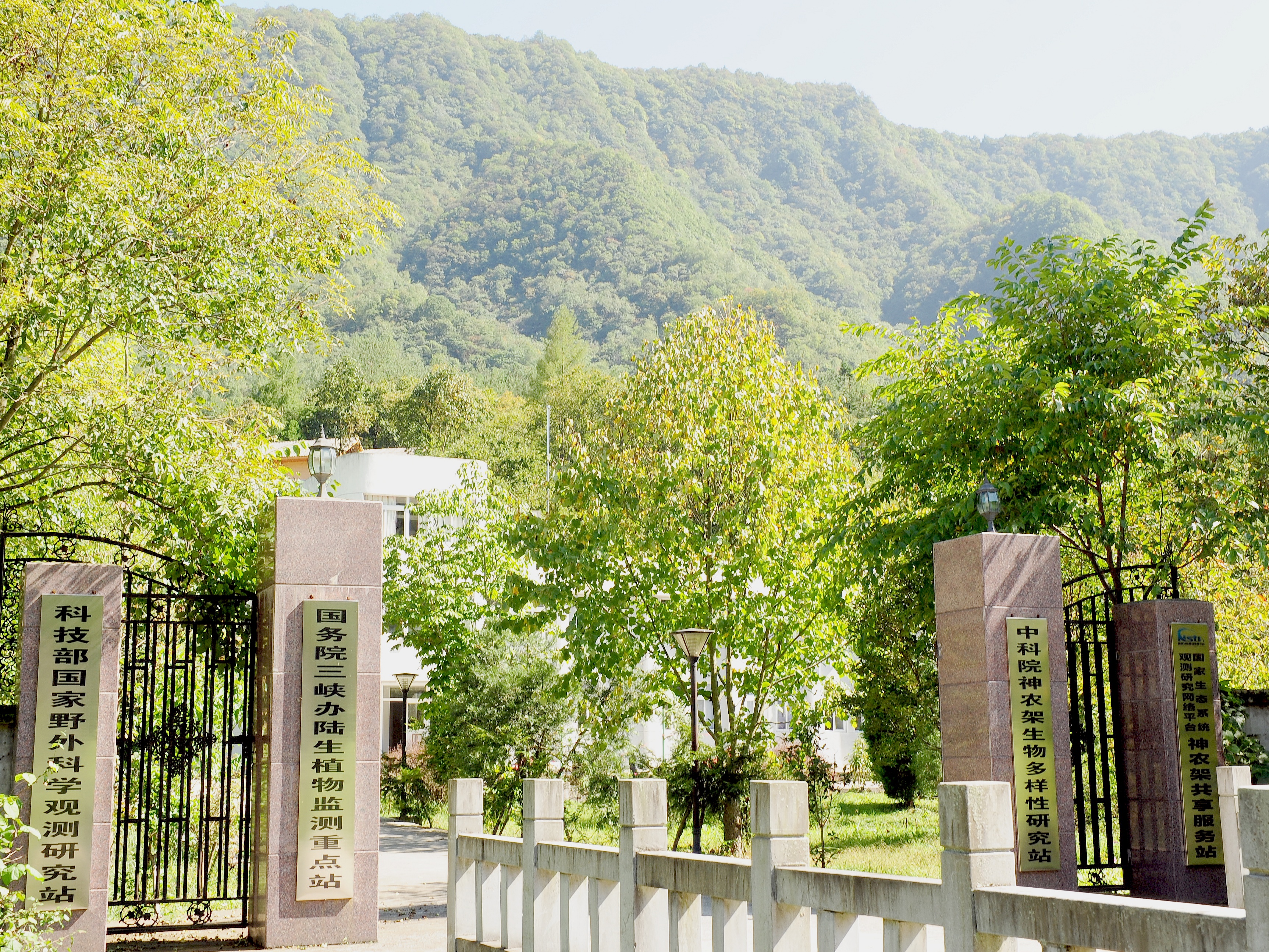
Shennongjia Station is located in Xingshan County, Hubei Province, China. It is located in the southern slope of Mount Shennongjia. The altitude is 1290m above sea level. The typical forest types are the northern subtropical mixed evergreen and deciduous broadleaved forest. Shennongjia Station was established in 1994, it became a station of National Field Research Station network running by the Ministry of Science and Technology of the People’s Republic of China in 2005, and became a member of Chinese Ecosystem Research Network (CERN), CAS in 2008.
-
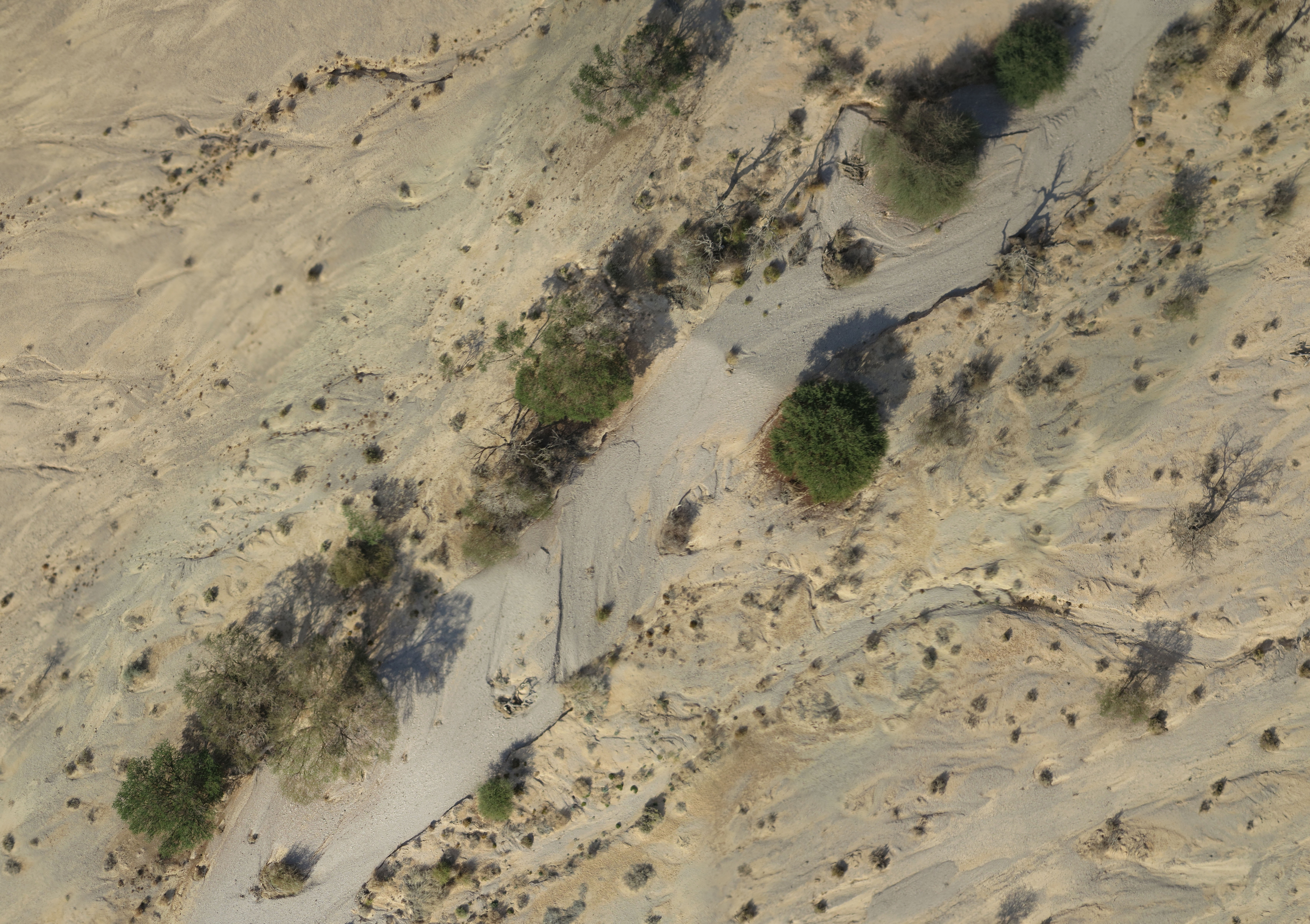
A small watershed that collects floods and run-off. The lowest place is home to a (relativity) dense Acacia savana. The slopes are completely bare. The wadi is covered with alluvium resting on a 6 m layer of red surface of late Pleistocene, which includes silt, clay and fine sand. Rainfall is 30 mm
-
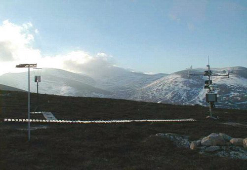
UK Environmental Change Network (ECN) site. The Cairngorms site is located high in the Cairngorms, near Aviemore in Speyside, Scotland. The site lies on the North-Western flank of the Cairngorms encompassing the catchment of the Allt a' Mharcaidh (a site in the ECN freshwater network). It is part of the Invereshie and Inshriach National Nature Reserve, within the Cairngorms National Park, and covers some 10 km2. This is the first ECN site in the UK's sub-arctic zone and is an important link not only to other upland ECN sites but to alpine site in Europe and globally through the GLORIA network, and also to networks across the Arctic (SCANNET and INTERACT). The Cairngorms site has been used intensively for research since the 1970s. An Automatic Weather Station (AWS) has been operating at the site since 1984 and was used in the Surface Water Acidification Programme from 1984 to 1994. CEH and MI have used the site for long-term hydrological and snow studies for about 15 years. From 1997-1999 it was one of the ECOMONT (land use change in mountain areas of Europe) sites. Researchers at several universities and institutes use the site for vegetation, soils and nutrient cycling studies. The site forms part of the larger Feshie catchment in the NICHE programme (National Infrastructure for Catchment Hydrology Experiments). This site is nested within the Cairngorms National Park LTSER site (https://deims.org/1b94503d-285c-4028-a3db-bc78e31dea07).
-

Tronchaney, Conca di Torgnon, (Torgnon, Aosta), + 388330 + 5075950; Aosta Valley
-
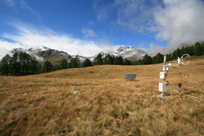
Tellinod, Conca di Torgnon, (Torgnon, Aosta), +389680 +5077920; Valle d'Aosta region
-
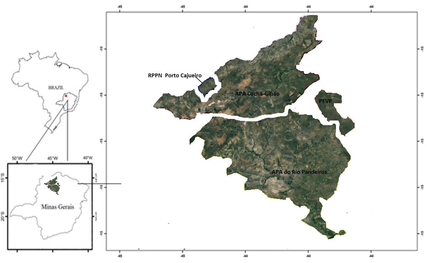
The PELD-VERE research site comprises three Conservation Units (UC): State Park of Veredas Peruaçu (PEVP), Environmental Protection Area of Pandeiros River (APA Rio Pandeiros) and Private Natural Reserve of Porto Cajueiro (RPPN Porto Cajueiro ). These UCs are located in the north of Minas Gerais, with the PEVP in the municipality of Cônego Marinho, APA Rio Pandeiros in the municipalities of Januária, Bonito de Minas and Cônego Marinho and RPPN Porto Cajueiro in Januária. These Ucs are very close to each other and are part of the Sertão Veredas-Peruaçu Mosaic. This mosaic, located on the left bank of the São Francisco River, covers the north and northwestern macroregions of Minas Gerais and a small part of the southwestern of Bahia and integrations of both protected and sustainable use conservations units, totaling more than 1,500,000 ha (FUNATURA 2008). The municipalities that make up the study site present tropical climate with dry winter, Aw of Köppen, with averages of temperature of 22.2º C to 22.7º C and average annual rainfall of 1008 to 1073 mm. Geomorphologically, the region forms part of the San Francisco Depression and San Francisco Plateau. The environmental conditions of the region are the result of a geological process based on the removal of sedimentary material occurring during the Tertiary period (Urucuia and Santa Helena Formations) and consequent exposure of the limestone layers of the Bambuí Series, monthly Pre-Cambrian remodeling. The soils of the region are usually sandy, unstructured, deep and with high drainage. Its origin comes from the transport and the sedimentation of material carried by great water flow in past geological periods. These conditions determined a soil that is poor in nutrients, very acidic and devoid of organic matter. The selection of areas is premised on the allocation of sample units in different environments, in relation to a current hydric situation and associated landscapes, all within the same climatic region. Thus, an area 1 will be located the PEVP, where it will be studied the Peruaçu Vereda (14º56'13 "S and 44º37'44" W), an environment that has drying over the years and is located in a protected area. The Area 2 will be located at APA Rio Pandeiros, in the Almescla Vereda (15º22'50 "S and 44º55'28" W), with loss of springs, and is inserted in a landscape with diverse antropic activities. Lastly, Area 3 will be located at the Porto Cajueiro RPPN (14º53'18 "S and 45º20'31" W), which does not change its watercourse and is inserted in a protected area. In this sense, three environments, such as subject to different local water conditions will be considered: two presented watercourse drying, but in different landscapes (preserved and impacted) and one a control environment, without severe disturbance.
-
The site is located in a primeval forest in The University of Tokyo Chichibu Forest (UTCF), as a field of research and education about forest science in the cool-temperate region. UTCF covers at 5,812 ha and occupies elevations ranging from 600 m to 1,600 m, which is composed of various types of natural forest stands.
-
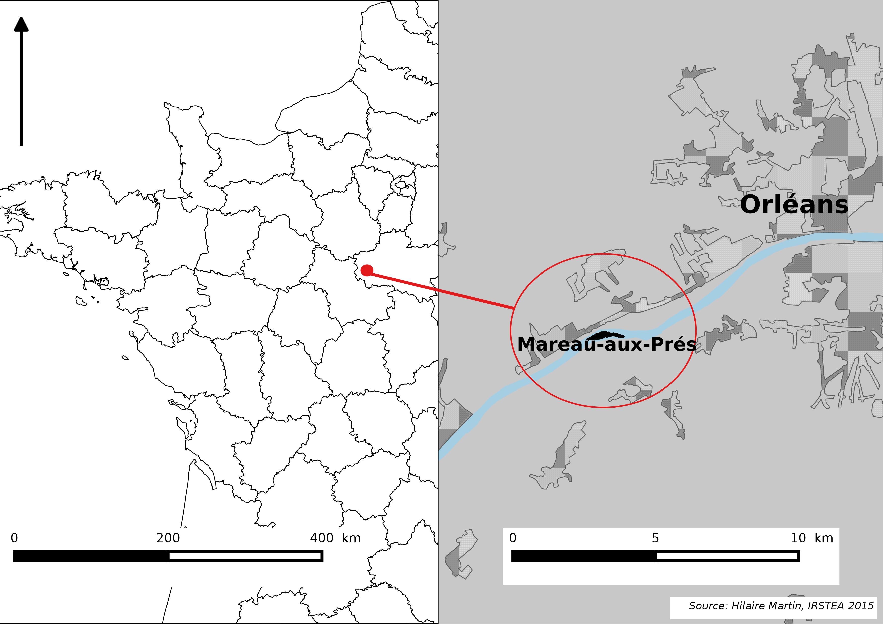
The Mareau-aux-Prés islands, along the Loire river, are characterized by a multiple channel pattern, where natural limestone riffles influence the morphology and spatial distribution of vegetated islands, secondary channels and alluvial bars. Within these islands, in september 2012, fluvial management operations (FMO) were launched. The vegetation of the central sandy-gravelly bar (3 ha area) was uprooted and the bar level lowered in order to maintain the flow capacity of the river. A new sandy-gravelly bar appeared in spring 2013, ideal field support for studying long-term ecological issues. A multidisciplinary research program (‘BioMareau’ project) is currently being conducted from 2012 to 2019, focusing on biodiversity recolonization and on interactions and feedbacks between biotic and abiotic compartments.
-
The Asa LTER site consists of 5 subsites; the Asa Experimental Forest, the Asa Experimental Production Forest, the FutMon-sites Sandbäcken and Ängavägen, and the IM site Aneboda. The Asa LTER site is situated in the nemo-boreal forest in south-central Sweden. It consists of five areas, integrated both geographically and thematically. The Asa Research Station has on-site permanent staff responsible for research and monitoring activities. Field laboratories and modern equipment are available as well as offices, lecture/meeting rooms, working rooms and lodging nearby.
-
Established in the 1950's, the Hubbard Brook Experimental Forest (HBEF) is located in the southern part of the White Mountain National Forest (WMNF) in central New Hampshire, USA. HBEF, and the broader WMNF have hilly, occasionally steep topography; coarse, acidic, glacially-derived soils; bedrock dominated by metamorphic rock of igneous and sedimentary origin; northern hardwood forests on lower slopes and spruce-fir forests at higher elevations (above ca. 800 m).