
environmental quality index
Type of resources
Available actions
Topics
Keywords
Contact for the resource
Provided by
Years
Formats
Representation types
-
Measurements of chlorophyll-a are part of lake monitoring, which is usually carried out by monthly sampling at many regular lake sites (5 to 17 sites depending on the intensity of the measurements over the years). The integrated sample represents the whole water column of this polymictic shallow lake with a mean lake depth of 1.2m. The photometric measurement satisfies the analytical standards of Ö-Norm in Austria.
-
The monitoring of bird populations focused on wetland species. It included breeding bird surveys and bird migration (bird ringing) of species most common in the reed belt of Lake Neusiedl, and meadows surrounding the soda pans. Bird surveys of Biological Station Lake Neusiedl refer mainly to the INTERREG Project of “Vogelwarte 2” and were in close collaboration with the National Park “Neusiedlersee – Seewinkel” and “BirdLife Österreich”.
-
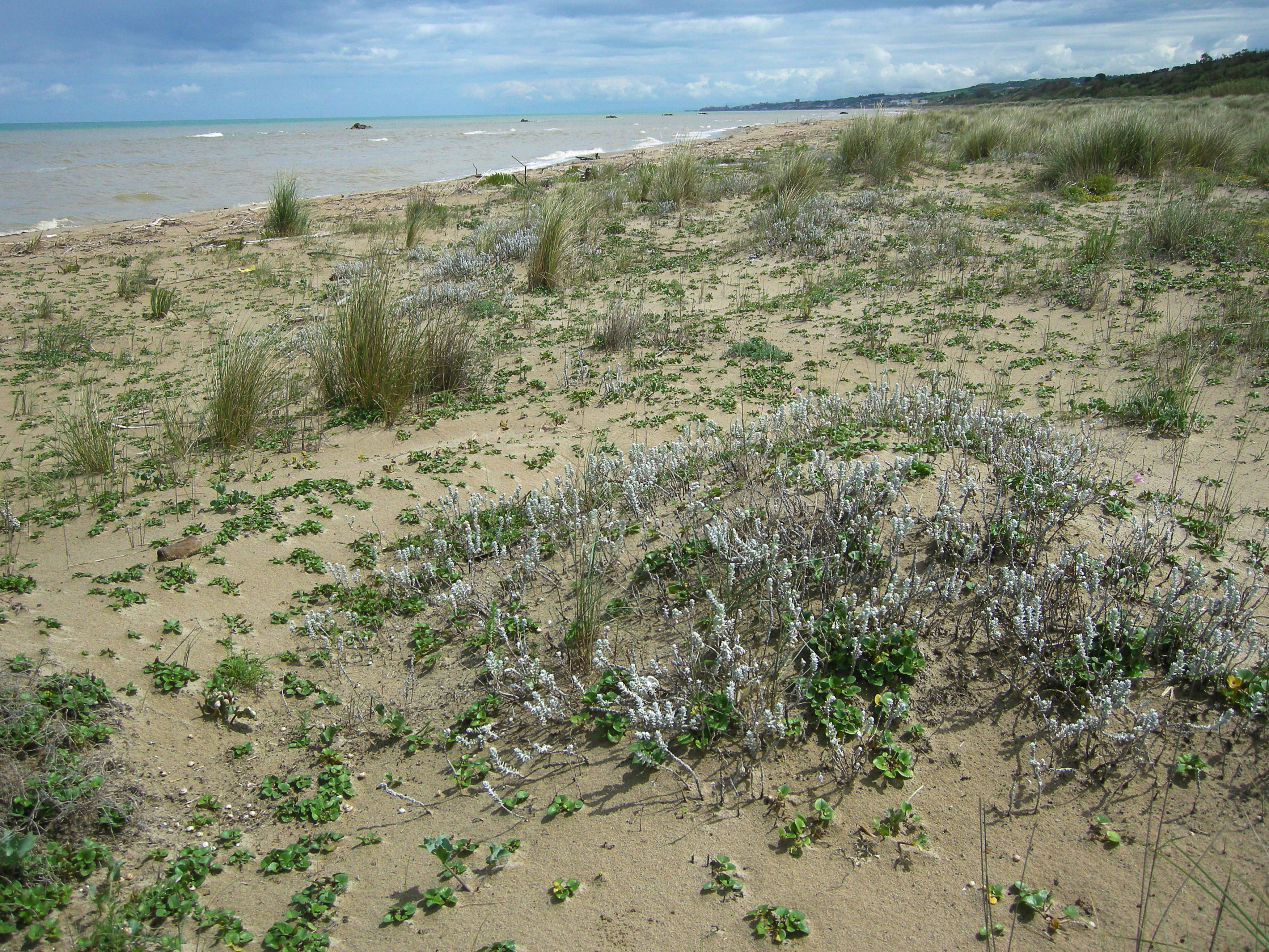
S.C.I IT7228221 Foce Trigno-Marina di Petacciato (Campobasso) S.C.I. IT7140108 Punta Aderci-Punta della Penna S.C.I. IT7140109 Marina di Vasto The site includes 3 Natura 2000 sites along the central Adriatic coast, where the last fragments of natural vegetation zonation on sand coastal dunes occur (shore vegetation, embryo and mobile dune vegetation, annual Mediterranean grasses and wet dune slacks).
-
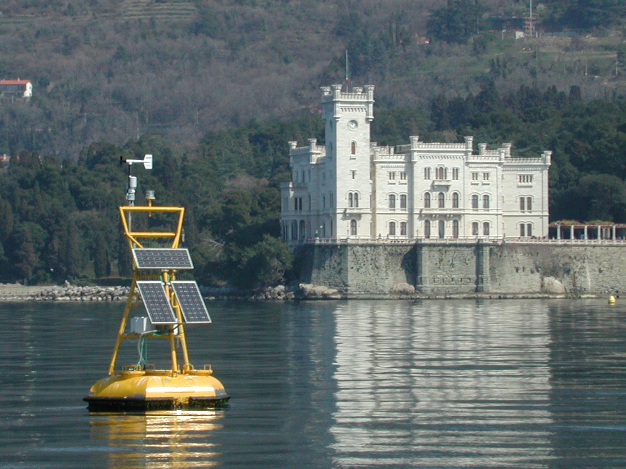
The coastal marine observatory site Gulf of Trieste lies within the Marine Protected Area (MPA) of Miramare and includes the biological time-series station “C1”, part of the Italian Long-Term Ecological Research (LTER) network, and the in situ continuous MAMBO meteo-oceanographic buoy. Marine Protected Areas represent one of the most effective systems for marine biodiversity preservation and management. Since 1986, the time-series station “C1” in the Gulf of Trieste (GoTTs, Gulf of Trieste Time series) represents a crucial site for marine ecological research, as it is subject to the interaction among several natural forcing (river, groundwater discharge, tides, general circulation, intense meteorological) and numerous anthropogenic activities (maritime transport, harbours of Trieste and Monfalcone, urban waste discharge, mussel- and fish-farming, fishing and recreational activities). In 1999, the ecological research site has been equipped with a meteo oceanographic buoy (MAMBO) in order to acquire continuous data on meteorological conditions at sea and on seawater physical and biogeochemical properties. Due to the high temporal dynamics of ecological processes in coastal ecosystems, continuous and real-time data of the main meteorological, physical and biogeochemical properties are fundamental for a better understanding of marine ecosystem functioning.
-
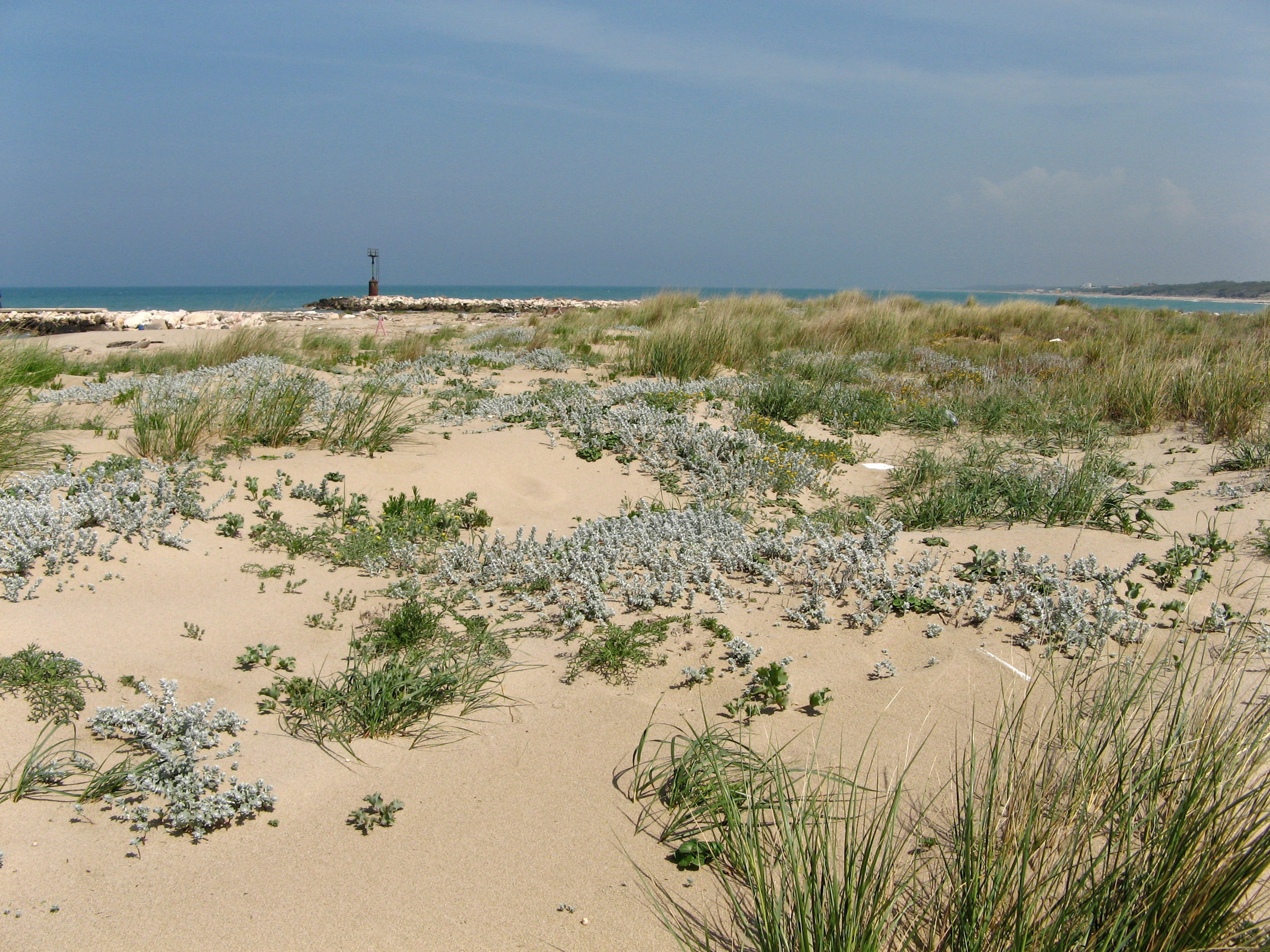
SCI IT7222217 Foce Saccione-Bonifica Ramitelli (Campobasso) The site includes 1 Natura 2000 site along the central Adriatic coast, where the last fragments of natural vegetation zonation on sand coastal dunes occur (shore vegetation, embryo and mobile dune vegetation, annual Mediterranean grasses, costa dunes with Juniperus spp and wet dune slacks).
-

The Seine estuary is a megatidal estuary located in northern France. It is the third largest estuarine ecosystem in the country after the Gironde and Loire along the French Atlantic coast; its waters flow into the English Channel. The geographical zone of influence of the Seine estuary runs from just upstream of the Poses dam, at the limit of the tidal penetration into the estuary — 160 km upstream of Le Havre —to the eastern part of the Bay of Seine. It can be divided into three sections: the fresh water upstream section (125 km), the mixing zone characterized by varying salinity levels (35 km), and the marine downstream section under the influence of the Seine River. The megatidal regime generates a turbidity maximum in the mixing zone (middle estuary) between the marine and fluvial sections of the estuary. The Seine estuary is a typical estuarine ecosystem: highly stressed by natural fluctuations and anthropogenic pressures, and hosting a rich ecological system. The Seine valley and its estuary are of major economic importance for France, with the presence of two maritime ports. It’s watershed (79,000 km2) is the home to 17 million people, and accounts for 50 % of the river traffic in France, 40 % of the country's economic activity, and 30 % of its agricultural activities. In addition to the Greater Paris area (> 11 million inhabitants), which contributes heavily to the Seine estuary's upstream inputs, two other major river settlements — Rouen (500,000 inhabitants) and Le Havre (300,000 inhabitants) — are maritime ports of international importance. Due to economic development, the Seine estuary has been subjected to major hydrodynamic, ecological, biogeomorphological and biogeochemical changes. The importance of studying the effects of anthropogenic impacts on estuarine ecosystems has increased in the last decade, especially under the Water Framework Directive, which aims to achieve “good environmental status” of all European water bodies.
-
The LTSER Zone Atelier Brest Iroise, created in 2012, is located in Brittany, NW-France. It aims at understanding the functioning and the long-term dynamics of the social-ecological system located along the land-ocean continuum. It combines work along different gradients and at different interfaces: between Earth compartments (sediment-water-atmosphere, land-ocean), tools (observation, experimentation, modeling), disciplines (especially between natural and human and social sciences) and between science and society. About half of the area (3000 km2) is terrestrial, including the watersheds of the Elorn (280 km2, 285,000 inhabitants mostly in the Brest area) and the Aulne (1820 km2, 70,000 inhabitants) rivers which are characterized by intensive agricultural practices. The Bay of Brest is a semi-enclosed coastal Bay, with an area of 180 km2. Part of this Bay and of the Aulne estuary is a Natura 2000 site, operated by the “Parc Naturel Regional d’Armorique” (PNRA). The marine part (3550 km2) of this land-ocean continuum is the Iroise Sea, comprising beaches, the continental shelf, the Sein Island and the Molène-Ouessant archipelago. This area corresponds to the limits of the first marine natural protected area created in France in 2007 (the “Parc Naturel Marin d’Iroise”, PNMI). This area presents exceptional natural and human heritage, including a rich marine biodiversity, human traditions and emblematic activities (e.g. great Scallop fishing).
-

Historically, the role of the Galapagos Islands has been considered critical due to the evolutionary diversification induced by natural and historical isolation. The Galapagos National Park was established in 1959, based on its historical importance associated with Charles Darwin's voyage and its rare and endemic biodiversity, composed of unique vertebrate and plant communities (Rozzi et al. 2010). In 1978, the Galapagos Islands were declared a UNESCO World Heritage Site, a critical factor associated with this national park (Rozzi et al. 2010). The Galapagos Islands are a pristine area with local and regional climates influenced by the interaction of ocean currents and winds driven by the Inter-Tropical Convergence Zone; ITCZ (Conroy et al. 2008, Trueman and d'Ozouville 2010). The long-term programme includes forty natural aquatic ecosystems (lakes, ponds, lagoons and swamps) that will be sampled on the islands of San Cristobal, Santa Cruz, Isabela and Floreana, where possible along a lowland-highland gradient. The number of sampling points will vary according to environmental heterogeneity and the presence of a littoral region, among other factors.