
faunistic diversity
Type of resources
Available actions
Topics
Keywords
Contact for the resource
Provided by
Years
Formats
Representation types
-
Database built by volunteers from the Portuguese Society for the Study of Birds. Each row is a validated record of an observed species. The information on the number of individuals of that species is not reliable.
-
The study of the cetacean strandings along the Central Adriatic coast started on 2009 and is currently underway. The data is collected occasionally, by citizens which observed them along the seashore. Most of those data are collected using citizen science approach and is stored also on an iNaturalist dedicated database (wildcoastCASCADE). Stored data describe species occurrences (e.g. Tursiops truncatus and Stenella cerueoalba), along with their conditions (e.g. necropsy information in relation with human impact and threats impinging the cetacean biodiversity). Spatial distribution of stranding individuals along central Adriatic coast are also analyzed. Further studies are currently underway.
-
Data on bird presence and abundance in Doñana is available since the 50ties, even before its protection. EBD-CSIC started standardized monitoring by aerial counts in the 70ties, initially focused on wintering birds but since de early 80ties counts are conducted monthly, and up to 50 bird species are identified in 52 counting areas within the marshes. Terrestrial bird count of main bird concentrations of Doñana have been conducted at the same time (both EBD-CSIC and Park Management) but were not standardized until 2002 by EBD-CSIC. Since then, monthly surveys have been conducted covering about 87 water bodies of the marshes and from fixed observation points (up to 196 water bird species are included). Additionally, each month, a transect (30 km) count of birds (all non-passerine species and Corvus corax) present at the beach and sea shore is done by car. Furthermore, during spring, colonial water bird nests are located and chicks ringed when possible. Several colonies have been monitored since the 80ties. Non-colonial waterbird nests are located monthly during the breeding season using linear transects on horse in the marshes, totalling about 65 km. These transects data are being collected since 2003. Earlier data on non-colonial breeding waterbirds are more disperse, although ringing activities have been done since the 70ties on regular bases.
-
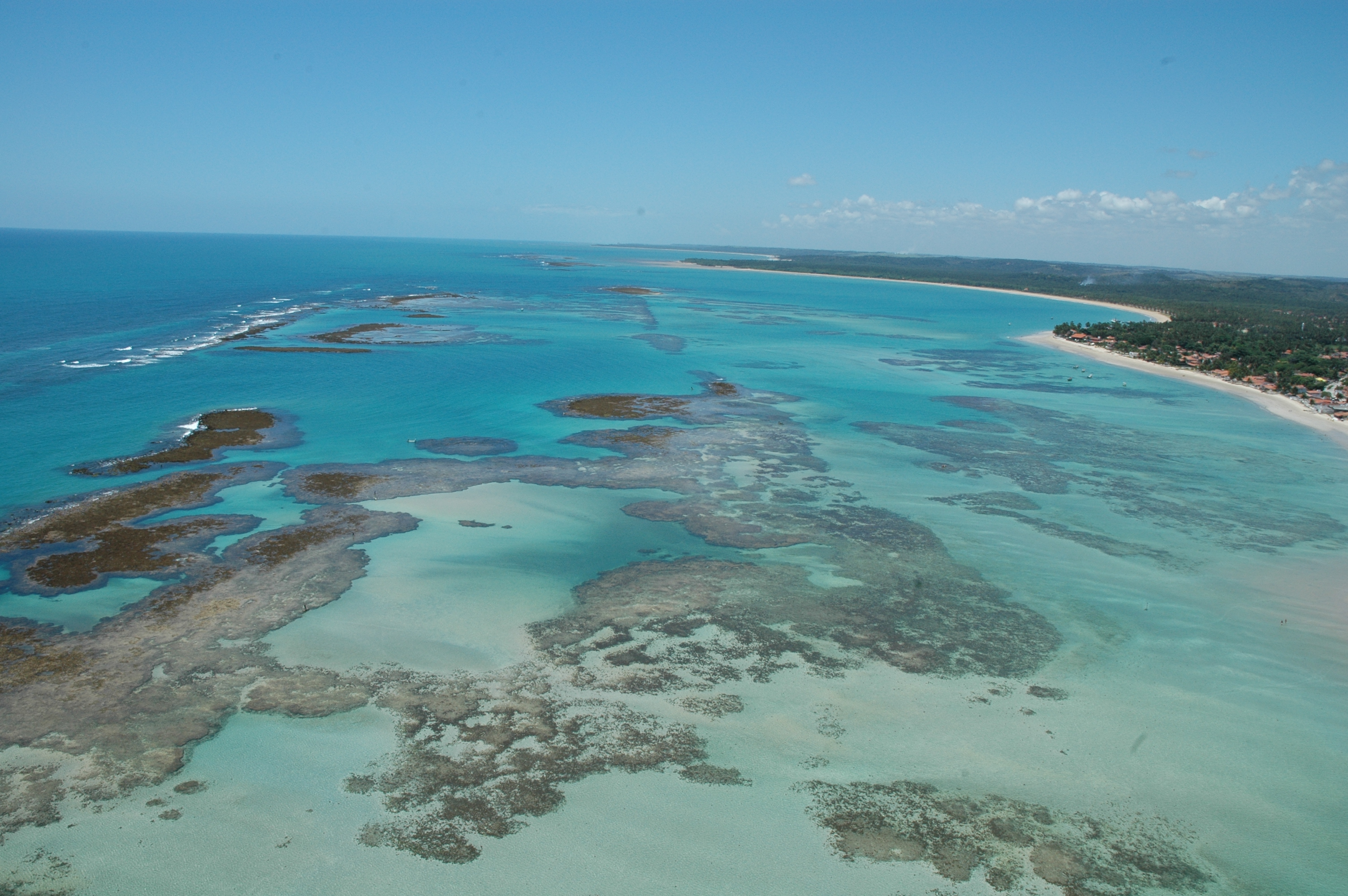
The Site is located on the northeast Brazilian coast, East Brazil LME, and includes the seascape extending from the coast to the continental slope. The coastal area is formed by an ecosystem complex including remnantes of Atlantic forest, mangroves, seagrass beds and coraline reefs. These ecosystems are interconnected along the seascape over the typically carbonatic shelf, with widths around 18 nautical miles. Along the shelf, submerged channels related to continental drainage in glacial periods, and submerged reefs, form habitats responsible for supporting resources exploited by intense fishing activity. The outermost portion of the continental shelf, considered as an area of significant biological and ecological interest (EBSA), is a biodiversity hotspot, home to reef fish spawning aggregations, and higher fish yield associated with evidence of sub-surface upwellings. These seascape support complex ecological processes, subject to intense use, in an area recognized as a priority for conservation. The presence of Marine Protected Areas reflects this characteristic, both for the need to protect these environments, and for the socio-economic importance, with two protected areas for sustainable use (APAs) and one for Integrated Protection (Park), organized in mosaic.
-
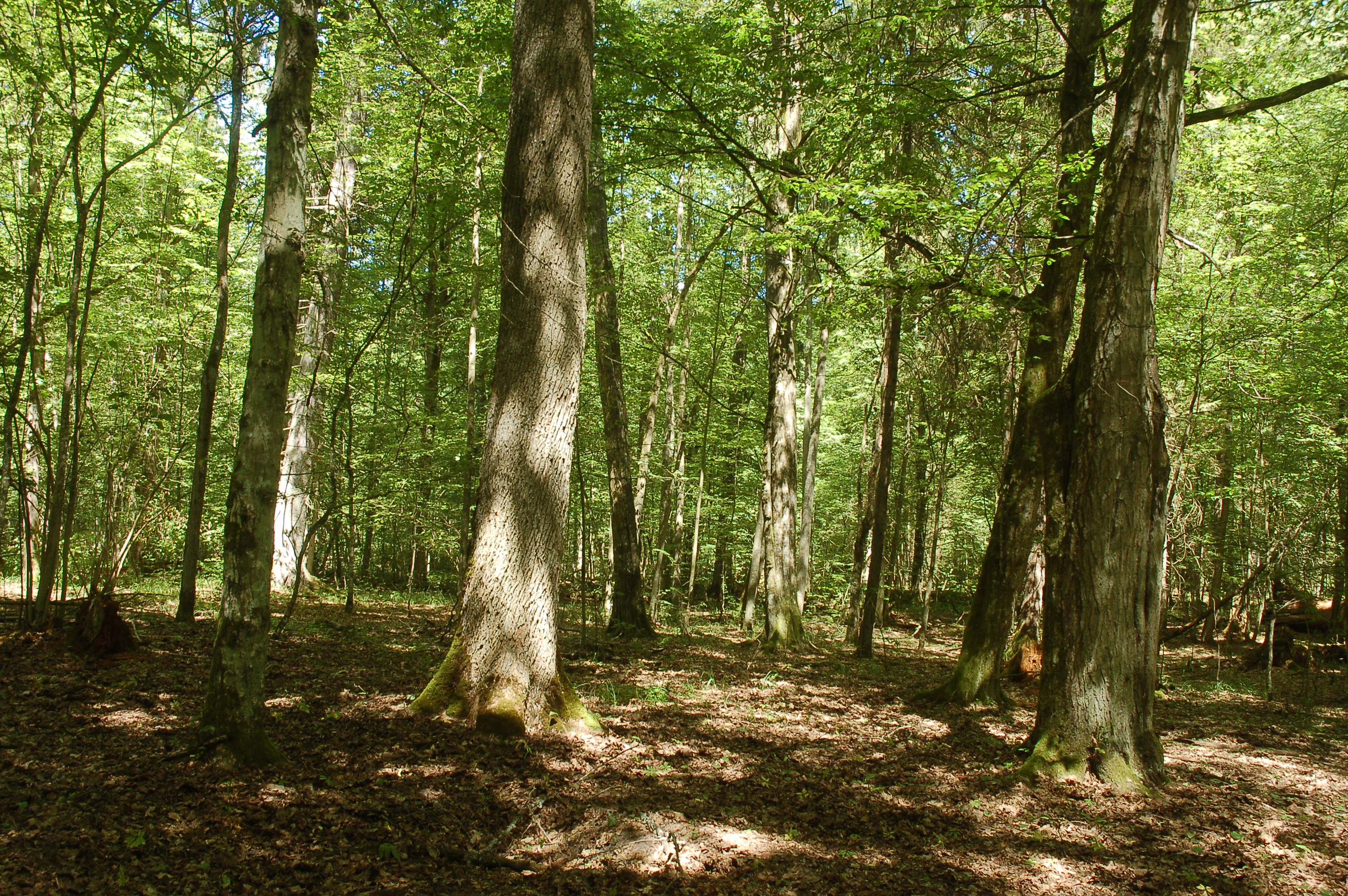
primeval, deciduous forest, succession
-
PLANNED (as of August 2016) regular monitoring activities of the Park's Natura 2000 habitats are specified in the new Park Protection Plan (currently in the final project stage, pending final approval and implementation resolution by the Minister of Environment). They'll altogether comprise 19 bird species, 8 mammal species (incl. 2 sp. of bats, wolf, brown bear, lynx, Tatra marmot, chamois), 2 amphibian species and 2 invertebrate species (beetles). Methodology-wise, depending on the species, they'll be conducted as 1 to several monitoring rounds/inspections performed annually or at several-year intervals, in most cases in a season-dependent manner, and will involve various, species-specific methods (field observations, tracking, transect counts, site inspection, counting/inventory of nests, colonies or dens/burrows, analysis of habitat area or condition, genetic sampling, etc. etc.). For the purpose of the Park's Protection Plan, nature inventory and assessment of the current state of conservation of the above-mentioned species was conducted and indicated by FV or U1 (no U2s or XXs, luckily) with respect to 3 parameters: population, habitat, future prospect - plus the cumulative value. The data may be available at the Park.
-
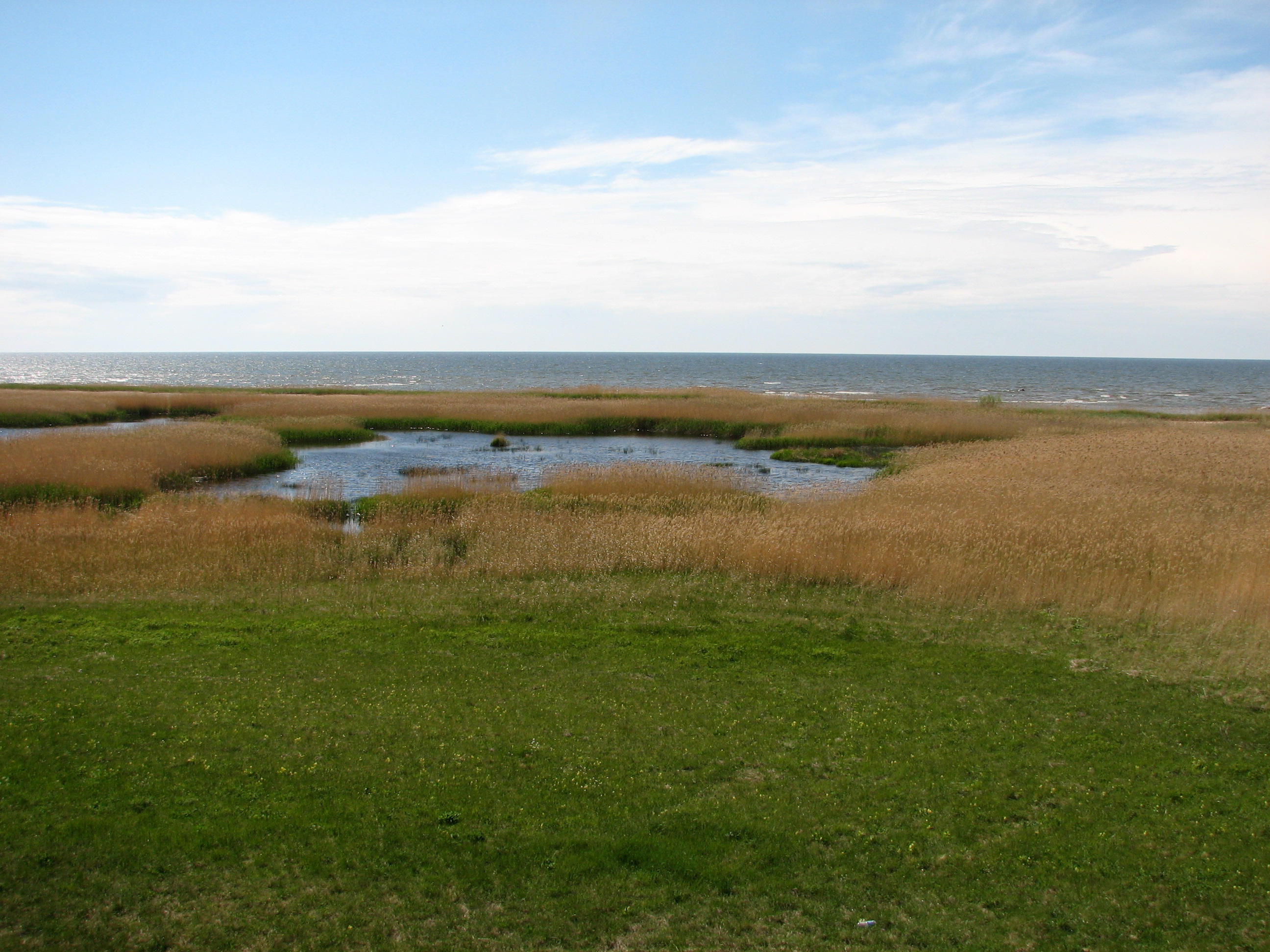
Botanical reserve “Randu meadows” is situated on the northern coast of the Riga Gulf. The botanical reserve is a part of the North Vidzeme Biosphere Reserve. It represents about 200 ha of unique coastal meadows with high habitat and species diversity. There were recorded 531 plant species, 42 are rare and protected in Latvia, 2 species are on the EU Biotope Directive 92/43/EEC list. Man has participated in the development of these littoral meadows for hundreds of years, by cattle grazing and hay harvesting. Recently, the intensity of grazing and mowing have sharply decreased, and the meadows are gradually overgrowing by reeds and shrubs. Wild cattle herd was introduced for some time in part of the grassland area in order to prevent overgrowth of meadows.
-
Lake Kraenepoel (Belgium) is a shallow lake (22 ha), consisting of two basins with different management history resulting in different nutrient status of both lakes.
-
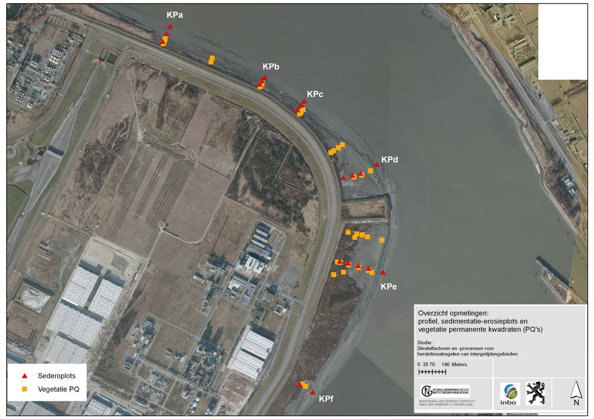
The site is a managed realignement (Sea Wall Removal) combined with a land lowering to start estuarine development in a suitable tidal frame. The site was created in 2002 and monitored in an initial phase intensively. (aspects of morphology, sediment characteristics (including polluents), macrozoobenthos, vegetation and birds). Vegetation and birds are ongoing monitoring.