
fire resistance
Type of resources
Available actions
Topics
Keywords
Contact for the resource
Provided by
Years
Formats
Representation types
-
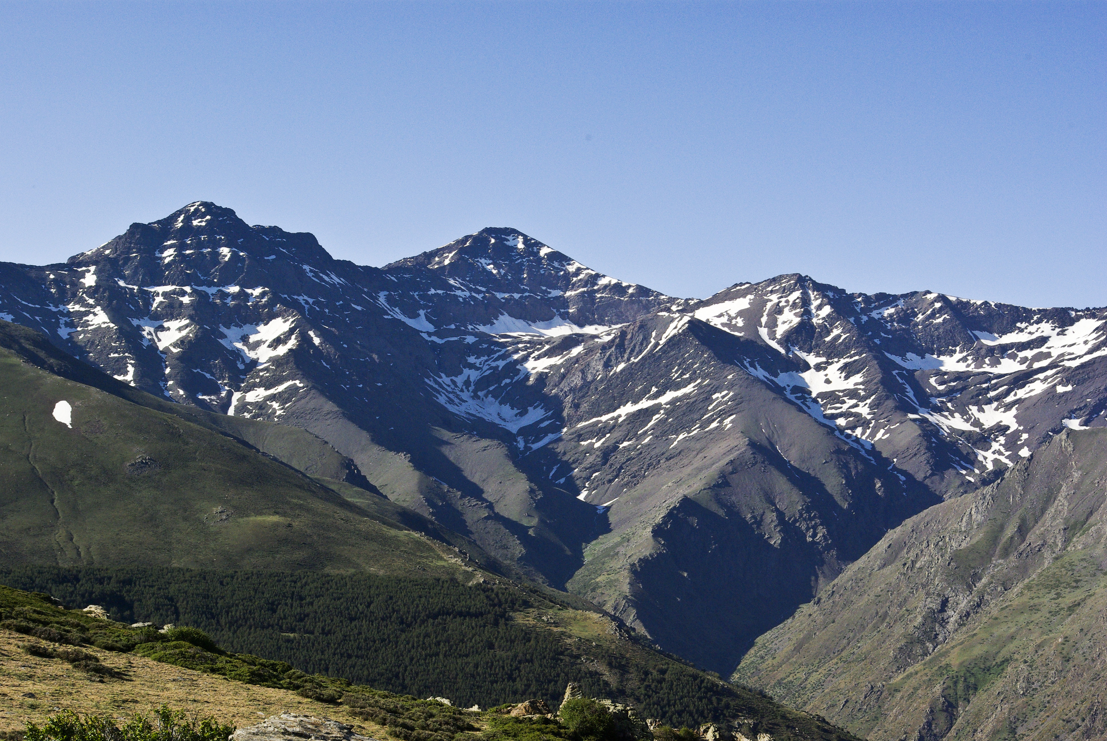
Mountain site, alpine forests Sierra Nevada (Andalusia, SE Spain), is a mountainous region with an altitudinal range between 860 m and 3482 m a.s.l. covering more than 2000 km2. The climate is Mediterranean, characterized by cold winters and hot summers, with pronounced summer drought (July-August). The annual average temperature decreases in altitude from 12-16ºC below 1500 m to 0ºC above 3000 m a.s.l., and the annual average precipitation is about 600 mm. Additionally, the complex orography of the mountains causes strong climatic contrasts between the sunny, dry south-facing slopes and the shaded, wetter north-facing slopes. Annual precipitation ranges from less than 250 mm in the lowest parts of the mountain range to more than 700 mm in the summit areas. Winter precipitation is mainly in the form of snow above 2000 m of altitude. The Sierra Nevada mountain range hosts a high number of endemic plant species (c. 80; Lorite et al. 2007) for a total of 2,100 species of vascular plants (25% and 20% of Spanish and European flora, respectively), being considered one of the most important biodiversity hotspots in the Mediterranean region. This mountain range has several legal protections: Biosphere Reserve MAB Committee UNESCO; Special Protection Area and Site of Community Importance (Natura 2000 network); and National Park. The area includes 61 municipalities with more than 90,000 inhabitants. The main economic activities are agriculture, tourism, cattle raising, beekeeping, mining, and skiing.
-
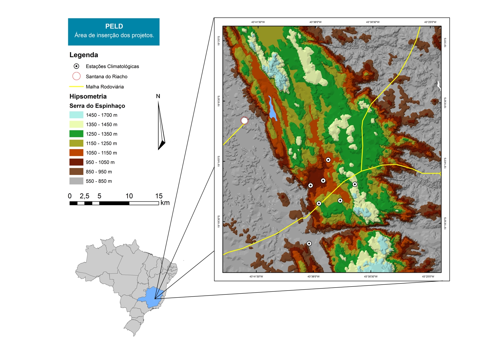
For over 20 years as a team of Long Term Sites in Serra do Cipó PELD-CRSC has been working to answer crucial questions of evolutionary ecology and provide a basis for understanding the spatio-temporal ecosystem functioning and it is future challenges with changes in climate and land use.
-
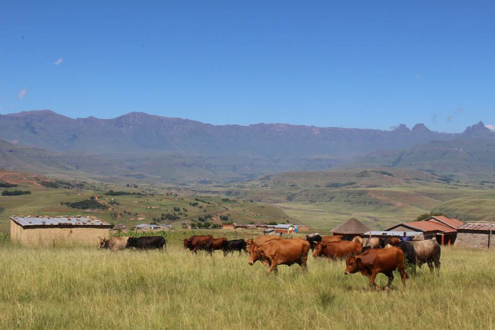
The Cathedral Peak research catchments in the northern uKhahlamba Drakensberg mountains, KwaZulu-Natal, South Africa have been a focus of observation research since the 1940’s. The Drakensberg mountains which fall in the grasslands biome, are a crucial water source area for South Africa, owing to the relatively high rainfall and ratio of rainfall to runoff conversion in this region. This portion of southern Africa's grassland biome also supports phenomenal levels of biodiversity. The research catchments themselves are primary, headwater catchments that fall within a protected area. The catchments were initially established to investigate the influence of various land management treatments on water but over time the research has broadened to a more interdisciplinary focus incorporating carbon–water–energy–biodiversity and the dynamics between these. Although the core of the observation and monitoring is sited in the catchments, the research extends beyond the protected area into communal, state, and privately owned lands. The land beyond the protected area is valued for agriculture, ranging from subsistence agriculture in impoverished villages to large-scale commercial agriculture. Scientific work in the landscape continues to grow and expand.