
fire severity index
Type of resources
Available actions
Topics
Keywords
Contact for the resource
Provided by
Years
Formats
Representation types
-
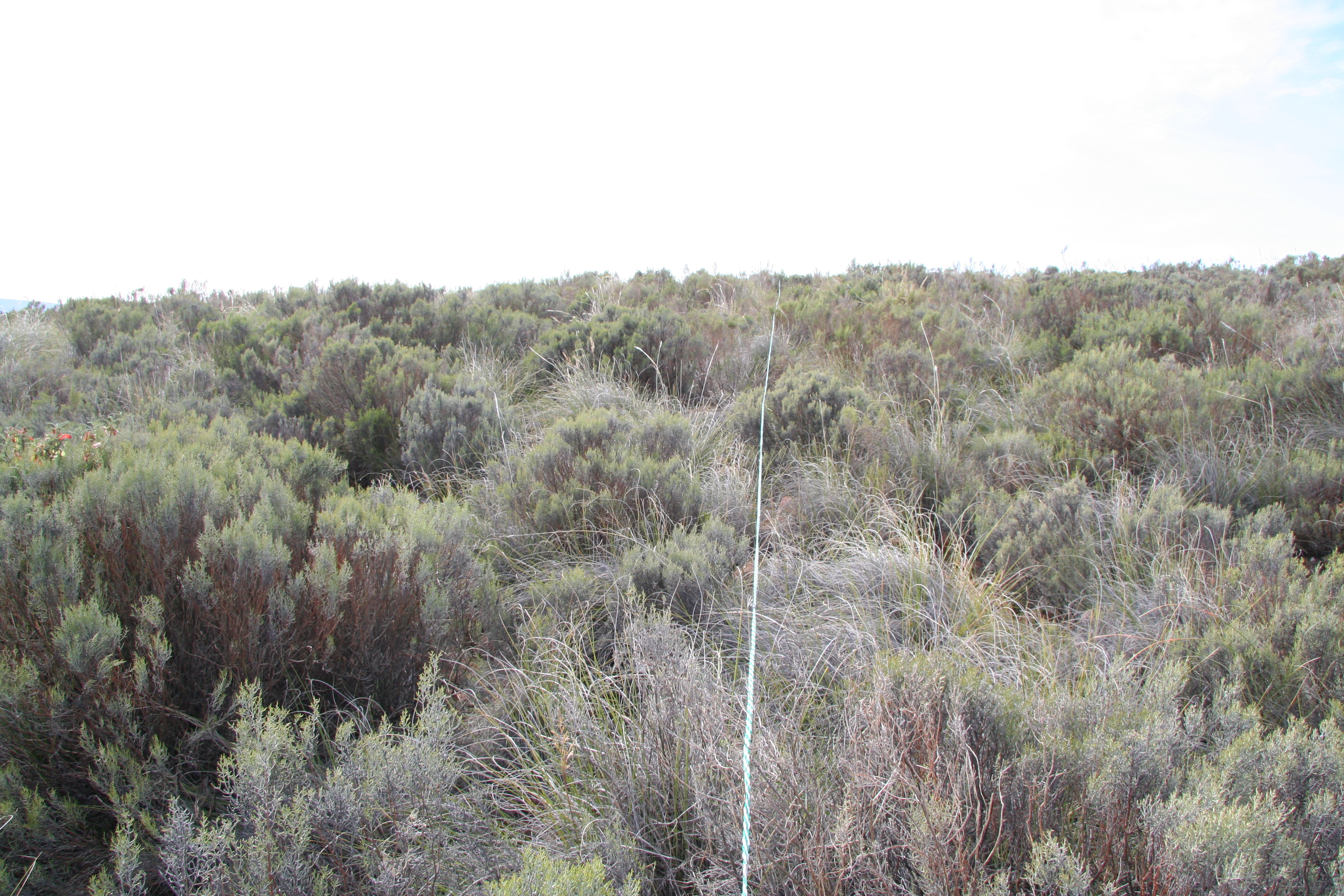
The Mountain Renosterveld of the Roggeveld is situated in the Fynbos Biome and is transitional in nature with a host of Karooid elements belonging to the Succulent Karoo Biome
-
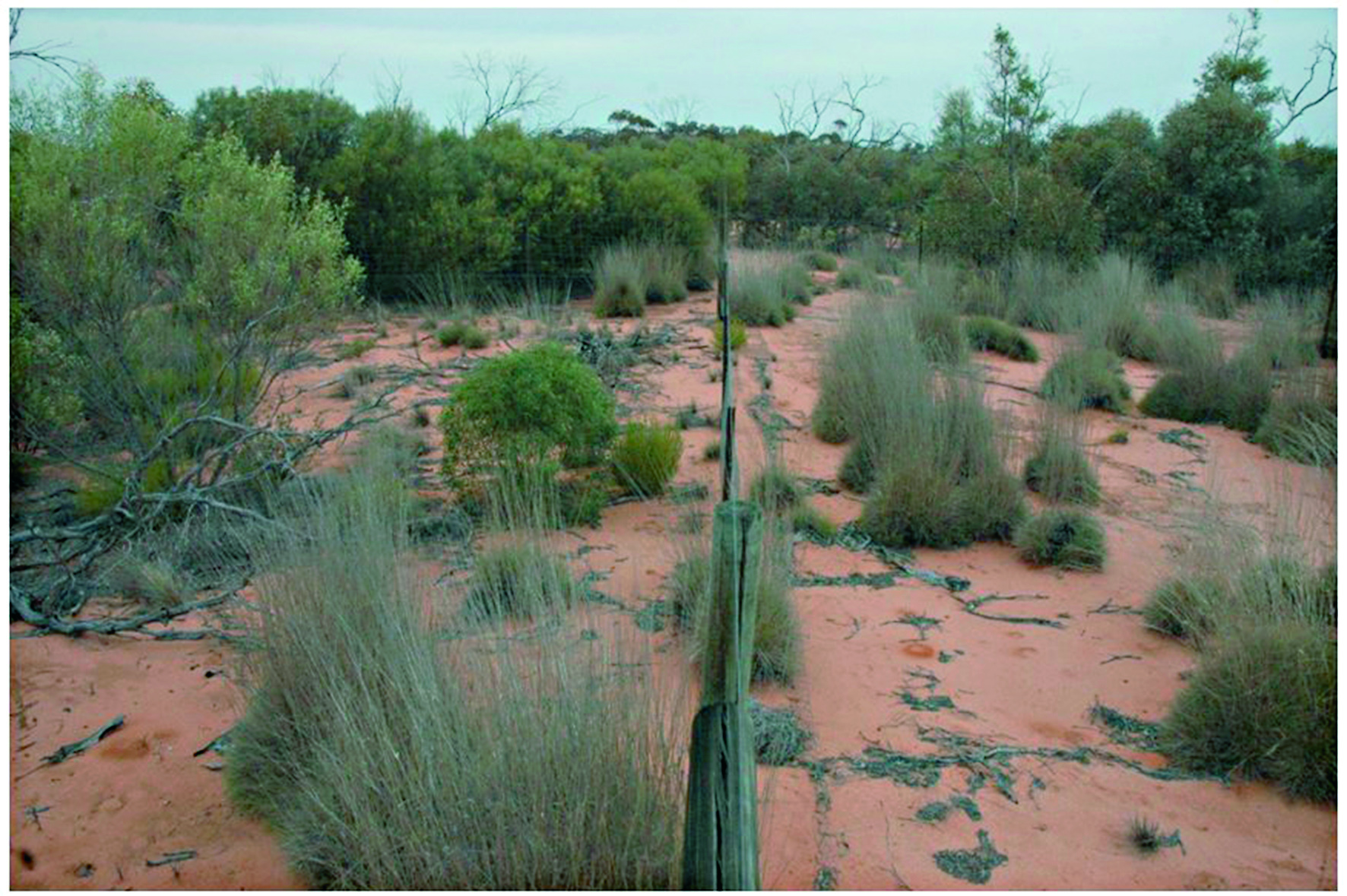
The Mallee Plot Network is located in the red aeolian sand dunefield landscape of the Scotia district within Tarawi Nature Reserve, Scotia Wildlife Sanctuary and Danggali Conservation Park in south-western New South Wales and adjacent areas of South Australia. The study area sits on the south-eastern edge of the Australian arid zone and is close to the arid limits of distribution of the mallee woodland biome, which stretches across the temperate semiarid belt of southern Australia (Noble 1984). Mallee woodlands typically occur in regions In the Scotia district and its surrounding region, mallee woodlands occur within a landscape mosaic that includes patches of woodland dominated by Casuarina pauper (belah) and shrublands dominated by Maireana sedifolia and M. pyramidata (bluebush) (Westbrooke et al. 1998). These latter vegetation types occur on gently undulating sandplains with a calcareous crust not far below the soil surface. In contrast, mallee woodlands dominate transverse east–west oriented dunefields. The dunes are characterised by deep, red sandy loams dominated by Eucalyptus socialis (pointed mallee), E. dumosa and E. costata—occasionally with Callitris verrucosa - with a mixed understorey of hummock grasses and shrubs, and a largely ephemeral ground layer of tussock grasses and forbs. The intervening swales have finer-textured red loams and generally support a wider range of eucalypts including E. oleosa and E. gracilis, but C. verrucosa is absent. Their understoreys typically include a higher density and diversity of shrubs but lack hummock grasses, and the ground layer is typically sparse. Detailed descriptions of vegetation and landscapes are included in Westbrooke et al. (1998). Temporal visits were initially staggered, then annual for 3 years and is now decadal. Between 2012 and 2018 the Mallee Plot Network was a member of Long Term Ecological Research Network (LTERN), Australia, a facility of the Australian Government's Terrestrial Ecosystem Research Network (TERN)..
-
Georeferenced areas burnt by wildfires, recorded by the Portuguese Institute for Nature Conservancy and Forests, a series from 1990-2014
-
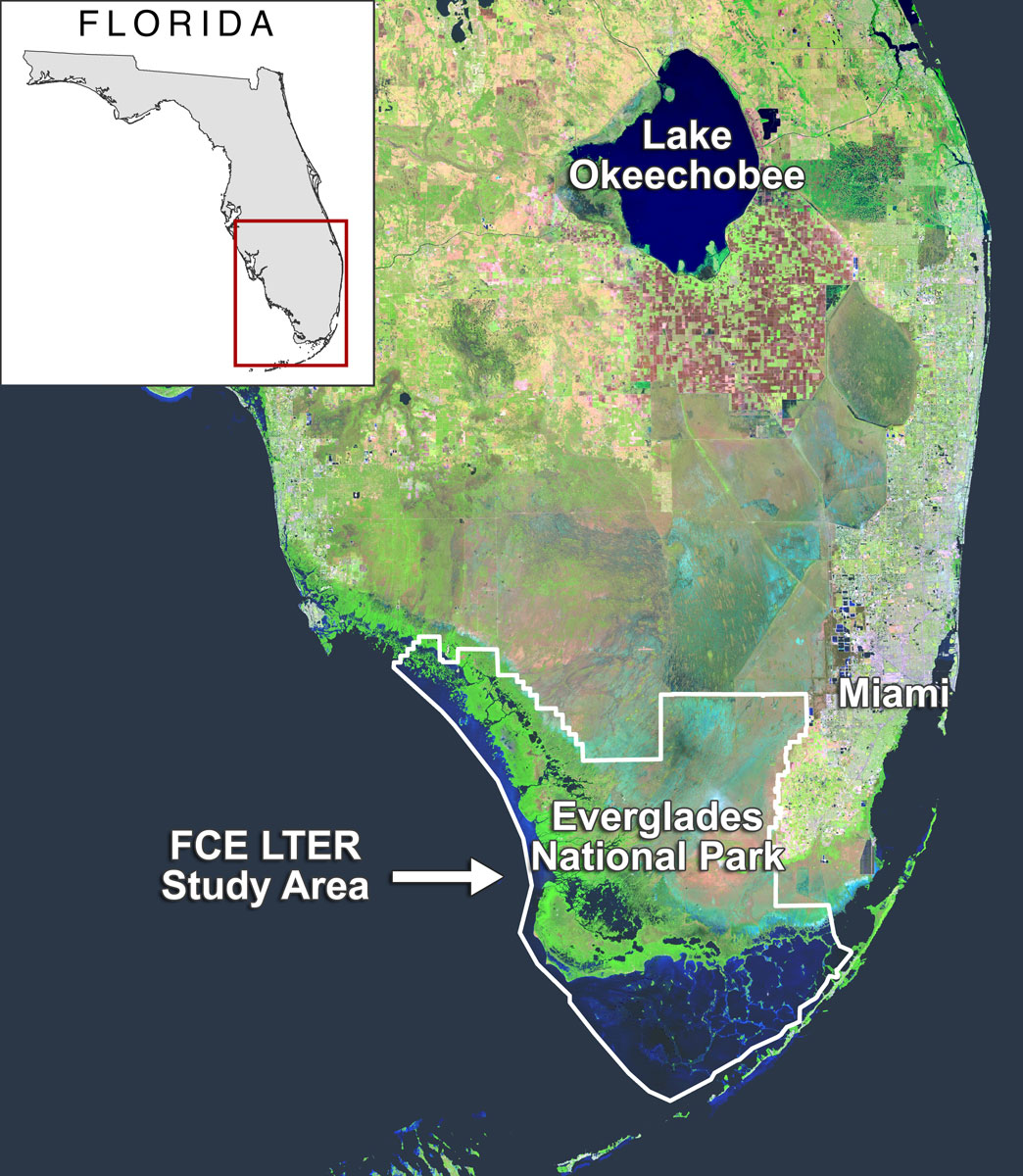
The majority of Florida Coastal Everglades LTER sites are located in freshwater marsh, estuarine mangroves, seagrass estuary ecosystems in Everglades National Park. Everglades National Park covers approximately 4300 km² of south Florida and is part of the greater Everglades ecosystem which extends north to Lake Okeechobee and the Kissimmee River.
-
The Upland Heath Swamps Plot Network is located in the Dharawal National Park, near Sydney, NSW. Sampling of vegetation is stratified along the soil moisture gradient and across the range of structural variability in the vegetation. Thus, three categories of soil moisture and three categories of vegetation structure (based on the height and form of shrubs) are sampled in a factorial design at 60 sites in upland swamps scattered throughout the study area (Keith & Myerscough 1993). Temporal visits are conducted every 5 years or when fires occur. Between 2012 and 2018 the Upland Heath Swamps Plot Network was a member of Long Term Ecological Research Network (LTERN), Australia, a facility of the Australian Government's Terrestrial Ecosystem Research Network (TERN).
-
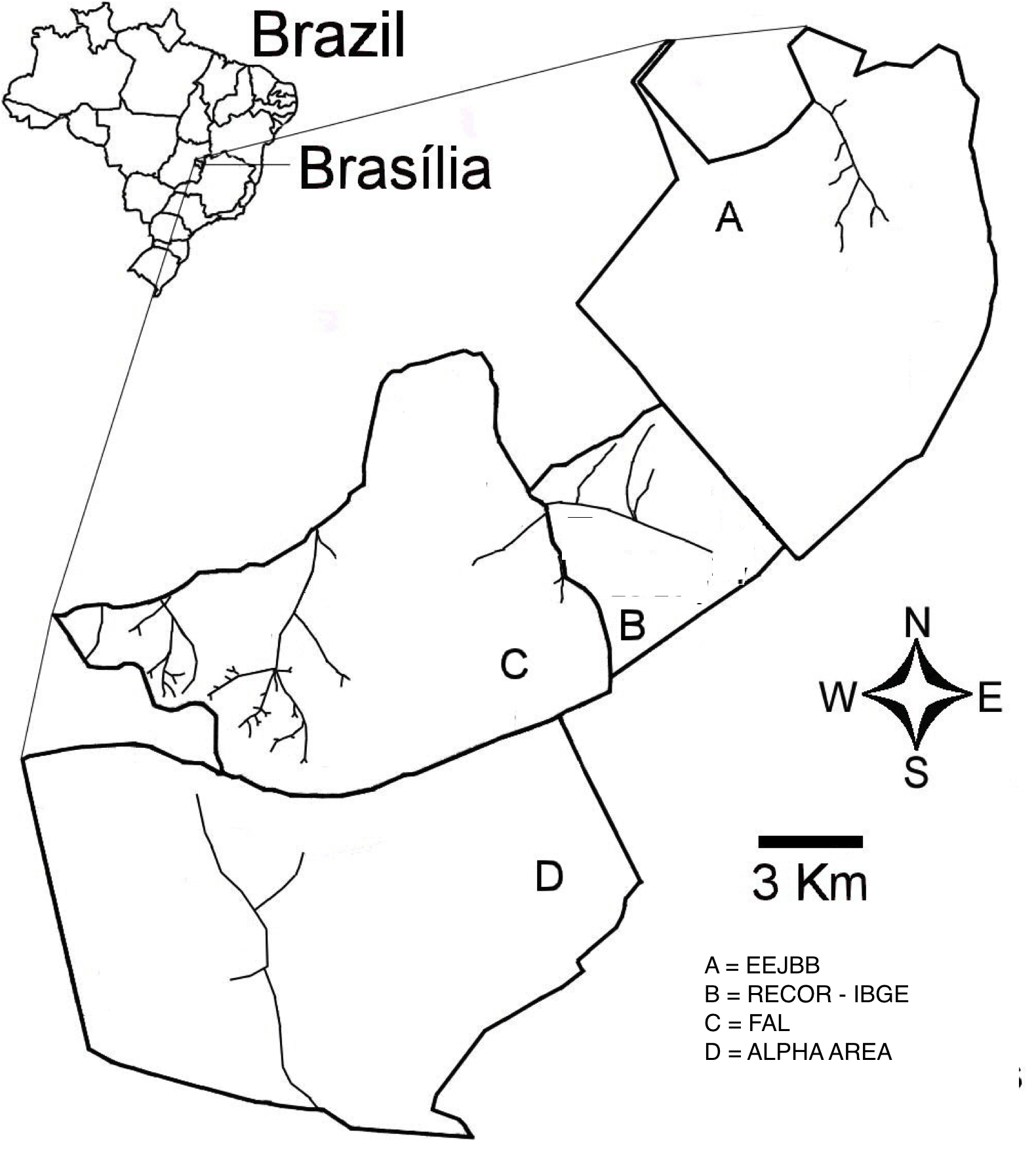
The “Área de Proteção Ambiental das Bacias do Gama e Cabeça de Veado” (AGCV) is located in the central area of the Cerrado domain in Brazil. This area of environmental protection is important due to its strategic localization as a buffer area between urban areas and the natural environments in DF, and by harboring hydric resources from two basins. There are three contiguous conservation units located inside the AGCV: Estação Ecológica do Jardim Botânico de Brasília (EEJBB; Ecologica Station of the Botanic Garden of Brasilia), the Reserva Ecológica do Roncador - IBGE (Recor - IBGE; Roncador Ecological Reserve) and Fazenda Água Limpa (FAL; Agua Limpa Farm, the ecological and agricultural field station of the Universidade de Brasília. In addition to those there is a contiguous 5,000-h area which is well-preserved, locally known as Alpha area. This latter and the three other conservation units are located 25 km SW of Brasília, Federal District, and together comprise about 15,000 ha in the core part of the Cerrado domain. A mosaic of Cerrado vegetation, including open vegetation, typical savanna formations, and forests occur in the region.
-
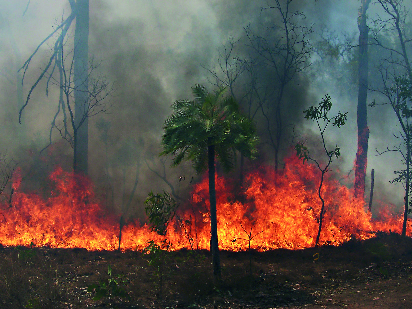
The Three Parks Savanna Fire-Effects Plot Network extends across three national parks (Kakadu, Litchfield and Nitmiluk) in the Top End of the Northern Territory. The fire monitoring program comprises two complementary components: satellite based mapping of fire events and on-ground assessment of change in biota at a set of permanent plots. Temporal visits are as follows: • 6 months (fire occurrence), • 4 months (fire mapping), • 5 years (vegetation), • opportunistic (fauna). Between 2012 and 2018 the Three Parks Savanna Fire-Effects Plot Network was a member of Long Term Ecological Research Network (LTERN), Australia, a facility of the Australian Government's Terrestrial Ecosystem Research Network (TERN).
-
The Nanangroe Plantation Plot Network is located in the southwest slopes of NSW west of Lake Burrinjuck and includes four exotic Pine Plantations (Nanangroe, Cotway, East Bungongo and Bungongo), as well as private properties adjacent to those plantations. Its research infrastructure is comprised of an array of stratified 2-ha long-term plots. Temporal visits occur annually / biennially (rotating sampling program). Between 2012 and 2018 the Nanangroe Plantation Plot Network was a member of Long Term Ecological Research Network (LTERN), Australia, a facility of the Australian Government's Terrestrial Ecosystem Research Network (TERN)).
-
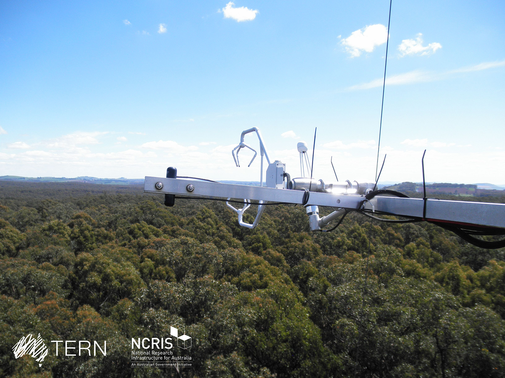
The Wombat Stringybark Eucalypt SuperSite is a member of the TERN Ecosystem Processes platform (https://www.tern.org.au/tern-observatory/tern-ecosystem-processes/), a field observatory within the Australian Terrestrial Ecosystem Network (TERN, http://www.tern.org.au/). The Wombat Stringybark Eucalypt SuperSite is located in the Wombat State Forest, Victoria, South Eastern Australia at an elevation of 713m. The site is a secondary re-growth forest that was last harvested in 1980. Dominant tree species are Eucalyptus obliqua (messmate stringybark), Eucalyptus radiata (narrow leaf peppermint) and Eucalyptus rubida (candlebark) with an average canopy height of 25 m. The understorey consists mainly of patchy grasses and the soil is a silty-clay overlying clay. The forest is managed by the Department of Environment, Land, Water and Planning and management includes selective harvesting and prescribed burning regimes. The climate of the study area is classified as cool-temperate to Mediterranean zone with cold and wet winters (May-Aug) and warm and dry summers (Dec-Feb). Key research objectives include: • What are the elements of structure, composition, functions and processes of the dry eucalypt forests of South Eastern Australia required for the sustainable management of these ecosystems? • What is the carbon sink/source strength of a dry sclerophyll forest and what is their contribution to Australia’s National Carbon Inventory? • What is the magnitude of emission and/or uptake of non-CO2 greenhouse gases, such as nitrous oxide and methane of dry eucalypt forest? • How will climate variability, drought or fire influence the ecosystem processes of dry eucalypt forest? The Dja Dja Wurrung peoples are the traditional owners at Wombat.
-
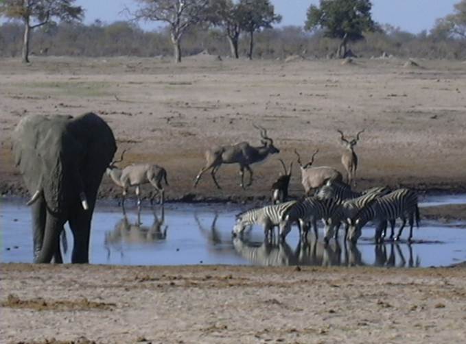
The LTSER Zone Atelier Hwange (ZAHWG) belongs to LTER-France network and is located in western Zimbabwe, in Sub-Saharan Africa, and is centered around Hwange National Park. The ecosystem is dominated by dystrophic savannas (mostly wooded savannas and dry woodlands) with discrete water sources. Surrounding land-uses include forestry areas, subsistence agro-pastoral farming, private ranches and hunting concessions, and mining. The ZAHG conducts an interdisciplinary research on the dynamics and resilience of this socio-ecological system organised, around a large protected area with re-known large mammal diversity and facing major social and climatic challenges for sustainable conservation