
fish abundance
Type of resources
Available actions
Topics
Keywords
Contact for the resource
Provided by
Years
Formats
Representation types
-
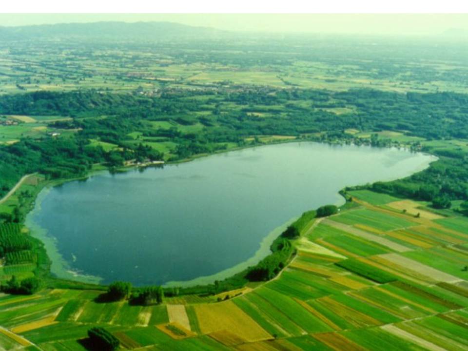
Lake Candia is a small and shallow lake, located in North-Westerm Italy. The mean elevation is 226 m a.s.l., the surface is 1,5 km², the max depth 7,7 m, the mean depth 4,7 m and the volume 0,007 km3. Lake Candia has suffered during its evolution a natural increase of its trophic state, undergoing a process of eutrophication culminated with a marked worsening of his ecological quality since the '60s. In the late '70s and mid '80s, this ecosystem was affected by fish mortality episodes and by the enormous development of emerged and submerged aquatic macrophytes. The systematic scientific study of Lake Candia began in 1985, when the CNR of Verbania was asked to perform a limnological research with the aim to propose a possible restoration intervention. In addition to the control of pollution sources from the basin, environmentally sound technologies were applied to reduce the effects of eutrophication, such as biomanipulation of the aquatic food chain and macrophyte control and management.The experiment conducted in Lake Candia has shown that significant improvements can be achieved through the management of a specific key components of the biocenosis of the lake. Data collection activities on hydrochemistry, phytoplankton, zooplankton, fish fauna, macrophytes, as well as physical limnology, took place from 1986 until 2012. To date, only hydrometeorological data collection (precipitation, air temperature, wind, solar radiation and lake levels), started in 1987, is active. LTER specific topics are: Long-term analysis of changes in community functional diversity of phyto-and zooplankton. Evaluation of the lake ecosystem response to short and intense rainfall events, in relation to the increase of nutrients input through runoff.
-
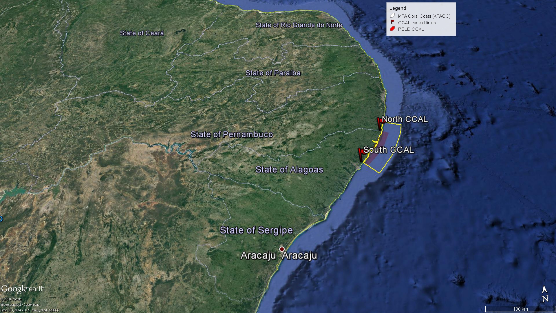
The Site comprises the Coastal Alagoas State portion of the Marine Protected Area Coral Coast (APACC), starting at the mouth of the Meirin River (Maceió, geographical coordinates: 9 ° 32'51 "S and 35 ° 36'59" W), following the preamar meanline, in the general northeasterly direction, bypassing and including the mangroves in all their extension to the left margin of the Persinunga River, on the border between Alagoas and Pernambuco States, geographical coordinates: 8 ° 54'49.04 "S and 35 ° 9'10.13" W, and advancing towards the direction of the Atlantic Ocean to the limit of the 10m isobath, according to the bathymetric chart of the Brazilian Navy. In this section, we can find significant samples of the main ecosystemic features present in APACC: estuaries, beach formations, marine angiosperm meadows, coralline reefs, and beach rocks.
-
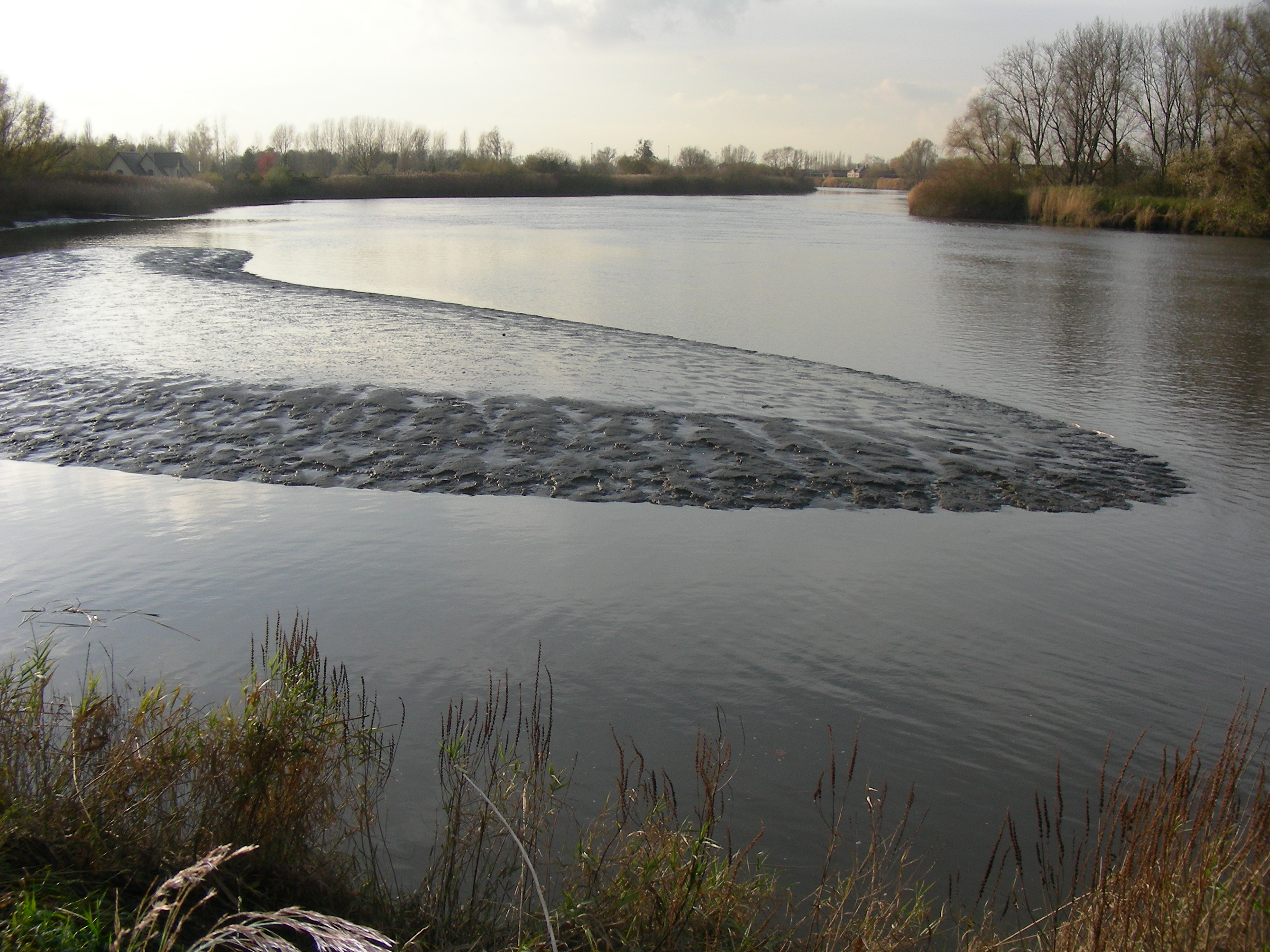
The study site starts at the mouth of the river (Vlissingen, the Netherlands) and extends to Gent, 160 km from the mouth, where tidal influence is stopped by sluices. The tributaries the Durme and the Rupel, with the Nete , Dijle and Zenne are also under tidal influence and are considered part of the estuary. The natural inundated areas around the river and the valleys up to 5m TAW are also part of the study system.
-
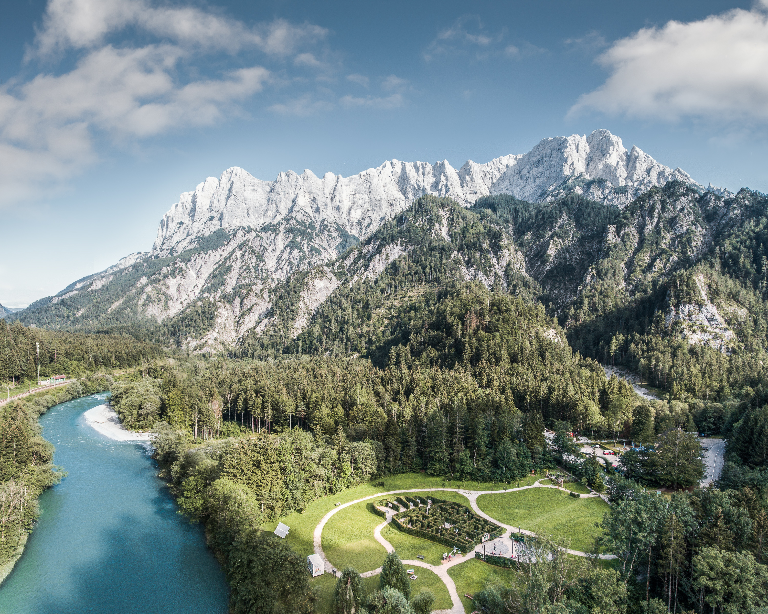
The Gesäuse Nationalpark and the Johnsbach valley belong to the Ennstal Alps, a part of the Northern Limestone Alps. They are situated in the province of Styria in the center of Austria. Together, they form the joint test site named Gesäuse-Johnsbachtal. This region is characterized by a mountainous landscape which is cut by the river “Enns”. In the north, it borders Eisenwurzen Nature Park and is only 6 km away from the Kalkalpen, a National Park in Upper Austria. In the south, the borders are the Eisenerzer Alps. The total area of the site is about 155 km². The terrain shows a great elevation range from 600-700 m in the Johnsbach valley to over 2300 m in the summit region of the Gesäuse, with Hochtor (2369 m) being the highest mountain. Due to the great range of altitude differences within small areas the Gesäuse-Johnsbachtal shows extremely diverse habitats and, consequently, species of animals and plants. In general, the landscape is dominated by mountain forests along with high Alpine rock formations and meadows. These complex topographic, hydrological, geological, geomorphological and meteorological conditions pose a scientific challenge for all kinds of environmental monitoring and modeling.
-
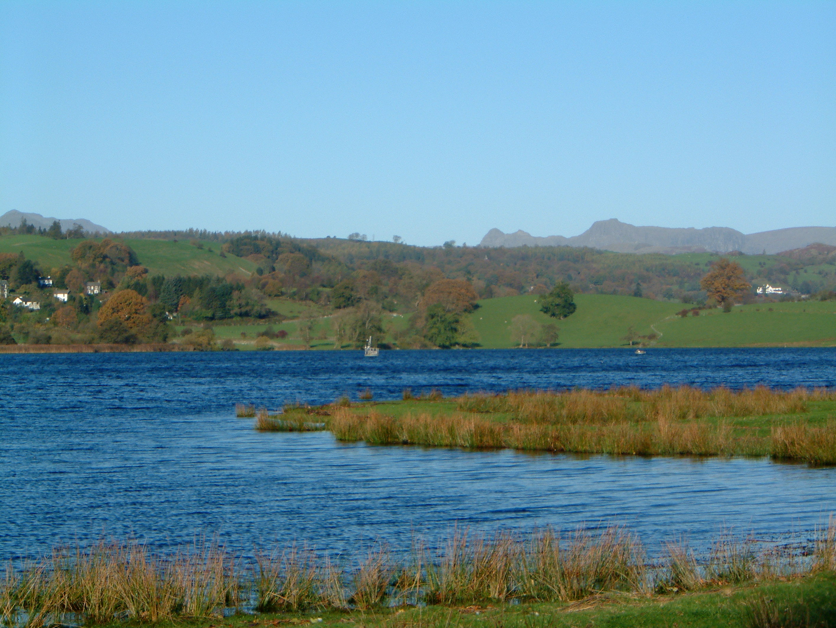
UK ECN Site. Esthwaite Water is a natural lake situated in a glacial valley and is generally agreed to be the most productive or eutrophic lake in the English Lake District. It lies approximately 65 m above sea level and has an area of 1 km2 and a maximum depth of 15.5 m. The average retention time is 90 days. The catchment area is 17.1 km 2 and the hills are composed geologically of Bannisdale slates and grits. The surrounding land is used chiefly for agricultural purposes and forestry. The lake is a grade 1 Site of Special Scientific Interest and has been a designated "Ramsar" site since November 1991. The diverse aquatic invertebrate fauna includes a number of species with restricted distributions in Britain, one of which is the flatworm, Bdellocephala punctata. The slender naiad, Najas flexilis, which is listed as Nationally Scarce, has been found in Esthwaite Tarn. Artificial enrichment of the lake occurs by input from the Hawkshead Sewage Treatment Works (which has operated a continuous programme of phosphate stripping since 1989) and originally from effluents from the fish farm which used to be situated towards the south of the lake. The lake undergoes summer stratification with oxygen depletion regularly below 7 m and sometimes as shallow as 5 m. The phytoplankton tends to be dominated by diatoms in spring and by cyanobacteria for much of the summer.
-
South-West Bulgaria, Mediterranean catchment
-
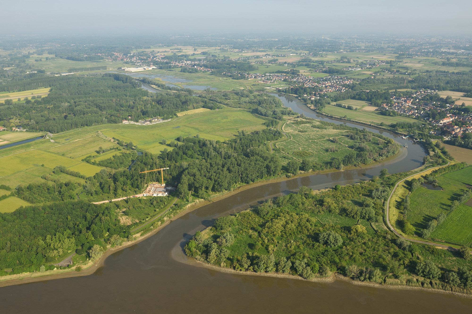
The Durme debouchment is a subsite (12 ha) of the Scheldt Estuary and its alluvial plains. The setup for deployed in the context of eLTER_RI is a cross-shore open-air laboratory open for other researchers and students to experiment in a long-term in-situ setup. The responses studied are on the level of sediment, infauna of tidal flats, (ground)water levels, carbon (including microphytobenthos and green-house gases), (ground)water quality and marsh vegetation (plant biodiversity, biomass). An end-goal is to provide long term field data to develop numerical eco-morphodynamic model(s) that is/are able to predict the effect of changed water budgets on carbon sequestration or greenhouse gas emissions, biodiversity (by eDNA), macro-invertebrate production and changes in tidal wetland plant species distribution and production in a cross-shore approach.
-
In order to combat the eutrophication of Lake Balaton, the Kis-Balaton Water Protection System (KBWPS) was initiated in the early 1980s. Originally, the KBWPS consisted of an 18 km2 shallow (less than 1.3 m) artificial lake system (Lake Hídvégi) and a 16 km2 wetland, which were constructed on the site of the former Kis-Balaton wetland in the mid-1980s. Later, the wetland part of the KBWPS was significantly enlarged (over 50 km2). Lake Hídvégi was designed to retain nutrients and provide ideal conditions for algae growth, while the wetland component of the KBWPS prevented these algae from entering Lake Balaton. Regular limnological, ornithological, ichthyological and plant ecological measurements are carried out in both Lake Hídvég and the wetland part of the KBWPS.
-
A Long Term Ecological Research Program -GUADALQUIVIR_LTER 1997-2022- has been maintained since 1997 at the Guadalquivir estuary. The temporal and spatial evolution of abundances and biomasses of the aquatic community species -plankton, fish, and crustacean- is monitored monthly since 26 years ago (1997 to present). Community data is resolved at different levels of the ecosystem -individuals, populations, and communities- and completed with their corresponding water environmental data -salinity, temperature, turbidity, dissolved oxygen, nutrients, pH, among others- as well as detailed information on trophic structure and biology of the main species. Since 2021 a new Spanish Science Agency project is working together with Guadalquivir-LTER on the socio-ecology of the region, management, and cooperation among different stakeholders.
-
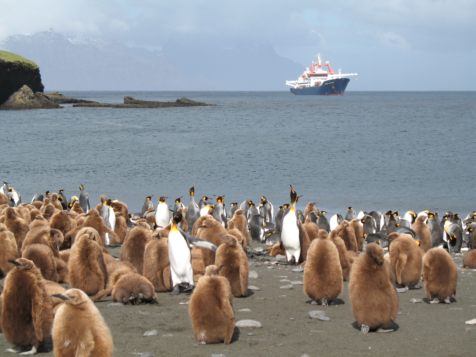
The LTSER Zone Antarctique belongs to LTER-France network and is located in Antarctica (Adelie Land), French sub-Antarctic Islands (Crozet archipelago, Kerguelen Islands, Saint-Paul et Amsterdam Islands) and southern ocean. General information below concerns Kerguelen Islands. The ZATA measures the impacts of climate change and human activities on antarctic and sub-antarctic ecosystems.