
flowering date
Type of resources
Available actions
Topics
Keywords
Contact for the resource
Provided by
Years
Formats
Representation types
-
Data on pollen is very valuable for many scientific questions relating to climate change, ecology and allergology. This data is analysed according to European standards by analysts at the Medical University of Vienna. At the Biologische Station Neusiedler See, a so-called pollen trap is used, which is positioned on the roof of the station and is maintained on a weekly basis. Air is sucked in and pollen particles adhere to a rotating adhesive film, allowing not only the detection of certain pollens, but also their temporal classification. This makes this method suitable for determining the pollen count and pollen forecasting.
-
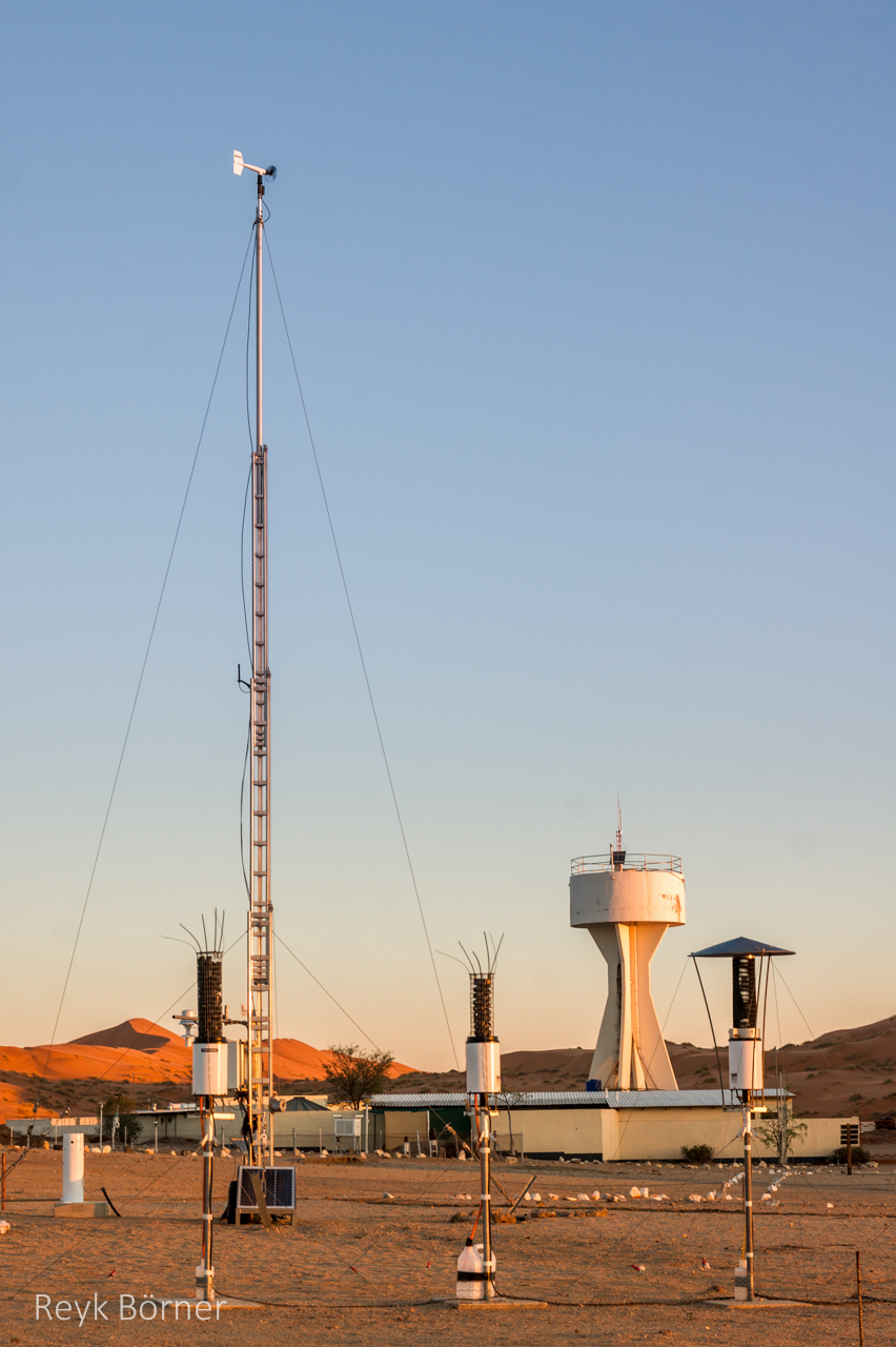
Gobabeb is a Research Centre with accommodation, conference, laboratory and teaching facilities in Namibia's Namib-Naukluft National Park, about 65km from the coast on the northern bank of the ephemeral Kuiseb River. It is located at a point where three main habitats meet (ephemeral river, gravel plain and the Namib erg) and lies within the inland edge of the fog zone. It is the designated monitoring and research centre for the Namib Sand Sea World Heritage Site.
-
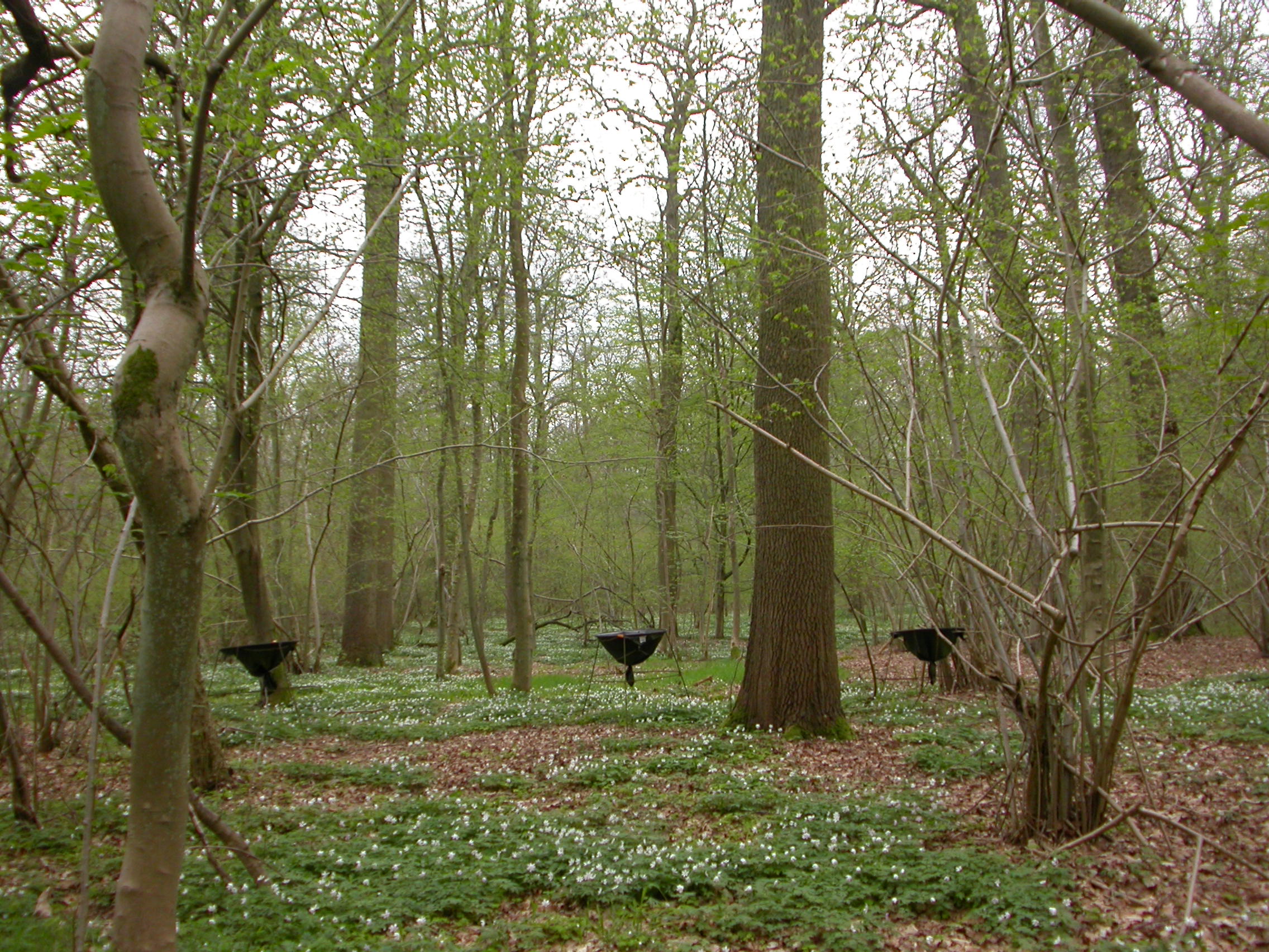
The Forest of Meerdaal is situated on the Belgian loess belt about 25 km south-east of Brussels. It is an ancient woodland site, previously managed as coppice with standards, well known history (up to the middle ages). It is managed as multifunctional forest containing strict forest reserves with dense sampling grid (measured every decade). its proximity to the university make it an ideal research subject. Over the years many different studies have been conducted and documented.
-
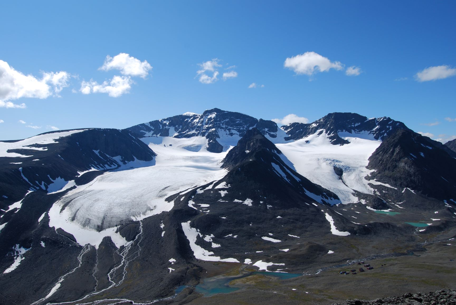
Tarfala Research Station is located at 1130 m a.s.l. in the high alpine Kebnekaise mountains, northern Sweden. The Tarfala valley catchment reaches from 2100 to 500 m a.s.l. Vegetation spans high alpine flora, mountain heath and meadows and the upper mountain birch forest zone. The lake, rivers and glacier meltwater streams is part of the headwaters for the unregulated Kalix River. The station was established in 1946 with the main aim to study glacier massbalance. The best known glacier is Storglaciären which is one of the most well studied glaciers in the world. The glaciers and terrestrial and aquatic ecosystems formed by the harsch climate in this area is now changing rapidly. Over the years the environmental monitoring program has expanded and includes today mountain meteorology, water discharge and chemistry, permafrost and vegetation. The station belongs to Stockholm University and is part of the Swedish Infrastructure for Ecosystem Science (SITES).
-
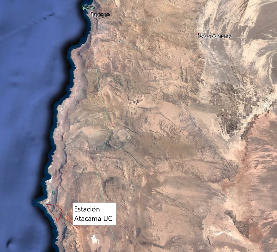
The Alto Patache fog oasis is located in northern Chile, 70 km south of Iquique, Tarapacá Region. This Oasis is located along the Coastal Range of Norte Grande, in the Atacama Desert, known for its remarkable aridity. The influence of coastal fog allows the development of a specially adapted vegetation, which provides habitat suitable for animal species.
-
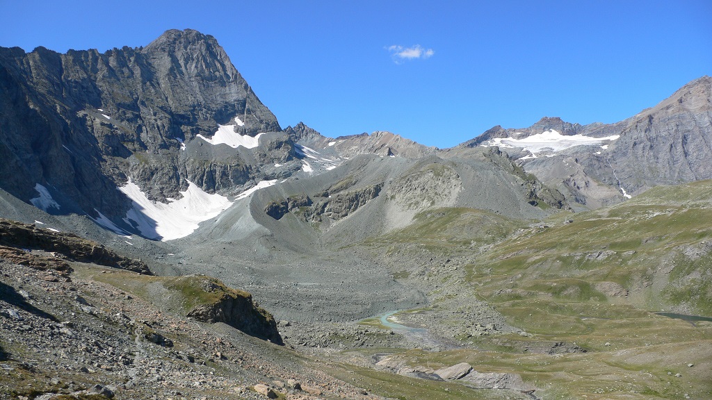
The Bessanese high-elevation experimental site is located in the Western European Alps (Graian Alps, municipality of Balme, Italy). This site is representative of the glacial and periglacial environments of the Alps. In this site, glaciers have been the main morphogenetic agent: the head of the basin hosts a well-developed glacial cirque, while the LIA has left an imposing moraine on the left side of the glacier as an indelible mark in the landscape. Additional cryogenic and atmospheric processes, running waters and gravity have contributed to shape the study area. These latter processes are becoming more and more important, compared to glacier shaping, in the present context of climate change, which led to an impressive-areal and volume reduction of the glacier. Most of the area once occupied by the glacier is now covered with debris which, in many cases, is ice-cored, or contains ice lenses. Downstream of the main lake of the basin, located at an elevation of about 2580 m, the debris forms a large and characteristic rock glacier. Among gravitative processes, rockfalls are particularly common and relevant from the hazard point of view in the study area. dataset available on Pangaea repository: 1. Nigrelli, Guido; Chiarle, Marta; Merlone, Andrea; Coppa, Graziano; Musacchio, Chiara (2022) – Rock temperature variability in the alpine cryosphere. Pangaea Data Publisher for Earth & Environmental Science, https://doi.pangaea.de/10.1594/PANGAEA.950246 2. Nigrelli, Guido; Barbero, Secondo; Chiarle, Marta (2021) – Solar radiation at the Bessanese high-elevation experimental site (Italy). Pangaea Data Publisher for Earth & Environmental Science, https://doi.org/10.1594/PANGAEA.930679 3. Nigrelli, Guido; Chiarle, Marta; Merlone, Andrea; Coppa, Graziano; Musacchio, Chiara (2018) – Rock and debris temperature in the alpine cryosphere. Pangaea Data Publisher for Earth & Environmental Science, https://doi.org/10.1594/PANGAEA.894317
-
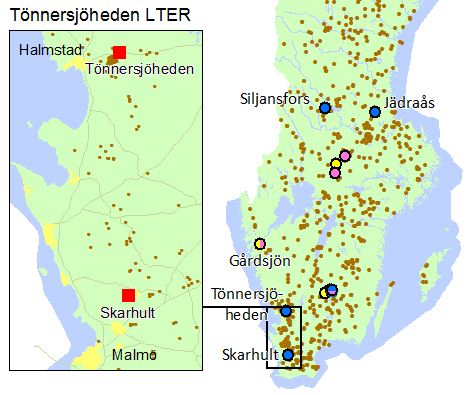
Tönnersjöheden and Skarhult experimental forests are situated in the nemoral/nemo-boreal zone closed to the Atlantic sea in South Sweden. Tönnersjöheden (1143 ha) was established as an experimental forest in 1923 with the original aim of studying ecosystems in transition from low productive broad-leaved forests and open Calluna heath-lands to conifer dominated forests. Skarhult (180 ha) was opened as an experimental forest in 1989 with a main focus on management and ecology of broad-leaved forest stands. Forests at Tönnersjöheden are dominated by old growth broad-leaved stands with long continuity, first and second rotations of planted coniferous stands and a number of planted stands with exotic tree species. Forests at Skarhult are dominated by naturally regenerated and planted pure and mixed broad-leaved forest stands of European beech (Fagus sylvatica L.), common oak (Quercus robur L.) and ash (Fraxinus excelsior L.). Research and monitoring activities cover a broad range of basic and applied subjects in the field of forest and forest related environmental sciences. The experimental forests are well-documented and well-described concerning history, climate, soils, vegetation and forest stands.
-
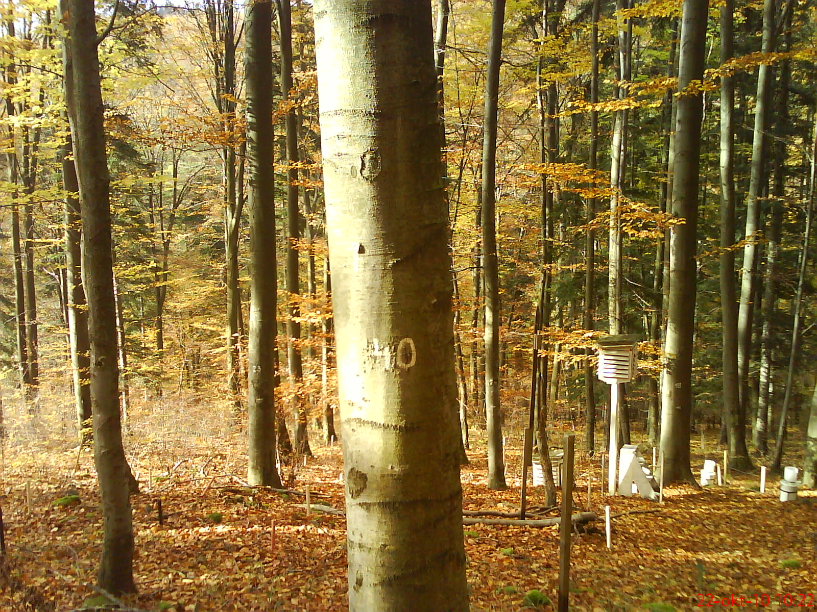
The research is focused on complex study of ecological processes running within the beech ecosystem at the lower edge of its occurrence. The Ecological Experimental Station (EES) was founded in the Kremnické vrchy Mountains (Western Carpathians, Slovakia) in 1986. It is located at 500 m a.s.l., on SW slope. The leading stand-forming association is Dentario bulbiferae-Fagetum Z l a t n i k 1935, with locally admixed Carici pilosae-Fagetum O b e r d. 1958. For both associations, to the permanent constituents (at different dominances and abundances) belong: Carex pilosa, Carex sylvatica, Carex digitata, Galium odoratum, Dentaria bulbifera, Anthyrium filix-femina, Dryopteris filix-mas. The dominant tree species at the locality is beech (80–95%); fir, oak and hornbeam are the associated species. The soil type is andic cambisol with high skeleton content (20–60%) and mild acid reaction (pH 5.4–6.4), the humus form is acid mull. The long-term mean (1951–1980) annual air temperature is approximately 6.8 °C, with a mean of 17 °C in the warmest month (July) and - 4 °C in the coldest month (January). The mean annual precipitation is approximately 780 mm. An increasing value (+1.1 °C) of the mean annual air temperature was observed during the last two decades; however, the mean annual precipitation did not change significantly. The site is equipped with a few climatic microstations, collectors for precipitation and litterfall, lysimeters, dendrometers, etc.
-
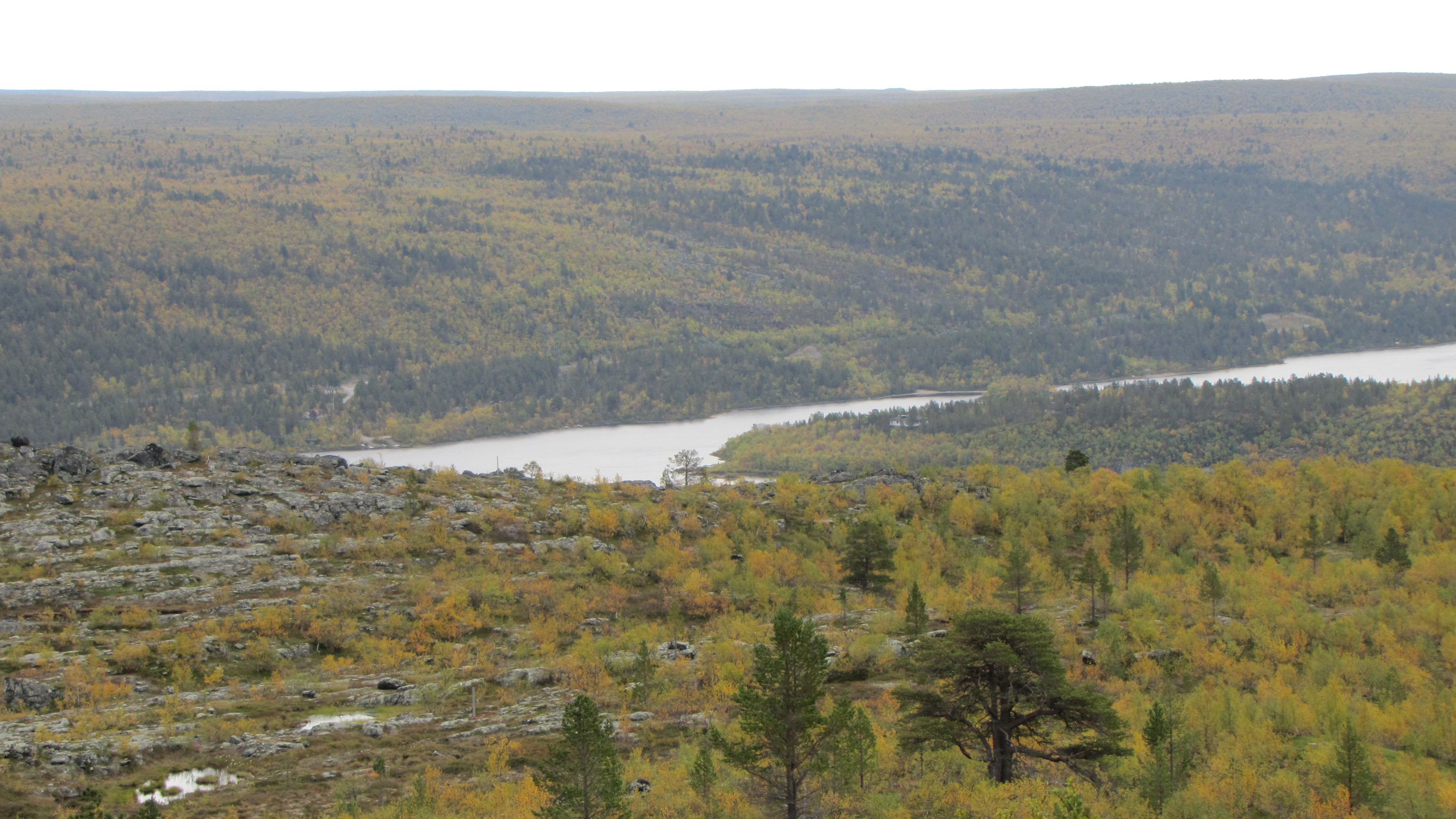
Kevo Subarctic Research Institute of the University of Turku is a modern research institute (strict nature reserve in the immediate vicinity) with long-term ecological data-sets and field-experiments at the northernmost tip of the European Community. This facility provides excellent research possibilities for scientists interested in environmental, ecological and evolutionary work in the ecotone between northern Boreal and Subarctic/Arctic Biomes. Kevo has established a research network (in collaboration with Department of Geology, University of Turku) for a long-term on study on Northern Fennoscandic Quaternary glacial cycles and Holocene environmental change (palaeoecology and –stratigraphy, lacustrine strata), including a research programme on late Weichselian climatic variability. Kevo is famous for the long term ecosystem studies on herbivory dynamics of the mountain birch forests and the geo-referenced data-set about vascular plant distribution in over 5000 one sq-km grid cells in the northernmost Finland as well as for studies on annual and seasonal fluctuations in animal numbers (small rodents, moths, predatory mammals and birds and in plant phenology and performance). Several research projects are focused on the vegetation dynamics influenced by reindeer grazing. Kevo also provides integration with the Finnmark area in the northermost Norway and has an established collaboration with various Sámi organizations over the area.
-

The Hölstein site is located in in the eastern part of the Swiss Jura mountains (47°26’16.4’’, 7°46’31.1’’; 540 m a.s.l.), in a mixed, temperate forest with an exceptionally high biodiversity and a vigorous tree regeneration. The research plot has a size of 1.6 ha and comprises 540 mature trees. The main tree species are Fagus sylvatica and Picea abies with an admixture of Abies alba, Quercus petraea, Pinus sylvestris, Acer pseudoplatanus, Carpinus betulus, Fraxinus excelsior and Sorbus torminalis. A canopy crane is installed in the center of the research area to access the tree canopies for in situ measurements and for sampling of leaf material. Rainout shelters will be installed in 2019 for conducting a long-term throughfall exclusion experiment.