
forest cover
Type of resources
Available actions
Topics
Keywords
Contact for the resource
Provided by
Years
Formats
Representation types
-
Georeferenced areas burnt by wildfires, recorded by the Portuguese Institute for Nature Conservancy and Forests, a series from 1990-2014
-
GIS layer - map of forest types. Forest typology based on abiotic habitat parameters such as soil fertility and moisture, widely used by the forestry sector. Also available are thematic GIS layers showing historic forest and forestry data, as well as more current data on forest management (incl. timber harvesting) and such parameters as dominant species: height, age, trunk circumference (standard breast level measurement), proportion of coverage, etc.
-
As in http://forest.jrc.ec.europa.eu/activities/forest-mapping/forest-cover-map-2000/ clipped for PA Montado and projected using EPSG:3763 (ETRS89/Portugal TM6).
-
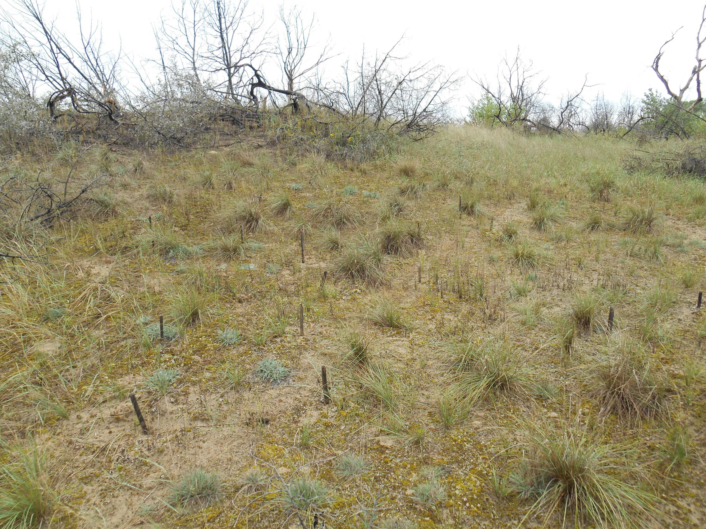
3 sites with 10 ha altogether; follow the long-term changes on sand steppe gaps of juniper-poplar forest in order to study the effect of fire
-
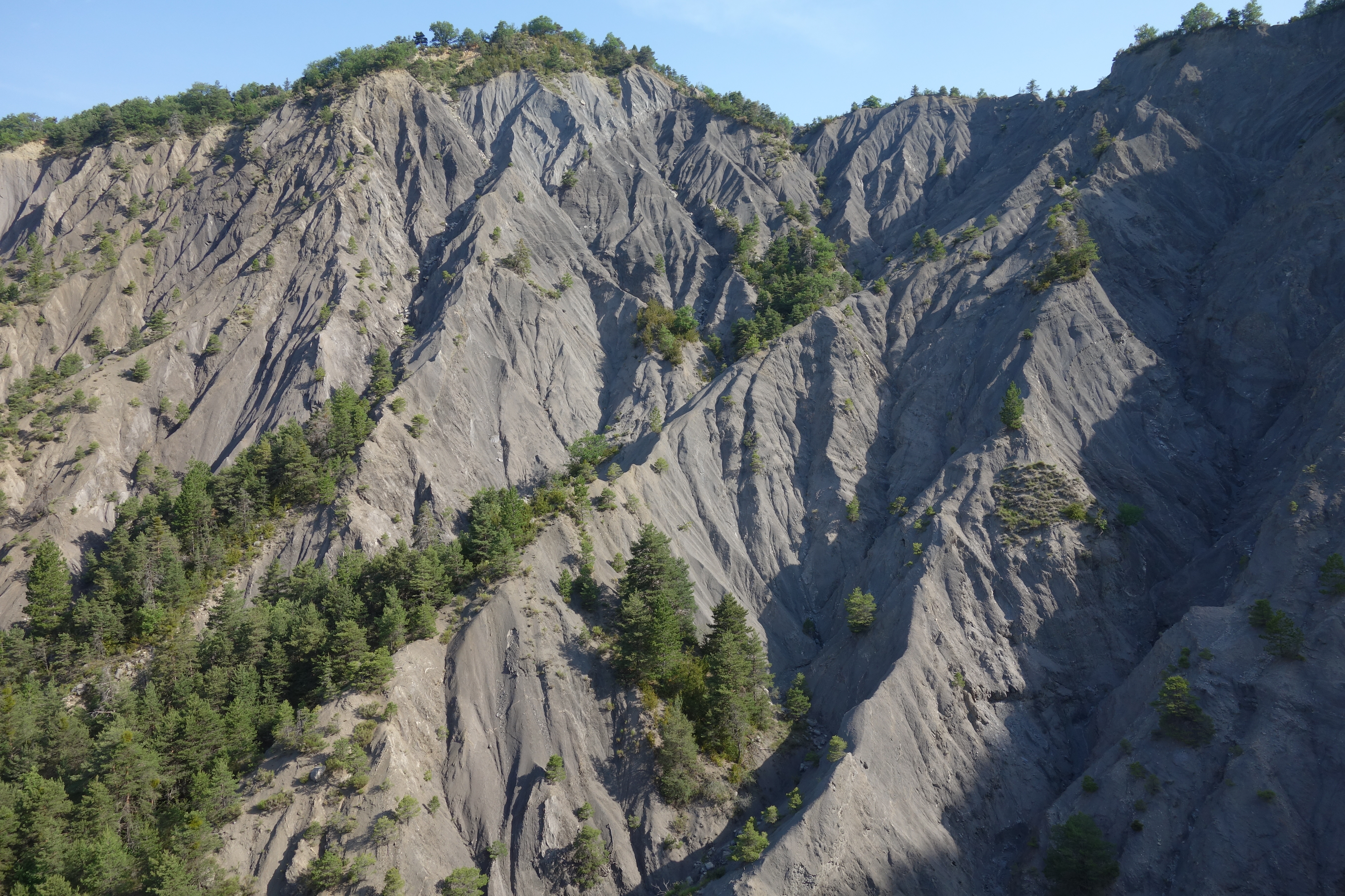
Draix site is part of Draix-Bleone observatory, located in the French South Alps, upstream of Digne, on the left side of the Bleone. Draix site was equipped in 1983 to study mountain erosion and sediment transport. It is composed of 4 catchments, which are equipped to measure water and sediment fluxes, at spatial scales ranging from 0.001 km2 to 1 km2, with contrasted land cover. These catchments are entirely situated on black marls that are very sensitive to weathering and erosion, resulting into a badland topography. One catchment was reforested at the end of the XIXth century whereas the other are mostly denuded. This site is characterized by intense erosion and intermittent sediment fluxes. The variables that are monitored on the long-term include rainfall and meteorology, high-frequency water discharge and suspended sediment concentration (1-10 minutes), event-scale bedload transport, and some physico-chemical properties of stream water and sediments.
-
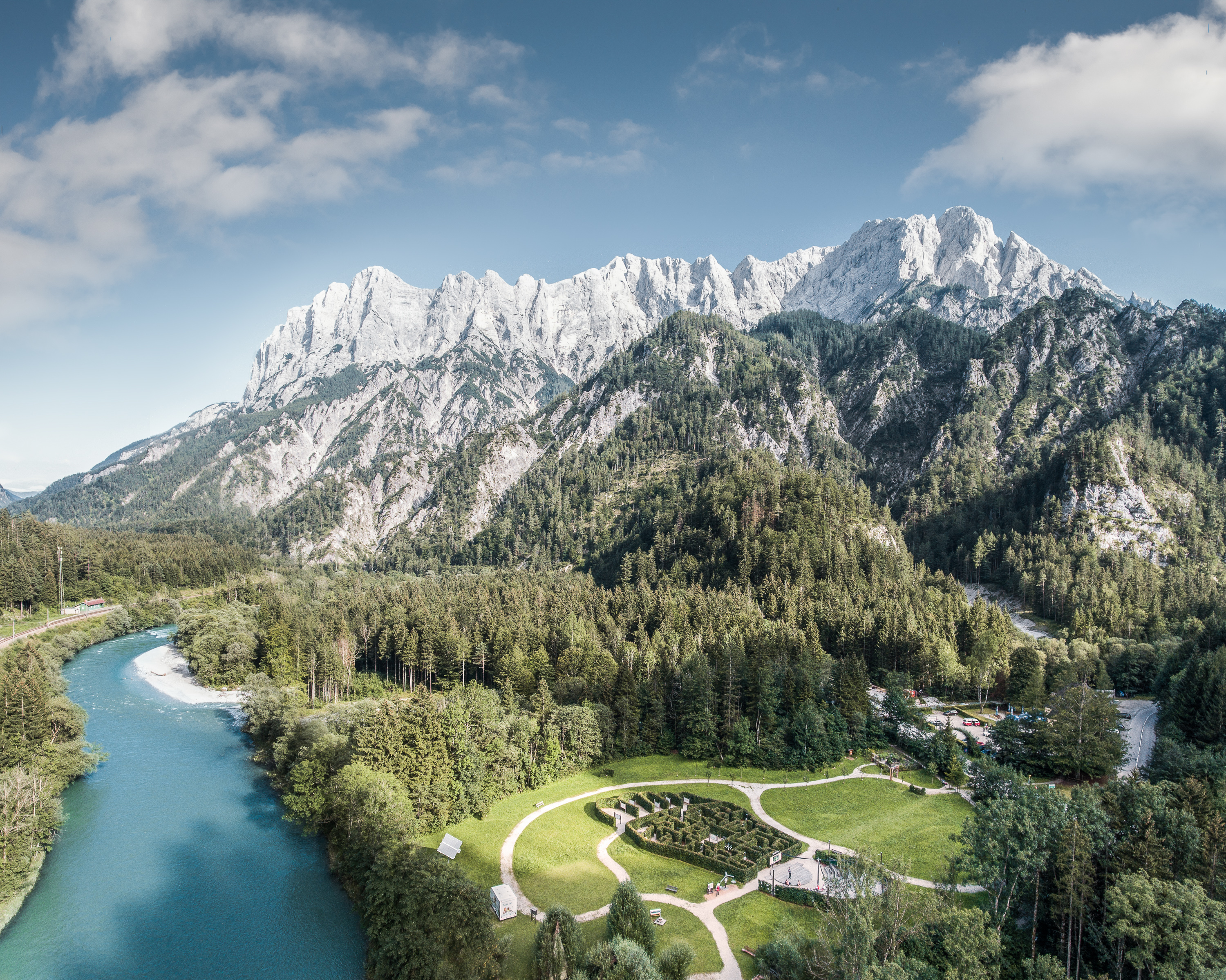
The Gesäuse Nationalpark and the Johnsbach valley belong to the Ennstal Alps, a part of the Northern Limestone Alps. They are situated in the province of Styria in the center of Austria. Together, they form the joint test site named Gesäuse-Johnsbachtal. This region is characterized by a mountainous landscape which is cut by the river “Enns”. In the north, it borders Eisenwurzen Nature Park and is only 6 km away from the Kalkalpen, a National Park in Upper Austria. In the south, the borders are the Eisenerzer Alps. The total area of the site is about 155 km². The terrain shows a great elevation range from 600-700 m in the Johnsbach valley to over 2300 m in the summit region of the Gesäuse, with Hochtor (2369 m) being the highest mountain. Due to the great range of altitude differences within small areas the Gesäuse-Johnsbachtal shows extremely diverse habitats and, consequently, species of animals and plants. In general, the landscape is dominated by mountain forests along with high Alpine rock formations and meadows. These complex topographic, hydrological, geological, geomorphological and meteorological conditions pose a scientific challenge for all kinds of environmental monitoring and modeling.
-
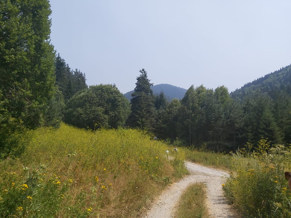
This site is located on the territory of National Park “Rila”, Bulgaria. Parangalitsa has been a reserve since 1933. It is situated on part of the southwestern slopes of Rila mountain, covering 1,509 hectares. It contains some of the oldest pine tree forests in Europe with an average age of over 200 years. The site is a part of the network of bioecological stations of Forest Research Institute – BAS and research is focused on highly productive coniferous forests with unique biomass. In the main experimental plots, long-term complex studies were conducted during the period 1979 - 1998, a large-scale database was created and a number of significant scientific results were obtained. In the period 2000 - 2018, separate targeted studies were carried out - focused on some ecosystem processes, which allows the analysis and evaluation of the functioning of ecosystems to be don
-
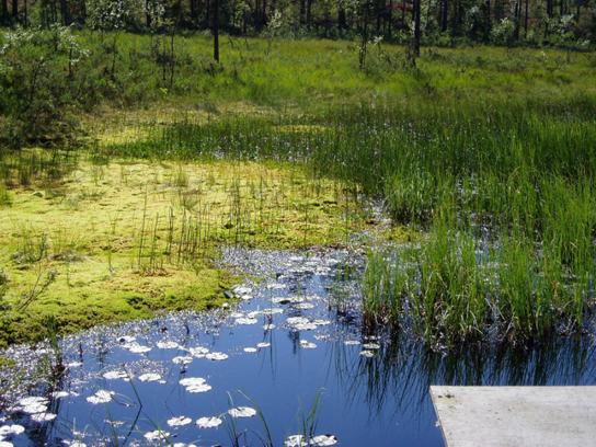
Coniferous forests and mire.
-
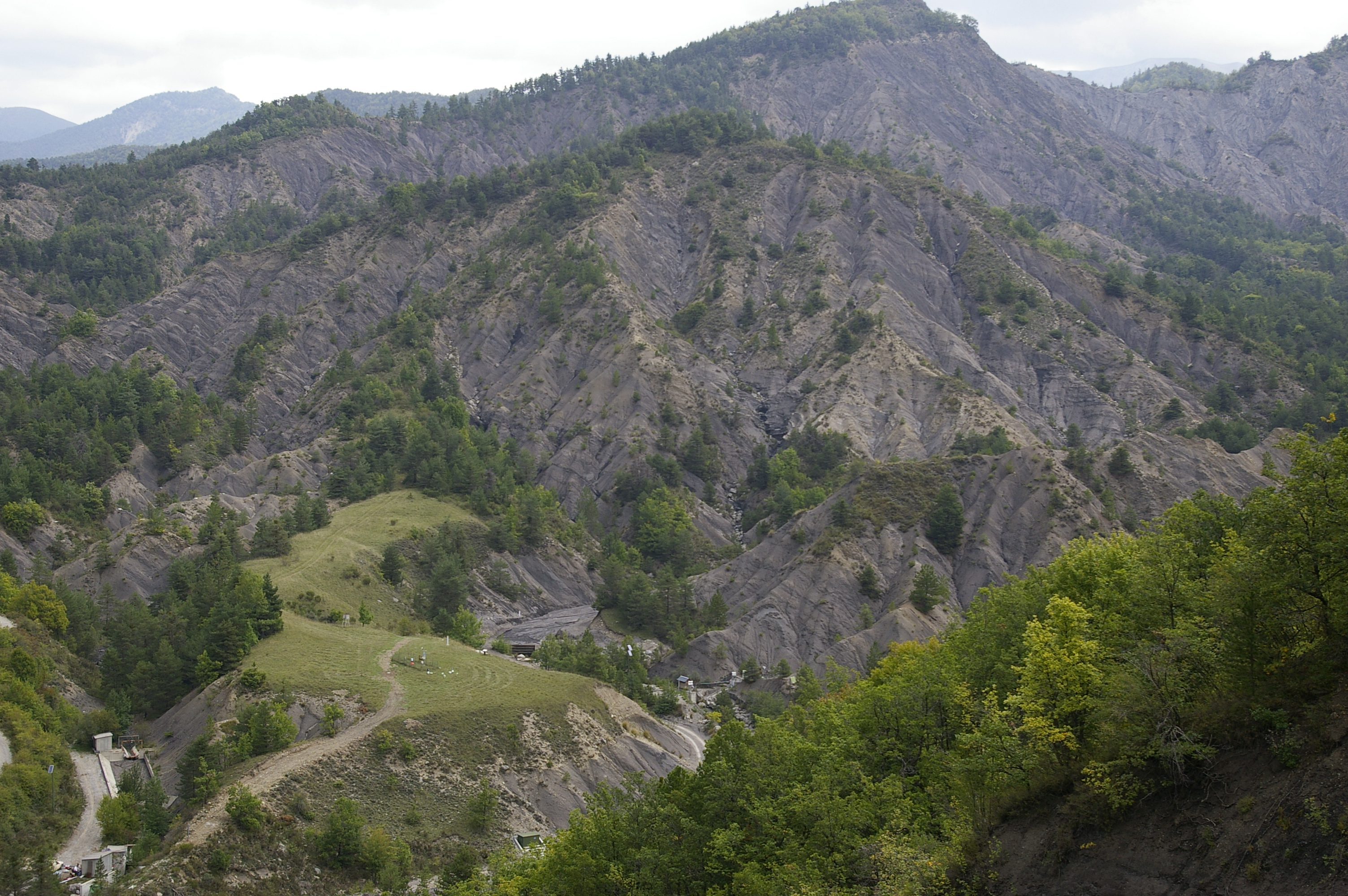
Draix-Bleone observatory was created in 1983 to study mountain erosion and sediment transport. It is located in the French South Alps, upstream of Digne, on the left side (Draix site) and right side (Galabre site) of the Bleone river. Several catchments are equipped to measure water and sediment fluxes, at spatial scales ranging from 0.001 km2 to 34 km2, with contrasted land use and land cover. The smallest catchments are entirely situated on black marl that are very sensitive to weathering and erosion, resulting in a badland topography. The Bouinenc and Galabre catchments integrate a larger diversity of lithologies and land use that are characteristic of the Pre-Alps. The climate is mountainous and Mediterranean. These sites are characterized by their intense erosion and intermittent sediment fluxes. The variables that are monitored on the long-term include rainfall and meteorology, high-frequency water discharge and suspended sediment concentration (1-10 minutes), event-scale bedload transport, some physico-chemical properties of stream water and sediments. Draix-Bleone Observatory is managed by IGE and is funded by INRAE, INSU and OSUG. It is a member of the French research infrastructure OZCAR. The GIS Draix-Bleone gathers all research teams involved on these sites.
-
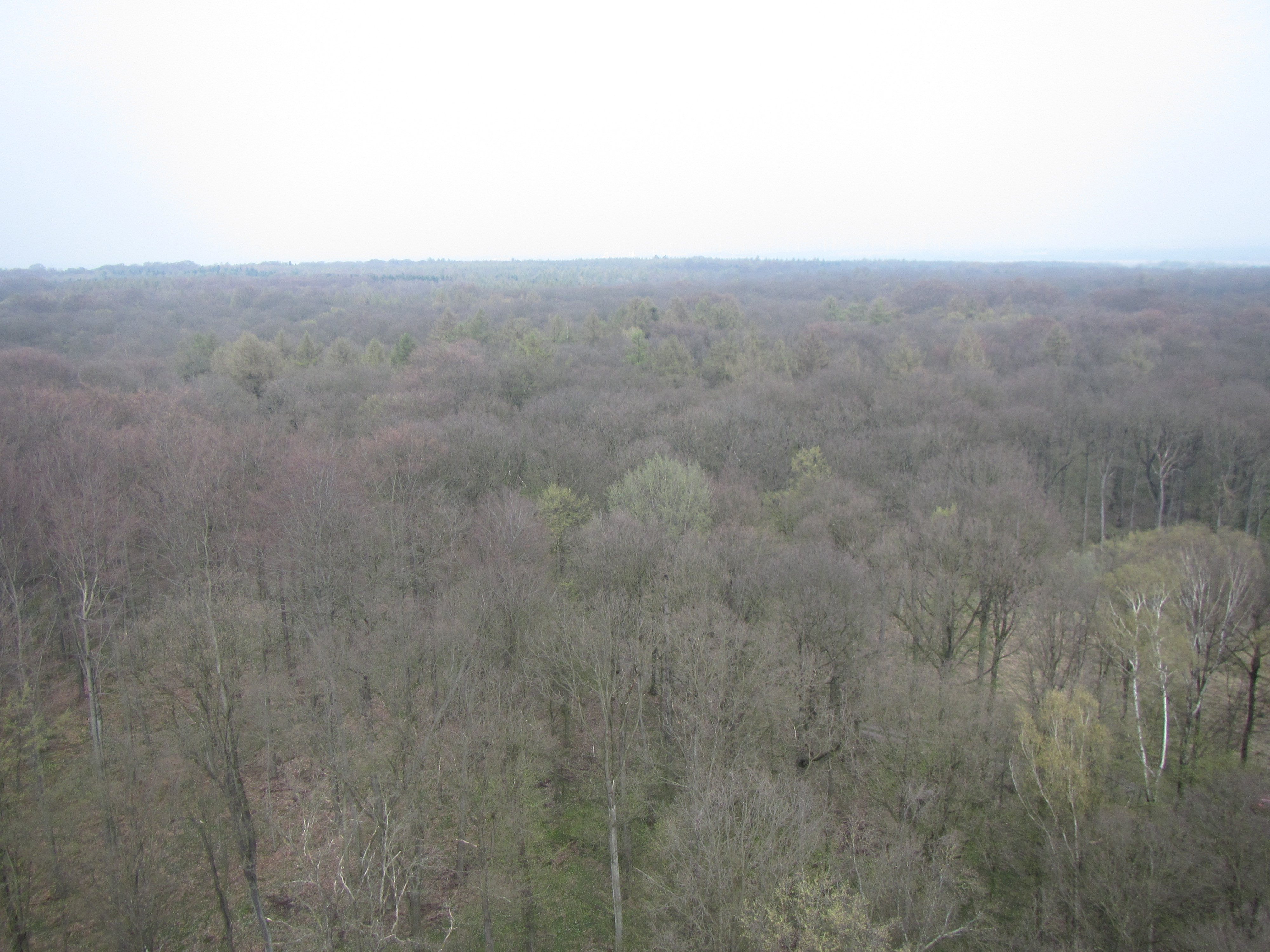
The Hohes Holz is a mixed beech forest, with an intensive research site with respect to carbon and water cycle at the northern border of the Bode catchment close to Magdeburg, Germany. It is certified as class 1 ecosystem station in ICOS.