
functional diversity
Type of resources
Available actions
Topics
Keywords
Contact for the resource
Provided by
Years
Formats
Representation types
-
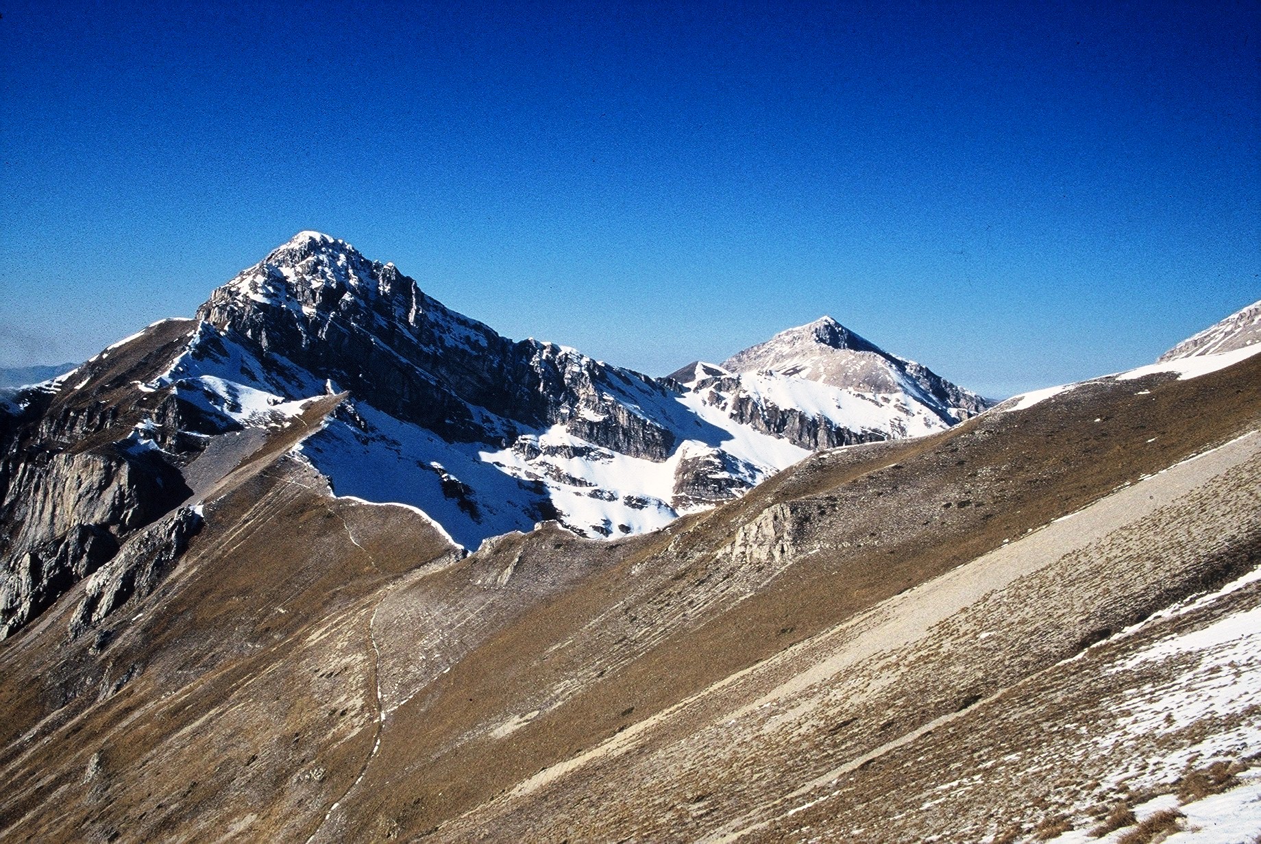
The site consists of “orographic islands” with high elevation vegetation in central Mediterranean basin, along the Apennines mountain range, within the Appennino Tosco-Emiliano National park and partially in the Appennino Modenese Regional park. It includes 64 permanent plots for plant species monitoring, distributed from timberline zone to the subalpine/alpine belt (1722-2000 m), that belong to the GLORIA project’s world network (GLobal Observation Research Initiative in Alpine ecosystems); The plots lie at the top of four summits, displayed along an altitudinal gradient, chosen following the GLORIA Target Region selection criteria. Furthermore, other 26 permanent plots, detached from the GLORIA project, have been settled on mount Prado. The observation and the long-term monitoring of vegetation and alpine plant species population started in 1999. The collection of soil temperature and osmotic potential started in 2001 and 2013, respectively. The site is resurveyed regularly to collect vegetation data (in term of presence/absence and coverage) and climatic data (temperature and osmotic potential data series recorded every 30 minutes by data loggers) in order to assess impacts of climate change on plant communities and single plant species of interest.
-
South-West Bulgaria, Mediterranean catchment
-
The site corresponds to the territory of Gran Paradiso National Park. This includes different ecosystems, present along the altitudinal gradient (ca. 800 – 4000 m asl): the woody areas of the montane belt, the ecotonal habitats of the subalpine belt and the meadows of the alpine one. The nival belt is widely represented inside the Park. The habitats with poor or no vegetation (rocks, screes, glaciers) cover about 60% of the territory, meadows and pastures 17%, about 20.2% is characterised by woods and shrubs, while 0.8% by cultivated lands and urban areas. The aquatic ecosystems, beyond the streams, comprise almost 15 lakes, bigger than 10,000 m2 and located at an altitude higher than 2000 m asl. The area is directly managed by the Park Authority; research and monitoring activities are coordinated by the Sanitary and Scientific Office of the Park.
-
In order to combat the eutrophication of Lake Balaton, the Kis-Balaton Water Protection System (KBWPS) was initiated in the early 1980s. Originally, the KBWPS consisted of an 18 km2 shallow (less than 1.3 m) artificial lake system (Lake Hídvégi) and a 16 km2 wetland, which were constructed on the site of the former Kis-Balaton wetland in the mid-1980s. Later, the wetland part of the KBWPS was significantly enlarged (over 50 km2). Lake Hídvégi was designed to retain nutrients and provide ideal conditions for algae growth, while the wetland component of the KBWPS prevented these algae from entering Lake Balaton. Regular limnological, ornithological, ichthyological and plant ecological measurements are carried out in both Lake Hídvég and the wetland part of the KBWPS.
-
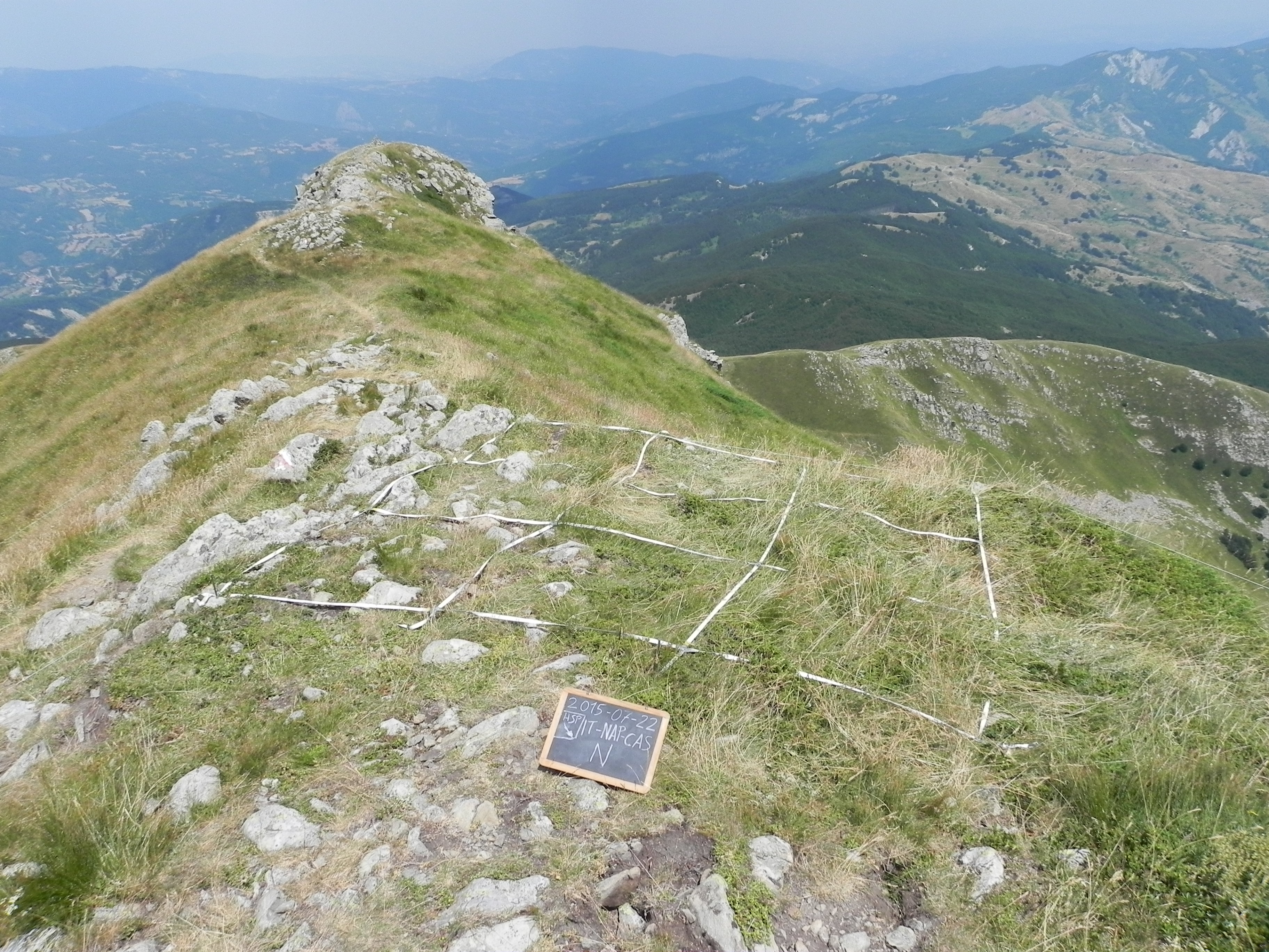
The site consists of high elevation vegetation in central Mediterranean basin, along the Apennines mountain range: xerophitic primary grassland (Pediculari elegantis-Seslerietum tenuifoliae) and mesophitic primary grassland (Luzulo italiacae-Festucetum macratherae), with important resident and migratory bird communities. Six plots, each one 100 m2 large, grouped in two cluster-plots including each one three plots, representative of a larger area of 0,5 km2 ca., ranging from 2100 to 2300 m a.s.l. (alpic and Mediterranean high-mountain belts.
-
The WelFin LTER-site is located at the Hanko peninsula, at the entrance to the Gulf of Finland. The activities are largely focused to the coastal areas surrounding Tvärminne Zoological Station (University of Helsinki); a marine station established in 1902. The site is well equipped to meet the research demands, offering differently sized research vessels, field equipment, a range of climate chambers, and modern analytical instrumentation. A large part of the surrounding area is a nature reserve, to be used only for science and education. Many of the partners of this site have a long history of scientific collaboration. Although high-quality basic research continues to be at the heart of the site’s activities, many of the research questions nowadays include aspects of human induced long-term change.
-
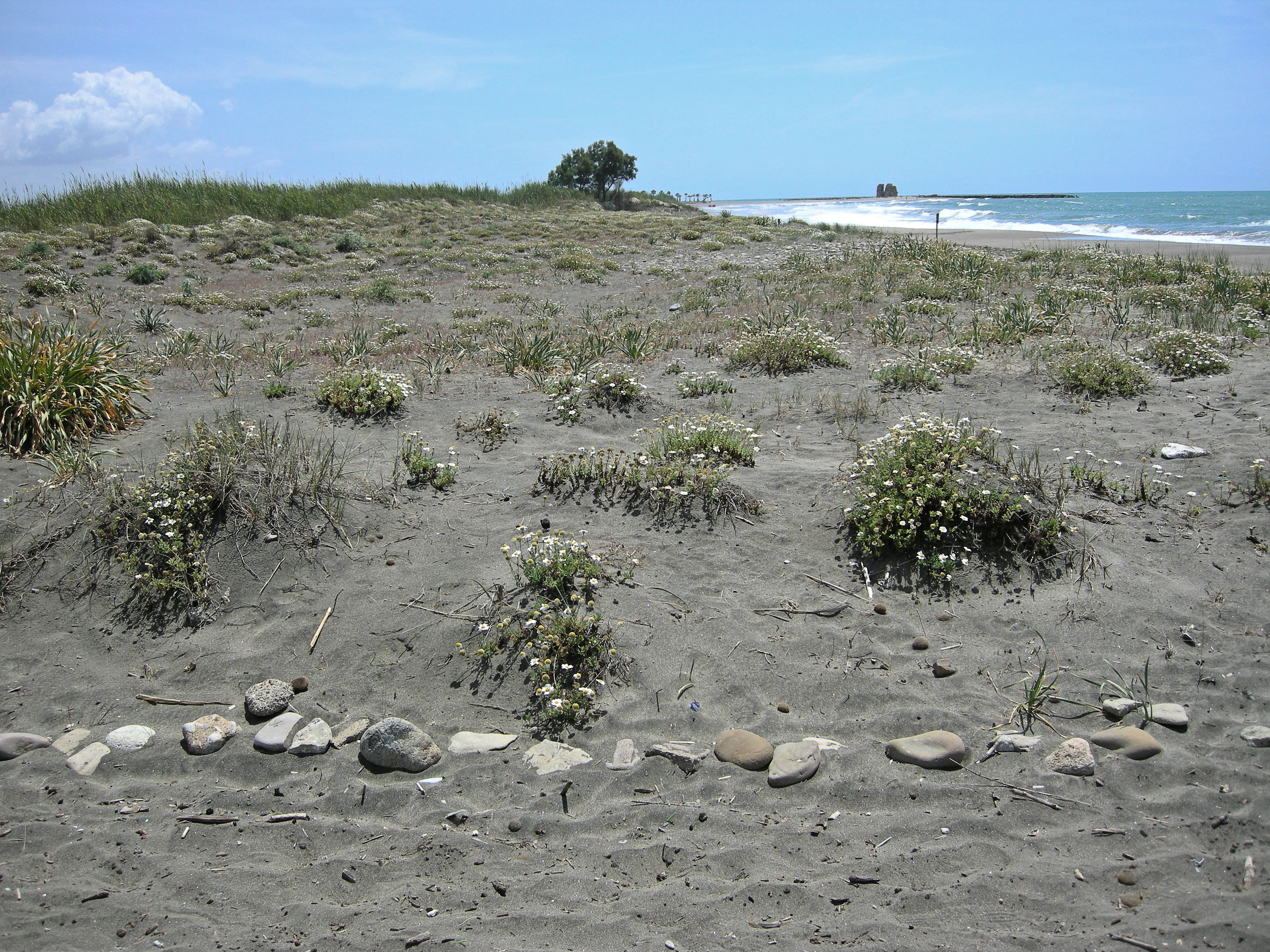
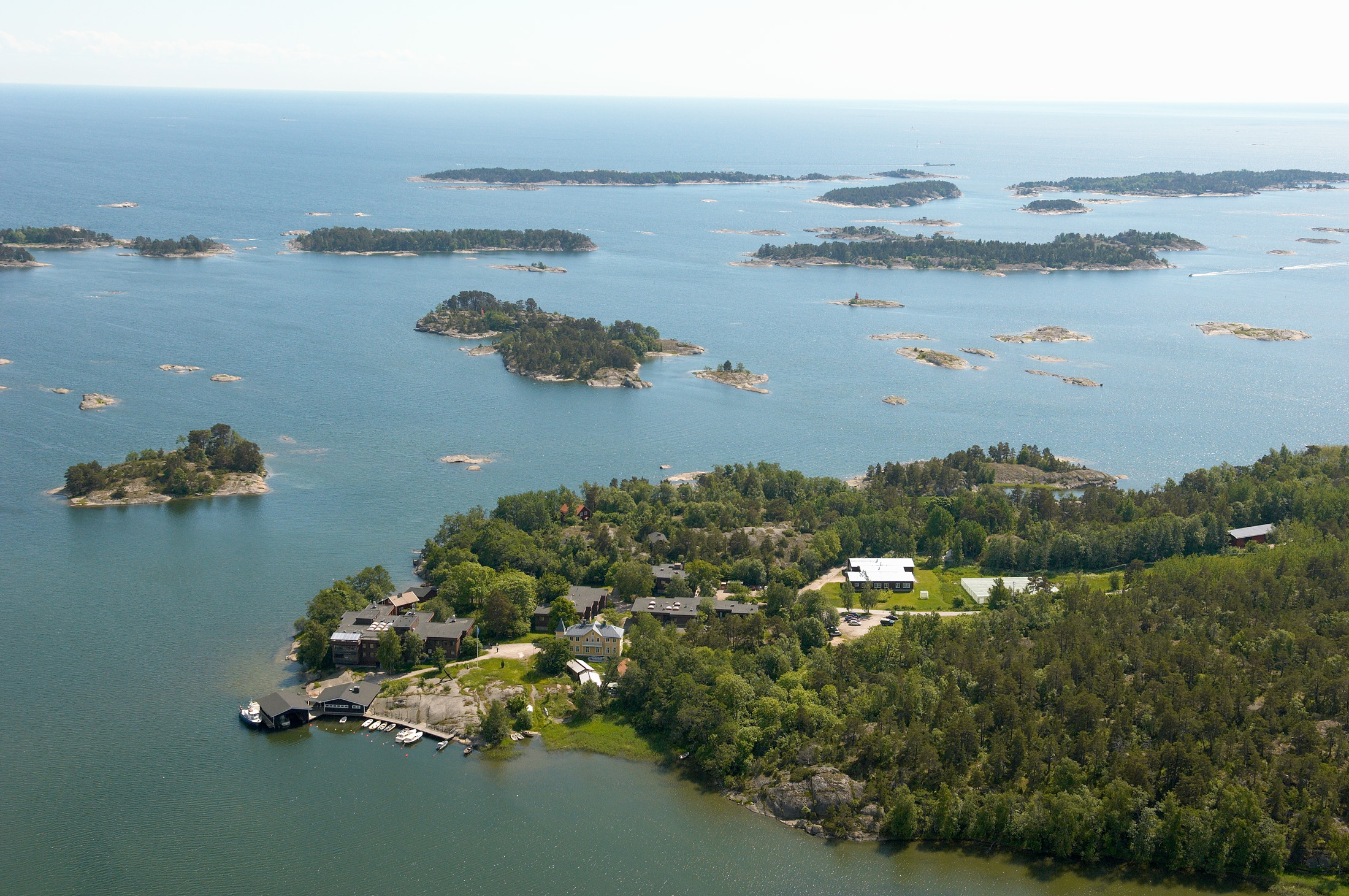
The site, located along the Tyrrhenian coast, north of Rome city, is a Special Protection Area (SPA) for migratory and nesting birds (Anatidae, Ardeidae). The wetland area is one of the last stretches of the Lazio wetlands which have been progressively reclaimed and cultivated during the last century. The flora and the fauna of the site is not only highly specialized but also highly endangered, with a relevant ecological value evidenced in previous studies. The site includes coastal dune habitats of European interest, as the annual vegetation of drift lines, the embryonic shifting dunes, the mobile dunes with Ammophila arenaria and the dune grasslands. There are also habitats related to wet and mud soils, as Mediterranean salt meadows and reed beds dominated by Phragmites australis.
-
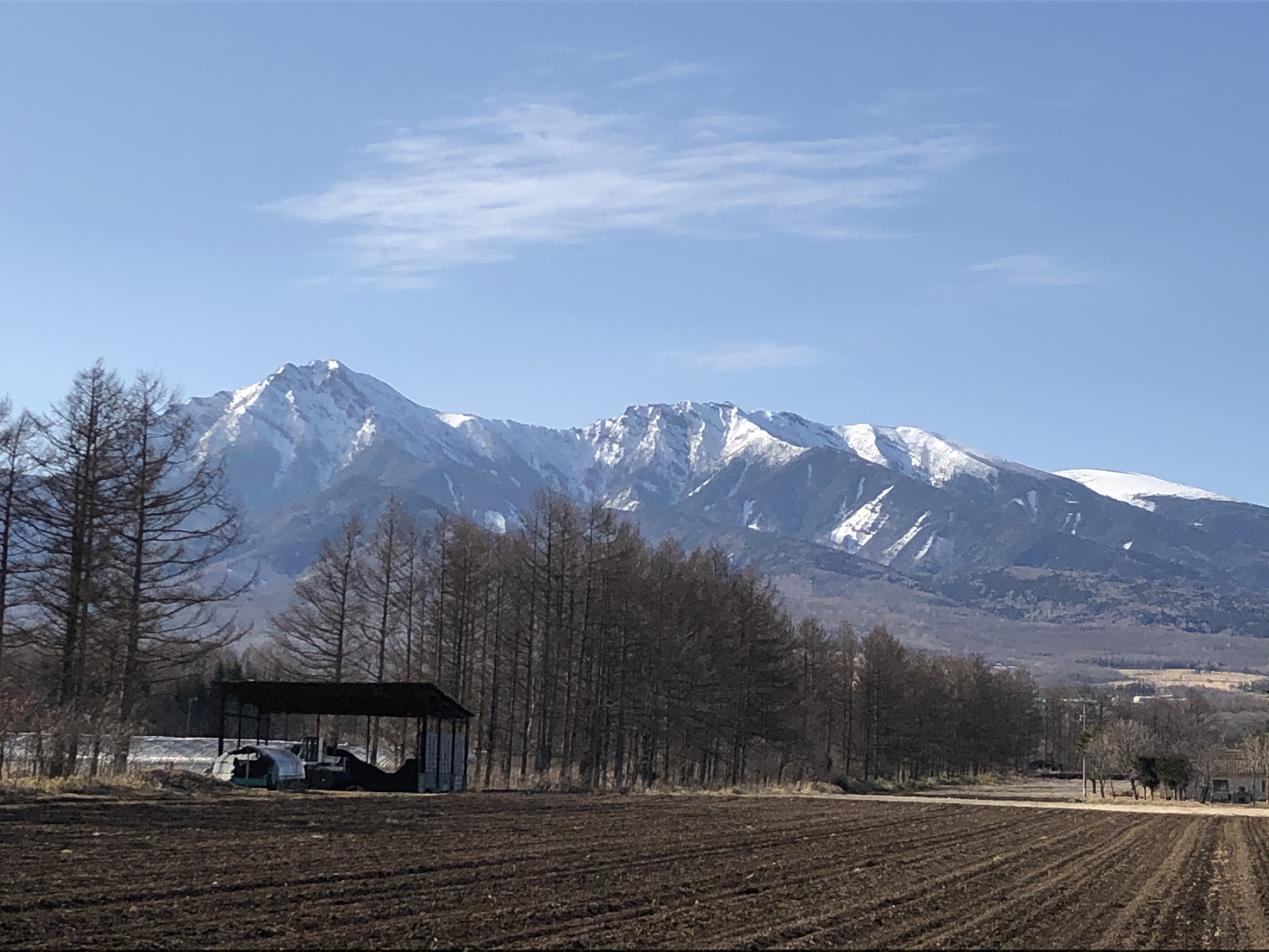
The Yatsugatake-Kawakami Forest of Mountain Science Center, University of Tsukuba, consists of three forest areas: the Yatsugatake Forest (80 ha) located in Minamimaki, Nagano Prefecture, Japan, the "Megumi-no-Mori" (14 ha) on the campus where the administration building is located, and the Kawakami Forest (189 ha) located in Kawakami, Nagano Prefecture, Japan. The Yatsugatake Forest is 1400-1450 m above sea level, and the Megumi-no-Mori is 1350 m above sea level. The forest is characterized by gentle slopes without remarkably topographic change and a mosaic of secondary deciduous broad-leaved forest dominated by oak (Quercus crispula) and Asian black birch (Betula davurica), and intermediate moor characterized by thatch herb (Moliniopsis japonica) and Japanese alder (Alnus japonica). Rare plants such as primrose (Primula sieboldii) and drosera (Drosera rotundifolia) are also found here. Black soil is distributed throughout the Yatsugatake Forest and Megumi-no-Mori. The Kawakami Forest is located between 1360 and 1700 m above sea level. 70% of the forest area is planted with Japanese larch (Larix kaempferi). The rest is a secondary deciduous broadleaf forest dominated by oak and birch. Some of the forests are dominated by a beech (Fagus crenata) stand, a natural Sawara cypress (Chamaecyparis pisifera) stand, and spruce (Picea alcokiana) stand. The forest is covered with brown and black soils, and the topography of the forest is more varied than that of the Yatsugatake Forest, including ridges and valleys. In the Kawakami Forest, an ecological survey of forest mammals is also being conducted. At these three forests, education and research are conducted on ecological surveys of trees, rare plants, and wildlife (population dynamics and conservation ecology), forest meteorological observations, and artificial forest management and operation.
-
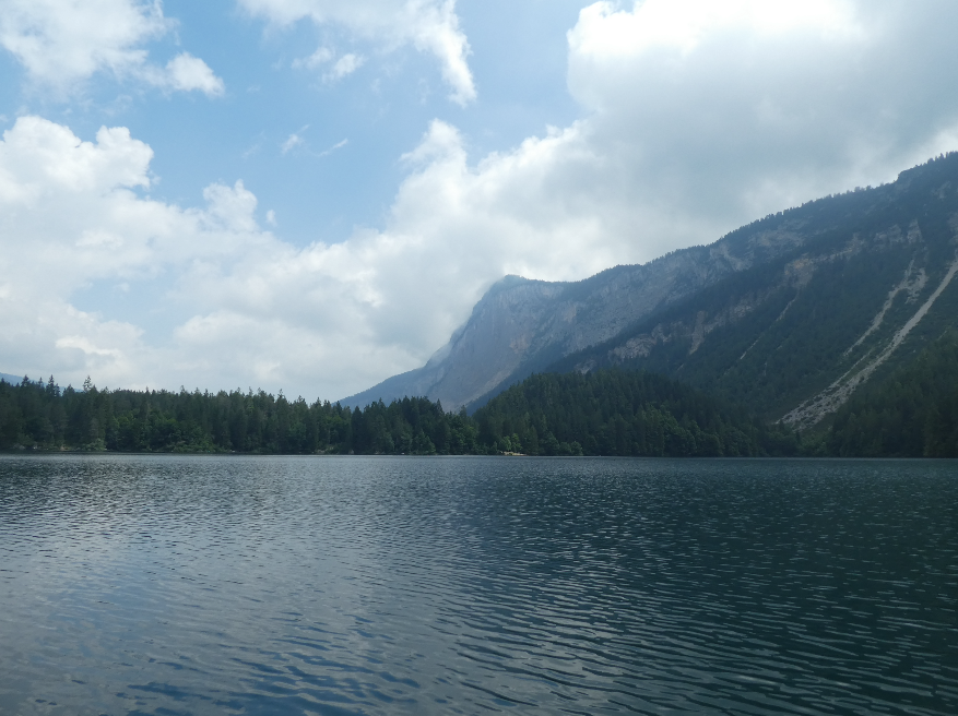
Lake Tovel has a long history of limnological research and over 300 publications since the late 1800s, including an intensive study by E. Baldi in the 1930s, document the continued interest in this lake. Tovel is famous for its clear waters and past red dinoflagellate blooms (Flaim et al. 2004. Phycologia 43:737–743) that no longer occur due to changes in land use (Borghi et al. 2006. Studi Trent. Sci. Nat., Acta Biol. 81:1-472). Besides its intrinsic biological value, Lake Tovel provides irrigation water and electrical energy to the local population, and its location in the heart of the Adamello Brenta Natural Park makes it an important tourist attraction. Following several sporadic surveys, since 1995 the lake is part of an ongoing long-term limnological study conducted by the Fondazione E. Mach (FEM) at S. Michele all’Adige TN, that includes temperature profiling, chemical and biological data taken at monthly intervals during the ice-free period and occasional winter sampling. FEM is well equipped for limnological field work with dinghy with electrical motor, multi-parameter probe, fluoroprobe, underwater quantum sensor, Eckman dredge, plankton nets, water sampling bottles, etc. Laboratory facilities include microscopy (bright field, phase contrast, interferential, fluorescent, inverted microscopes and stereoscopes) with image analysing software, a wet lab and a fine chemistry lab for nutrients and major ions in water as well as organics by ion chromatography and liquid chromatography-Mass Spectrometry (LC-MS). Also available are molecular laboratories equipped with basic (PCR, electrophoresis) and advanced techniques (Sanger and NG sequencing). Limnological data are supported by meteorological data provided by a meteorological station situated in the lake and active since 1976. Recently, sensors for high frequency data (HFD) for temperature, dissolved oxygen, light (at various depths) and water level have been installed on a central lake platform. Notwithstanding its modest altitude (1178 m asl), Tovel has characteristics similar to a 'high altitude' lake because its waters are particularly cold and transparent. The lake is oligotrophic (PT <10 µg/L) with a high biodiversity of plankton, especially of flagellates (Hansen & Flaim 2007J Limnol 66:107-141)and rotifers (Obertegger et al. 2008 J Plank Res 30:633–643). Cold-water dinoflagellates from the lake have been studied for their life cycles (Flaim et al. 2009 Hydrobiologia 639:85–98), lipid profiles (Flaim et al. 2012 Hydrobiologia 698: 285-293) and their response to stressors such as UVR (Obertegger et al. 2011 J. Phycol. 47:811–820). Furthermore, marked water level fluctuations due to the input of snowmelt water are influential in structuring the plankton community (Obertegger et al. 2007. Aquat. Sci. 69:575 – 583). Lake Tovel is an ideal ‘natural laboratory’ where we study the biotic and abiotic parameters tied to climate change and verify ecological theories.
-
The Algoa Bay Sentinel Site is a coastal observatory comprising four programmes and a geographical footprint spanning >300 km of coastline on the warm-temperate south-east coast of South Africa. The Continuous Monitoring Programme (CMP) comprise 37 permanently moored in situ observatories measuring a series of physical properties of the coastal ocean between Port Alfred and Oyster Bay. The Pelagic Ecosystem LTER Programme (PELTER) perform long-term observations selected Essential Biodiversity Variables (EBV), including phytoplankton and zooplankton. The Sandy Beaches LTER Programme (SBLTER) entail observations of short- and long-term changes in surfzone diatoms among other variables at 10 sandy beach stations in Algoa Bay. The Rocky Shores LTER Programme (RSLTER) conducts repeat observations of benthic communities associated with 7 stations on Algoa Bay island complexes and surrounding shores. The Benthic Ecosystem LTER Programme employs remote imagery technologies (sBRUV, ROV, jump cameras) to monitor long-term change in the community structure of fishes and invertebrates. First observations commenced in 2008 and is ongoing. In situ moorings record water temperature and current velocity at hourly intervals and are serviced every 3 to 6 months. PELTER and SBLTER stations are sampled monthly, while BELTER and RSLTER stations are visited quarterly and biannually respectively. The majority of moorings and stations are situated within the Addo Elephant National Park Marine Protected Area, home to the largest remaining African Penguin colony in the world. ABSS data serve conservation, research and resource management efforts.