
genetic parameter
Type of resources
Available actions
Topics
Keywords
Contact for the resource
Provided by
Years
Formats
Representation types
-
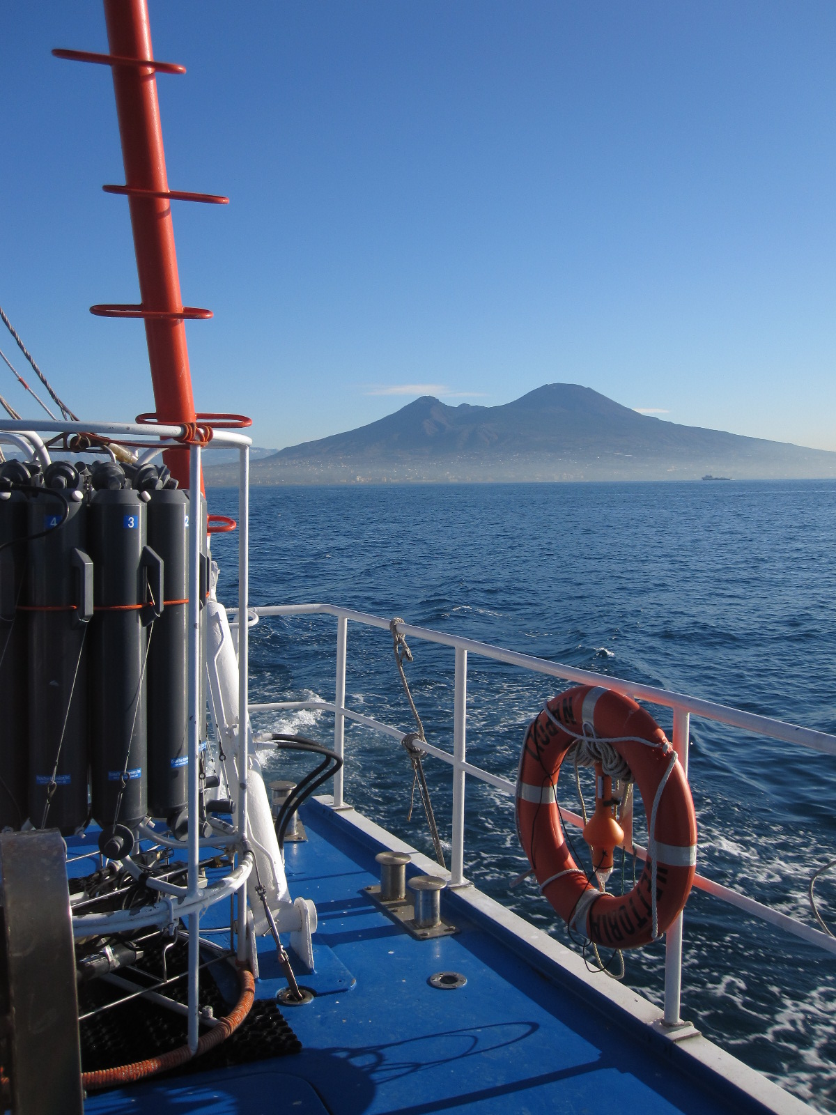
The Gulf of Naples has an extension of ca 870 kmq and an average depth of 170 m. The coastal area, which is inhabited since pre-Roman age, is densely populated and small factories are actively growing. In the Gulf, polluted areas (Sarno river mouth, harbours) coexist with pristine areas, including some Protected Marine Areas. Research on marine organisms has started before since the beginning of 1800, but first ecological studies date back to the 70ies of the last century. A long-term monitoring station (LTER-MC, 49°49’N, 14°15’E) is located 2 nm off Naples city (depth ca 75 m) at the boundary between eutrophied coastal waters and oligotrophic Tyrrhenian waters. Larger areas of the Gulf have been sampled occasionally in several cruises. The main research at these sites addresses plankton variability in response to environmental forcing. Plankton samples are collected along with environmental data at a weekly scale, and species identification is performed with traditional methods coupled with Electron microscopy and molecular tools. Phytoplankton species are often grown in the lab for experimental work or taxonomic analyses, which have led to the discovery of about 15 new microalgal species. Special investigations have addressed, among other topics, the role of viruses in the demise of algal blooms, the rate of dinoflagellate cyst production over the seasons, the rhythm of sexual reproduction in diatoms and grazing of meso- and microzooplankton. The MC data set represents one of the few plankton time series available in the Mediterranean Sea, and it is certainly one of the longest. Extensive seagrass meadows are located around the flegrean islands: the endemic Posidonia oceanica (L.) Delile infact can grow both on rock and sand substrates. In this area, in the last decades a reduction in shoot density has been detected, as a result of anchoring, the impact of the local fishery and water quality. Around the island of Ischia (within a Marine Protected Area), Posidonia oceanica forms a continuous belt (0.5-38 m depth), covering about 17 km2 of the seafloor. The best known meadow (Station LTER-LA), studied since 1979, is located in the northern part of the island (40°41,582 N, 13°53,361 E). Only in this station, the meadow is continuous from 0.5 m down to 32 m depth, covering an area of about 3 kmq. Other meadows have also been monitored. In recent years at the station Castello Aragonese (40°43,51 N, 13°57,55 E), where natural CO2 emissions allow for the study of ecosystem responses to ocean acidification, is under monitoring.The main research lines are focused on the responses of marine plants and associated communities to environmental variability and changes. Plant-animal interactions, spanning from biodiversity and distribution patterns in space and time to phylogenetic and phylogeographic traits, from trophic-chemical relationships to life-history features and molecular phylogeography and speciation are also investigated.
-
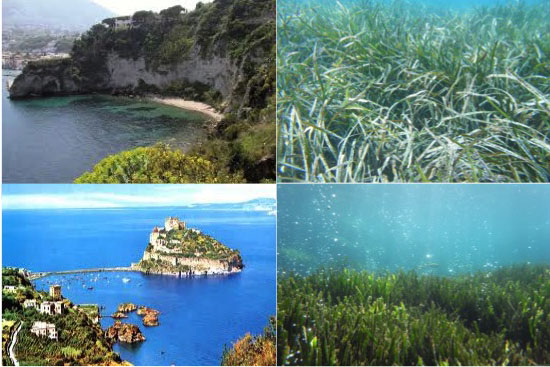
Researches on marine benthic organisms around the Flegrean islands in the Gulf of Naples have been traditionally performed at the Stazione Zoologica since its foundation in 1872. The peculiarity of this area is strictly related to its geographic location, corrisponding to the winter surface isotherm of 14°C that cuts the Mediterranean Sea into two and represents a climatic boundary barrier for species with different biogeographic affinities. The richness in marine species and habitats of this area (including the islands of Ischia, Procida and Vivara) is preserved by the establishment in 2008 of the Marine Protected Area ‘Regno di Nettuno’. One of the most important habitat of the Gulf of Naples is represented by the Posidonia oceanica beds, an endemic seagrass that forms around the island of Ischia a continuous belt, from 0.5 m down to 38 m in depth, covering about 1700ha of the seafloor. Several meadows have been studied by the Benthic Group, located at Villa Dohrn on the Island of Ischia: Scarrupata di Barano, Cava dell’Isola, La Nave, San Pietro, Castello Aragonese and Lacco Ameno. The best-known meadow is that of Lacco Ameno (LA), studied since 1976, and located in the northern part of the island, in the bay bounded by ‘Monte Vico’ and the city of Lacco Ameno (40,7598 N, 13,900 E). Only in this station, the meadow is continuous from 0.5 m down to 32 m in depth and it covers an area of about 308 ha. In this pilot site (Station LTER-LA), a significant variability at different spatial and temporal scales has been recorded for plant descriptors and associated communities. In particular, at 5 and 10 m depths, a decrease in meadow density (a descriptor of the ecological status of a meadow, widely used by many authors to indicate the plant abundance) is evident since the end of 1980. This fact seems to suggest an increase in the anthropic pressure, even if other factors, such as physical disturbance, topographic complexity and nutrient availability, might operate to modify this system. The high plasticity of P. oceanica, which responds to a wide range of environmental conditions, have driven our researches towards the study of the effects of climatic changes, such as ocean acidifcation, on this vegetated system. Issues associated to climate changes are being approached also by the comparison with another Ischia P.oceanica meadow. This is located at Castello Aragonese (40,73083°N 13,96310°E), on the east side of the island, where a number of vents which release CO2 affect the P. oceanica system. These CO2 vents are unusual in that they are not heated and neither do they produce toxic compounds, providing a natural laboratory for the study of the ecosystem level effects of ocean acidification.
-
The Hainich-Dün region is situated in the west of Thuringia close to the border to Hessen. It consists of the forest region Hainich in the south, and the Dün region in the north, connected by the Obere Eichsfeld. The Hainich with its 16,000 ha is one of the largest closed forest areas in Germany that is dominated by broad-leaved trees. The National Park Hainich, founded in 1997, is located at the southern edge of this region and covers an area of 7600 ha.
-
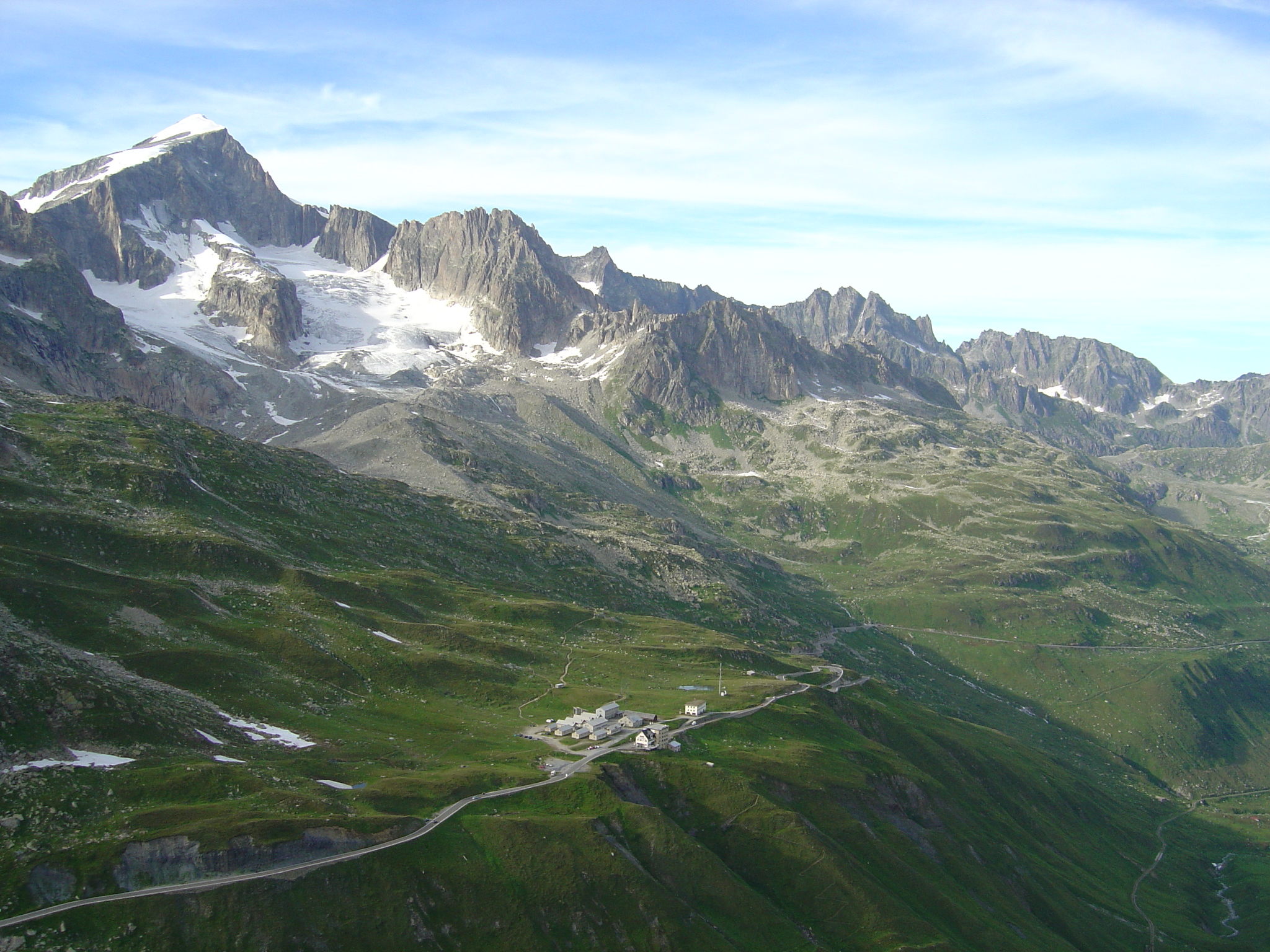
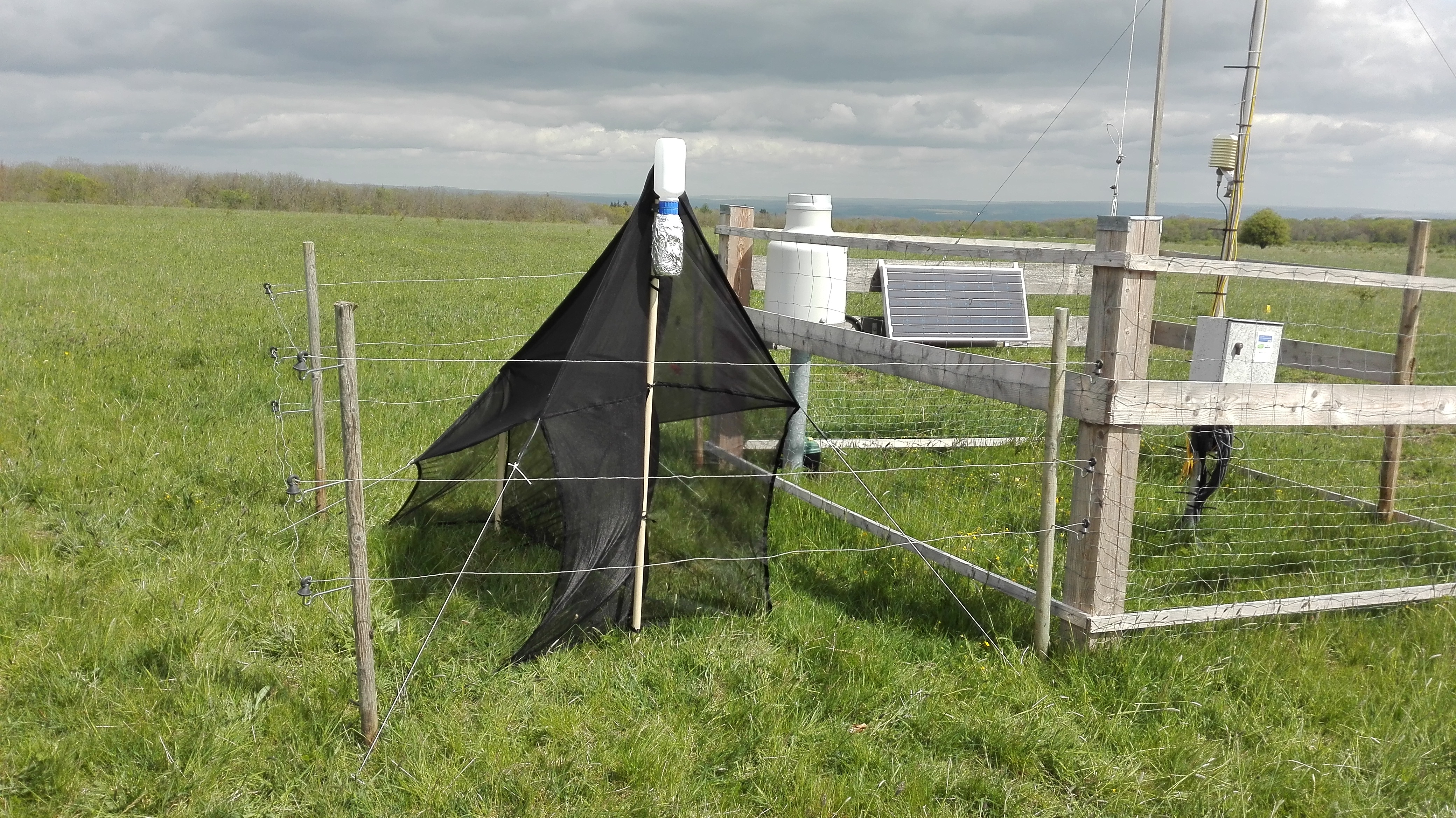
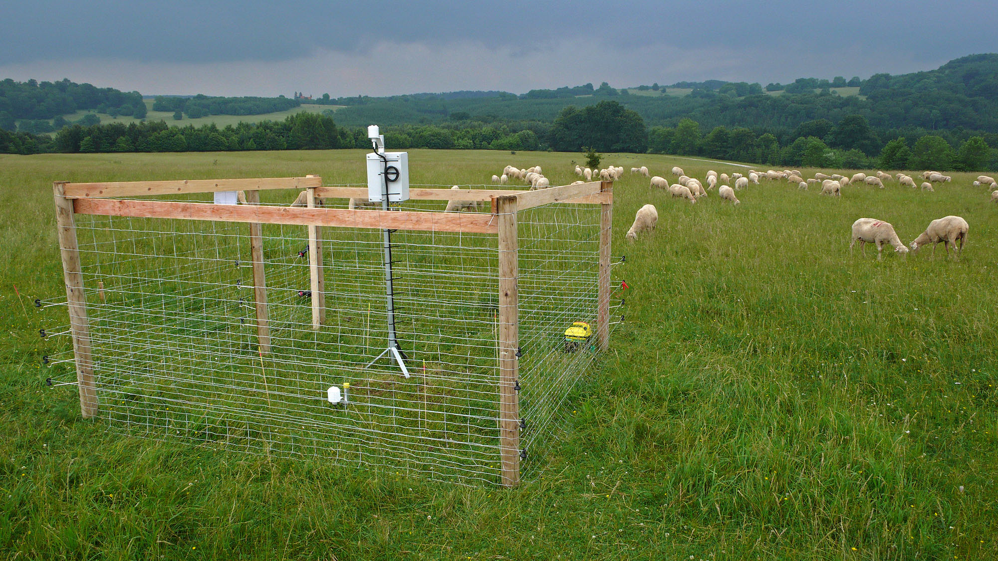
Alpine Research and Education Station Furka, ALPFOR, Switzerland The ALPFOR station is unique in Europe by being located at 2440 m a.s.l. directly in the centre of the alpine belt (Swiss central Alps), convenient access by public transport or car. ALPFOR was founded by members of the Institute of Botany of the University of Basel in cooperation with the regional 'Korporation Ursern' (Andermatt) and the Swiss Army in 2009. Three major buildings of the former military camp ‘Furkablick’ have been adapted and renovated in 2009-2011 to serve the new science- and education-oriented needs. Funds were provided by private and public donations. The station is run by the independent, non-profit organisation ALPFOR (affiliated to the University of Basel) that aims at supporting long-term activities in research and education in alpine ecology, fostering sustainable management and use of high mountain ecosystems. The three ALPFOR houses offer space for projects, courses and conferences: dining/lecture room for 80-100 persons, 45 beds in 2- to 7-person rooms, 2 large kitchen facilities, several working rooms and modern sanitary facilities in all 3 houses. The station is open from 1st June to 30th September, please notify there is no access during wintertime. Year-round weather station, total N deposition, multi-site soil temperatures, 300 flowering plant species (biodiversity hotspot), high geo- and topographic diversity. Inventory of flora and fauna on 22 permanent plots (c. 400-600 m2). Research topics (since 1991): - Microclimatology - Influence of elevated CO2 on growth and water regime - Impact of N deposition, warming, sheep trampling on alpine grassland - Population biology, reproductive ecology, molecular genetics of plant populations - Hydrological consequences of land use change - Ecological consequences of N-fixing shrub encroachment - Biodiversity monitoring
-
In the framework of an initiative to advance biodiversity research in Germany, we established three exemplary large-scale and long-term research sites (funded by the German Research Foundation). They are termed Biodiversity Exploratories, in contrast to mainly descriptive observatories. The exploratories sustain the scientific infrastructure to develop the intellectual framework needed to address critical questions about changes in biodiversity and to evaluate the impacts of those changes for ecosystem processes. Thus, in the exploratories biodiversity and ecosystem research will be merged at a large scale and with a long-term perspective.
-
The site is a wave-exposed rocky shore typical of central-northern Chile. The coastal border (including littoral zone and intertidal shore) as well as the shallow subtidal habitat (down to about 25-30m deep) has been protected from human intervention since 1982. In 2005 the marine area was declared Area Marina Costera Protegida (AMCP) de Chile (Marine Protected Area). Adjacent to the marine reserve there is a marine laboratory, Estación Costera de Investigaciones Marinas of P. Universidad Católica de Chile.
-
The Biosphere Reserve Schorfheide-Chorin with its sander areas, ground and end moraines is representative for the glacially formed lowlands of northern Germany. Different soil types (podzolised) brown earth, lessivé, pararendzina, podzols, bog soils) are the base for diverse vegetation. With an annual precipitation of about 480-580 mm, the Schorfheide belongs to the driest parts of Germany. Its natural potential vegetation comprises zonal pine-oak forests, beech forests, oak-beech forests, as well as azonal alder and downy birch forests. On dry sandy hills subcontinental xerotherm grasslands occur. Typical of the area is the huge number of lakes, moors, fens and mires.
-
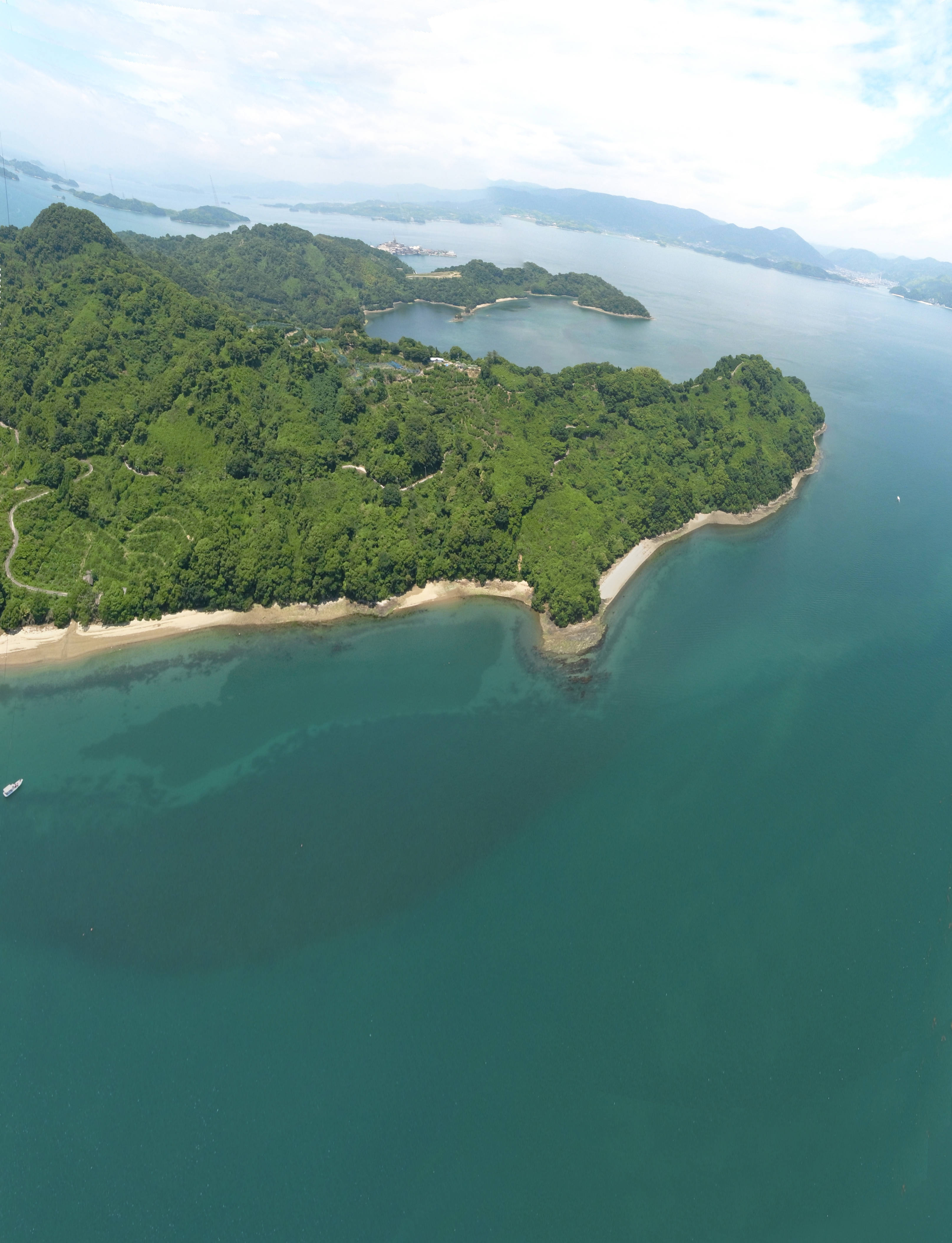
Seto Inland Sea is the largest inland sea of Japan including more than two thousand islands. The complicated coastlines make multiple kind of habitats within a local seascape, which is a suitable environment for coastal marine organisms. Suo-nada and Aki-nada are parts of western part of Seto Inland Sea, especially including many natural and larger tidal flats and seagrass meadows with better condition, respectively. Main researches in the site include ecological researches on the biodiversity and ecosystem functionings of tidal flat and seagrass/algal beds have been conducted to monitor coastal environment and to secure the sustainable utilization of fisheries products.
-
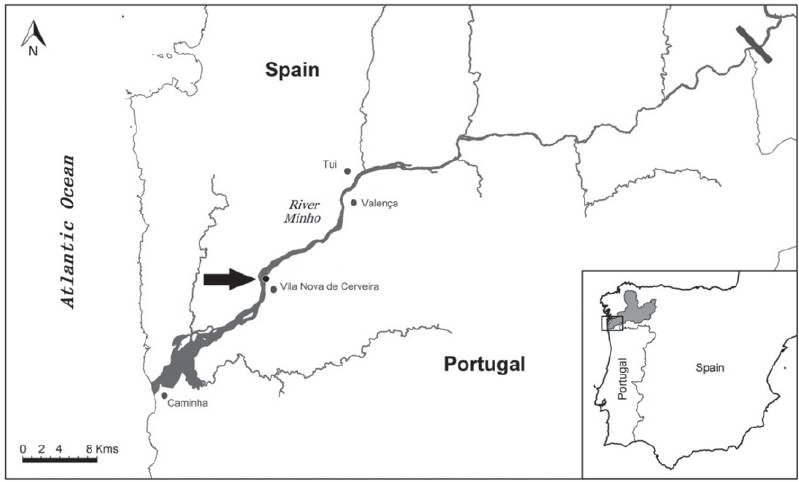
The Minho River estuary is located in the western Iberian margin (SW Europe), in the border region between the Minho (north of Portugal) and Galicia (Spain) regions. It is classified as a mesotidal estuary, covering a total area of 23 km2. The estuary has a great socio-economic importance, providing goods and services to about 80,000 of persons. It has also a high ecological value, mainly due to its large diversity of habitats and biodiversity (it is included in NATURA 2000; it is classified as a “Zona de Protecção Especial para Aves” (ZEP), an “Important Bird Area” (IBA) and is a CORINE Biotope). The high productivity of this estuary makes it a refuge place for nursery and feeding of marine species, essential to ecosystem functioning. The Minho estuary is still relatively low impacted by anthropogenic activities, however, in the last decades, the environmental pressures and impacts have been increasing, with the most important at the present being: physical and hydrological alterations mainly due to the construction of dams and other facilities to support human activities (e.g. fluvial transport of people and goods, touristic activities, etc); the presence of non-native (exotic) invasive species that have been contributed to the decline of several native species, including some with high economic and conservational interest; and organic and chemical contamination produced or increased by anthropogenic activities (industrial, urban and agricultural sources) still found in low concentrations in water, sediments and organisms but with a general increasing trend over the years; and alterations resulting from global climate changes. This ecosystem has been intensively studied, especially in the last two decades, in relation to hydromorphological characteristics, water quality, communities diversity and functioning, populations health, pollution, among other aspects. However, more knowledge is still needed on environmental chemical contamination and on the effects of complex mixtures of those pollutants in wild populations, communities and ecosystem functioning. In addition, more attention should be given to alterations resulting from global climate changes, in particular in relation to extreme events (e.g. heat waves, floods) and interactions between pollution, invasive species, and abiotic factors variation. Knowledge on plants and microorganisms (especially pathogens and parasits) is lacking.
-
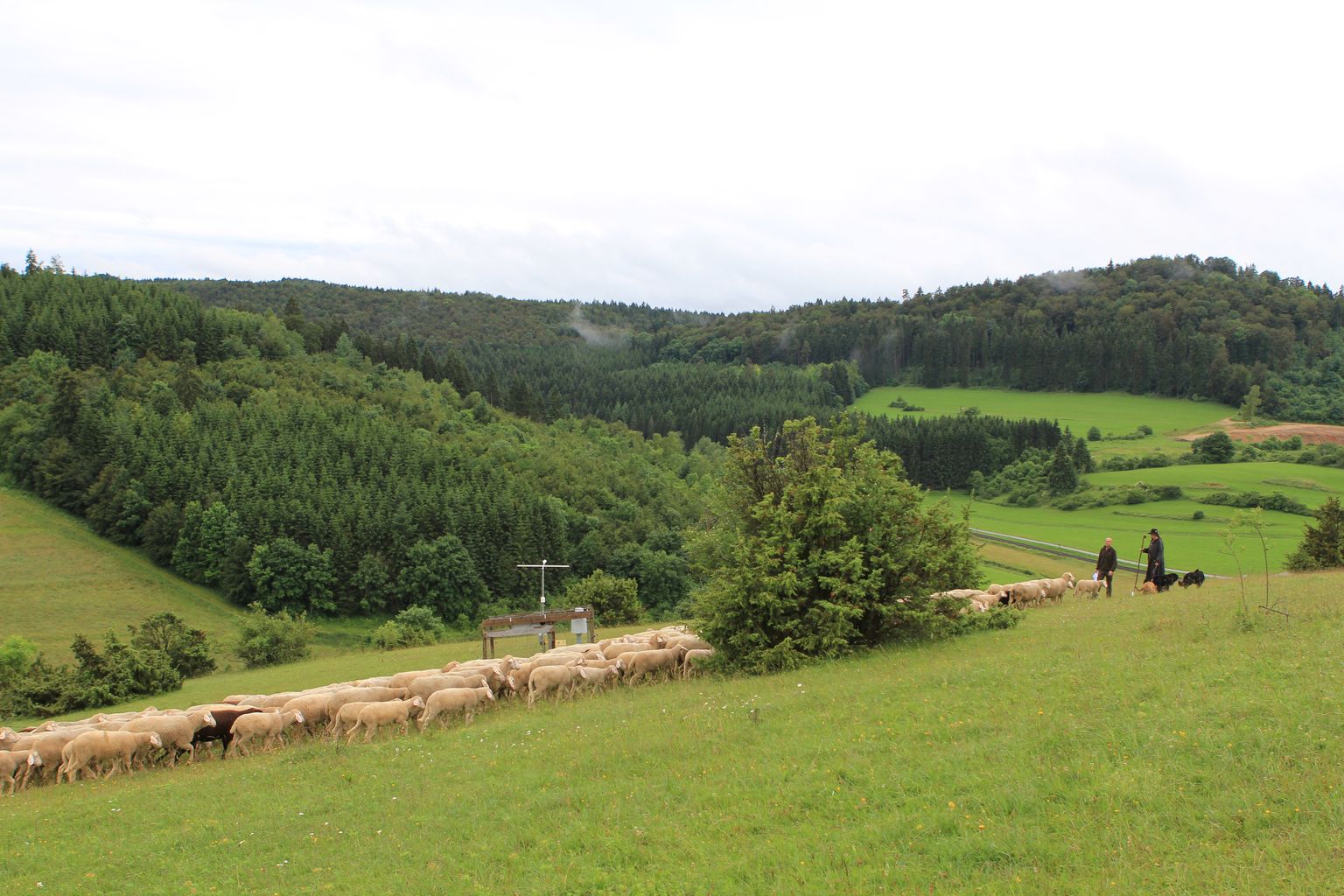
The establishing Biosphere Reserve Schwäbische Alb covers more than 84,000 ha in the centre of the mountain range of the Schwäbische Alb in the state of Baden-Württemberg in SW-Germany. 42000 ha of this area comprise the Exploratory. The Schwäbische Alb with its calcareous bedrock was formed during the tertiary, when the sediments of the Jurassic sea rose due to tectonic movements in the upper Rhine valley. The landscape is representative for a wide range of similar calcareous mountain ranges, which extend from the Franconian Alb in the NE to Swiss and French Jura mountains. It is characterized by a mosaic of forest and grassland, where grasslands generally have a relatively high proportion, mainly due to a many-century-long tradition of sheep herding. Forests range from natural old-growth beech forests over mixed forests to intensely managed spruce monocultures. Special forest types include park-like forests with many solitary trees created by century-long grazing, and untouched mixed forests in small canyons. Grasslands range from unfertilized pastures mainly grazed by sheep over unfertilized or moderately fertilized meadows to fertilized intensely used grassland. Forest and grasslands are interspersed with root crop fields, while hardly any cereals are cultivated in the area. The area has been characterized by low-intensity agriculture for many centuries.