
germination date
Type of resources
Available actions
Topics
Keywords
Contact for the resource
Provided by
Years
Formats
Representation types
-
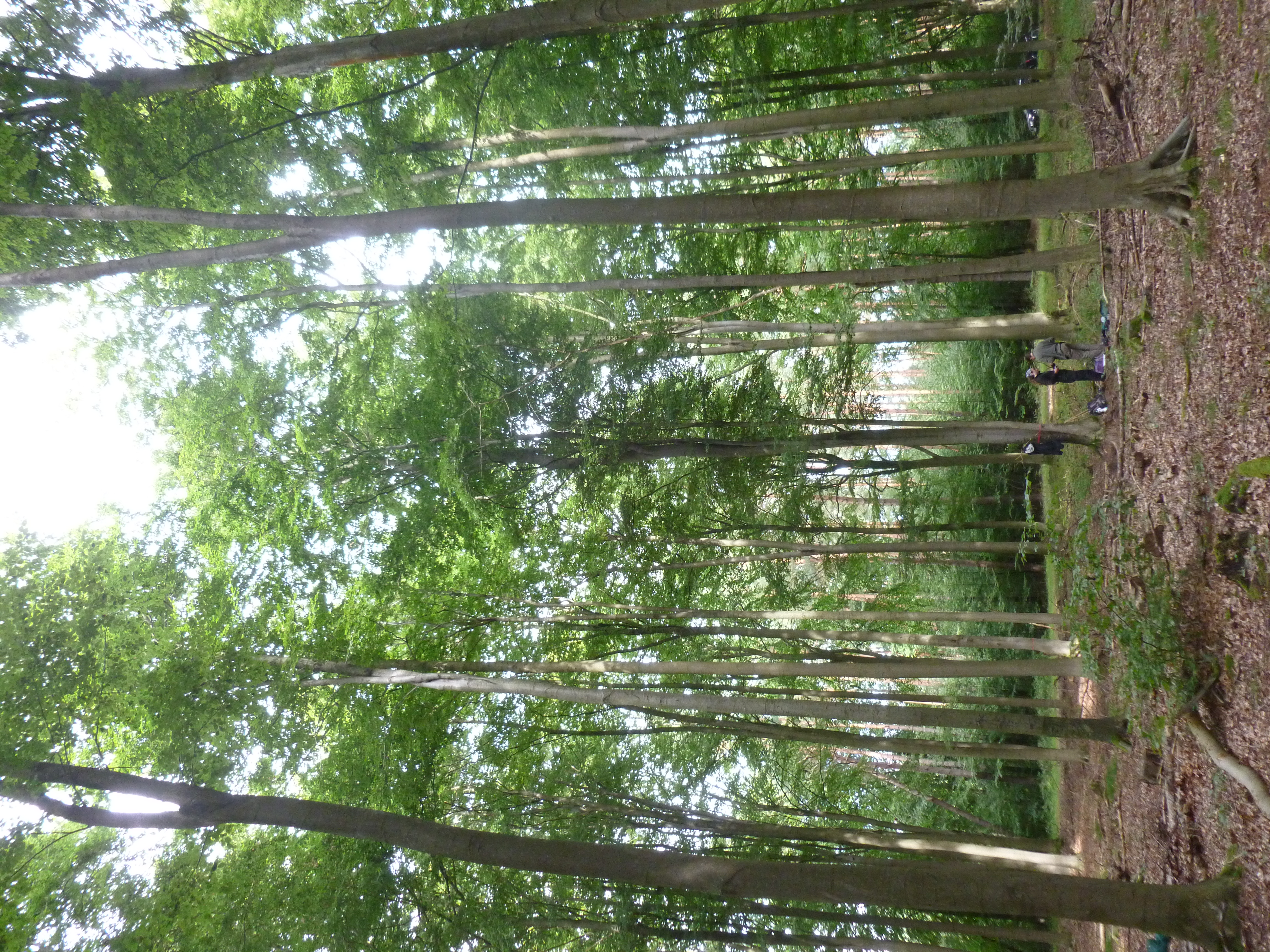
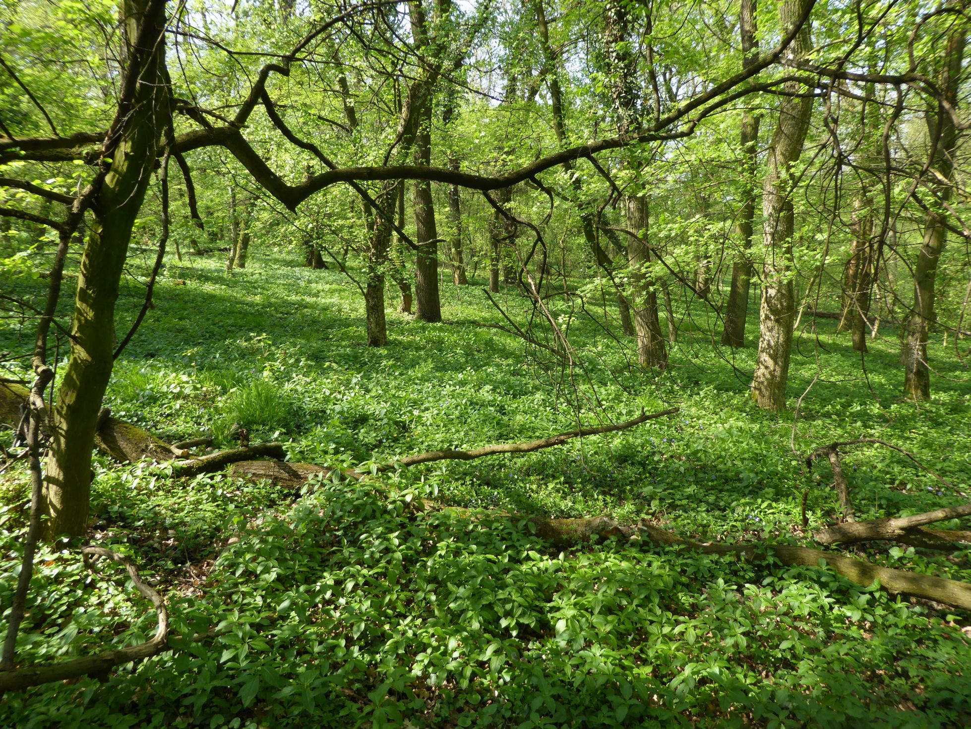
Closed monodominant beech forest; Stand age: 80 years; average tree height 28m.
-
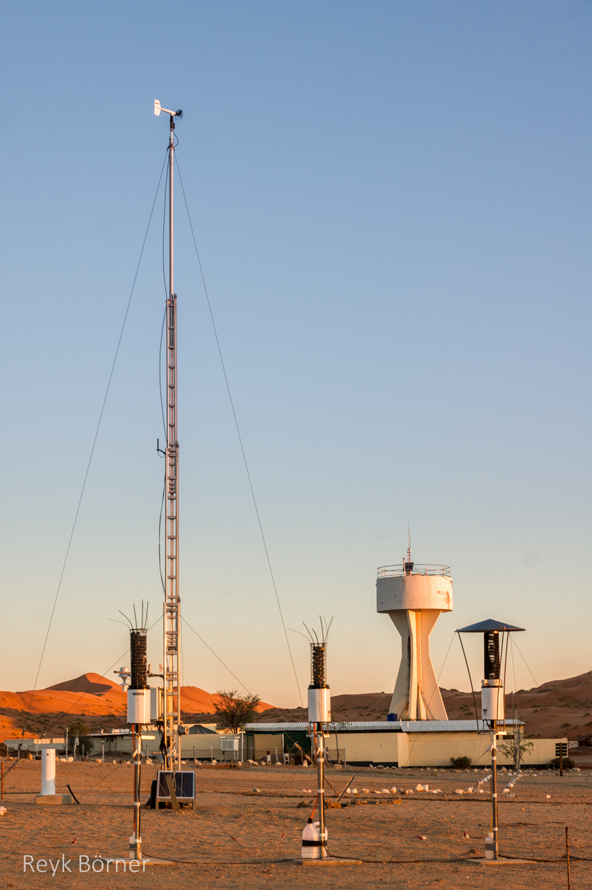
Gobabeb is a Research Centre with accommodation, conference, laboratory and teaching facilities in Namibia's Namib-Naukluft National Park, about 65km from the coast on the northern bank of the ephemeral Kuiseb River. It is located at a point where three main habitats meet (ephemeral river, gravel plain and the Namib erg) and lies within the inland edge of the fog zone. It is the designated monitoring and research centre for the Namib Sand Sea World Heritage Site.
-
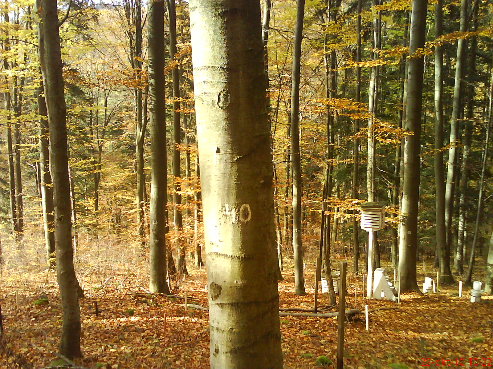
The research is focused on complex study of ecological processes running within the beech ecosystem at the lower edge of its occurrence. The Ecological Experimental Station (EES) was founded in the Kremnické vrchy Mountains (Western Carpathians, Slovakia) in 1986. It is located at 500 m a.s.l., on SW slope. The leading stand-forming association is Dentario bulbiferae-Fagetum Z l a t n i k 1935, with locally admixed Carici pilosae-Fagetum O b e r d. 1958. For both associations, to the permanent constituents (at different dominances and abundances) belong: Carex pilosa, Carex sylvatica, Carex digitata, Galium odoratum, Dentaria bulbifera, Anthyrium filix-femina, Dryopteris filix-mas. The dominant tree species at the locality is beech (80–95%); fir, oak and hornbeam are the associated species. The soil type is andic cambisol with high skeleton content (20–60%) and mild acid reaction (pH 5.4–6.4), the humus form is acid mull. The long-term mean (1951–1980) annual air temperature is approximately 6.8 °C, with a mean of 17 °C in the warmest month (July) and - 4 °C in the coldest month (January). The mean annual precipitation is approximately 780 mm. An increasing value (+1.1 °C) of the mean annual air temperature was observed during the last two decades; however, the mean annual precipitation did not change significantly. The site is equipped with a few climatic microstations, collectors for precipitation and litterfall, lysimeters, dendrometers, etc.
-

The Hölstein site is located in in the eastern part of the Swiss Jura mountains (47°26’16.4’’, 7°46’31.1’’; 540 m a.s.l.), in a mixed, temperate forest with an exceptionally high biodiversity and a vigorous tree regeneration. The research plot has a size of 1.6 ha and comprises 540 mature trees. The main tree species are Fagus sylvatica and Picea abies with an admixture of Abies alba, Quercus petraea, Pinus sylvestris, Acer pseudoplatanus, Carpinus betulus, Fraxinus excelsior and Sorbus torminalis. A canopy crane is installed in the center of the research area to access the tree canopies for in situ measurements and for sampling of leaf material. Rainout shelters will be installed in 2019 for conducting a long-term throughfall exclusion experiment.
-
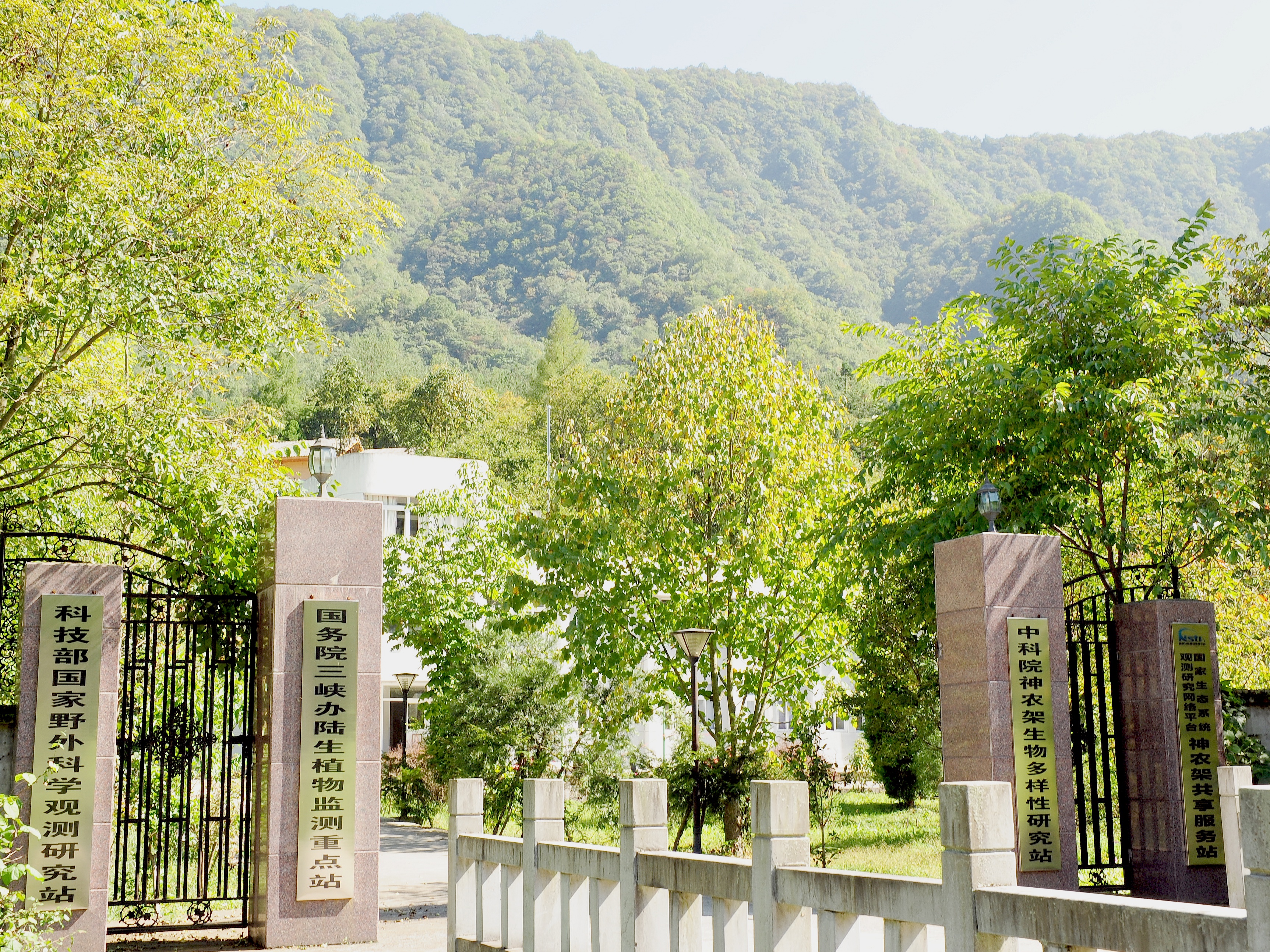
Shennongjia Station is located in Xingshan County, Hubei Province, China. It is located in the southern slope of Mount Shennongjia. The altitude is 1290m above sea level. The typical forest types are the northern subtropical mixed evergreen and deciduous broadleaved forest. Shennongjia Station was established in 1994, it became a station of National Field Research Station network running by the Ministry of Science and Technology of the People’s Republic of China in 2005, and became a member of Chinese Ecosystem Research Network (CERN), CAS in 2008.
-
The Bab forest (66 ha) was selected as an example of a lowland deciduous broad-leaved forest on loess for ecosystem research in the International Biological programme (IBP) in 1967. More than 60 researchers performed a comprehensive ecosystem research at the site within IBP and MaB programmes in 1967-1975. This period finished by production of syntheses in micro-meteorology and micro-climate, soils, soil microbiology, ecophysiological processes of plants (photosynthesis, water relations, mineral nutrition), primary productivity, nutrient cycles, water circulation, and secondary productivity. The ecosphisiological studies continued in 1975-1980, later the research was focused to plant population biology and alien plants invasions. The ecosystem research was re-established in 2007. The inventory of shrub and trees, herb vegetation, selected animal groups allowed identification of changes during 40 years caused probably by the climate changes and anthropogenic disturbances. The differences in decomposition of selected native and invasive plant species were assessed. The biomonitoring of the air pollution was done using mosses as indicator organisms. Now the research is focused to dynamics of forest ecosystem (vegetation, selected invertebrate groups, small mammals) and impact of forestry management (clear-cuts) to structure and dynamics of forest ecosystem. The multisite trampling experiment (ALTER-Net) and tea decomposition experiment (ILTER) were/are performed at the site.
-
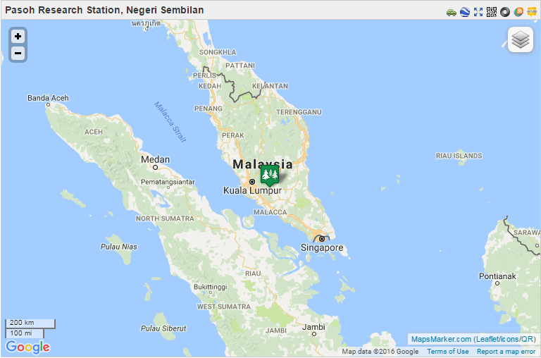
From 1970 to 1974, the Pasoh FRIM Research Station (Pasoh FRS) has been a site for intensive research of lowland rain forest ecology and dynamics under a joint research project between University of Malaya and the International Biological Programme (IBM). Pasoh forest was also the main study site for the Reproductive Biology of Forest Trees Project, a joint research project between University of Aberdeen and University of Malaya from 1974 to 1978. Since then, various research projects on biodiversity, forest productivity, flora, fauna, micrometeorology, soils, hydrology and nutrient cycling were conducted in collaboration with local universities.. In December 1977, Forest Research Institute Malaysia (FRIM) took over the management of the research station from University of Malaya. This was made possible through the collaboration with the Negeri Sembilan State Forestry Department. The Pasoh forest station has since become a leading tropical forest field research station. This could not have been possible without the commitment from the state forestry department to gazette 1,840 ha of the Pasoh reserve as a Research Forest. All research activities are monitored by the Pasoh Research Committee (PRC) in FRIM since 1999. The Director of the Negeri Sembilan Forestry Department is also a Committee member. The main attraction of the Pasoh Reserve is its floristically rich forest. A total of 335,256 stems 1 cm dbh (diameter at breast height) and above belonging to 814 species, 294 genera and 78 families has been recorded within an area of 50 ha. The most common plant families are the Euphorbiaceae and Annonaceae among the smaller trees, and the Dipterocarpaceae, Leguminosae and Burseraceae. The most common species is Xerospermum noronhianum (Sapindaceae) locally known as ‘rambutan pacat,/em>’, which accounts for 2.5% of the total number of plants. For trees above 30 cm dbh, the most abundant species is Shorea leprosula (meranti tembaga), a member of the Diptrerocarpaceae family. Being an isolated forest surrounded by oil palm estates and other land uses, forest gaps, formed by windthrow of a large tree or a group of trees, are a fairly common feature at Pasoh. Within these gaps, one can find many regenerating seedlings and saplings. Although Pasoh lacks charismatic animals such as tigers and elephants, it still harbours a good composition of small mammals, primates and birds Today Pasoh is not only the site of many research studies by both local scientists and scientists from abroad but is also an educational centre for school children, college and university students as well as the general public.
-
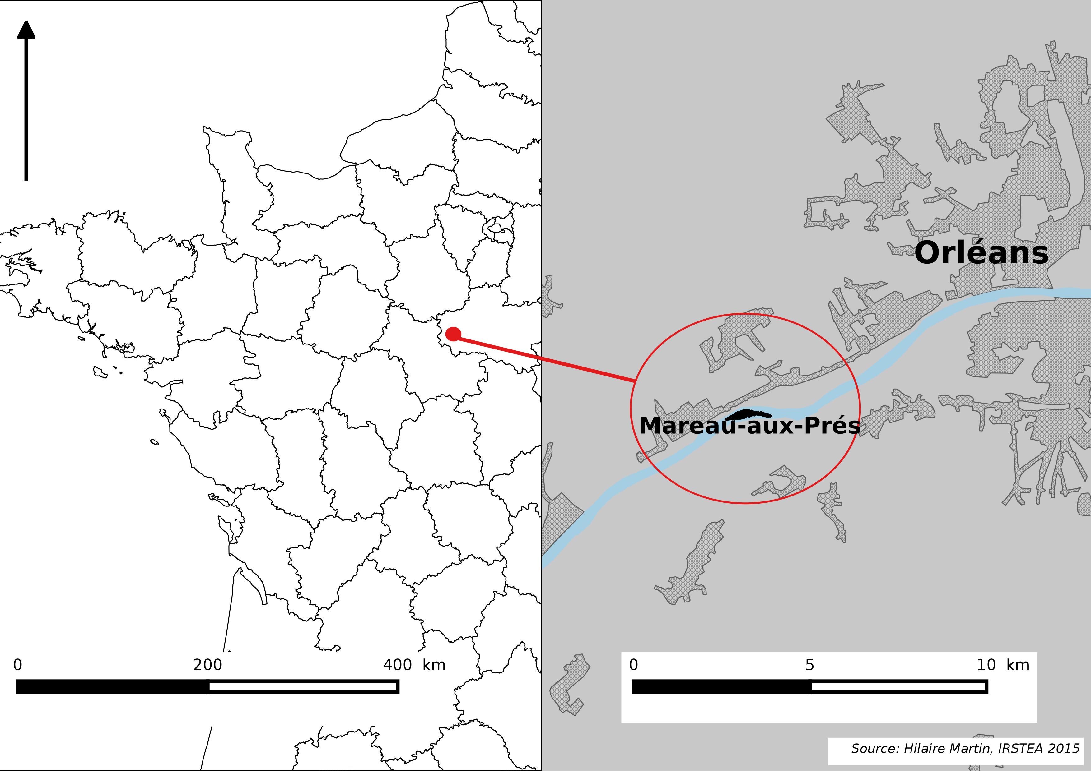
The Mareau-aux-Prés islands, along the Loire river, are characterized by a multiple channel pattern, where natural limestone riffles influence the morphology and spatial distribution of vegetated islands, secondary channels and alluvial bars. Within these islands, in september 2012, fluvial management operations (FMO) were launched. The vegetation of the central sandy-gravelly bar (3 ha area) was uprooted and the bar level lowered in order to maintain the flow capacity of the river. A new sandy-gravelly bar appeared in spring 2013, ideal field support for studying long-term ecological issues. A multidisciplinary research program (‘BioMareau’ project) is currently being conducted from 2012 to 2019, focusing on biodiversity recolonization and on interactions and feedbacks between biotic and abiotic compartments.
-
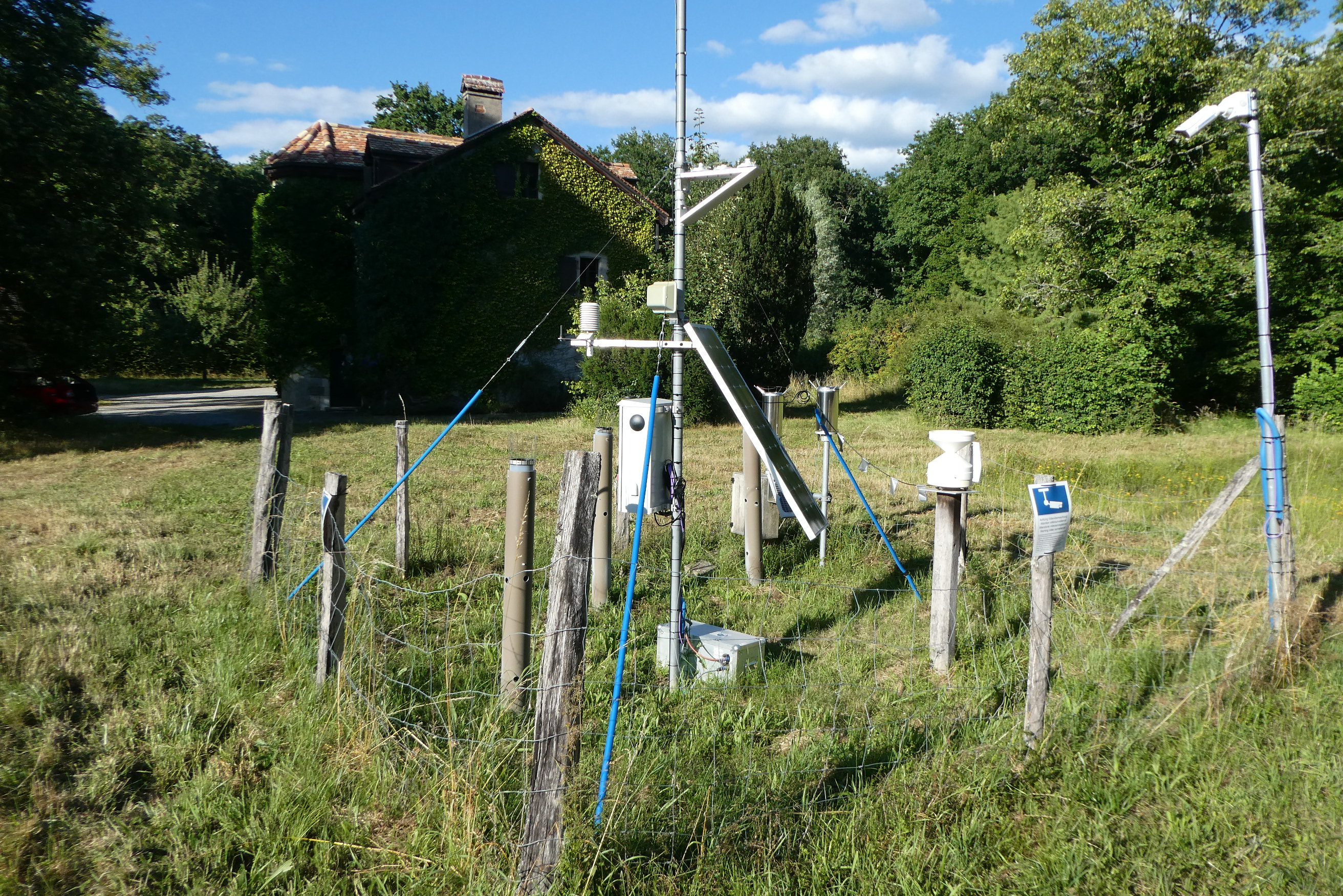
The forest site "Jussy" has been installed in 1995 as part of the Swiss Long-term Forest Ecosystem Research Programme LWF. The programme investigates anthropogenic and natural forces on the long-term health of the forests and the potential risks to humans. For this, a profound understanding of the relationship between processes, causes and effects in the ecosystem are necessary. The objectives of the LWF research programme include (i) early detection and a representative assessment of changes in forest condition, (ii) determination of external influences, both from anthropogenic and natural sources such as element inputs and climate and their effect on the forest ecosystem, (iii) development of indicators to assess the condition of the forest, (iv) integrated risk assessment based on different stress scenarios, and (v) extended platform for internal and external research projects. The LWF research programme provides, on the one hand, long-term data series from the last 20 years, together with a scientific interpretation to national and international policy makers. On the other hand, the available data and latest LWF infrastructure provide an attractive scientific platform for collaboration with both national and international partners. The site is located close to Jussy in the canton of Geneva, within a natural, mixed forest stand which mainly consists of 90 year-old sessile oak (Quercus petrea), 60 year-old aspen (Populus tremula), and 60 year-old European hornbeam (Carpinus betulus) trees. Among others, the site is equipped with two meteorological measurement stations; one is located within the forest stand, the second is co-located in the nearby open-field, allowing to measure the forest stand effect on micro-climate. The following parameters are being measured (starting-end year): Atmospheric deposition (throughfall and bulk deposition) (1997-today), Circular vegetation plots (1995-today), Crown Condition Assessment (1995-today), Deadwood survey (1995, 2005-today), Diameter and Height measurements (2000-today), Foliar analyses (1997-today), Leaf area index (LAI) (1996-today), Lichens (2003-today), Litterfall (1997-1998), Manual circumference band measurement (2001-today), Matric potential (manual suction cups) (1996-today), Meteorological measurements (1997-today), O3 Injuries (2002-today), Ozone visible injury assessment (2002-today), Passive sampling of NH3 (1999-2000), Passive sampling of NO2 (1999-2000), Passive sampling of O3 (2000-today), Permanent vegetation quadrats (1995-today), Phenological observations (1997-today), Soil matrix chemistry (1995-today), Soil morphology (1995-today), Tree core sampling (1916-1998), Tree crown measurements (1995-today), Deadwood sampling (2009-today).
-
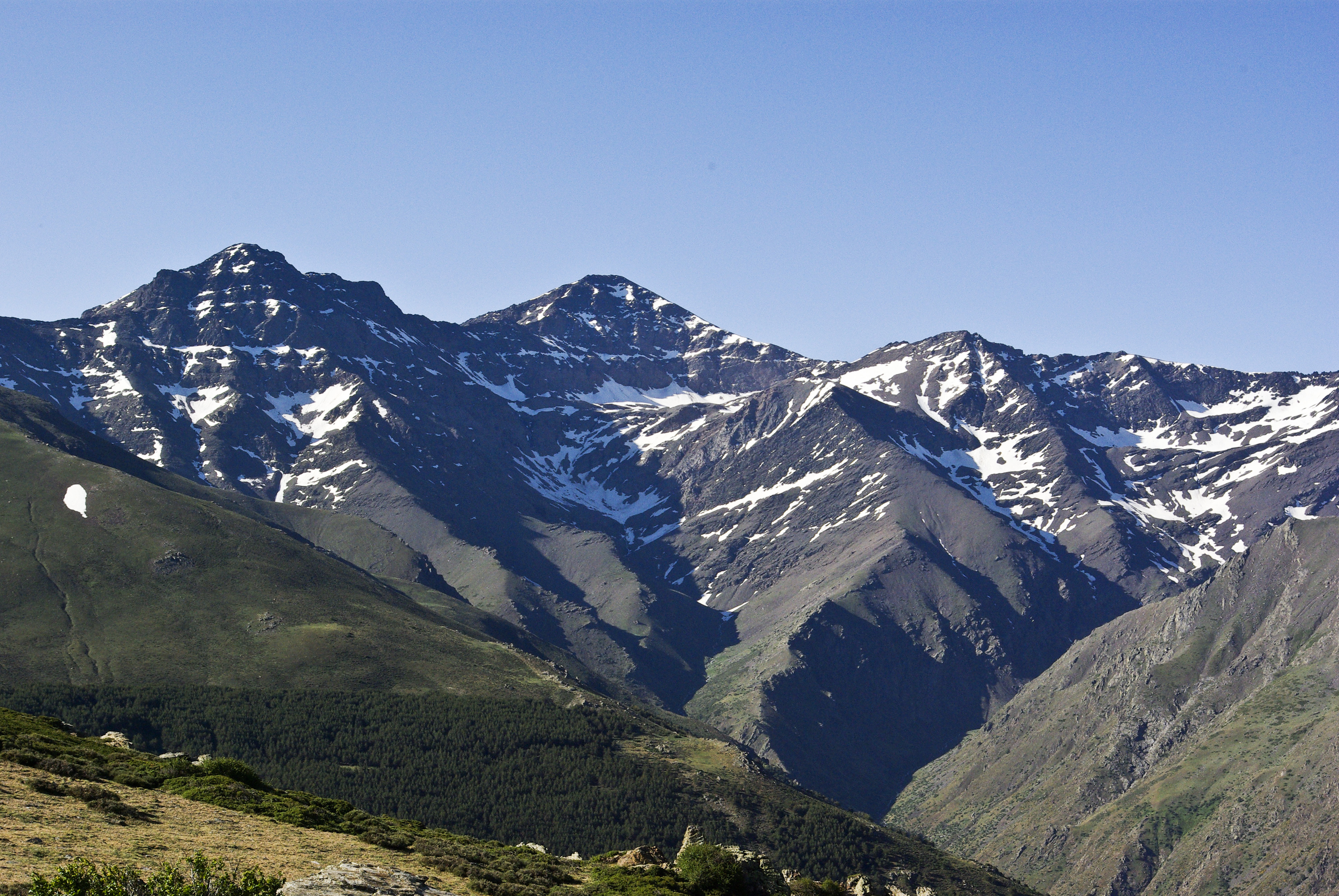
Mountain site, alpine forests Sierra Nevada (Andalusia, SE Spain), is a mountainous region with an altitudinal range between 860 m and 3482 m a.s.l. covering more than 2000 km2. The climate is Mediterranean, characterized by cold winters and hot summers, with pronounced summer drought (July-August). The annual average temperature decreases in altitude from 12-16ºC below 1500 m to 0ºC above 3000 m a.s.l., and the annual average precipitation is about 600 mm. Additionally, the complex orography of the mountains causes strong climatic contrasts between the sunny, dry south-facing slopes and the shaded, wetter north-facing slopes. Annual precipitation ranges from less than 250 mm in the lowest parts of the mountain range to more than 700 mm in the summit areas. Winter precipitation is mainly in the form of snow above 2000 m of altitude. The Sierra Nevada mountain range hosts a high number of endemic plant species (c. 80; Lorite et al. 2007) for a total of 2,100 species of vascular plants (25% and 20% of Spanish and European flora, respectively), being considered one of the most important biodiversity hotspots in the Mediterranean region. This mountain range has several legal protections: Biosphere Reserve MAB Committee UNESCO; Special Protection Area and Site of Community Importance (Natura 2000 network); and National Park. The area includes 61 municipalities with more than 90,000 inhabitants. The main economic activities are agriculture, tourism, cattle raising, beekeeping, mining, and skiing.