
grain size
Type of resources
Available actions
Topics
Keywords
Contact for the resource
Provided by
Years
Formats
Representation types
-
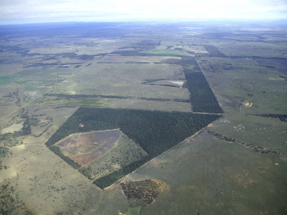
The aim of the Brigalow Catchment Study is to determine the effects of land clearing and land use change on hydrology, water quality, soil fertility and crop and animal productivity in the Brigalow Belt bioregion of central Queensland, Australia
-
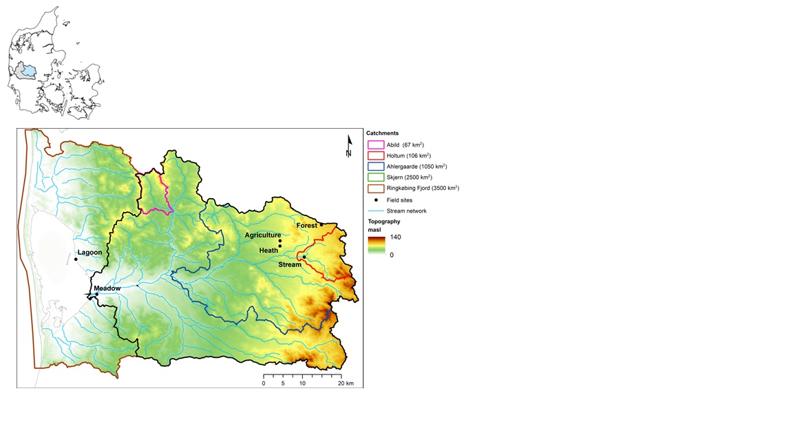
The HOBE experimental catchment is located in the western part of Denmark. The topography of the catchment is relatively flat. The surface elevations in the eastern part of the catchment are about 125 m above sea level at the Jutland ridge and gently decreasing to sea level elevations towards the coast. Alluvial outwash deposits in the form of sand and gravel dominate the central part of the catchment. Towards east, glacial deposits of moraine till are present with a higher content of clay. Also the remnants from the Saale glaciation have higher clay content and the dominant sediment type at these locations is clayey sand. Overall the top sediments are highly permeable with little water retention capability and the stream flow is therefore dominated by groundwater inflow. Based on a classification of the topsoil four soil classes can be identified in the catchment. The by far most dominating soil type is fine/coarse sandy soil. The Quaternary deposits have a thickness less than 50 m in the eastern and central part of the area increasing up to 250 m towards west. The Quaternary deposits are underlain by Miocene sediments in the form of alternating layers of marine, lacustrine and fluvial deposits forming layers of clay, silt, sand and gravel. Further below thick layers of Paleogene clay are found with little permeability and thus acting as a lower impermeable boundary for the aquifer systems. The sand and gravel layers from the Quaternary and Miocene periods form interconnected aquifer systems. The land surface of the catchment is predominantly agriculture and due to the sandy soil characteristics extensive irrigation of the agricultural crops takes place. Based on satellite data the land-use distribution is estimated as follows: grain and corn (55%), grass (30%), forest (7%), heath (5%), urban (2%) and other (1%). The climate of the observatory is of maritime origin and influenced by weather systems coming from the Atlantic Ocean. The weather conditions are variable with frequent precipitation. The prevailing winds from west lead to relatively mild winters and cool summers. The mean annual precipitation is about 1050 mm/year. It varies over the season with highest amounts in the months of October-December and lowest in the months of April-May. The mean annual temperature is 8.20C. The highest mean monthly temperature is in August (16.50C) and the lowest in January (1.40C). Precipitation in the form of snow is highly variable from year to year; in some years, no snowfall occurs and in others, it may stay on the ground for months.
-

The Cairngorms National Park is one of 15 National Parks in the UK (one of two in Scotland) and is Britain's largest National Park (4,528 km2). It is the location for some of the most spectacular landscapes in Britain and is home to an incredible diversity of wildlife and plants. http://cairngorms.co.uk/the-park/facts-figures/ The aims of the National Park are: • To conserve and enhance the natural and cultural heritage of the area; • To promote sustainable use of the natural resources of the area; • To promote understanding and enjoyment (including enjoyment in the form of recreation) of the special qualities of the area by the public; • To promote sustainable economic and social development of the area’s communities. Cairngorms National Park, seven broad habitats can be identified: • Enclosed farmlands • Woodlands • Open waters (rivers, lochs, wetlands and floodplains) • Mountains • Moorland • Semi-natural grasslands • Urban • Population of c17,500 • 25.8% of population over 60 (higher than Scottish average) • Average health index in top 25% of Scotland (based on deprivation indices) • Extensive core paths network • 55 Munros including 5 summits over 4000 feet • 3 ski centres • National Cycle Network Route 7 • 1 Long Distance Route (Speyside Way) • Relatively low atmospheric pollution • Annual precipitation over 2250mm on summits and under 900mm in straths • Average annual snow cover 200 days on summits and 50 days on low-ground • Prevailing winds from south-west