
ground water level
Type of resources
Available actions
Topics
Keywords
Contact for the resource
Provided by
Years
Formats
Representation types
-
Measurement of groundwater level in RMO from 1951-2020.
-
Groundwater of the Etzbachquelle in the Gesäuse-Johnsbachtal site.
-
This dataset contains information about the water level of the Los Molinos spring (Sorbas, Spain) (1973-2014) and water chemical composition. In addition, measures of temperature and CO2 outside and inside the caverns of the karst system in gypsum of Sorbas, isotopic water composition and micro erosion are provided.
-
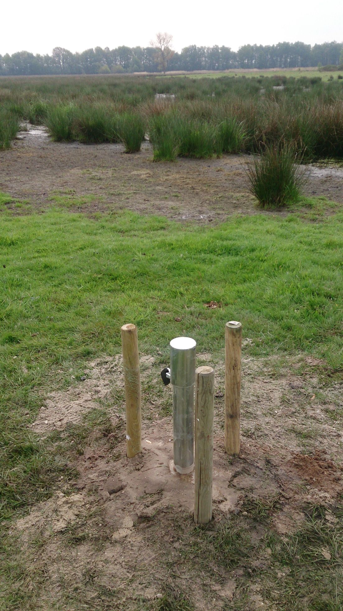
The site comprises 10 km stretch of a stream valley managed as a private nature/state reserve some 17 kilometer North of the city of Hasselt. Since 1995,the restoration projects are carried out aiming at restoring the fen/carr ecosystem. Monitoring of the ground- and surface water dynamics and chemistry, the vegetation evolution is carried out by INBO.
-
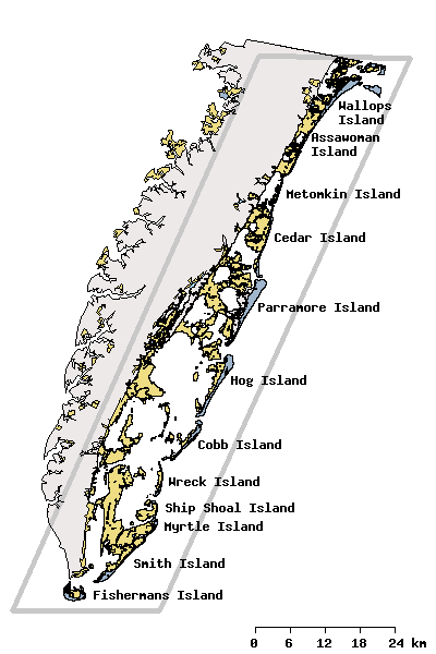
Research activities of the VCR/LTER focus on the mosaic of transitions and steady-state systems that comprise the barrier-island/lagoon/mainland landscape of the Eastern Shore of Virginia. Primary study sites are located on Hog Island, Parramore Island and mainland marshes near Nassawadox VA. The VCR/LTER uses field laboratory and housing facilities at the Anheuser-Busch Coastal Research Center in Oyster, VA.
-
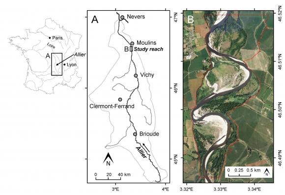
This study site is in the south of the city of Moulins, including the National Nature Reserve of the Val d'Allier which protects 1,450 hectares over approximately 28 km along the lower course of the Allier River. The Allier river is considered as the last wild river of Europe because of its strong fluvial dynamics and remaining free meandering river segments. The studied sector within the nature reserve is still very mobile, with a strong lateral dynamic, where the width of the divagation can be of the order of one kilometer. At this scale, it is unique in Europe.
-
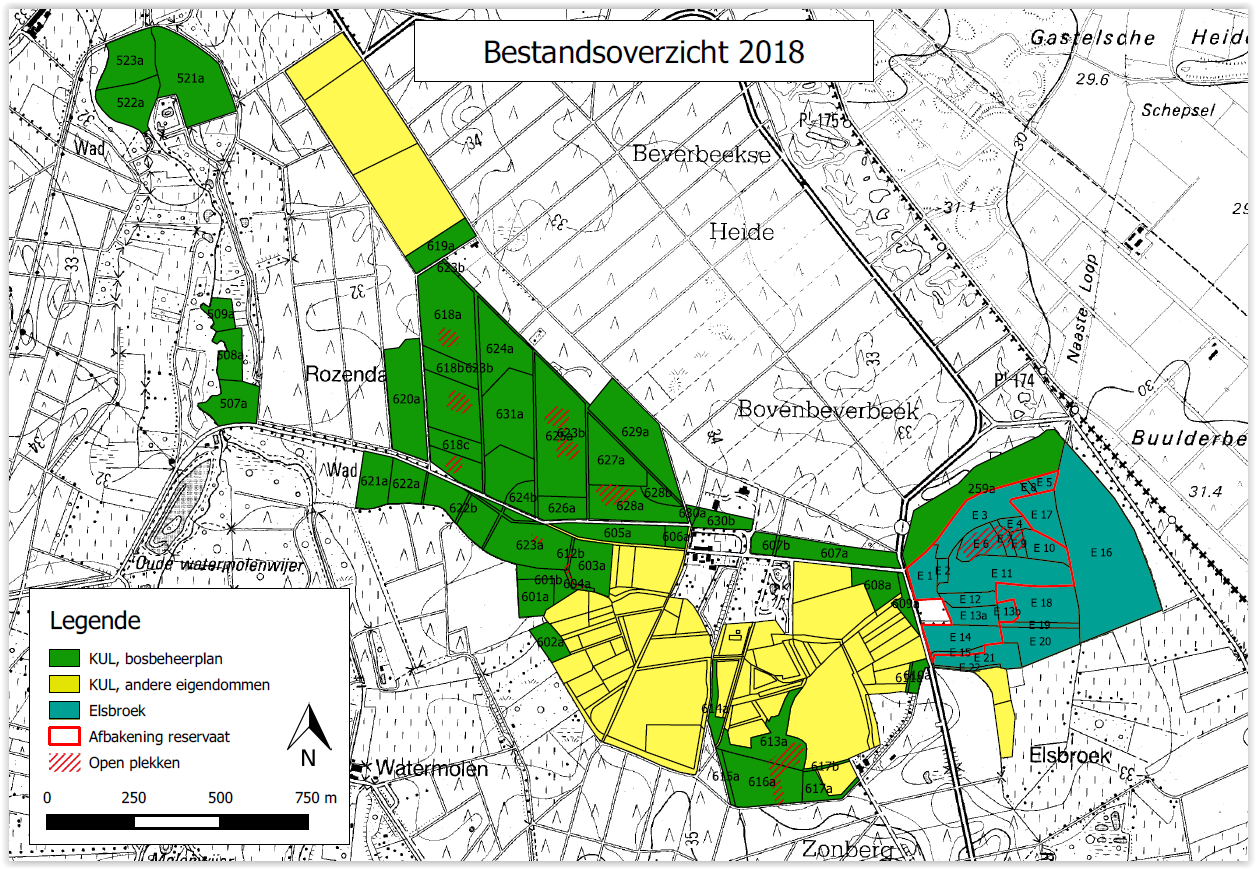
Beverbeek is a complex site consisting of areas with a primary conservation purpose as the two gazetted nature reserves Elsbroek (mesotrophic and oligotrophic mire with alder-birch woodland, Myrica bush) and Zooren (alluvial plain forest). Other parts are multifunctional forests with scots pine, corsican black pine, oak, larch, douglas fir, etc.
-
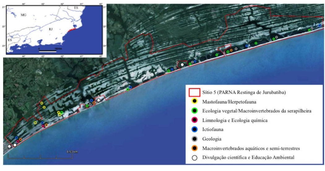
On the quaternary coastal plains of the northern of Rio de Janeiro State, the Restinga de Jurubatiba National Park Brazil encompass 11 vegetational units varying from shrub vegetation (locally known as "restinga") to inundated forest and 18 coastal lagoons which differ largelly in salinity. Organisms such as reptiles, amphibians, mammals, fish, aquatic and terrestrial plants and processes (carbon cycling) have being study since 1999 under this site of the Brazilian Long Term of Ecological Studies innitiative.
-
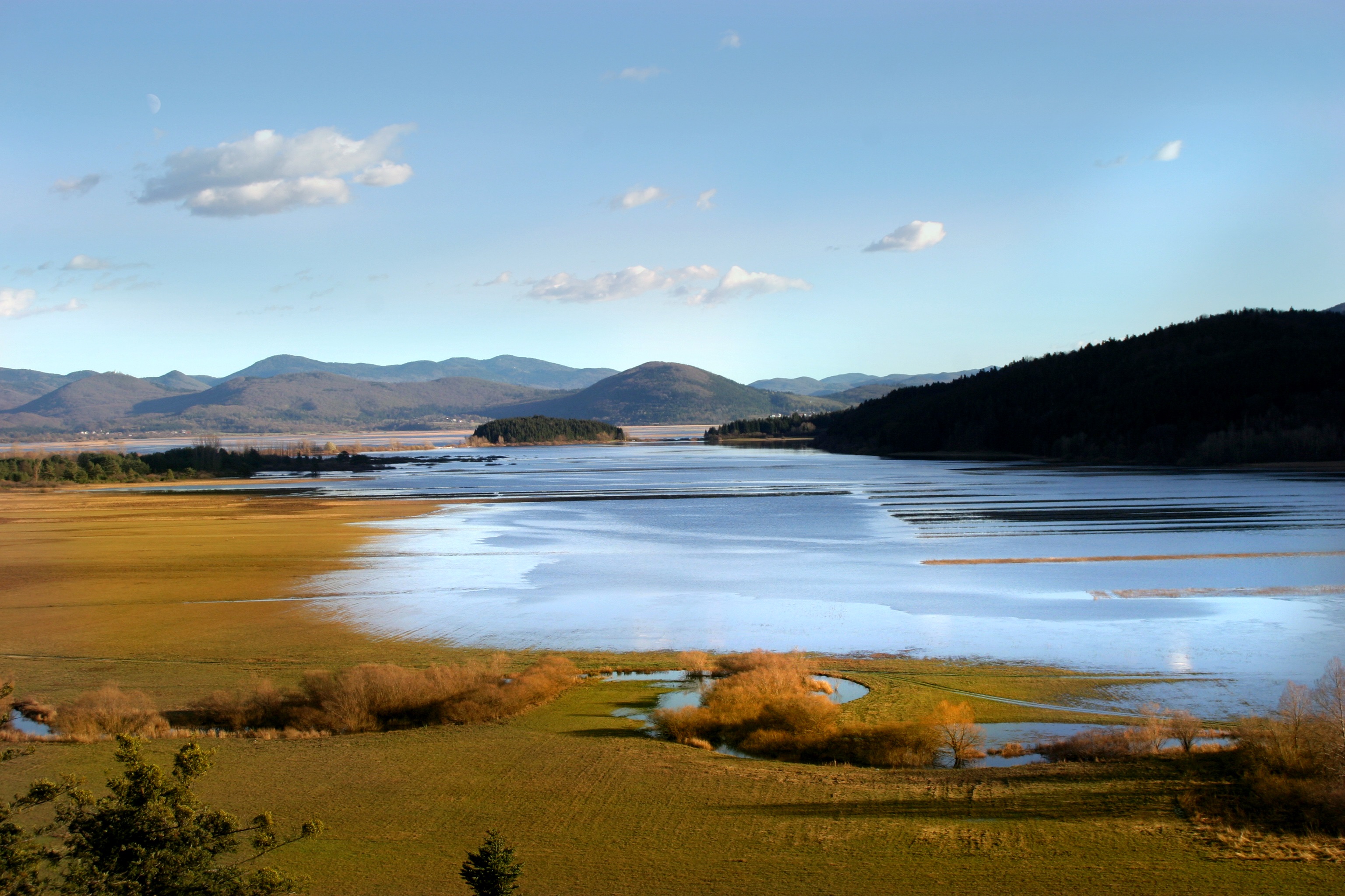
Lake Cerknica is intermittent lake appearing at the bottom of closed depression Cerkniško polje extending on the area of 38 km2. The karst features are associated with carbonate rock, both with limestone and dolomite. About 80 % of inflow consists of karst and only 15% of surface waters. The outflow is completely karstic. In spring and usually late in autumn the lake reaches normal level 550 m a.s.l., covering the area of 26 km2. Polje is flooded for 9 and dry for about 2 months, usually in summer. Lake Cerknica is a highly diverse ecosystem that changes in time and space. Vegetation pattern shows clear zonal distribution that depends on extent and frequency of flooding. The lake supports rich fauna with many endangered species, providing temporary shelters and food for protected large carnivores, such as brown bear, wolf, lynx and numerous species of water birds. In recent decades, flood and drought events have become increasingly irregular altering processes and conditions for many species.
-
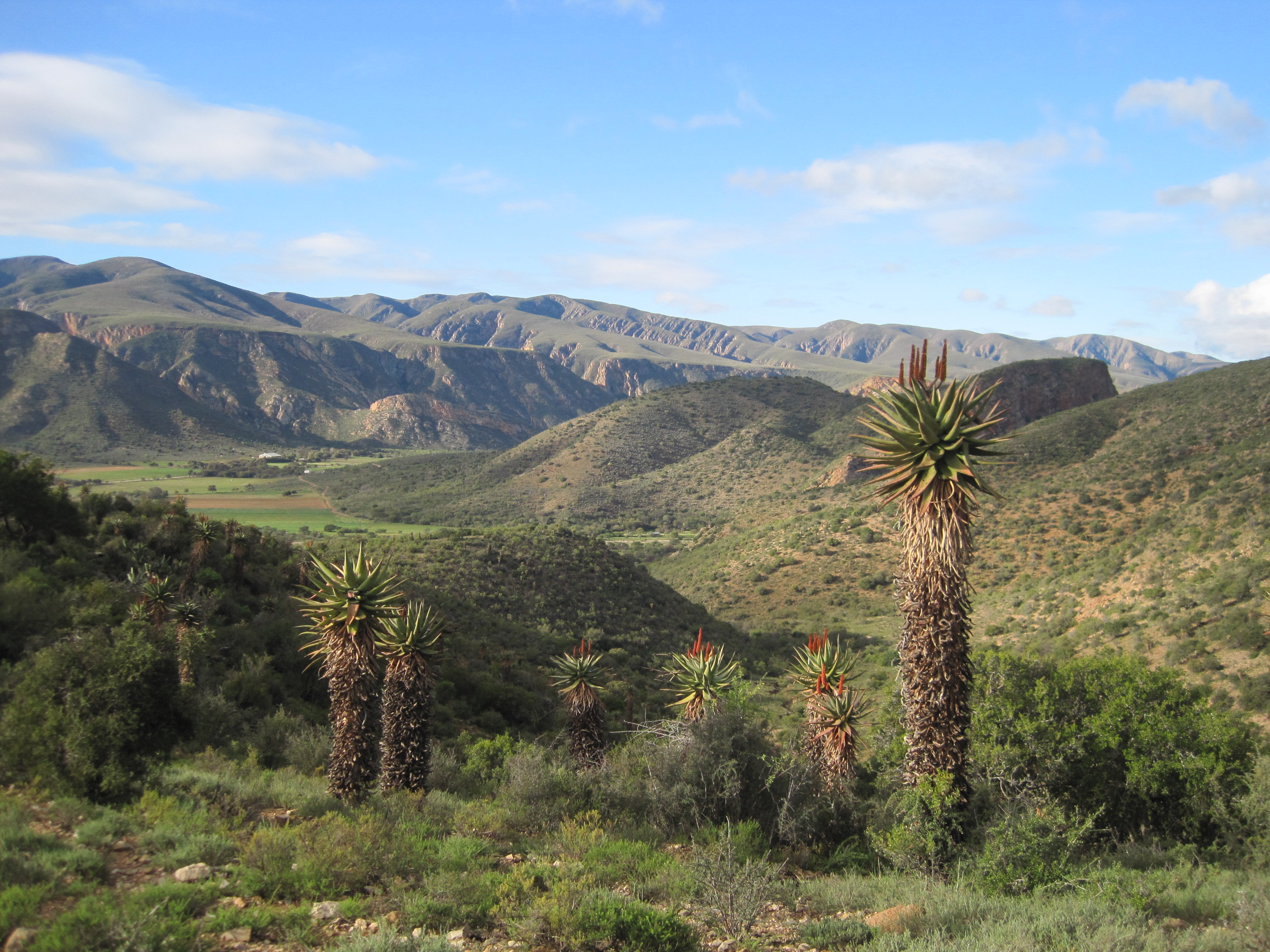
This site covers the catchment area of the Baviaanskloof River and surrounding Baviaanskloof Mega-Reserve area, where ecological, agricultural and social systems are managed collaboratively in order to promote sustainable use of the landscape.