
groundwater permeability
Type of resources
Available actions
Topics
Keywords
Contact for the resource
Provided by
Years
Formats
Representation types
-
Located 2 km east of the Science Campus of the University of Poitiers, the Hydrogeological Experimental Site (HES) occupies an area of 12 hectares on land belonging to the University. From the geologic viewpoint the SEH occupies the north flank of the “Seuil du Poitou”, a huge Mesozoic carbonate plateau marking the transition between the Aquitaine and Paris sedimentary basins. The studies conducted at the SEH focus mainly on the Dogger Aquifer. The experimental layout now comprises 35 boreholes, including two vertical and two inclined cored holes.
-
The Chalk Karst observatory groups different karst sites on the Cretaceous Chalk located at the Paris Basin (Norville, Radicatel, Yport, Saint-Martin-Le-Nœud). These karst watersheds range from 10 to 200 km2 and the land use consists of agriculture and grazing under oceanic climate. There are characterized by chalk plateaus covered with clay-with-flints owing to chalk weathering constituting a fairly impervious layer and with quaternary silts. These surficial formations range from 3 to 20 meters depth and are highly susceptible to crusting, compaction, and erosion, particularly during autumn and winter. A numerous swallow holes locally penetrates the chalk through the above-mentioned impervious layer, resulting in a strong connection of the surface with the aquifer inducing infiltration of turbidity releases at spring and well used to drinking water (up to 500 NTU). These Chalk karst sites are one the sites of the French SO-KARST labellised by INSU-CNRS and are a part of the French RBV-Network and ZA Seine.
-
Coniferous forest.
-
The 'West Polesie' Biosphere Reserve has been created in 2002. Reserve area (140 000 ha) covers almost whole Łęczna-Włodawa Lake District as well as its near vicinity. It is situated about 40 km north-east of Lublin adjacent to Ukraine’s Shatski Biosphere Reserve. West Polesie includes Poleski National Park, three Landscape Parks: Sobiborski, Łęczna Lake District and Chełmski. The most important protected area in the Reserve is Poleski National Park, with natural resources of lakes (e.g. Łukie, Moszne, Długie) and peatbogs (Orłowskie, Durne Bagno, Bagno Bubnów). Many kinds of endangered species of fauna and flora can be found in the West Polesie area. Villages in this rural area show many examples of traditional wooden architecture and still maintain a cultural and folklore life. The 'West Polesie' Biosphere Reserve is located in the eastern part of Lubelskie voivodship and consist 25 administrative units (3 towns and 22 communes).
-
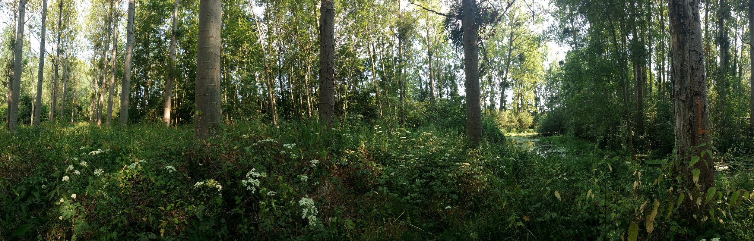
The study plot was established by the Institute of Forest Ecology (Mendel University in Brno) in 1968, namely in connection with the UNESCO International Biological Programme (IBP) and the UNESCO programme “Man and the Biosphere” (MAB). Research was aimed at the primary production, element and water cycling and the secondary production of invertebrates, birds and small mammals. It refers to a semi-natural floodplain forest free of management measures characterized by the Ulmeto-Fraxinetum carpineum forest type group. Dominant tree species are as follows: Fraxinus excelsior, Quercus robur, Populus nigra, Tilia platyphyllos, and Acer campestre. In consequence of flood control, the local floodplain forest was affected by changes in the water regime (absence of natural floods, fall of the groundwater table) from 1972. In the course of the 1970s and 1980s, it resulted in the insufficient supply of water. Since the 1990s, revitalization measures have been carried out (increasing the ground water level by means of channels) for improving forest health. Changes in the water regime have resulted in the improving condition of the floodplain forest ecosystem that has been documented owing to LTER on the site. Following research activities are carried out there: (i) monitoring selected parameters of the stand microclimate and mesoclimate, (ii) evaluating the moisture balance in the forest ecosystems, (iii) evaluating the water regime and moisture conditions of the floodplain forest ecosystem, (iv) evaluating temperature and moisture conditions, (v) research into the water relations of trees, (vi) evaluating long-term changes in the synusia of small terrestrial mammals of the floodplain forest, and (vii) evaluating decomposition processes.
-
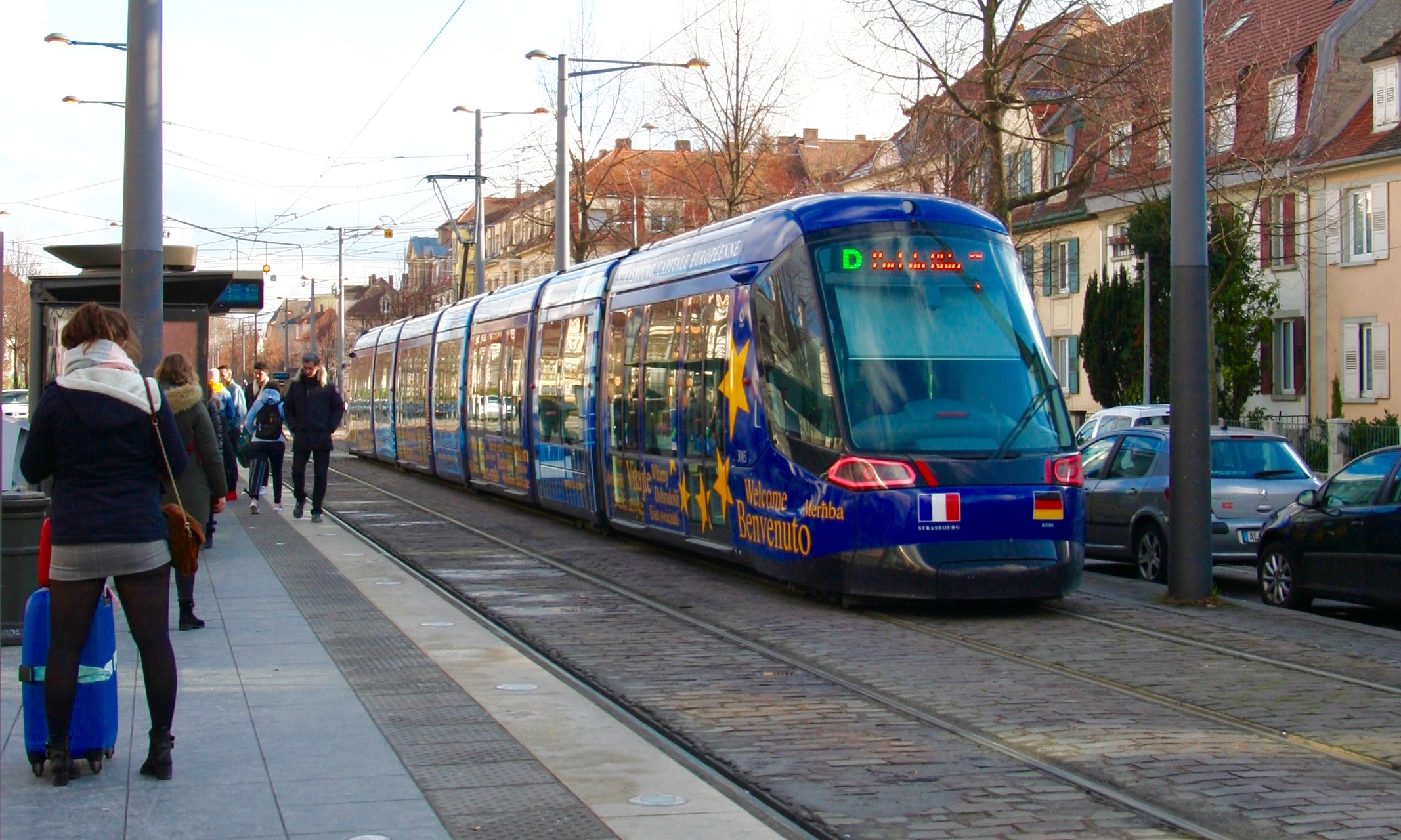
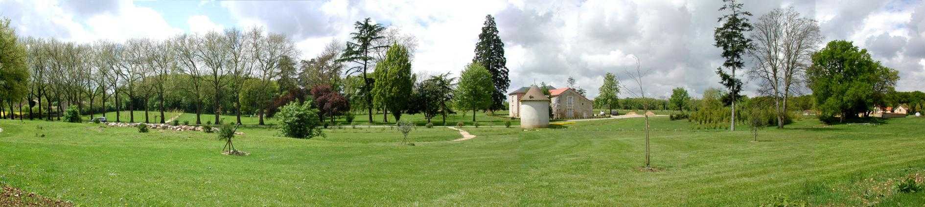
The LTSER Zone Atelier Environnementale Urbaine belongs to LTER-France network and is located in eastern France.The Zone Atelier Environnementale Urbaine ZAEU was created in 2010. It focuses on urban area and urban socioecosystem research questions. The main objective is to define how to facilite an harmonious development according to the city needs without badly impacting the natural system around. The Eurometropole of Strasbourg is a close partner of the ZAEU: local authorities participate to the research experimentations and observation campains. Six working groups are dealing with natural systems in order to better understand the urban ecosystem (biodiversity, hydrology, air and climate, urban metabolism) and the socio system (social and economic dimensions of the society and the individuals, groups behavior and values, politics strategies). In the working groups, we study issues like hydrological system processes in the urban area, population health, energy consomption and production at the city scale, pollutions and contaminations of the various spheres, refusal management with regards to the context of global changes, sustainable development and transitions (economy, ecology, energy).
-
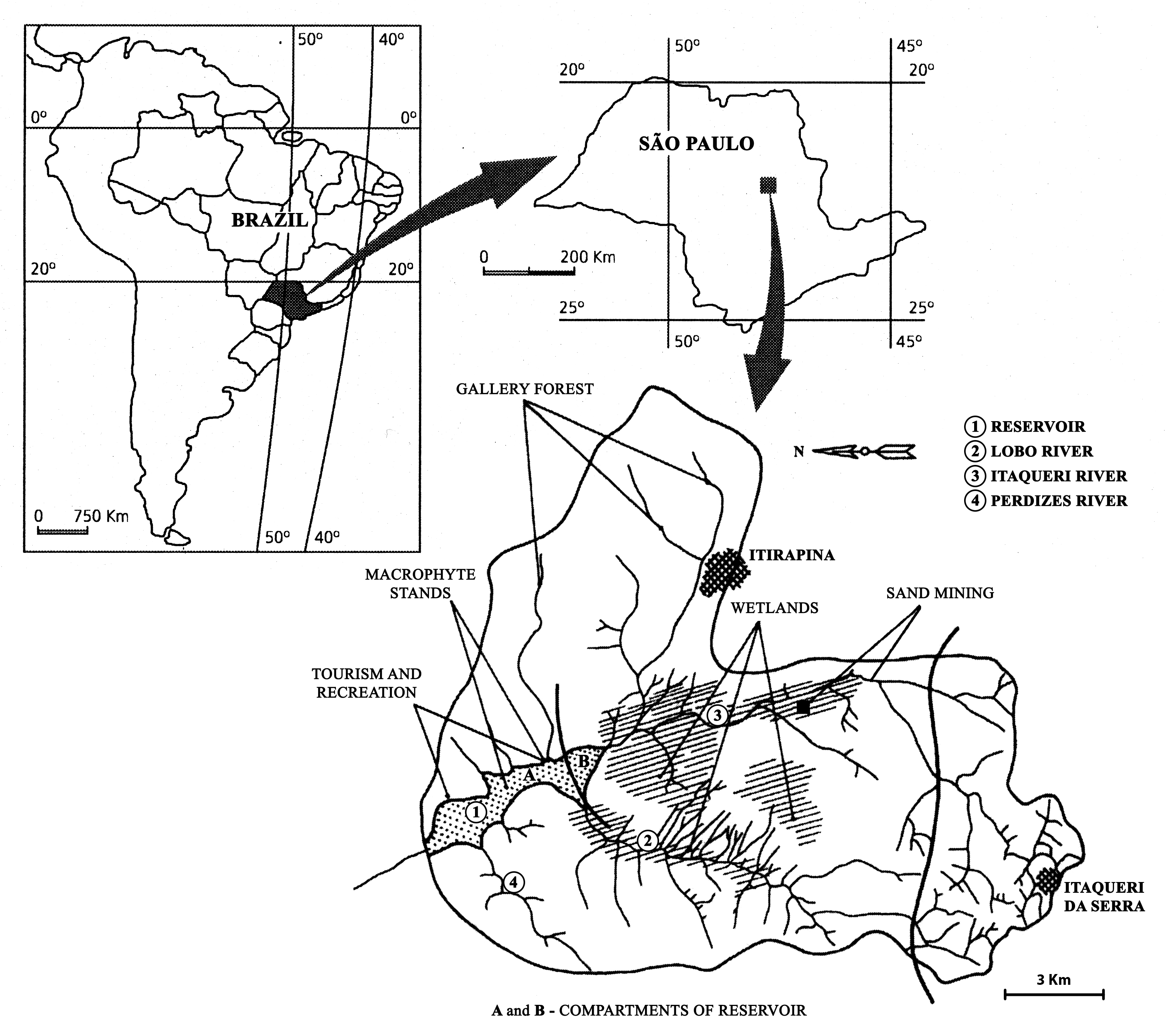
The watershed is located in the center of São Paulo State, Southeast of Brazil. The coordinates are: Lat. 22º 10' 08,5" S; Long. 47º 57' 11,7" W. The drainage density is 0.75km/km2. The maximum altitude is 800m. Basin declivity is 0.00575m/m. The local climate is characterised by alternating dry and wet periods, the wetter period falling in summer and autumn, and the winter and spring seasons being mainly dry. Annual precipitation is around 1500 mm per year. Temperatures are typically between 15 °C and 17 °C during the coldest winter month (July); in the warmest summer month (January), water temperatures between 21 °C to 23 °C are recorded. Potential evapotranspiration is between 500 mm to 1000 mm per year. According to the Koppen classification, the climate is described as ‘warm with a dry period’. The watershed is dominated by holocenic sandy sediments. In the lowland areas, hydromorphic and organic soils predominate. Soils derived from basalt intrusion occur in some areas of the watershed, as red soil hotspots. The natural vegetation is characteristically a savanna type, the Cerrado, typical of the continental regions of Brazil, consisting of bushes and trees adapted to a long (six months) dry season with periodic fires. Given the hydrogeochemical character of the watershed, the ionic strength and the nutrient content of the water of Lobo-Broa Reservoir are correspondingly low.
-
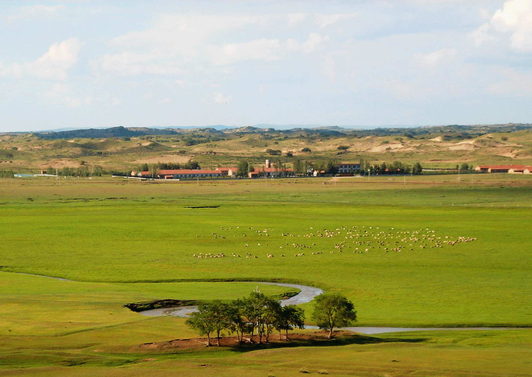
The Inner Mongolia Grassland Ecosystem Station (IMGERS) of the Chinese Academy of Sciences is located in the Xilin River Basin, Inner Mongolia. It was established in 1979. This area is characterized by a typical temperate semiarid climate with a mean annual (1982-2012) precipitation of 297 mm and a mean annual temperature of 0.9°C. Growing season usually runs from late April to late September. The soil in this site is chestnut soil with relatively homogeneous physiochemical properties.
-
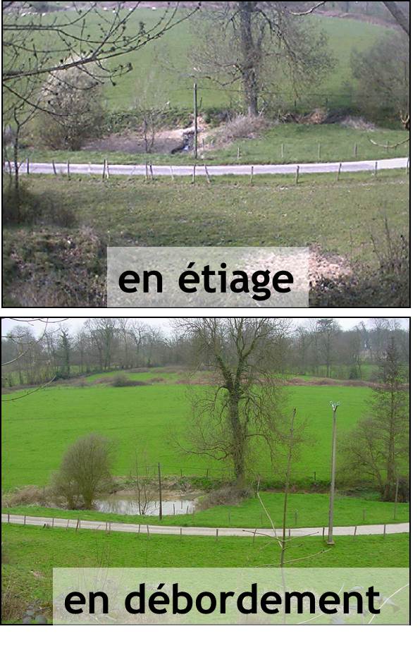
The Bassée floodplain is a large area in the Seine river basin (~ 50 km long and 5-10 km wide). Series of hydrological installations (dikes, channelization, damming, drainage, sand and gravel pits) have considerably reduced the flooding in the plain which nervertheless remains an important resource in the Seine river basin for freshwater and biodiversity. The level of anthropization increases from upstream to downstream. Projects for new hydrological installation (damming, channelization) still exist, which supports a high monitoring activity in this area.
-
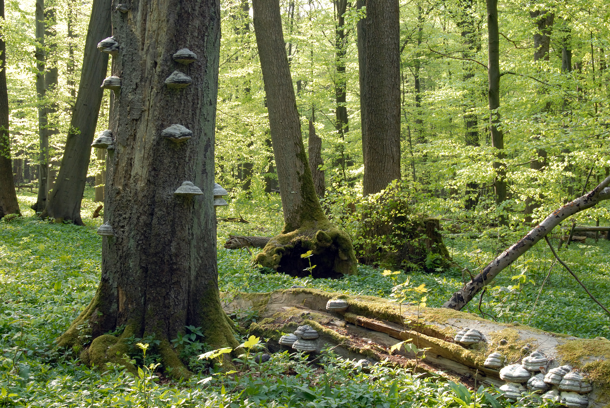
Hainich is a large deciduous forest area in Thuringia and is situated in central Germany not far from the town of Eisenach with the famous Wartburg Castle. With a total area of ca. 16.000 hectares (13.000 hectares of which is forest), Hainich is the largest continuos area of deciduous forest in Germany. On the 31.12.1997 the southern part of Hainich, with an area of 7.500 hectares, was declared Germany’s 13th National Park. Since then it has been seen as a place of relaxation close to nature that is open to sustainable tourism. The area has gone through an amazing development which is quite unique. Since 2011 Hainich is part of UNESCO World Heritage Site "Primeval Beech Forests of the Carpathians and the Ancient Beech Forests of Germany".