
habitat heterogeneity
Type of resources
Available actions
Topics
Keywords
Contact for the resource
Provided by
Years
Formats
Representation types
-
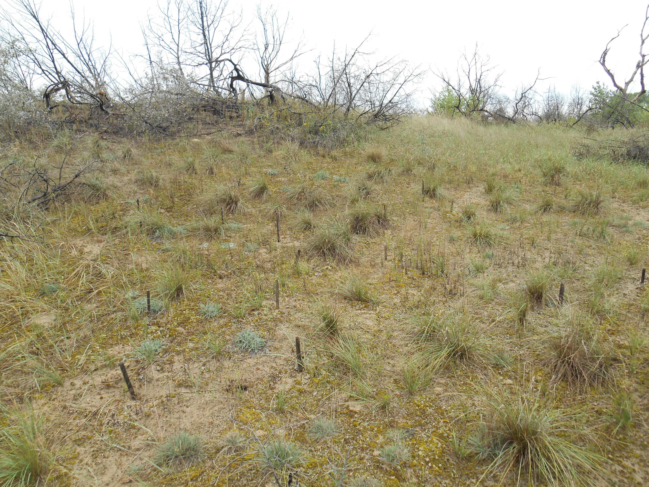
3 sites with 10 ha altogether; follow the long-term changes on sand steppe gaps of juniper-poplar forest in order to study the effect of fire
-
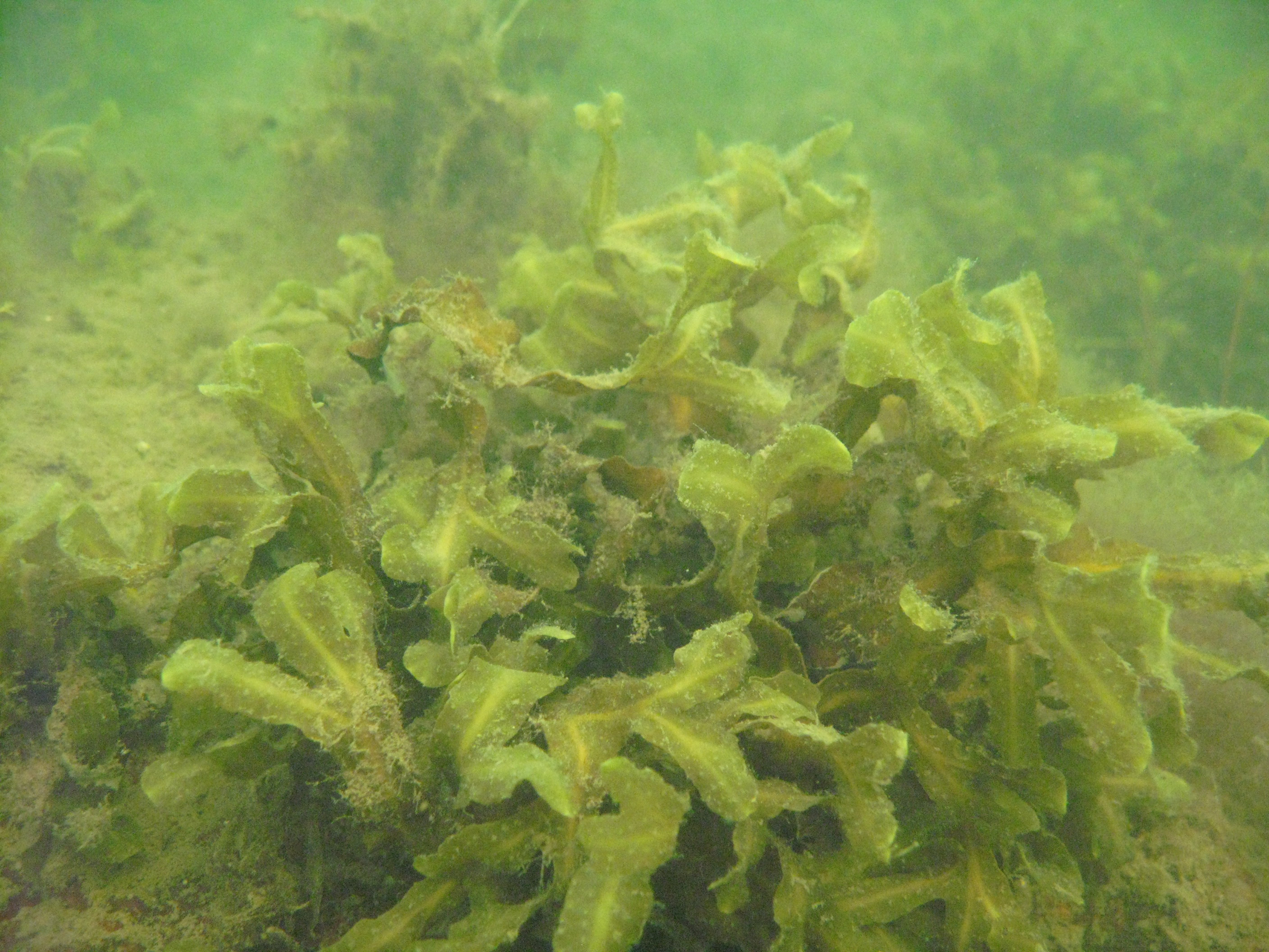
Western part of the Gulf of Riga (the Baltic Sea) littoral and sublitoral zone. The marine site is located on the west coast of the Gulf, in the Engure Nature protected area. The monitoring activities are based on three transects which represent an open area of very similar substrate type. These transects are located on the tip of Mersrags, 2.5 km northwards from the port of Mersrags. Long-term studies of the Gulf of Riga coastal zone communities and macrophytes as the key component of littoral zone under natural and anthropogenic impact and possible threats to the littoral zone biological resources. The SCUBA diving is used in marine site assessment.
-
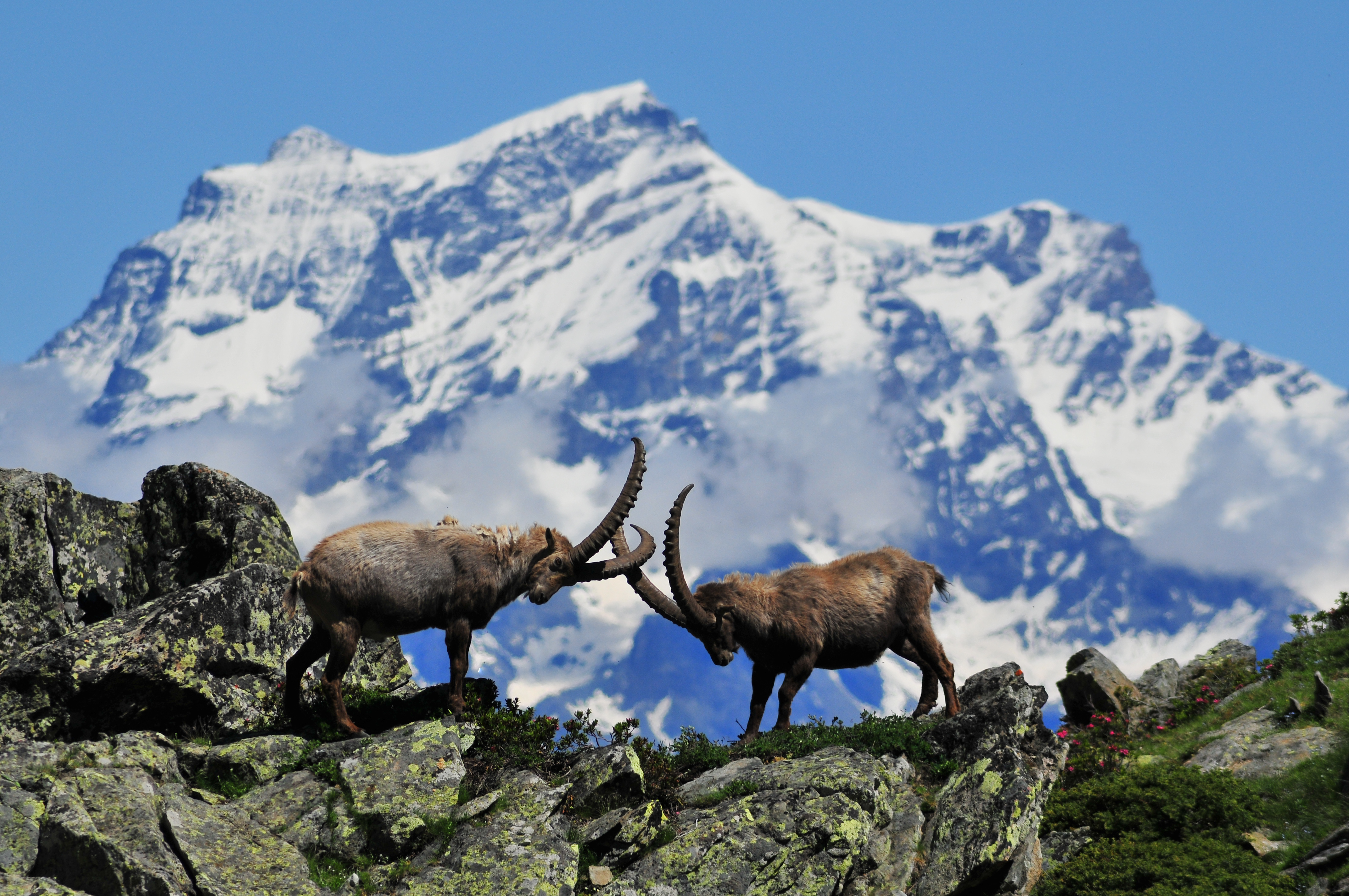
The site corresponds to the territory of Gran Paradiso National Park. This includes different ecosystems, present along the altitudinal gradient (ca. 800 – 4000 m asl): the woody areas of the montane belt, the ecotonal habitats of the subalpine belt and the meadows of the alpine one. The nival belt is widely represented inside the Park. The habitats with poor or no vegetation (rocks, screes, glaciers) cover about 60% of the territory, meadows and pastures 17%, about 20.2% is characterised by woods and shrubs, while 0.8% by cultivated lands and urban areas. The aquatic ecosystems, beyond the streams, comprise almost 15 lakes, bigger than 10,000 m2 and located at an altitude higher than 2000 m asl. The area is directly managed by the Park Authority; research and monitoring activities are coordinated by the Sanitary and Scientific Office of the Park.
-
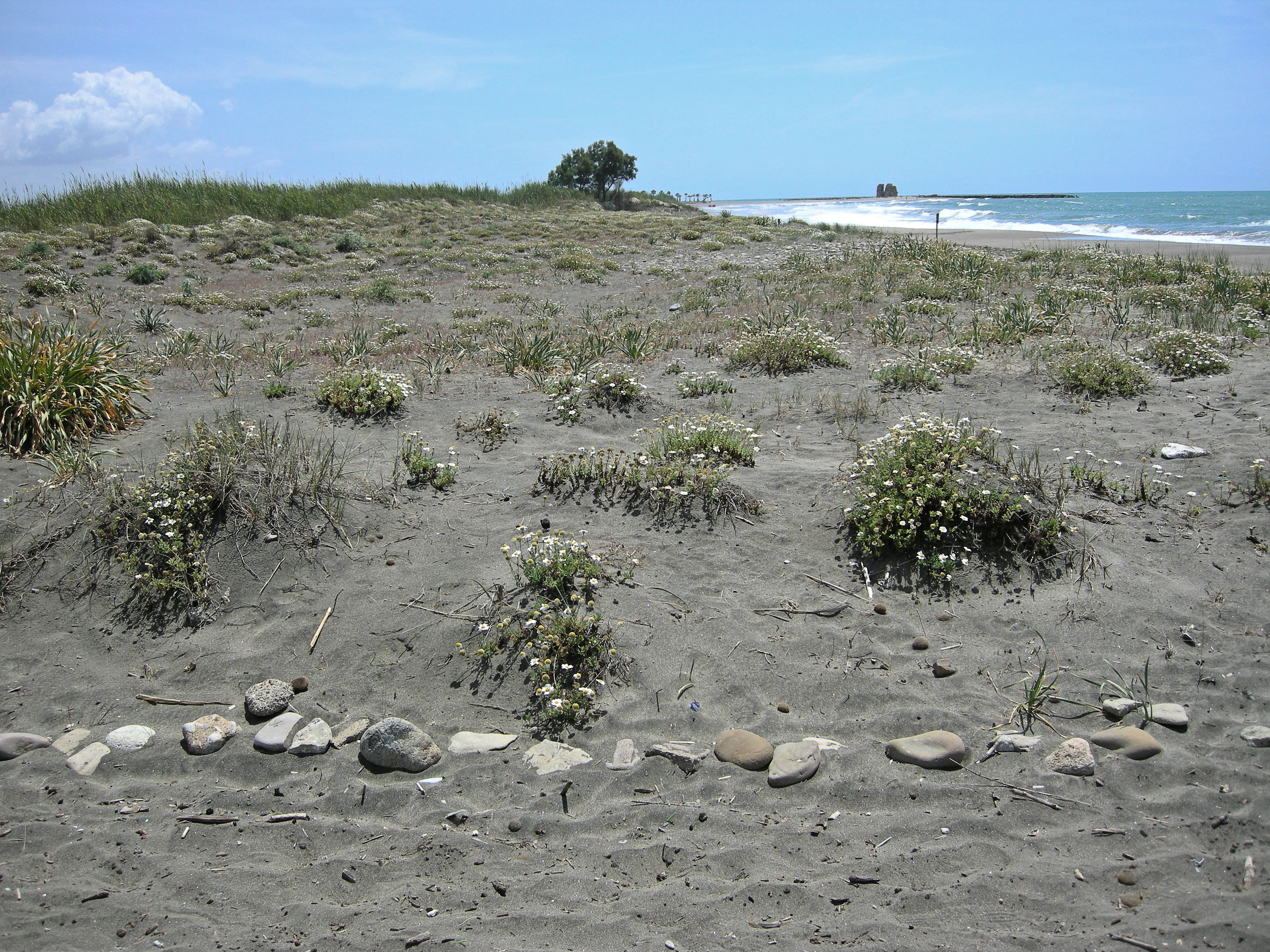
The site, located along the Tyrrhenian coast, north of Rome city, is a Special Protection Area (SPA) for migratory and nesting birds (Anatidae, Ardeidae). The wetland area is one of the last stretches of the Lazio wetlands which have been progressively reclaimed and cultivated during the last century. The flora and the fauna of the site is not only highly specialized but also highly endangered, with a relevant ecological value evidenced in previous studies. The site includes coastal dune habitats of European interest, as the annual vegetation of drift lines, the embryonic shifting dunes, the mobile dunes with Ammophila arenaria and the dune grasslands. There are also habitats related to wet and mud soils, as Mediterranean salt meadows and reed beds dominated by Phragmites australis.
-
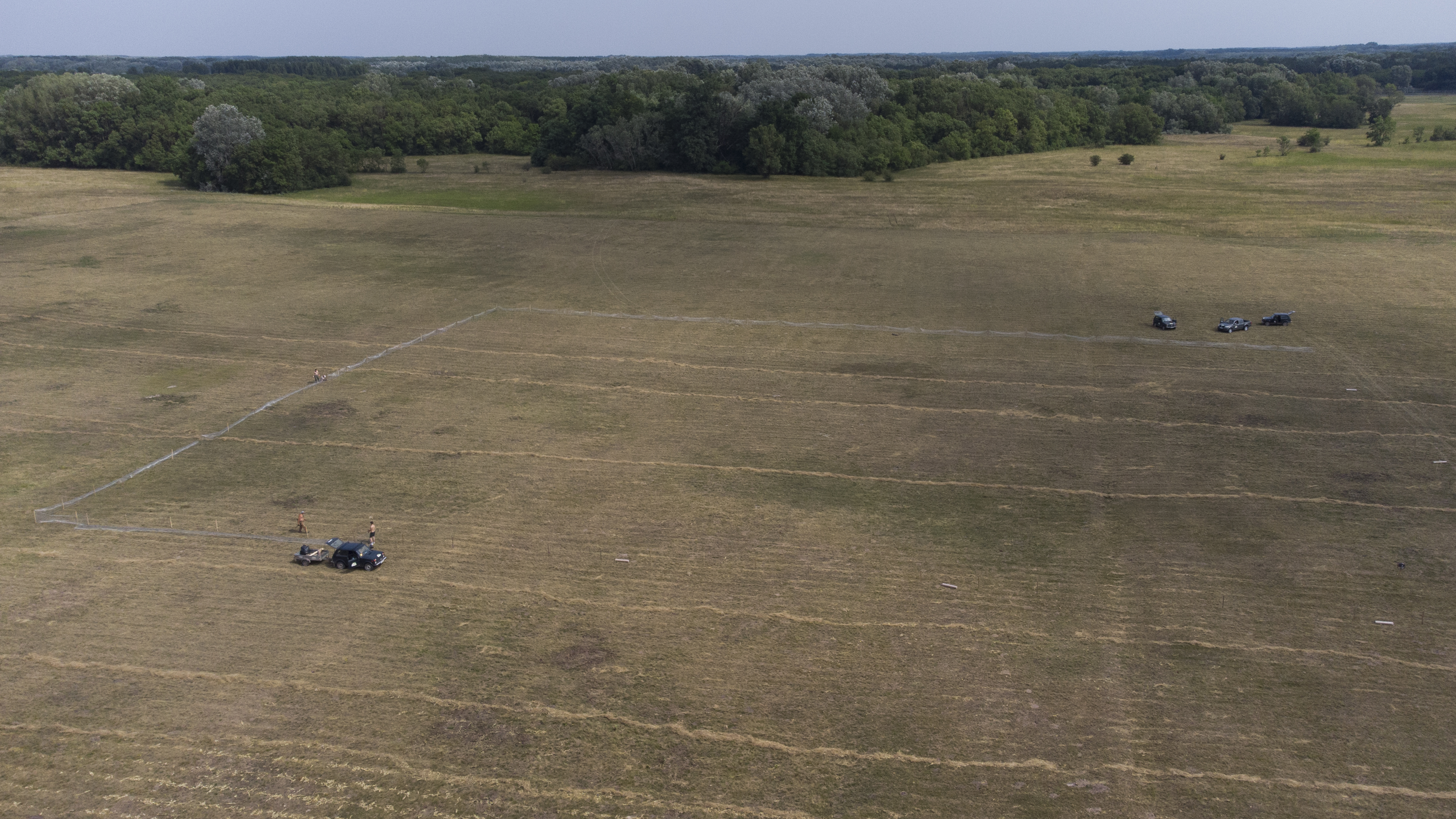
The site is a revitalized young steppe habitat patch, dominated by fescue (Festuca rupicola). The average altitude is around 100 m. The site is a grazing spot and it was recently used for the reintroduction of the European ground squirrel (Spermophilus citellus) to the area after 70 years. Other important species present at the site include Vojvodina blind mole rat (Nannospalax (leucodon) montanosyrmiensis) and Spring meadow saffron (Bulbocodium versicolor).
-
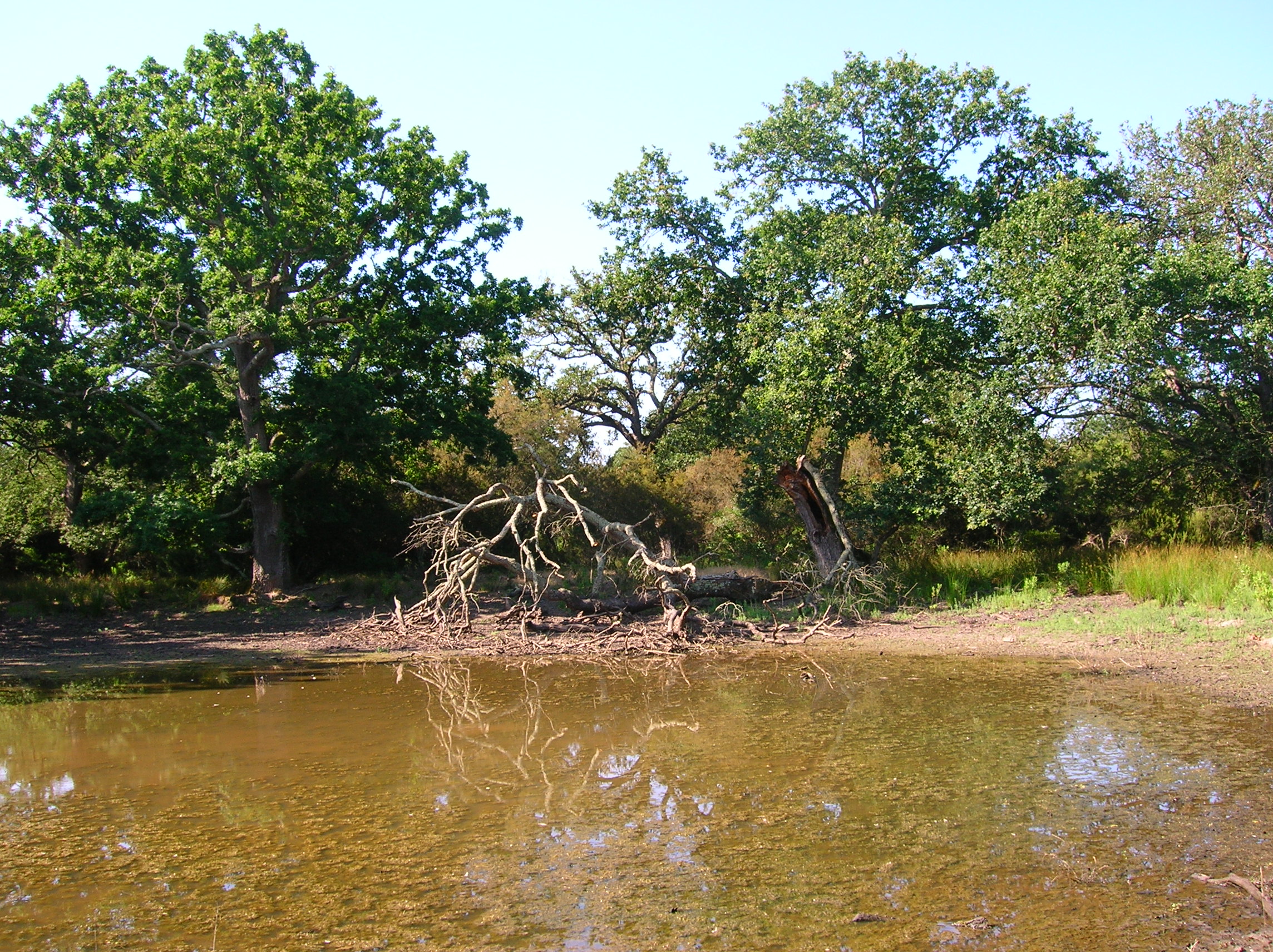
The Presidential Estate of Castelporziano stretches itself over an area of about 6100 ha and is located approximately 24 km from the city of Rome. The territory is characterized by remarkable natural features. It shows most of the typical Mediterranean ecosystems (relict strips of lowland forest with hygrophilous vegetation, deciduous and evergreen mixed oak woods, Mediterranean scrub, dune vegetation). Until recently (2019), there were large surfaces of stone pine unfortunately destroyed by the combined action of alien pest Toumeyella parvicornis with Tomicus destruens, the main pest of Mediterranean pine forests. Inside the Estate, there are two Special Areas of Conservation (SACs): one concerning the coastal strip (IT6030027) and the other one concerning hygrophulous oak-woods (IT6030028). In addition to including the two SACs, the Estate is in its entirety Special Protection Area (SPA - IT 6030084). From a botanical point of view this area, together with the neighbouring Castelfusano territory, represents what remains of the vast forest system that covered the entire delta of the Tiber and the surrounding areas. The land is mostly flat, but in the North there are modest reliefs that are not higher than 85 m. on sea level. A complex set of ancient dunes and a chain of more recent dunes stretch out along the coastline. There are many temporary and permanent natural pools and wetland areas with seasonal floodings caused by meteoric water and groundwater, which usually dry out during summer and represent sites with the greatest biodiversity. From an ecological point of view, those “relict wetland areas” play actually a very important role for biodiversity because of plant species which are typical of hydrosoil and in the past were widespread but have now almost disappeared.
-
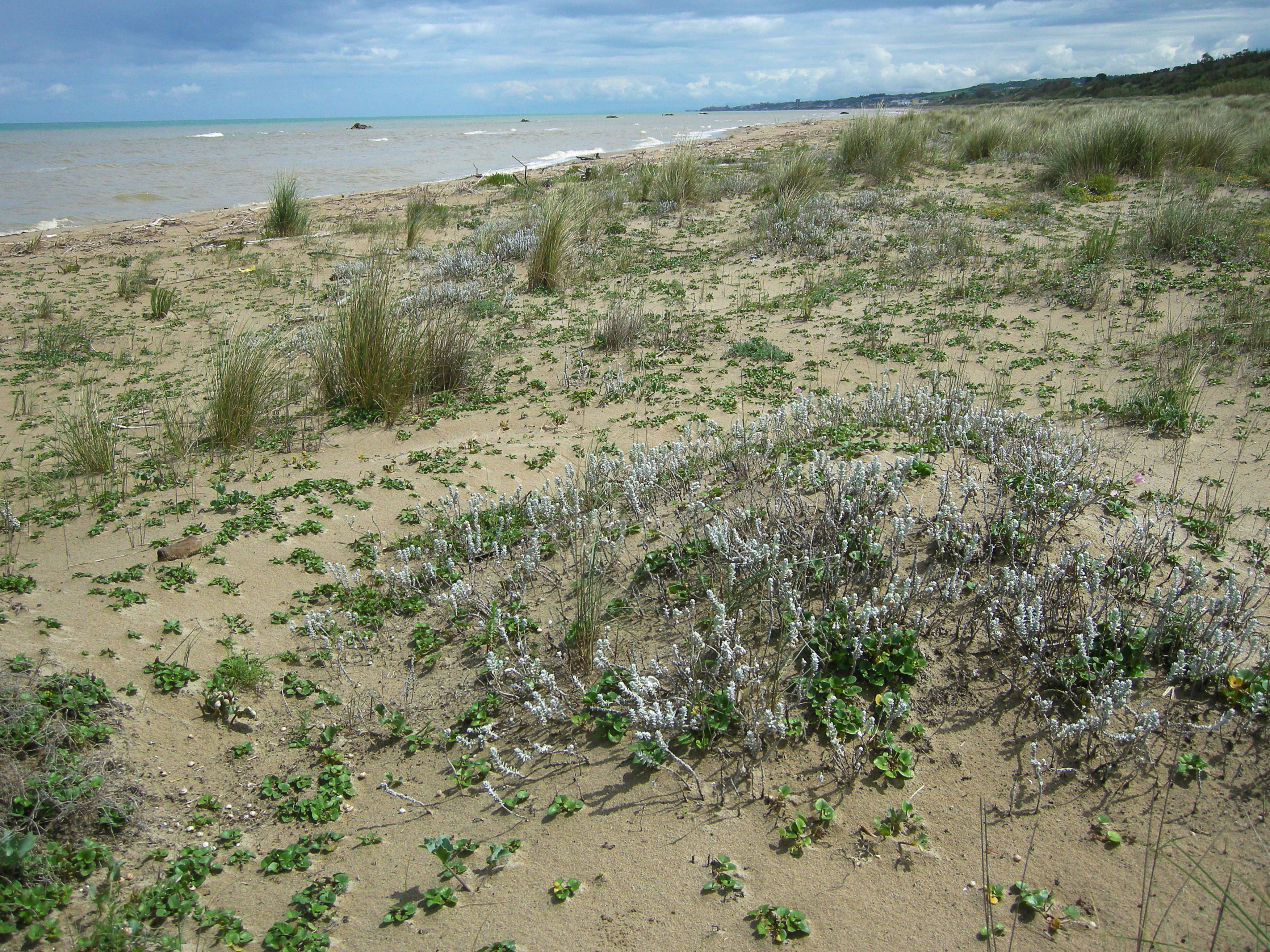
S.C.I IT7228221 Foce Trigno-Marina di Petacciato (Campobasso) S.C.I. IT7140108 Punta Aderci-Punta della Penna S.C.I. IT7140109 Marina di Vasto The site includes 3 Natura 2000 sites along the central Adriatic coast, where the last fragments of natural vegetation zonation on sand coastal dunes occur (shore vegetation, embryo and mobile dune vegetation, annual Mediterranean grasses and wet dune slacks).
-
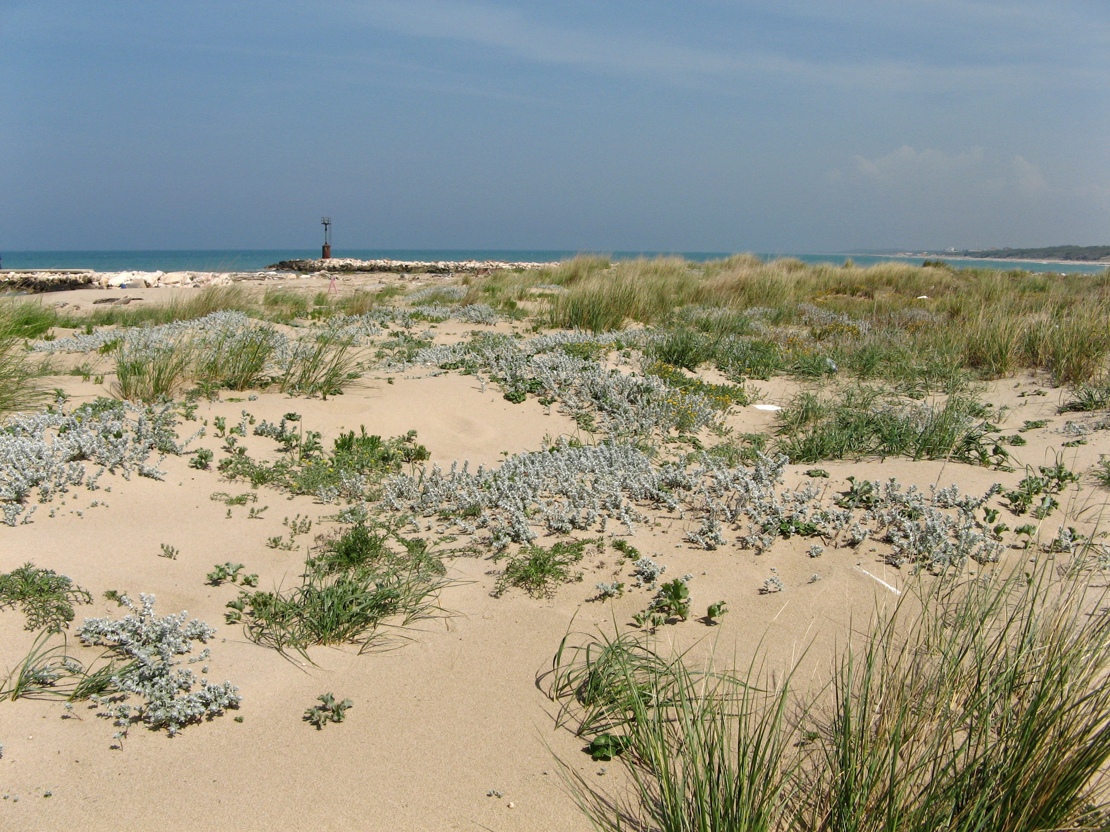
SCI IT7222217 Foce Saccione-Bonifica Ramitelli (Campobasso) The site includes 1 Natura 2000 site along the central Adriatic coast, where the last fragments of natural vegetation zonation on sand coastal dunes occur (shore vegetation, embryo and mobile dune vegetation, annual Mediterranean grasses, costa dunes with Juniperus spp and wet dune slacks).
-

The Seine estuary is a megatidal estuary located in northern France. It is the third largest estuarine ecosystem in the country after the Gironde and Loire along the French Atlantic coast; its waters flow into the English Channel. The geographical zone of influence of the Seine estuary runs from just upstream of the Poses dam, at the limit of the tidal penetration into the estuary — 160 km upstream of Le Havre —to the eastern part of the Bay of Seine. It can be divided into three sections: the fresh water upstream section (125 km), the mixing zone characterized by varying salinity levels (35 km), and the marine downstream section under the influence of the Seine River. The megatidal regime generates a turbidity maximum in the mixing zone (middle estuary) between the marine and fluvial sections of the estuary. The Seine estuary is a typical estuarine ecosystem: highly stressed by natural fluctuations and anthropogenic pressures, and hosting a rich ecological system. The Seine valley and its estuary are of major economic importance for France, with the presence of two maritime ports. It’s watershed (79,000 km2) is the home to 17 million people, and accounts for 50 % of the river traffic in France, 40 % of the country's economic activity, and 30 % of its agricultural activities. In addition to the Greater Paris area (> 11 million inhabitants), which contributes heavily to the Seine estuary's upstream inputs, two other major river settlements — Rouen (500,000 inhabitants) and Le Havre (300,000 inhabitants) — are maritime ports of international importance. Due to economic development, the Seine estuary has been subjected to major hydrodynamic, ecological, biogeomorphological and biogeochemical changes. The importance of studying the effects of anthropogenic impacts on estuarine ecosystems has increased in the last decade, especially under the Water Framework Directive, which aims to achieve “good environmental status” of all European water bodies.
-
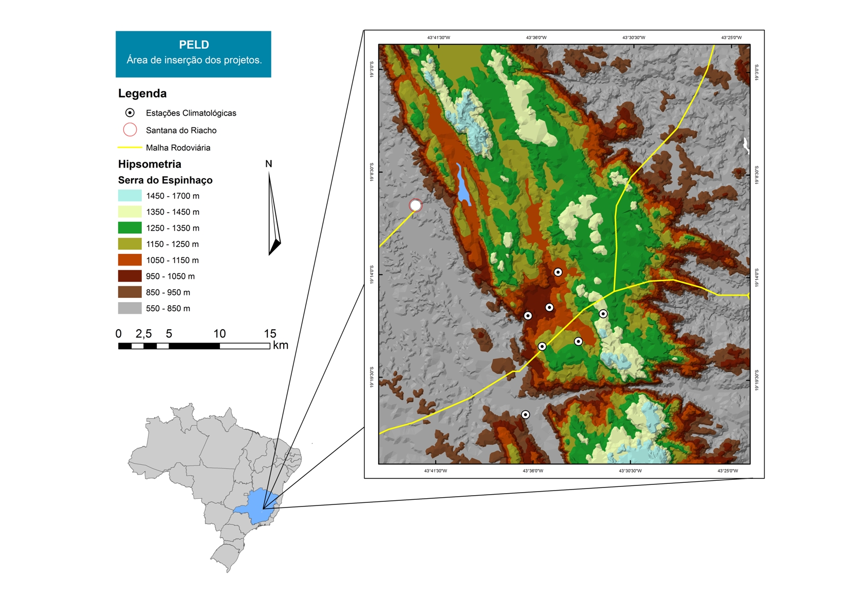
For over 20 years as a team of Long Term Sites in Serra do Cipó PELD-CRSC has been working to answer crucial questions of evolutionary ecology and provide a basis for understanding the spatio-temporal ecosystem functioning and it is future challenges with changes in climate and land use.