
habitat use
Type of resources
Available actions
Topics
Keywords
Contact for the resource
Provided by
Years
Formats
Representation types
-
None
-
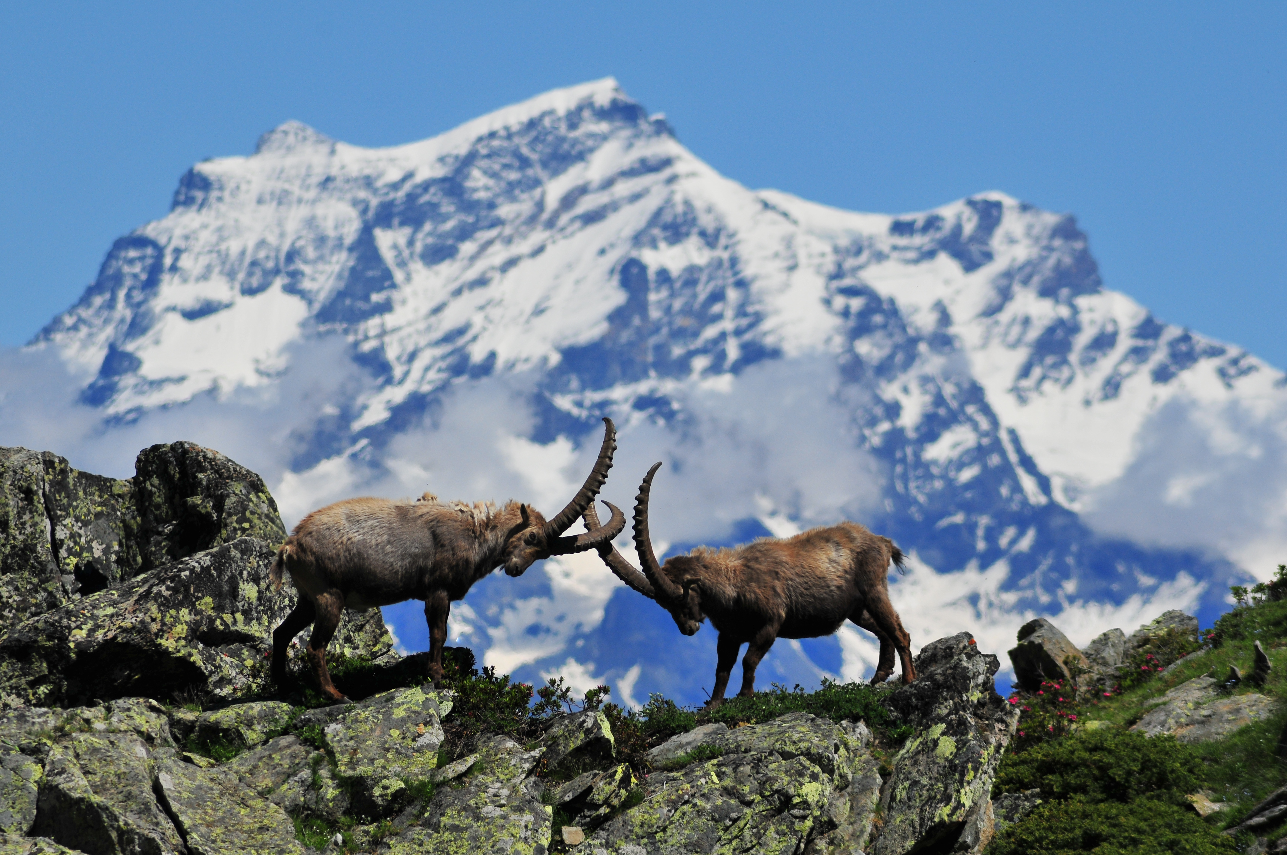
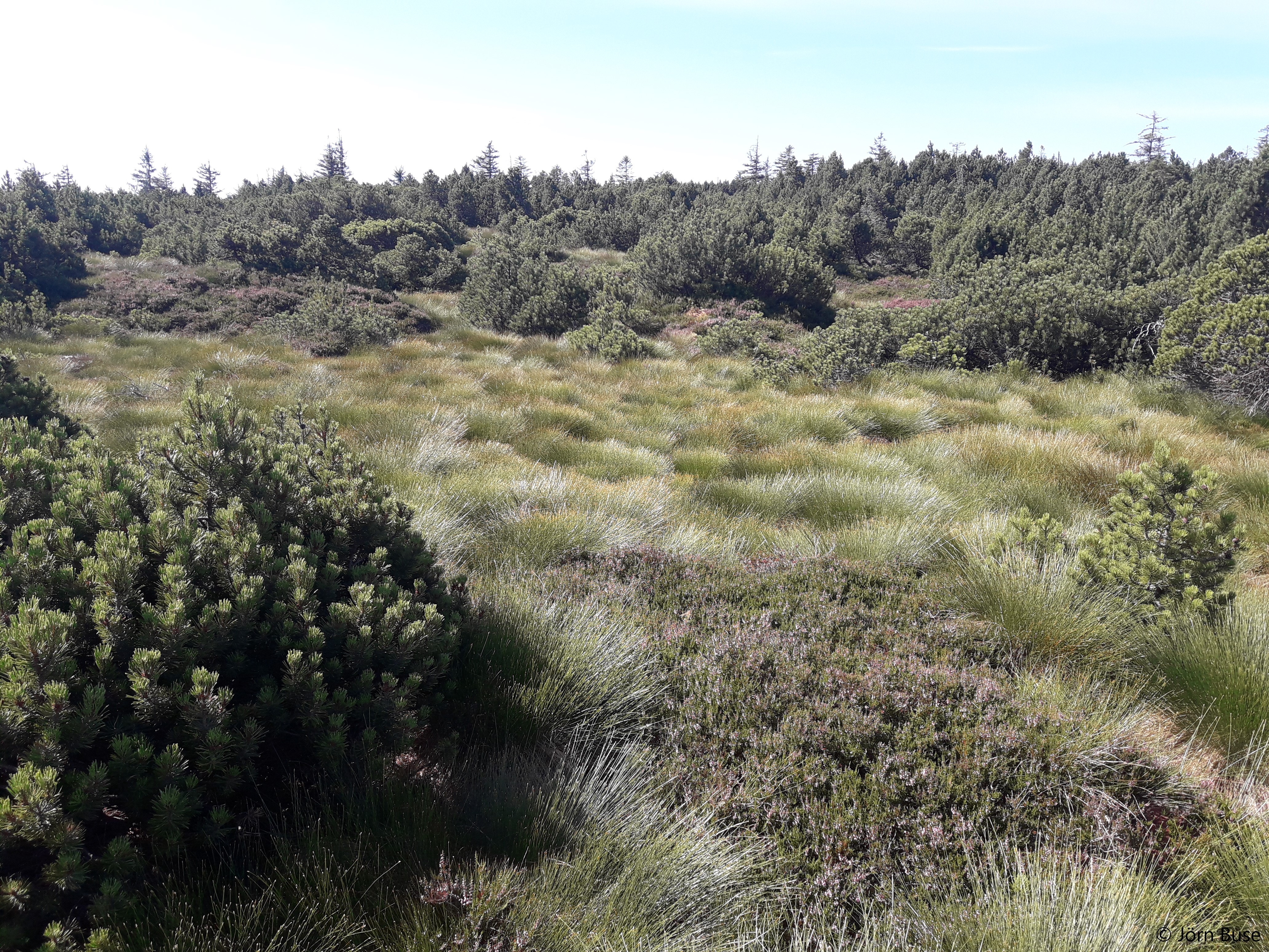
The site corresponds to the territory of Gran Paradiso National Park. This includes different ecosystems, present along the altitudinal gradient (ca. 800 – 4000 m asl): the woody areas of the montane belt, the ecotonal habitats of the subalpine belt and the meadows of the alpine one. The nival belt is widely represented inside the Park. The habitats with poor or no vegetation (rocks, screes, glaciers) cover about 60% of the territory, meadows and pastures 17%, about 20.2% is characterised by woods and shrubs, while 0.8% by cultivated lands and urban areas. The aquatic ecosystems, beyond the streams, comprise almost 15 lakes, bigger than 10,000 m2 and located at an altitude higher than 2000 m asl. The area is directly managed by the Park Authority; research and monitoring activities are coordinated by the Sanitary and Scientific Office of the Park.
-
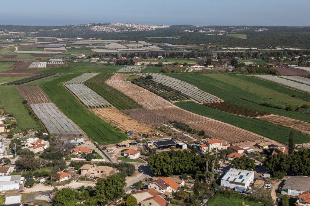
The Ramat Hanadiv LTSER platform is a unique texture of the region surrounding Hanadiv Valley and Taninim River basin. It integrates nature values with agriculture, rural communities, and heritage sites. The platform extends over an area of apprx. 15,500 hectares, including Ramat Hanadiv Nature Park and five neighboring municipal Councils: 1. Binyamina Givat-Ada (Urban; Local Council ) 2. Zikhron Ya’akov (Urban; Local Council ) 3. Hof Hacarmel (Rural; Regional Council) 4. Jisr A-Zarqa )Arab village; Local Council) 5. Alona (Rural; Regional Council) Ramat Hanadiv LTER site is located in the heart of the platform, at the southern tip of the Carmel Mountain Ridge. Ramat Hanadiv spreads over approximately 450 hectares of typical natural Mediterranean vegetation, surrounding the Memorial Gardens in which Baron Benjamin Edmond de Rothschild and his wife are buried. With mean annual rainfall of 500-600 mm and mean annual temperature of 170C-190C, Ramat Hanadiv Nature Park is characterized by diverse habitats and communities.
-
The site is a revitalized young steppe habitat patch, dominated by fescue (Festuca rupicola). The average altitude is around 100 m. The site is a grazing spot and it was recently used for the reintroduction of the European ground squirrel (Spermophilus citellus) to the area after 70 years. Other important species present at the site include Vojvodina blind mole rat (Nannospalax (leucodon) montanosyrmiensis) and Spring meadow saffron (Bulbocodium versicolor).
-
The Presidential Estate of Castelporziano stretches itself over an area of about 6100 ha and is located approximately 24 km from the city of Rome. The territory is characterized by remarkable natural features. It shows most of the typical Mediterranean ecosystems (relict strips of lowland forest with hygrophilous vegetation, deciduous and evergreen mixed oak woods, Mediterranean scrub, dune vegetation). Until recently (2019), there were large surfaces of stone pine unfortunately destroyed by the combined action of alien pest Toumeyella parvicornis with Tomicus destruens, the main pest of Mediterranean pine forests. Inside the Estate, there are two Special Areas of Conservation (SACs): one concerning the coastal strip (IT6030027) and the other one concerning hygrophulous oak-woods (IT6030028). In addition to including the two SACs, the Estate is in its entirety Special Protection Area (SPA - IT 6030084). From a botanical point of view this area, together with the neighbouring Castelfusano territory, represents what remains of the vast forest system that covered the entire delta of the Tiber and the surrounding areas. The land is mostly flat, but in the North there are modest reliefs that are not higher than 85 m. on sea level. A complex set of ancient dunes and a chain of more recent dunes stretch out along the coastline. There are many temporary and permanent natural pools and wetland areas with seasonal floodings caused by meteoric water and groundwater, which usually dry out during summer and represent sites with the greatest biodiversity. From an ecological point of view, those “relict wetland areas” play actually a very important role for biodiversity because of plant species which are typical of hydrosoil and in the past were widespread but have now almost disappeared.
-
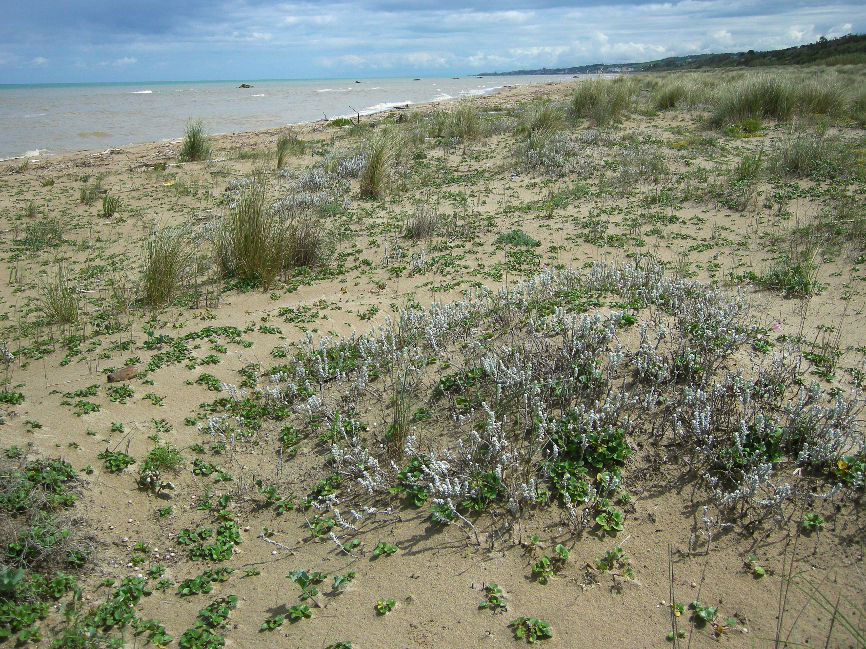
S.C.I IT7228221 Foce Trigno-Marina di Petacciato (Campobasso) S.C.I. IT7140108 Punta Aderci-Punta della Penna S.C.I. IT7140109 Marina di Vasto The site includes 3 Natura 2000 sites along the central Adriatic coast, where the last fragments of natural vegetation zonation on sand coastal dunes occur (shore vegetation, embryo and mobile dune vegetation, annual Mediterranean grasses and wet dune slacks).
-
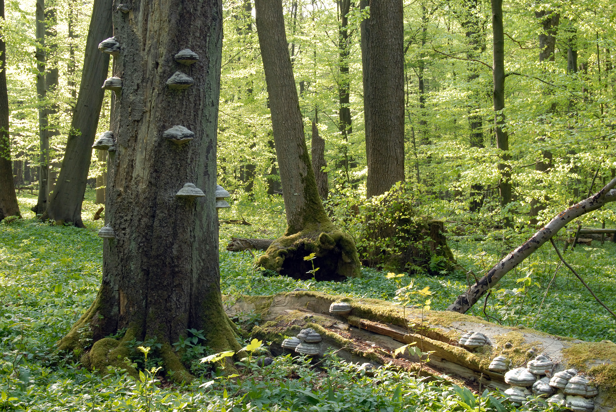
Hainich is a large deciduous forest area in Thuringia and is situated in central Germany not far from the town of Eisenach with the famous Wartburg Castle. With a total area of ca. 16.000 hectares (13.000 hectares of which is forest), Hainich is the largest continuos area of deciduous forest in Germany. On the 31.12.1997 the southern part of Hainich, with an area of 7.500 hectares, was declared Germany’s 13th National Park. Since then it has been seen as a place of relaxation close to nature that is open to sustainable tourism. The area has gone through an amazing development which is quite unique. Since 2011 Hainich is part of UNESCO World Heritage Site "Primeval Beech Forests of the Carpathians and the Ancient Beech Forests of Germany".
-
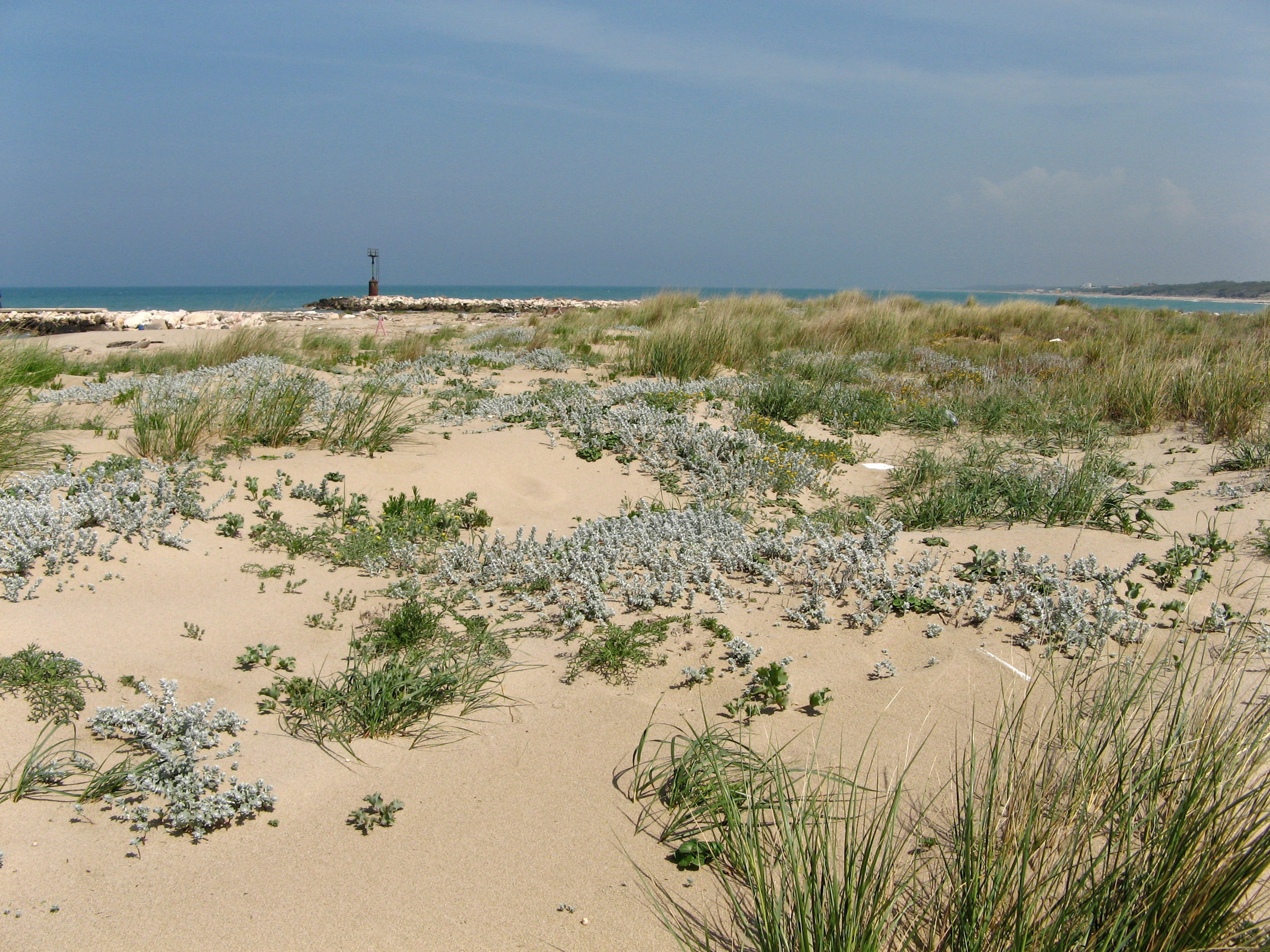
SCI IT7222217 Foce Saccione-Bonifica Ramitelli (Campobasso) The site includes 1 Natura 2000 site along the central Adriatic coast, where the last fragments of natural vegetation zonation on sand coastal dunes occur (shore vegetation, embryo and mobile dune vegetation, annual Mediterranean grasses, costa dunes with Juniperus spp and wet dune slacks).
-

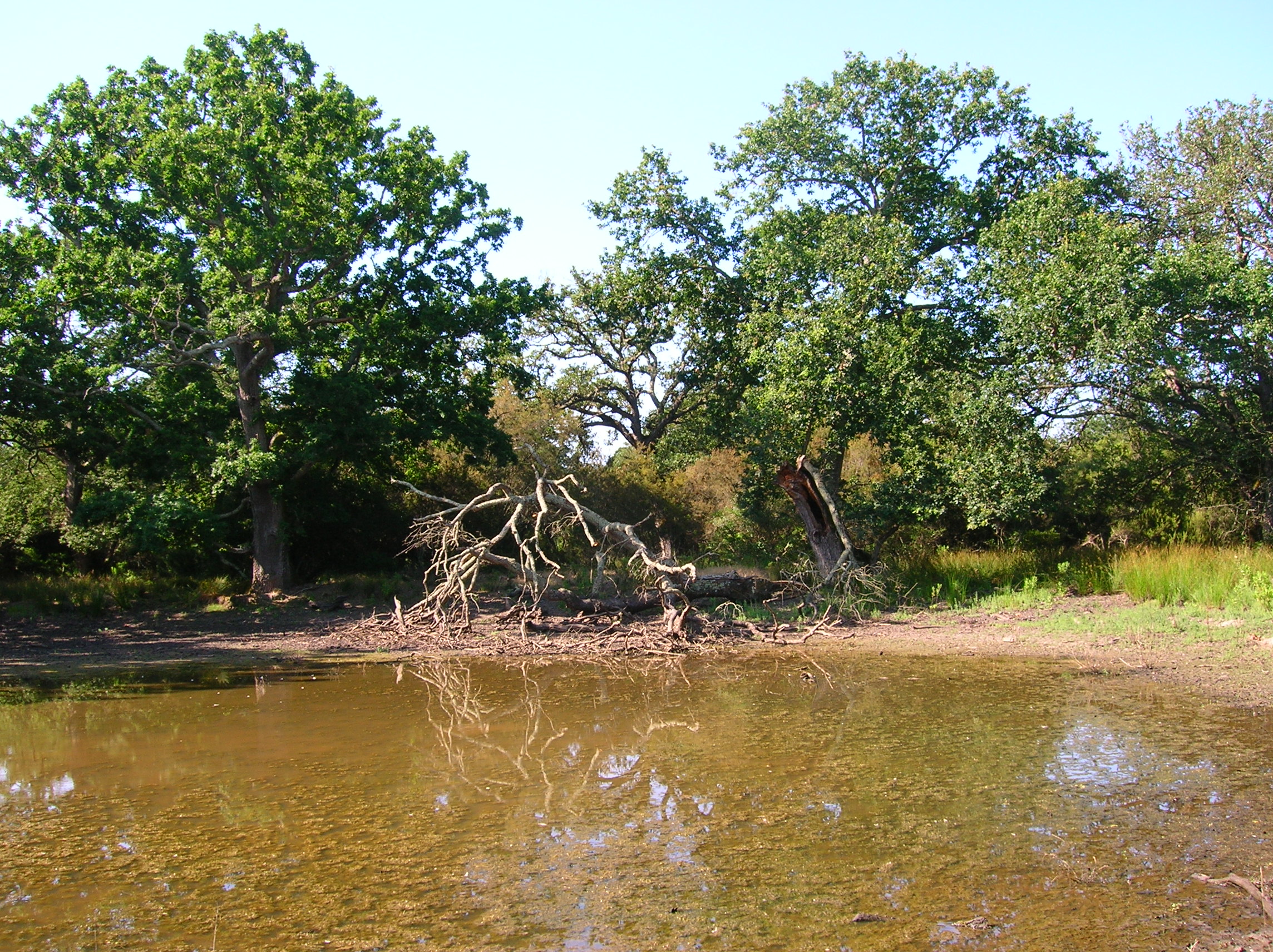
The Seine estuary is a megatidal estuary located in northern France. It is the third largest estuarine ecosystem in the country after the Gironde and Loire along the French Atlantic coast; its waters flow into the English Channel. The geographical zone of influence of the Seine estuary runs from just upstream of the Poses dam, at the limit of the tidal penetration into the estuary — 160 km upstream of Le Havre —to the eastern part of the Bay of Seine. It can be divided into three sections: the fresh water upstream section (125 km), the mixing zone characterized by varying salinity levels (35 km), and the marine downstream section under the influence of the Seine River. The megatidal regime generates a turbidity maximum in the mixing zone (middle estuary) between the marine and fluvial sections of the estuary. The Seine estuary is a typical estuarine ecosystem: highly stressed by natural fluctuations and anthropogenic pressures, and hosting a rich ecological system. The Seine valley and its estuary are of major economic importance for France, with the presence of two maritime ports. It’s watershed (79,000 km2) is the home to 17 million people, and accounts for 50 % of the river traffic in France, 40 % of the country's economic activity, and 30 % of its agricultural activities. In addition to the Greater Paris area (> 11 million inhabitants), which contributes heavily to the Seine estuary's upstream inputs, two other major river settlements — Rouen (500,000 inhabitants) and Le Havre (300,000 inhabitants) — are maritime ports of international importance. Due to economic development, the Seine estuary has been subjected to major hydrodynamic, ecological, biogeomorphological and biogeochemical changes. The importance of studying the effects of anthropogenic impacts on estuarine ecosystems has increased in the last decade, especially under the Water Framework Directive, which aims to achieve “good environmental status” of all European water bodies.
-
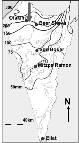
Designation: Ecosystem research and management under land-use and climate change. Climate: Mean annual precipitation 150-200mm between November and April; mean maximum summer temperature 34° C, mean minimum winter temperature 6° C. (Data avialable for 15-min interval meteorological measurements and daily summaries for rainfall, air and soil humidity and temperature, wind velocity and direction, from 1997 to the present.) Principal biomes: Semiarid shrub land (shrub-grass steppe), rocky and loessial watersheds, ephemeral streams. Vegetation is dominated by patch-forming dwarf shrubs (Noaea mucronata, Atractylis serratuloides and Thymelea hirsuta) with species-rich annual winter vegetation in the inter shrub (dominated by Stipa capensis and other grasses) and shrub patch understory (dominated by Anagallis arvensis and other forbs). As a result of drought there are also two new sub biomes: crust land and grass land. Management: Livestock grazing excluded in central watershed (20 ha) since 1987; restricted/controlled grazing by Bedouin sheep herds in surroundings; in the outer parts of the area native and exotic trees were planted in 1985-87 in contour dykes (‘shikhim’) on the slopes and in terraces in the riverbed. Research: 1. Long-term experiments (up to 20 years) for monitoring changes in abundance, diversity, species composition and distribution, and development of biological soil crusts (BSC), perennial plants (dwarf shrubs) and winter annuals in relation to rainfall, soil disturbance, patch distribution, and livestock grazing. 2. long term hydrological studies on rainfall-runoff relationship under natural and manipulation experiments. 3. Short-term experiments and surveys (1 to 5 years) A. for testing hypotheses about the detailed processes, mechanisms and interactions involved in the development, dynamics and stability of shrub- and BSC-dominated patches, their landscape mosaic patterns and their feed-back relationships with flows of materials through the landscape; B. for testing hypothesis on the effect of geodiversity on the stability of shrub land to extreme drought and understanding state changes in drylands. 4. Long term studies on cross scale-cross level interactions in natural and human modified landscape. 5. Network-related research including regional comparisons of herbaceous plant productivity in open rangeland along the Israeli North-South rainfall gradient, and global comparison of woody plant diversity effects on ecosystem functionality of most dryland regions of the world.