
heat flow
Type of resources
Available actions
Topics
Keywords
Contact for the resource
Provided by
Years
Formats
Representation types
-
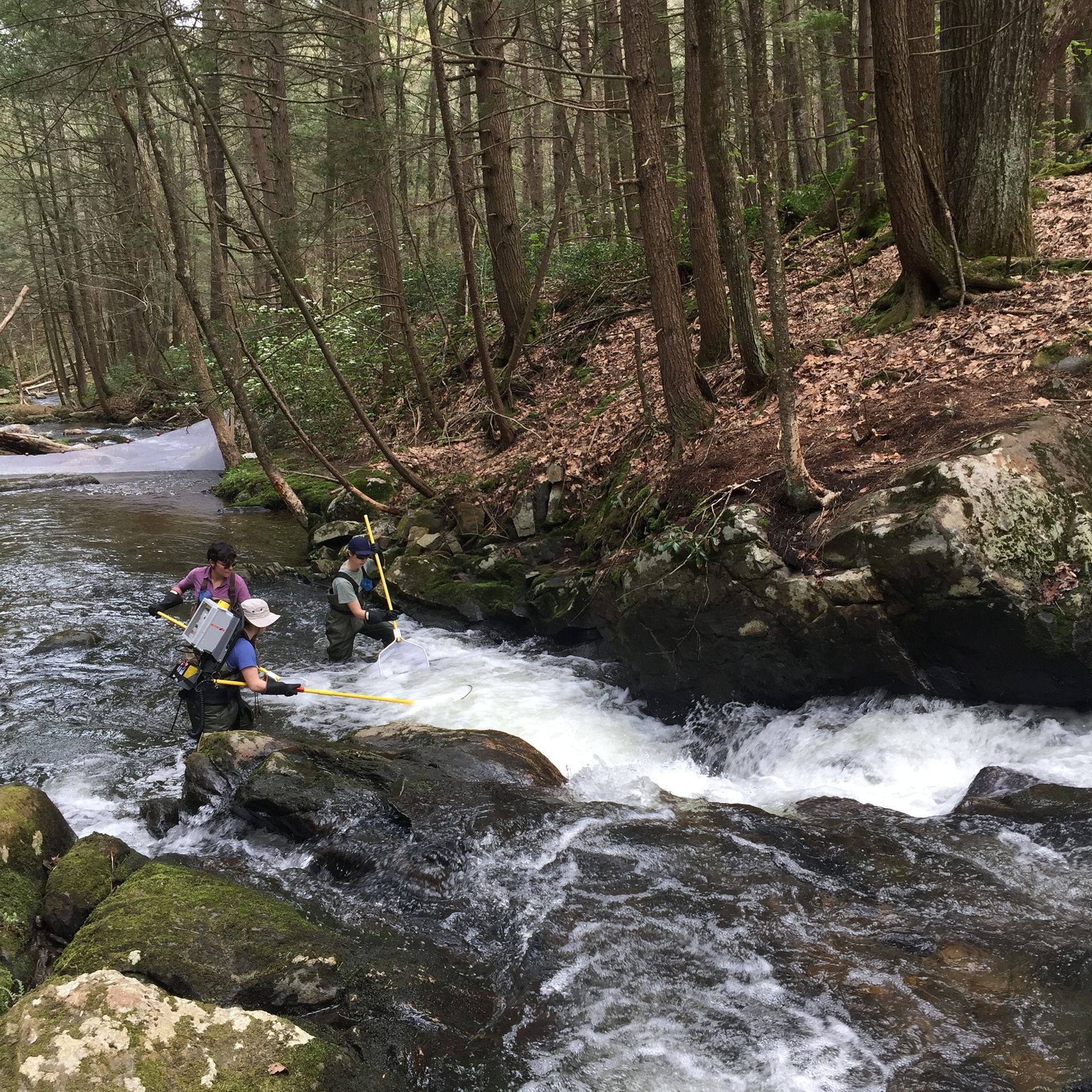
The Lower Hop Brook is a core aquatic site in Domain 01 Northeast in Massachusetts. HOPB site is a 3rd-4th order wadeable stream that flows into the Quabbin Reservoir in central Massachusetts. The section of stream selected by NEON flows from Shutesbury Road to the inlet of reservoir. Several beaver dams and ponds characterize the area upstream of Shutesbury Road. The Lower Hop Brook site is a clear-water, moderate gradient stream with gradient increasing as the stream approaches the reservoir. Minimal beaver activity (dams, ponds) is anticipated in the upper portions of the reach during the life of the NEON project. Large debris dams characterize the reach downstream. Substrate ranges from sand to cobbles, boulders, and finally bedrock outcrops downstream. The stream canopy is predominantly a mixed deciduous, northern hardwood forest with beech trees near the stream. Total data products collected at this site 78.
-
Lodz is the third-largest city in Poland. Located in the central part of the country, approximately 135 km south-west of Warsaw. It has a population of 753,192 people. It is the capital of Lodz Voivodeship. Although Lodz was given city rights in 1423, it developed rapidly only in XIX century. It became a centre of textile industry for central and Eastern Europe. During the economic transition of the 1990s Lodz lost its industry. Since that time it has been developing towards the centre of culture, education, and technology. Lodz has a network of numerous but small water courses, and is located in the hills that constitute the first order watershed between the largest Polish rivers, the Wisła and the Odra. The rivers flow in a star-shaped structure to the north to supply the Bzura, then the Wisła, and to the south to supply the Ner and the Odra. This situation affords benefits in eliminating the risk of flooding posed by one major river, on the other hand, exposing the source areas to adverse environmental conditions resulting from urbanization, is unfavourable, and increases risk of flood and drought. The research in the city is organized around issues like: urban sprawl and its effects on environment, society and health; development of blue-green infrastructure; social inclusion and marginalization; eco-gentrification; ecosystem services and their valuation; development of ecohydrological NBS to support regulatory services in the city. LTSER is strongly focused on implementations in the area of integrative city revitalization, water management, and restoration of rivers. The platform consists of two big demonstration - implementation areas with monitoring system for discharges and water quality, however based on learning-alliance group of stakeholders it is linked to many data sources on environmental monitoring, biodiversity, economy, societal information. The future research-implementation-collaboration challenge is NBS linked revitalization of old town, increase adaptive potential of urban areas to climate change, and protection of green ring and blue-green network of the city.
-
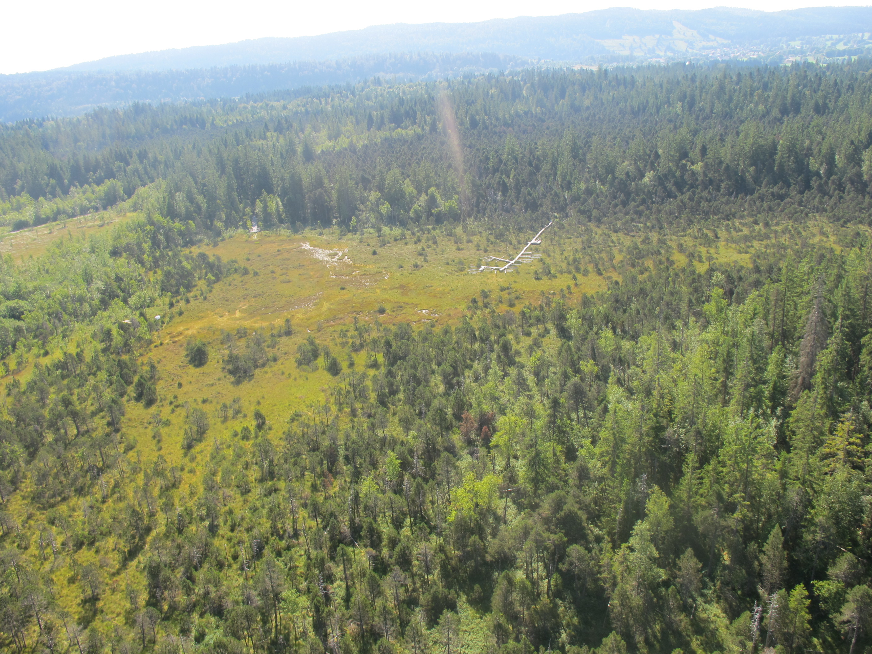
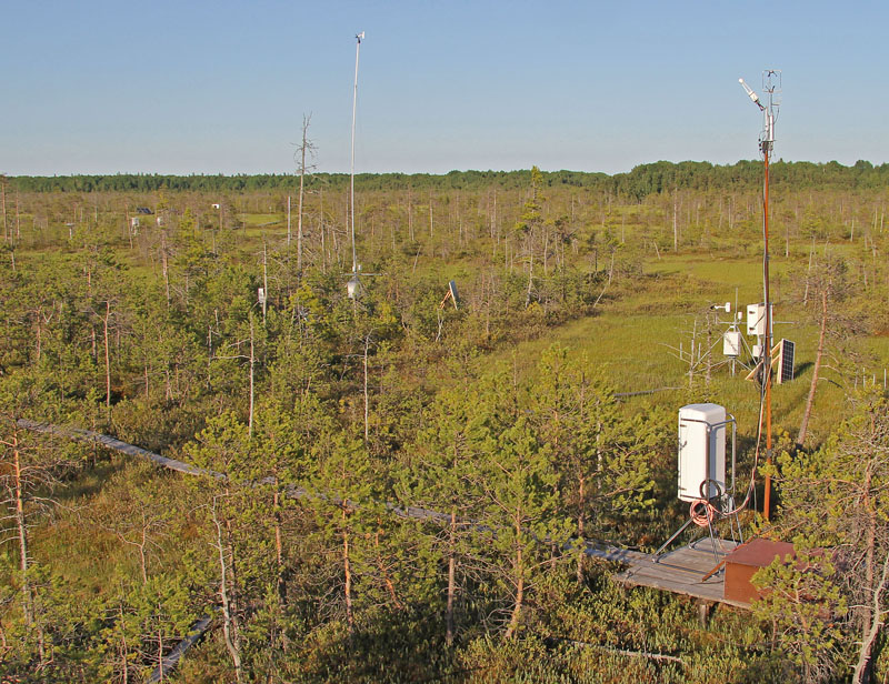
This is a Sphagnum dominated bog, which is part of a mire complex.
-
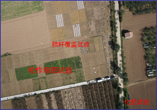
Changwu station was found in 1984 as one of field experiment stations of Institute of Soil and Water Conservation, Chinese Academy of Sciences (ISWC, CAS). It joined the Chinese Ecosystem Research Network (CERN) organized by CAS in 1991 and the National Ecosystem Research Network of China (CNERN) in 2005 by the Ministry of Science and Technology of the People’s Republic of China. The station located in Wangdong Village, Hongjia town, Changwu County, Shaanxi Province, 200 km away from Xi’an city. Its location is E107°41′ and N35°12′, south of the Loess Plateau. It belongs to the warm temperate semi-humid continental monsoon climate. Mean annual precipitation is 580mm and temperature 9.1℃, frost-free day 171. The elevation is about 1200 m and the depth of ground water is 50-80m. Main crops are winter wheat, spring maize, potato, sorghum, millet, beans and so on. The zonal soil is called Heilu soil with a parent material of clay loam Malan loess paleosol soil with an average depth in excess of 100m that were deposited during the Quaternary period. It belongs to the high table land - gully region, and a typical rain-fed agricultural area on the Loess Plateau. Wangdong small watershed, which the station located in, is 6.3km2. Three landform types are high table land, slop land called “Liang” and valley, which occupy the total area of watershed with 35%, 35.6% and 29.4%, respectively. The soil is deep and has good physical properties, like reservoir, support the agro-ecological system.
-
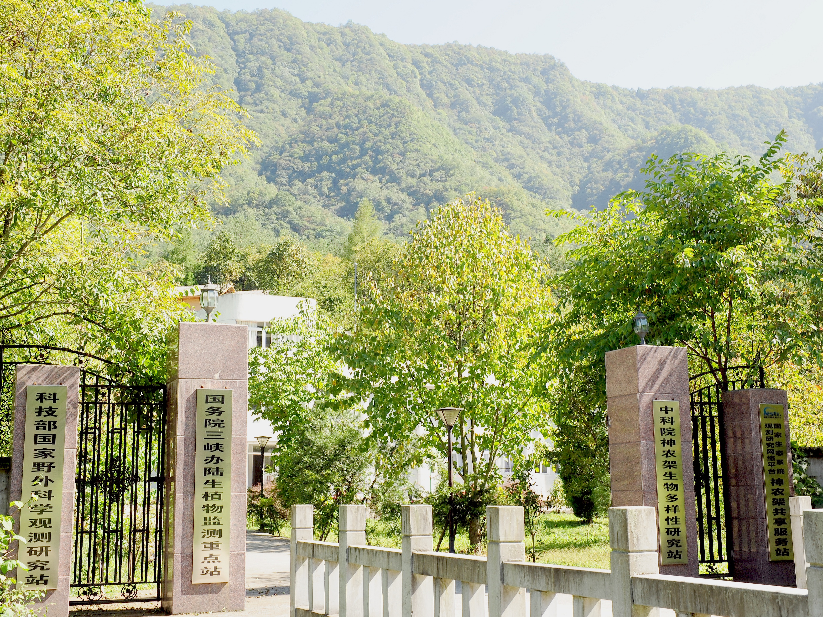
Shennongjia Station is located in Xingshan County, Hubei Province, China. It is located in the southern slope of Mount Shennongjia. The altitude is 1290m above sea level. The typical forest types are the northern subtropical mixed evergreen and deciduous broadleaved forest. Shennongjia Station was established in 1994, it became a station of National Field Research Station network running by the Ministry of Science and Technology of the People’s Republic of China in 2005, and became a member of Chinese Ecosystem Research Network (CERN), CAS in 2008.
-
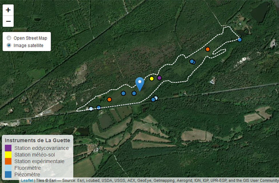
This is a peatland located in Sologne, 80 km south of Orléans. La Guette peatland is one of the four sites of the SNO Tourbières (CNRS). All the sites of the SNO Tourbières are part of OZCAR (French Observatory on the critical zone). The site was hydrologicaly disturbed. Restoration works took place in 2014. A labeling procedure has began to become associated site of ICOS.
-
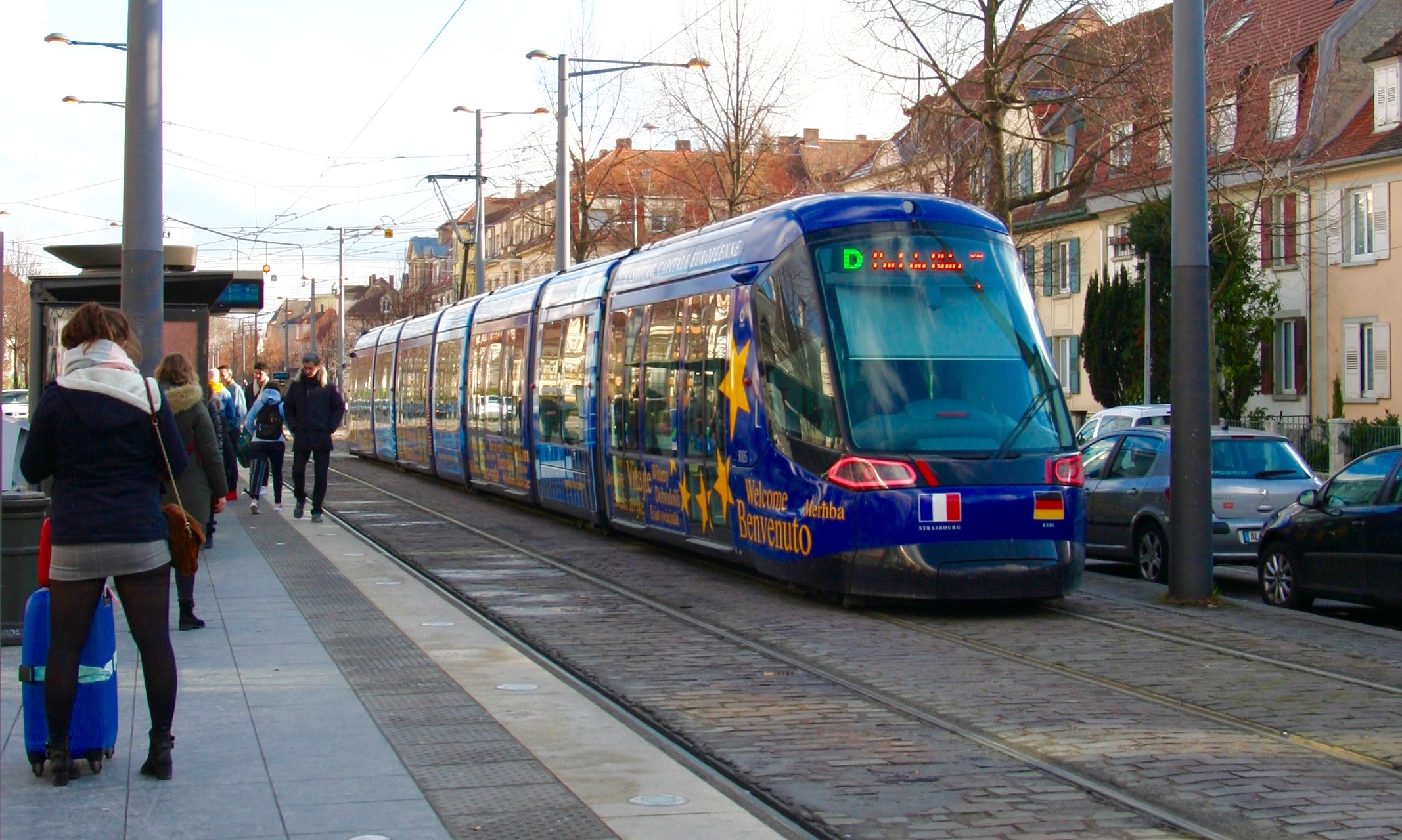
The LTSER Zone Atelier Environnementale Urbaine belongs to LTER-France network and is located in eastern France.The Zone Atelier Environnementale Urbaine ZAEU was created in 2010. It focuses on urban area and urban socioecosystem research questions. The main objective is to define how to facilite an harmonious development according to the city needs without badly impacting the natural system around. The Eurometropole of Strasbourg is a close partner of the ZAEU: local authorities participate to the research experimentations and observation campains. Six working groups are dealing with natural systems in order to better understand the urban ecosystem (biodiversity, hydrology, air and climate, urban metabolism) and the socio system (social and economic dimensions of the society and the individuals, groups behavior and values, politics strategies). In the working groups, we study issues like hydrological system processes in the urban area, population health, energy consomption and production at the city scale, pollutions and contaminations of the various spheres, refusal management with regards to the context of global changes, sustainable development and transitions (economy, ecology, energy).
-
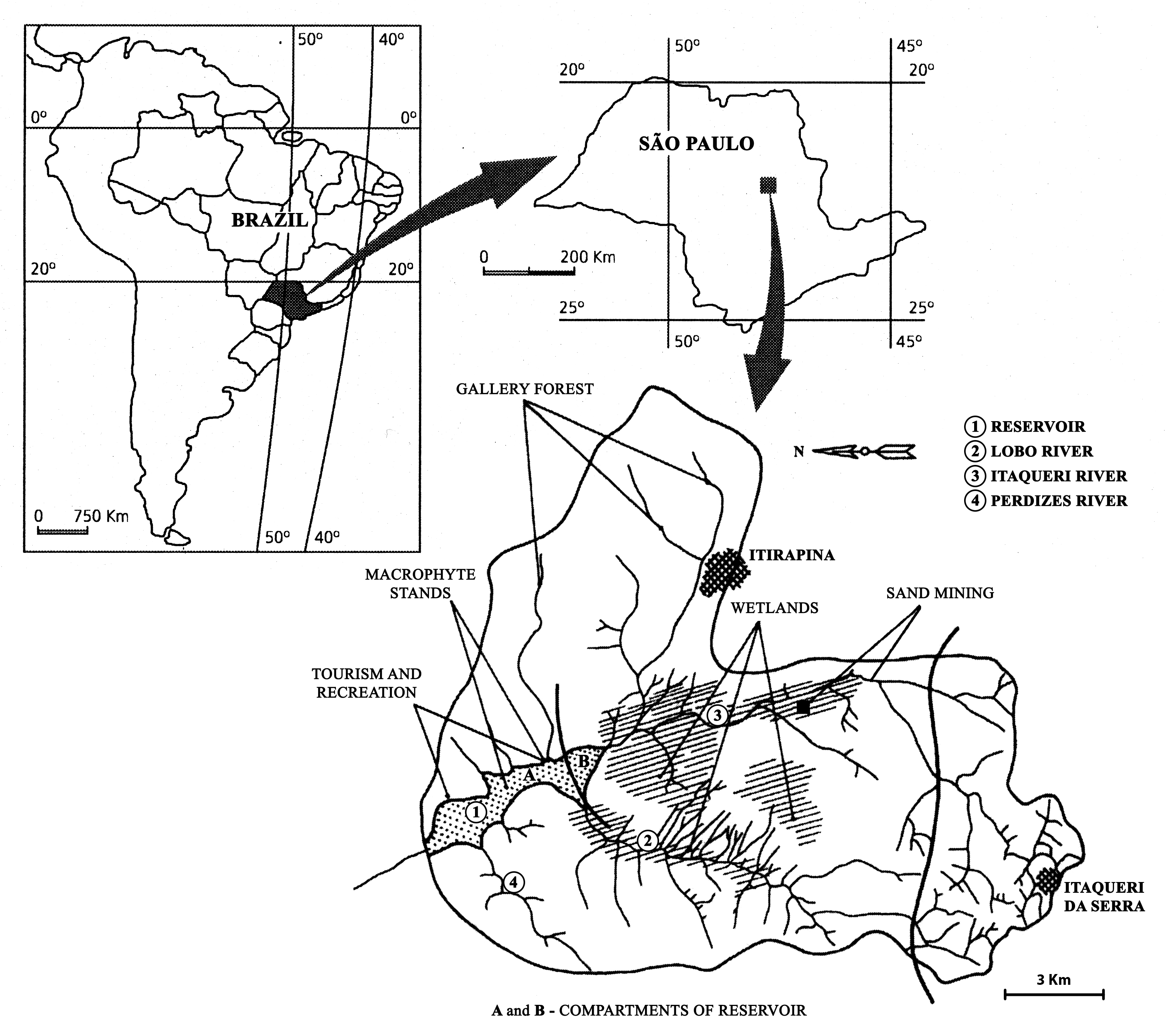
The watershed is located in the center of São Paulo State, Southeast of Brazil. The coordinates are: Lat. 22º 10' 08,5" S; Long. 47º 57' 11,7" W. The drainage density is 0.75km/km2. The maximum altitude is 800m. Basin declivity is 0.00575m/m. The local climate is characterised by alternating dry and wet periods, the wetter period falling in summer and autumn, and the winter and spring seasons being mainly dry. Annual precipitation is around 1500 mm per year. Temperatures are typically between 15 °C and 17 °C during the coldest winter month (July); in the warmest summer month (January), water temperatures between 21 °C to 23 °C are recorded. Potential evapotranspiration is between 500 mm to 1000 mm per year. According to the Koppen classification, the climate is described as ‘warm with a dry period’. The watershed is dominated by holocenic sandy sediments. In the lowland areas, hydromorphic and organic soils predominate. Soils derived from basalt intrusion occur in some areas of the watershed, as red soil hotspots. The natural vegetation is characteristically a savanna type, the Cerrado, typical of the continental regions of Brazil, consisting of bushes and trees adapted to a long (six months) dry season with periodic fires. Given the hydrogeochemical character of the watershed, the ionic strength and the nutrient content of the water of Lobo-Broa Reservoir are correspondingly low.
-
Mukhrino Field Station is owned and run by the UNESCO Chair on Environmental Dynamics and Climate Change at the Yugra State University, Khanty-Mansiysk, Russia. The Mukhrino Field Station is located at the east bank of the Irtysh River near the confluence with the Ob River in the central taiga area of Western Siberia (60°54’ N, 68°42’ E), 30 km south-west of the town of Khanty-Mansiysk (60 000 inhabitants). Due to the severe continental climate, the environmental conditions in the region are comparable with the sub-arctic zone of Northern Europe. The research site is representative for the Western Siberian pristine carbon accumulating peatland ecosystem (“plain mires”). The mires cover c. 60 % of the land surface and can be regarded as important sources/sinks of greenhouse gases and aerosols. The main mire type of the site is raised bogs of the type Pine-dwarf shrubs-bogs (Ryam) characterized by pine trees, Ledum palustre and dwarf shrubs, with areas of Sphagnum fuscum. Interspersed are mires of the type Poor fens (partly drained in the summer) dominated by Carex lasiocarpa and other graminoids, and Sphagnum balticum. Also ridge-hollow complexes, consisting of bog ridges and poor fen hollows are present.
-

Tronchaney, Conca di Torgnon, (Torgnon, Aosta), + 388330 + 5075950; Aosta Valley