
insoluble organic carbon content
Type of resources
Available actions
Topics
Keywords
Contact for the resource
Provided by
Years
Formats
Representation types
-
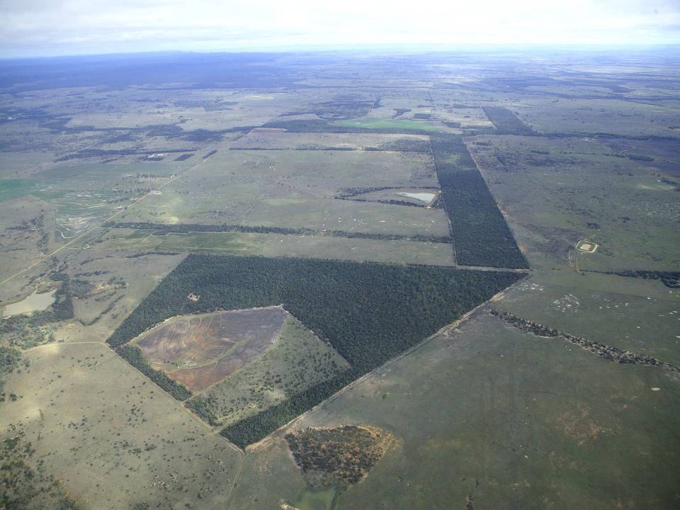
The aim of the Brigalow Catchment Study is to determine the effects of land clearing and land use change on hydrology, water quality, soil fertility and crop and animal productivity in the Brigalow Belt bioregion of central Queensland, Australia
-
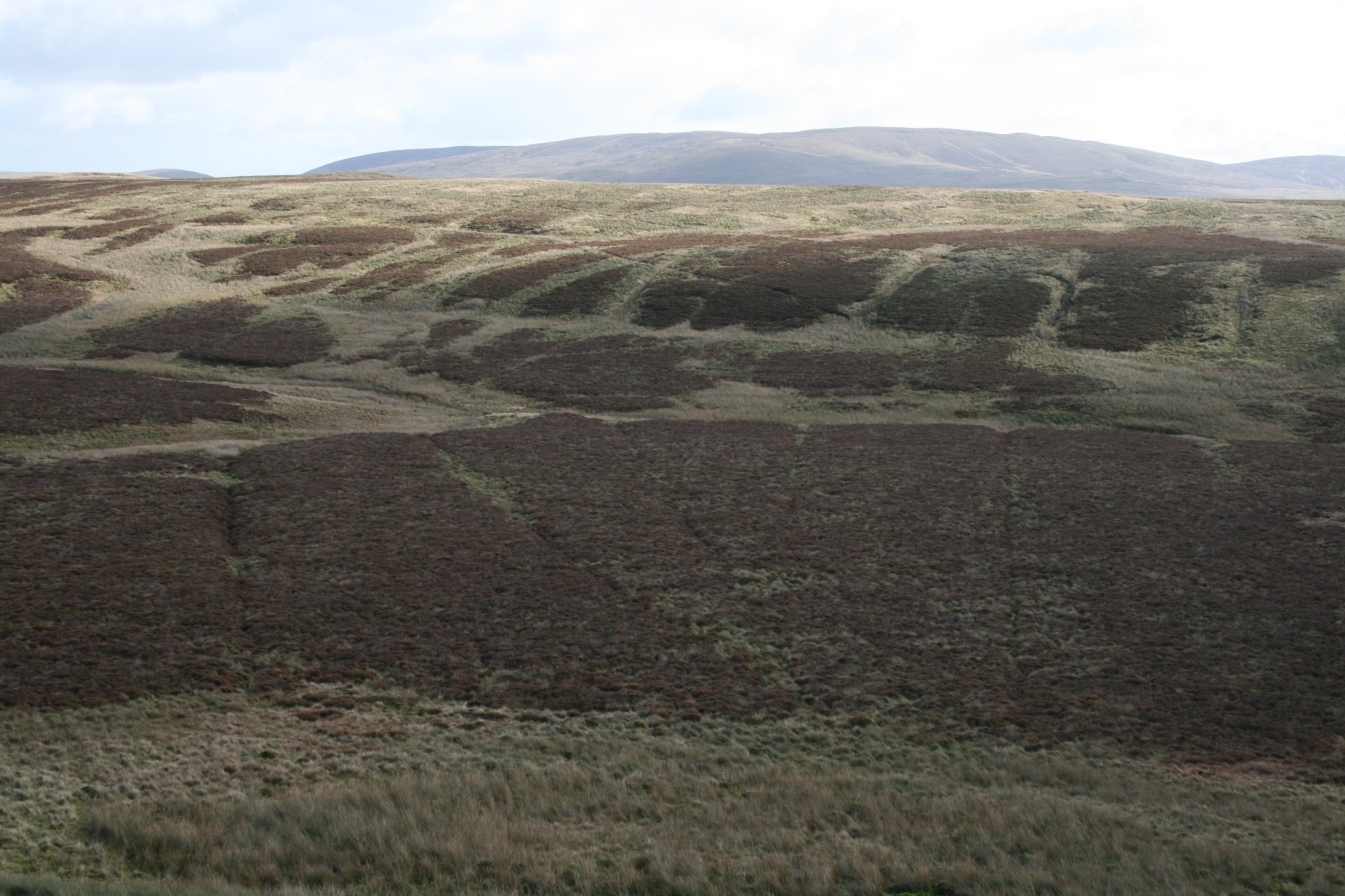
Mixed lowland and upland catchment established as a major UK research platform for ecological research, including long-term monitoring of greenhouse has fluxes and water quality, ecosystem-scale experiments, ecological and biogeochemical process studies and modelling. The Conwy catchment incorporates a range of habitats broadly representative of Wales, comprising upland bog and heath, mountain grassland, lowland improved grassland, conifer and broadleaf woodland.
-

The Cairngorms National Park is one of 15 National Parks in the UK (one of two in Scotland) and is Britain's largest National Park (4,528 km2). It is the location for some of the most spectacular landscapes in Britain and is home to an incredible diversity of wildlife and plants. http://cairngorms.co.uk/the-park/facts-figures/ The aims of the National Park are: • To conserve and enhance the natural and cultural heritage of the area; • To promote sustainable use of the natural resources of the area; • To promote understanding and enjoyment (including enjoyment in the form of recreation) of the special qualities of the area by the public; • To promote sustainable economic and social development of the area’s communities. Cairngorms National Park, seven broad habitats can be identified: • Enclosed farmlands • Woodlands • Open waters (rivers, lochs, wetlands and floodplains) • Mountains • Moorland • Semi-natural grasslands • Urban • Population of c17,500 • 25.8% of population over 60 (higher than Scottish average) • Average health index in top 25% of Scotland (based on deprivation indices) • Extensive core paths network • 55 Munros including 5 summits over 4000 feet • 3 ski centres • National Cycle Network Route 7 • 1 Long Distance Route (Speyside Way) • Relatively low atmospheric pollution • Annual precipitation over 2250mm on summits and under 900mm in straths • Average annual snow cover 200 days on summits and 50 days on low-ground • Prevailing winds from south-west
-
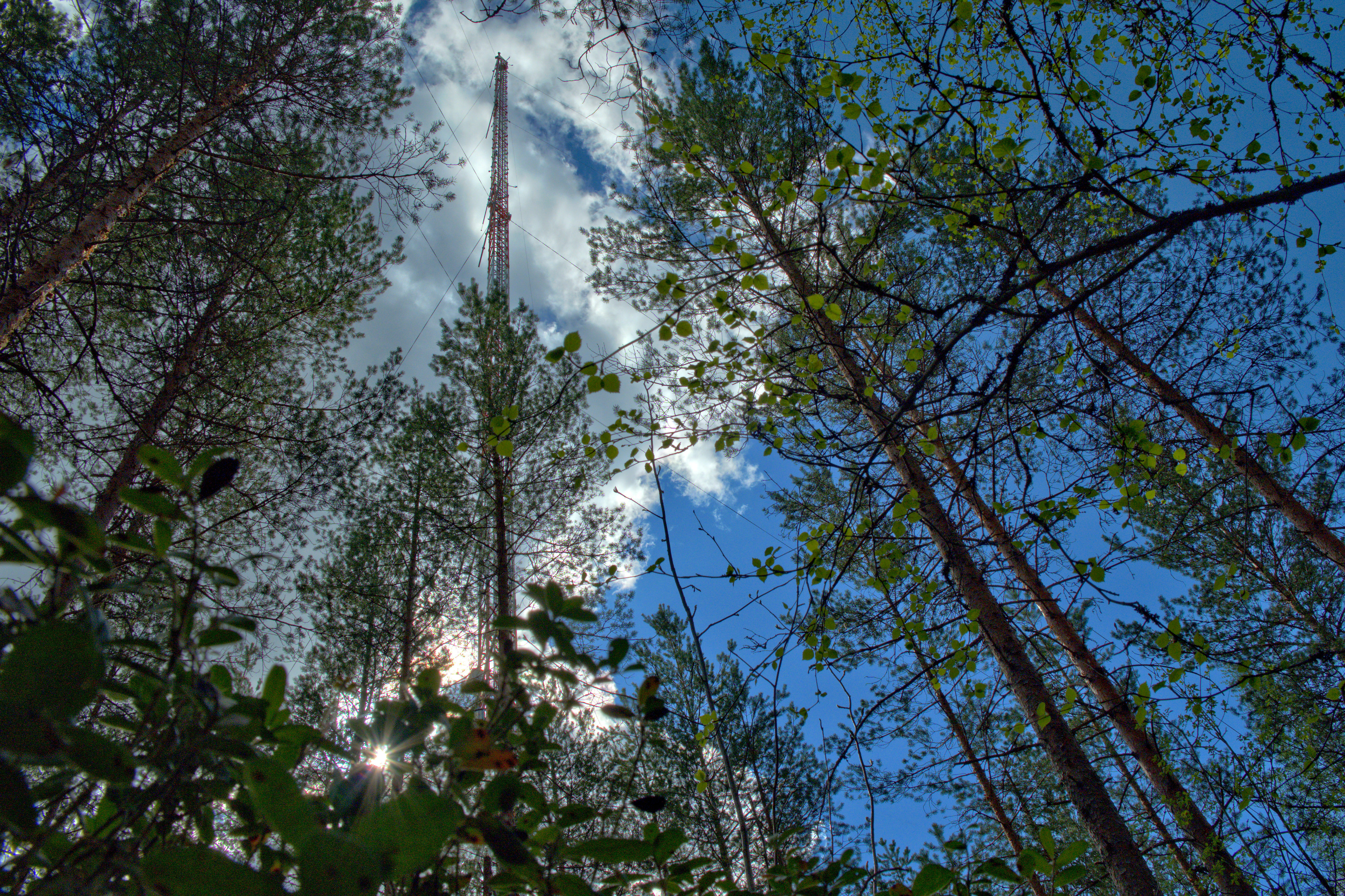
The Hyytiälä SMEAR II site (Station for Measuring Ecosystem-Atmosphere Relations) is situated in the Hyytiälä Forestry Field Station of the University of Helsinki. The site consists is a managed, 60-yr old Scots pine forest stand. The main idea of SMEAR type infrastructures is continuous, comprehensive measurements of fluxes, storages and concentrations in the land ecosystem–atmosphere continuum. The forest measurements are operated continuously since 1996, and include e.g. leaf, stand and ecosystem scale measurements of greenhouse gases, volatile organic compounds, pollutants (e.g. O3, SO2, NOx) and aerosols, in addition to full suite of meteorological measurements. The biogeochemical cycles and vegetation–soil–atmosphere interactions are studied both experimentally and with long-term observations. The site has full carbon, water and nitrogen budgets made over 10 years, and it is a full ICOS ecosystem and atmospheric station. Ecosystem and atmosphere measurements also exist nearby in two open oligotrophic fen sites and a humic lake with forested catchment. Most of the measured data can be retrieved from: https://smear.avaa.csc.fi/
-
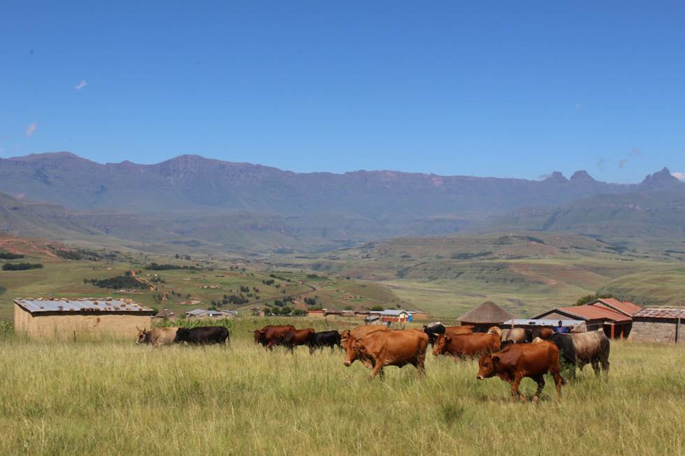
The Cathedral Peak research catchments in the northern uKhahlamba Drakensberg mountains, KwaZulu-Natal, South Africa have been a focus of observation research since the 1940’s. The Drakensberg mountains which fall in the grasslands biome, are a crucial water source area for South Africa, owing to the relatively high rainfall and ratio of rainfall to runoff conversion in this region. This portion of southern Africa's grassland biome also supports phenomenal levels of biodiversity. The research catchments themselves are primary, headwater catchments that fall within a protected area. The catchments were initially established to investigate the influence of various land management treatments on water but over time the research has broadened to a more interdisciplinary focus incorporating carbon–water–energy–biodiversity and the dynamics between these. Although the core of the observation and monitoring is sited in the catchments, the research extends beyond the protected area into communal, state, and privately owned lands. The land beyond the protected area is valued for agriculture, ranging from subsistence agriculture in impoverished villages to large-scale commercial agriculture. Scientific work in the landscape continues to grow and expand.