
land cover type
Type of resources
Available actions
Topics
Keywords
Contact for the resource
Provided by
Years
Formats
Representation types
-
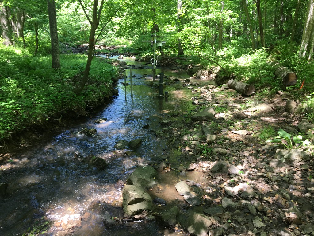
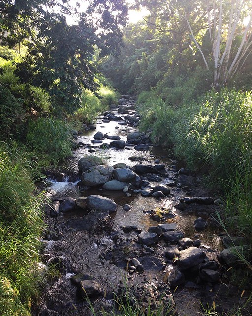
The Posey Creek (POSE) core aquatic site is part of NEON's Mid-Altantic Domain 2 sites. POSEY is a wadeable stream near Front Royal, VA and is located on the Smithsonian Conservation Biology Institute land. It is a shallow stream (<40 cm at average flow) and 3 - 5 m wide (6 meters wide during high flows). This site has one meteorological station located in the riparian area. The met station is outfitted with a subset of the same sensors used at terrestrial sites. Measurements include wind speed and direction, air temperature, barometric pressure, relative humidity, shortwave radiation, and PAR. This site has one upstream sensor station and one downstream sensor station. Measurements include PAR, temperature, water quality [specific conductivity, chlorophyll a, dissolved oxygen content, pH, turbidity, and fluorescent dissolved organic matter (only downstream)], and nitrate is measured at the downstream station. Eight groundwater wells throughout the site collect specific conductivity, water tempertaure, and elevation of groundwater. Field ecologists collect the following types of observational data at this site: aquatic organisms (Aquatic Microbes (surface water), macroinvertebratesmicroalgae, plants and macroalgae, zooplankton. Biogeochemical data on plants,sediment water and particulates. As well as physical aquatic data on bathymetric maps, stage,secchi depth and depth profiles, and riparian assessment. Total data products planned for this site: 78
-
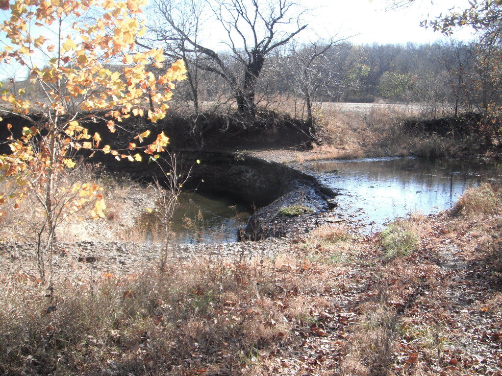
McDiffett Creek (MCDI) is located within the Urban Prairie Research Area approximately 25 km southeast of the KONZ tower. [2] It is a second-order perennial stream flowing through the middle of agricultural land. The Urban Prairie Research Area is a small tract of land composed of native prairie, grazing, hay, and historically cultivated fields. It is managed by the Konza Prairie Biological Station in association with Kansas State University and is located in the Flint Hills region of Kansas just 10km south of Manhattan, KS. The MCDI site is encompassed in the NEON Prairie Peninsula Domain, which includes the largest remaining areas of unplowed tallgrass prairie in North America. The Prairie Peninsula domain consists of grasslands, forests, and agricultural cover types. The Domain hosts four other NEON field sites, one other aquatic and three terrestrial, all of which are located in Kansas. Remote sensing surveys of this site collect lidar, spectrometer and high resolution RGB camera data. This site has one meteorological station located in the riparian area. The met station is outfitted with a subset of the same sensors used at terrestrial sites. Measurements include wind speed and direction, air temperature, barometric pressure, relative humidity, shortwave radiation, and PAR. This site has one phenocam near the stream. This site has one upstream sensor station and one downstream sensor station. Measurements include PAR, temperature, water quality [specific conductivity, chlorophyll a, dissolved oxygen content, pH, turbidity, and fluorescent dissolved organic matter (only downstream)], and nitrate is measured at the downstream station. Eight groundwater wells throughout the site collect specific conductivity, water tempertaure, and elevation of groundwater.Field ecologists collect the following types of observational data at this site: aquatic organisms (Aquatic Microbes (surface water),macroinvertebrates microalgae, plants and macroalgae, zooplankton. Biogeochemical data on plants,sediment water and particulates.As well as physical aquatic data on bathymetric maps, stage,secchi depth and depth profiles, and riparian assessment. Total data products planned for this site: 79
-
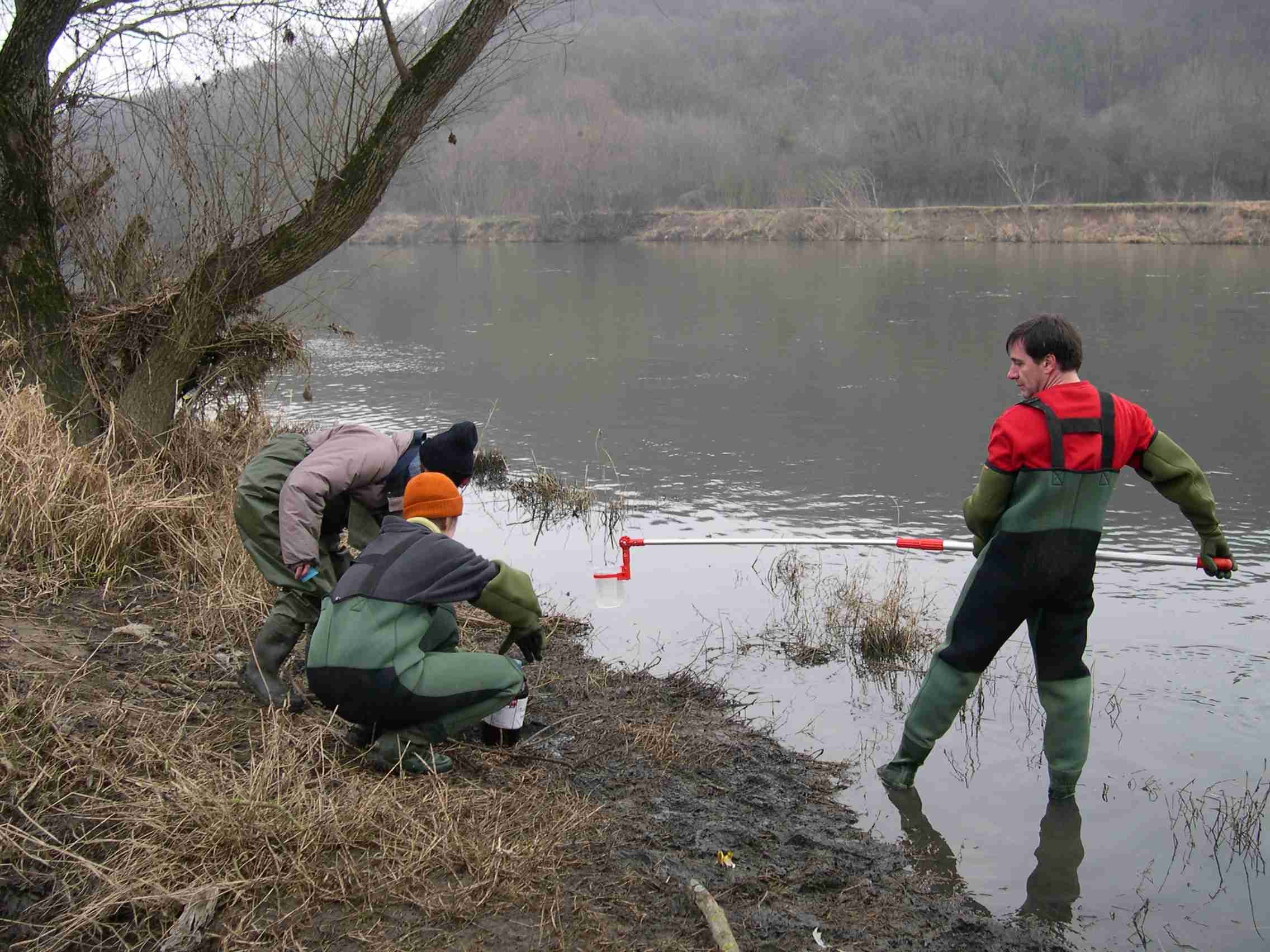
High resolution hydrology recording mainly by PLSC_Sensors (measuring water level, temperature-depending on water level it is the ground air temperature or water temperature- and conductivity) but also by Hydrolab-Multiparameter Sensors (measuring temperature, oxygen, pH, conductivity, turbidity) for monitoring the soda pans in the vicinity of soda Lake Neusiedl. The on-line measurement of these wetland sensors in the “Seewinkel”-district are measuring at high time resolution of every three minutes. The locations of these sensors are in the soda pans, which mostly dry out at least once a year, and are as follows (in alphabetical order): Hydrolab-Waterquality_Multiparameter-Sensor - Fuchslochlacke: N47°47.376’ & E016°51.149’ PLSC-Sensor - Fuchslochlacke: N47°47.376’ & E016°51.149’ PLSC-Sensor - Graurinderkoppel: N47°43.400’ & E016°48.148’ PLSC-Sensor - Meierhof-Lacke (Apetloner Hof): N47°43.296’ & E016°49.359’ PLSC-Sensor - Unterer Stinker: N47°48.161’ & E016°47.098’
-
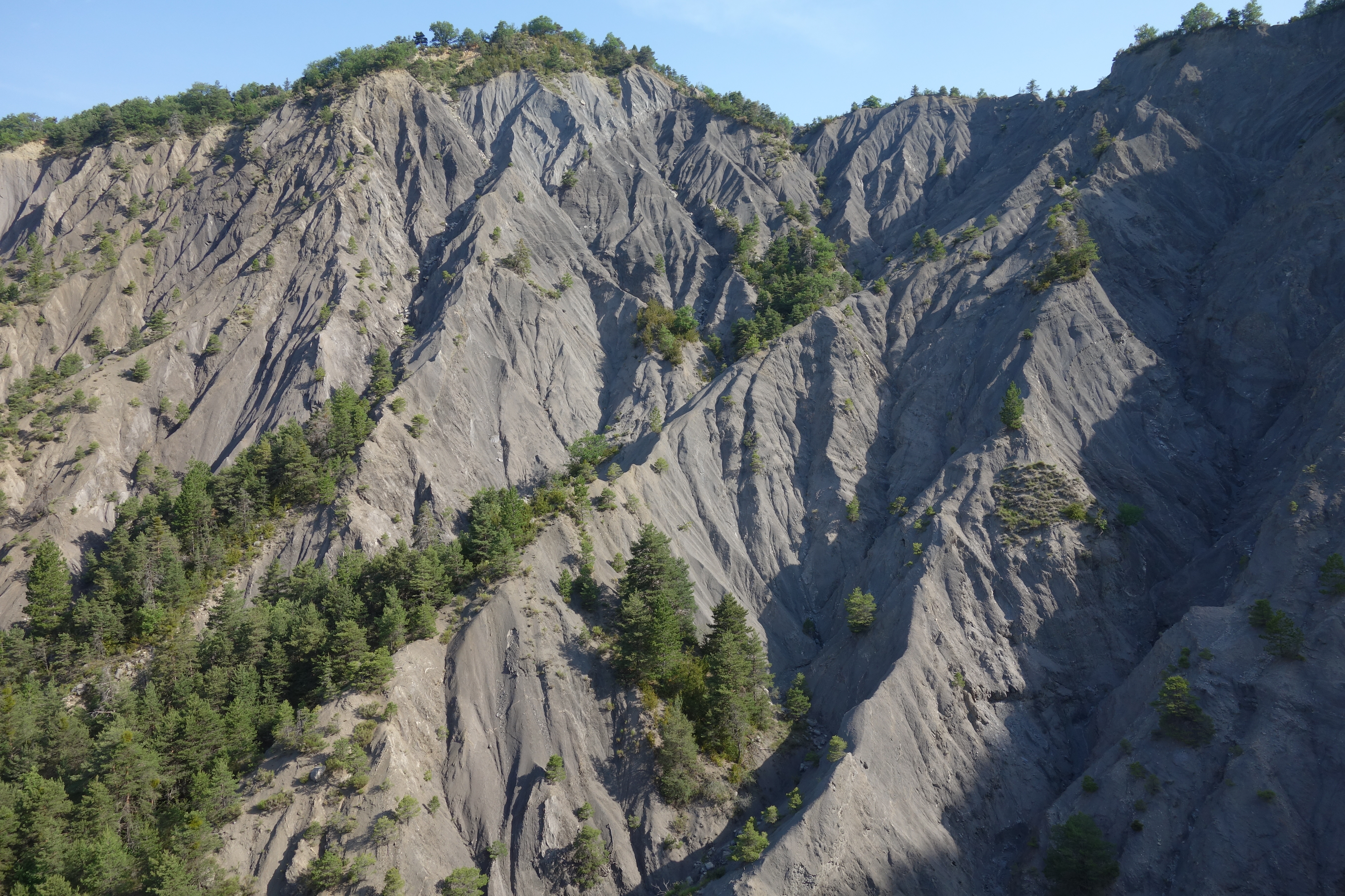
Draix site is part of Draix-Bleone observatory, located in the French South Alps, upstream of Digne, on the left side of the Bleone. Draix site was equipped in 1983 to study mountain erosion and sediment transport. It is composed of 4 catchments, which are equipped to measure water and sediment fluxes, at spatial scales ranging from 0.001 km2 to 1 km2, with contrasted land cover. These catchments are entirely situated on black marls that are very sensitive to weathering and erosion, resulting into a badland topography. One catchment was reforested at the end of the XIXth century whereas the other are mostly denuded. This site is characterized by intense erosion and intermittent sediment fluxes. The variables that are monitored on the long-term include rainfall and meteorology, high-frequency water discharge and suspended sediment concentration (1-10 minutes), event-scale bedload transport, and some physico-chemical properties of stream water and sediments.
-
The Rio Cupeyes (CUPE) core aquatic wadeable stream field site is part of the NEON Altantic Neotropical domain 04. The site is located in a rainforest area within the mountains of western Puerto Rico. The Rio Cupeyes is one of the most pristine 2nd order streams on the island, and is part of the Guanajibo River watershed in the Maricao State Forest. The Commonwealth of Puerto Rico manages the area. This wilderness area is used primarily for fishing and other recreational activities.The area is made up of old and second growth tropical moist and wet forest. And the Rio Cupeyes represents an increasingly rare intact Puerto Rican stream ecosystem. Automated stream sensors, and meteorological stations collect data year round and NEON field scientists collect field observations of aquatic plants, animals, biogeochemistry and more. Due to logistical and permitting issues, this aquatic site does not have groundwater wells. Total data products collected at this site: 76.
-
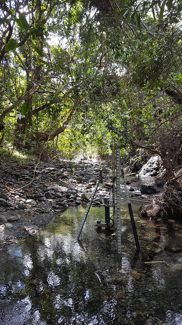
Rio Guilarte (GUIL) a relocatable aqautic site and is part of the NEON Altantic Neotropical 04 domain. GUIL is a 2nd order wadeable stream field site located in central Puerto Rico on the site of an older agricultural experimental station. The surrounding land has primary been used for growing coffee, oranges and limes. This is a rainforest area, with daily afternoon rains and frequent flooding. Bamboo and other thick vegetation line the riverbanks and the water level can change dramatically when the rains come through. Automated stream sensors, and meteorological stations collect data year round and NEON field scientists collect field observations of aquatic plants, animals, biogeochemistry and more. This site has one meteorological station located in the riparian area. The met station is outfitted with a subset of the same sensors used at terrestrial sites. Measurements include wind speed and direction, air temperature, barometric pressure, relative humidity, shortwave radiation, and PAR. This site has one phenocam near the stream. Six groundwater wells throughout the site collect specific conductivity, water tempertaure, and elevation of groundwater. Total data products collected at this site: 81
-
The Gesäuse Nationalpark and the Johnsbach valley belong to the Ennstal Alps, a part of the Northern Limestone Alps. They are situated in the province of Styria in the center of Austria. Together, they form the joint test site named Gesäuse-Johnsbachtal. This region is characterized by a mountainous landscape which is cut by the river “Enns”. In the north, it borders Eisenwurzen Nature Park and is only 6 km away from the Kalkalpen, a National Park in Upper Austria. In the south, the borders are the Eisenerzer Alps. The total area of the site is about 155 km². The terrain shows a great elevation range from 600-700 m in the Johnsbach valley to over 2300 m in the summit region of the Gesäuse, with Hochtor (2369 m) being the highest mountain. Due to the great range of altitude differences within small areas the Gesäuse-Johnsbachtal shows extremely diverse habitats and, consequently, species of animals and plants. In general, the landscape is dominated by mountain forests along with high Alpine rock formations and meadows. These complex topographic, hydrological, geological, geomorphological and meteorological conditions pose a scientific challenge for all kinds of environmental monitoring and modeling.
-
The LTSER Zone Atelier Bassin de la Moselle belongs to LTER-France network and is located in eastern France, Lorraine / Moselle. The ZAM acquires knowledge for better controls the impact of human activities on the quality of the water resources in Lorraine County (France), in the watershed of the Moselle River.
-
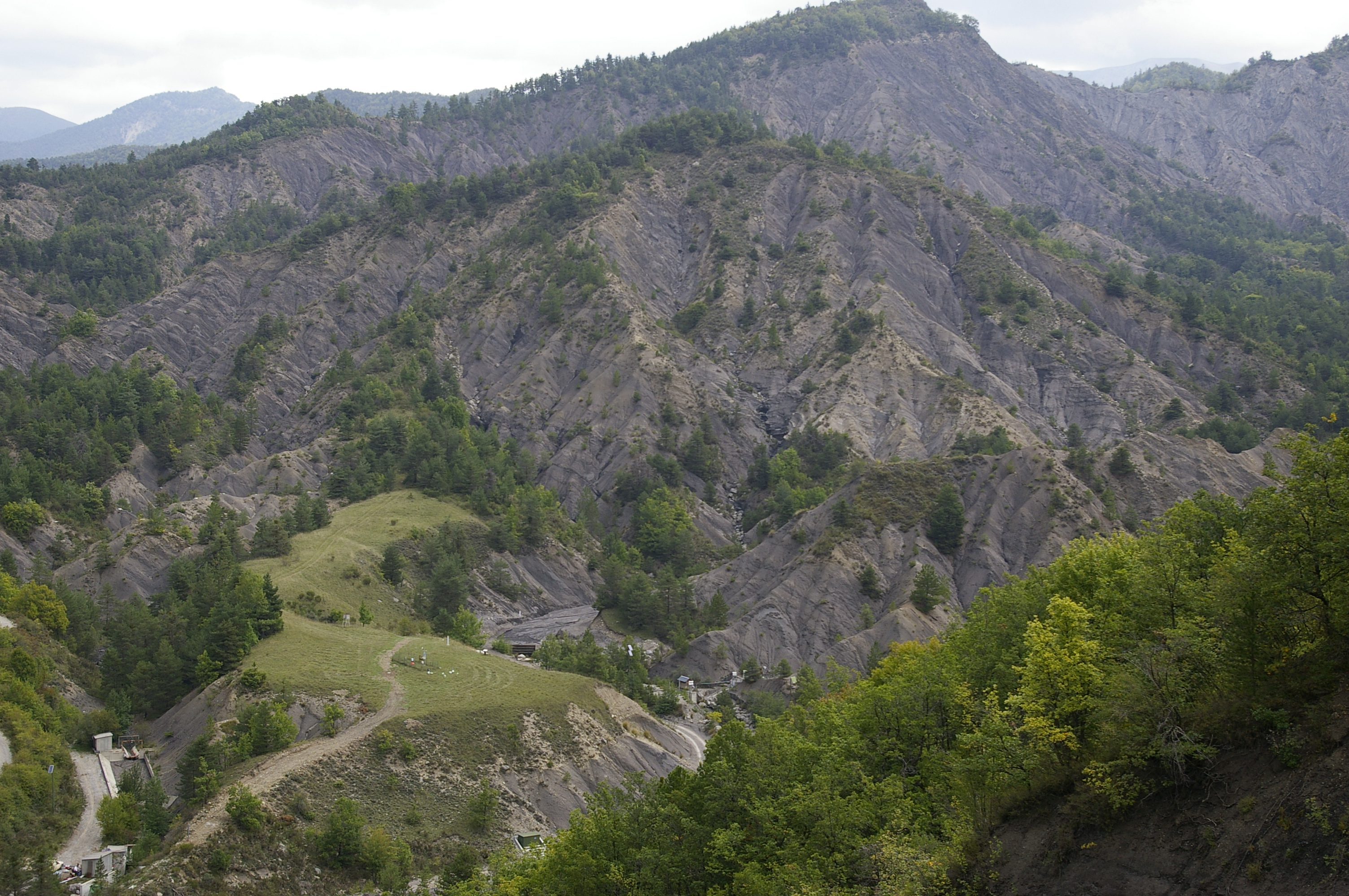
Draix-Bleone observatory was created in 1983 to study mountain erosion and sediment transport. It is located in the French South Alps, upstream of Digne, on the left side (Draix site) and right side (Galabre site) of the Bleone river. Several catchments are equipped to measure water and sediment fluxes, at spatial scales ranging from 0.001 km2 to 34 km2, with contrasted land use and land cover. The smallest catchments are entirely situated on black marl that are very sensitive to weathering and erosion, resulting in a badland topography. The Bouinenc and Galabre catchments integrate a larger diversity of lithologies and land use that are characteristic of the Pre-Alps. The climate is mountainous and Mediterranean. These sites are characterized by their intense erosion and intermittent sediment fluxes. The variables that are monitored on the long-term include rainfall and meteorology, high-frequency water discharge and suspended sediment concentration (1-10 minutes), event-scale bedload transport, some physico-chemical properties of stream water and sediments. Draix-Bleone Observatory is managed by IGE and is funded by INRAE, INSU and OSUG. It is a member of the French research infrastructure OZCAR. The GIS Draix-Bleone gathers all research teams involved on these sites.
-
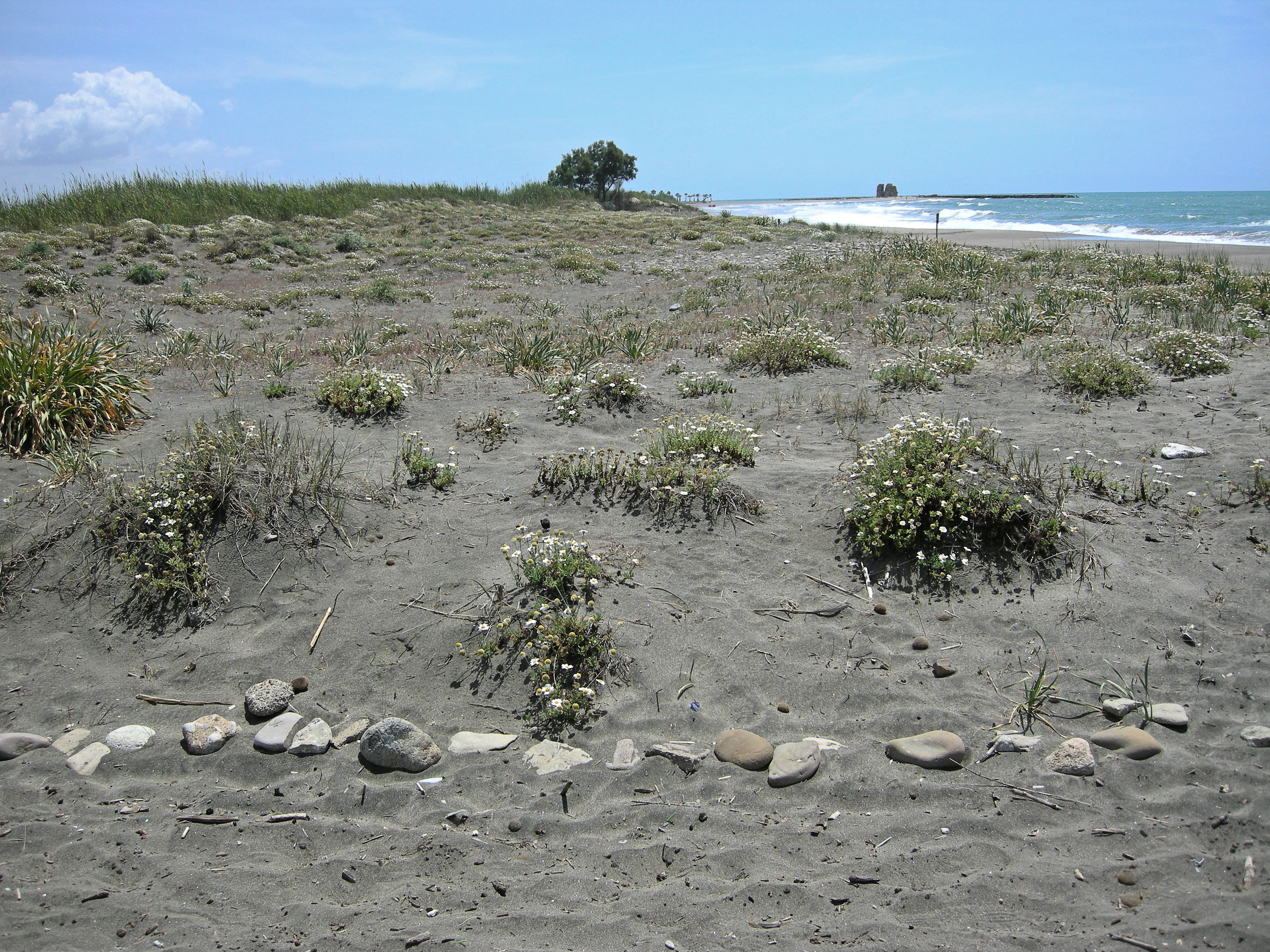
The site, located along the Tyrrhenian coast, north of Rome city, is a Special Protection Area (SPA) for migratory and nesting birds (Anatidae, Ardeidae). The wetland area is one of the last stretches of the Lazio wetlands which have been progressively reclaimed and cultivated during the last century. The flora and the fauna of the site is not only highly specialized but also highly endangered, with a relevant ecological value evidenced in previous studies. The site includes coastal dune habitats of European interest, as the annual vegetation of drift lines, the embryonic shifting dunes, the mobile dunes with Ammophila arenaria and the dune grasslands. There are also habitats related to wet and mud soils, as Mediterranean salt meadows and reed beds dominated by Phragmites australis.