
land surface temperature
Type of resources
Available actions
Topics
Keywords
Contact for the resource
Provided by
Years
Formats
Representation types
-
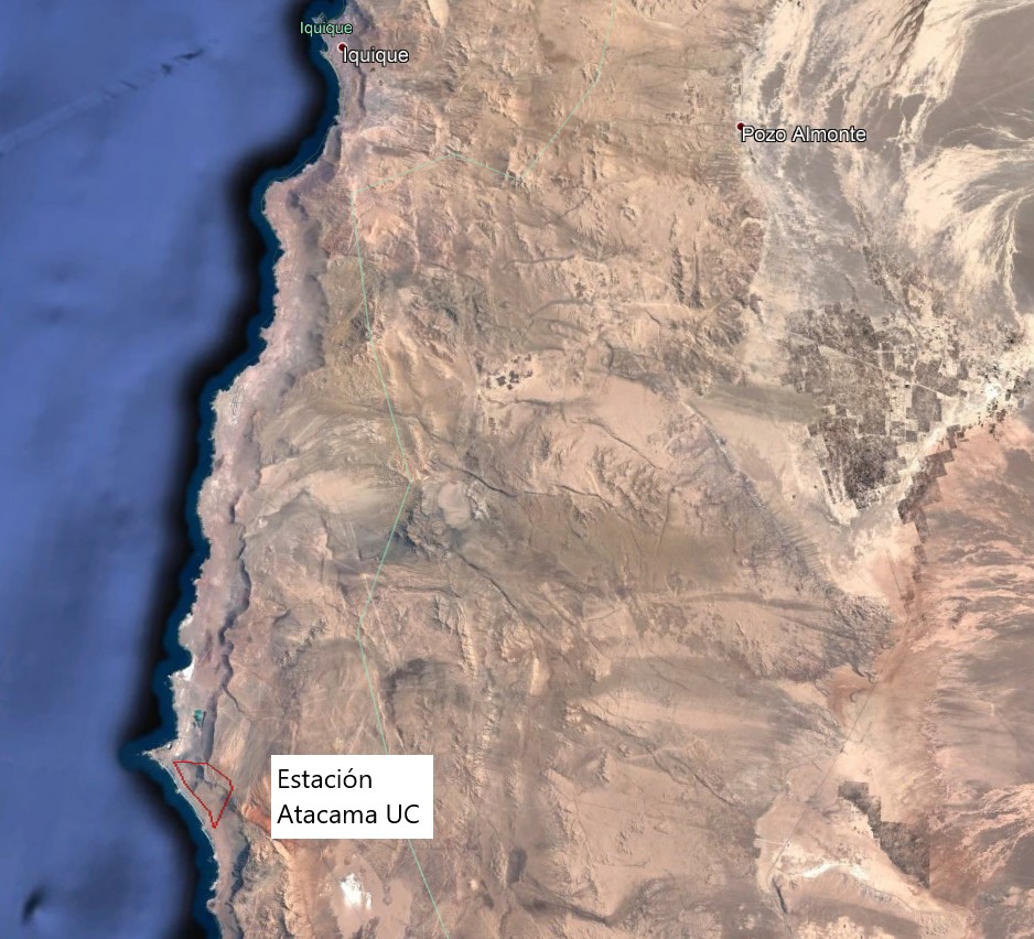
The Alto Patache fog oasis is located in northern Chile, 70 km south of Iquique, Tarapacá Region. This Oasis is located along the Coastal Range of Norte Grande, in the Atacama Desert, known for its remarkable aridity. The influence of coastal fog allows the development of a specially adapted vegetation, which provides habitat suitable for animal species.
-
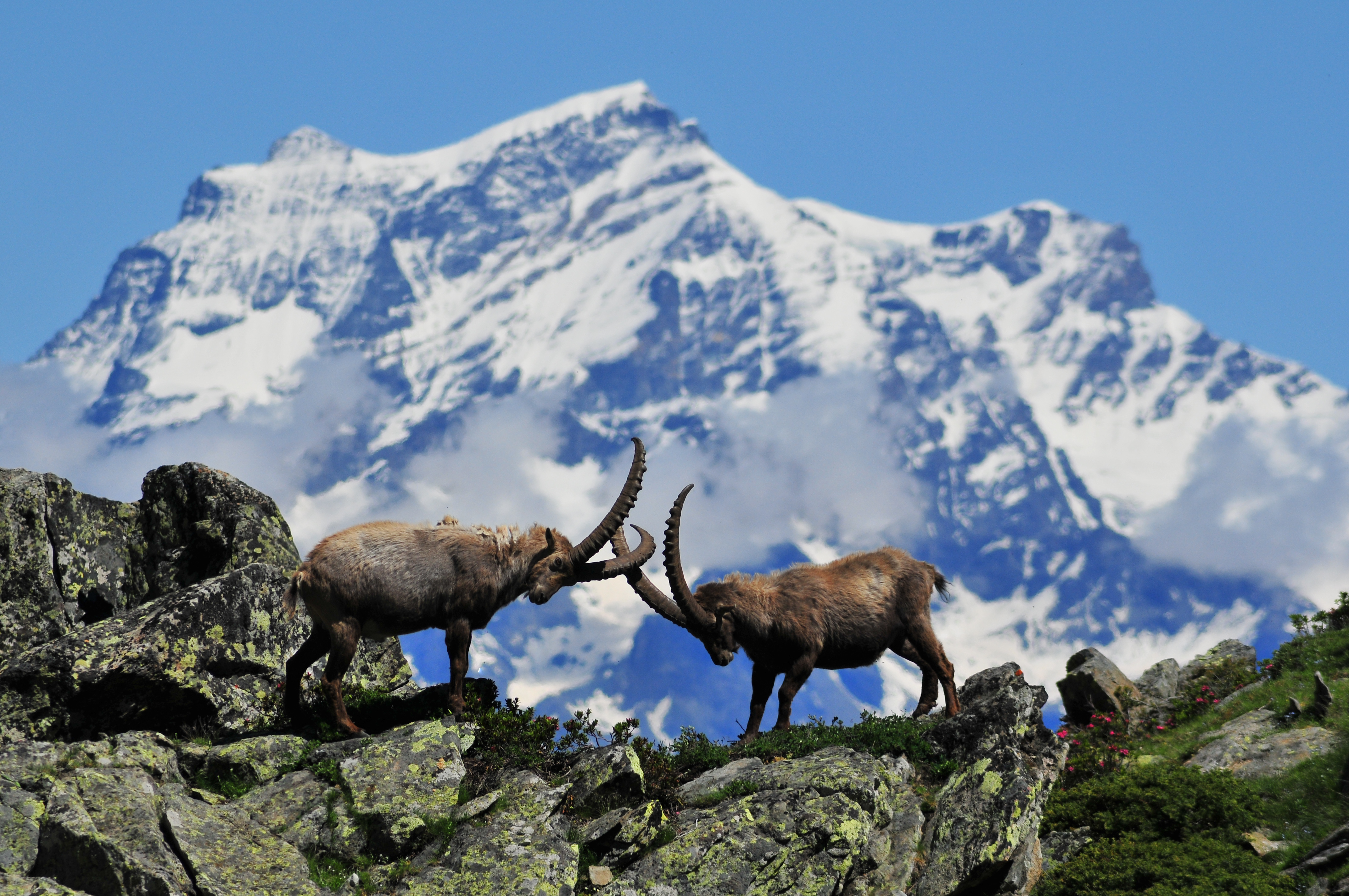
The site corresponds to the territory of Gran Paradiso National Park. This includes different ecosystems, present along the altitudinal gradient (ca. 800 – 4000 m asl): the woody areas of the montane belt, the ecotonal habitats of the subalpine belt and the meadows of the alpine one. The nival belt is widely represented inside the Park. The habitats with poor or no vegetation (rocks, screes, glaciers) cover about 60% of the territory, meadows and pastures 17%, about 20.2% is characterised by woods and shrubs, while 0.8% by cultivated lands and urban areas. The aquatic ecosystems, beyond the streams, comprise almost 15 lakes, bigger than 10,000 m2 and located at an altitude higher than 2000 m asl. The area is directly managed by the Park Authority; research and monitoring activities are coordinated by the Sanitary and Scientific Office of the Park.
-
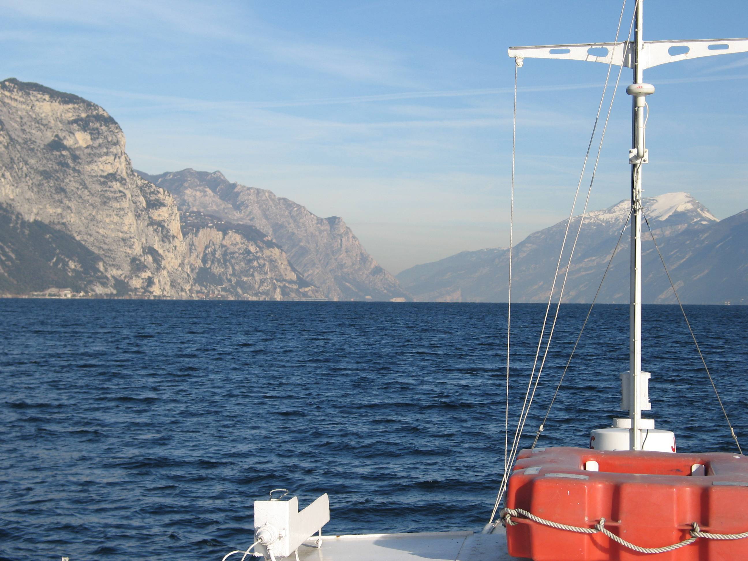
Lake Garda has the largest volume (49 billions of cubic meters) and the most extensive area (368 km2) of Italian lakes. Along with lakes Orta, Maggiore, Lugano, Como, Iseo and Idro, it forms part of the group of deep lakes located south of the Alps in one of the most densely populated and highly productive area of Italy. With a total volume of over 124 billions of cubic meters, these lakes constitute one of the largest freshwater supplies in Europe. Their waters are used for agriculture, industry, fishery and drinking. Moreover, they are an important resource for recreation and tourism thanks to both attractive landscape and water quality. In Lake Garda, sporadic studies were carried out irregularly by various Institutions up to the end of the 1980s. Since the beginning of the 1990s, continuous monthly samplings and measurements were carried out by the Department of Biology of the Padova University (Responsible, Nico Salmaso), with the collaboration of ARPAV. Since 2005 the whole limnological research is performed by the Limnological research group of the Agrarian Institute of S. Michele all’Adige – E. Mach Foundation (S. Michele all’Adige, Trento; coordinator, Nico Salmaso). Since the 1970s, Lake Garda showed an increase in the trophic status, with mean annual concentrations of total phosphorus in the whole water column increasing from ca. 10 µg P/L to 20 µg P/L. In the last 4-5 years of observations, TP showed a stabilisation of the concentrations, around 18 µg P/L. At the community level, annual phytoplankton cycles underwent a unidirectional and slow shift mainly due to changes in the species more affected by the nutrient enrichment of the lake. After a first and long period of dominance by conjugatophytes (Mougeotia) and diatoms (Fragilaria), phytoplankton biomass in recent years was sustained by cyanobacteria (Planktothrix). Other important modifications in the development of phytoplankton were superimposed on this pattern due to the effects of annual climate fluctuations principally mediated by the deep mixing events at spring overturn. Main specific research objectives in this LTER station include: -Changes in the physical, chemical and biological variables at different temporal scales, from months to decades and centuries (paleoecology). Update of the time series of hydrological, climatological and limnological data, whith special attention to lake evolution and effects on biotic communities in relation to ongoing climatic changes. Definition of predictive models. - Identification of the environmental and biotic mechanisms favouring the development of cyanobacteria (including the recent appearence of blooms and new species). Identification of the factors selecting for the development of toxic strains, the production and concentrations of epato- and neurotoxins, and their impact on trophic webs and water usability. The limnological field facilities of the limnological research group include 2 rubber dinghies, 2 multi-parameter probes, a fluoroprobe, a FlowTracker Handheld ADV Sonntek, underwater Quantum sensors, a Kajak corer and an Eckman dredge for sediment sampling. The unit also has several laboratories. These include the hydrobiology and microscopy laboratory, equipped for analyses of basic limnological variables (photosynthetic pigments, dry weight, dissolved oxygen, water turbidity, macrophytes) and of phytoplankton, picoplankton and periphyton samples (microscopes, invertoscopes, fluorescent microscopy, image analysis). The analytical and environmental chemistry laboratory is equipped for analysis of the major ions and nutrients (phosphorus, nitrogen and silica), as well as organic molecules (with focus on cyanotoxins) by means of spectrophotometry, ion chromatography and Liquid Chromatography-Mass Spectrometry (LC-MS). We have access to genetic laboratories equipped with the principal analytical tools, i.e. PCR, electrophoresis, and sequencing. The data collected at monthly frequency since 1991 includes water temperature and oxygen. Phytoplankton was collected since 1993, while complete data recording (including chemistry and zooplankton) begun in 1995.
-
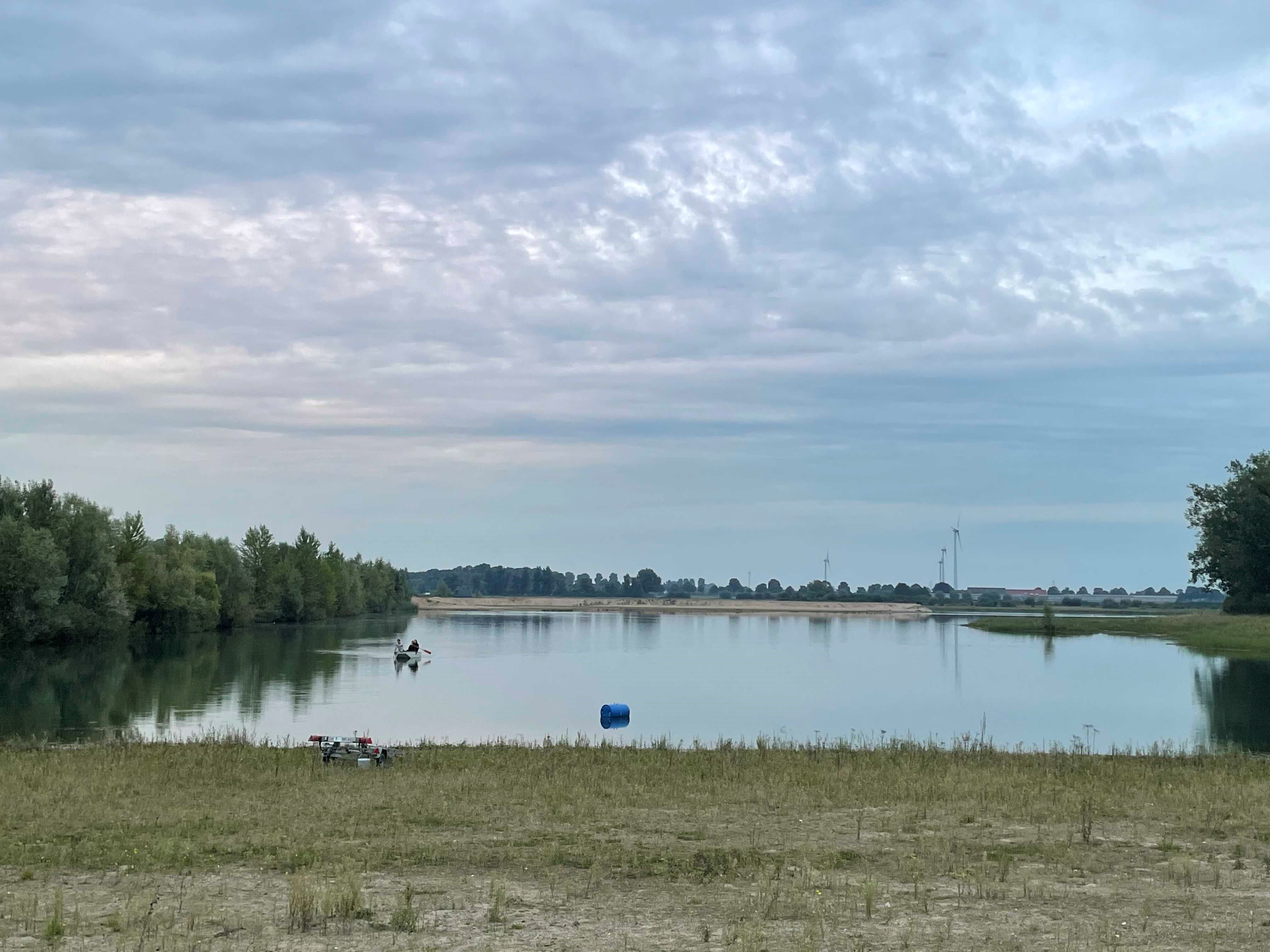
How do freshwater ecosystems react to changing environmental conditions and to what extent can these changes be captured in the dynamics of eco-evolutionary processes? The project REES ('Rhine Eco-Evolutionary System') aims at the long-term assessment of eco-evolutionary interactions in the Rhine as a limnic habitat under consideration of diverse associated water bodies. The study area includes the main flow channel of the Rhine (km 845, North Rhine-Westphalia), as well as Rhine oxbows, Rhine water-fed gravel pit lakes in ecological succession and the surrounding floodplain (Rees, district of Kleve). The Ecological Research Station Rees-Grietherbusch of the Institute of Zoology (University of Cologne) and the Nature Conservation Center District Kleve e.V. form the central infrastructure of the study area. In addition, the Ecological Rhine Station of the University under the direction of Prof. Dr. Arndt is also associated to the project, which enables direct sampling and experimental recording of the main Rhine flow channel. The extensive system of standing and flowing freshwater bodies covered in the REES study site allows the investigation of dynamic variations in biodiversity composition at all levels, from species diversity of communities to genomic diversity at the molecular level of individuals and populations. Along a selected trophic cascade, representative species will be long-term observed and analyzed ecologically and especially also (population-)genomically. The incorporation of ecological genomics is the core aspect of this LTER-D project, which is intended to capture the feedback of evolutionary changes on the ecological system. Population genomic approaches can be used to infer both evolutionary and ecological processes from genomic data. To cope with the dimension of this project, REES is designed as an interdisciplinary collaboration project and currently counts seven project partners with corresponding subordinate projects.
-
The Lautaret-Oisans platform focuses on the study of socio-ecosystems and the critical zone of the alpine mountains. The research and observation sites are focused on three sub-systems: little-engineered high mountains; alpine pastures; and lakes, rivers and watershed heads. The platform is built around the Lautaret-Roche-Noire site (https://deims.org/8574370e-934e-418a-af63-e15f4cbc5084) and Lautaret Garden infrastructures.
-
In Britz we study the water consumption (evapotranspiration) of important commercial tree species since 1974. The main feature are the nine large-scale lysimeters, installed at a depth of over 5 m with a surface area of 100 m² (10x10 m) each. They are planted with 0.3 ha experimental stands of Scots pine (Pinus sylvestris) (3 lysimeters), European beech (Fagus sylvatica) (2), European larch (Larix decidua) (2), and Douglas fir (Pseudotsuga menziesii) (2) spaced corresponding to the forestry practice at that time. About 15 years ago one Larch lysimeter was clear-cut and replanted with sessile oak (Quercus petraea). On two Scots Pine lysimeters, European beech was planted building now the understory. The areas surrounding the lysimeters were planted in a similar fashion. Seepage water collecting at the bottom of the lysimeter flows down a shaft and is measured mechanically by a tipping counter and registered electronically. Soil moisture is measured with probes to a total depth of 5 m. Precipitation in the open field and the stand is recorded with Hellmann rain gauges. In addition, the station is equipped with devices assessing individual tree water transport and growth (sap-flow sensors, dendrometers), an Eddy-Fluy-Tower and much more. The studies are aimed at revealing the effects of different tree species and mixtures on the ground and landscape water balance. Moreover, the effects of drought on tree performance and tree-internal water budgets are of interest. However, recently we added acoustic monitoring, a pollen collector, regular UAV flights to our assessments and are always open to more co-operations.
-
The Bassée floodplain is a large area in the Seine river basin (~ 50 km long and 5-10 km wide). Series of hydrological installations (dikes, channelization, damming, drainage, sand and gravel pits) have considerably reduced the flooding in the plain which nervertheless remains an important resource in the Seine river basin for freshwater and biodiversity. The level of anthropization increases from upstream to downstream. Projects for new hydrological installation (damming, channelization) still exist, which supports a high monitoring activity in this area.
-
The Ploemeur-Guidel observatory (Britanny, France) is focusing on surface-depth relationships in a fractured crystalline geological context and oceanic climate. It is built on 2 sub-sites, one highly anthropized, the other in natural state. In Ploemeur, groundwater has been pumped since 1991, supplying more than 1 million m3 of clean drinking water annual at a sustainable rate. Such high productivity is explained the specific fractured network in granite and micaschists, draining deep geological layers (~400 m). Extracted water quality is very good, with limited nitrate concentration, in a region that has been strongly affected by widespread pollution. Guidel site is in a similar, but natural context. Deep iron-rich groundwater is upflowing, creating surface and deep groundwater-dependent ecosystems, and feeding a classified coastal wetland. Both sites have a very dense equipment to study rapid to long-term surface-depth exchanges: a flux tower, unsaturated zone monitoring, a network of ~50 shallow (<10m) and deep boreholes (>80m), hydrochemical, temperature and deformation. An well-characterized fractured experimental site offers the possibility to conduct experiments to test innovative instruments and develop new methodologies
-
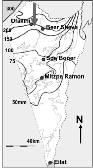
Designation: Ecosystem research and management under land-use and climate change. Climate: Mean annual precipitation 150-200mm between November and April; mean maximum summer temperature 34° C, mean minimum winter temperature 6° C. (Data avialable for 15-min interval meteorological measurements and daily summaries for rainfall, air and soil humidity and temperature, wind velocity and direction, from 1997 to the present.) Principal biomes: Semiarid shrub land (shrub-grass steppe), rocky and loessial watersheds, ephemeral streams. Vegetation is dominated by patch-forming dwarf shrubs (Noaea mucronata, Atractylis serratuloides and Thymelea hirsuta) with species-rich annual winter vegetation in the inter shrub (dominated by Stipa capensis and other grasses) and shrub patch understory (dominated by Anagallis arvensis and other forbs). As a result of drought there are also two new sub biomes: crust land and grass land. Management: Livestock grazing excluded in central watershed (20 ha) since 1987; restricted/controlled grazing by Bedouin sheep herds in surroundings; in the outer parts of the area native and exotic trees were planted in 1985-87 in contour dykes (‘shikhim’) on the slopes and in terraces in the riverbed. Research: 1. Long-term experiments (up to 20 years) for monitoring changes in abundance, diversity, species composition and distribution, and development of biological soil crusts (BSC), perennial plants (dwarf shrubs) and winter annuals in relation to rainfall, soil disturbance, patch distribution, and livestock grazing. 2. long term hydrological studies on rainfall-runoff relationship under natural and manipulation experiments. 3. Short-term experiments and surveys (1 to 5 years) A. for testing hypotheses about the detailed processes, mechanisms and interactions involved in the development, dynamics and stability of shrub- and BSC-dominated patches, their landscape mosaic patterns and their feed-back relationships with flows of materials through the landscape; B. for testing hypothesis on the effect of geodiversity on the stability of shrub land to extreme drought and understanding state changes in drylands. 4. Long term studies on cross scale-cross level interactions in natural and human modified landscape. 5. Network-related research including regional comparisons of herbaceous plant productivity in open rangeland along the Israeli North-South rainfall gradient, and global comparison of woody plant diversity effects on ecosystem functionality of most dryland regions of the world.
-
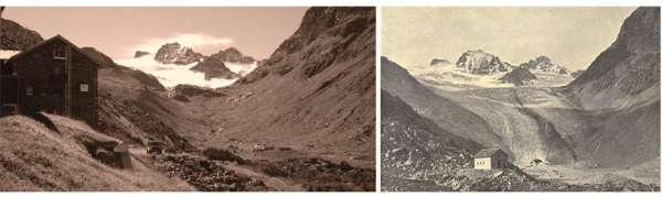
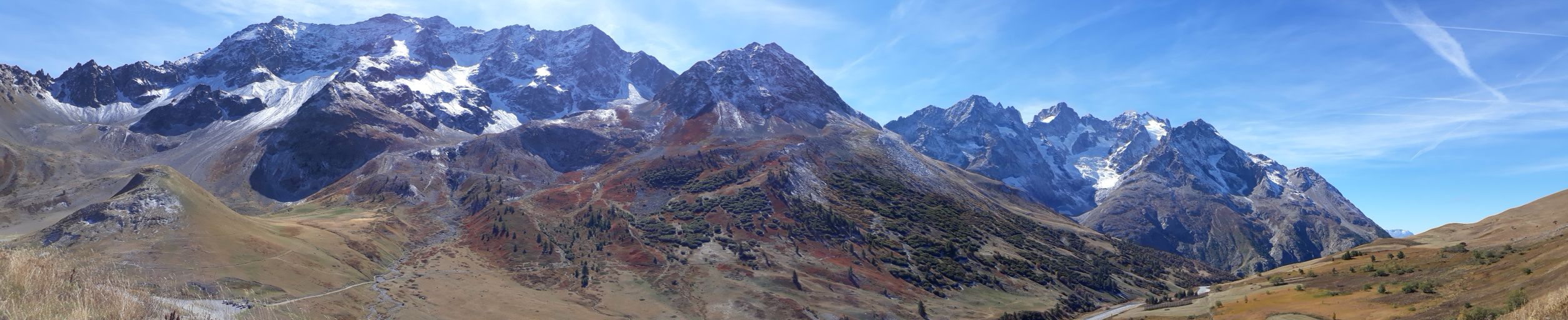
The site is located at the main Alpine ridge in Silvretta group right at the border between Austria and Switzerland. Jamtalferner glacier and it's forefield is subject to scientific reseach for more than 100 years. Current monitoring includes climate, hydrology, glacier mass balance, permafrost, paleoglaciology, society and biotic succession in the periglacial area. In addition to that, several short time research projects are carried out, e.g. concerning glacier albedo. The site inlcudes the are from the highest peaks at 3384 m a.s.l. and the valley further down to the communities of Galtür and Ischgl (1263 m a.s.l.). More information can be found at the website of the environmental education program Jamtal www.umweltbildung-jamtal.info.