
landscape composition
Type of resources
Available actions
Topics
Keywords
Contact for the resource
Provided by
Years
Formats
Representation types
-
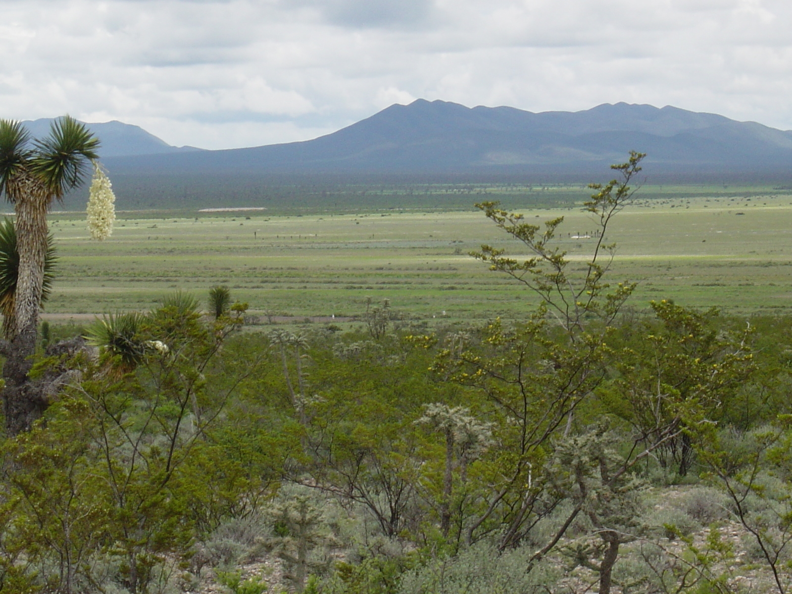
Los esfuerzos de investigación se enfocan a la región del altiplano mexicano conocida como “El Tokio”, donde se distribuyen los pastizales gipsófilos y salinos en el noreste de México y la cual es reconocida como una región prioritaria para la conservación de especies de aves residentes endémicas y migratorias. El área se caracteriza por valles intermontanos en los cuales se presentan suelos con altos contenidos de yeso y carbonatos de calcio, así como pastizales de porte bajo que no rebasan los 15 cm de altura en promedio. En estos valles habita el perrito llanero mexicano (Cynomys mexicanus), especie clave en el ecosistema. La vegetación circundante a estos valles está caracterizada por matorrales de gobernadora (creosote bush) con elementos sobresalientes de Yucca. El área es fuertemente impactada por actividades agrícolas y ganaderas, las cuales se llevan a cabo desordenadamente y sin medidas de mitigación.
-
The analyses are focused on monitoring coastal sand dunes landscape (mapping) of the central Adriatic area, which are representative of Mediterranean dune ecosystems and are partially included in the long-term ecological monitoring network (LTER - site code: LTER_EU_IT_081). Based on the use of specific GIS software and integrating photo-interpretation and classification of remotely sensed data, the study depict multi-temporal changes by mapping and updating land cover and vegetation information (1954- to date) of the cast of south Abruzzo and Molise regions. Specific attention is given to the identification of the seashore, dune habitats (coastal plant communities) and land cover types at a detailed spatial scale (1:5000).
-
The analyses are focused on monitoring coastal sand dunes landscape (mapping) of the central Adriatic area, which are representative of Mediterranean dune ecosystems and are partially included in the long-term ecological monitoring network (LTER - site code: LTER_EU_IT_080). Based on the use of specific GIS software and integrating photo-interpretation and classification of remotely sensed data, the study depict multi-temporal changes by mapping and updating land cover and vegetation information (1954- to date) of the cast of south Abruzzo and Molise regions. Specific attention is given to the identification of the seashore, dune habitats (coastal plant communities) and land cover types at a detailed spatial scale (1:5000).
-

The sites Friedeburg, Greifenhagen, Harsleben, Schafstädt, Siptenfelde and Wanzleben are part of the TERENO Harz / Central German Lowland Observatory in Saxony-Anhalt run by the Helmholtz Centre for Environmental Research UFZ. These sites have a focus on biodiversity monitoring in the “normal landscape” which is characterized by agricultural use (about 60 % coverage of Saxony-Anhalt). Each site is a 4x4 km landscape of mainly arable land and semi-natural habitats like e.g. hedges and forests. The site Schafstädt is part of the "Querfurter Platte" ranking about the richest soils in Germany. It is characterized by a quite flat topography and a mean elevation of 177 m asl. The average size of crop fields is highest compared to the other sites and the total area covered by crop fields is still 97 % and all semi-natural habitats summing up to 2 %.
-
The sites Friedeburg, Greifenhagen, Harsleben, Schafstädt, Siptenfelde and Wanzleben are part of the TERENO Harz / Central German Lowland Observatory in Saxony-Anhalt run by the Helmholtz Centre for Environmental Research UFZ. These sites have a focus on biodiversity monitoring in the “normal landscape” which is characterized by agricultural use (about 60 % coverage of Saxony-Anhalt). Each site is a 4x4 km landscape of mainly arable land and semi-natural habitats like e.g. hedges and forests. The site Siptenfelde is in the eastern part of the Harz mountains and characterized by a distinct topography. The mean elevation is 423 m asl and besides meadows and agricultural fields the village Siptenfelde is surrounded by forest. Thus the area covered by forest amounts to 61 %, crop fields 18 % and all semi-natural habitats sum up to 15 %.
-
The site is a 4x4 km square within an agricultural dominated landscape (about 75% arable land) in the eastern part of the lower Harz mountains. It is intended for observation and a weather station and some simple devices are installed (combined flight traps aiming at insects; temperature loggers at each trap). The sites Friedeburg, Greifenhagen, Harsleben, Schafstädt, Siptenfelde and Wanzleben are part of the TERENO Harz / Central German Lowland Observatory in Saxony-Anhalt run by the Helmholtz Centre for Environmental Research UFZ. These sites have a focus on biodiversity monitoring in the “normal landscape” which is characterized by agricultural use (about 60 % coverage of Saxony-Anhalt). Each site is a 4x4 km landscape of mainly arable land and semi-natural habitats like e.g. hedges and forests. The site Greifenhagen is characterized by a distinct topography with valleys and slopes and a mean elevation of 270 m asl. The area covered by crop fields is 71 % and all semi-natural habitats sum up to 6 %.
-
As in http://forest.jrc.ec.europa.eu/activities/forest-mapping/forest-cover-map-2000/ clipped for PA Montado and projected using EPSG:3763 (ETRS89/Portugal TM6).
-
The same as http://land.copernicus.eu/pan-european/corine-land-cover/view, clipped for PA Montado and projected using EPSG:3763 (ETRS89/Portugal TM6)
-
The same as http://land.copernicus.eu/pan-european/corine-land-cover/view, clipped for PA Montado and projected using EPSG:3763 (ETRS89/Portugal TM6)
-
A map produced by the Portuguese Geographic Institute with a minimum spatial unit of representation of 1 ha. Spatial accuracy 5.5 m and thematic accuracy 85.13%, with an error of 2% for a confidence level of 95%. There are several levels of detail, concerning land occupation.