
landscape configuration
Type of resources
Available actions
Topics
Keywords
Contact for the resource
Provided by
Years
Formats
Representation types
-
The analyses are focused on monitoring coastal sand dunes landscape (mapping) of the central Adriatic area, which are representative of Mediterranean dune ecosystems and are partially included in the long-term ecological monitoring network (LTER - site code: LTER_EU_IT_081). Based on the use of specific GIS software and integrating photo-interpretation and classification of remotely sensed data, the study depict multi-temporal changes by mapping and updating land cover and vegetation information (1954- to date) of the cast of south Abruzzo and Molise regions. Specific attention is given to the identification of the seashore, dune habitats (coastal plant communities) and land cover types at a detailed spatial scale (1:5000).
-
The analyses are focused on monitoring coastal sand dunes landscape (mapping) of the central Adriatic area, which are representative of Mediterranean dune ecosystems and are partially included in the long-term ecological monitoring network (LTER - site code: LTER_EU_IT_080). Based on the use of specific GIS software and integrating photo-interpretation and classification of remotely sensed data, the study depict multi-temporal changes by mapping and updating land cover and vegetation information (1954- to date) of the cast of south Abruzzo and Molise regions. Specific attention is given to the identification of the seashore, dune habitats (coastal plant communities) and land cover types at a detailed spatial scale (1:5000).
-

The sites Friedeburg, Greifenhagen, Harsleben, Schafstädt, Siptenfelde and Wanzleben are part of the TERENO Harz / Central German Lowland Observatory in Saxony-Anhalt run by the Helmholtz Centre for Environmental Research UFZ. These sites have a focus on biodiversity monitoring in the “normal landscape” which is characterized by agricultural use (about 60 % coverage of Saxony-Anhalt). Each site is a 4x4 km landscape of mainly arable land and semi-natural habitats like e.g. hedges and forests. The site Schafstädt is part of the "Querfurter Platte" ranking about the richest soils in Germany. It is characterized by a quite flat topography and a mean elevation of 177 m asl. The average size of crop fields is highest compared to the other sites and the total area covered by crop fields is still 97 % and all semi-natural habitats summing up to 2 %.
-
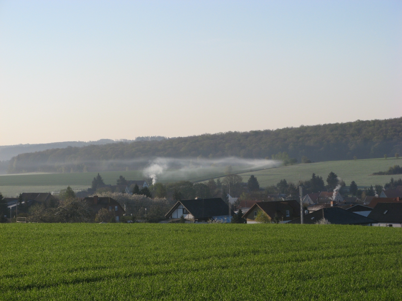
The sites Friedeburg, Greifenhagen, Harsleben, Schafstädt, Siptenfelde and Wanzleben are part of the TERENO Harz / Central German Lowland Observatory in Saxony-Anhalt run by the Helmholtz Centre for Environmental Research UFZ. These sites have a focus on biodiversity monitoring in the “normal landscape” which is characterized by agricultural use (about 60 % coverage of Saxony-Anhalt). Each site is a 4x4 km landscape of mainly arable land and semi-natural habitats like e.g. hedges and forests. The site Siptenfelde is in the eastern part of the Harz mountains and characterized by a distinct topography. The mean elevation is 423 m asl and besides meadows and agricultural fields the village Siptenfelde is surrounded by forest. Thus the area covered by forest amounts to 61 %, crop fields 18 % and all semi-natural habitats sum up to 15 %.
-
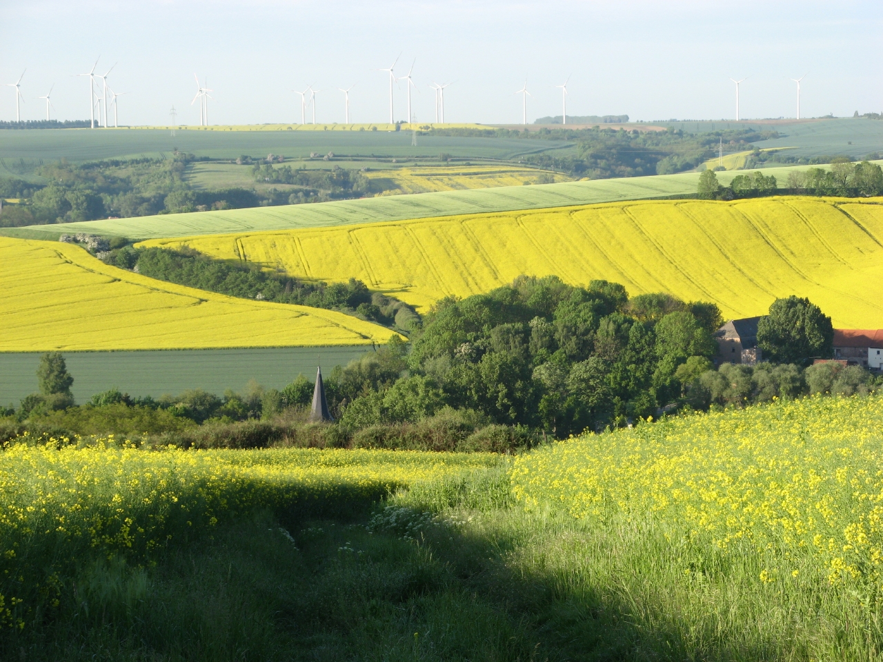
The site is a 4x4 km square within an agricultural dominated landscape (about 75% arable land) in the eastern part of the lower Harz mountains. It is intended for observation and a weather station and some simple devices are installed (combined flight traps aiming at insects; temperature loggers at each trap). The sites Friedeburg, Greifenhagen, Harsleben, Schafstädt, Siptenfelde and Wanzleben are part of the TERENO Harz / Central German Lowland Observatory in Saxony-Anhalt run by the Helmholtz Centre for Environmental Research UFZ. These sites have a focus on biodiversity monitoring in the “normal landscape” which is characterized by agricultural use (about 60 % coverage of Saxony-Anhalt). Each site is a 4x4 km landscape of mainly arable land and semi-natural habitats like e.g. hedges and forests. The site Greifenhagen is characterized by a distinct topography with valleys and slopes and a mean elevation of 270 m asl. The area covered by crop fields is 71 % and all semi-natural habitats sum up to 6 %.
-
Hailun Agricultural Ecological Station located in Hailun city, Heilongjiang province, was established in 1978, briefly named Hailun Agro-ecosystem Station. The main research fields at that time were the optimal management of agriculture and advanced technology utilization in agricultural production. Chinese ecosystem research network(CERN) established in 1988 selected Hailun station as one of its components. The objective of Hailun station was to study the agro-ecosystem and sustainable development of agriculture in black soil zone in Northease China. Also, Hailun station was considered as one of components, when national field research net was built in 2005.
-
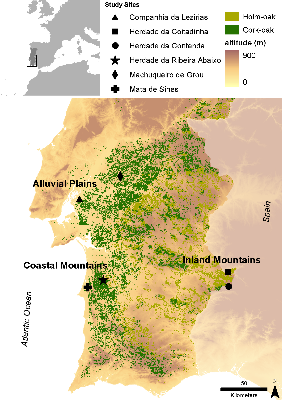
Cork (Quercus suber) and holm (Quercus ilex L.) oaks were probably the dominant oak species in the Iberian Peninsula south of the Cantabrian/ Pyrenean mountains since the end of the last glaciation. Despite a large range overlap between both species, cork-oak was confined to the mild western regions of the Peninsula (thereby encompassing most of the Portuguese territory), occurring only in small patches along the coast further east, while holm oak was and still is the dominant oak over most of the Centre and East of the Peninsula, subjected to a harsher continental climate. Millennia of land clearing driven by human population growth and need for agricultural land lead to the almost complete elimination of cork oaks from the Centre and North of Portugal (and Galicia), where the mountainous relief and relatively high precipitation allowed for the establishment of numerous small farms. However, in the dry lowlands south of river Tajus, the impossibility of land irrigation and the poor soil quality were two of the main drivers that contributed to the establishment of the montado agro-sylvo-pastoral system. Today, roughly 90% of Portuguese cork-oak montados are found in this region (Alentejo) and represent the largest cork-oak montado area in the world. Here, the species basically occurs on two soil types – the skeletal schist soils that result from the weathering of the Palaeozoic hercinic core of the Peninsula and the alluvial plains of the Tajus and Sado rivers, which well drained sandy soils, correspond to an ecological optimum for this species. When compared with holm oaks, cork-oaks are relatively fragile, being unable to withstand severe droughts and continental climates (inland) or calcareous soils (in the Algarve). Therefore, as one proceeds south of the Tajus, the flatlands become divided between the coastal cork-oak montados and the inland holm oak montados. In spite of their physiological differences, holm oak forests were also cleared with different extents in different areas and the same pattern emerged, with most of the Portuguese holm oak montados occurring nowadays in inland Alentejo. These montados are in fact the western limit of the Spanish dehesas; their aggregated area constitutes the largest extension of montado ecosystem in the world. Data series of Alentejo province concerning the main key drivers of change and available to the research team are: Climate (historical time series since 1930 and every thirty years onwards, plus climatic models); Satellite images (1984, 1990, 1994 and 2004 – several series along the year, 2008); Aerial Photographies (1960/70, 1974/80, 1995, 2005); Forestry inventories (60’s/70’s, 1995, 2005). In each of the three core research and monitoring stations encompassing the variety of edapho-climatic conditions to which most montados are subjected, and that are proposed in the current proposal (see research plan), two study case sites were selected to illustrate contrasting human pressures. More relevance was given to cork oak montados, due to the importance of cork industry for the national PIB, as well as to the global importance of the Portuguese territory for this ecosystem. Two main and one secondary contrasts related to human pressures will be monitored: i) vulnerability to dryness (also related to land use), monitored at Machuqueira do Grou and Companhia das Lezírias (less vulnerable) vs Ribeira Abaixo and Sines (more vulnerable); and ii) vulnerability to grazing intensification, monitored at Companhia das Lezírias (more vulnerable) vs Machuqueira do Grou and Ribeira Abaixo (less vulnerable). The same vulnerability to grazing intensification will be monitored at the two holm oak site, where the main contrast is the type of grazer: cattle (Coitadinha) vs game species (Contenda). Finally, the additional contrast refers to the proximity to pollution sources that can be explored by the comparison between Companhia das Lezírias and Sines (more exposed) vs. all other study sites (less exposed).
-
The sites Friedeburg, Greifenhagen, Harsleben, Schafstädt, Siptenfelde and Wanzleben are part of the TERENO Harz / Central German Lowland Observatory in Saxony-Anhalt run by the Helmholtz Centre for Environmental Research UFZ. These sites have a focus on biodiversity monitoring in the “normal landscape” which is characterized by agricultural use (about 60 % coverage of Saxony-Anhalt). Each site is a 4x4 km landscape of mainly arable land and semi-natural habitats like e.g. hedges and forests. The site Friedeburg is close to the river Saale and about 20 km northwest of the city of Halle (Saale). It is characterized by a distinct topography with valleys and slopes with a mean elevation of 122 m asl. Accordingly the average size of crop fields is lowest compared to the other sites, but the total area covered by crop fields is still 71 % and all semi-natural habitats summing up to 10 %.
-

The sites Friedeburg, Greifenhagen, Harsleben, Schafstädt, Siptenfelde and Wanzleben are part of the TERENO Harz / Central German Lowland Observatory in Saxony-Anhalt run by the Helmholtz Centre for Environmental Research UFZ. These sites have a focus on biodiversity monitoring in the “normal landscape” which is characterized by agricultural use (about 60 % coverage of Saxony-Anhalt). Each site is a 4x4 km landscape of mainly arable land and semi-natural habitats like e.g. hedges and forests. The site Wanzleben is situated in the "Magdeburger Börde", a flat area with highest ranking of soil quailty in Germany.. It is characterized by a mostly flat topography with a mean elevation of 113 m asl. The area covered by crop fields is 77 % and all semi-natural habitats summing up to 8 %.
-
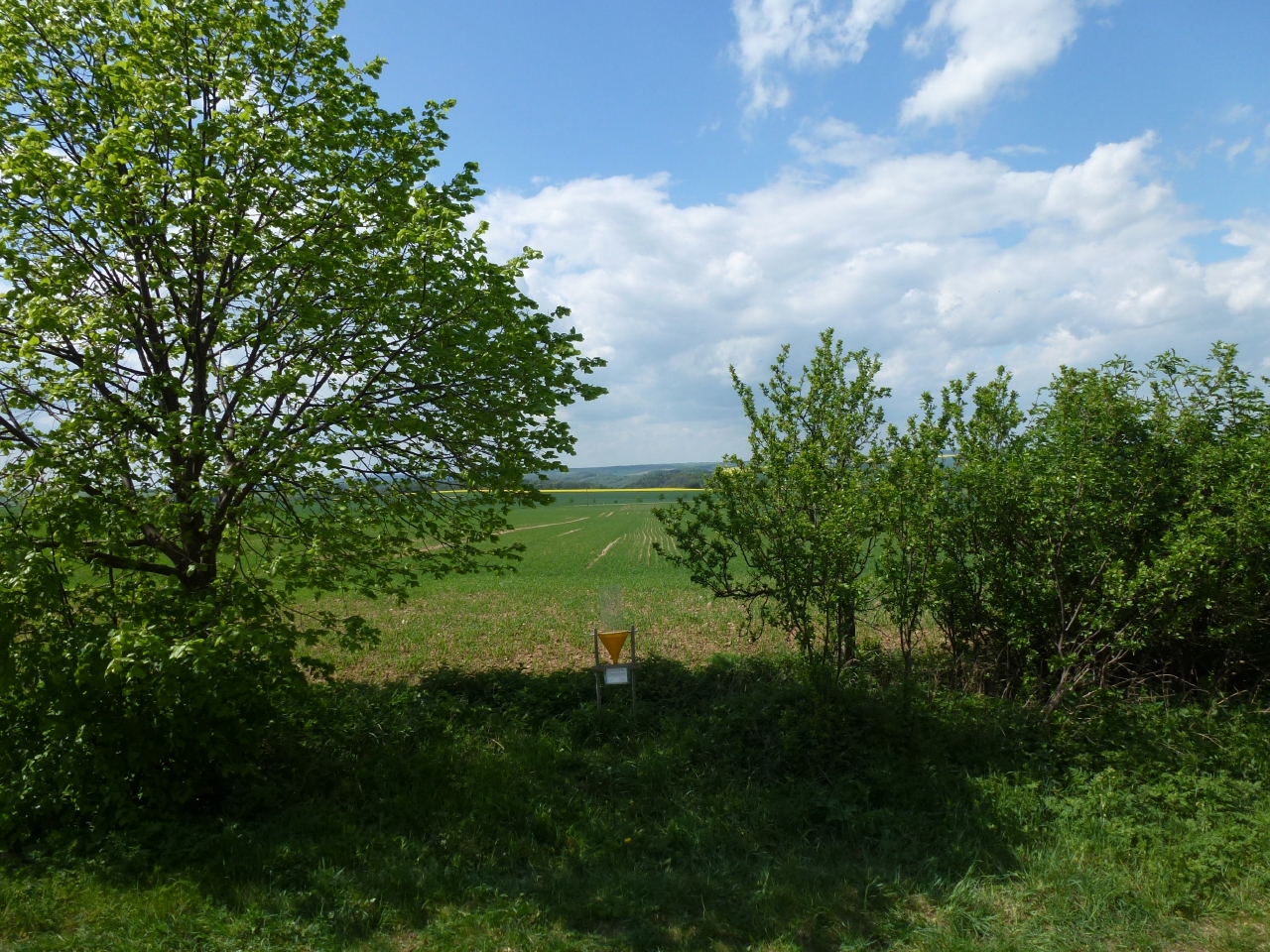
Covers an elevational gradient from 0 to 2,200 m in the Serra dos Órgãos mountain range, with high elevation grasslands (campos de altitude), cloud and lowland rainforests in the Atlantic Forest biome. In the lowlands it includes fragmented landscapes due to deforestation occurred in the last 500 years, with a variety of land uses in the matrix were fragments are inserted. Long term studies and monitoring actions focus on the effects two main factors: effects of climate change and land use. Presents high species richness, embracing a National Park (Parque Nacional da Serra dos Órgãos), a state park (Parque Estadual dos Três Picos), a private reserve (Reserva Ecológica Guapiaçu), and other federal and state protected areas.