
landscape connectivity
Type of resources
Available actions
Topics
Keywords
Contact for the resource
Provided by
Years
Formats
Representation types
-
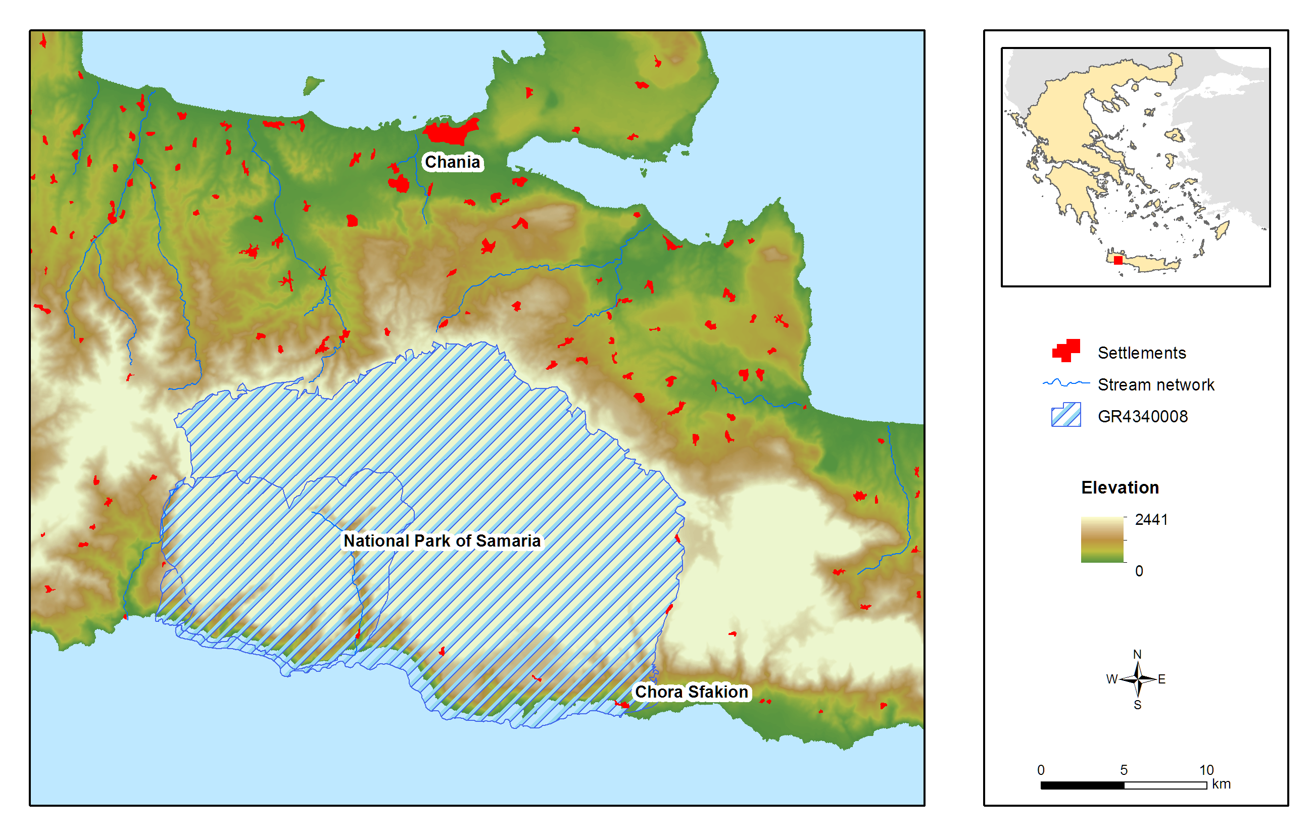
Samaria (White Mountains) National Park is located on the West part of island of Crete and was declared as a National Park via a Royal Decree in 1962. It is a muli-designated area and specifically a National Park, Landscape of Outstanding Beauty, Natura 2000 site coded GR 4340008 and GR4340014 and Biosphere Reserve in the framework of the “Man and Biosphere” Programme of UNESCO. It has been awarded with the European Diploma of Protected Areas of the Council of Europe. Also a hotspot for biodiversity and a place with a strong and important anthropogenic environment (history, special songs, traditions, etc.). It contains one of the largest gorges in the Balkans, Samaria Gorge, with a total length of 13 km while nine main gorges are located within the area of the White Mountains. These specific landscape configuration schemes sustain unique abiotic and biotic environmental characteristics, most of them unknown, because of the site’s wilderness and difficultness for direct scientific filed work. The specificity of the area can be easily identified in numbers: 58.454 ha, altitude ranging from 0-2.454m, more than 50 summits higher than 2000 meters a.s.l., 14 different types of habitats, approximately 40% of the entire extent of the county of Chania. Mean Annual Rainfall is between 600mm to 2000mm depending on the elevation. The entire area comprises one of the two main environmental lungs of Crete and a configuration leading to the current meteorological and hydrological conditions set in the western part of the island. President of the National Park is Dr. Petros Lymperakis, researcher from the Natural History Museum of Crete (lyberis@nhmc.uoc.gr). The National Park is characterized by a rich biodiversity, a high degree of endemism in fauna and flora, distinctive geological configurations and specific landscape features. Distinctive species of fauna found in the area are: the Cretan wild goat (Capra aegagrus cretica), the largest mammal of the island, the Cretan wildcat (Felis sylvestris cretensis) and a species of mouse (Acomys minous) which is considered to be rare. The rich avifauna of the area includes 69 species, with Gypaetus barbatus among others. The area houses 172 endemic species and subspecies, while 97 of them are endemic to Crete and 24 are specifically endemic (steno-endemic) to smaller areas. Some of the most distinctive species are: Cephalanthera cucullata, Nepeta sphaciotica, Bupleurum kakiskalae and Zelkova abelicea. The past 2 years a complete survey has begun in order to identify the Park’s central environmental characteristics. Nowadays, the monitoring system is comprised by: 1) Monitoring and surveillance of 15 terrestrial habitats and 34 species of flora. 2) Monitoring and surveillance of 256 species of avifauna. 3) Monitoring and surveillance of all possible species of fauna, including coastal and marine species. 4) Monitoring and surveillance of two marine habitats. 5) Recording of meteorological and hydrological conditions via four (4) meteo-stations located in the vicinity of the National Park and transmittance of data through the internet. The basic threats and pressures characterizing the site can be cumulated in: Α) Landscape fragmentation Β) Desertification induced by overgrazing and uncontrolled fires C) Modifications in water and groundwater regime induced by large scale infrastructures D) Poaching and uncontrolled abstraction of endemic species of flora E) Massive touristic flow and F) Relative medium and large-scale touristic infrastructures.
-
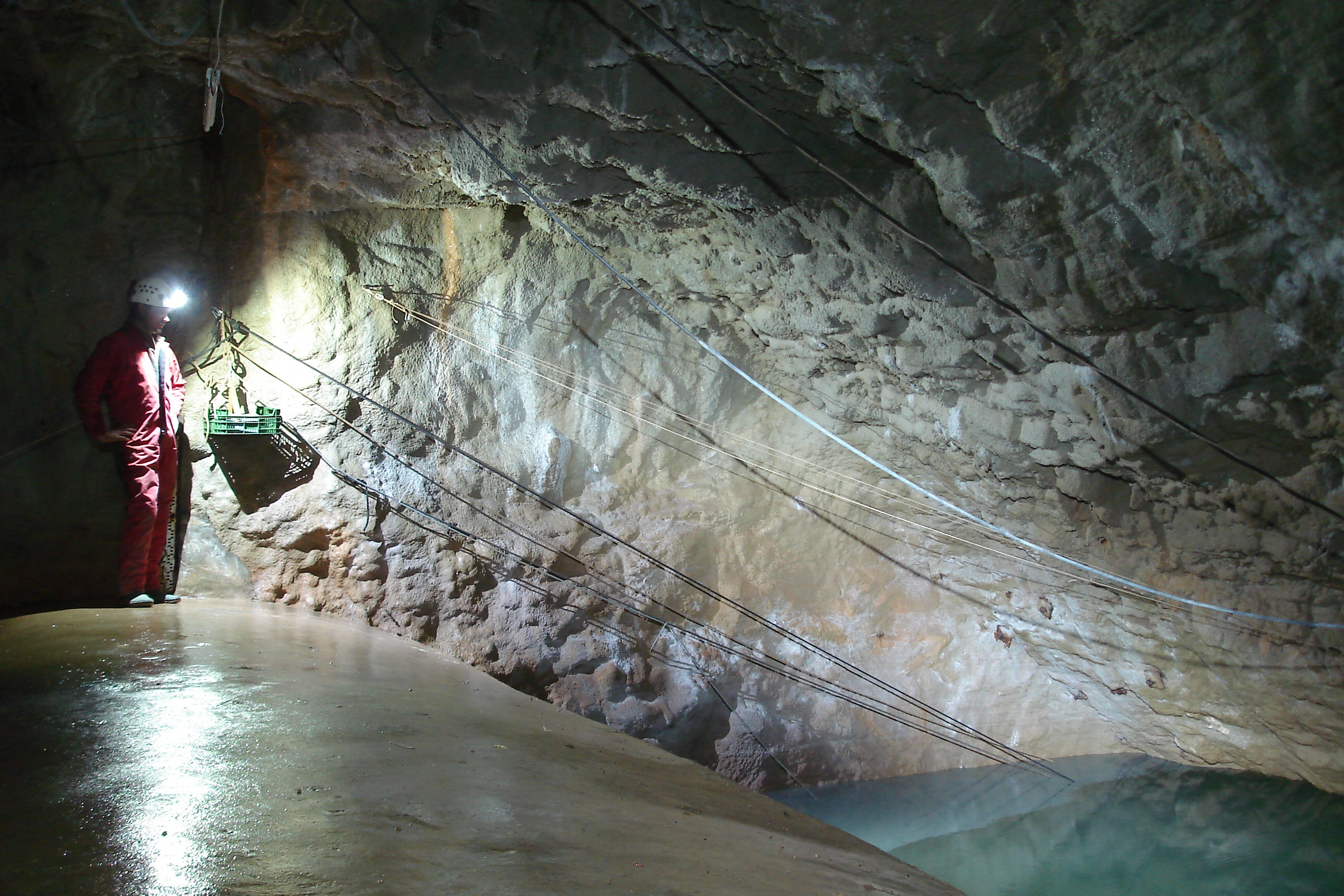
The Mediterranean and coastal site of Port-Miou is a wide regional carbonate aquifer, with a catchment area around 400 km², in south of France (Provence, France). It extends mainly over natural land, in the vicinity of one of the main city of France (Marseille), facing recent urban expansion and future groundwater resources management issues. Top of the recharge area culminates at 1100 m asl, and the main outlets are submarine springs. Karst features are observed in surface (polje, intermittent rivers, sinkholes, karren, caves) and underground. Many karst networks have been explored in the unsaturated zone of the aquifer, but also in the saturated zone below the sea level. Karst features and conduits drive the groundwater flows to the main outlets. The Port-Miou submarine springs outflow from huge flooded karst conduits, explored by cave diving over several kilometers inland, and to -235 m deep. Groundwater is brackish, polluted by seawater intrusion. The Port-Miou observation site includes flow rate, salinity and temperature monitoring at the main brackish spring, in an in-situ underground laboratory located 500 m inland from the seashore, directly in the main karst conduit. Rainfall is also recording in the catchment area, and rain water samples are collected for water isotopes observation.
-
As in http://forest.jrc.ec.europa.eu/activities/forest-mapping/forest-cover-map-2000/ clipped for PA Montado and projected using EPSG:3763 (ETRS89/Portugal TM6).
-
The same as http://land.copernicus.eu/pan-european/corine-land-cover/view, clipped for PA Montado and projected using EPSG:3763 (ETRS89/Portugal TM6)
-
The same as http://land.copernicus.eu/pan-european/corine-land-cover/view, clipped for PA Montado and projected using EPSG:3763 (ETRS89/Portugal TM6)
-
A map produced by the Portuguese Geographic Institute with a minimum spatial unit of representation of 1 ha. Spatial accuracy 5.5 m and thematic accuracy 85.13%, with an error of 2% for a confidence level of 95%. There are several levels of detail, concerning land occupation.
-
A map produced by the Portuguese Geographic Institute with a minimum spatial unit of representation of 1 ha. Spatial accuracy 5.5 m and thematic accuracy 85.13%, with an error of 2% for a confidence level of 95%. There are several levels of detail, concerning land occupation. For the moment, only Level 2 is publicly available.
-
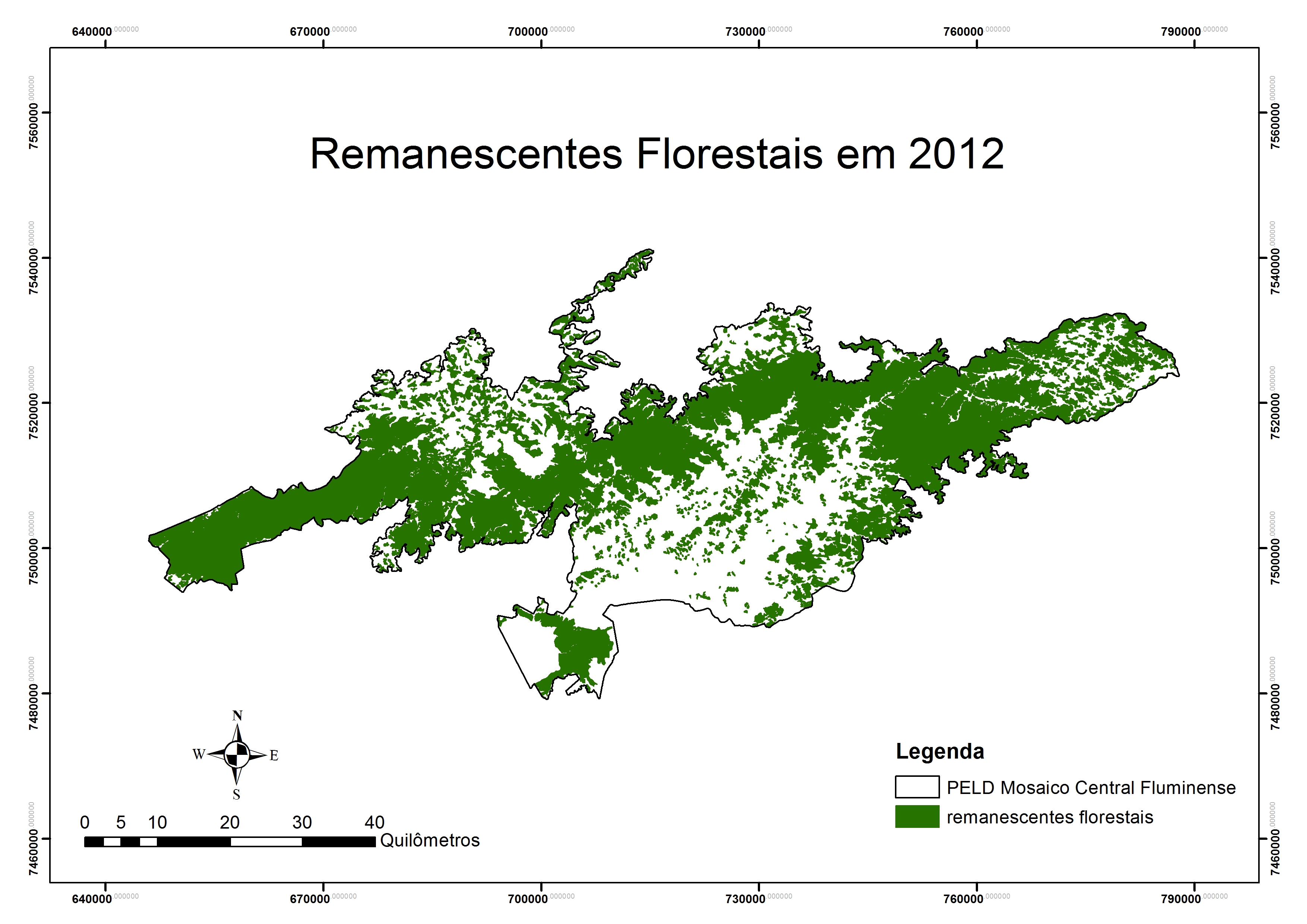
Covers an elevational gradient from 0 to 2,200 m in the Serra dos Órgãos mountain range, with high elevation grasslands (campos de altitude), cloud and lowland rainforests in the Atlantic Forest biome. In the lowlands it includes fragmented landscapes due to deforestation occurred in the last 500 years, with a variety of land uses in the matrix were fragments are inserted. Long term studies and monitoring actions focus on the effects two main factors: effects of climate change and land use. Presents high species richness, embracing a National Park (Parque Nacional da Serra dos Órgãos), a state park (Parque Estadual dos Três Picos), a private reserve (Reserva Ecológica Guapiaçu), and other federal and state protected areas.
-
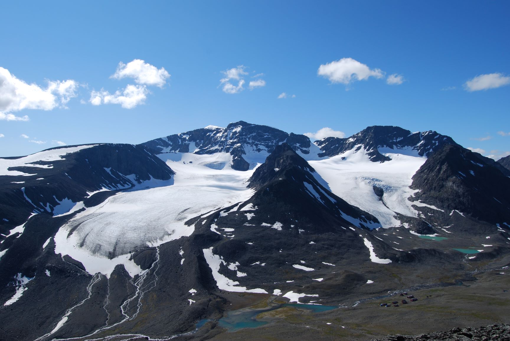
Tarfala Research Station is located at 1130 m a.s.l. in the high alpine Kebnekaise mountains, northern Sweden. The Tarfala valley catchment reaches from 2100 to 500 m a.s.l. Vegetation spans high alpine flora, mountain heath and meadows and the upper mountain birch forest zone. The lake, rivers and glacier meltwater streams is part of the headwaters for the unregulated Kalix River. The station was established in 1946 with the main aim to study glacier massbalance. The best known glacier is Storglaciären which is one of the most well studied glaciers in the world. The glaciers and terrestrial and aquatic ecosystems formed by the harsch climate in this area is now changing rapidly. Over the years the environmental monitoring program has expanded and includes today mountain meteorology, water discharge and chemistry, permafrost and vegetation. The station belongs to Stockholm University and is part of the Swedish Infrastructure for Ecosystem Science (SITES).
-
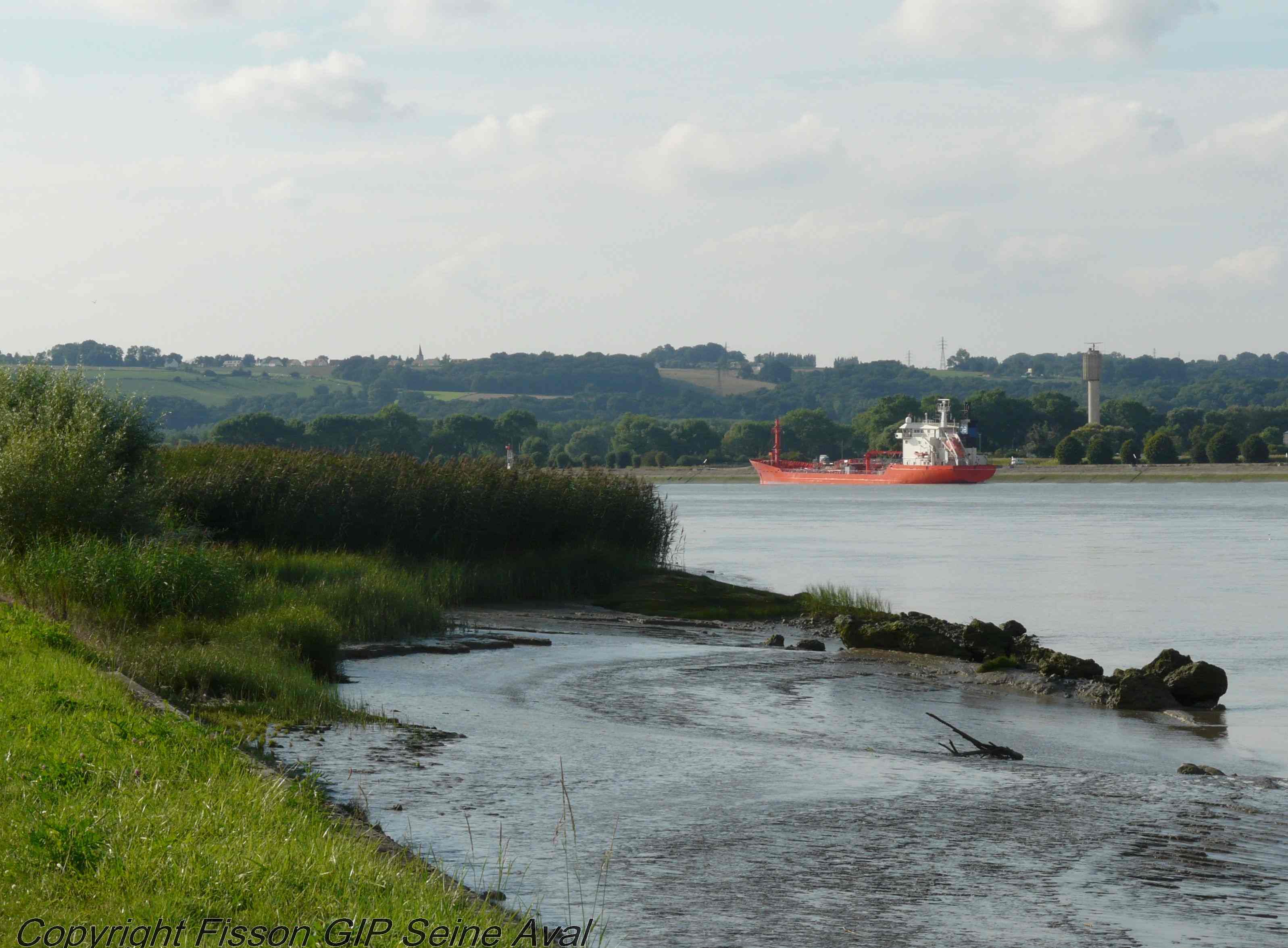
The LTSER Zone Atelier Seine belongs to LTER-France network and is located in Seine River Basin. The ZA Seine general aim is the study of a whole region. How its inhabitants construct the aquatic environment, as well as the quality of surface- and ground-waters may be seen as the dominant scientific question. The question is posed at various scales in space (from sub-catchments to the whole basin), and in time (from historical analysis starting in the Middle-Age to prospective studies for the next century).