
landscape fragmentation
Type of resources
Available actions
Topics
Keywords
Contact for the resource
Provided by
Years
Formats
Representation types
-
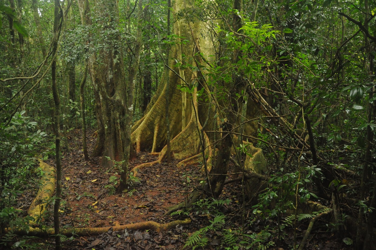
The site is composed by a set of Atlantic Forest fragments and restoration sites scattered in an agricultural landscape in north of Parana state, south Brazil. The forest in this region is a seasonal semi-deciduous form of Atlantic Forest, which undergone strong conversion rates from 1940 to 1980 and presently has only 8% forest cover, distributed in a myriad of small fragments. Forest fragmentation, fertilizer and pesticide leakage from agricultural fields and urbanization are the main regional drivers of environmental change. In each sub-site (forest fragment or restoration site) we are sampling flora, fauna and ecosystem attributes (forest biomass, litter fall, litter decomposition etc). The site is maintained by Londrina State University
-
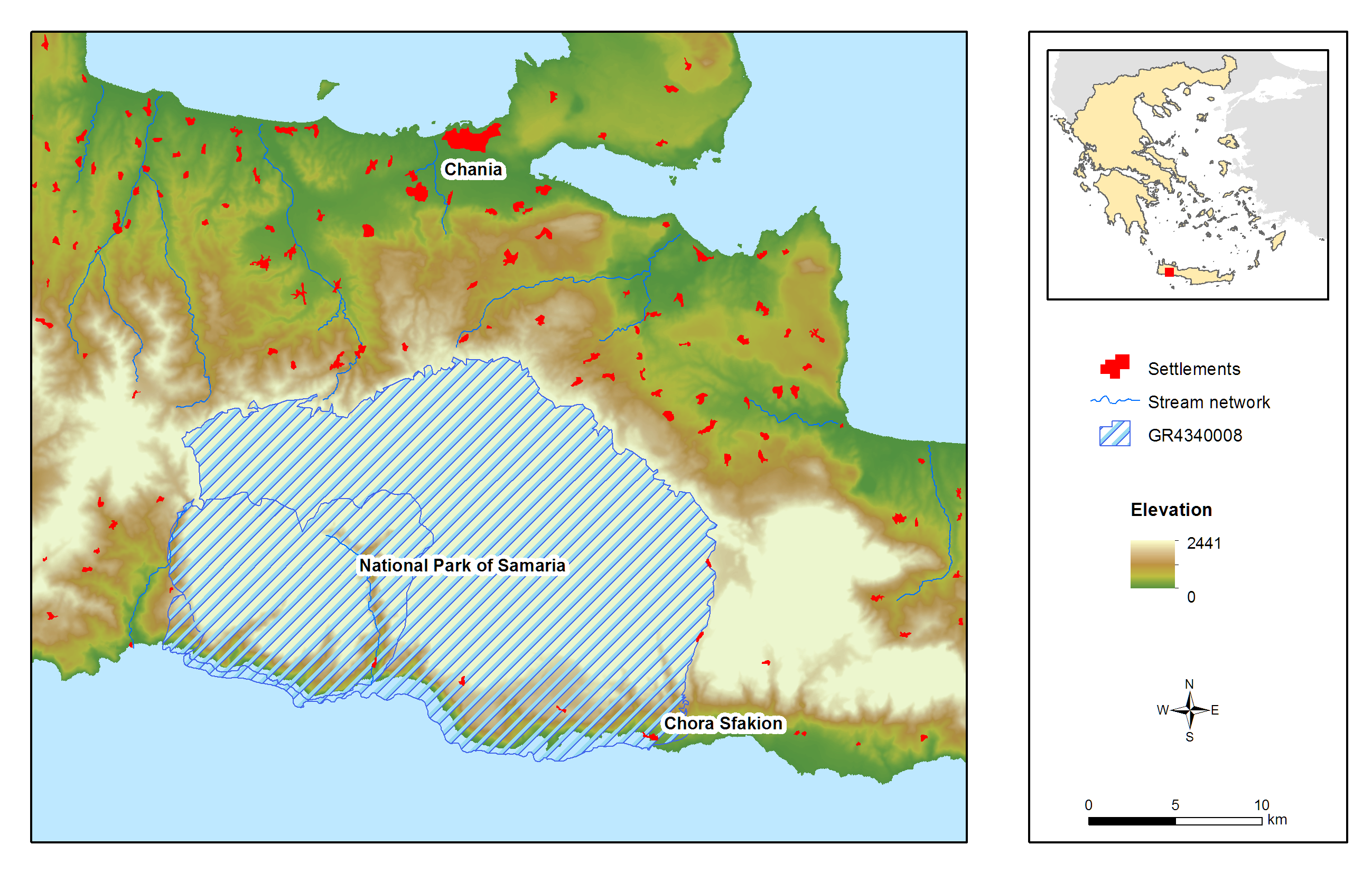
Samaria (White Mountains) National Park is located on the West part of island of Crete and was declared as a National Park via a Royal Decree in 1962. It is a muli-designated area and specifically a National Park, Landscape of Outstanding Beauty, Natura 2000 site coded GR 4340008 and GR4340014 and Biosphere Reserve in the framework of the “Man and Biosphere” Programme of UNESCO. It has been awarded with the European Diploma of Protected Areas of the Council of Europe. Also a hotspot for biodiversity and a place with a strong and important anthropogenic environment (history, special songs, traditions, etc.). It contains one of the largest gorges in the Balkans, Samaria Gorge, with a total length of 13 km while nine main gorges are located within the area of the White Mountains. These specific landscape configuration schemes sustain unique abiotic and biotic environmental characteristics, most of them unknown, because of the site’s wilderness and difficultness for direct scientific filed work. The specificity of the area can be easily identified in numbers: 58.454 ha, altitude ranging from 0-2.454m, more than 50 summits higher than 2000 meters a.s.l., 14 different types of habitats, approximately 40% of the entire extent of the county of Chania. Mean Annual Rainfall is between 600mm to 2000mm depending on the elevation. The entire area comprises one of the two main environmental lungs of Crete and a configuration leading to the current meteorological and hydrological conditions set in the western part of the island. President of the National Park is Dr. Petros Lymperakis, researcher from the Natural History Museum of Crete (lyberis@nhmc.uoc.gr). The National Park is characterized by a rich biodiversity, a high degree of endemism in fauna and flora, distinctive geological configurations and specific landscape features. Distinctive species of fauna found in the area are: the Cretan wild goat (Capra aegagrus cretica), the largest mammal of the island, the Cretan wildcat (Felis sylvestris cretensis) and a species of mouse (Acomys minous) which is considered to be rare. The rich avifauna of the area includes 69 species, with Gypaetus barbatus among others. The area houses 172 endemic species and subspecies, while 97 of them are endemic to Crete and 24 are specifically endemic (steno-endemic) to smaller areas. Some of the most distinctive species are: Cephalanthera cucullata, Nepeta sphaciotica, Bupleurum kakiskalae and Zelkova abelicea. The past 2 years a complete survey has begun in order to identify the Park’s central environmental characteristics. Nowadays, the monitoring system is comprised by: 1) Monitoring and surveillance of 15 terrestrial habitats and 34 species of flora. 2) Monitoring and surveillance of 256 species of avifauna. 3) Monitoring and surveillance of all possible species of fauna, including coastal and marine species. 4) Monitoring and surveillance of two marine habitats. 5) Recording of meteorological and hydrological conditions via four (4) meteo-stations located in the vicinity of the National Park and transmittance of data through the internet. The basic threats and pressures characterizing the site can be cumulated in: Α) Landscape fragmentation Β) Desertification induced by overgrazing and uncontrolled fires C) Modifications in water and groundwater regime induced by large scale infrastructures D) Poaching and uncontrolled abstraction of endemic species of flora E) Massive touristic flow and F) Relative medium and large-scale touristic infrastructures.
-
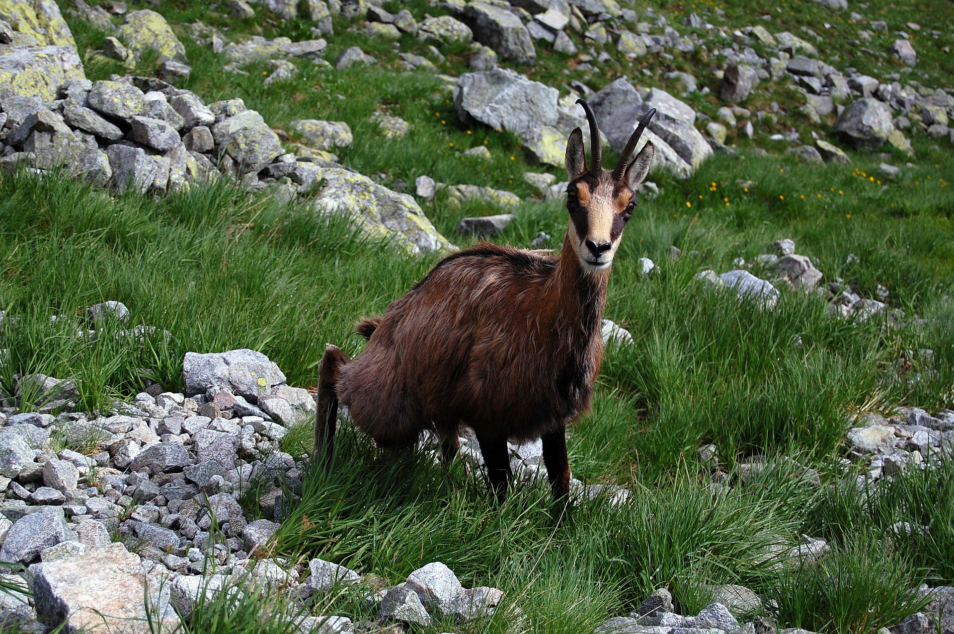
The Tatra National Park was established in 1954 to protect the Polish part of the Tatra mountains: both the High Tatras and Western Tatras, plus the northern foothills of the range. The area of the Park is approx. 212 km2, with no formally established buffer zone. Since 1992, the Park has been included in the UNESCO MaB Reserve (covering both Polish and Slovak Tatras - please see its separate description as the "Parent site" here on this website). It is also also included in the Natura 2000 network: both as “bird” Special Protection Area (SPA) and “habitat” Site of Community Importance (SCI) - the code PLC 120001. The Park protects nature, landscape, and cultural heritage of the only truly alpine mountain range in Poland. Although currently devoid of glaciers (however, dotted with a number of beatiful mountain oligotrophic lakes instead) its geomorphology is largely a result of glacial activity which shaped its crystalline, metamorphic and sedimentary bedrocks. The mountains are characterized by climate, soils, hydrological features (mountain springs and lakes), caves and karst areas, and rich biodiversity typical of subalpine and alpine environments. Also characteristic are altitudinal vegetation zones / belts (described elsewhere in this profile), These vegetation zones span from mixed forests, through coniferous forests and dwarf pine to Alpine meadow communities, above which sparse vegetation endures among rocks and screes. About 2/3 of the Tatras are covered by forest ecosystems. Most important tree species are Picea abies and Abies alba, although Pinus sylvestris, Pinus cembra, Larix decidua and Pinus mugo occur as well, accompanied birch (Betula sp.) and rowan (Sorbus sp.). In mixed forests occurring at lower elevations, species of beech (Fagus sp.) and maple (Acer sp.) can be found. The Park's ecosystems can be divided into terrestrial forest ecosystems (occupying almost 13 000 ha), terrestrial non-forest ecosystems (approx. 7770 ha, 49 plant communities) and freshwater ecosystems (approx. 192 ha, out of which lakes occupy approx. 149 ha). As much as 60% of the Park is covered by habitats requiring conservation (32 types of habitats of Community importance) The Park is home to more than 10 000 species (approx. 5500 species of invertebrates, 290 - vertebrates, 1000 - vascular plants, over 1000 - fungi, 700 - lichens, 500 - mosses etc.). Out of them as many as 1000 are endemites. The Tatras are an important centre of endemic fauna and flora, including rare relic species. There are 35 endemic species mong flowering plants alone. Examples for regional endemic species are: Erysimum wahlenbergii, Cochlearia tatrae, Pulsatilla slavica and Erigeron hungaricus. The Alpine meadows are renowned for their diversity. About 300 plant species can be found there. Various species in the Alpine environments are interpreted as glacial relicts, e.g. Ranunculus alpestris, Ranunculus glacialis, Dianthus glacialis, Gentiana frigida, Primula minima and Saxifraga aizoides. In snowbed environments Salix herbacea and Salix reticulata are characteristic. The Tatra Mountains are famous for their large predator species such as the wildcat (Felis silvestris), lynx (Lynx lynx), wolf (Canis lupus) and brown bear (Ursus arctos), which are largely extinct in other parts of Central Europe. Characteristic bird species are the Golden eagle (Aquila chrysaetos), Eurasian nutcracker (Nucifraga caryocatactes), rock ptarmigan (Lagopus muta), Eurasian eagle-owl (Bubo bubo), Western capercaillie (Tetrao urogallus) and black grouse (Tetrao tetrix). An endemic subspecies of the chamois exist in the Tatra as well (Rupicapra rupicapra tatrica). 29 animal and 6 plant species are species of Community importance. The site has code:LTER_EU_PL_017
-
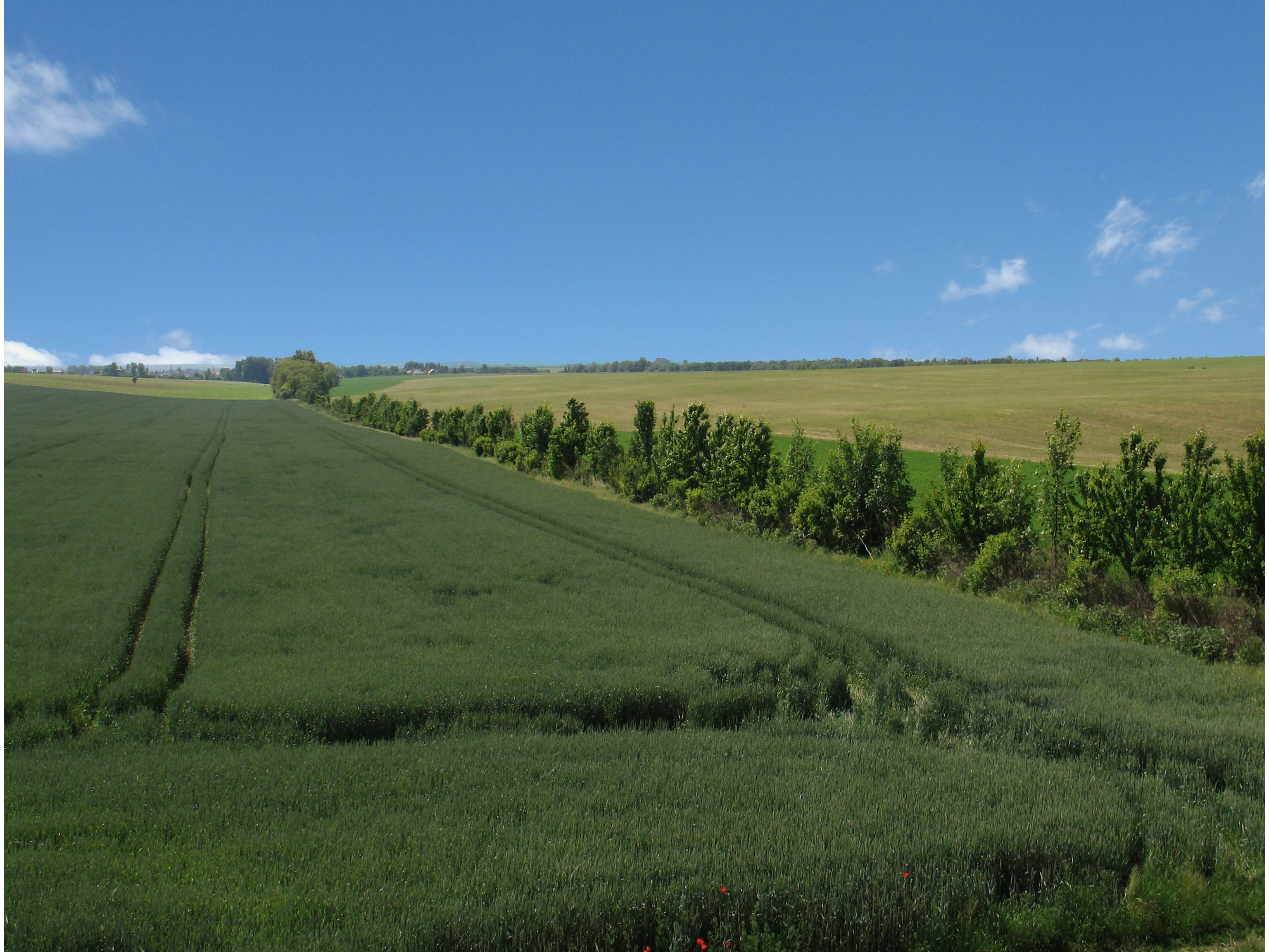
LTSER Trnava is located in the south-west Slovakia, in territory of one city (Trnava) and 44 rural municipalities with total area of 741.33 km2. Arable land dominate (65.13 %), followed by forests (17,78%), built-up area 7.84%, grassland (2.15%), gardens (1.83%), water bodies (1,38%), vineyards (0,81%), orchards (0.2%), and other plots (2.9%). The main part of the LTSER (central and southern parts) is located in the Danubian Lowland. Because of the best, most fertile soils and favourable climatic condition, it is intensively used for agriculture, especially as arable land. In this part of LTSER is located the largest settlement – Trnava. It represents the administrative centre of the county and region with highest population, trade and industry. Hilly northwest part of the LTSER, located in the Little Carpathians Mts. belongs to the Malé Karpaty Protected Landscape Area. This is the only large protected area having vineyard character in Slovakia; vineyards forms transition belt between lowland arable land and forested hills/mountains. Several types of deciduous forests are developed – oak-hornbeam and beech forests are most common, in steeper sites are developed ravine forest dominated by ash and maple. The LTSER represents intensively used industrial and agricultural area with specific environmental problems (strong degree of contamination of environment, the degradation processes of agricultural land, etc.) and low degree of ecological stability. Use of the most productive soils for construction of industrial parks represents a significant environmental issue.
-
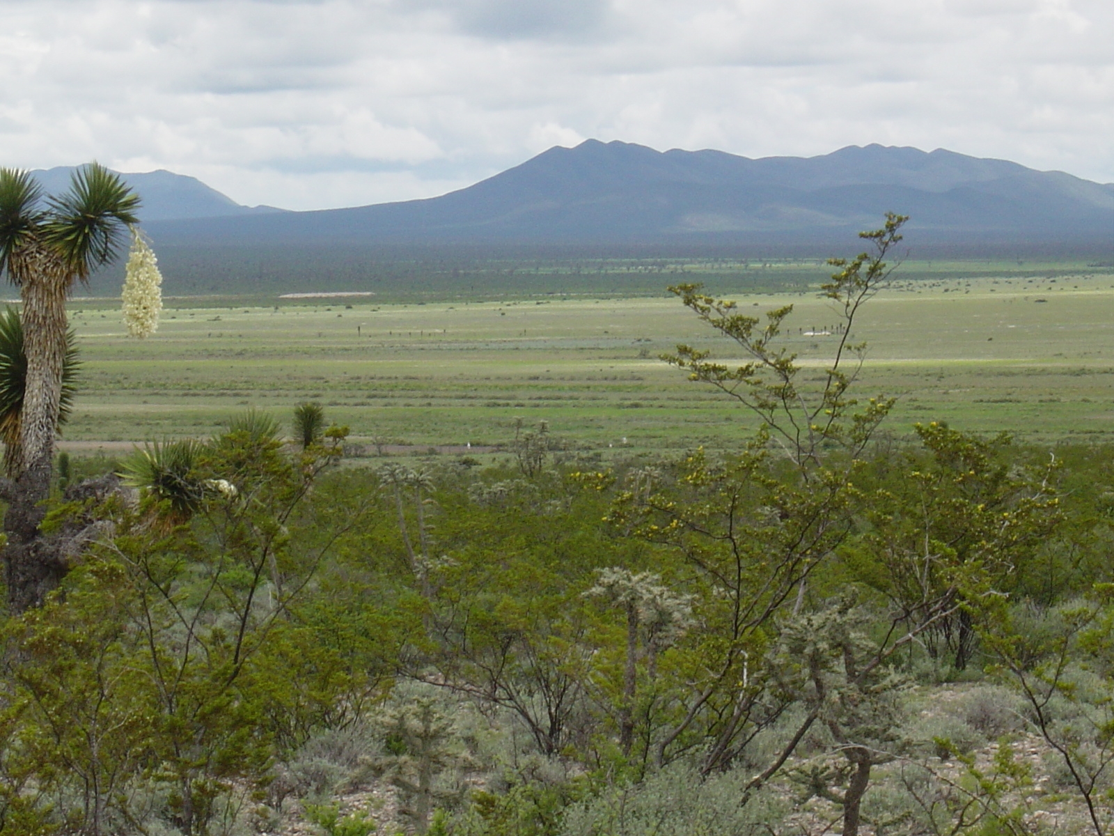
Los esfuerzos de investigación se enfocan a la región del altiplano mexicano conocida como “El Tokio”, donde se distribuyen los pastizales gipsófilos y salinos en el noreste de México y la cual es reconocida como una región prioritaria para la conservación de especies de aves residentes endémicas y migratorias. El área se caracteriza por valles intermontanos en los cuales se presentan suelos con altos contenidos de yeso y carbonatos de calcio, así como pastizales de porte bajo que no rebasan los 15 cm de altura en promedio. En estos valles habita el perrito llanero mexicano (Cynomys mexicanus), especie clave en el ecosistema. La vegetación circundante a estos valles está caracterizada por matorrales de gobernadora (creosote bush) con elementos sobresalientes de Yucca. El área es fuertemente impactada por actividades agrícolas y ganaderas, las cuales se llevan a cabo desordenadamente y sin medidas de mitigación.
-
The area is located in north-east of Slovakia on the border with Poland and the Ukraine, in Bukovské vrchy mountains which are part of the Carpathian mountain range. It has a highland to upland character. The study area is in Snina district within the Prešov region and is part of the National Park of Poloniny and East Carpathians Biosphere Reserve. It belongs to ŕemore wilderness areas in Slovakia, remote from industrial centres and with restricted accessibility. In the year of 1980-1986, 7 villages were removed as a result of construction of the water reservoir Starina. There are currently 10 villages within the study area.
-
As in http://forest.jrc.ec.europa.eu/activities/forest-mapping/forest-cover-map-2000/ clipped for PA Montado and projected using EPSG:3763 (ETRS89/Portugal TM6).
-
The same as http://land.copernicus.eu/pan-european/corine-land-cover/view, clipped for PA Montado and projected using EPSG:3763 (ETRS89/Portugal TM6)
-
The same as http://land.copernicus.eu/pan-european/corine-land-cover/view, clipped for PA Montado and projected using EPSG:3763 (ETRS89/Portugal TM6)
-
A map produced by the Portuguese Geographic Institute with a minimum spatial unit of representation of 1 ha. Spatial accuracy 5.5 m and thematic accuracy 85.13%, with an error of 2% for a confidence level of 95%. There are several levels of detail, concerning land occupation.