
landscape pattern
Type of resources
Available actions
Topics
Keywords
Contact for the resource
Provided by
Years
Formats
Representation types
-
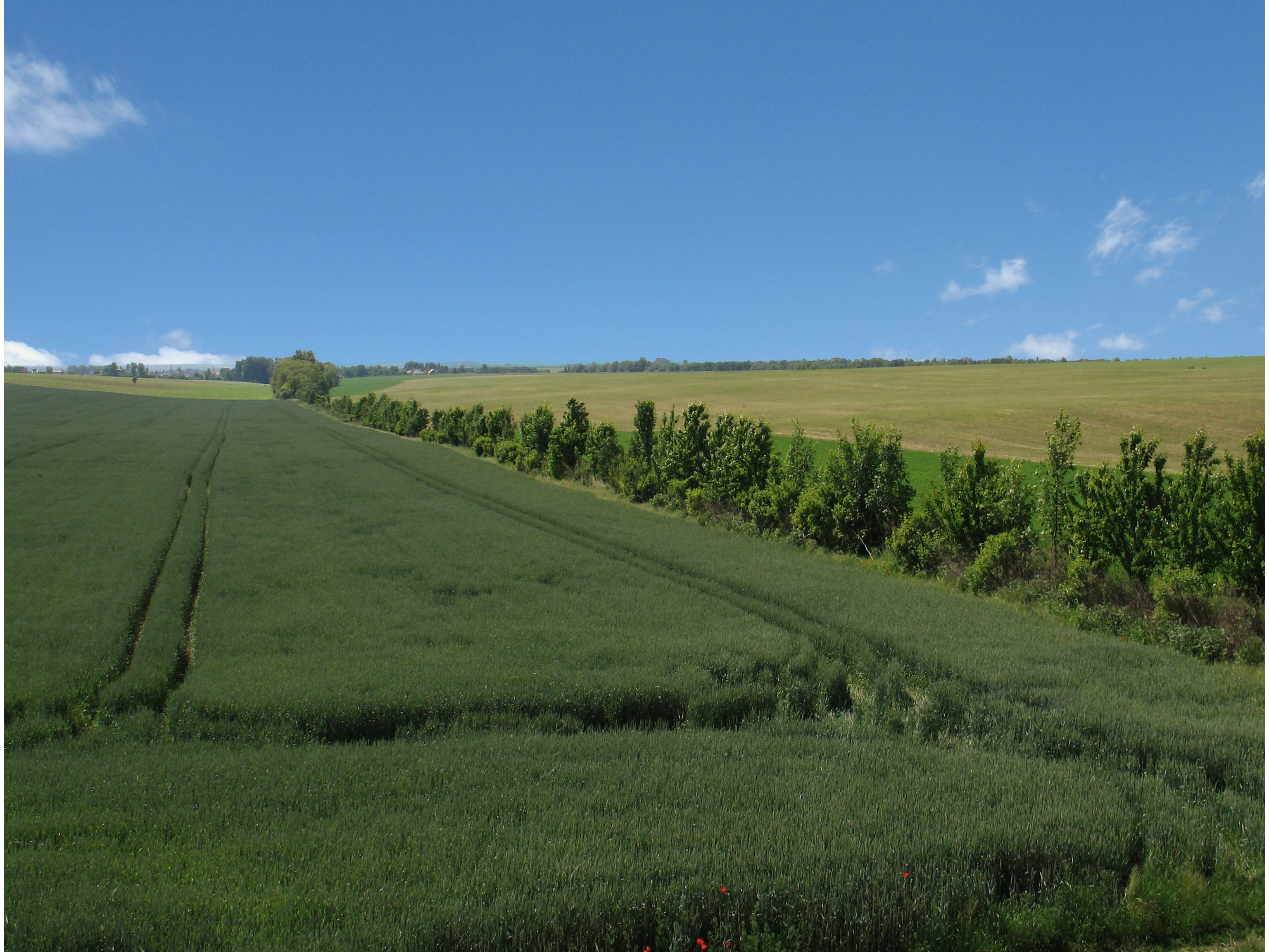
LTSER Trnava is located in the south-west Slovakia, in territory of one city (Trnava) and 44 rural municipalities with total area of 741.33 km2. Arable land dominate (65.13 %), followed by forests (17,78%), built-up area 7.84%, grassland (2.15%), gardens (1.83%), water bodies (1,38%), vineyards (0,81%), orchards (0.2%), and other plots (2.9%). The main part of the LTSER (central and southern parts) is located in the Danubian Lowland. Because of the best, most fertile soils and favourable climatic condition, it is intensively used for agriculture, especially as arable land. In this part of LTSER is located the largest settlement – Trnava. It represents the administrative centre of the county and region with highest population, trade and industry. Hilly northwest part of the LTSER, located in the Little Carpathians Mts. belongs to the Malé Karpaty Protected Landscape Area. This is the only large protected area having vineyard character in Slovakia; vineyards forms transition belt between lowland arable land and forested hills/mountains. Several types of deciduous forests are developed – oak-hornbeam and beech forests are most common, in steeper sites are developed ravine forest dominated by ash and maple. The LTSER represents intensively used industrial and agricultural area with specific environmental problems (strong degree of contamination of environment, the degradation processes of agricultural land, etc.) and low degree of ecological stability. Use of the most productive soils for construction of industrial parks represents a significant environmental issue.
-
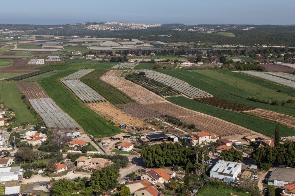
The Ramat Hanadiv LTSER platform is a unique texture of the region surrounding Hanadiv Valley and Taninim River basin. It integrates nature values with agriculture, rural communities, and heritage sites. The platform extends over an area of apprx. 15,500 hectares, including Ramat Hanadiv Nature Park and five neighboring municipal Councils: 1. Binyamina Givat-Ada (Urban; Local Council ) 2. Zikhron Ya’akov (Urban; Local Council ) 3. Hof Hacarmel (Rural; Regional Council) 4. Jisr A-Zarqa )Arab village; Local Council) 5. Alona (Rural; Regional Council) Ramat Hanadiv LTER site is located in the heart of the platform, at the southern tip of the Carmel Mountain Ridge. Ramat Hanadiv spreads over approximately 450 hectares of typical natural Mediterranean vegetation, surrounding the Memorial Gardens in which Baron Benjamin Edmond de Rothschild and his wife are buried. With mean annual rainfall of 500-600 mm and mean annual temperature of 170C-190C, Ramat Hanadiv Nature Park is characterized by diverse habitats and communities.
-
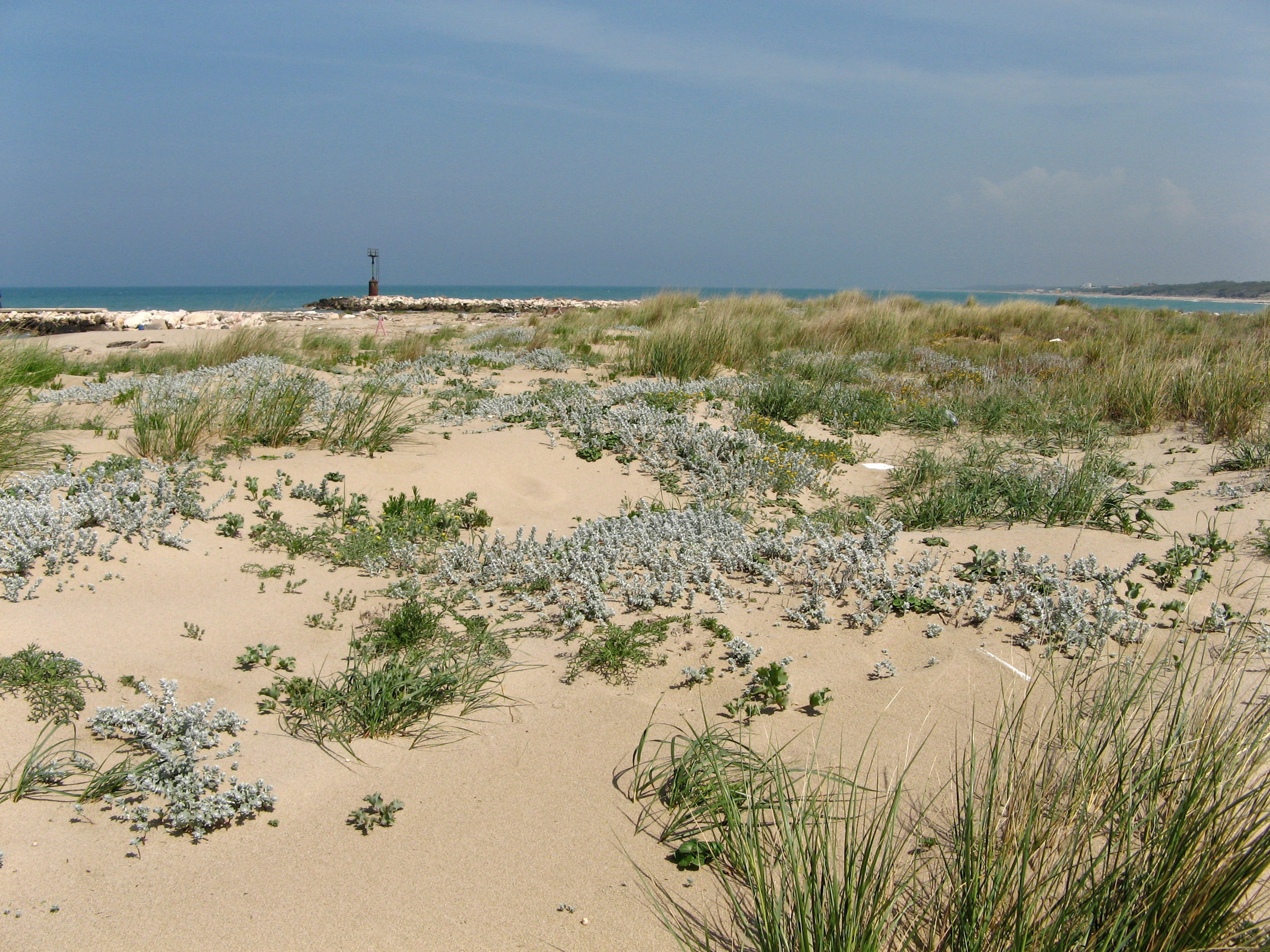
SCI IT7222217 Foce Saccione-Bonifica Ramitelli (Campobasso) The site includes 1 Natura 2000 site along the central Adriatic coast, where the last fragments of natural vegetation zonation on sand coastal dunes occur (shore vegetation, embryo and mobile dune vegetation, annual Mediterranean grasses, costa dunes with Juniperus spp and wet dune slacks).
-
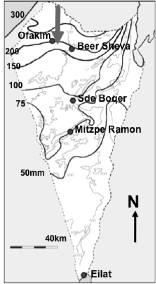
Designation: Ecosystem research and management under land-use and climate change. Climate: Mean annual precipitation 150-200mm between November and April; mean maximum summer temperature 34° C, mean minimum winter temperature 6° C. (Data avialable for 15-min interval meteorological measurements and daily summaries for rainfall, air and soil humidity and temperature, wind velocity and direction, from 1997 to the present.) Principal biomes: Semiarid shrub land (shrub-grass steppe), rocky and loessial watersheds, ephemeral streams. Vegetation is dominated by patch-forming dwarf shrubs (Noaea mucronata, Atractylis serratuloides and Thymelea hirsuta) with species-rich annual winter vegetation in the inter shrub (dominated by Stipa capensis and other grasses) and shrub patch understory (dominated by Anagallis arvensis and other forbs). As a result of drought there are also two new sub biomes: crust land and grass land. Management: Livestock grazing excluded in central watershed (20 ha) since 1987; restricted/controlled grazing by Bedouin sheep herds in surroundings; in the outer parts of the area native and exotic trees were planted in 1985-87 in contour dykes (‘shikhim’) on the slopes and in terraces in the riverbed. Research: 1. Long-term experiments (up to 20 years) for monitoring changes in abundance, diversity, species composition and distribution, and development of biological soil crusts (BSC), perennial plants (dwarf shrubs) and winter annuals in relation to rainfall, soil disturbance, patch distribution, and livestock grazing. 2. long term hydrological studies on rainfall-runoff relationship under natural and manipulation experiments. 3. Short-term experiments and surveys (1 to 5 years) A. for testing hypotheses about the detailed processes, mechanisms and interactions involved in the development, dynamics and stability of shrub- and BSC-dominated patches, their landscape mosaic patterns and their feed-back relationships with flows of materials through the landscape; B. for testing hypothesis on the effect of geodiversity on the stability of shrub land to extreme drought and understanding state changes in drylands. 4. Long term studies on cross scale-cross level interactions in natural and human modified landscape. 5. Network-related research including regional comparisons of herbaceous plant productivity in open rangeland along the Israeli North-South rainfall gradient, and global comparison of woody plant diversity effects on ecosystem functionality of most dryland regions of the world.
-
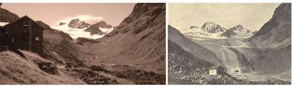
The site is located at the main Alpine ridge in Silvretta group right at the border between Austria and Switzerland. Jamtalferner glacier and it's forefield is subject to scientific reseach for more than 100 years. Current monitoring includes climate, hydrology, glacier mass balance, permafrost, paleoglaciology, society and biotic succession in the periglacial area. In addition to that, several short time research projects are carried out, e.g. concerning glacier albedo. The site inlcudes the are from the highest peaks at 3384 m a.s.l. and the valley further down to the communities of Galtür and Ischgl (1263 m a.s.l.). More information can be found at the website of the environmental education program Jamtal www.umweltbildung-jamtal.info.
-
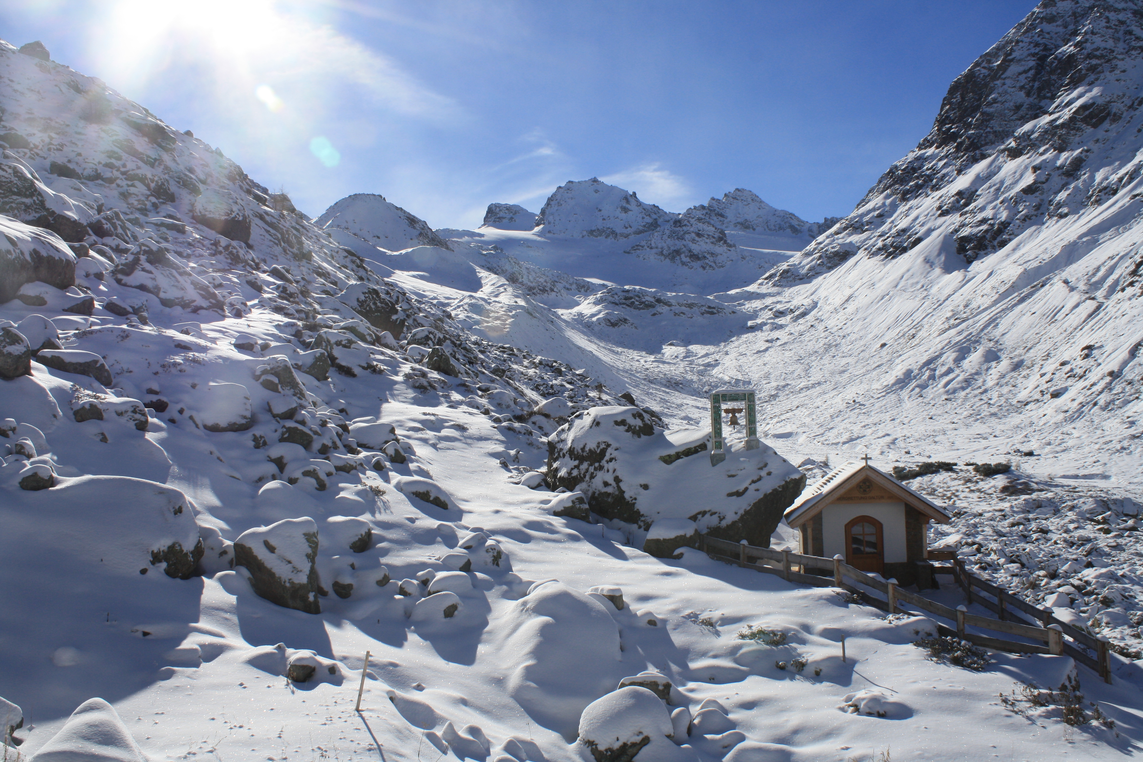
The LTSER platform Oberes Paznaun includes the communities of Ischgl and Galtür (225 km²), and covers an elevation range from 1263 to 3384 m.a.sl.. The village of Galtür is one of the highest permanently inhabited places in the Alps. Fluchthorn, the highest peak of the largely glacier-covered Silvretta, was taken down by about 30m in 2023, when a major rock fall occurred as a result of reducing permafrost. Both the effects of climate and those of land use change affect the very sensitive livelihoods in the are, exposed as they are to natural hazards, such as avalanches, rock fall and floods. The region was economically weak until winter tourism boomed from the 1970s. Skiing as dominant source of income now has an impact on land use as well as on social and economic structures in the region. Management issues arise from the high number of incoming tourists. Local stakeholder networks involved in spatial planning and hazard management are also part of the LTSER Platform. The local Alpinarium museum is dedicated to presenting the livelihoods of mountain communities and acts as a local hub for linking science and society. Apart from the long-term monitoring of the environmental parameters, initiated in 1895 with glacier length changes, the socio-economic research in the Paznaun area dates back to the 1960s. Socio-economic and socio-ecological research in the region focuses on the multiple feedbacks between environmental and socio-economic changes in the region. The avalanche disaster of Ischgl and Galtür in 1999 affected disaster management and related structures in many ways, not only for the region, but for all of Austria, for instance leading to the foundation of crisis intervention teams. The question of how to deal with impacts of climate change, for example on hydrology and water management, is part of research projects in the area connecting stakeholders and scientists. The overarching aim of the platform Oberes Paznaun is linking up geosphere, atmosphere, hydrosphere and biosphere research with local political and administrative processes for sustainable development in a warming future.
-

Historically, the role of the Galapagos Islands has been considered critical due to the evolutionary diversification induced by natural and historical isolation. The Galapagos National Park was established in 1959, based on its historical importance associated with Charles Darwin's voyage and its rare and endemic biodiversity, composed of unique vertebrate and plant communities (Rozzi et al. 2010). In 1978, the Galapagos Islands were declared a UNESCO World Heritage Site, a critical factor associated with this national park (Rozzi et al. 2010). The Galapagos Islands are a pristine area with local and regional climates influenced by the interaction of ocean currents and winds driven by the Inter-Tropical Convergence Zone; ITCZ (Conroy et al. 2008, Trueman and d'Ozouville 2010). The long-term programme includes forty natural aquatic ecosystems (lakes, ponds, lagoons and swamps) that will be sampled on the islands of San Cristobal, Santa Cruz, Isabela and Floreana, where possible along a lowland-highland gradient. The number of sampling points will vary according to environmental heterogeneity and the presence of a littoral region, among other factors.
-

The Cairngorms National Park is one of 15 National Parks in the UK (one of two in Scotland) and is Britain's largest National Park (4,528 km2). It is the location for some of the most spectacular landscapes in Britain and is home to an incredible diversity of wildlife and plants. http://cairngorms.co.uk/the-park/facts-figures/ The aims of the National Park are: • To conserve and enhance the natural and cultural heritage of the area; • To promote sustainable use of the natural resources of the area; • To promote understanding and enjoyment (including enjoyment in the form of recreation) of the special qualities of the area by the public; • To promote sustainable economic and social development of the area’s communities. Cairngorms National Park, seven broad habitats can be identified: • Enclosed farmlands • Woodlands • Open waters (rivers, lochs, wetlands and floodplains) • Mountains • Moorland • Semi-natural grasslands • Urban • Population of c17,500 • 25.8% of population over 60 (higher than Scottish average) • Average health index in top 25% of Scotland (based on deprivation indices) • Extensive core paths network • 55 Munros including 5 summits over 4000 feet • 3 ski centres • National Cycle Network Route 7 • 1 Long Distance Route (Speyside Way) • Relatively low atmospheric pollution • Annual precipitation over 2250mm on summits and under 900mm in straths • Average annual snow cover 200 days on summits and 50 days on low-ground • Prevailing winds from south-west
-
Mols Bjerge National Park or Nationalpark Mols Bjerge is a Danish national park in the area known as Mols Bjerge (lit.: Mols Hills) in Syddjurs Municipality, Central Jutland, inaugurated on the 29th of August 2009. The protected area, measures 180 square kilometres (69 sq mi) in size. The Mols Hills, reaching a height of 137 metres (449 ft), are centrally located in the park, and take up 2,500 ha. "More than half of all wild Danish plant species" can be found at Mols Bjerge. The park comprise most of the southern parts of the headland of Djursland. It is bounded on the east by the sea of Kattegat, the forests of Kaløskovene in the west and to the south by multiple inlets, coves and plains of glacially generated moraine. The town of Ebeltoft, along with villages and summer house residence areas, are considered part of the park. Land in the national park is held under both private and state ownership. Nearly 33% of the park is cultivated and 80% of the hill area is under private ownership. Mols Bjerge National Park has a rolling and widely varying topography of woodlands and open countryside, created with the end of the last ice age. Elevation in the park area varies in height rising to a maximum of 137 metres (449 ft) in Mols Hills, with many types of habitats such as heath, forests, pastures, bogs, meadows, a variety of coastal habitats and sea
-
Vestskoven is a 15 km2 ongoing afforestation area located 15 km west of central Copenhagen. Since 1967 arable land has successively been bought up for afforestation in order to establish a large forest area for outdoor activities and wood production. In 1998, afforestation chronosequences in oak (Quercus robur) and Norway spruce (Picea abies) were established as a research platform to quantify soil carbon dynamics, water recharge, nitrogen budgets and ground vegetation species diversity. The soil and grund vegetation species composition were resampled in the chronosequences after 13 years in 2011. Since 2003, an ICP-Forests Level II/Core plot with integrated monitoring under the UN Convention on Long-Range Transboundary Air Pollution (CLRTAP) is placed in an oak stand. Monitoring has developed over time. There is no time limit on the monitoring financed by the Ministry of Environment and Food in Denmark.