
landscape structure
Type of resources
Available actions
Topics
Keywords
Contact for the resource
Provided by
Years
Formats
Representation types
-
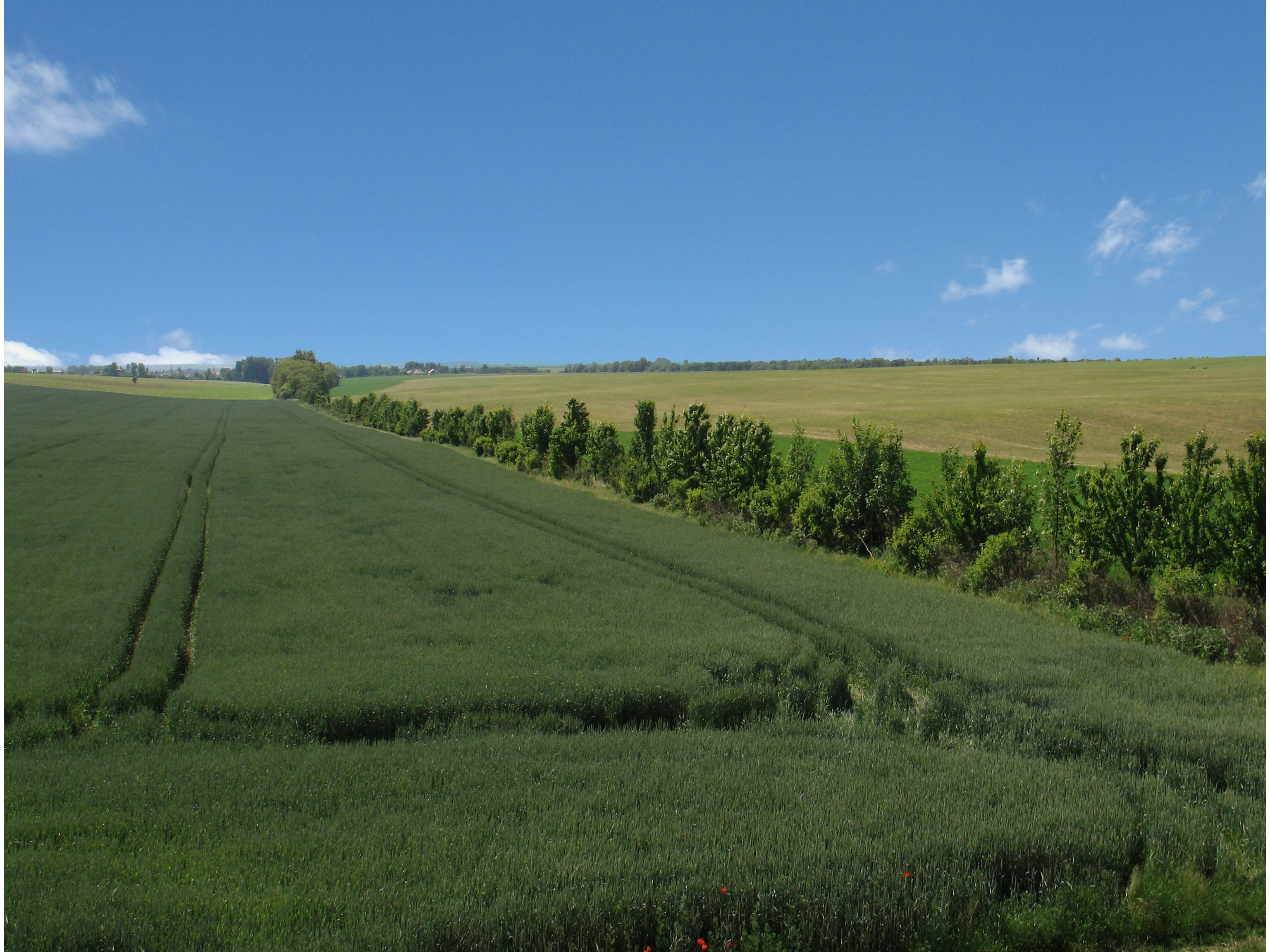
LTSER Trnava is located in the south-west Slovakia, in territory of one city (Trnava) and 44 rural municipalities with total area of 741.33 km2. Arable land dominate (65.13 %), followed by forests (17,78%), built-up area 7.84%, grassland (2.15%), gardens (1.83%), water bodies (1,38%), vineyards (0,81%), orchards (0.2%), and other plots (2.9%). The main part of the LTSER (central and southern parts) is located in the Danubian Lowland. Because of the best, most fertile soils and favourable climatic condition, it is intensively used for agriculture, especially as arable land. In this part of LTSER is located the largest settlement – Trnava. It represents the administrative centre of the county and region with highest population, trade and industry. Hilly northwest part of the LTSER, located in the Little Carpathians Mts. belongs to the Malé Karpaty Protected Landscape Area. This is the only large protected area having vineyard character in Slovakia; vineyards forms transition belt between lowland arable land and forested hills/mountains. Several types of deciduous forests are developed – oak-hornbeam and beech forests are most common, in steeper sites are developed ravine forest dominated by ash and maple. The LTSER represents intensively used industrial and agricultural area with specific environmental problems (strong degree of contamination of environment, the degradation processes of agricultural land, etc.) and low degree of ecological stability. Use of the most productive soils for construction of industrial parks represents a significant environmental issue.
-
High resolution hydrology recording mainly by PLSC_Sensors (measuring water level, temperature-depending on water level it is the ground air temperature or water temperature- and conductivity) but also by Hydrolab-Multiparameter Sensors (measuring temperature, oxygen, pH, conductivity, turbidity) for monitoring the soda pans in the vicinity of soda Lake Neusiedl. The on-line measurement of these wetland sensors in the “Seewinkel”-district are measuring at high time resolution of every three minutes. The locations of these sensors are in the soda pans, which mostly dry out at least once a year, and are as follows (in alphabetical order): Hydrolab-Waterquality_Multiparameter-Sensor - Fuchslochlacke: N47°47.376’ & E016°51.149’ PLSC-Sensor - Fuchslochlacke: N47°47.376’ & E016°51.149’ PLSC-Sensor - Graurinderkoppel: N47°43.400’ & E016°48.148’ PLSC-Sensor - Meierhof-Lacke (Apetloner Hof): N47°43.296’ & E016°49.359’ PLSC-Sensor - Unterer Stinker: N47°48.161’ & E016°47.098’
-
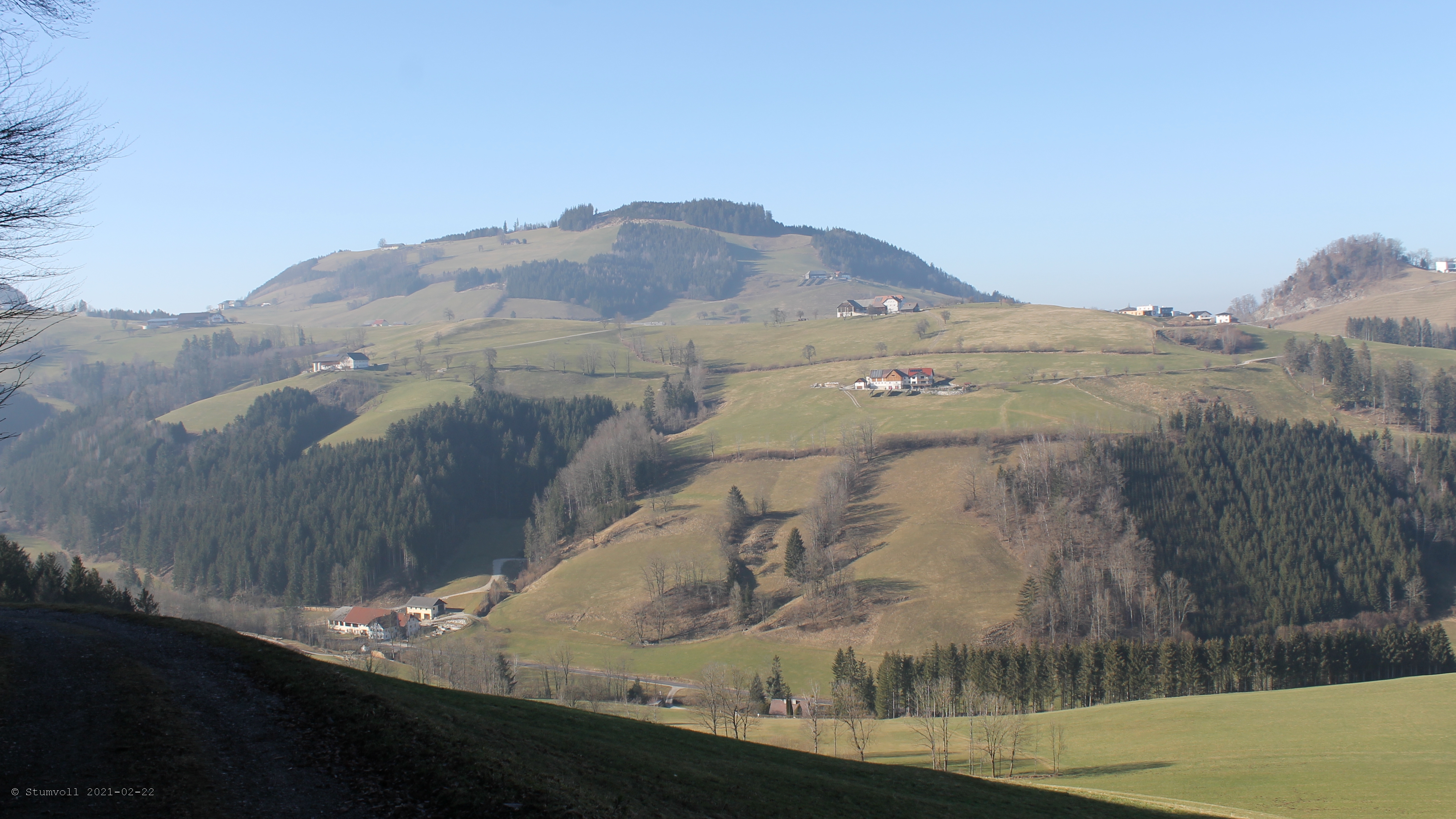
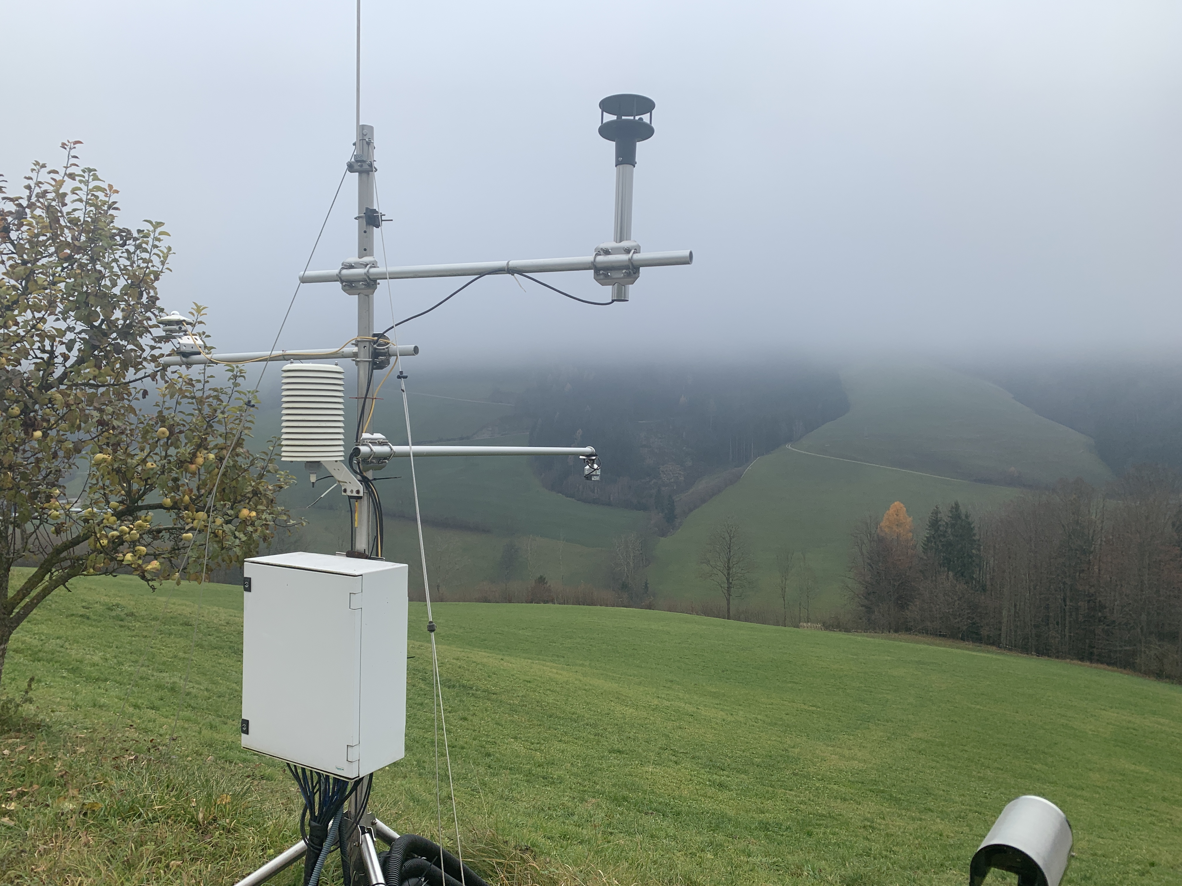
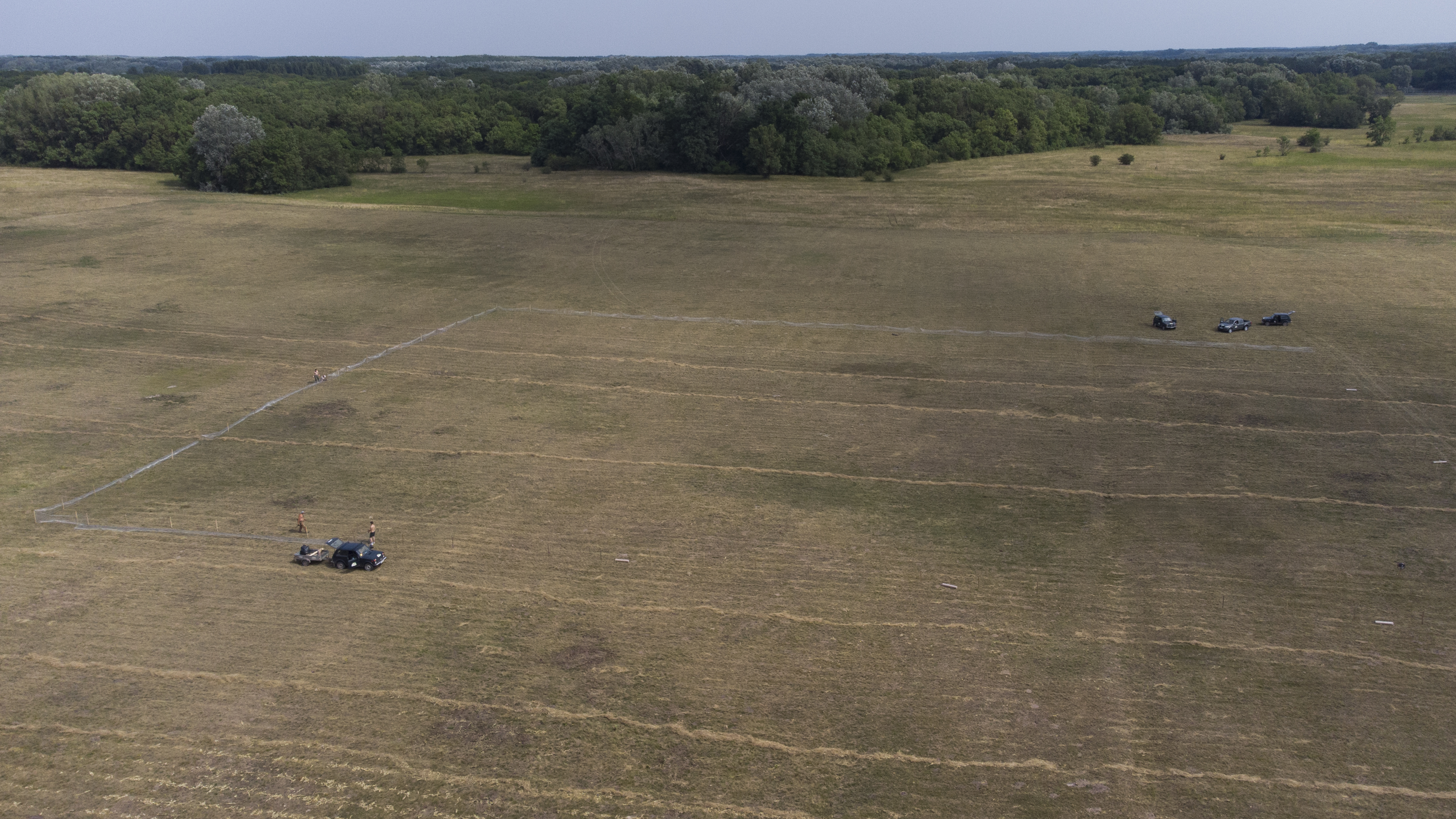
The ENGAGE working group (Geomorphological Systems and Risk Research at the Institute for Geography and Regional Research) has been running a long-term monitoring project to investigate landslides in Lower Austria. Landslides (translational and rotational failures, debris flows, rock avalanches, rock falls, etc.) number among the most abundant natural hazards in Lower Austria. Resulting from sporadic phases of activity it is essential to generate specific long-term measurement series, enabling the analysis of changes in surface movements as well as underground in connection with triggering factors. Therefore, in 2014 the project “NoeSLIDE – Monitoring diverse types of landslides in Lower Austria” was initiated. The research sites are compiled under the parent site "LTER NoeSLIDE" which has three subsites, of which one is the Hofermühle Landslide Observatory. The Hofermühle site is located in the district of Waidhofen a.d. Ybbs, Lower Austria. The site is located in the Flysch Zone, a geologically predestined zone known to be extremely prone to landslide processes in Austria. Within the 0.15 km² hydrological catchment of the Hofermühle torrent, landslide processes can be defined as complex, being constituted by shallow earth sliding in the middle and gently inclined part of the catchment nearby the torrent, accumulation of material and resulting earth flowing down the steepening torrent path. It can be defined as complex earth slide - earth flow, which has shown different phases of activity in the last 10 years on different parts of the landslide mass. Major activation occurred in 2011 (subsidence via sliding by 2 m in 2 weeks), re-activation in 2013 (formation of earth flow with 20m/h) and processes have slowed down significantly since then to only a few cm to dm per year on the parts affected by sliding – as far as known. To investigate both surface and sub-surface dynamics and potential interrelations, a varity of permant and individual measurement techniques are applied at the study site. Direct investigations include dynamic probing, percussion drilling and core sampling. Hydro-meteorological parameters are acquired via TDRs (time domain reflectrometry) probes, piezometers for groundwater estimation and a meteorological station (precipitation, temperature, snow height, wind, solar radiation). Sub-surface displacements are measured with both manual and automatic inclinometers. Surface dynamics are investigated via multi-temporal TLS (terrestrial laser scanning) and UAV-based SfM (unmanned aerial vehicle; structure from motion) data. Data from permanent installations is given in 5 min resolution (TDR, piezometer, meteorological station, inclinometer).
-
The monitoring of bird populations focused on wetland species. It included breeding bird surveys and bird migration (bird ringing) of species most common in the reed belt of Lake Neusiedl, and meadows surrounding the soda pans. Bird surveys of Biological Station Lake Neusiedl refer mainly to the INTERREG Project of “Vogelwarte 2” and were in close collaboration with the National Park “Neusiedlersee – Seewinkel” and “BirdLife Österreich”.
-
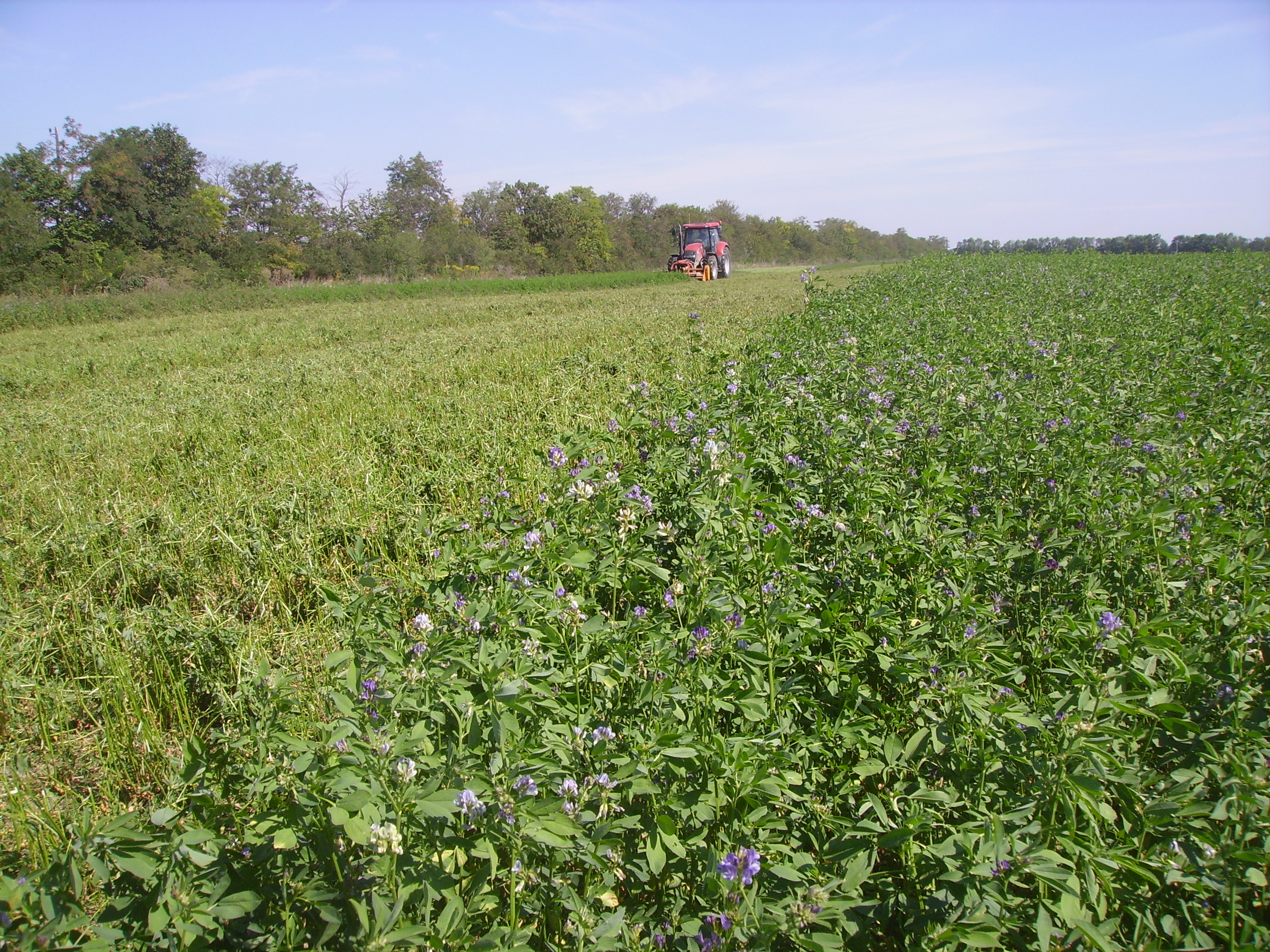
The Rutzendorf Experimental Station is an agricultural research site of the University of Natural Resources and Live Sciences Vienna (BOKU), belonging to the Landwirtschaftliche Versuchswirtschaften GmbH. It is representative for the productive soils managed as arable land in the Marchfeld area (Lower Austria). The soil is described as a silty loamy Calcaric Phaeozem (WRB), a Chernozem according to Austrian soil classification. Management on the farm is without livestock, no organic fertilizers are applied. The farm was converted to organic farming in the production year 2002/03. The 8-year crop rotation comprises luzerne (2 yrs), winter wheat*, grain maize, spring barley*, field peas*, winter wheat, winter rye. Cover crop mixtures are grown where indicated in the crop rotation with an asteric. Current research questions include to study (i) the long-term sustainability and productivity of the stockless organic arable system compared to a livestock-keeping system, (ii) the mitigation of climate change effects on the soil-plant system by reducing soil cultivation intensity, and (iii) the development of biodiversity following the conversion to organic farming and enhancement of landscape elements. Regularly meteorological data, crop yields and quality, physical, chemical and biological soil traits, weed species and diaspores, springtails, wild bees and other animal species are assessed. Studies have been conducted as research projects financed nationally and by the European Union, e.g. in two EIP projects.
-
Landslides (translational and rotational slides, debris flows, rock avalanches, rock falls, etc.) rank among the most common natural hazards in Lower Austria. As these processes often inherit sporadic phases of activity, it is essential to generate specific long-term measurement series, enabling the analysis of surface and sub-surface dynamics in connection with potential triggering factors. Therefore, in 2014 the project “NoeSLIDE – Monitoring diverse types of landslides in Lower Austria” was initiated. Three subsites are summarized under the parent site "LTER NoeSLIDE".where various types of landslide processes, Hofermühle (complex earth slide - earth flow), Gresten (Salcher landslide) and Brandstatt are monitored with "classic" as well as novel approaches. This includes surface and subsurface monitoring systems. The main research aims comprise implementation of long-term monitoring systems (10+ years) for continuous observation of gravitational mass movements, testing of novel and innovative methods on multiple locations and data availability in a WebGIS application for simple online analyses for authorized users.
-
The Jornada Basin Long-Term Ecological Research (LTER) program is part of a national network of long-term ecological research sites funded by the US National Science Foundation (NSF). The Jornada LTER program has been continuously funded since 1982 to develop general principles governing changes between grassland and shrubland ecosystems based on long-term data collected in the Chihuahuan Desert. Research themes at the Jornada LTER focus on vegetation change, climate and land use impacts on ecosystem function, and the role of dryland processes in structuring communities and landscapes. We translate our findings to dryland ecosystems around the world, and forecast the dynamics of future ecosystem states in response to changing climate and land use. The Jornada Basin is located in southern New Mexico, USA, approximately 25 km northeast of the city of Las Cruces (32.6 N -106.7 W, elevation 1315 m). Annual precipitation is 24 cm and maximum temperatures average 13 C in January and 36 C in June. The study site is near the northern extent of the Chihuahuan Desert, which is the largest of the North American warm deserts, in a region has undergone large shifts in the relative dominance of grasslands and shrublands over the past century. We partner closely with the USDA-ARS Jornada Experimental Range (JER) and the NMSU Chihuahuan Desert Rangeland Research Center (CDRRC), allowing us to benefit from a long history of rangeland research, and to contribute to science-based management and sustainability practices.The Jornada Basin LTER project is administered by New Mexico State University.
-
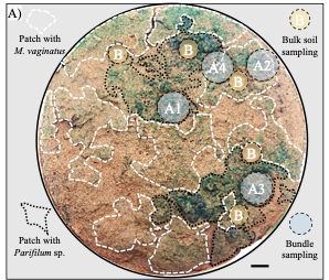
The site is a revitalized young steppe habitat patch, dominated by fescue (Festuca rupicola). The average altitude is around 100 m. The site is a grazing spot and it was recently used for the reintroduction of the European ground squirrel (Spermophilus citellus) to the area after 70 years. Other important species present at the site include Vojvodina blind mole rat (Nannospalax (leucodon) montanosyrmiensis) and Spring meadow saffron (Bulbocodium versicolor).
-
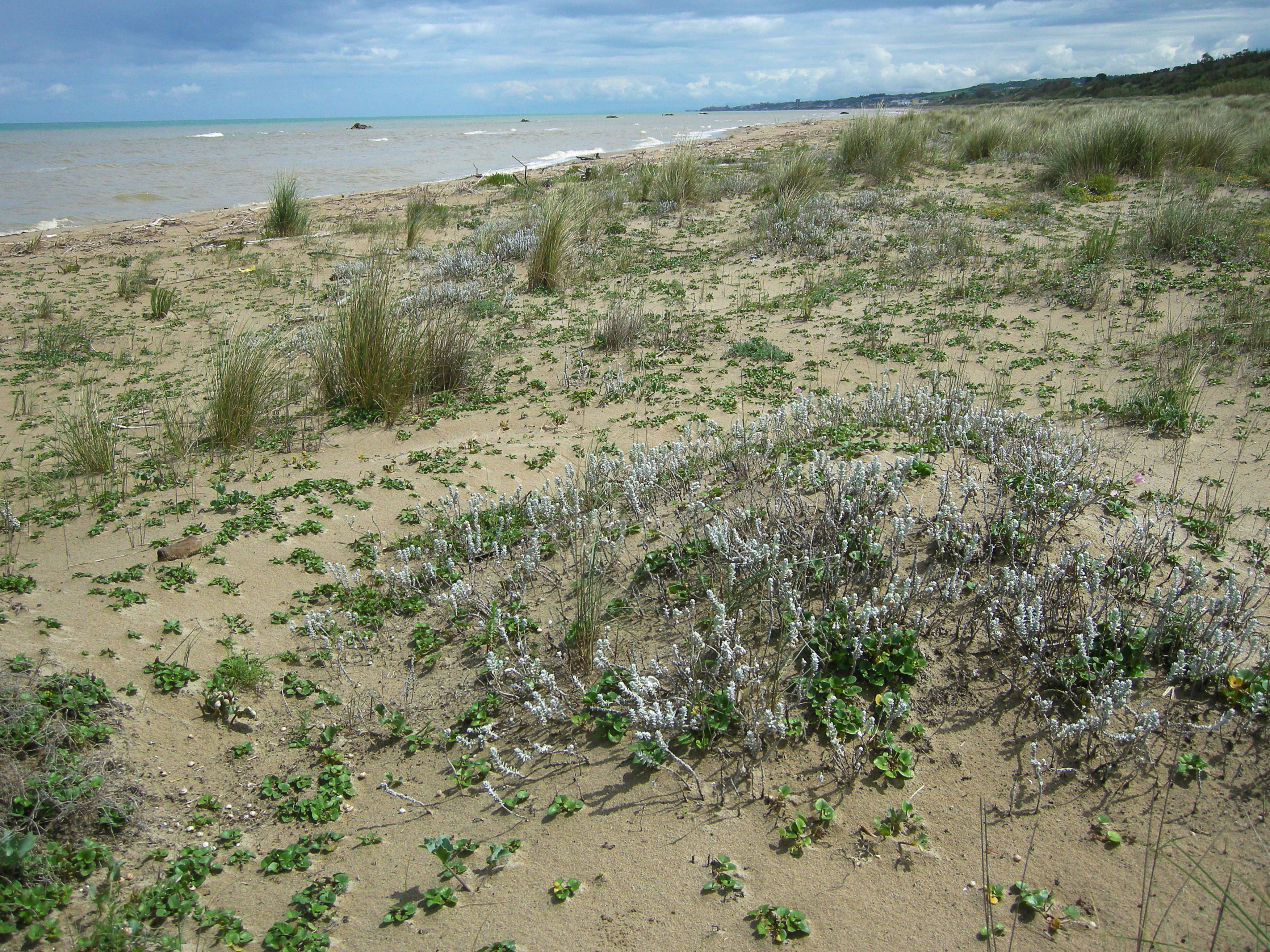
S.C.I IT7228221 Foce Trigno-Marina di Petacciato (Campobasso) S.C.I. IT7140108 Punta Aderci-Punta della Penna S.C.I. IT7140109 Marina di Vasto The site includes 3 Natura 2000 sites along the central Adriatic coast, where the last fragments of natural vegetation zonation on sand coastal dunes occur (shore vegetation, embryo and mobile dune vegetation, annual Mediterranean grasses and wet dune slacks).
-
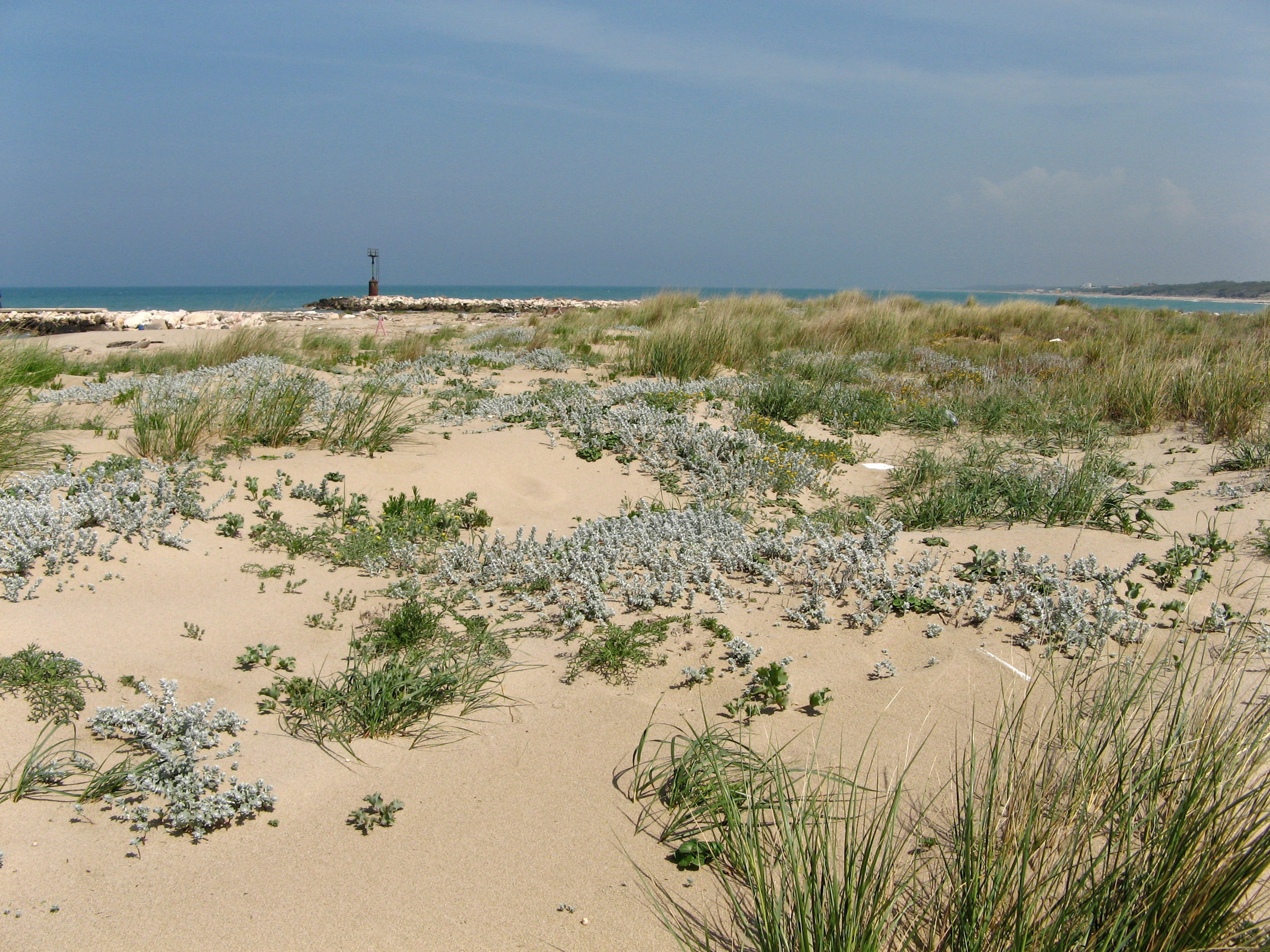
SCI IT7222217 Foce Saccione-Bonifica Ramitelli (Campobasso) The site includes 1 Natura 2000 site along the central Adriatic coast, where the last fragments of natural vegetation zonation on sand coastal dunes occur (shore vegetation, embryo and mobile dune vegetation, annual Mediterranean grasses, costa dunes with Juniperus spp and wet dune slacks).