
latent heat
Type of resources
Available actions
Topics
Keywords
Contact for the resource
Provided by
Years
Formats
Representation types
-
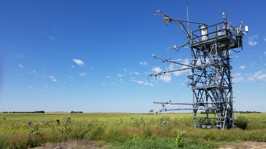
The Lyndon B. Johnson National grasslands (CLBJ) is a core terrestrial within NEON's Domain 7: Southern Plains. CLBJ is located in the Great Plains region of north-central Texas, about an hour drive from the Dallas-Fort Worth metroplex. LBJ occupies approximately 20,000+ acres of public lands managed by the U.S. Forest Service. The grasslands are home to Black Creek Lake, which hosts an established recreation site consisting of seven picnic units, seven walk-in camp units, one improved boat ramp and an accessible fishing bridge. There are nearly 75 miles of established trails on site great for hiking, mountain biking, horseback riding, photography, and wildlife viewing. Remote sensing surveys of this field site collect lidar, spectrometer and high-resolution RGB camera data. The flux/meteorological tower at this site is 72 with 5 measurement levels. The tower top extends above the vegetation canopy to allow sensors mounted at the top and along the tower to capture the full profile of atmospheric conditions from the top of the vegetation canopy to the ground. The tower collects physical and chemical properties of atmosphere-related processes, such as humidity, wind, and net ecosystem gas exchange. Precipitation data are collected by a Double Fence Intercomparison Reference (DFIR) near the tower and a series of throughfalls located in the soil array. This site has one phenocam on the top of the flux tower and one near the bottom of the tower. This site has five soil plots placed in an array within the airshed of the flux tower. Field ecologists collect the following types of observational data at this site: Terrestrial organisms (birds, ground beetles, mosquitoes, plants, small mammals, soil microbes, ticks), Biogeochemical data, and soil data.
-
The Caribou-Poker Research Watershed hosts a set of co-located terrestrial and aquatic field sites on land owned by the University of Alaska Fairbanks and the Alaska Department of Natural Resources. Just 35 minutes outside of Fairbanks, the sites are easy to access from the Steese Highway. Remote sensing surveys of this field site collect lidar, spectrometer and high-resolution RGB camera data. The flux/meteorological tower at this site is 59’ with 5 measurement levels. The tower top extends above the vegetation canopy to allow sensors mounted at the top and along the tower to capture the full profile of atmospheric conditions from the top of the vegetation canopy to the ground. The tower collects physical and chemical properties of atmosphere-related processes, such as humidity, wind, and net ecosystem gas exchange. Precipitation data are collected by a Double Fence Intercomparison Reference (DFIR) near the tower and a series of throughfalls located in the soil array. This site has five soil plots placed in an array within the airshed of the flux tower. Field ecologists collect the following types of observational data at this site: Terrestrial organisms (birds, ground beetles, mosquitoes, plants, small mammals, soil microbes, ticks), Biogeochemical data, and and soil data. Total data products planned for this site: 117.
-
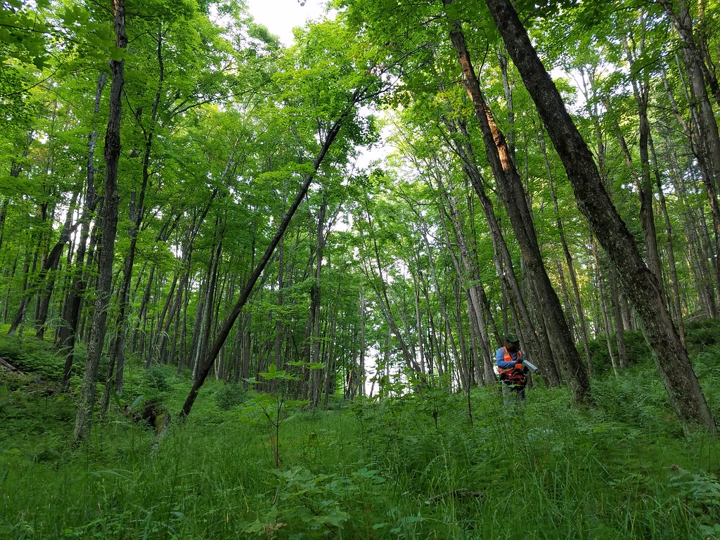
Mountain Lake Biological Station is located in a remote, but accessible southern portion of the Appalachian Mountain Chain in southwestern Virginia, approximately 20 km northwest of Blacksburg, VA. The Jefferson National Forest is contiguous to the station, with 42.5 km2 of woodland is designated as NFS Wilderness. The relocatable terrestrial NEON site is comprised of three parcels of land, with the northern two segments owned by the US Forest Service and the southern portion hosted by the University of Virginia. The 11.14 km2 site is situated on the elevated divide between the Atlantic and Mississippi drainage basins and is characterized by abrupt changes in environmental gradients and fine-scale variances in ecological niches. It is the only NEON Appalachians & Cumberland Plateau Domain site located in Virginia, as the other four domain 07 sites are found in Tennessee. Remote sensing surveys of this field site collect lidar, spectrometer and high-resolution RGB camera data. The flux/meteorological tower at this site is 94 with 6 measurement levels. The tower top extends above the vegetation canopy to allow sensors mounted at the top and along the tower to capture the full profile of atmospheric conditions from the top of the vegetation canopy to the ground. The tower collects physical and chemical properties of atmosphere-related processes, such as humidity, wind, and net ecosystem gas exchange. Precipitation data are collected by a tipping bucket at the top of the tower and a series of throughfalls located in the soil array. This site has five soil plots placed in an array within the airshed of the flux tower. Field ecologists collect the following types of observational data at this site: Terrestrial organisms (birds, ground beetles, mosquitoes, plants, small mammals, soil microbes, ticks), Biogeochemical data, and soil data. Total data products planned for this site: 115
-
The Lenoir Landing (LENO) relocatable terrestrial site is part of NEON's Ozarks Complex Domain 7. LENO is located across the 4,218-acre Choctaw National Wildlife Refuge and Lenoir Landing Park. The site is located in southwest Alabama approximately 129km (80 mi) north of Mobile. Lenoir Landing Park hosts the Data Tower and tower plots and is managed by the U.S. Army Corp of Engineers. The distributed plots are located 5 km south of the tower shed on the Choctaw National Wildlife Refuge managed by the U.S. Fish and Wildlife Service. The site is characterized by Hardwood bottomland with seasonal flooding and is located along the Tomgigbee River which hosts the Lower Tombigbee river aquatic site. Remote sensing surveys of this field site collect lidar, spectrometer and high-resolution RGB camera data. The flux/meteorological tower at this site is 149 with 6 measurement levels. The tower top extends above the vegetation canopy to allow sensors mounted at the top and along the tower to capture the full profile of atmospheric conditions from the top of the vegetation canopy to the ground. The tower collects physical and chemical properties of atmosphere-related processes, such as humidity, wind, and net ecosystem gas exchange. Precipitation data are collected by a tipping bucket at the top of the tower and a series of throughfalls located in the soil array. This site has five soil plots placed in an array within the airshed of the flux tower. Field ecologists collect the following types of observational data at this site: Terrestrial organisms (birds, ground beetles, mosquitoes, plants, small mammals, soil microbes, ticks), Biogeochemical data, and soil data.
-
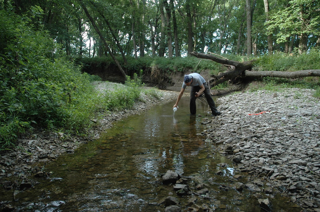
King's Creek is located within the Konza Prairie Biological Station approximately five kilometers west of the KONZ tower. [10] It is a second-order creek that drains a mixed agricultural, pasture, and tallgrass prairie dominated watershed. The Konza Prairie is located in the Flint Hills region of Kansas just 10km south of Manhattan, KS. It is hosted by the Nature Conservancy and Kansas State University. The KING site is encompassed in the NEON Prairie Peninsula Domain, which includes the largest remaining areas of unplowed tallgrass prairie in North America. The Prairie Peninsula domain consists of grasslands, forests, and agricultural cover types. The Domain hosts four other NEON field sites, one other aquatic and three terrestrial, all of which are located in Kansas. Remote sensing surveys of this site collect lidar, spectrometer and high resolution RGB camera data. This site has one meteorological station located in the riparian area. The met station is outfitted with a subset of the same sensors used at terrestrial sites. Measurements include wind speed and direction, air temperature, barometric pressure, relative humidity, shortwave radiation, and PAR. This site has one phenocam near the stream. This site has one upstream sensor station and one downstream sensor station. Measurements include PAR, temperature, water quality [specific conductivity, chlorophyll a, dissolved oxygen content, pH, turbidity, and fluorescent dissolved organic matter (only downstream)], and nitrate is measured at the downstream station. Eight groundwater wells throughout the site collect specific conductivity, water tempertaure, and elevation of groundwater.Field ecologists collect the following types of observational data at this site: aquatic organisms (Aquatic Microbes (surface water),macroinvertebrates microalgae, plants and macroalgae, zooplankton. Biogeochemical data on plants,sediment water and particulates.As well as physical aquatic data on bathymetric maps, stage,secchi depth and depth profiles, and riparian assessment. Total data products planned for this site: 79
-
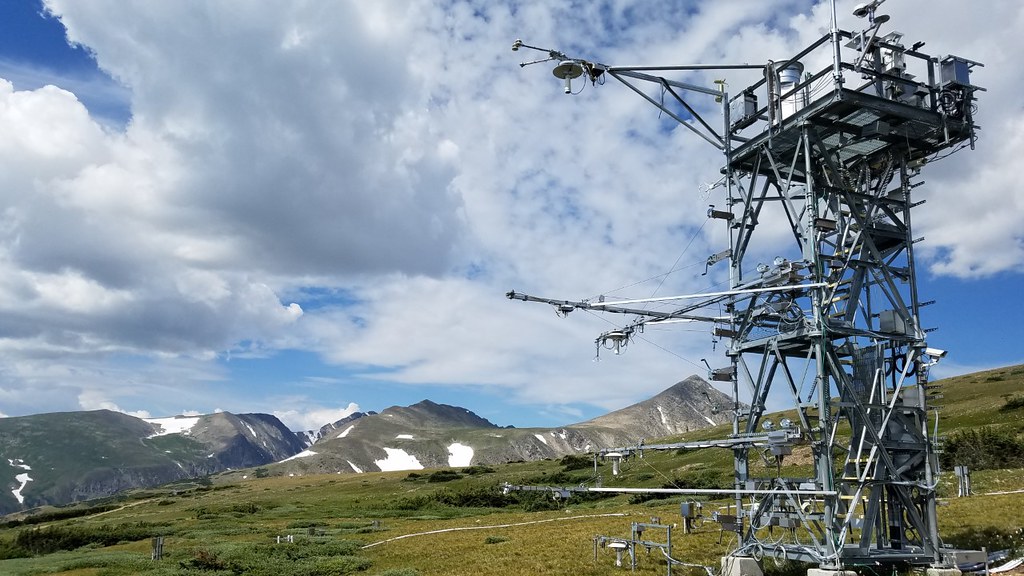
Niwot Ridge Mountain Research Station is a core terrestrial site within NEON's Domain 13: Southern Rockies and Colorado Plateau. The Niwot Ridge sits approximately 27 km west of Boulder, Colorado, and 6 km east of the Continental Divide. Topography, climate, and biota of the site are representative of Rocky Mountain alpine ecosystems, including extensive alpine tundra (mostly herbs, some shrubs and scree) and subalpine coniferous forests (Abies lasciocarpa and Picea engelmanii at higher elevations), talus slopes, wetlands and a variety of glacial landforms. Niwot Ridge is the highest field site in the gradient, at 3,500 m (11,500 feet). The sampling plots at the upper elevations of the site are in alpine meadow and tundra. A bit lower down, a few sampling plots are in subalpine forest. Remote sensing surveys of this field site collect lidar, spectrometer and high-resolution RGB camera data. The flux/meteorological tower at this site is 26 with 4 measurement levels.The tower top extends above the vegetation canopy to allow sensors mounted at the top and along the tower to capture the full profile of atmospheric conditions from the top of the vegetation canopy to the ground. The tower collects physical and chemical properties of atmosphere-related processes, such as humidity, wind, and net ecosystem gas exchange. Precipitation data are collected by a tipping bucket at the top of the tower and a series of throughfalls located in the soil array. This site has five soil plots placed in an array within the airshed of the flux tower. Field ecologists collect the following types of observational data at this site: Terrestrial organisms (birds, ground beetles, mosquitoes, plants, small mammals, soil microbes, ticks), Biogeochemical data, and and soil data.Total data products planned for this site: 117
-
The NEON site at Rocky Mountain National Park (RMNP) is a relocatable terrestrial field site and part of NEON's Central Plains Domain 10. RMNP is located seventy kilometers northwest of Denver, the RMNP site includes National Park and Forest Service land in the foothills of Colorado. The NEON tower and corresponding TOS plots are located in a property that is owned by the National Park Service but outside of Rocky Mountain National Park's core boundaries. TOS distributed plots are located within the Roosevelt National Forest (U.S. Forest Service). The area is a populardestination for hiking, camping, shooting, and other recreational activities. Remote sensing surveys of this field site collect lidar, spectrometer and high-resolution RGB camera data. The flux/meteorological tower at this site is 81 with 5 measurement levels. The tower top extends above the vegetation canopy to allow sensors mounted at the top and along the tower to capture the full profile of atmospheric conditions from the top of the vegetation canopy to the ground. The tower collects physical and chemical properties of atmosphere-related processes, such as humidity, wind, and net ecosystem gas exchange. Precipitation data are collected by a tipping bucket at the top of the tower and a series of throughfalls located in the soil array. This site has five soil plots placed in an array within the airshed of the flux tower. Field ecologists collect the following types of observational data at this site: Terrestrial organisms (birds, ground beetles, mosquitoes, plants, small mammals, soil microbes, ticks), Biogeochemical data, and soil data. Total data products planned for this site: 116
-
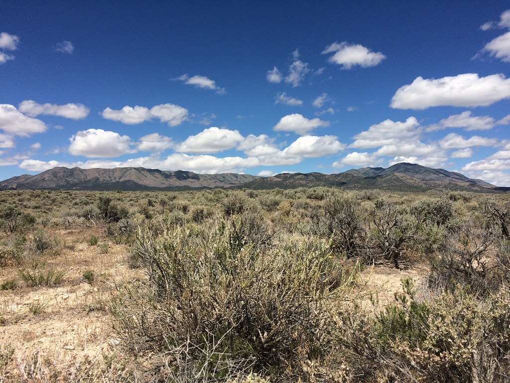
The Onaqui (ONAQ) field site is a core terrestrial site within NEON's Domain 15: Great Basin. The Onaqui site is located approximately 80km southwest of Salt Lake City. It is characterized by the sagebrush and western juniper community that dominates the Great Basin. The Great Basin Domain is bordered by the Sierra Nevada to the west, the Rocky Mountains and Colorado Plateau to the east, the Mojave Desert to the south, and the Columbia Plateau to the north. Remote sensing surveys of this field site collect lidar, spectrometer and high-resolution RGB camera data. The flux/meteorological tower at this site is 26ft with 4 measurement levels.The tower top extends above the vegetation canopy to allow sensors mounted at the top and along the tower to capture the full profile of atmospheric conditions from the top of the vegetation canopy to the ground. The tower collects physical and chemical properties of atmosphere-related processes, such as humidity, wind, and net ecosystem gas exchange. Precipitation data are collected by a tipping bucket at the top of the tower and a series of throughfalls located in the soil array. This site has five soil plots placed in an array within the airshed of the flux tower. Field ecologists collect the following types of observational data at this site: Terrestrial organisms (birds, ground beetles, mosquitoes, plants, small mammals, soil microbes, ticks), Biogeochemical data, and and soil data.
-
North Sterling (STER) is a relocatable terrestrial site is part of NEON's Central Plains Domain 10. STER is 100 miles to the east of CPER, is hosted by a private landowner with a strong interest in soil science and sustainable agriculture. The family farm has been in operation for nearly 100 years. Currently, the farm supports a mix of cattle grazing and field crops, primarily wheat, millet and hay. Remote sensing surveys of this field site collect lidar, spectrometer and high-resolution RGB camera data. The flux/meteorological tower at this site is 26ft with 4 measurement levels. The tower top extends above the vegetation canopy to allow sensors mounted at the top and along the tower to capture the full profile of atmospheric conditions from the top of the vegetation canopy to the ground. The tower collects physical and chemical properties of atmosphere-related processes, such as humidity, wind, and net ecosystem gas exchange. Precipitation data are collected by a tipping bucket at the top of the tower and a series of throughfalls located in the soil array. This site has five soil plots placed in an array within the airshed of the flux tower. Field ecologists collect the following types of observational data at this site: Terrestrial organisms (birds, ground beetles, mosquitoes, plants, small mammals, soil microbes, ticks), Biogeochemical data, and soil data. Total data products planned for this site: 113
-
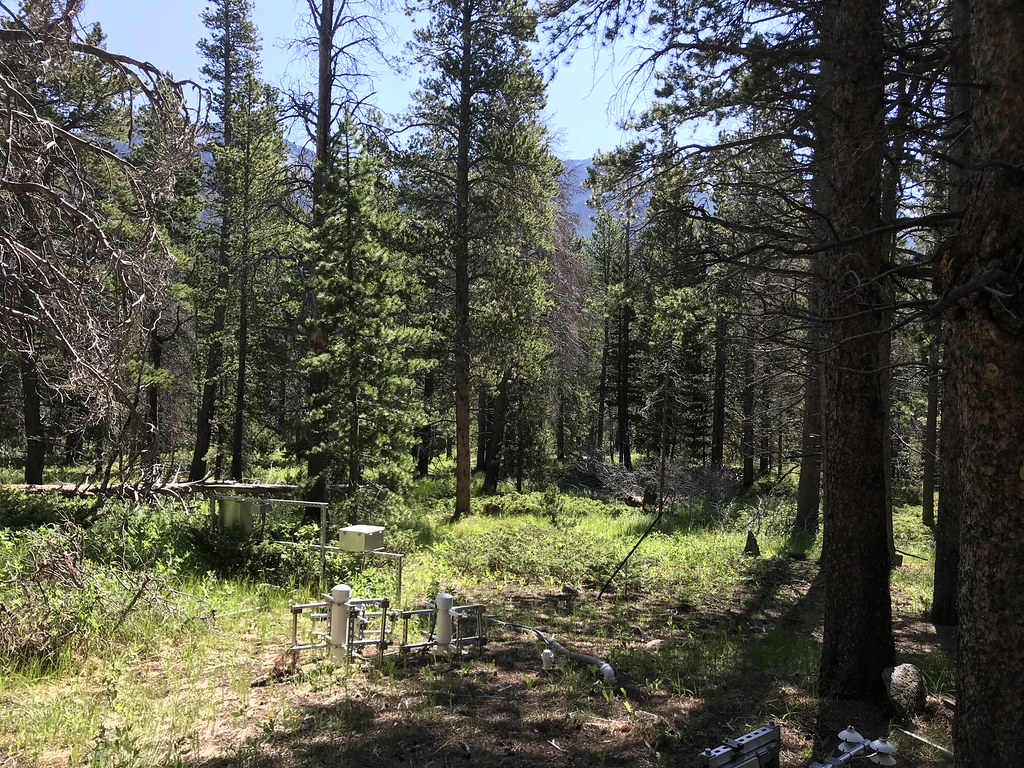
University of Notre Dame Environmental Research Center (UNDERC) is a core terrestrial site in NEON's Great Lakes Domain 5. Straddling the border between Northern Wisconsin and Michigan's Upper Peninsula, the UNDERC property comprises approximately 7500 acres and is maintained as an environmental education and research facility. UNDERC also has 30 lakes comprising 1350 acres, including Crampton Lake, a NEON aquatics site. The flux/meteorological tower at this site is 127ft with 6 measurement levels. The tower top extends above the vegetation canopy to allow sensors mounted at the top and along the tower to capture the full profile of atmospheric conditions from the top of the vegetation canopy to the ground. The tower collects physical and chemical properties of atmosphere-related processes, such as humidity, wind, and net ecosystem gas exchange. Precipitation data are collected by a tipping bucket at the top of the tower, a Double Fence Intercomparison Reference (DFIR) near the tower, and a series of throughfalls located in the soil array. UNDERC site includes airborne remote sensing surveys, automated instrument measurements and observational field sampling.There are also multiple plots for soil sensors and sampling and organismal sampling including birds,mammals, ticks and mosquitoes.