
leaf area
Type of resources
Available actions
Topics
Keywords
Contact for the resource
Provided by
Years
Formats
Representation types
-
Field work - plot measurements (n=18)
-
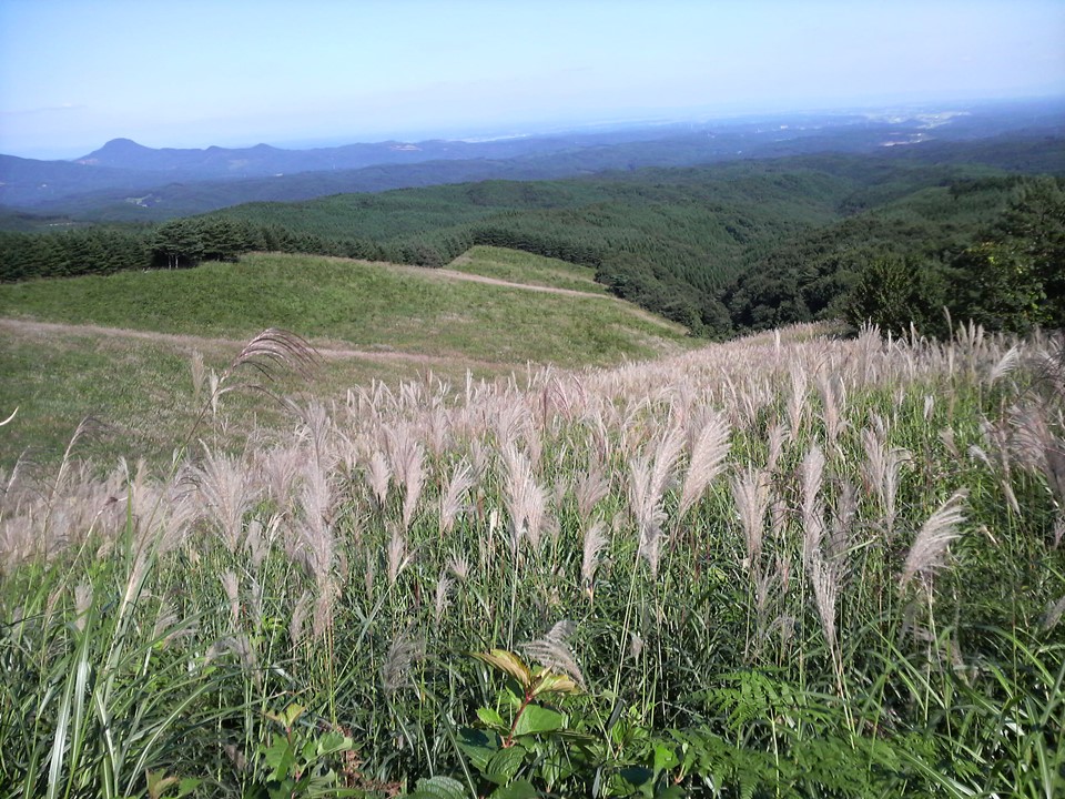
This site was established on a tall, Japanese native grass (Miscanthus sinensis) pasture in 1982. Three different treatments (cutting, cattle grazing and abundoning) has been carried out. Vegetational characteristics is investigated on 60 locations (20 locations x 3 treatments, 2 m x 2 m each) in late August to early September.
-
The site Unterpullendorf is part of the European Level II Forest Monitoring System in the frame of the International Co-operative Programme on Assessment and Monitoring of Air Pollution Effects on Forests (ICP Forests). This site is one out of 16 Austrian Level II sites; it was established in 1995 and is, since 2006, part of the LTER Austria network. The site is situated about 80 km south of Vienna near the Hungarian border at 290 m a.s.l., in a homogenous about 100 years old managed oak stand.
-
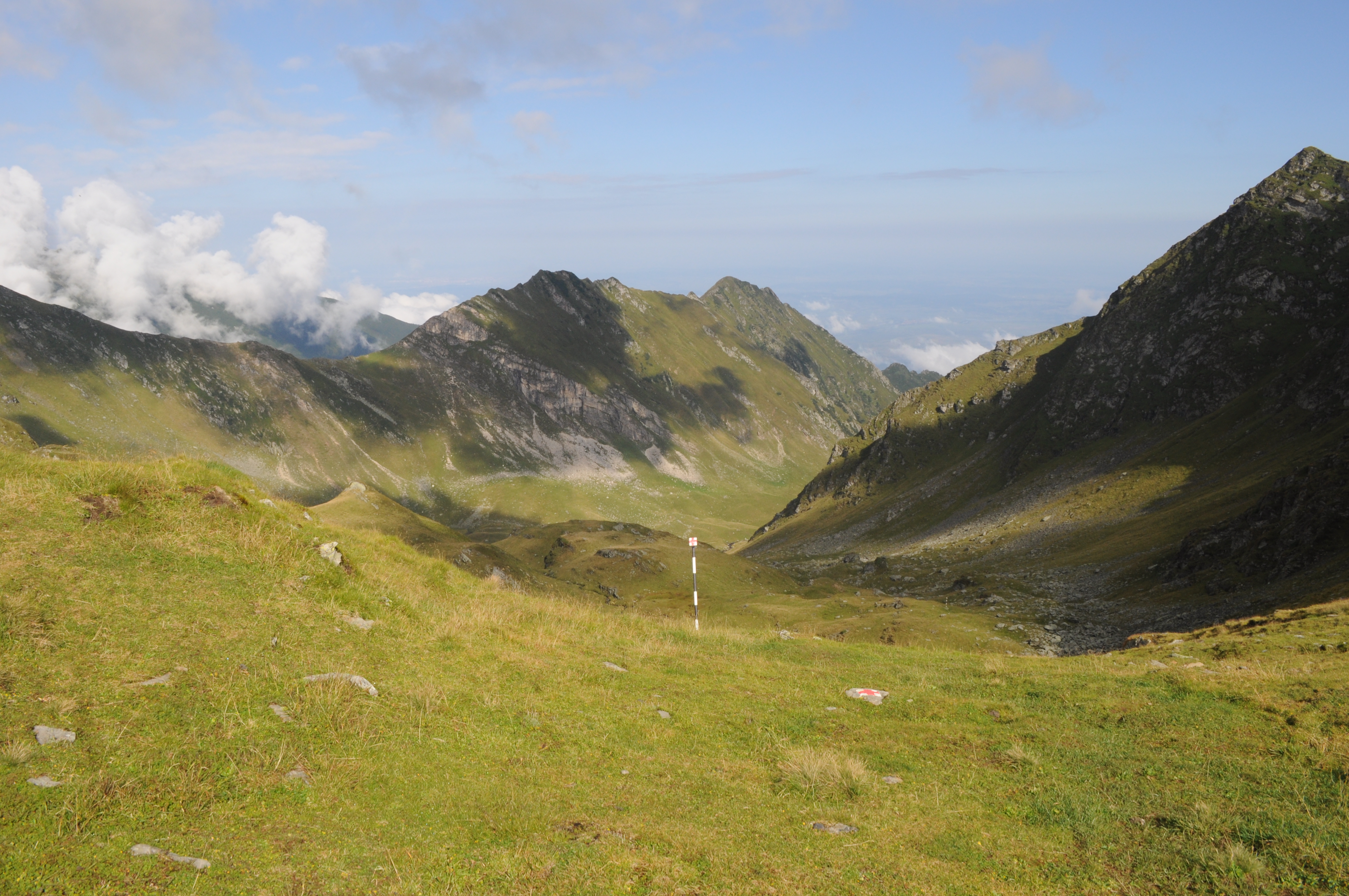
The site is located in the Southern Carpathians (Romania). The predominant ecosystems are grasslands located above tree line, dominated by Carex curvula, Juncus trifidus (alpine zone) and Festuca airoides, Nardus stricta (subalpine zone). The site consists of monitoring points in subalpine and alpine meadows in the Bâlea-Paltinul area.
-
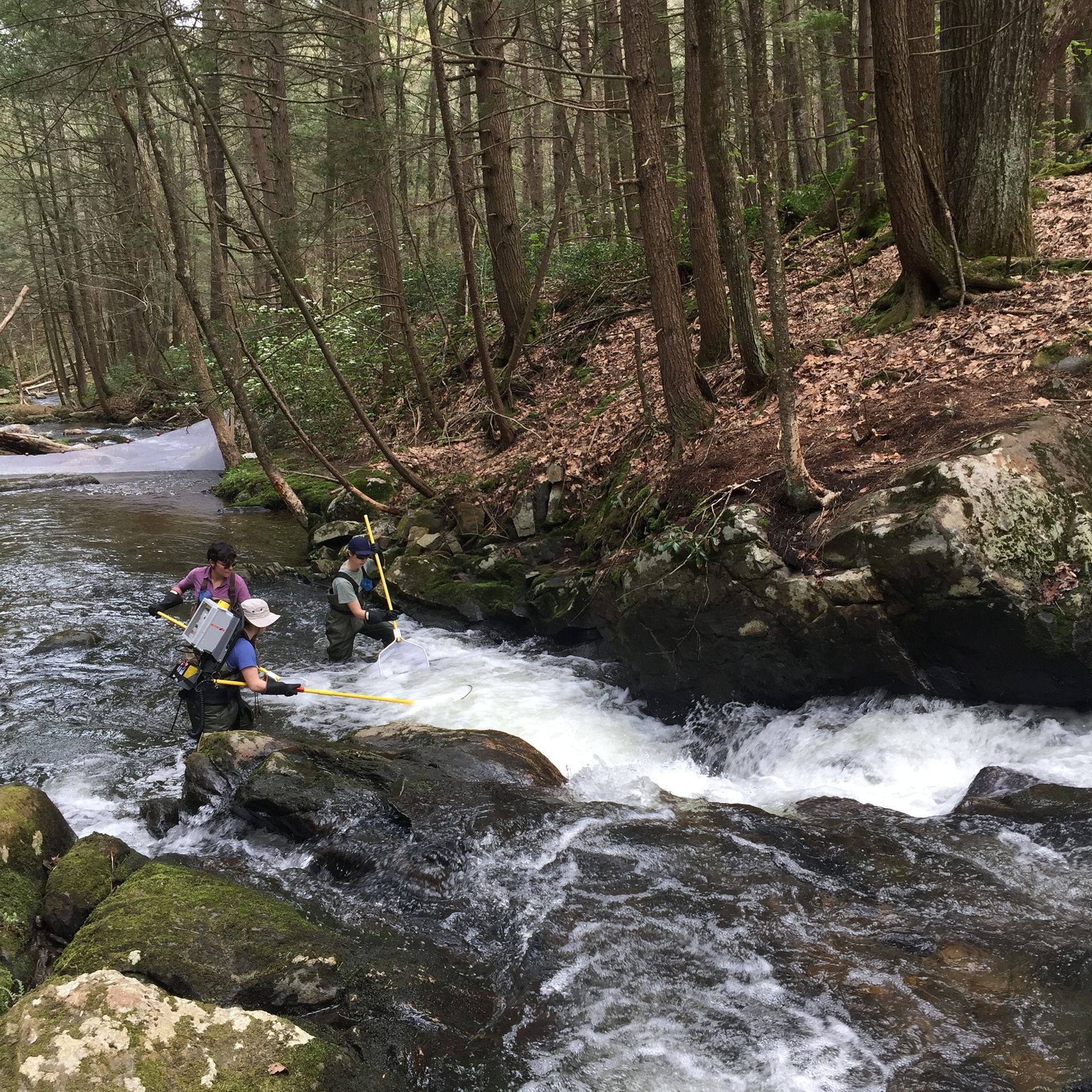
The Rollesbroich site is located in the low mountain range “Eifel” near the German-Belgium border and covers the area of the small Kieselbach catchment (40 ha) with altitudes ranging from 474 to 518 m.a.s.l.. The climate is temperate maritime with a mean annual air temperature and precipitation of 7.7 °C and 1033 mm, respectively, for the period from 1981 to 2001. Soils are dominated by (stagnic) Cambisols and Stagnosols on Devonian shales with occasional sandstone inclusions that are covered by a periglacial solifluction clay–silt layer. The mountainous grassland vegetation is dominated by perennial ryegrass (Lolium perenne) and smooth meadow grass (Poa pratensis). The study site is highly instrumented. All components of the water balance (e.g. precipitation, evapotranspiration, runoff, soil water content) are continuously monitored using state-of-the-art instrumentation, including weighable lysimeters, runoff gauges, cosmic-ray soil moisture sensors, a wireless sensor network that monitors soil temperature, and soil moisture at 189 locations in different depths (5, 20 and 50 cm) throughout the study site. Periodically also different chamber measurements were made to access soil or plant gas exchange.
-
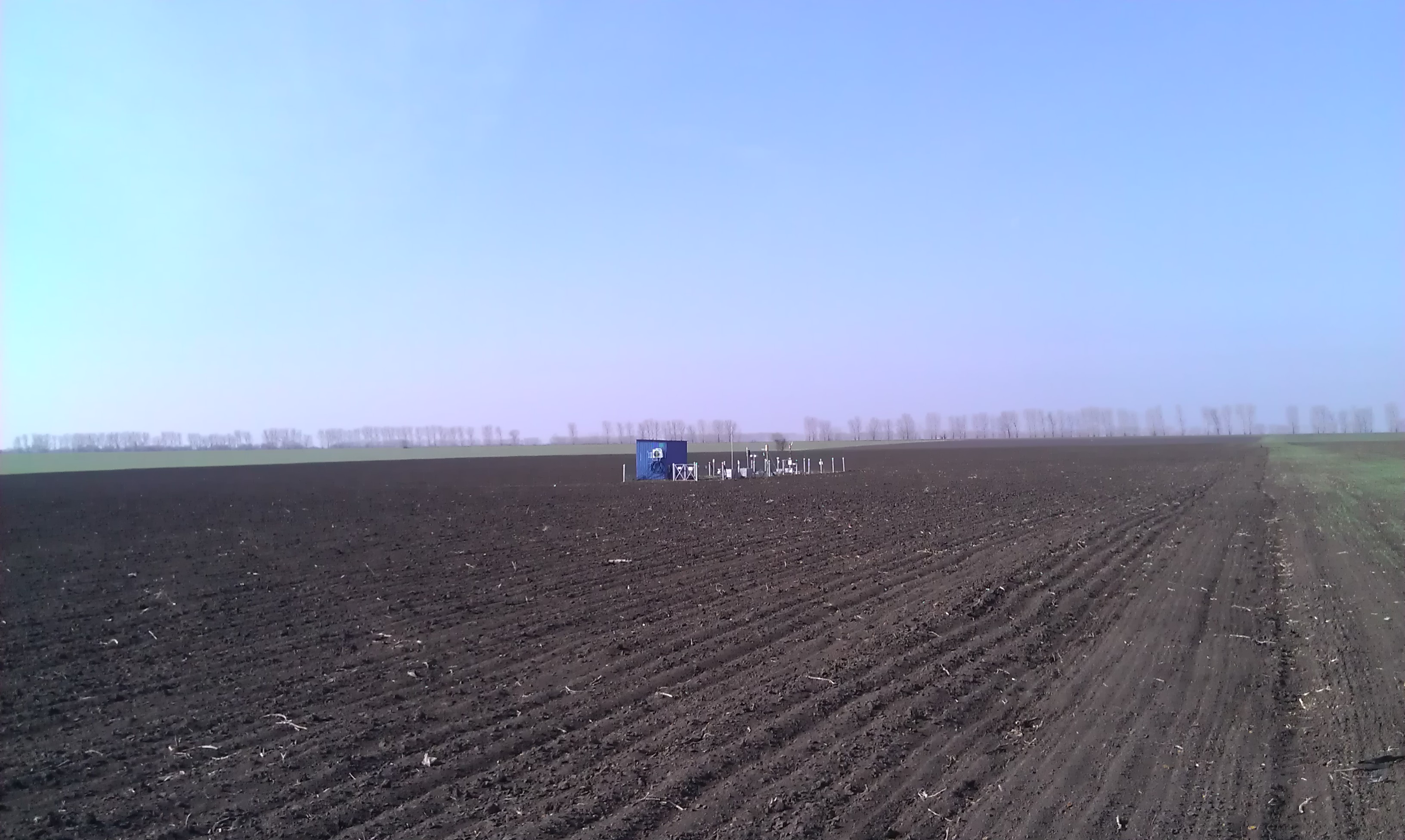
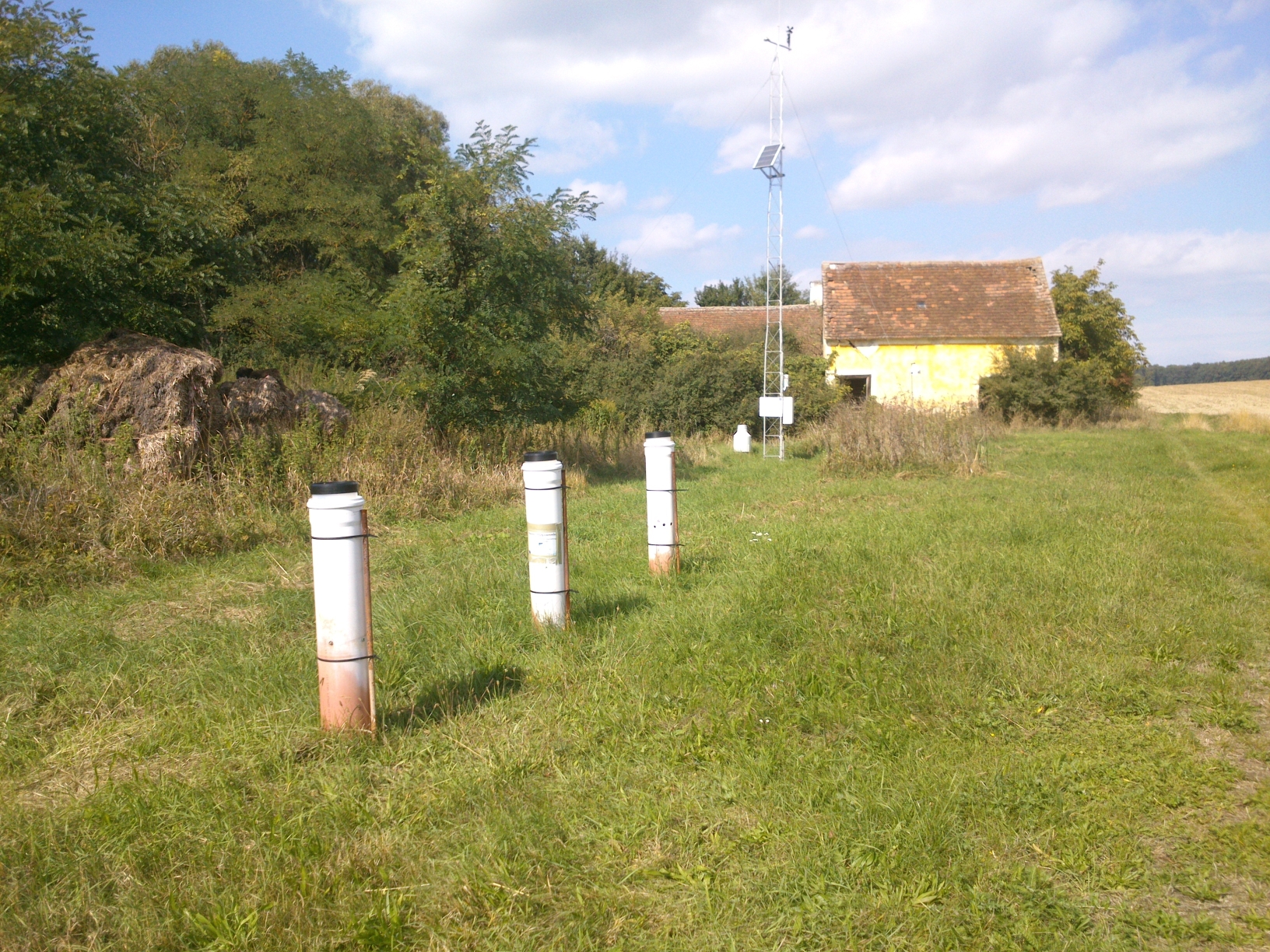
Research Monitoring Station "Petrodolinskoye" (PTR) of the Regional Centre for Integrated Environmental Monitoring and Ecological Studies (RCIEM) of Odessa National I. I. Mechnikov University (ONU) is located on an actively managed arable land. The site is situated 8 km from the Dniester River, which enters the Black Sea (29 km from the study site). The station is located near the village “Mirnoe” (46º27'22.12''N; 30º20'9.94''E), 27 km southeast of Odessa and was established in 2006 within the framework of the EU FP6 NitroEurope IP (Medinets et al., 2014). The arable field study site is 10 ha in size with a flat topography at an elevation of 66 m above sea level. The soil is a black soil (FAO definition: Chernozems Vermi-Calcic, CH vec), and representative for the south of Ukraine (Medinets et al., 2014b, 2016). The climate is temperate continental, with an annual average air temperature of 10.5 °С (period of 2000-2014), an annual minimum mean of 8.4 °С and an annual maximum mean of 12.5 °С. Total average annual precipitation is 432 mm. The atmospheric total N (TN) deposition rate is moderate at ca. 11.4 kg N ha-1 y-1 with significant organic N contribution of circa 67% (Medinets et al., 2016). Crop rotation and management. The study site has been under active agricultural management for more than 200 years, although a detailed history of the agricultural management is unknown. Before autumn 2006 the area was managed by a collective farm (‘kolkhoz’). The study field, 10 ha in size, was leased in autumn 2006 from the Association of Agricultural Enterprises “Granit”. The crop rotation started with wheat in 2006, in the period 2007 – 2014 was onions (2007), tomatoes (2008), barley (2009) and winter wheat (2009/2010) followed by winter onion (2010/2011), carrot (2011), tomato (2012), red beetroot (2013) and onion (2014) followed by winter wheat. This rotation is typical for this region. Crops (except cereals) were grown with drip irrigation (installed in 5-10 cm depth), with fertilizer applied together with the irrigation (fertigation). E.g., during the study period of 2012-2014 the field was fertilized with mineral NPK fertilizers (see Medinets et al., 2016). To prevent plant diseases and to suppress weeds, pesticides and herbicides were applied to all crops following farmers practice. The following tillage methods were used: deep ploughing (40 cm depths), disking (10 cm depth), harrowing (10 cm depth), cultivation (10 cm depth), inter-row cultivation (5 cm depth); the soil was also disturbed under installation/ removing of irrigation tubes (see Medinets et al., 2016).
-
The Lower Hop Brook is a core aquatic site in Domain 01 Northeast in Massachusetts. HOPB site is a 3rd-4th order wadeable stream that flows into the Quabbin Reservoir in central Massachusetts. The section of stream selected by NEON flows from Shutesbury Road to the inlet of reservoir. Several beaver dams and ponds characterize the area upstream of Shutesbury Road. The Lower Hop Brook site is a clear-water, moderate gradient stream with gradient increasing as the stream approaches the reservoir. Minimal beaver activity (dams, ponds) is anticipated in the upper portions of the reach during the life of the NEON project. Large debris dams characterize the reach downstream. Substrate ranges from sand to cobbles, boulders, and finally bedrock outcrops downstream. The stream canopy is predominantly a mixed deciduous, northern hardwood forest with beech trees near the stream. Total data products collected at this site 78.
-
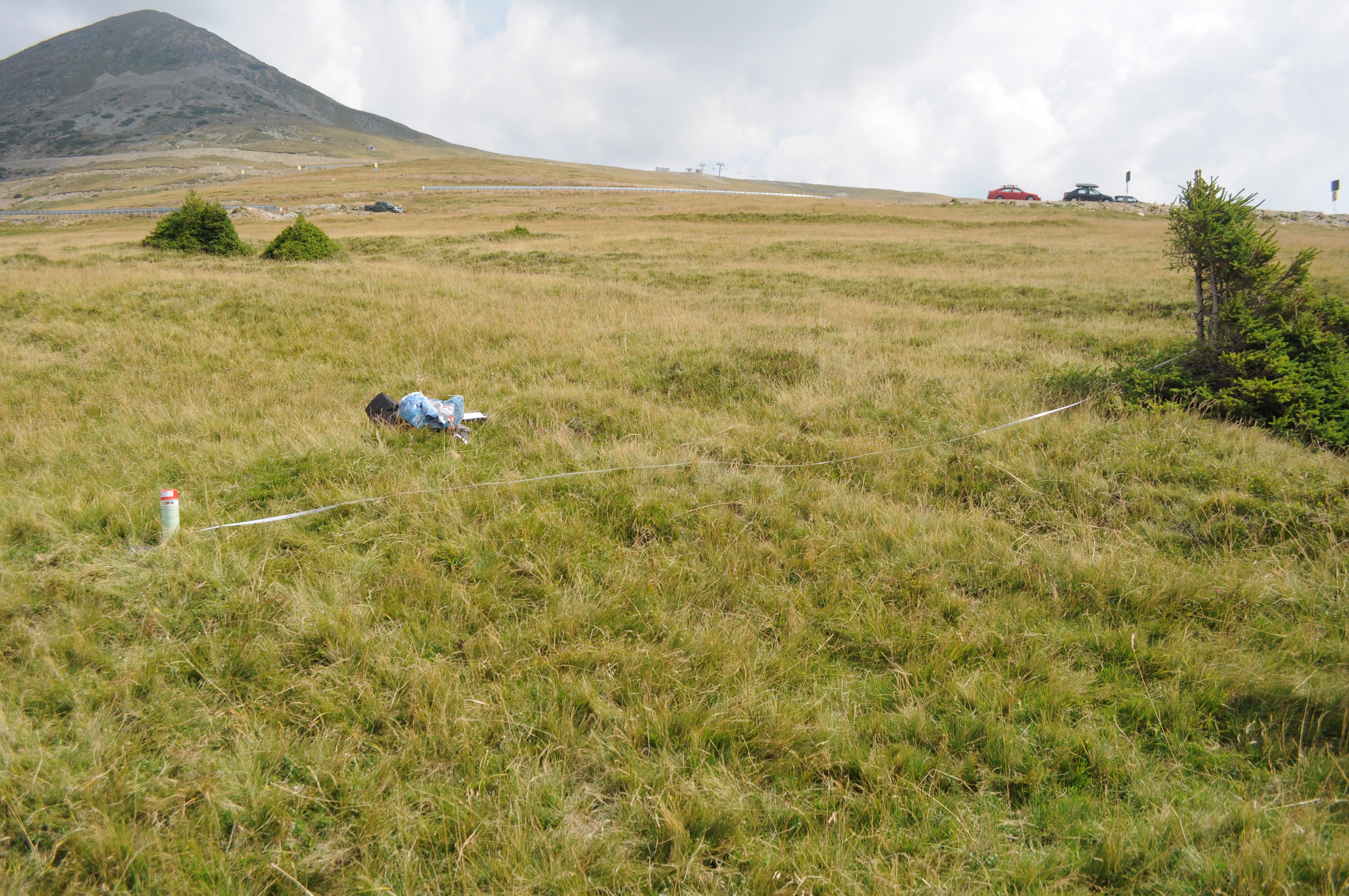
The site is located in the Southern Carpathians (Romania). The predominant ecosystems are grasslands located above tree line, dominated by Carex curvula, Juncus trifidus (alpine zone) and Festuca airoides, Nardus stricta, Festuca nigrescens (subalpine zone). The site consists of monitoring points in subalpine and alpine meadows.
-
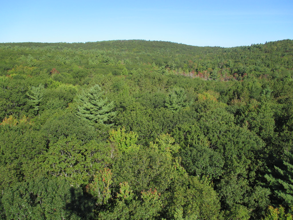
Harvard Forest is a core site in Domain 01: Northeast. Located 73 miles from Boston in Petersham, Massachusetts The Harvard Forest site is spread across 49 km2 of land and is the core NEON site for the Northeast region. Representative habitats at Harvard Forest include northern, transition, and central forests; marshes, swamps, and conifer-dominated bogs; and forest plantations. NEON's meteorological/flux tower and tower sampling plots are located on land owned by Harvard Forest - Harvard University, LTER an forest with a rich history of scientific research. The distributed sampling plots are located along the edge of the Quabbin reservoir which is managed by the Massachusetts Department of Conservation and Recreation, Division of Water Supply Protection. For access to the area along the Quabbin, visitors must be accompanied by a NEON project employee. Total data products collected at this site is 119.
-
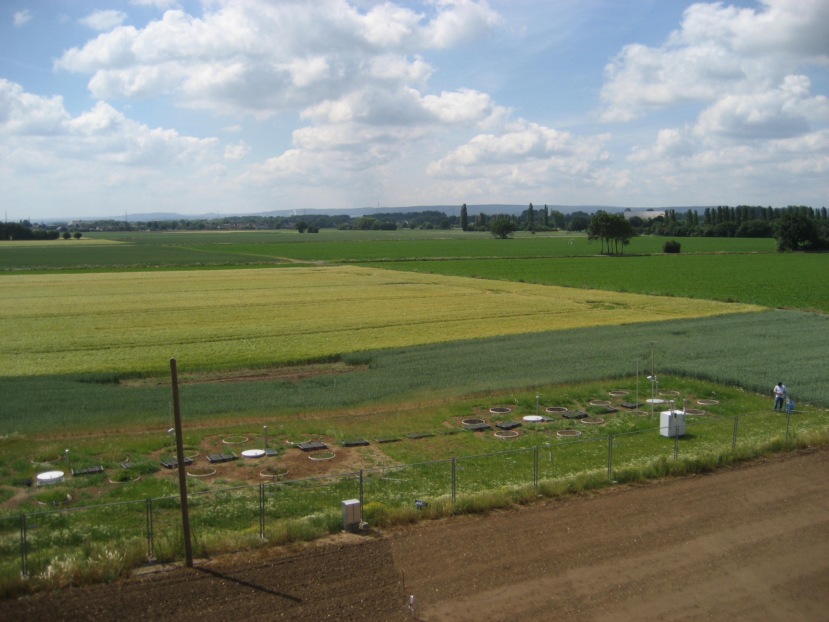
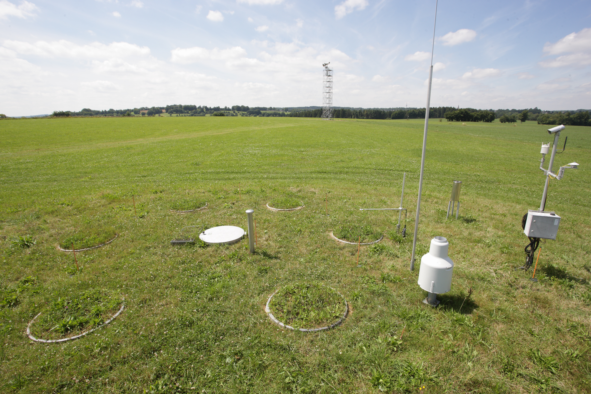
The Selhausen site represents the heterogeneous agricultural rural area of the lower Rhine valley. The climate is temperate maritime with a mean annual temperature of 10°C and annual precipitation of 700 mm for the period from 1961 to 2014 (meteorological tower, Forschungszentrum Jülich). The most important crops in the region of Selhausen are sugar beet (beta vulgaris), winter wheat (triticumavesticum), winter barley (hordeum vulgare), maize (zea mays) and rape seed (brassica napus). Only parts of the region are managed as grasslands. The underlying Quaternary sediments are mostly fluvial deposits covered with loess. Major soil types are luvisols and gleyed cambisols, partly with large contents of gravel. The land surface is generally flat with slopes up to 4° in the area of a former channel of the Rur River system. From 2007 to 2010 a first long-term eddy covariance study was conducted within the Selhausen region (measurements can be found at the European fluxes database cluster, ID: DE-Seh). In spring 2011 a new station (50.865°N, 6.447°E, 203m a.s.l.) was equipped with a CSAT3 sonic anemometer and LI7500 gas analyzer. Besides flux measurements and typical climate parameters (radiation, air temperature, air humidity, soil moisture, soil temperature etc.), also the phenological development of the crops and farming activities were recorded. The station fits now the standards of a Level-1 site for the European project ICOS (Integrated Carbon Observation System). As a pan-European long-term research infrastructure ICOS aims at providing harmonized and high-precision scientific data on carbon cycle and greenhouse gas budget and perturbations.