
leaf area ratio
Type of resources
Available actions
Topics
Keywords
Contact for the resource
Provided by
Years
Formats
Representation types
-
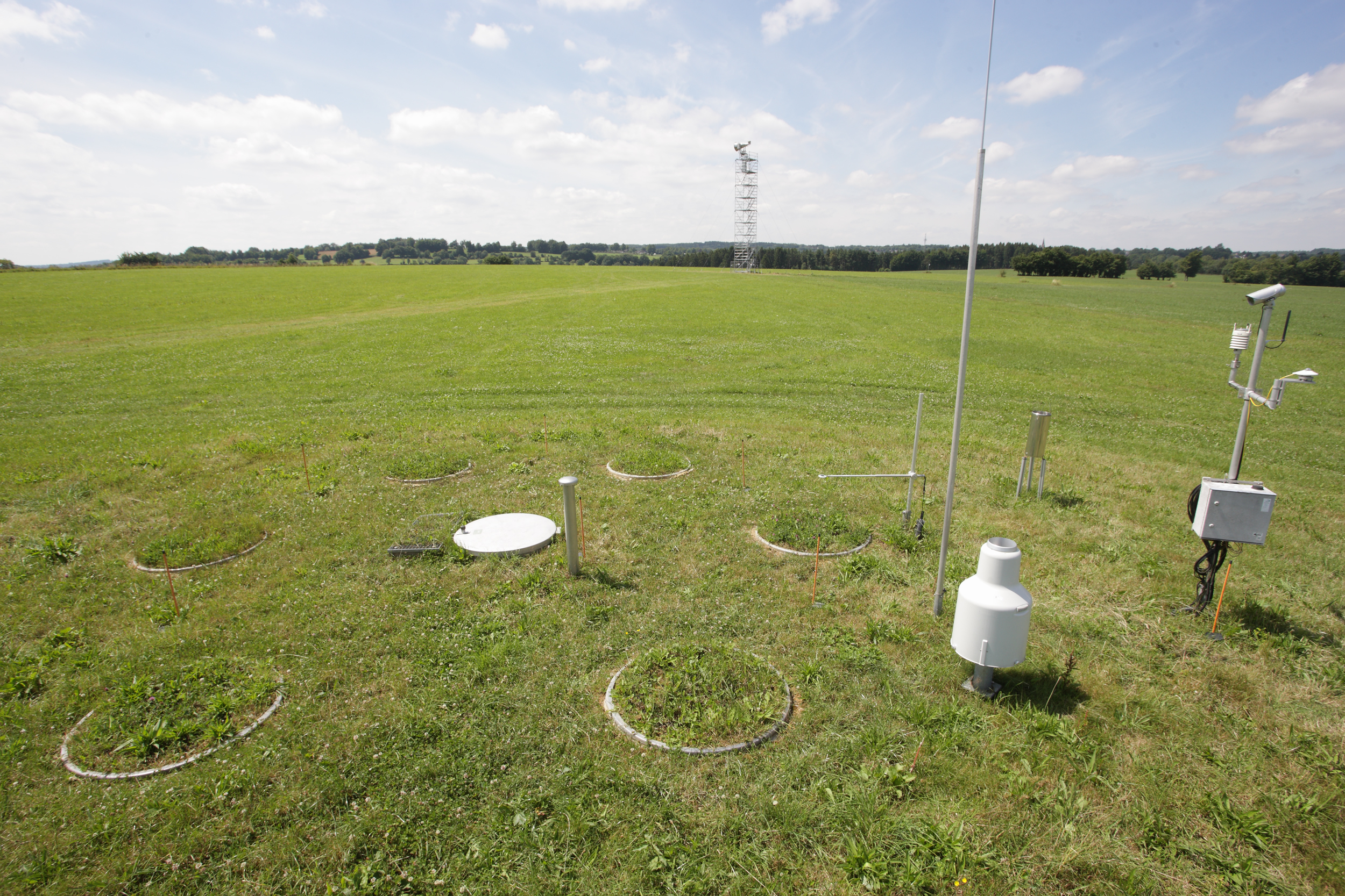
The Rollesbroich site is located in the low mountain range “Eifel” near the German-Belgium border and covers the area of the small Kieselbach catchment (40 ha) with altitudes ranging from 474 to 518 m.a.s.l.. The climate is temperate maritime with a mean annual air temperature and precipitation of 7.7 °C and 1033 mm, respectively, for the period from 1981 to 2001. Soils are dominated by (stagnic) Cambisols and Stagnosols on Devonian shales with occasional sandstone inclusions that are covered by a periglacial solifluction clay–silt layer. The mountainous grassland vegetation is dominated by perennial ryegrass (Lolium perenne) and smooth meadow grass (Poa pratensis). The study site is highly instrumented. All components of the water balance (e.g. precipitation, evapotranspiration, runoff, soil water content) are continuously monitored using state-of-the-art instrumentation, including weighable lysimeters, runoff gauges, cosmic-ray soil moisture sensors, a wireless sensor network that monitors soil temperature, and soil moisture at 189 locations in different depths (5, 20 and 50 cm) throughout the study site. Periodically also different chamber measurements were made to access soil or plant gas exchange.
-
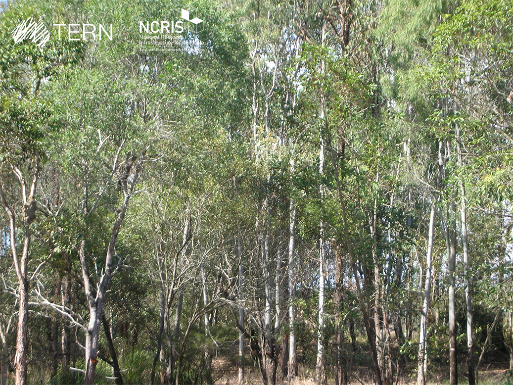
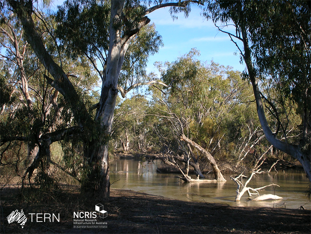
SEQ Peri-urban SuperSite - Karawatha is a member of the Australian SuperSite Network (SuperSites, http://www.supersites.net.au/), a facility within the Australian Terrestrial Ecosystem Network (TERN, http://www.tern.org.au/). SuperSites aims to answer both network wide and site-specific science questions through long term monitoring using both sensor technology and classical field methods. The SEQ Peri-urban SuperSite’s (SEQP) core infrastructure is located along two longitudinal transects north and south of Brisbane where the urban footprint is expanding the most rapidly. Karawatha Forest is on the southern peri-urban edge of Brisbane and is managed by the Brisbane City Council. It contains a variety of habitats from freshwater lagoons and sandstone ridges, to dry eucalypt forests and wet heath.
-
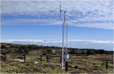
Mt Halla San is in Jeju Island, the only volcanic subtropical island, in South Korea. Every year the island is hit by several typhoons. It has shaped unique environmental characteristics and biodiversity. In addition the mountain is one of the most popular vacation sites with growing ecological concern.
-
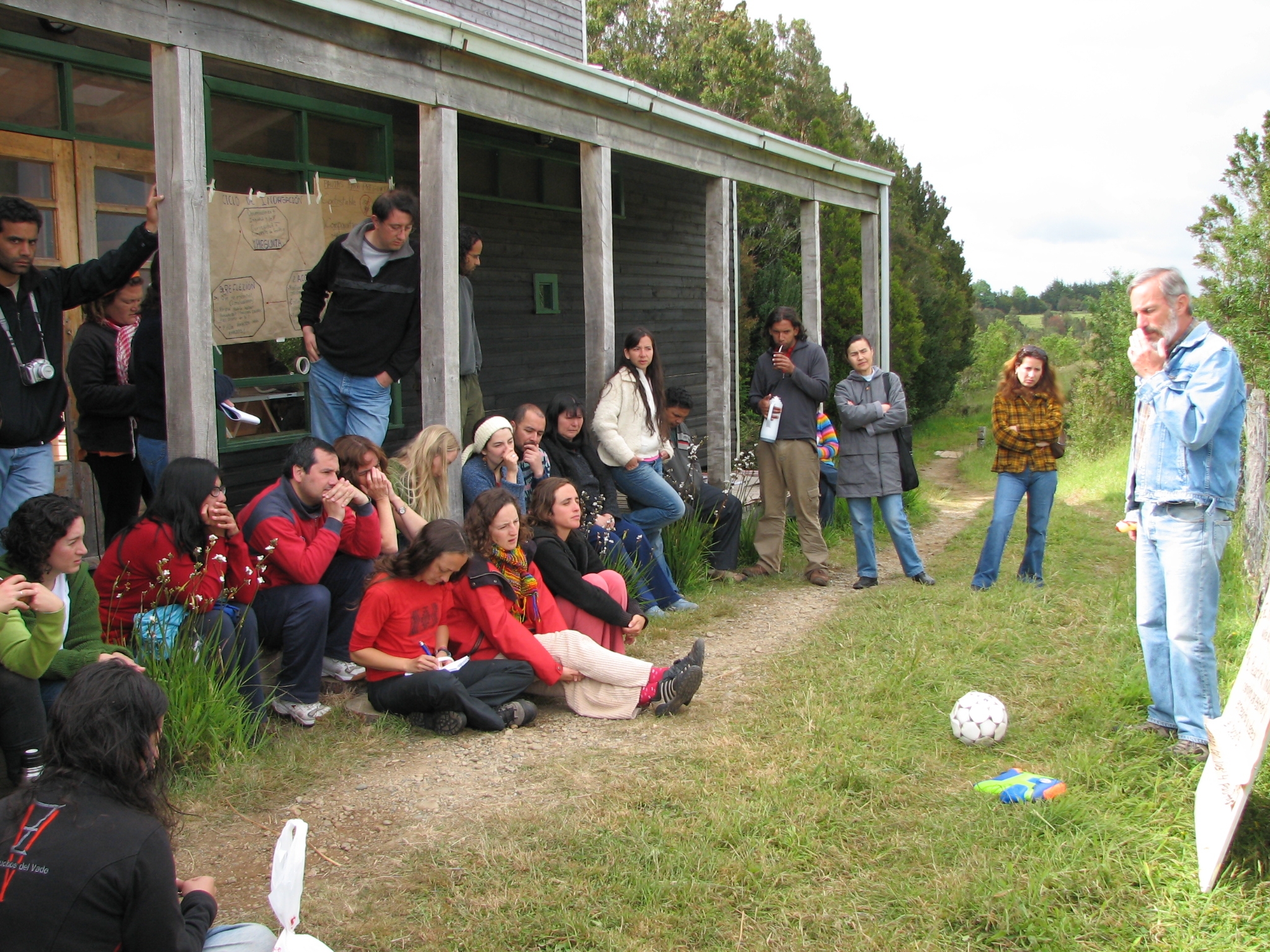
Senda Darwin Biological Station is located along Route 5 south, at a distance of 14 kilometers from the city of Ancud, in the north of Chiloe Island. It aims to facilitate scientific research, environmental education and the application of knowledge for temperate forests conservation.
-

The Great Western Woodlands SuperSite is a member of the Australian SuperSite Network (SuperSites, http://www.supersites.net.au/), a facility within the Australian Terrestrial Ecosystem Network (TERN, http://www.tern.org.au/). The GWW Supersite comprises a mosaic of temperate woodland, heathland and Mallee vegetation within the Great Western Woodlands (GWW) in south-western Western Australia. The core plots are located on the proposed Credo Conservation Reserve, a former pastoral lease that was established in 1906–07 where it first carried sheep and later cattle. In 2007 the lease was sold to the government and managed by the Western Australian Department of Parks and Wildlife who are collaborators on a range of projects. Native title claims of traditional ownership at this site have been registered by the Marlinyu Ghoorlie and Maduwongga Peoples. Key research objectives include: What are the impacts of climate change and management on the fundamental flows of energy, carbon, water and nutrient stocks in semi-arid woodland ecosystems. • Are old-growth semi-arid woodlands carbon sources or carbon sinks? • Are fire regimes changing in the GWW? • How do GWW biodiversity and fire fuels change with time since fire and what are the implications for fire management? • How do GWW woodlands and shrublands persist at low rainfall? What are the ecological determinants of the Menzies line (the striking boundary between the GWW and mulga) and how does it inform management for climate adaptation? • How will GWW biodiversity be affected by climate change? Will the response of fauna depend predominantly depend on vegetation responses? • How will regional versus population-scale genetic variability in key traits such as water use efficiency contribute to climate adaptation? • What are the thresholds of woodland persistence with respect to fire and rainfall? • What exotic species are invading the GWW, and which are the greatest threat under climate change?
-
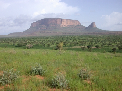
The Gourma mesoscale site (Mali) is part of the AMMA-CATCH observation network. Its characteristics are as follows :a 30000 km² endoreic area in semi arid climate. The studies are dedicated to vegetation monitoring in a pastoral environment.
-
The Calperum Mallee SuperSite is a member of the Australian SuperSite Network (SuperSites, http://www.supersites.net.au/), a facility within the Australian Terrestrial Ecosystem Network (TERN, http://www.tern.org.au/). The SuperSite is located on Calperum Station, near Renmark, South Australia with research plots located in mallee woodland, Callitris woodland and floodplain black box, river red gum and lignum ecosystems. The property was a pastoral grazing lease for nearly 150 years, so it has suffered grazing-induced modifications to its ecosystems that are now being actively restored. The Native Title for the area is held by the First Peoples of the River Murray and Mallee. Key research objectives include: • What are the fundamental energy, carbon, water and nutrient stocks and flows in the Mallee, Callitris woodland and river floodplain ecosystems? • How are these stocks and flows responding to the management interventions (reduced and controlled grazing, controlled fire, controlled floods on the floodplain)? • How are the biota changing in form, frequency and distribution as climate changes and management interventions are imposed? • How important is the connectivity between these ecosystems for hydrology, faunal movement and as refugia in times of drought?
-
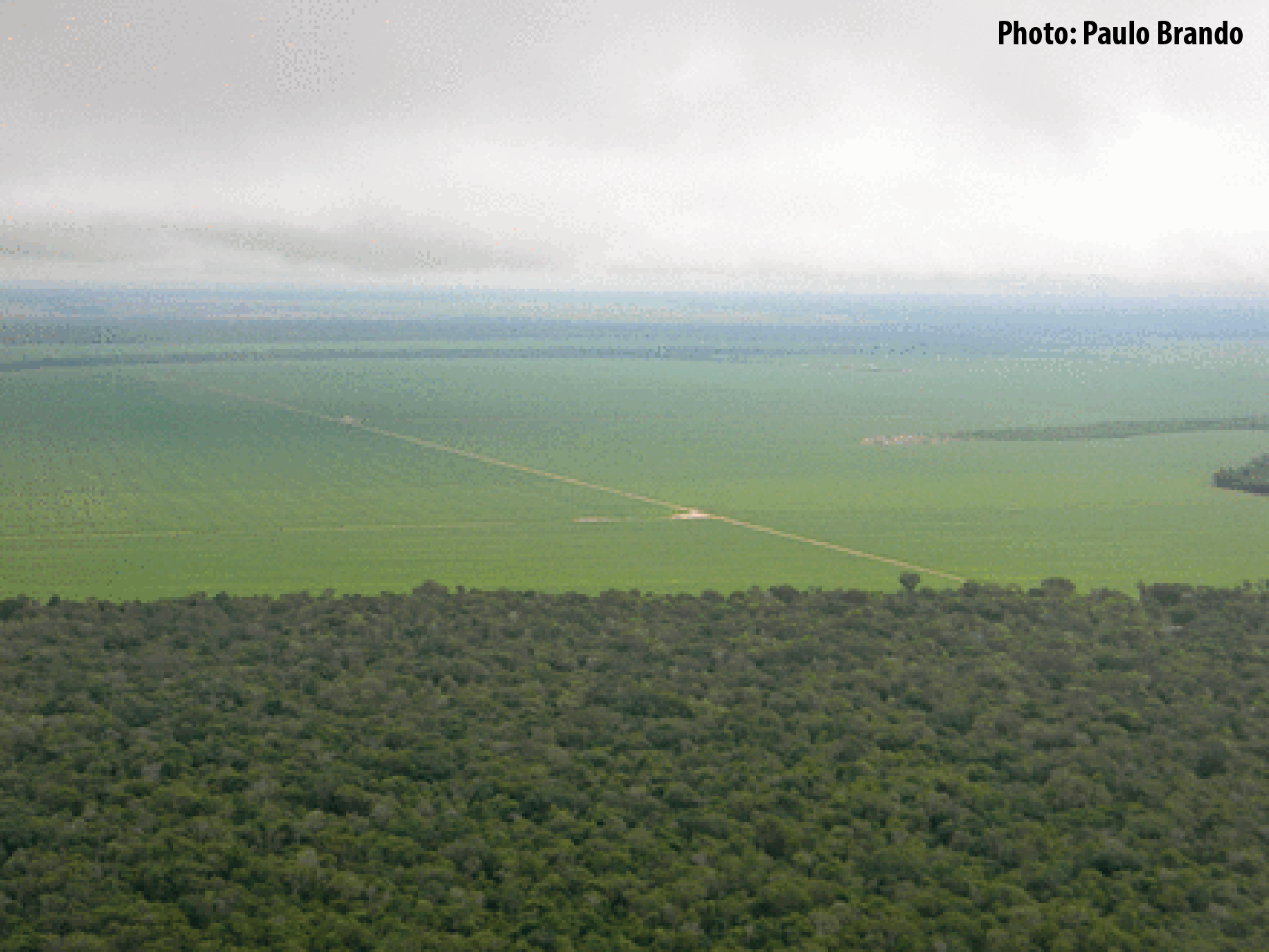
Tanguro Ranch is located in the southern Amazon, the driest portion of the Amazon Basin, and harbors a transitional forest (between Amazon forests and savannas). Tanguro lies on the Amazonian agricultural frontier, where largest rates of deforestation and fire occurred in last decades. The ranch experienced deforestation for cattle pasture in the mid-1980s, followed by a cropland expansion in the early 2000s. Starting in 2010, it has undergone a rapid shift from soybean single cropping to soybean-corn double cropping. The topography, soils, hydrology and farming practices at Tanguro are typical of the southern and eastern Amazonian agricultural frontier, a region that is highly vulnerable to changes in fire regime, climate change, and their interactions. Tanguro ranch represents changes that occur in a much wider area and that will probably occur in other regions of the Amazon Basin in a near future.
-
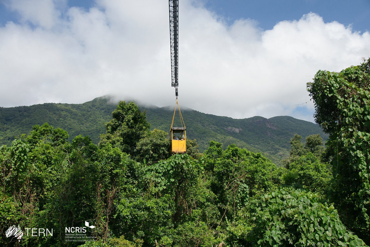
FNQ Rainforest SuperSite-Daintree is a member of the Australian SuperSite Network (SuperSites, http://www.supersites.net.au/), a facility within the Australian Terrestrial Ecosystem Network (TERN, http://www.tern.org.au/). SuperSites aims to answer both network wide and site-specific science questions through long term monitoring using both sensor technology and classical field methods. The FNQ Rainforest SuperSite is divided structurally into two transects, each based around an intensive study site node: the lowland rainforest node is based in the Daintree rainforest near Cape Tribulation and the upland rainforest is based at Robson Creek. The rainforests of FNQ occupy less than 0.2% of Australia’s landmass, yet support more than 10% of its flora, 36% of its mammals and 48% of its birds. The last remnants of the rainforests which formerly covered most of the continent, these globally significant World Heritage communities are also a repository for many ancestral lineages of the iconic species of Australia today, including kangaroos and eucalypts. Significant environmental clines (altitude, temperature, rainfall) exist over short distances in the region. This enables the monitoring of multiple parameters across a broad range of environments possible within the compact footprint of the FNQ Rainforest SuperSite. The Daintree node comprises two sites (i) the Daintree Rainforest Observatory (DRO) at Cape Tribulation, comprising a long-term monitoring plots, canopy crane, and extensive researcher and teaching infrastructure and (ii) research facilities at the Daintree Discovery Centre at Cow Bay, an award winning ecotourism interpretive centre featuring a canopy tower, aerial walkway and scientific monitoring. Key research objectives include: ● How are the biota (in particular locally endemic species) changing in form, frequency and distribution and what are the drivers for this? ● Does the vegetation represent a stable structure (overstorey versus understory dynamics) or has climate change affected it? ● Which taxa of organisms are the most sensitive to local climate change and how can these be assembled into an accurate biodiversity monitoring tool? ● What are the fundamental vertical and lateral energy, carbon, water and nutrient stocks and flows in the tropical forests of north Queensland? ● How are these stocks and flows responding to past management and climate change and how are they likely to respond in the future? ● How important is the connectivity between these ecosystems
-
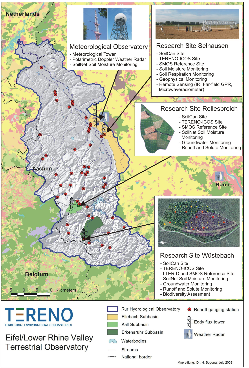
The central monitoring site of the Eifel/Lower Rhine Valley Observatory is the catchment area of the River Rur. It covers a total area of 2354 km² and exhibits a distinct land use gradient: The lowland region in the northern part is characterised by urbanisation and intensive agriculture whereas the low mountain range in the southern part is sparsely populated and includes several drinking water reservoirs. Furthermore, the Eifel National Park is situated in the southern part of the Rur catchment serving as a reference site. Intensive test sites are placed along a transect across the Rur catchments in representative land cover, soil, and geologic settings: In order to obtain spatially distributed information about river discharge rates, the Rur catchment is partitioned into a nested set of sub-catchments that will span distinct assemblages of hydrologic features and several orders of magnitude in drainage area. More detailed measurements and characterisation of smaller, focal catchments are embedded within progressively larger catchments, allowing the critical evaluation and development of scaling strategies. Additionally, for the analysis of the groundwater flow system and groundwater exchange rates on a regional scale, the monitoring of natural tracers of ground and surface waters will be carried out.