
leaf nitrogen concentration
Type of resources
Available actions
Topics
Keywords
Contact for the resource
Provided by
Years
Formats
Representation types
-
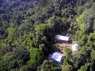
The site comprises 10,000 ha of pristine lowland rainforest in northern Papua New Guinea, owned by indigenous landowners from Wanang Village and declared as Conservation Area. The forest has >500 species of woody plants and largely intact, mildly hunted vertebrate communities. The site includes a field research station (phone, radio, accommodation, catering, solar power) accessible on foot or by helicopter. Further, the site has 50-ha forest dynamics plot from the Center for Tropical Forest Science network, with >300,000 stems tagged and monitored from 2012. There is significant background information on plants, birds, frogs, and several insect taxa. Insect monitoring programme is planned from 2013.
-

The Hölstein site is located in in the eastern part of the Swiss Jura mountains (47°26’16.4’’, 7°46’31.1’’; 540 m a.s.l.), in a mixed, temperate forest with an exceptionally high biodiversity and a vigorous tree regeneration. The research plot has a size of 1.6 ha and comprises 540 mature trees. The main tree species are Fagus sylvatica and Picea abies with an admixture of Abies alba, Quercus petraea, Pinus sylvestris, Acer pseudoplatanus, Carpinus betulus, Fraxinus excelsior and Sorbus torminalis. A canopy crane is installed in the center of the research area to access the tree canopies for in situ measurements and for sampling of leaf material. Rainout shelters will be installed in 2019 for conducting a long-term throughfall exclusion experiment.
-
The Sani Environmental Observatory (S.E.O.) is located within a mature, near-coastal Aleppo pine (Pinus halepensis L.) ecosystem at the peninsula of Kassandra, in Chalkidiki, Greece. It is part of the Stavronikita forest, which comprises approximately 300 ha of land covered mainly by forests and to a lesser extend by shrubs and pastures. The Observatory aims primarily at the assessment of the carbon and water balance of this typical low-elevation forest ecosystem to the ongoing climatic shift. Such ecosystems may be prone to the intensified heat and drought events, as well as to the associated insects’ and pathogens’ outbreaks, which are increasingly occurring at the Mediterranean region and particularly at its eastern part. Although Aleppo pines, as well as other Mediterranean pines, are generally adapted to the region’s xerothermic conditions, the in-depth understanding of their ecophysiological and growth responses will allow us to predict the potential of such ecosystems to adapt to climate change. SEO also serves to assess the carbon stocks and fluxes and the contribution of these natural, old-growth ecosystems to carbon sequestration and, thus, to climate change mitigation. S.E.O. is developed by the Forest Research Institute (Lab of Forest Ecophysiology) of the Hellenic Agricultural Organization Dimitra with the support of Sani Resort SA, the owner of the studied forest ecosystem, presenting a nice example of collaboration between the research community and the private sector. Given that SEO is located at a region of high touristic and aesthetic value, close to a wetland and the sea, the Observatory also plans actions to familiarize people with environmental monitoring and the multiple functions and services of the studied Mediterranean ecosystem.
-
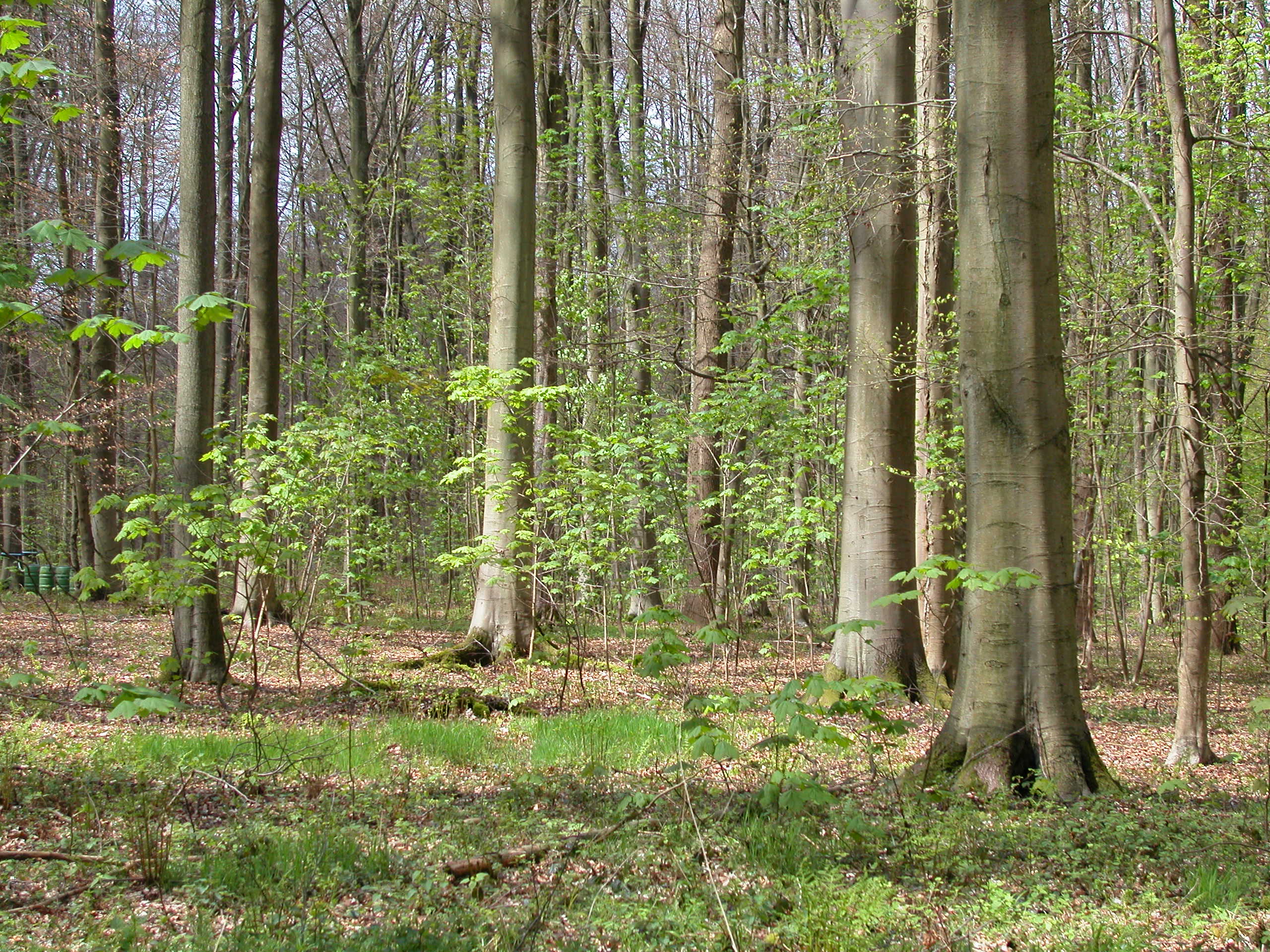
The Aelmoeseneie Forest is a 28.5 ha mixed deciduous forest in the community of Gontrode, just southeast of Ghent. The largest part of the forest is ‘ancient forest’, i.e. it is permanently forested since before 1775, while the forest is surrounded by agricultural land (mostly pastures). The soil consists of a silt loam to loam soil (Planosol), overlaying a mosaic of tertiary clayey and sandy deposits with high base saturation starting at 50 cm depth. Forest management is designed to obtain a more natural tree species composition and to conserve biodiversity. More info can be found at www.aelmoeseneiebos.ugent.be.
-
The site Bily Kriz (Bílý Kříž) is located in Moravian-Silesian Beskids Mountains. Ecosystem type: Managed secondary pure Norway spruce stand. Prevailing species: Norway spruce (Picea abies [L.] Karst.) Height of the stand: 17 m (2016) Understory: Vaccinium myrtillus L. Year of plantation: 1981 by 4 years old seedlings
-
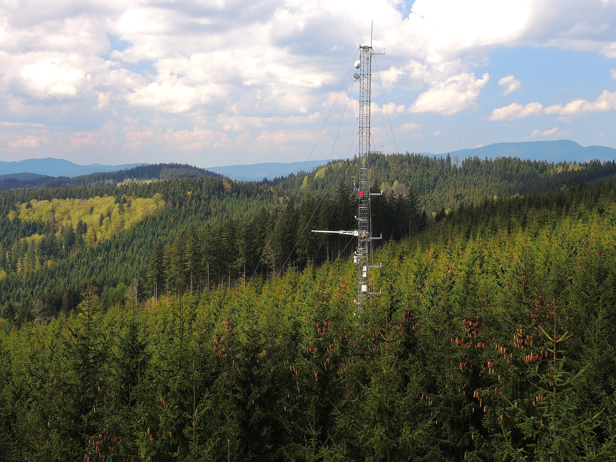
The site is located next to Wettingen in the canton of Aargau, within a natural, mixed forest stand which mainly consists of 150 year-old beech (Fagus sylvatica) and 120-170 year-old spruce (Picea abies) trees. Among others, the site is equipped with two meteorological measurement stations; one is located within the forest stand, the second is co-located in the nearby open-field, allowing to measure the forest stand effect on micro-climate. The following parameters are being measured since 2013: Soil solution chemistry (lysimeters), TREENET, atmospheric deposition (throughfall and bulk deposition), circular vegetation plots, crown condition assessment, diameter and height measurements, foliar analyses, leaf area index (LAI), litterfall, manual circumference band measurements, Ozone visible injury assessment, permanent vegetation quadrats, phenological observations, sapflow measurements, soil matrix chemistry, tree core sampling, automated point dendrometer measurements, automatic circumference band measurements.
-

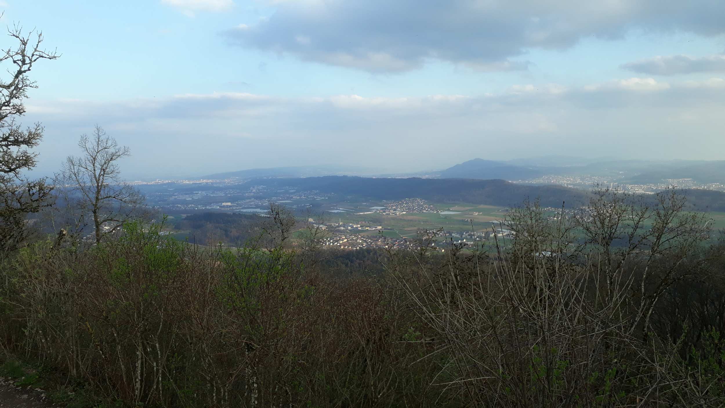
As the largest contiguous pine forest in Switzerland, the Pfyn forest in Canton Valais (46° 18' N, 7° 36' E, 615 m ASL) offers the best conditions for such measurements. In light of this, a WSL research team installed a long-term experiment of 20 years duration in the Pfyn forest. The average temperature here is 9.2°C, the yearly accumulated precipitation is 657 mm (average 1961-1990). The pines in the middle of the forest are about 100 years old and 10.8 m high. The test area has 876 trees covering 1.2 ha divided into 8 plots of 1'000 m2 each (Image 4). Between the months of April and October four of these plots are irrigated by a sprinkler system providing an additional 700 mm of water, annually. In the other four plots, the trees grow under natural, hence relatively dry conditions.
-
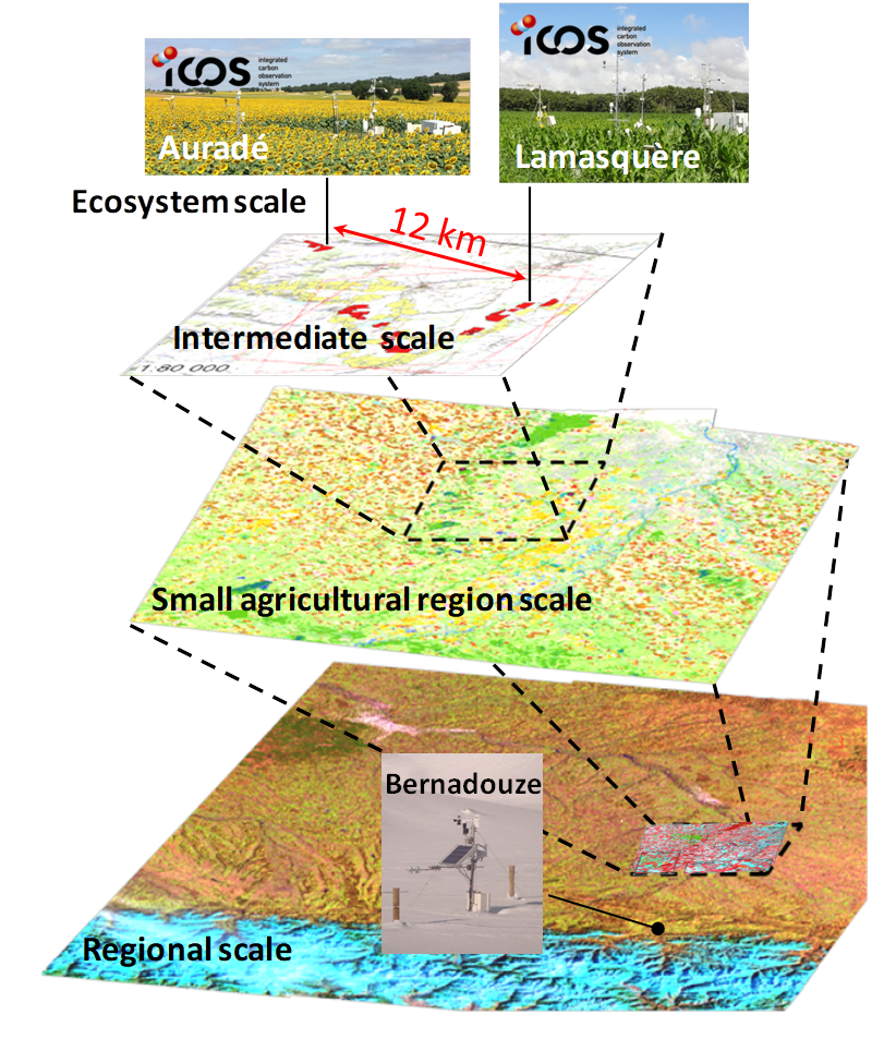
The Regional Spatial Observatory (OSR), labeled in 2007 by the National Institute of Sciences of the univers (INSU), is supported by the Center of Spatial Studies of the BIOSPHERE (CESBIO, OMP). The mission of the OSR aims at documenting on the long term the effects of the climate change and the increasing anthropogenic pressures on the hydrologic and agro-ecologic evolutions in the South-West of France near Toulouse, for various spatial and temporal scales.
-
This LTER-site corresponds with a 0.25 ha intensive forest monitoring plot (ICP Forests Level II) including a 0.25 ha buffer zone. The site is located in a homogeneous stand of Corsican pine (Pinus nigra ssp. laricio var. Corsicana Loud.) planted in 1930 on former heathland and is part of Gewestbos Ravels, a landscape (about 1000 ha) with deciduous and coniferous forests, heathland, bogs and pastures in the northern part of the Campine ecoregion of Flanders. The terrain is gently sloping (1-2 %) and the soil is a well-drained sandy soil (Endogleyic Folic Brunic Albic Arenosol (Dystric)). Ground vegetation is dominated by ferns (Dryopteris dilatata and D. carthusiana) and Vaccinium myrtillus. After a storm in February 2007 felled several trees an understorey of Betula pubescens started to develop. Intensive monitoring was started in 1987 with the main objective to study the effects of air pollution on biogeochemical cycling and forest performance (growth, vitality). This yielded a number of long-term data series including on atmospheric deposition, air quality, soil and soil solution chemistry, tree mineral nutrition, ground vegetation and growth. Monitoring will be continued in the future as a statutory task of INBO.
-
Large forest area, ancient woodland of beech forests, just south of Brussels. In this forest, numerous research activities covering silviculture, forest history, biodiversity inventories, geomorphology, recreation etc... have taken place. Therefore, the complete forest is proposed as an LTSER-platform. Within the forest, two active long-term ecological monitoring programmes are present: - one ICP Forests Level II intensive forest monitoring plot (permanent sampling since 1987) - strict forest reserve monitoring programme on an area of 100 ha (periodic sampling of 15 ha since 1986, extended to 100 ha in 2000) On July 7th 2017, the strict forest reserve 'Joseph Zwaenepoel', together with 4 other unmanaged reserves in the forest, was added to the UNESCO Natural Heritage Site ' Primeval Beech Forests of the Carpathians and Other Regions of Europe' (http://whc.unesco.org/en/list/1133). Besides these, a large number of former research projects, PhD research and a detailed management follow-up make the Sonian Forest one of the best mapped and documented forests in Belgium / Europe.