
litter residence time
Type of resources
Available actions
Topics
Keywords
Contact for the resource
Provided by
Years
Formats
Representation types
-
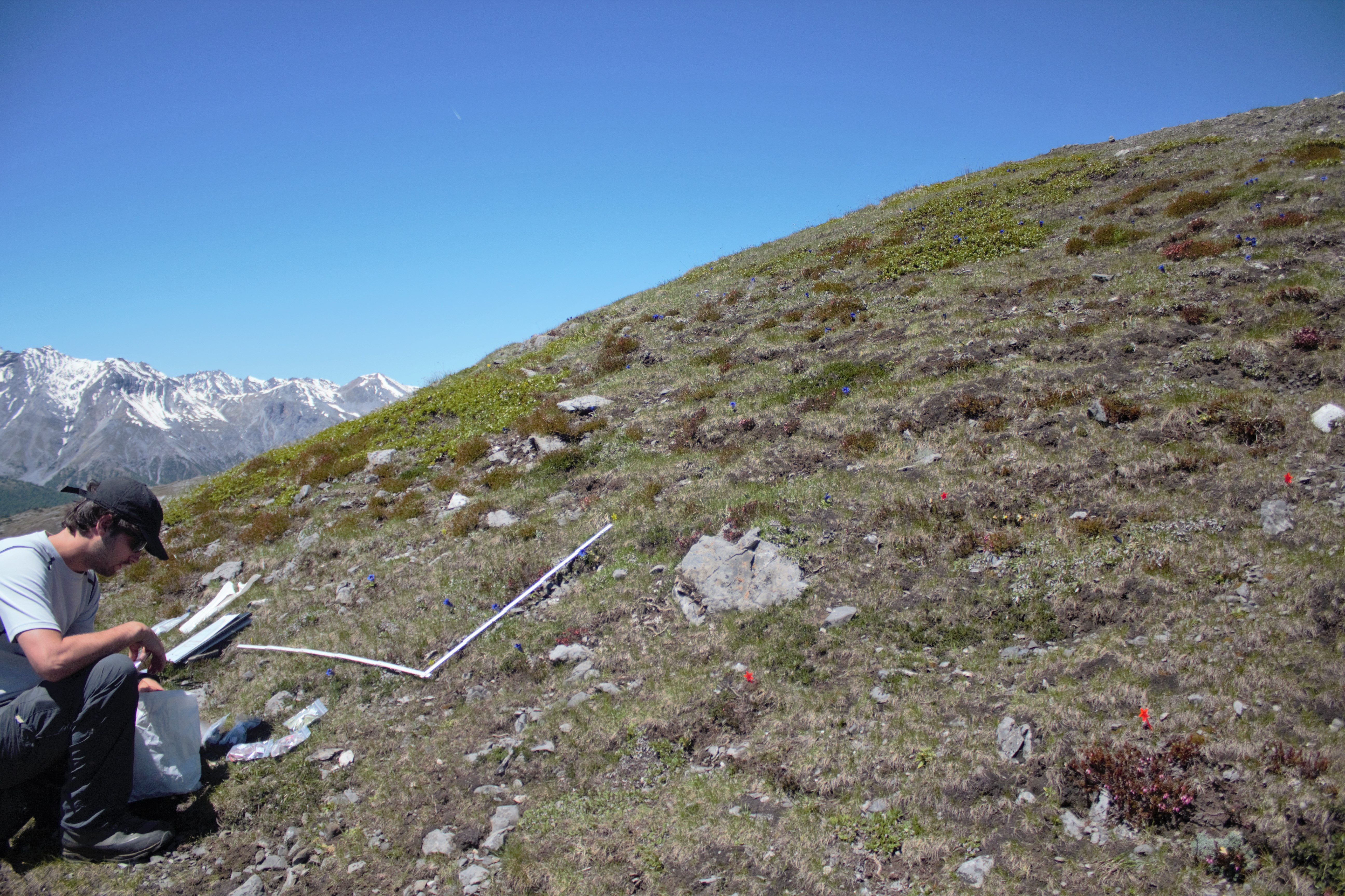
Summit associated with GLORIA target region on dolomite of the Swiss national park. Not used for vegetation monitoring, only for teabag study. Original GLORIA summit at the same altitude is located inhighly sensitive area of the park, where access only occasionally permitted.
-
None
-
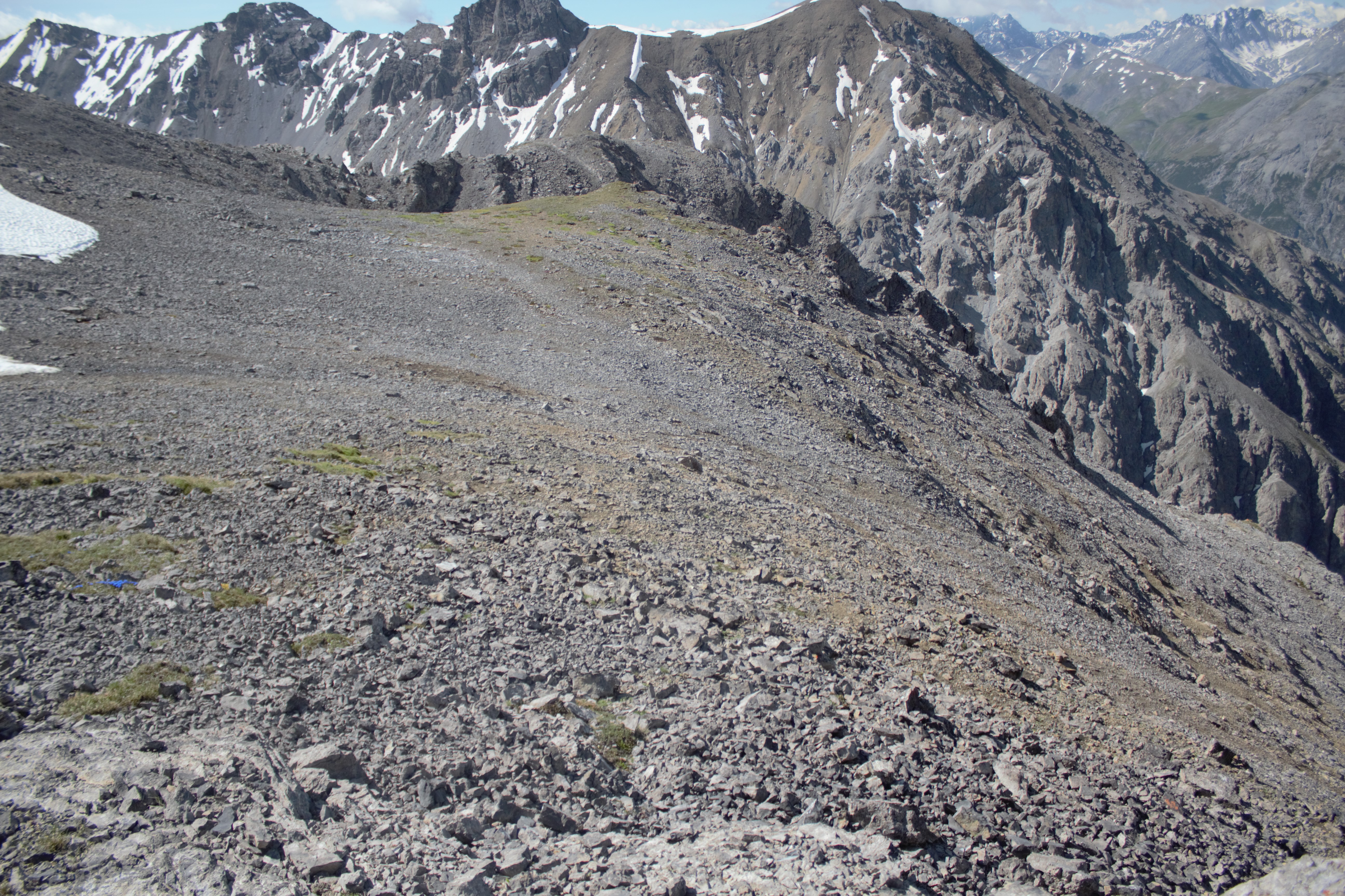
lowest GLORIA summit on dolomite in the Swiss Nationa Park region
-
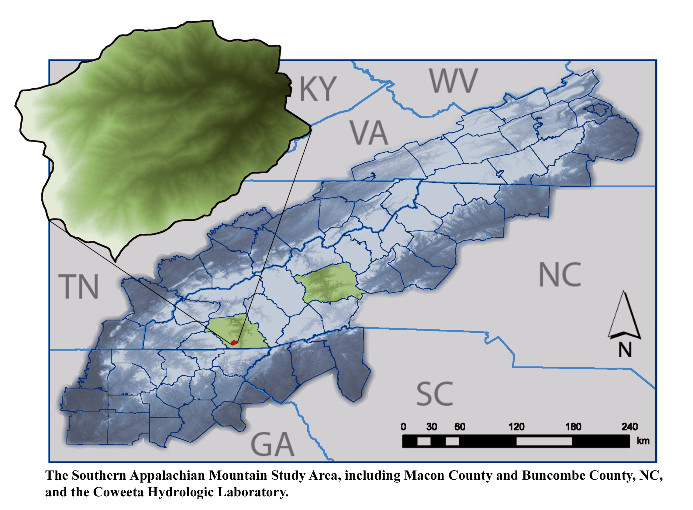
The majority of research is conducted within the US Forest Service Coweeta Hydrologic Laboratory located in the Nantahala Mountain Range of western North Carolina, USA, within the Blue Ridge Physiographic Province. The site is part of the Upper Little Tennessee River Watershed Basin.
-
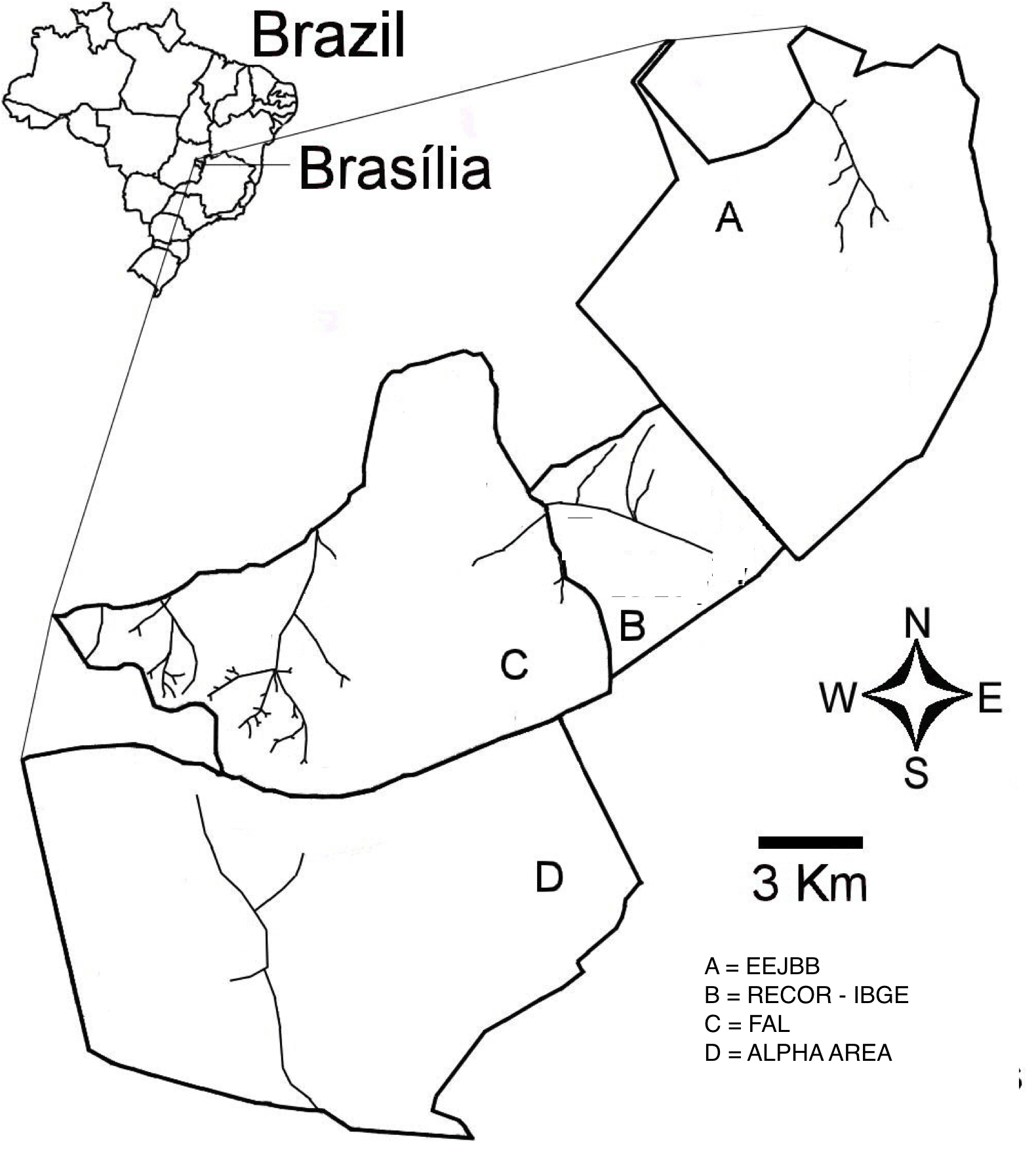
The “Área de Proteção Ambiental das Bacias do Gama e Cabeça de Veado” (AGCV) is located in the central area of the Cerrado domain in Brazil. This area of environmental protection is important due to its strategic localization as a buffer area between urban areas and the natural environments in DF, and by harboring hydric resources from two basins. There are three contiguous conservation units located inside the AGCV: Estação Ecológica do Jardim Botânico de Brasília (EEJBB; Ecologica Station of the Botanic Garden of Brasilia), the Reserva Ecológica do Roncador - IBGE (Recor - IBGE; Roncador Ecological Reserve) and Fazenda Água Limpa (FAL; Agua Limpa Farm, the ecological and agricultural field station of the Universidade de Brasília. In addition to those there is a contiguous 5,000-h area which is well-preserved, locally known as Alpha area. This latter and the three other conservation units are located 25 km SW of Brasília, Federal District, and together comprise about 15,000 ha in the core part of the Cerrado domain. A mosaic of Cerrado vegetation, including open vegetation, typical savanna formations, and forests occur in the region.
-
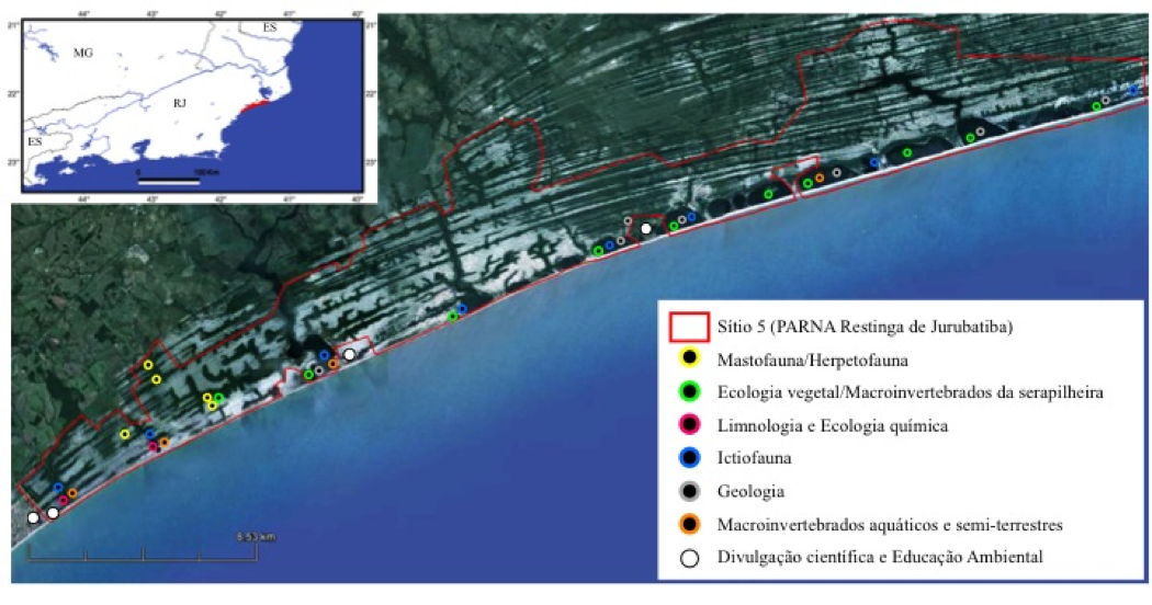
On the quaternary coastal plains of the northern of Rio de Janeiro State, the Restinga de Jurubatiba National Park Brazil encompass 11 vegetational units varying from shrub vegetation (locally known as "restinga") to inundated forest and 18 coastal lagoons which differ largelly in salinity. Organisms such as reptiles, amphibians, mammals, fish, aquatic and terrestrial plants and processes (carbon cycling) have being study since 1999 under this site of the Brazilian Long Term of Ecological Studies innitiative.
-
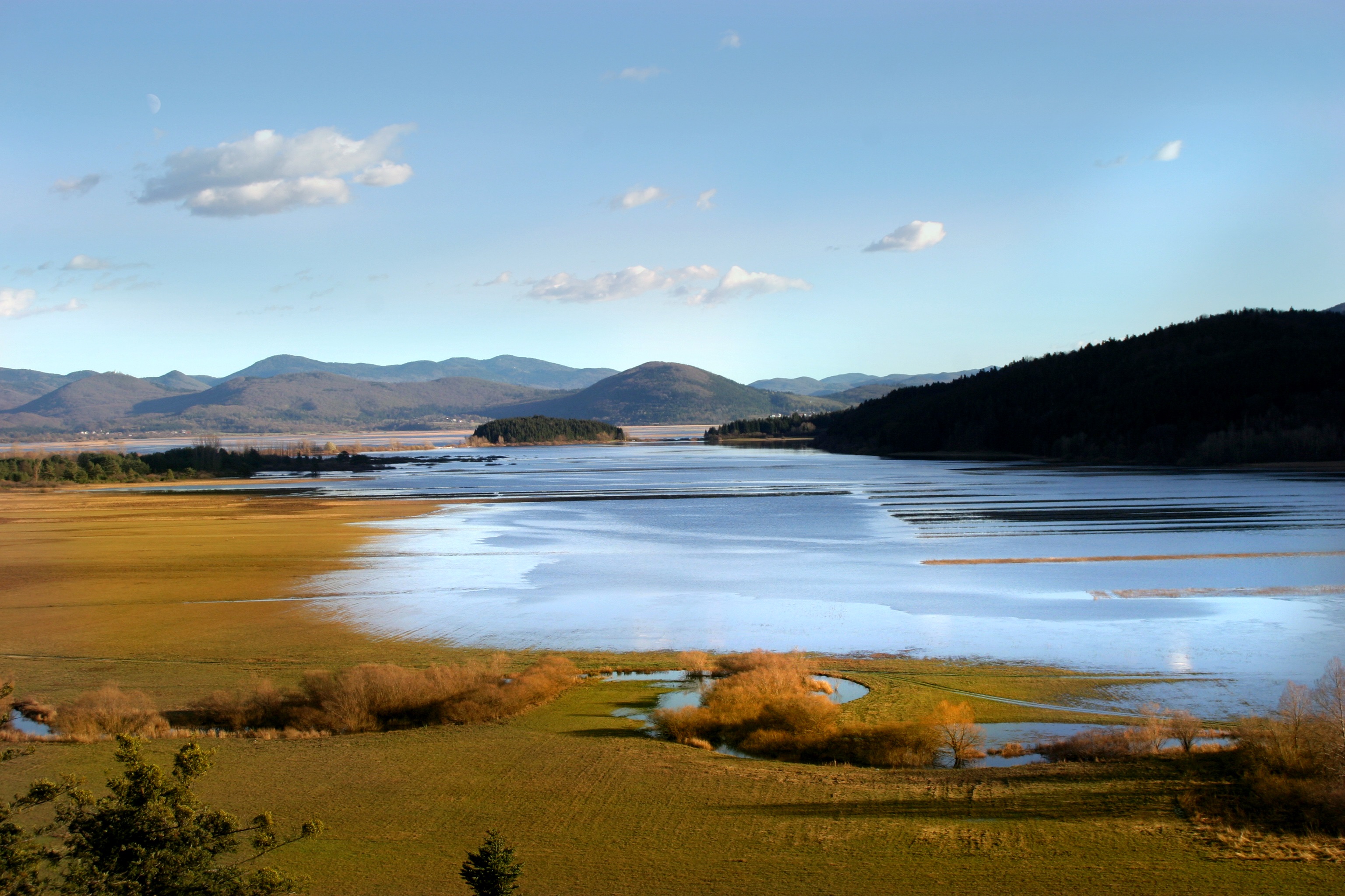
Lake Cerknica is intermittent lake appearing at the bottom of closed depression Cerkniško polje extending on the area of 38 km2. The karst features are associated with carbonate rock, both with limestone and dolomite. About 80 % of inflow consists of karst and only 15% of surface waters. The outflow is completely karstic. In spring and usually late in autumn the lake reaches normal level 550 m a.s.l., covering the area of 26 km2. Polje is flooded for 9 and dry for about 2 months, usually in summer. Lake Cerknica is a highly diverse ecosystem that changes in time and space. Vegetation pattern shows clear zonal distribution that depends on extent and frequency of flooding. The lake supports rich fauna with many endangered species, providing temporary shelters and food for protected large carnivores, such as brown bear, wolf, lynx and numerous species of water birds. In recent decades, flood and drought events have become increasingly irregular altering processes and conditions for many species.
-
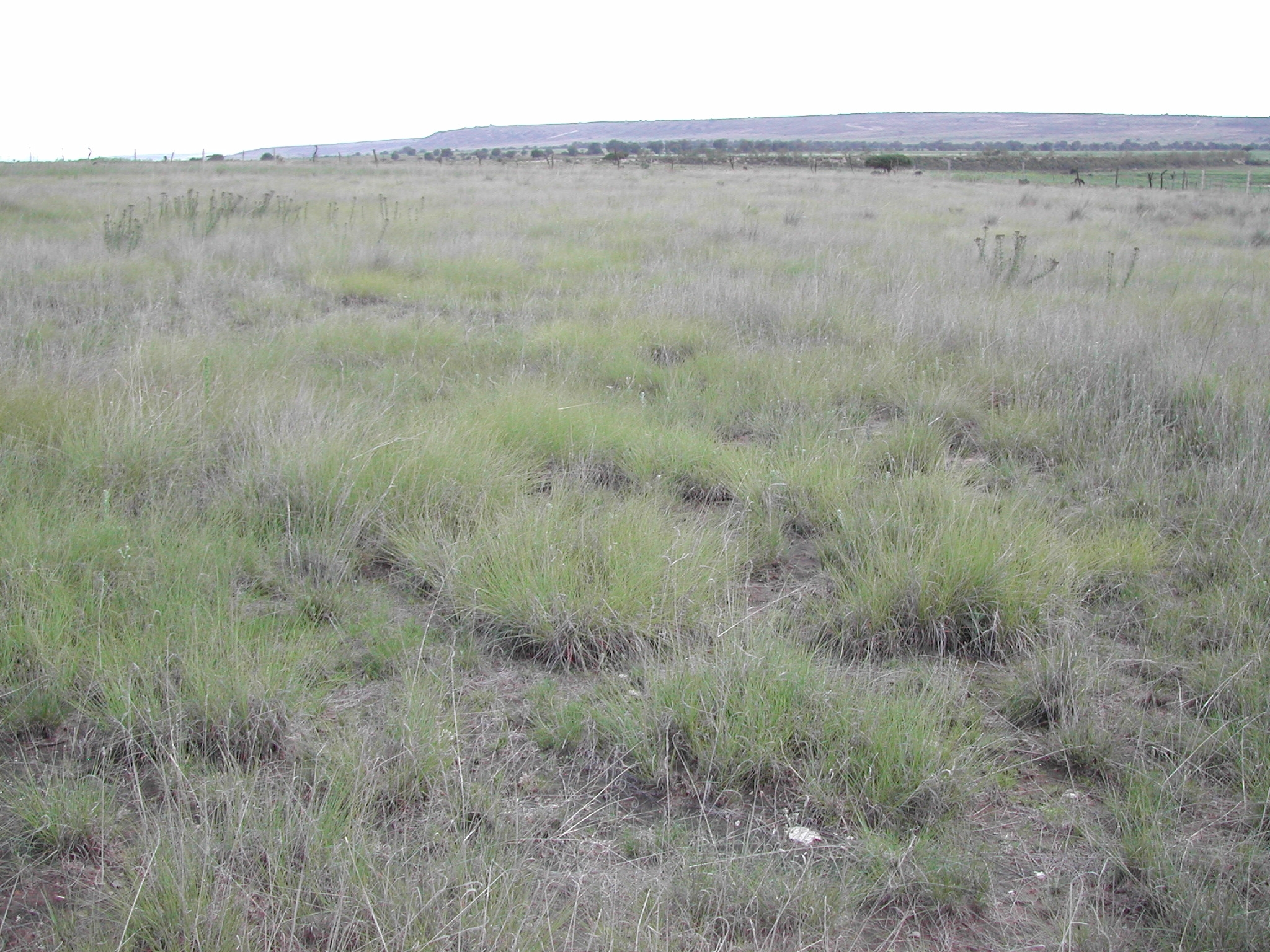
Los sitios están localizados a lo largo del bioma de pastizal semiárido que se extiende desde el norte del estado de Chihuahua, hasta la subprovincia geográfica de los Llanos de Ojuelos en el noreste de Jalisco. Todos exhiben una vegetación de pastizal semiárido dominado por gramíneas cortas del género Bouteloua. La topografía se caracteriza por llanuras, mientras los suelos predominantes están clasificados como xerosol háplico asociado a litosol y xerosol háplico asociado con litosol y planosol éutrico; estos suelos son someros (menos de 50 cm de profundidad). El tipo de uso histórico ha sido de pastoreo, aunque existen algunas áreas donde se realizó agricultura de temporal.
-

Hydrometeorological and biogeochemical observations within 5 embedded catchments (from 0.2 to 14.5 km2). Alpine Mediterranean climate with heavy rainfall and flash floods in automn. The geology is mainly granite. The land use is mainly grassland and forest. More information at http://www.ohmcv.fr
-
The Kellogg Biological Station (KBS) is located in southwest Michigan in the eastern portion of the U.S. cornbelt, 50 km east of Lake Michigan in the SW corner of the state (42° 24′ N, 85° 24′ W, elevation 288 m). Annual rainfall at KBS averages 1,005 mm/y with about half falling as snow; potential evapotranspiration (PET) exceeds precipitation for about 4 months of the year. Mean annual temperature is 10.1 °C. KBS is 1600 ha of cropping systems, successional communities, and small lakes. Surrounding KBS is a diverse, rural-to-semirural landscape typical of the U.S. Great Lakes and upper Midwest regions. The diversity of land use, soil and vegetation types, and aquatic habitats within a 50-km radius of the Station is high. Most of southwest Michigan is on the pitted outwash plain of the morainic system left by the last retreat of the Wisconsin glaciation, circa 12,000 years ago. Soils in the area developed on glacial till, and include well- and poorly-drained alfisols, mollisols, and entisols. Most regional soils are sandy loam and silty clay loam of moderate fertility, principal Station soils are Typic Hapludalfs. Land use around KBS ranges from urban (Kalamazoo, with a metropolitan population of 180,000, is 20 km south of the Station) to rural; vegetation ranges from cultivated and early successional old fields to older growth oak-hickory and beech-maple forests; and aquatic habitats include more than 200 bodies of water of different morphometries, alkalinities, and degrees of eutrophication within 50 km. Cropping systems in the area are typical of the U.S. cornbelt — mainly corn/soybean rotations with wheat of varying importance, and alfalfa an important forage crop. KBS yields are typical of non-irrigated yields elsewhere in the North Central Region. KBS LTER research is carried out in a variety of experimental systems. The most important of these is the Main Cropping System Experiment (MCSE), which was started in 1989 and consists of 11 different cropping systems or successional plant communities, ranging from annual corn-soybean-wheat rotations to late-successional deciduous forest. All communities are replicated within the landscape.