
macrofauna abundance
Type of resources
Available actions
Topics
Keywords
Contact for the resource
Provided by
Years
Formats
Representation types
-
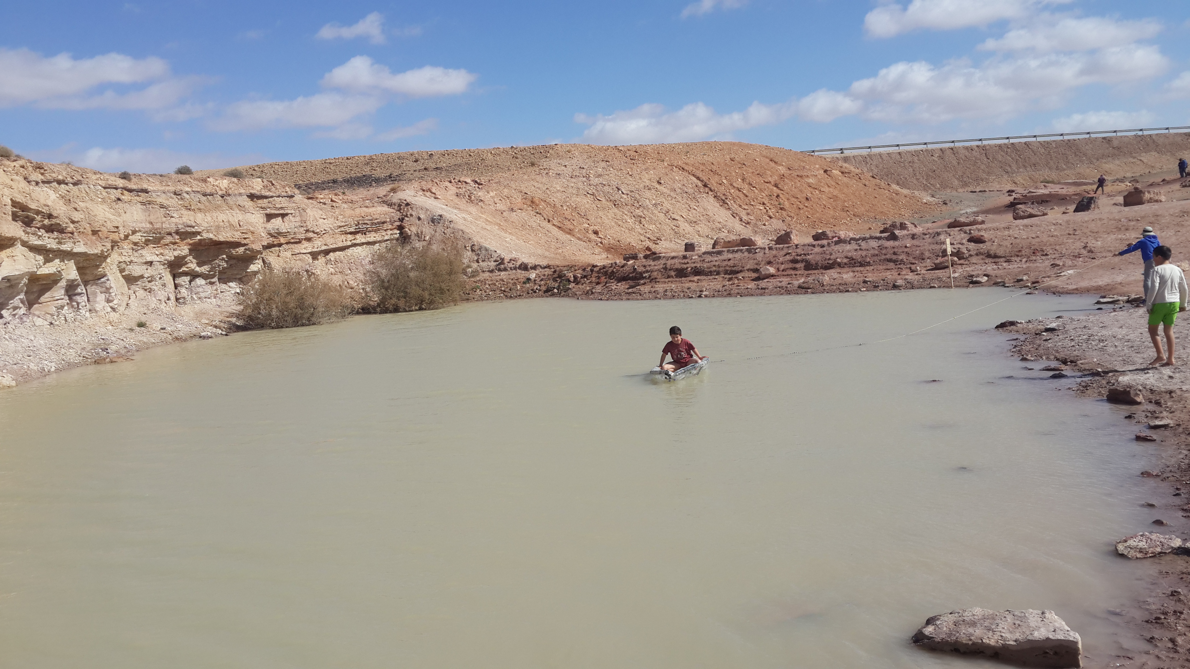
The site is located between two bio -geographical zones arid and hyper-arid, the research is carried out by both sides. The arid side is characterized by remains of terraces from the Nabatean agriculture runoff. The main research topics that being studied in the site are: biodiversity, climate change, runoff hydrology. The arid zone is a geo hydrological ecological system which is depended on a combination of rainfall and runoff that creates water enriched parches that support relatively high biodiversity. The hyper arid zone is runoff depended system the source of runoff are stipe, slope consist on bare bedrock, biological activities are constructed in the dry riverbeds that functions as sinks for the runoff generated from the slopes.
-
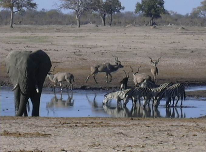
The LTSER Zone Atelier Hwange (ZAHWG) belongs to LTER-France network and is located in western Zimbabwe, in Sub-Saharan Africa, and is centered around Hwange National Park. The ecosystem is dominated by dystrophic savannas (mostly wooded savannas and dry woodlands) with discrete water sources. Surrounding land-uses include forestry areas, subsistence agro-pastoral farming, private ranches and hunting concessions, and mining. The ZAHG conducts an interdisciplinary research on the dynamics and resilience of this socio-ecological system organised, around a large protected area with re-known large mammal diversity and facing major social and climatic challenges for sustainable conservation
-
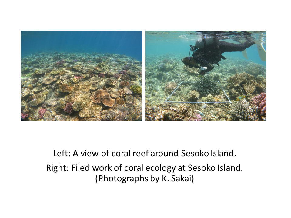
Sesoko Island is located at the west of northern part of Okinawa Island, Okinawa Prefecture, Japan. Okinawa Prefecture is in subtropical climate, and islands of Okinawa are fringed by coral reefs. Sesoko Island is a good field for studying coral reefs.
-
Managed realignment in the brackish part of the Scheldt Estuary. Realised since April 2004. A formal sand stock was removed to allow tidal influence.
-
Guanabara Bay (GB) is the second largest bay in the coast of Brazil (384 km2) (22o41 to 22o56 S ; 43o02 to 43o18 W). In its surroundings live 16 million inhabitants (6 million in Rio de Janeiro city). This system experiences steep spatial gradient from the entrance to inner bay. GB receives high load of nutrients and organic material from riverine sources and from domestic and industrial sewage inputs. As a consequence, this system is characterized as a high eutrophicate and polluted one. In spite of its poor environmental status, GB still presents many living resources who use the bay as a refuge, feeding and nursery grounds, with some of those species having commercial interest. An important characteristic of GB is the influence of South Atlantic Central Water, a deep, cold and rich nutrient water, that enters the bay during the Cabo Frio upwelling period. This phenomenon permits to maintain the bay at a relative good health level in its central part, in contrast with the marginal areas highly polluted. Although encroached on by urban expansion, the inner east margins of Guanabara Bay is still bordered by a 90 km2 fringing mangrove system, of which 43 km2 is an environmental protection area, Guapimirim.
-
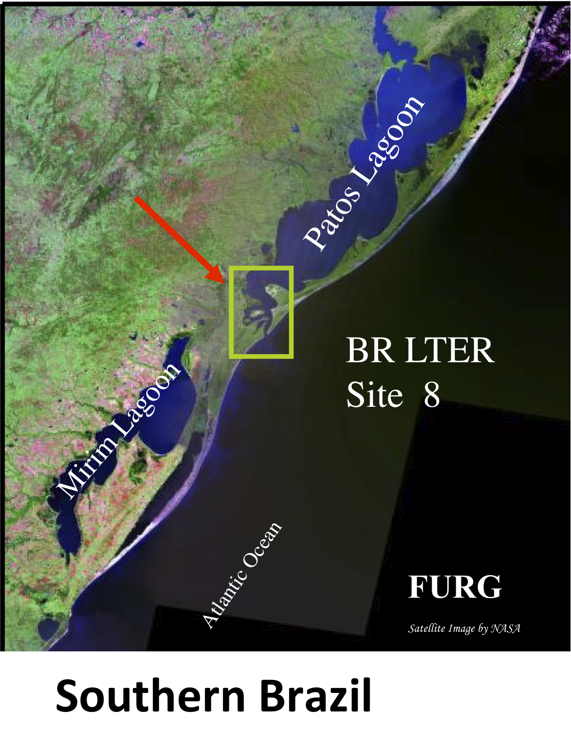
Patos Lagoon is the largest (1,036,000 ha) choked lagoon in the world, extending from the city of Porto Alegre (30º30’ S) to Rio Grande (32º12’ S) in southern Brazil, at the Atlantic coast of South America. In the southern reaches, the Patos Lagoon Estuary and Adjacent Coast (PLEA) present high biological productivity and at the same time provide significant ecosystem services including artisanal and industrial fisheries, an industrial conglomerate and is home to an important maritime port. The hydrology and biology of the ecosystem has been studied since the nineteenth century and the site has been included in the framework of the Brazilian Long Term Ecological Research in 1998. Systematic analysis has been conducted of abiotic and biotic information unraveling the functioning of the ecosystem and their organisms from phytoplankton to marine mammals. Climatic events and human activities both affect the ecology of the highly dynamic PLEA. This shallow warm temperate estuary is river dominated, and freshwater discharge peaks are strongly associated with El Niño Southern Oscillation - ENSO episodes. Rainfall increases significantly during El Niño periods, while low discharge occurs during La Niña when drought conditions are observed. These phenomena influence salinity, physico-chemical water characteristics and sediment dynamics in the estuary, which in turn influence the biota. Long-term continuous studies (more than 25 years) have demonstrated that significant changes of phytoplankton, zooplankton, macrobenthic fauna and flora, crustaceans, fish and marine mammals in these coastal ecosystems are induced by natural impacts and human-related factors. Moreover, freshwater water discharge to the Atlantic Ocean has an overriding influence on ecological processes in the adjacent coastal region and vice-versa fishing activities on the coastal region influence the ecology of the estuary. These conclusions were only possible due to long-term continuous studies conducted in the Patos Lagoon estuary and adjacent coastal region, making this dataset the most comprehensive in South America.
-
The White Carpathian (Bílé Karpaty) Mts. are important especially for their vast species-rich meadows with many rare and endangered species, often having here very large populations or remarkably isolated occurrences distant from the centres of their natural ranges. Čertoryje Nature Reserve and its buffer zone, which form the majority of the LTER site, is the largest area of this precious habitat in the White Carpathians. Meadows which were not fertilized (or even ploughed up) under socialist agriculture in the second half of the 20th century are the most valuable. These meadows are usually situated on steep slopes which were hardly accessible to the machinery and were thus often totally abandoned and gradually overgrew with expansive grasses and scrub. Their current biological diversity therefore needs resumption of the former extensive management (scrub elimination and subsequent regular mowing without fertilization). These resoration activities started here in the mid 1980s. A fine-scale monitoring of vegetation succession after management restoration at one of these plots is a component of the long-term research here since 1989. The opposite extreme of socialist agricultural management of species-rich meadows was their conversion to arable land. These fields have been gradually re-grassed since 1989. Restoration of the former species-richness is however very slow (or even impossible) and needs special restoration measures. Hence another objective of the local long-term research is the succession on re-grassed arable fields. Spatially detailed observations take place on the eastern slope of the Výzkum hill and are aimed to find out an optimalized economic method of restoring a species-rich meadow (four variants are tested). Except vegetation succession, also the development of several soil fauna coenoses (Testacea, Nematoda, Oribatida, Collembola, Enchytraeidae, Lumbricidae, Oniscidea, Diplopoda, Chilopoda, Opiliones, and Carabidae) has been studied here since 2000. Since 2009, also succession in a broader landscape context is studied, taking into account restored grasslands in a major part of the whole White Carpathian Mountains. More than one tenth of the localities from this landscape study takes place directly in the LTER site, representing about 100 hectares regrassed by a regional species-rich seed mix since 2000 and 30 hectares regrassed by a commercial clover-grass seed mix in the late nineties. The research is focused on both plants (mainly vascular plants, additionally also bryophytes) and animals (Auchenorrhyncha, Heteroptera, Lepidoptera: Hesperioidea, selected phytophagous Coleoptera).
-
The North Sea Benthos Observatory included several endo- and epibenthic long-term series in the North Sea (see map), which provide a comprehensive and habitat-specific assessment of temporal variability of benthic communities in the North Sea against the background of changing climate and human activities such as fishery. The specific characteristics of the single time series are as following: 1. JADE epifauna sampled since 1972 every 2. and 3. quarter. 2. NORDERNEY infauna since 1978 in the 1., 2. and 3. quarter. 3. TRANSECT German Bight to Doggerbank (Infauna) since 1990 every May. 4. GSBTS, in- and epifauna in 6 specific areas (so called "Boxes") from the German Bight to the Northern North Sea since 1998 in July/August. 5. IBTS, in- and epifauna in the south-eastern North Sea (24 ICES rectangles) since 1998 in July/August. 6. DOGGERBANK infauna, several decades: 1920s, 1950s, 1980s, 1990s, 2000s. 7. JADE BAY infauna, several decades: 1930s, 1970s, 2009. 8. GASEEZ, epifauna in the German Exclusive Economic Zone since 2007 in November/December.
-
Curonian lagoon biosphere polygon is a part of ecologic and specialized monitoring system for biological diversity and NATURA2000.
-
NINA Aquatic Research Station, Ims provides advanced research facilities on aquatic research, primarily focused on fish ecology