
mean annual precipitation
Type of resources
Available actions
Topics
Keywords
Contact for the resource
Provided by
Years
Formats
Representation types
-
This site falls partly with the isimagaliso wetland park as well as within forestry areas on its boundary. SAEON is beuiling onf a >40 year ground water record and has added rain gauges to the site. It is a cimplimentory site to teh SAEON MCP site assessing the realtive impacts of land use land cover and climate on the ecosystem services in the area. Threats to Lake St Lucia Ramsar Site from proposed open cast mining operations in 1992 (CES, 1992) prompted a national and international outcry culminating in an international petition to “Save St Lucia” that led to its declaration as a World Heritage Site. This culminated in the proclamation and development of the iSimangaliso Wetland Park that protects the marine and coastal environments from Cape St Lucia to the Mozambique Border. The conservation policy in terms of the 1992 Conservation Development Plan was to protect a diversity of habitats such as coastal dune forests, coastal grasslands, hygrophilous grassland, coastal woodlands and shrublands. This vegetation mix would allow for the required habitat and feeding area for priority St Lucia animal species ...” (CES, 1992). Consequently, the St Lucia system, with its rich diversity of habitats, will be protected by national and international legislation for long-term global prosperity.
-
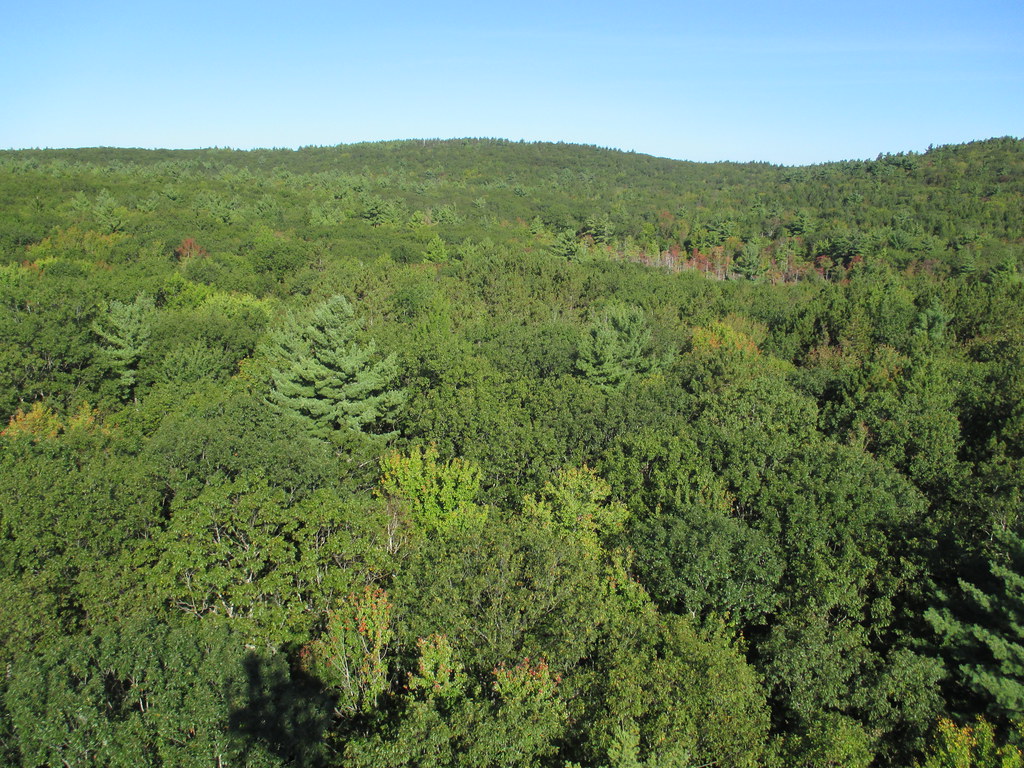
Harvard Forest is a core site in Domain 01: Northeast. Located 73 miles from Boston in Petersham, Massachusetts The Harvard Forest site is spread across 49 km2 of land and is the core NEON site for the Northeast region. Representative habitats at Harvard Forest include northern, transition, and central forests; marshes, swamps, and conifer-dominated bogs; and forest plantations. NEON's meteorological/flux tower and tower sampling plots are located on land owned by Harvard Forest - Harvard University, LTER an forest with a rich history of scientific research. The distributed sampling plots are located along the edge of the Quabbin reservoir which is managed by the Massachusetts Department of Conservation and Recreation, Division of Water Supply Protection. For access to the area along the Quabbin, visitors must be accompanied by a NEON project employee. Total data products collected at this site is 119.
-
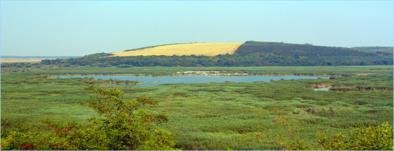
The Srebarna Lake was designated as a Monument of World Cultural and Natural Heritage (1983), UNESCO biosphere reserve (1977), Ramsar site (1975) and Important Bird Area (1990) because of its extremely rich ornithofauna and mainly because of the breeding of globally threatened species Dalmatian Pelican (Pelecanus crispus), Pygmy Cormorant (Phalacrocorax pygmeus) and Ferruginous Duck (Aythya nyroca). During the last years the lake ecosystem underwent significant changes towards strong eutrophication and anthropogenically speeded-up succession. The main reasons were the interrupted connection with the Danube River (because of a dyke built in 1948) together with the pumping-out of the underground waters, as well as the agricultural changes and activities in the watershed basin. The restoration activities carried out in 1993-1994 and especially the canal which connected the lake with the Danube lead to the beginning of lake recovery. All these events influenced the biodiversity of the reserve. The dominant plant association is that of the Reed (Phragmites australis), which occupies about two-thirds (400 ha) of the Reserve's total surface area. Gray Willow (Salix cinerea) and Purple Willow (Salix purpurea) bushes grow in some places. The second widest spread plant species after the Reed is the Lesser Reedmace (Typha angustifolia), and it is more abundant than the Great Reedmace (Typha latifolia). Of all 139 vascular plant species hosted by the Reserve, 11 are rare or endangered. Some 19 fish species occurred in the lake until 1948. There are 21 reptile and amphibian species, and 41 mammal species. The avifauna numbered a total of 230 bird species. The nesting colony of Dalmatian Pelican (Pelecanus crispus) is the pearl of the Reserve.
-
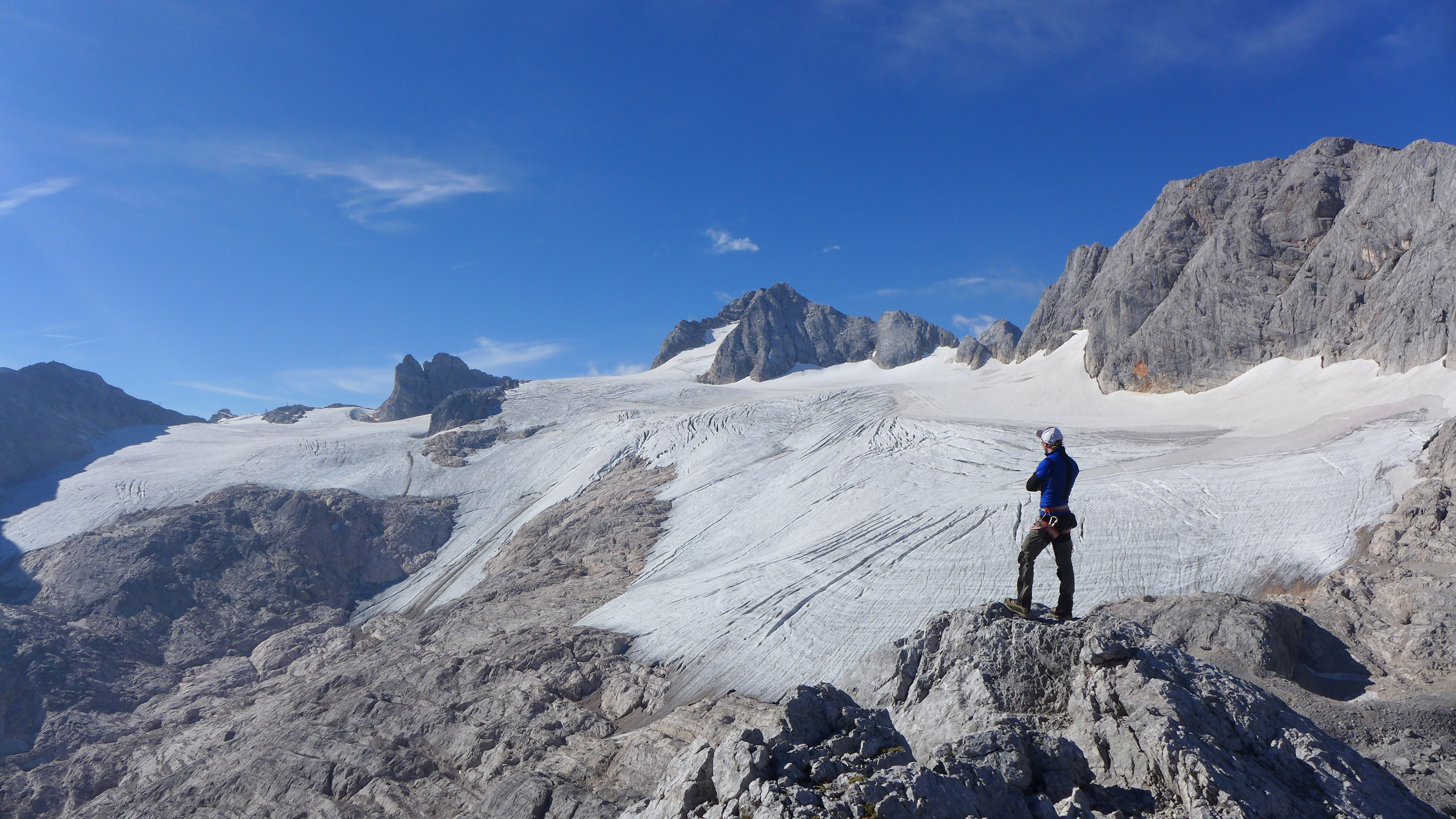
The Hallstätter Glacier is the largest glacier in the northern Limestone Alps. The Hallstätter Glacier is oriented to the northeast and is bordered by Rock walls. The Large plateau above 2550 m.a.s.l. is connected by three short tongues. The largest altitude zone in terms of area is between 2550 m and 2600m. The highest point of the glacier is at 2905 m, the lowest point is on 2240 m. With an area of 2.623 km² (glacier boundary 2020), the glacier lost half of its extent compared to the glacier peak in 1856. In the past 10years, the area has increased by around 13 %.
-
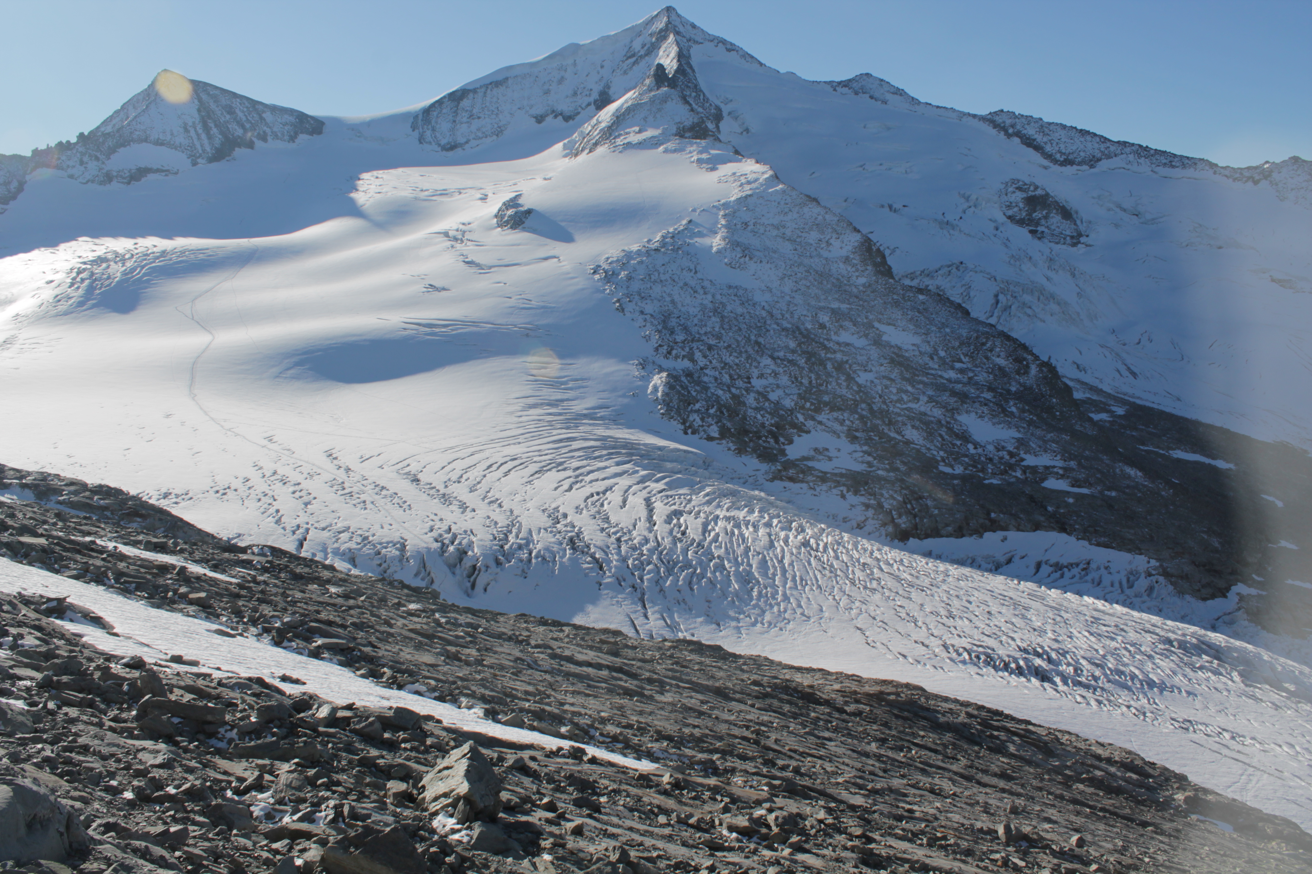
The Venedigerkees in the Hohe Tauern National Park is the easternmost tributary glacier to the former tongue of Obersulzbachkees. As a result of the strong retreat of Obersulzbachkees, the glacier disintegrated into several tributary glaciers, with a large lake remaining at the location of a famous serac zone, the 'Türkische Zeltstadt'. Mass balance of the Venedigerkees is measured since 2011/12 with the direct or glaciological method. Furthermore, an automatic weather station was built between Venedigerkees and Keeskogel in 2018.
-
The meteorological sensors are located on the roof of the main building of the Biological Station (N 47,7691; E 16,7662; Position (elevation): 122 msl) in the close vicinity of Lake Neusiedl. The parameters that are on-line recoded every 15 minutes are as follows: Air humidity (%RH), Global radiation (W/m²), Air temperature (°C), Wind speed ([Average] (km/h), Wind direction (°), Rain yearly (mm), Precipitation (mm); time resolution: 15 minutes. There are also two traditional weather stations at the station and on the jetty, which are maintained by the Hydrolographic Service Burgenland and enable parameters such as temperature, humidity, precipitation and water level to be recorded. In addition to the Adcon weather station on the roof of the station, there are currently 3 other stations in operation in Seewinkel. These positions are: • Unterer Stinkersee (N 47,8018; E 16,7842) • Neudegg (N 47,7029; E 16,8098) • Östliche Fuchslochlacke (N 47,7907; E 16,8624)
-
Mt Halla San is in Jeju Island, the only volcanic subtropical island, in South Korea. Every year the island is hit by several typhoons. It has shaped unique environmental characteristics and biodiversity. In addition the mountain is one of the most popular vacation sites with growing ecological concern.
-
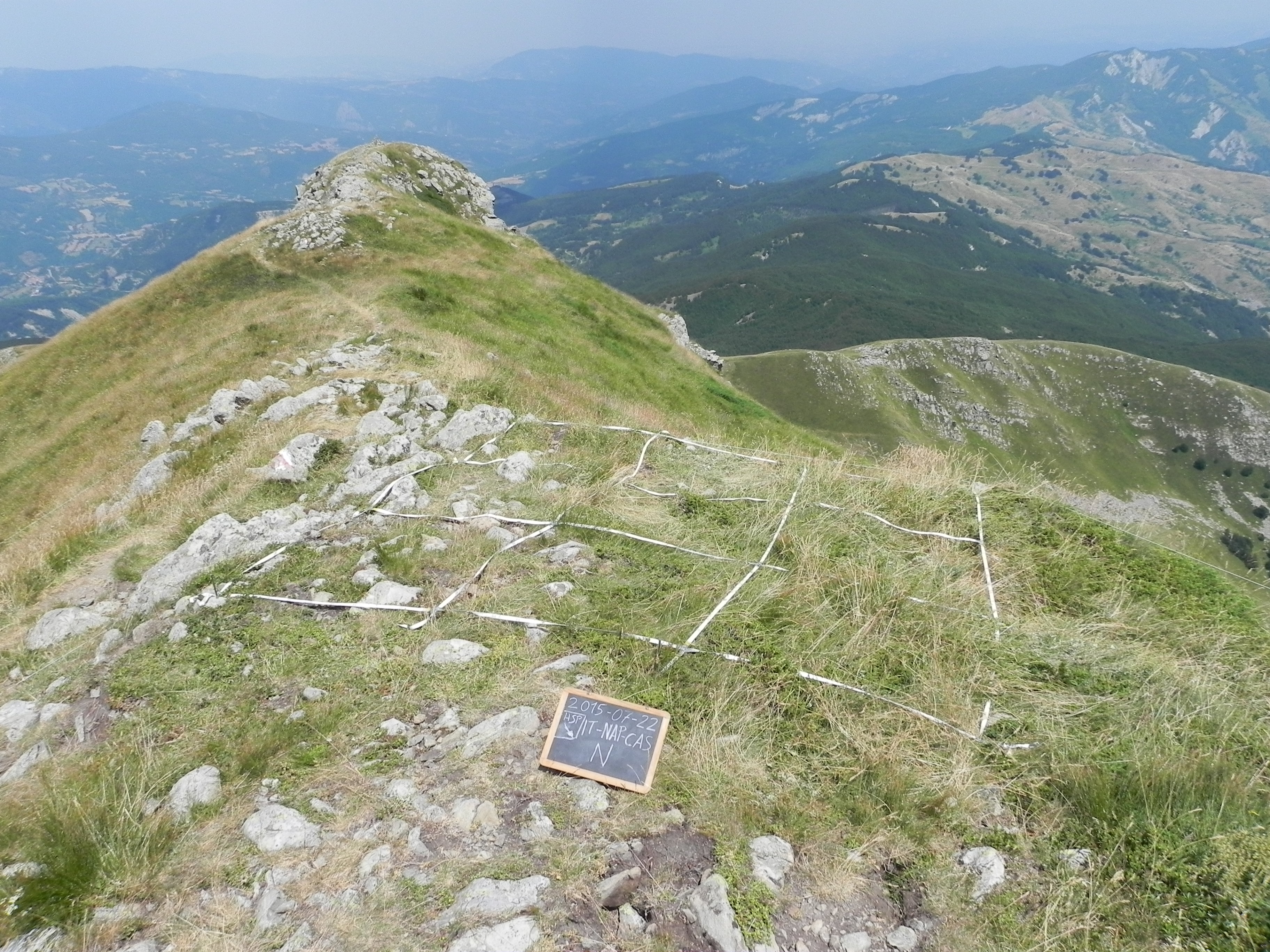
The site consists of “orographic islands” with high elevation vegetation in central Mediterranean basin, along the Apennines mountain range, within the Appennino Tosco-Emiliano National park and partially in the Appennino Modenese Regional park. It includes 64 permanent plots for plant species monitoring, distributed from timberline zone to the subalpine/alpine belt (1722-2000 m), that belong to the GLORIA project’s world network (GLobal Observation Research Initiative in Alpine ecosystems); The plots lie at the top of four summits, displayed along an altitudinal gradient, chosen following the GLORIA Target Region selection criteria. Furthermore, other 26 permanent plots, detached from the GLORIA project, have been settled on mount Prado. The observation and the long-term monitoring of vegetation and alpine plant species population started in 1999. The collection of soil temperature and osmotic potential started in 2001 and 2013, respectively. The site is resurveyed regularly to collect vegetation data (in term of presence/absence and coverage) and climatic data (temperature and osmotic potential data series recorded every 30 minutes by data loggers) in order to assess impacts of climate change on plant communities and single plant species of interest.
-
SITES Lönnstorp research station is situated in the Scanian agricultural landscape between Malmö and Lund and has a focus on the design, sustainable development and assessment of arable cropping systems, in conventional and organic farming. The research station is available for research within ecology, agronomy, environmental science, agroecology and other disciplines. SITES Lönnstorp research station have access to 60 hectares of conventional and 18 hectares of organic farm land, mainly cultivated with annual crops, representative for agricultural practise in southern Sweden. The station is also a part of SITES, Swedish Infrastructure for Ecosystem Science. SITES is a nationally co-ordinated infrastructure for terrestrial and limnological field research. In 2016, SAFE (SITES Agroecological Field Experiment) was established at the research station. SAFE make it possible to compare four different agroecosystems, a conventional reference system, an organic system, a perennial system and an agroecological intensified system.
-
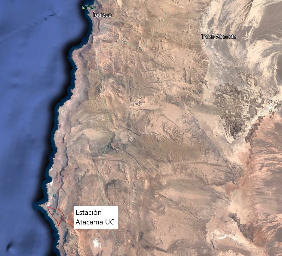
The Alto Patache fog oasis is located in northern Chile, 70 km south of Iquique, Tarapacá Region. This Oasis is located along the Coastal Range of Norte Grande, in the Atacama Desert, known for its remarkable aridity. The influence of coastal fog allows the development of a specially adapted vegetation, which provides habitat suitable for animal species.