
microbial biomass carbon
Type of resources
Available actions
Topics
Keywords
Contact for the resource
Provided by
Years
Formats
Representation types
-
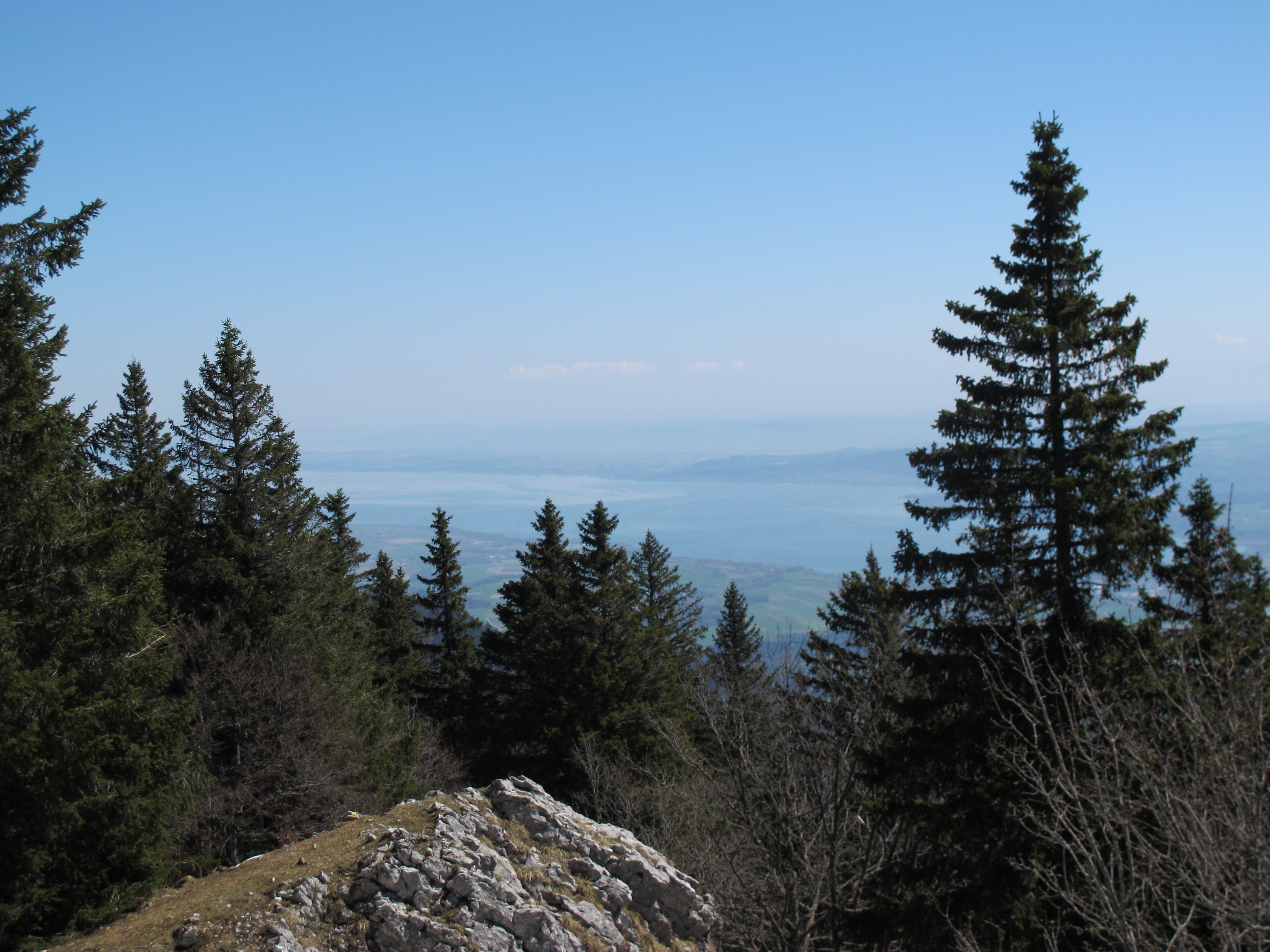
Socio-ecological interactions in ecosystems of mid-altitude mountains The LTSER Zone Atelier Arc Jurassien belongs to LTER-France network and is located in eastern France.The LTSER site Jurassian Arc (ZAAJ stands for Zone atelier Arc jurassien, in French) is designed to promote long-term interdisciplinary research into the environment and ecosystems in relation to society issues. It federates a network of research partnerships around interactions between the environment, society and the dynamics of moutain socio-ecological systems.ZAAJ helps to capitalise on field data and to analyze and promote the results from long-term observation schemes at the interface between ecology, the environment and society. Benefiting of more than 25 years of experience on the issue, accredited by the CNRS Ecology and Environment Institute (INEE) in 2013, ZAAJ is a cluster of five research units totalling 40 researchers.
-
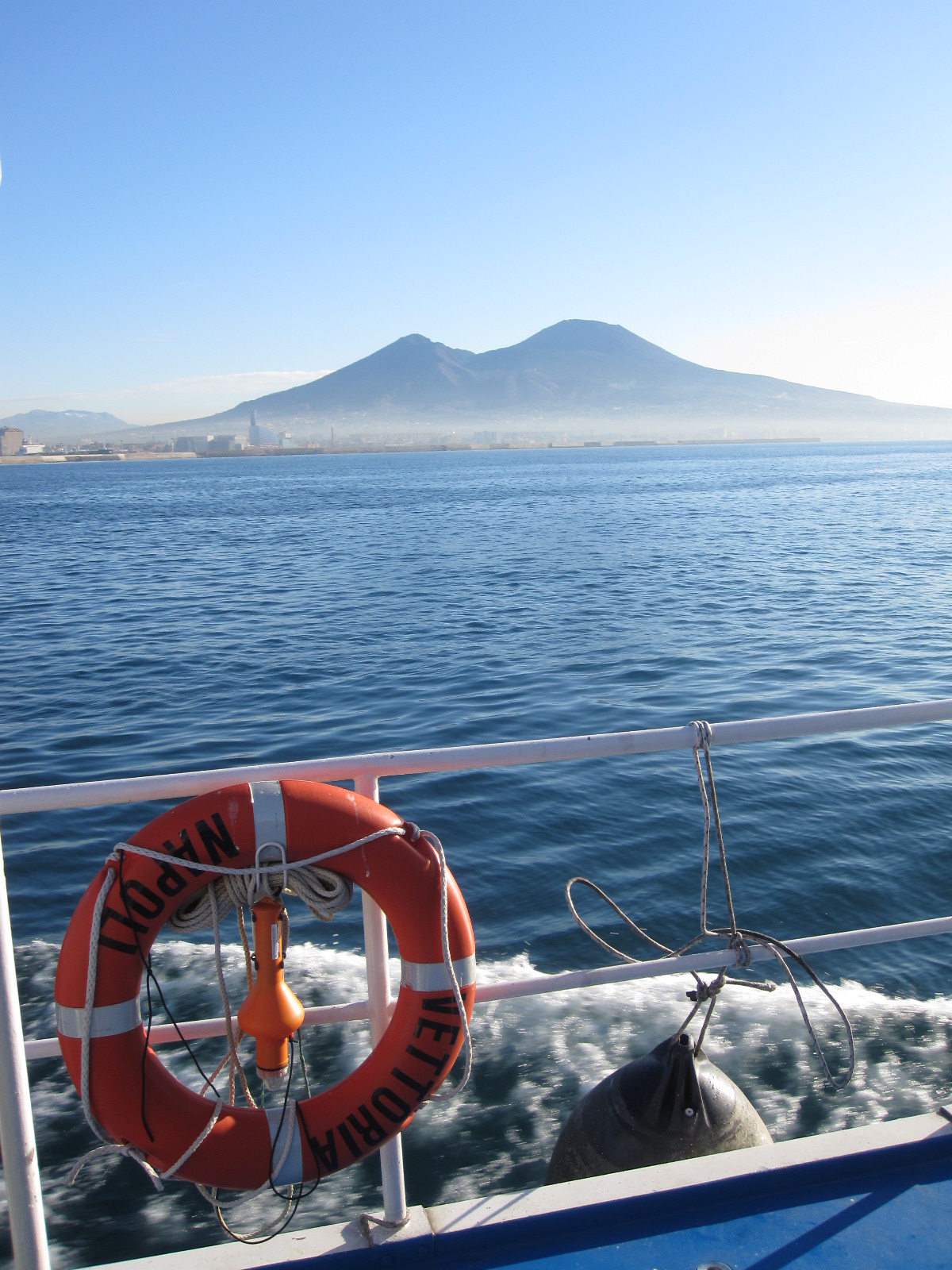
The Gulf of Naples has an extension of ca 870 kmq and an average depth of 170 m. The coastal area, which is inhabited since pre-Roman age, is densely populated and small factories are actively growing. In the Gulf, polluted areas (Sarno river mouth, harbours) coexist with pristine areas, including some Protected Marine Areas. Research on marine organisms has started before since the beginning of 1800, but first ecological studies date back to the 70ies of the last century. The long-term monitoring station (LTER-MC, 40°49’N, 14°15’E) is located 2 nm off Naples city (depth ca 75 m) at the boundary between eutrophied coastal waters and oligotrophic Tyrrhenian waters. Larger areas of the Gulf have been sampled occasionally in several cruises. The MC data set represents one of the few plankton time series available in the Mediterranean Sea, and it is certainly one of the longest.
-
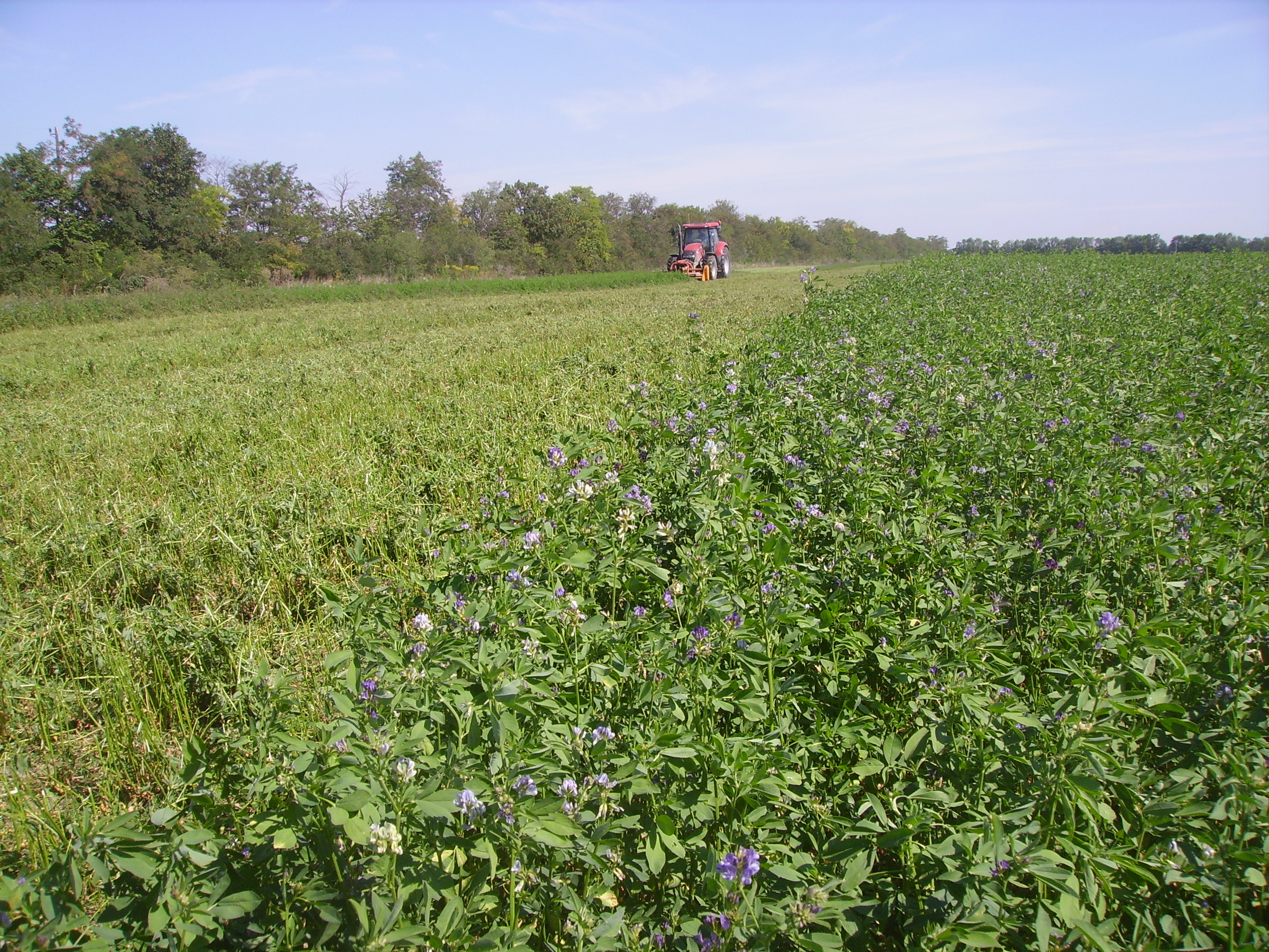
The Rutzendorf Experimental Station is an agricultural research site of the University of Natural Resources and Live Sciences Vienna (BOKU), belonging to the Landwirtschaftliche Versuchswirtschaften GmbH. It is representative for the productive soils managed as arable land in the Marchfeld area (Lower Austria). The soil is described as a silty loamy Calcaric Phaeozem (WRB), a Chernozem according to Austrian soil classification. Management on the farm is without livestock, no organic fertilizers are applied. The farm was converted to organic farming in the production year 2002/03. The 8-year crop rotation comprises luzerne (2 yrs), winter wheat*, grain maize, spring barley*, field peas*, winter wheat, winter rye. Cover crop mixtures are grown where indicated in the crop rotation with an asteric. Current research questions include to study (i) the long-term sustainability and productivity of the stockless organic arable system compared to a livestock-keeping system, (ii) the mitigation of climate change effects on the soil-plant system by reducing soil cultivation intensity, and (iii) the development of biodiversity following the conversion to organic farming and enhancement of landscape elements. Regularly meteorological data, crop yields and quality, physical, chemical and biological soil traits, weed species and diaspores, springtails, wild bees and other animal species are assessed. Studies have been conducted as research projects financed nationally and by the European Union, e.g. in two EIP projects.
-
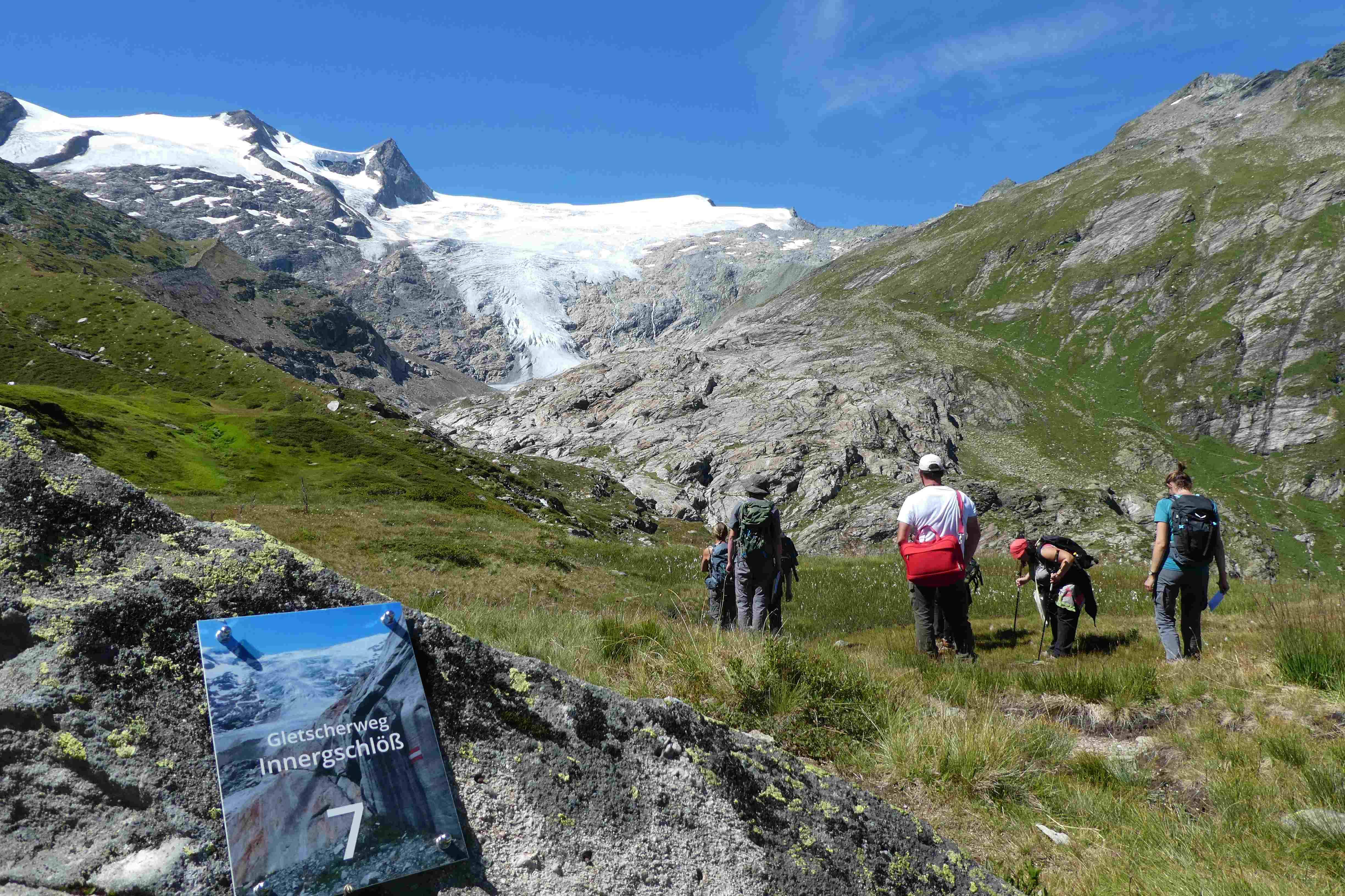
Hohe Tauern NP was established more than 40 years ago as one of the biggest protected areas in Central Europe to protect at long-term wide areas of the Austrian main-ridge of the Alps. The 1.856 square kilometre Hohe Tauern National Park is split into a 1.213 square kilometre core zone and a 643 square kilometre buffer zone and stretches over three provinces. Until the first and largest national park in Austria was actually created, the three provinces of Carinthia, Salzburg and Tyrol had to establish the corresponding legal framework. The Provincial Parliament of Carinthia passed the legislation to create the Hohe Tauern National Park in 1981. Salzburg followed with its national park legislation in 1984, followed by Tyrol in 1992. In this 40 years Hohe Tauern NP established the Nationalpark idea in its region working together with all stakeholders (land owners, tourism, majors, hunting organisations, governmental departments…). The International Union for the Conservation of Nature IUCN awarded Carinthia in 2001 and Salzburg and Tyrol in 2006 with the international recognition of a national park with its "Category II" listing. The distinction that the national park has with a core zone, where nature can develop without human influence and a buffer zone, where traditional cultivation could be continued was key for gaining this international recognition. Contractual agreements between landowners, hunters and the national park paved the way and were pioneering for many protected areas. Hohe Tauern NP contains 3 main zones: - core zone (km²): 1.078 - buffer zone (km²): 643 - special protected areas (km²): 135 About 845 km² of the area is nature zone, which remains untouched by humans (no land use based on IUCN criteria, i.e. no hunting, no grazing). The altitudinal belts from the valleys to the summits of the three-thousand-metre-tall mountains represent an exceptional biodiversity. This is home to many plants and wildlife species originating from the Central Asian tundra, the Arctic and even Southern Europe. The preservation of all significant Alpine ecosystems across large areas of the Hohe Tauern National Park has been unimpaired. More than one third of all plant species recorded in Austria can be found in the national park. For mammals, birds, reptiles and amphibians, this figure is at around 50%. Even those animals that were nearly extinct in almost all of Europe at the beginning of the 19th century are now provided a safe habitat in the Hohe Tauern National Park. This impressive biodiversity is a result of the different prevailing climatic, geological, geomorphological and hydrological conditions in the high mountains and the differing adaptation strategies of the plants and animals. The Tauern Window – a unique tectonic window in terms of shape and size – provides insight into the deepest tectonic layer of the Alps and is thus key for understanding the geological structure of the Alps. Rocks of differing ages, different origins and different chemical composition harbour a genuine hoard of up to 200 different minerals. Nature protection (ecosystems/Natura2000 habitats) and species conservation projects play a big role in the work and history of Hohe Tauern NP (e.g. bearded vulture, ibex, golden eagle, …). The NP and its work do not stop at the protected areas borders and for a lot of species it is important that the whole region is aware of its impacts on biodiversity. According to the altitude gradation of the Hohe Tauern National Park "high mountain habitat types" are typical. Based on the aerial photo interpretation of the National Park montane to alpine grassland and pastures dominate with a third. This also reflects the zoning with the outer zone in the sense of an Alpine cultural landscape zone with alpine pastures – and the transition to the high alpine core zone. The core zone is formed by the "eternal ice" of the glaciers around the highest mountains of Austria as well as scree slopes with and without pioneer vegetation dominate. CORINE Land Cover L3 (2018): 35 % bare rocks, 24 % natural grasslands, 20 % sparsely vegetated areas, 9 % coniferous forest, 7 % glaciers and perpetual snow, 2 % moors and heathland, 1 % pastures.
-
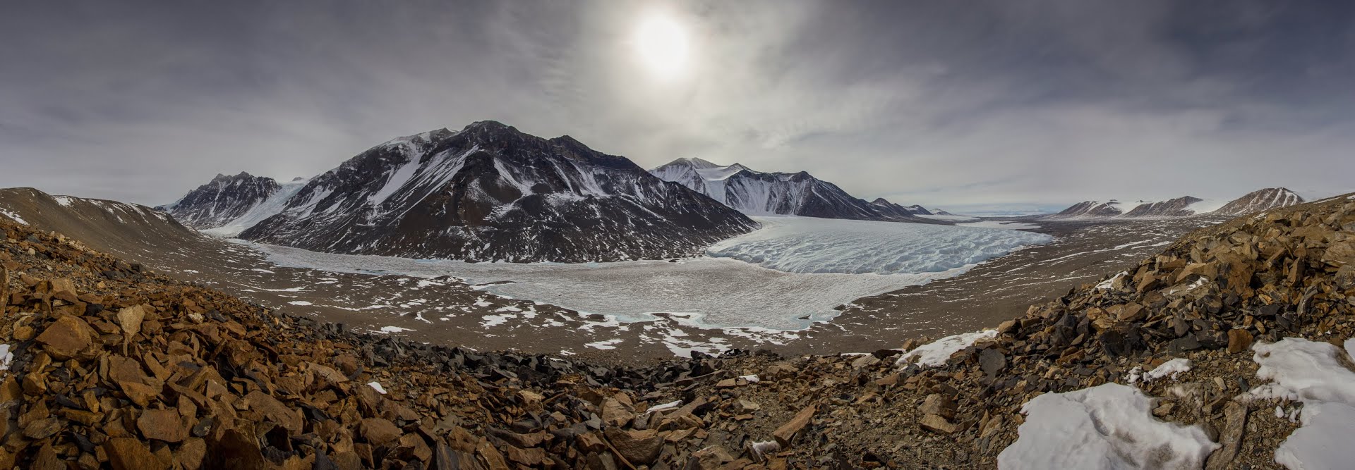
The McMurdo Dry Valleys (MDVs) (78°S, 162°E) represent the largest (4500 km^2) ice-free area on the Antarctic continent. The MDV landscape is a mosaic of glaciers, soil and exposed bedrock, and stream channels that connect glaciers to closed-basin, permanently ice-covered lakes on the valley floors. Mean annual air temperatures are cold (ranging from -15 to -30°C on the valley floors), and precipitation is low (~50 mm annual water equivalent as snow). Summer air temperatures typically hover around freezing and winter air temperatures are commonly < -40°C. While the water columns of the lakes are liquid and biologically active year round, glacial meltwater streams flow and soils thaw only during the austral summer. There are no vascular plants, but microbial mats are abundant in lakes and streams. Mat organisms are transported by wind onto glacier and lake ice surfaces where they actively metabolize in liquid water pockets (cryoconites) that form during the summer months. In the streams, which desiccate for ~10 months each year, cyanobacterial mats host extensive diatom and soil invertebrate communities. Lakes provide a habitat for diverse phototrophic and heterotrophic plankton communities that are adapted to annual light-dark cycles and temperatures near 0°C. Soils are inhabited by nematodes, rotifers, and tardigrades, all of which are metabolically active during summer. The McMurdo Dry Valleys LTER (MCM) began studying this cold desert ecosystem in 1993 and showed that its biocomplexity is inextricably linked to past and present climate drivers. In the fifth iteration of the MCM LTER program, we are working to determine how the MDVs respond to amplified landscape connectivity resulting from contemporary climate variation.
-
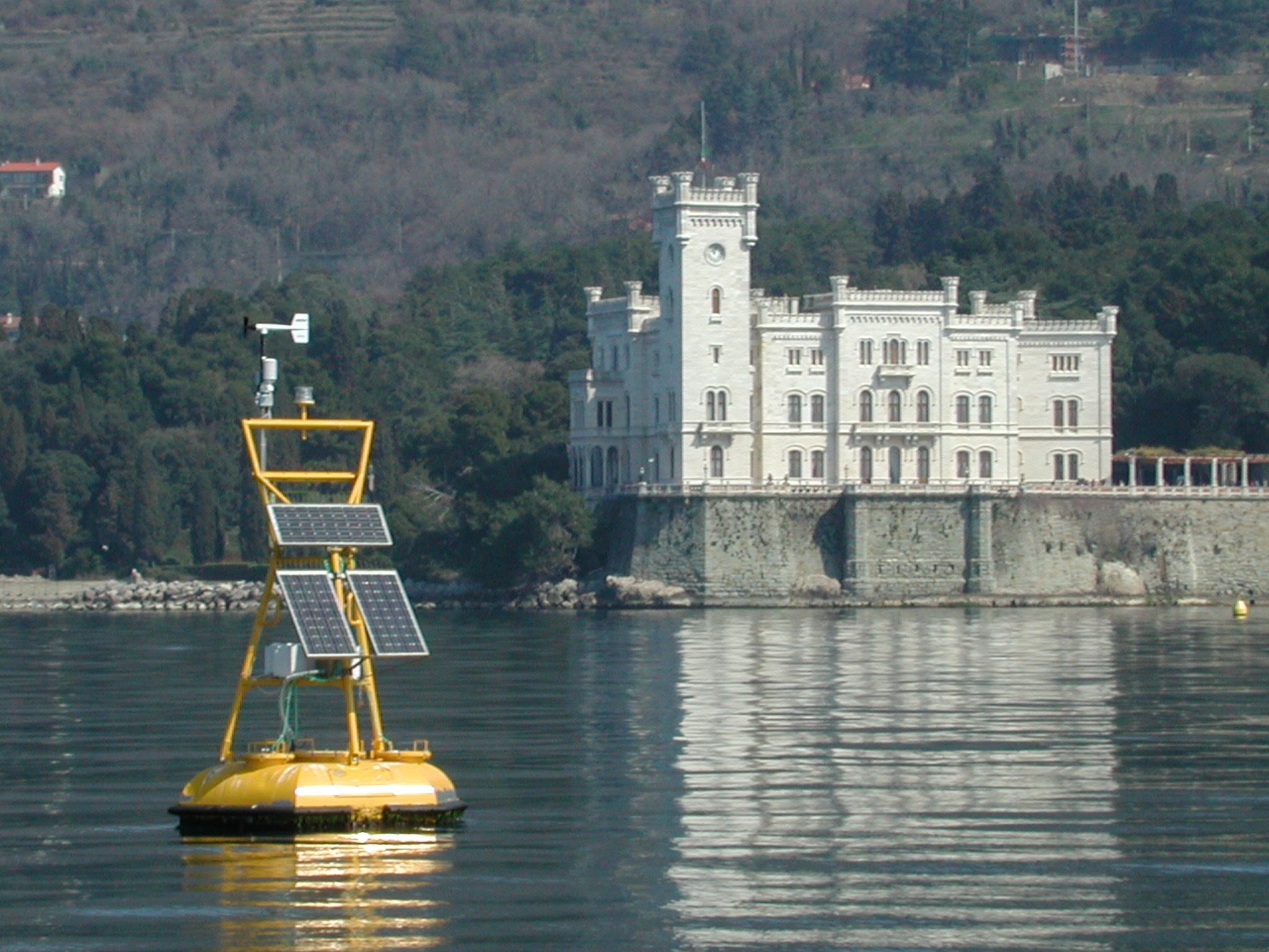
The coastal marine observatory site Gulf of Trieste lies within the Marine Protected Area (MPA) of Miramare and includes the biological time-series station “C1”, part of the Italian Long-Term Ecological Research (LTER) network, and the in situ continuous MAMBO meteo-oceanographic buoy. Marine Protected Areas represent one of the most effective systems for marine biodiversity preservation and management. Since 1986, the time-series station “C1” in the Gulf of Trieste (GoTTs, Gulf of Trieste Time series) represents a crucial site for marine ecological research, as it is subject to the interaction among several natural forcing (river, groundwater discharge, tides, general circulation, intense meteorological) and numerous anthropogenic activities (maritime transport, harbours of Trieste and Monfalcone, urban waste discharge, mussel- and fish-farming, fishing and recreational activities). In 1999, the ecological research site has been equipped with a meteo oceanographic buoy (MAMBO) in order to acquire continuous data on meteorological conditions at sea and on seawater physical and biogeochemical properties. Due to the high temporal dynamics of ecological processes in coastal ecosystems, continuous and real-time data of the main meteorological, physical and biogeochemical properties are fundamental for a better understanding of marine ecosystem functioning.
-
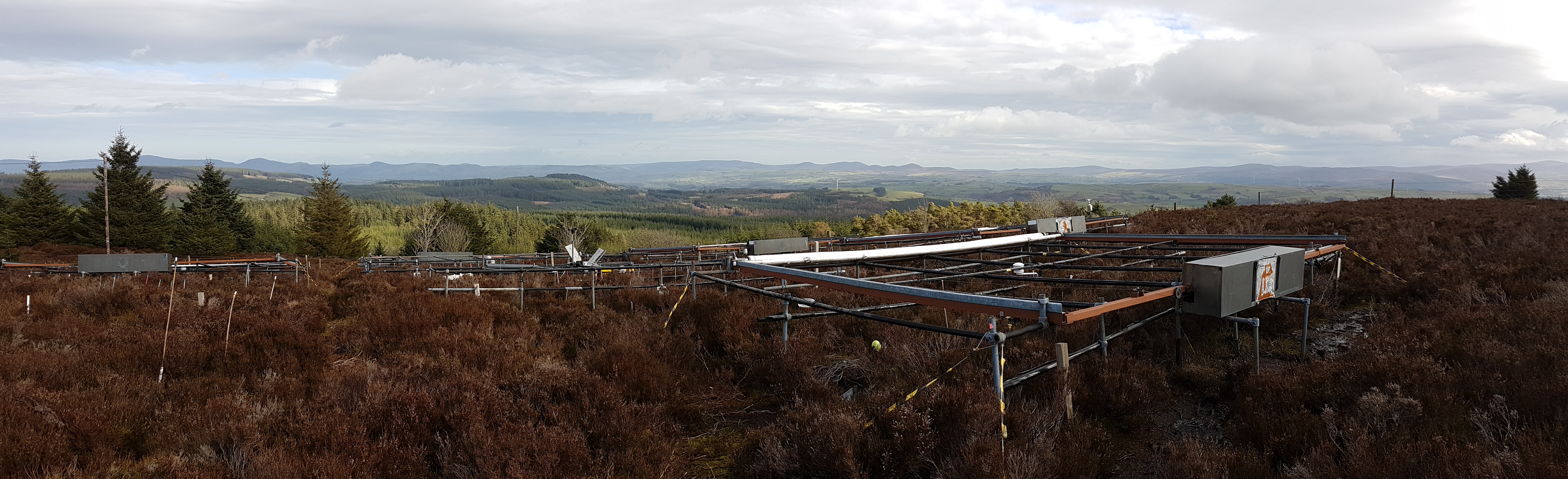
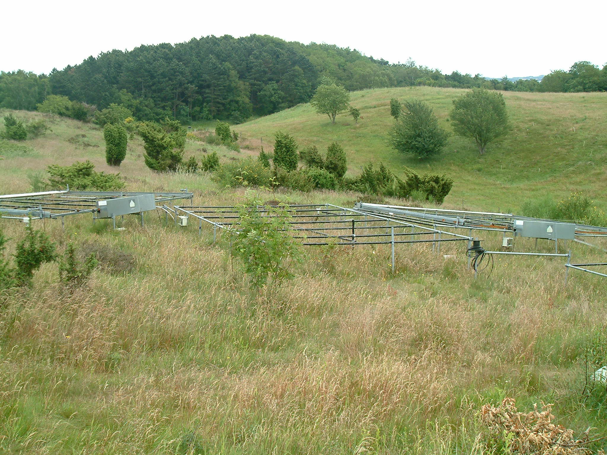
The site is located in Clocaenog Forest in North East Wales (53o 03’ 19’’N -03o 27’ 55’’ W). It is a typical upland west-atlantic moorland, dominated by the evergreen shrub Calluna vulgaris (heather). Heather makes up >60% of the plant biomass at the site, but Vaccinium myrtillus and Empetrum nigrum are also present.
-

As the largest contiguous pine forest in Switzerland, the Pfyn forest in Canton Valais (46° 18' N, 7° 36' E, 615 m ASL) offers the best conditions for such measurements. In light of this, a WSL research team installed a long-term experiment of 20 years duration in the Pfyn forest. The average temperature here is 9.2°C, the yearly accumulated precipitation is 657 mm (average 1961-1990). The pines in the middle of the forest are about 100 years old and 10.8 m high. The test area has 876 trees covering 1.2 ha divided into 8 plots of 1'000 m2 each (Image 4). Between the months of April and October four of these plots are irrigated by a sprinkler system providing an additional 700 mm of water, annually. In the other four plots, the trees grow under natural, hence relatively dry conditions.
-
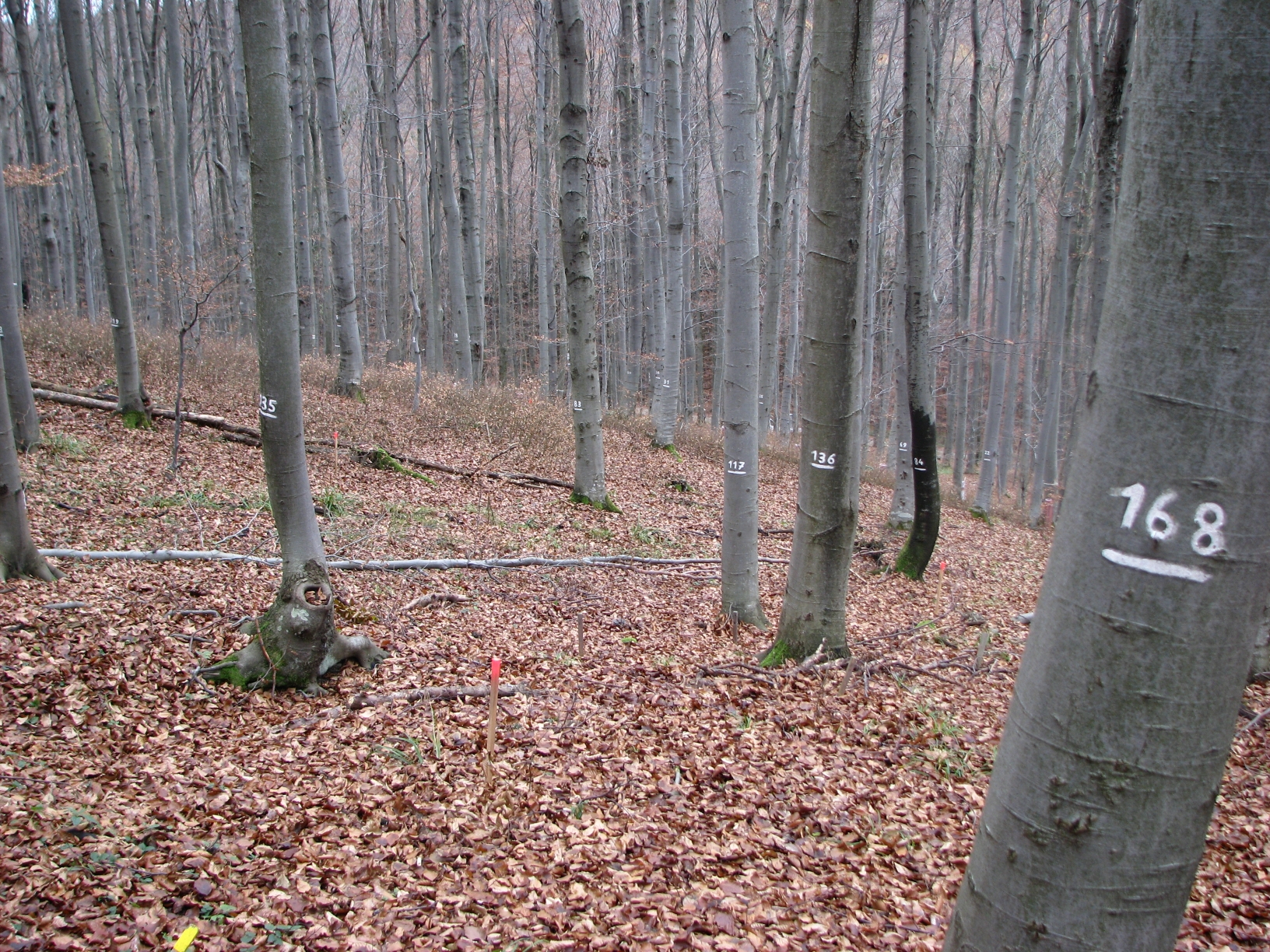
The site Klausen-Leopoldsdorf is part of the European Level II Forest Monitoring System in the frame of the International Co-operative Programme on Assessment and Monitoring of Air Pollution Effects on Forests (ICP Forests). The site was established in 1995 and is, since 2006, part of the LTER Austria network. It is situated in a homogenous 80 years-old managed beech stand about 20km west of Vienna. The LTER-CWN research area in Klausenleopoldsdorf is divided into 3 subplots: a measuring weir, a dendrometer/sapflow measuring facility and GHG-chambers for measuring the fluxes of CO2 and other relevant GHG´s. All 3 subplots were installed in 2019 to collect high-resolution data. The measuring weir is located at about 475m a.s.l and the other subplots (denrometer/sapflow, GHG measuring chambers) are located at about 510m a.s.l. The observed catchment of the measuring weir has an area of 46 hectares. The dominating soil types in the catchment are Planosoils and Stagnosols. The subplots are situated in the near vicinity of the ICP-forest plot.
-
Mols Bjerge National Park or Nationalpark Mols Bjerge is a Danish national park in the area known as Mols Bjerge (lit.: Mols Hills) in Syddjurs Municipality, Central Jutland, inaugurated on the 29th of August 2009. The protected area, measures 180 square kilometres (69 sq mi) in size. The Mols Hills, reaching a height of 137 metres (449 ft), are centrally located in the park, and take up 2,500 ha. "More than half of all wild Danish plant species" can be found at Mols Bjerge. The park comprise most of the southern parts of the headland of Djursland. It is bounded on the east by the sea of Kattegat, the forests of Kaløskovene in the west and to the south by multiple inlets, coves and plains of glacially generated moraine. The town of Ebeltoft, along with villages and summer house residence areas, are considered part of the park. Land in the national park is held under both private and state ownership. Nearly 33% of the park is cultivated and 80% of the hill area is under private ownership. Mols Bjerge National Park has a rolling and widely varying topography of woodlands and open countryside, created with the end of the last ice age. Elevation in the park area varies in height rising to a maximum of 137 metres (449 ft) in Mols Hills, with many types of habitats such as heath, forests, pastures, bogs, meadows, a variety of coastal habitats and sea