
mineral nitrogen mineralised from humus
Type of resources
Available actions
Topics
Keywords
Contact for the resource
Provided by
Years
Formats
Representation types
-
The LTSER Zone Atelier Armorique belongs to LTER-France network and is located in Brittany, north-western France. The ZA Armorique conducts an interdisciplinary exploration of landscapes from urban areas to rural countryside, integrating social and environmental dynamics.
-
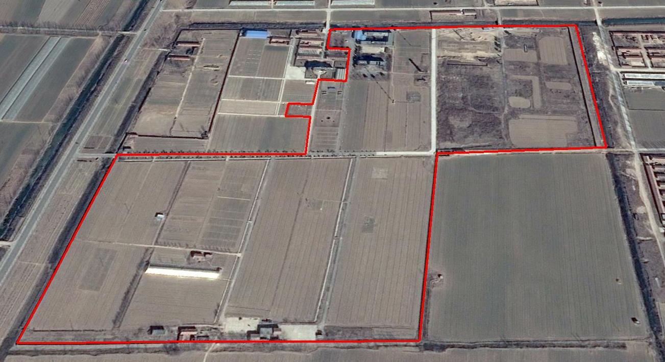
The Yucheng Comprehensive Experiment Station (YCES) of Chinese Academy of Sciences (CAS) is located at the irrigation district of the Yellow River Basin in the Huang-Huai-Hai Plain, also called North China Plain. Physiognomy is characterized as hinterland covered mainly by fluvo-aquic soil (Fluvisol or cambisal) and salinized fluvo-aquic soil in the Yellow River Alluvial Plain. This region is dominated by warm-temperate semi-humid monsoon climate with ample energy and water resources. Historically, natural disasters such as drought, waterlogging, salinization, and wind erosion frequently occurred, resulting in vulnerable ecological environment and low grain production. Integrated improvements and managements were deployed in last several decades, and this region has become suitable for planting winter wheat, corn, cotton, and soybean with high yields in the Huang-Huai-Hai Plain. Research objectives and contents Objectives: regional sustainable agriculture rational utilization of natural resources such as water, land, climate, biomass, etc. Contents: conducting long-term observations and experiments understanding the mechanism of energy transfer and mass cycle in farmlands developing models from point to regional scales improving and developing instruments and measurement methods improving agro-ecosystem managements demonstrating research results and technologies Research achievements: Outstanding research results and massive experiment data have been achieved at the YCES. The achievements cover research fields of farmland evapotranspiration, crop water use, water transfer mechanism, experimental remote sensing techniques, regional agriculture demonstration, and technology transfer. More than 1,000 papers, 15 monograph books, and 5 data sets have been published. A number of awards were granted by national, CAS, and international academic organizations, for example, Agriculture Prize granted by the Third World Academy of Sciences Science and Technology Progress Award by Chinese Academy of Sciences National Top Award of Science and Technology Progress
-

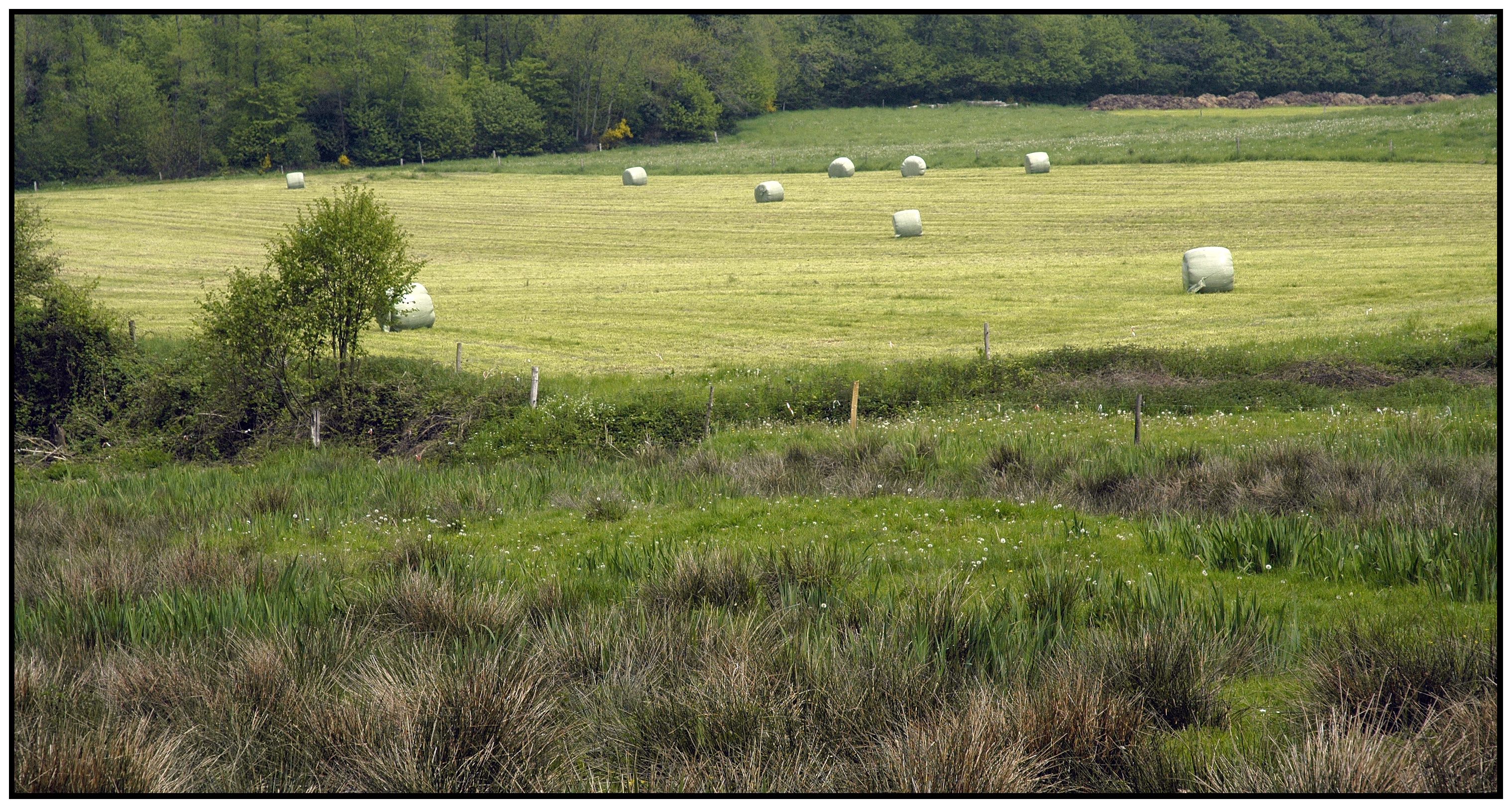
The Cairngorms National Park is one of 15 National Parks in the UK (one of two in Scotland) and is Britain's largest National Park (4,528 km2). It is the location for some of the most spectacular landscapes in Britain and is home to an incredible diversity of wildlife and plants. http://cairngorms.co.uk/the-park/facts-figures/ The aims of the National Park are: • To conserve and enhance the natural and cultural heritage of the area; • To promote sustainable use of the natural resources of the area; • To promote understanding and enjoyment (including enjoyment in the form of recreation) of the special qualities of the area by the public; • To promote sustainable economic and social development of the area’s communities. Cairngorms National Park, seven broad habitats can be identified: • Enclosed farmlands • Woodlands • Open waters (rivers, lochs, wetlands and floodplains) • Mountains • Moorland • Semi-natural grasslands • Urban • Population of c17,500 • 25.8% of population over 60 (higher than Scottish average) • Average health index in top 25% of Scotland (based on deprivation indices) • Extensive core paths network • 55 Munros including 5 summits over 4000 feet • 3 ski centres • National Cycle Network Route 7 • 1 Long Distance Route (Speyside Way) • Relatively low atmospheric pollution • Annual precipitation over 2250mm on summits and under 900mm in straths • Average annual snow cover 200 days on summits and 50 days on low-ground • Prevailing winds from south-west
-
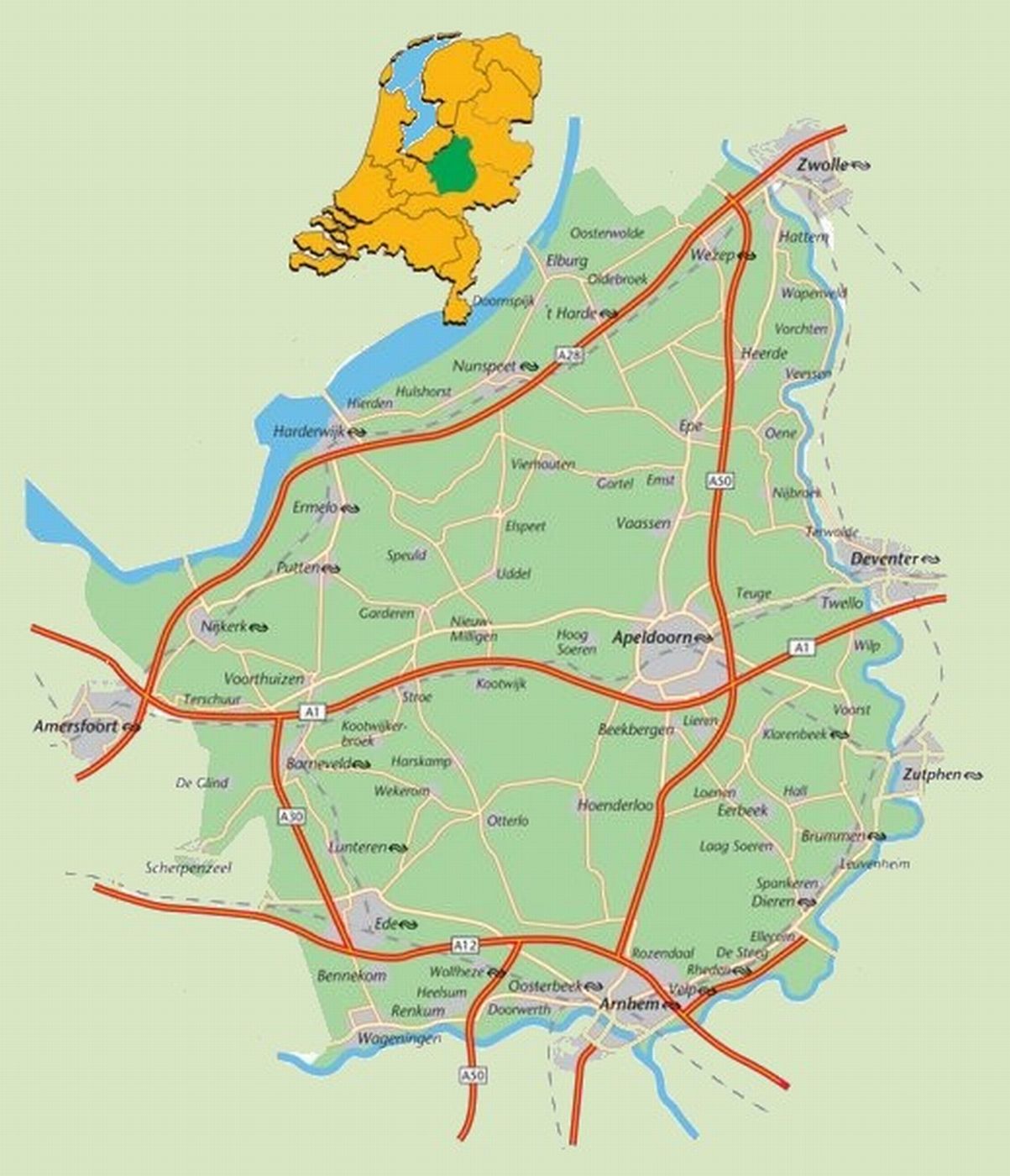
The area defined as ‘the Veluwe’ lies in the province of Gelderland, the Netherlands, West of the river IJssel and North of the river Rhine. The region hosts the largest connected nature area of the country: around 91.947 ha are part of the Natura 2000 area. The natural landscape consists of a mix of forests, heathlands, sand drifts, lakes, and moorlands. The Veluwe was settled a long time ago, and the area is now densely populated (van der Zouwen, 2006). Traces of burial mounds and agricultural fields are indicators of former human settlements. During prehistoric and medieval times, extraction of iron and timber took place on the Veluwe. After the start of the 19th century, large scale deforestation occurred, with several consequences for the nature and the landscape of the area. Human colonization increased rapidly in the 20th century. This resulted in increased infrastructure, intensified agriculture, and increased water extraction, with consequences for the groundwater levels and biodiversity (Jongmans et al., 2012; Schaminée and Jansen, 2009). As it stands, the present nature regions are surrounded by agriculture, settlements, or infrastructure. This means there is a lot of interaction between humans and nature. For example, the National Park De Hoge Veluwe and the Kröller-Müller museum and surrounding attractions get more than half a million visitors per year (ZKA Consultants & Planners, 2013). The unique circumstances of highly populated areas combined with nature provide great opportunities for research on the varied interactions between nature and humans to be carried out. A great array of different ecological and socio-economic research has already been carried out in the Veluwe, which makes it a good quality LTSER platform right from the start. One criteria for a LTSER platform is the definition of relevant themes or research questions (ILTER, 2014).
-
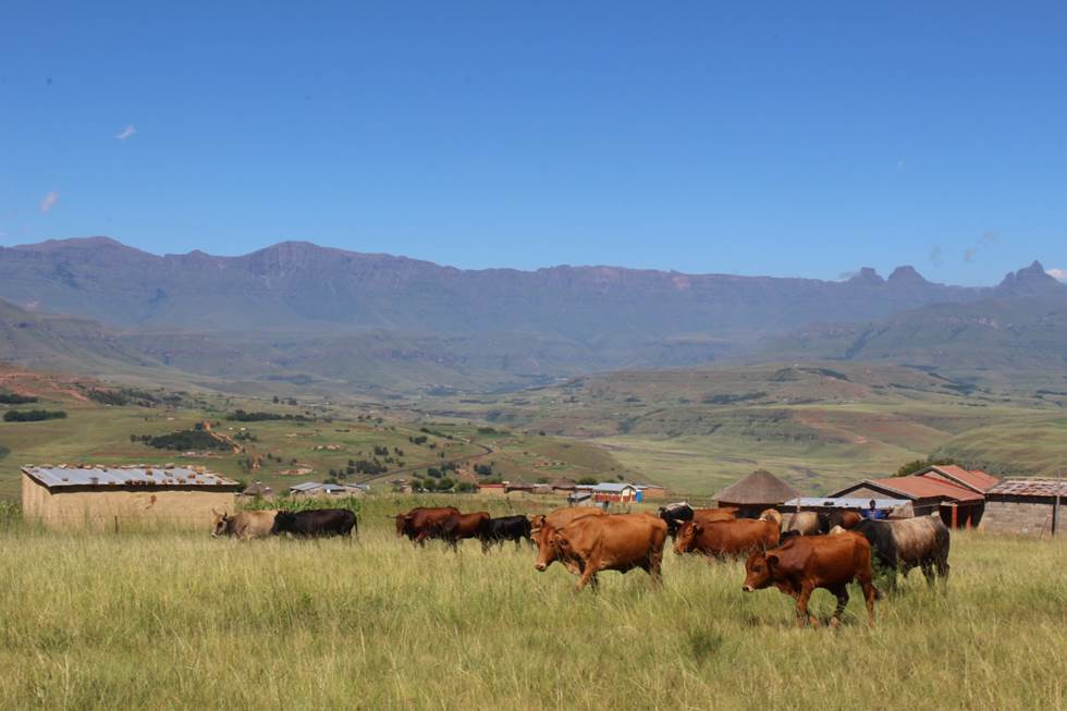
The Cathedral Peak research catchments in the northern uKhahlamba Drakensberg mountains, KwaZulu-Natal, South Africa have been a focus of observation research since the 1940’s. The Drakensberg mountains which fall in the grasslands biome, are a crucial water source area for South Africa, owing to the relatively high rainfall and ratio of rainfall to runoff conversion in this region. This portion of southern Africa's grassland biome also supports phenomenal levels of biodiversity. The research catchments themselves are primary, headwater catchments that fall within a protected area. The catchments were initially established to investigate the influence of various land management treatments on water but over time the research has broadened to a more interdisciplinary focus incorporating carbon–water–energy–biodiversity and the dynamics between these. Although the core of the observation and monitoring is sited in the catchments, the research extends beyond the protected area into communal, state, and privately owned lands. The land beyond the protected area is valued for agriculture, ranging from subsistence agriculture in impoverished villages to large-scale commercial agriculture. Scientific work in the landscape continues to grow and expand.
-
The Zöbelboden was established in 1992 as the only Integrated Monitoring station in Austria under the UN Convention on long-range transboundary air pollution (CLRTAP). In 2006 it became part of LTER Austria. The Zöbelboden covers a small forested catchment (90 ha) of a karstic mountain range (500 to 950 m above sea level) in the Kalkalpen National Park. Monitoring and research is focussing on climate change effects on forest ecosystems, the forest carbon and nitrogen cycle, biodiversity, and air pollution effects on forested catchments. The Zöbelboden represents one of the best known karst catchments in Europe with long-term data series of the major components of its ecosystems. The site is part of many national and international monitoring and research networks (ICP Integrated Monitoring, EMEP, LTER, forestREplot, SoilTemp, LifePlan, IG-L, EU NEC-D, etc.). The Zöbelboden is managed by the Environment Agency Austria with technical support of the Kalkalpen National Park and the Austrian Federal Forests.