
net far infrared radiation irradiance
Type of resources
Available actions
Topics
Keywords
Contact for the resource
Provided by
Years
Formats
Representation types
-
It contains the raw data obtained from the multiparameter stations Sierra Nevada.
-
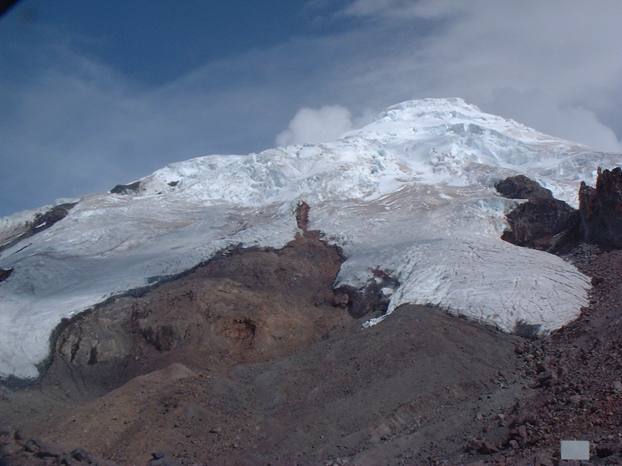
Antizana 15 alpha Glacier is one of the 17 tongues of the Antizana volcanoe in Ecuador, from 4820 to 5760 m a.s.l..
-
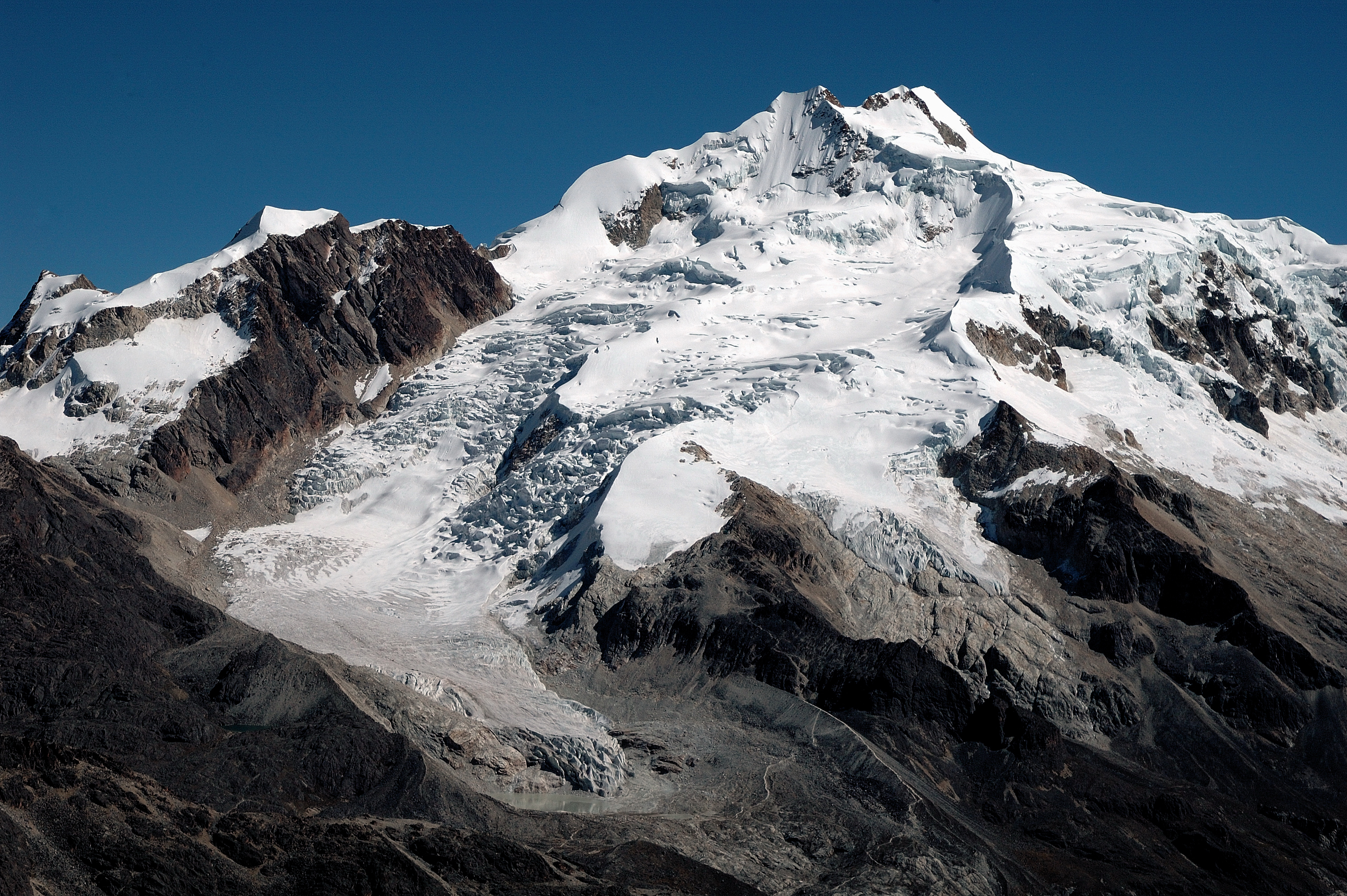
Zongo Glacier is located in the Huayna Potosi region (Cordillera Real, Bolivia) 30 km north of La Paz city, between the dry Altiplano plateau in the west and the wet Amazonian basin in the east, under outer tropics meteorological conditions (strong seasonality in precipitation, low seasonality in temperature).
-
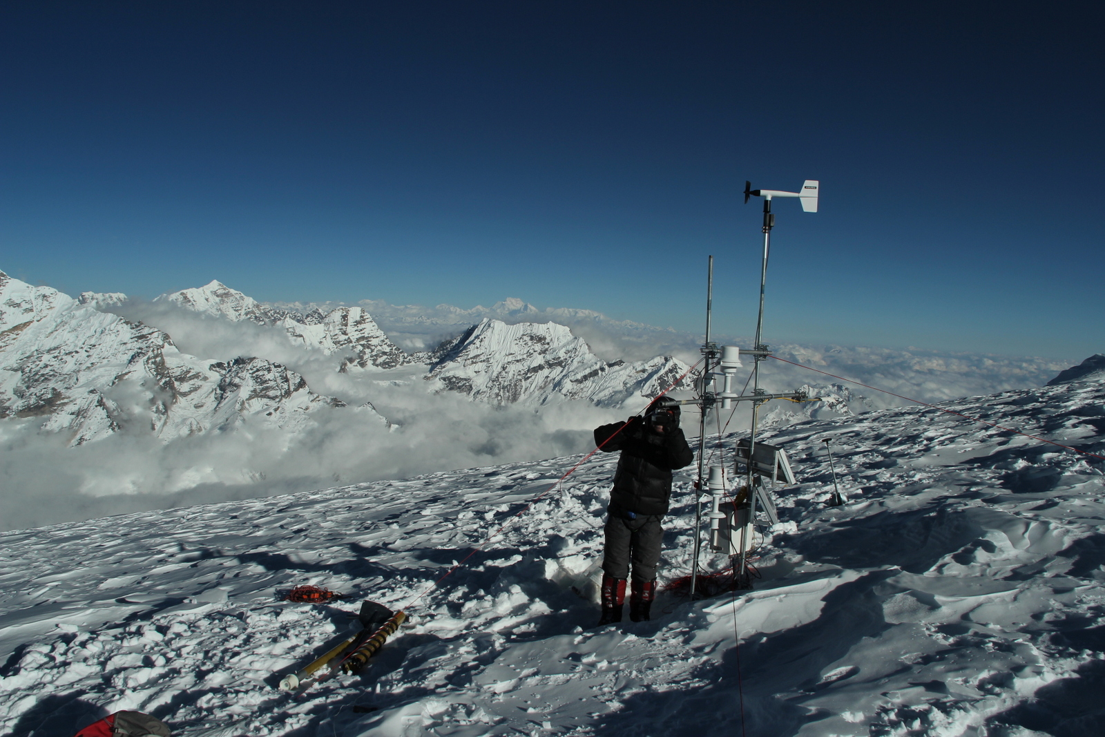
Mera glacier (MER) is located in Nepal, near the Khumbu valley. This glacier is free debris cover. Mas sbalance and dynaic measurements were initiaited in 2007. In addition, meteorological observations complete the data base. 2 weather stations are on the moraine and on the glacier itself. MER is a part of the French Glacier Observatory GLACIOCLIM/CRYOBS-CLIM. All the series on Mera glacier (MER) are unique and necessary for glaciological studies because Himalaya is still partly unknown in terms of future evolution. Data permit to calibrate models in order to determine future glacier evolution. Mera data are also unique to test hydrological model in the catchment.
-
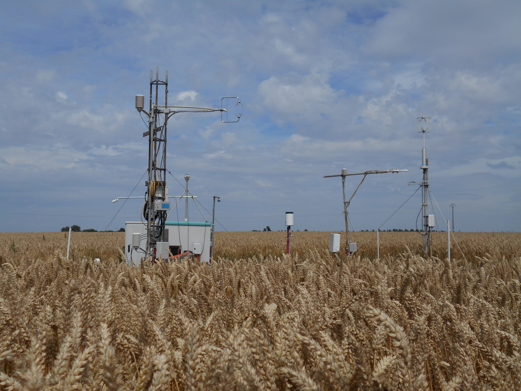
The site is a cropland with a 4-year rotation. Fluxes of CO2 and water vapour are measured by an eddy covariance system. Research activities are carried out by the university of Liège (GxABT).
-
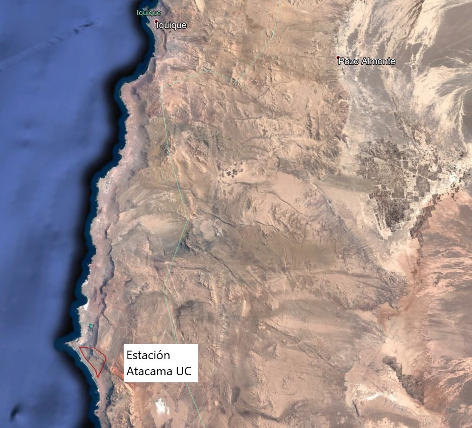
The Alto Patache fog oasis is located in northern Chile, 70 km south of Iquique, Tarapacá Region. This Oasis is located along the Coastal Range of Norte Grande, in the Atacama Desert, known for its remarkable aridity. The influence of coastal fog allows the development of a specially adapted vegetation, which provides habitat suitable for animal species.
-
It is located in the region of the Grand Causses, south of the Massif Central. The karstic aquifer of Durzon represents a surface of 100 km² which feeds the spring of Durzon. This spring supplies the drinking water of the Aveyron part of Larzac. The observatory has a set of sites dedicated to gravimetric, inclinometric and hydro-geodesic observations, as well as a flow tower for evapotranspiration measurements.
-
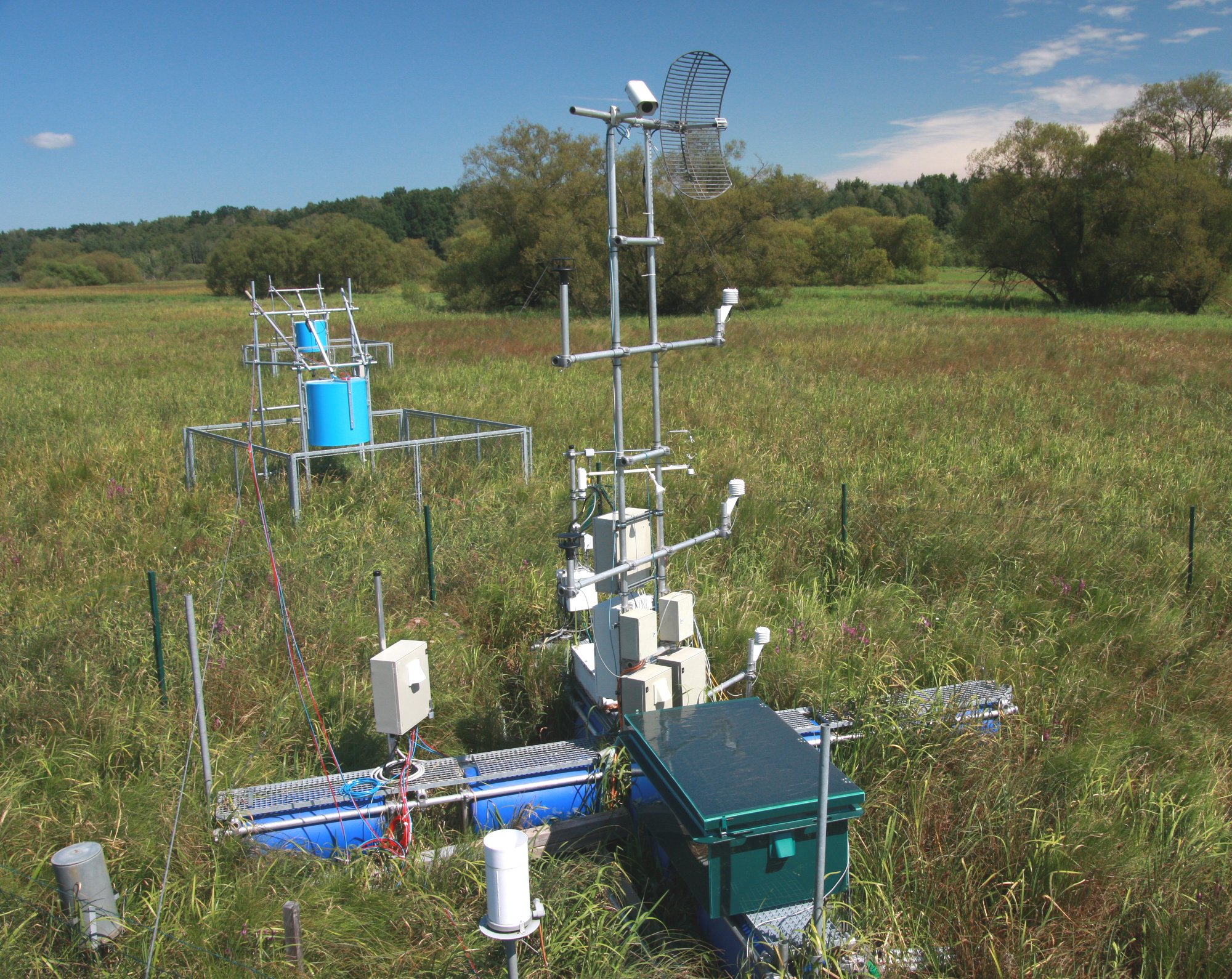
The Třeboň Wet Meadows is an LTER site of a 1 hectare area. It is a part of a wetland with the total area of 450 hectares situated in the inundation area of a large human-made reservoir (Rožmberk fishpond, 5 km2). The Wet Meadows are a predominantly herbaceous wetland with an up to several meters thick layer of organic sediment, which is superimposed on quaternary alluvial sands and clays. The vegetation cover is formed mainly by tall sedges (Carex acuta, C. vesicaria) and reed Canarygrass (Phalaris arundinacea). During the last 50 years, after cessation of mowing, a distinct stand structure of hummocks and hollows has developed. The hummocks are formed by tussocks of Carex acuta. On the site, wide water level fluctuations are recorded in some years. The relatively regular spring floods and irregular summer floods occur as a consequence of snow melting and summer rains in the catchment area, respectively. Extreme floods occurred in the summer of 2002 and both spring and summer of 2006, when the water level culminated at 2 m above the soil surface. The most frequently recorded position of the water level is at about −0.1 m. From 1977 to 2006, meteorological measurements were executed in a meteorological screen. Starting from 2006, the measurements have been executed with electronic sensors connected to data-loggers. Since that time, the site has been equipped for measuring carbon exchange and fluxes of CO2 and H2O (eddy covariance system, Licor). Since the spring of 2011, the site has been equipped for measuring methane and CO2 emissions from the sedges (automatic static flow chamber with a laser gas analyzer, LGR).The Wet Meadows are included in the integrated carbon observation system (ICOS) as a wetland ecosystem station.
-
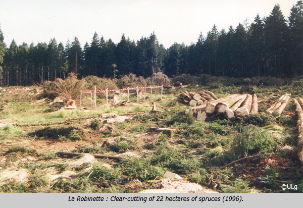
La Robinette is a 81 ha catchment located in the east of Belgium (« Hertogenwald »: Duke's forest) within the municipality of Baelen. Biogeochemistry (nutrient and organic carbon in throughfall, rainfall, soil solution and outlet) has been studied since 1991 as a reference catchment within the frame of a liming experiment (Waroneu catchment) and critical loads calculations. The catchment, initially covered by Picea abies, was subjected to windthrow, reducing coverage to 46% (1990s) and experimental clearcut of 22 ha (1996), followed by afforestation with deciduous species in 1998. Four 2-ha plots were planted with deciduous species in alternate rows. Alder, rowan, birch and oak were also planted within the catchment. In 2012, the catchment was covered by 8% mature and 41% young conifers (Picea abies), 7% deciduous trees (Fagus sylvatica, Quercus robur, Betula pendula, Alnus glutinosa, Sorbus aucuparia, Salix caprea ), 44% open space. Biogeochemical measurements have been complemented with experiments on litterfall, litter decomposition, soil respiration, N cycle processes. Flux and meteorological data have been collected from 2007 to 2011 (CarboEurope) and from end 2016 (ICOS). In addition, since 2013, biogeochemistry and soil microbial parameters (microbial biomass, N mineralization, basal respiration) are studied in 6 intensive plots, reflecting major combinations of vegetation and upper soil characteristics within the catchment.
-

Tronchaney, Conca di Torgnon, (Torgnon, Aosta), + 388330 + 5075950; Aosta Valley