
net primary productivity
Type of resources
Available actions
Topics
Keywords
Contact for the resource
Provided by
Years
Formats
Representation types
-
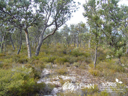
Gingin Banksia Woodland SuperSite is located on the Swan Coastal Plain, approximately 10 km southwest of Gingin, near Perth, Western Australia, sited on land traditionally owned by the Yued group of the Noongar people. The site has an elevation of 51 m and 2 km from the University of Western Australia International Gravity Wave Observatory. The Gingin Banksia Woodland SuperSite is located in a natural woodland of high species diversity (overstorey dominated by Banksia spp.) that overlays the Gnangara groundwater mound, Perth’s most important groundwater resource. The mean annual precipitation is 641mm for this coastal heath woodland. The overstorey is dominated by Banksia spp. mainly B. menziesii, B. attenuata, and B. grandis with a height of around 7 m and leaf area index of about 0.8. There are occasional stands of eucalypts and acacia that reach to 10 m and have a denser foliage cover. There are many former wetlands dotted around the woodland, most of which were inundated all winter and some had permanent water 30 years ago. The water table has now fallen below the base of these systems and they are disconnected and are no longer permanently wet. The fine sediments, sometimes diatomaceous, hold water and they have perched water tables each winter. There is a natural progression of species accompanying this process as they gradually become more dominated by more xeric species. The soils are mainly Podosol sands, with low moisture holding capacity. Field capacity typically about 8 to 10%, and in summer these generally hold less than 2% moisture. The water table is at about 8.5 m below the surface, and a WA Dept of water long-term monitoring piezometer is near the base of the OzFlux tower. The Swan Coastal Plain bioregion consists of five main geomorphic entities that are roughly located parallel to the coastline including three coastal sand dune systems with ages increasing inland from the coast. Banksia Woodlands is restricted to the Swan Coastal Plain IBRA bioregion and immediately adjacent areas, including the Dandaragan plateau. Vegetation consists of a prominent tree layer of Banksia with scattered eucalypts and other tree species present within or emerging above the Banksia canopy, and a diverse understorey including sclerophyllous shrubs, graminoids and forbs. The Gingin SuperSite is collocated with the Land Ecosystem Atmosphere Program (LEAP) - Gingin. The traditional owners at Gingin are the Yued group of the Noongar People.
-

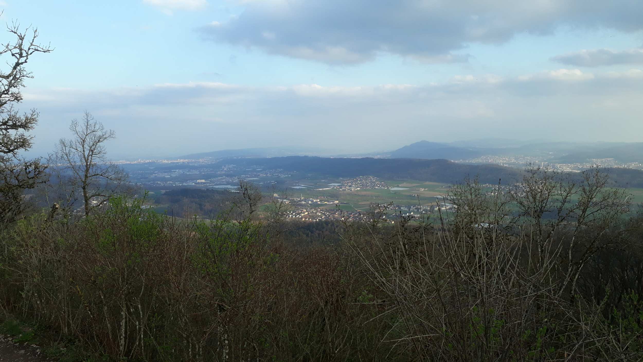
The Hölstein site is located in in the eastern part of the Swiss Jura mountains (47°26’16.4’’, 7°46’31.1’’; 540 m a.s.l.), in a mixed, temperate forest with an exceptionally high biodiversity and a vigorous tree regeneration. The research plot has a size of 1.6 ha and comprises 540 mature trees. The main tree species are Fagus sylvatica and Picea abies with an admixture of Abies alba, Quercus petraea, Pinus sylvestris, Acer pseudoplatanus, Carpinus betulus, Fraxinus excelsior and Sorbus torminalis. A canopy crane is installed in the center of the research area to access the tree canopies for in situ measurements and for sampling of leaf material. Rainout shelters will be installed in 2019 for conducting a long-term throughfall exclusion experiment.
-
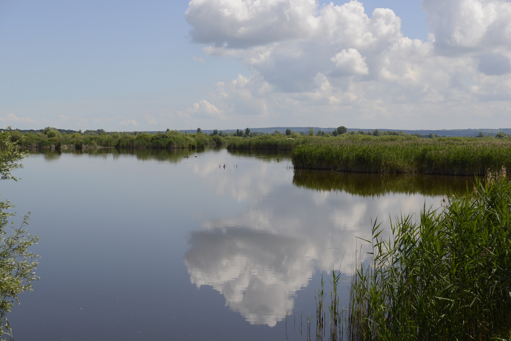
In order to combat the eutrophication of Lake Balaton, the Kis-Balaton Water Protection System (KBWPS) was initiated in the early 1980s. Originally, the KBWPS consisted of an 18 km2 shallow (less than 1.3 m) artificial lake system (Lake Hídvégi) and a 16 km2 wetland, which were constructed on the site of the former Kis-Balaton wetland in the mid-1980s. Later, the wetland part of the KBWPS was significantly enlarged (over 50 km2). Lake Hídvégi was designed to retain nutrients and provide ideal conditions for algae growth, while the wetland component of the KBWPS prevented these algae from entering Lake Balaton. Regular limnological, ornithological, ichthyological and plant ecological measurements are carried out in both Lake Hídvég and the wetland part of the KBWPS.
-
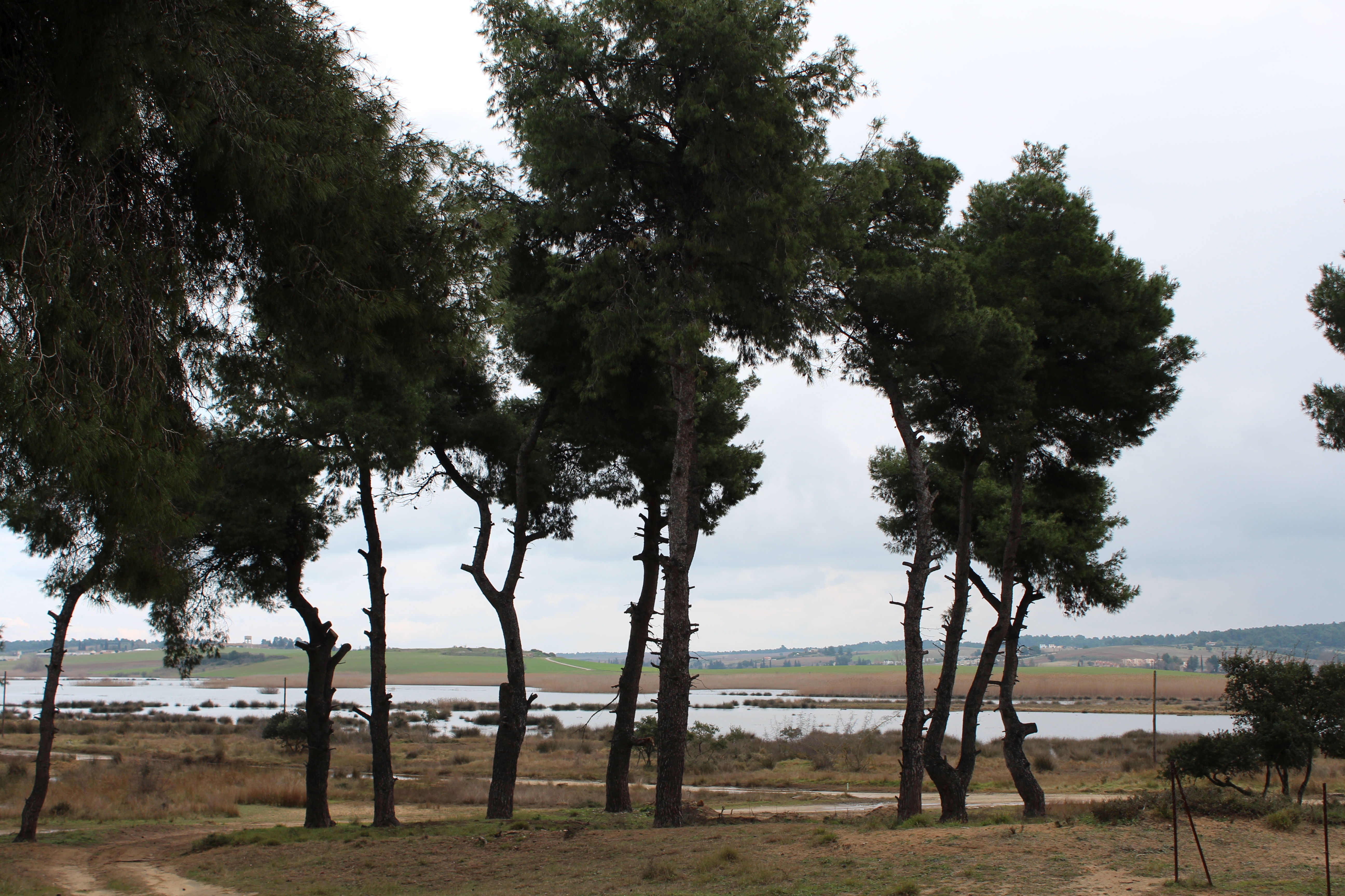
The Sani Environmental Observatory (S.E.O.) is located within a mature, near-coastal Aleppo pine (Pinus halepensis L.) ecosystem at the peninsula of Kassandra, in Chalkidiki, Greece. It is part of the Stavronikita forest, which comprises approximately 300 ha of land covered mainly by forests and to a lesser extend by shrubs and pastures. The Observatory aims primarily at the assessment of the carbon and water balance of this typical low-elevation forest ecosystem to the ongoing climatic shift. Such ecosystems may be prone to the intensified heat and drought events, as well as to the associated insects’ and pathogens’ outbreaks, which are increasingly occurring at the Mediterranean region and particularly at its eastern part. Although Aleppo pines, as well as other Mediterranean pines, are generally adapted to the region’s xerothermic conditions, the in-depth understanding of their ecophysiological and growth responses will allow us to predict the potential of such ecosystems to adapt to climate change. SEO also serves to assess the carbon stocks and fluxes and the contribution of these natural, old-growth ecosystems to carbon sequestration and, thus, to climate change mitigation. S.E.O. is developed by the Forest Research Institute (Lab of Forest Ecophysiology) of the Hellenic Agricultural Organization Dimitra with the support of Sani Resort SA, the owner of the studied forest ecosystem, presenting a nice example of collaboration between the research community and the private sector. Given that SEO is located at a region of high touristic and aesthetic value, close to a wetland and the sea, the Observatory also plans actions to familiarize people with environmental monitoring and the multiple functions and services of the studied Mediterranean ecosystem.
-

The BLE LTER program (https://ble.lternet.edu/) focuses on productivity, trophic relationships, and biogeochemical cycling in the network of lagoons that span Alaska’s northernmost coastline. BLE is examining factors that affect the stability and resilience of microbial and metazoan food webs, including drivers and forms of primary production, in these highly dynamic ecosystems.
-
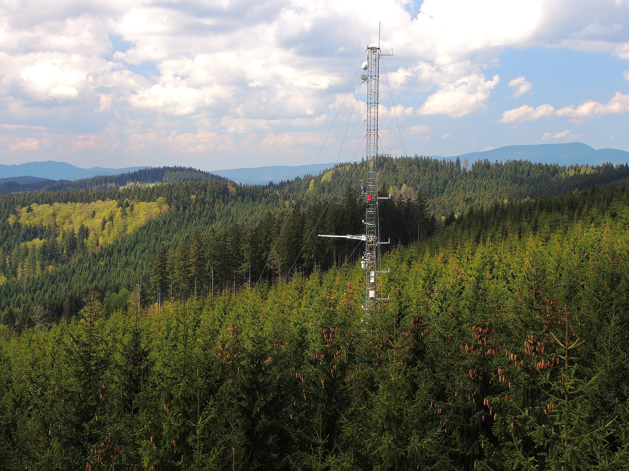
The site Bily Kriz (Bílý Kříž) is located in Moravian-Silesian Beskids Mountains. Ecosystem type: Managed secondary pure Norway spruce stand. Prevailing species: Norway spruce (Picea abies [L.] Karst.) Height of the stand: 17 m (2016) Understory: Vaccinium myrtillus L. Year of plantation: 1981 by 4 years old seedlings
-
The site is located next to Wettingen in the canton of Aargau, within a natural, mixed forest stand which mainly consists of 150 year-old beech (Fagus sylvatica) and 120-170 year-old spruce (Picea abies) trees. Among others, the site is equipped with two meteorological measurement stations; one is located within the forest stand, the second is co-located in the nearby open-field, allowing to measure the forest stand effect on micro-climate. The following parameters are being measured since 2013: Soil solution chemistry (lysimeters), TREENET, atmospheric deposition (throughfall and bulk deposition), circular vegetation plots, crown condition assessment, diameter and height measurements, foliar analyses, leaf area index (LAI), litterfall, manual circumference band measurements, Ozone visible injury assessment, permanent vegetation quadrats, phenological observations, sapflow measurements, soil matrix chemistry, tree core sampling, automated point dendrometer measurements, automatic circumference band measurements.
-
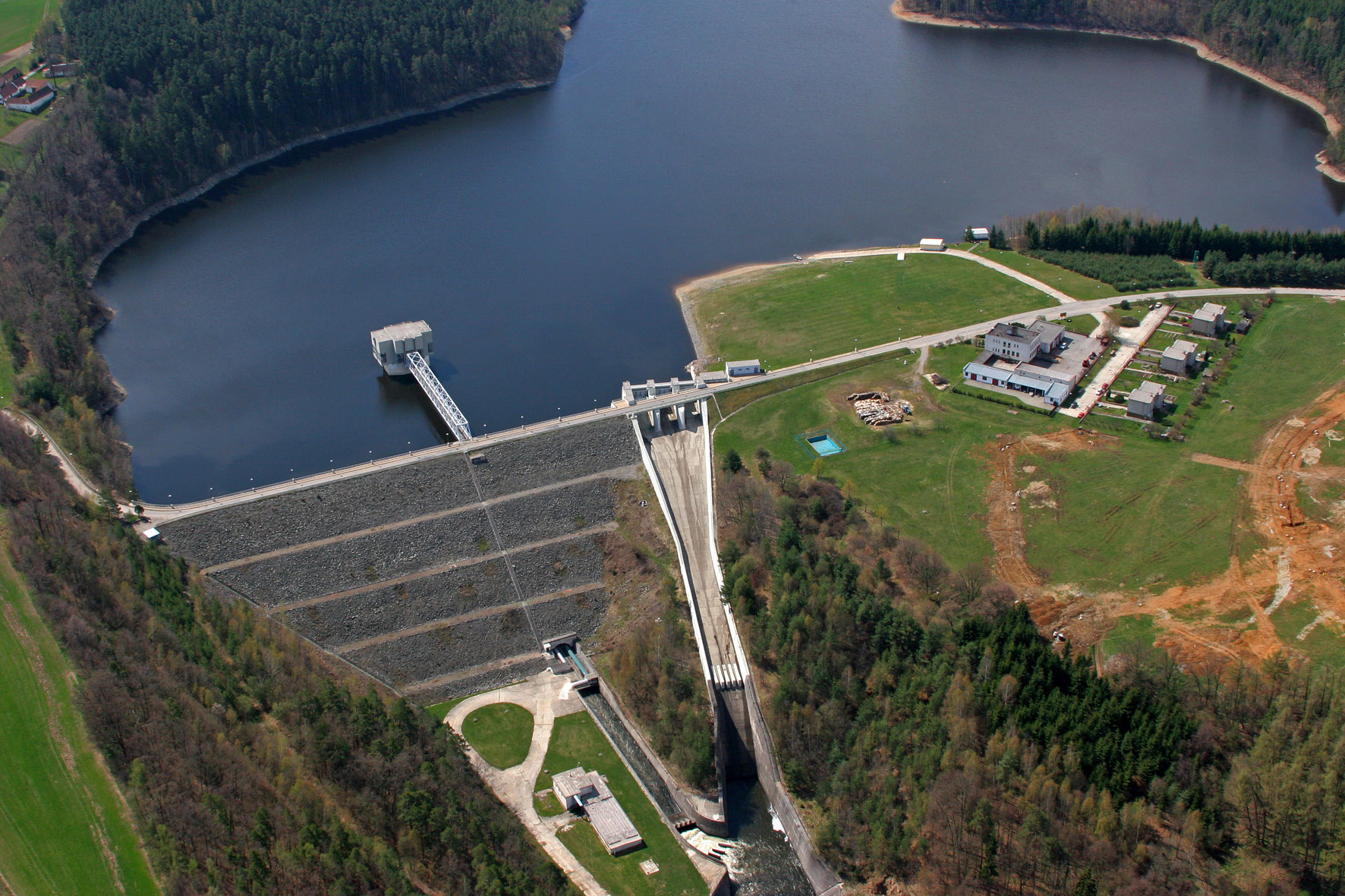
The Římov Reservoir was constructed in 1971–1978 at 21.85 km of the Malše River (tributary of the Vltava River), downstream its confluence with the Černá stream. The reservoir serves as an important drinking water supply for South Bohemia and helps to maintain a minimum flow downstream. The dam is 47 m high and 290 m long. Reservoir volume is 34.3×10⁶ m3, the catchment area is 489 km2.Mean annual flow is 4,3 m3 s-1 and mean theoretical water retention time 92 days. The Římov Reservoir is a canyon-shaped impoundment with steep banks, the „tower“ for drinking water input is at 5 m distance from the dam. Being a drinking water source, Římov Reservoir is protected and no other uses are allowed. Regular investigations of the Římov reservoir in its lacustrine part started in 1979 and have continued at three-week intrevals up to now. Since 1997, the Římov reservoir has been a part of the Czech LTER network. The parameters studied include physical, chemical and biological data on pelagic organisms like bacteria, protists, phytoplankton and zooplankton. Once per year, the abundance and species composition of fish is investigated. Besides regular monitoring, a lot of extensive studies were done of pelagic organisms, their diversity, interactions and functions as well as chemical processes in water and sediment, both in the lacustrine part and in the canyon-shaped riverine part near the inflow. Such intense studies were possible due to the vicinity of well equipped labs in České Budějovice and the construction of a field station at the dam (in 1994).
-

As the largest contiguous pine forest in Switzerland, the Pfyn forest in Canton Valais (46° 18' N, 7° 36' E, 615 m ASL) offers the best conditions for such measurements. In light of this, a WSL research team installed a long-term experiment of 20 years duration in the Pfyn forest. The average temperature here is 9.2°C, the yearly accumulated precipitation is 657 mm (average 1961-1990). The pines in the middle of the forest are about 100 years old and 10.8 m high. The test area has 876 trees covering 1.2 ha divided into 8 plots of 1'000 m2 each (Image 4). Between the months of April and October four of these plots are irrigated by a sprinkler system providing an additional 700 mm of water, annually. In the other four plots, the trees grow under natural, hence relatively dry conditions.
-
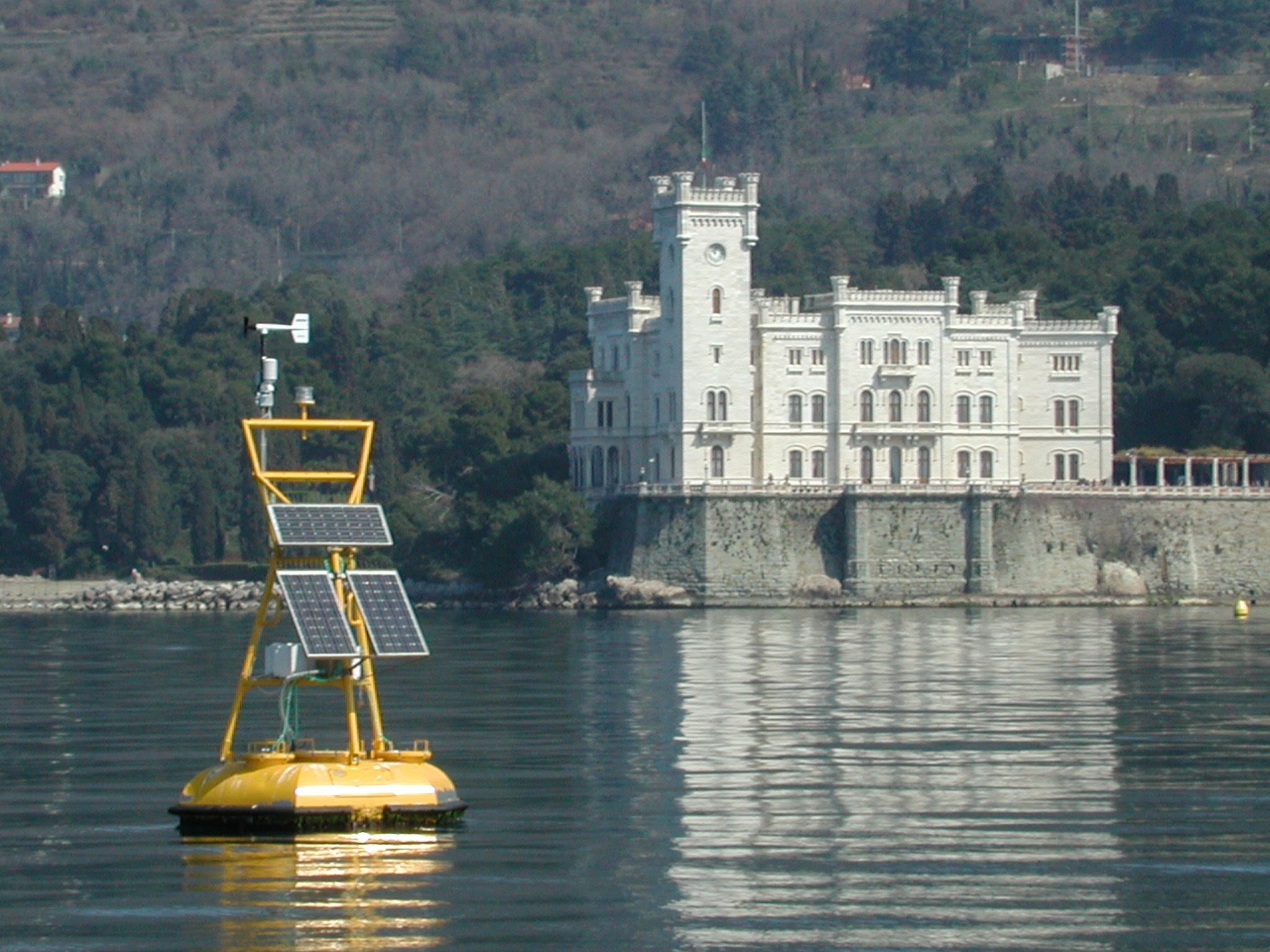
The coastal marine observatory site Gulf of Trieste lies within the Marine Protected Area (MPA) of Miramare and includes the biological time-series station “C1”, part of the Italian Long-Term Ecological Research (LTER) network, and the in situ continuous MAMBO meteo-oceanographic buoy. Marine Protected Areas represent one of the most effective systems for marine biodiversity preservation and management. Since 1986, the time-series station “C1” in the Gulf of Trieste (GoTTs, Gulf of Trieste Time series) represents a crucial site for marine ecological research, as it is subject to the interaction among several natural forcing (river, groundwater discharge, tides, general circulation, intense meteorological) and numerous anthropogenic activities (maritime transport, harbours of Trieste and Monfalcone, urban waste discharge, mussel- and fish-farming, fishing and recreational activities). In 1999, the ecological research site has been equipped with a meteo oceanographic buoy (MAMBO) in order to acquire continuous data on meteorological conditions at sea and on seawater physical and biogeochemical properties. Due to the high temporal dynamics of ecological processes in coastal ecosystems, continuous and real-time data of the main meteorological, physical and biogeochemical properties are fundamental for a better understanding of marine ecosystem functioning.