
net radiation irradiance
Type of resources
Available actions
Topics
Keywords
Contact for the resource
Provided by
Years
Formats
Representation types
-
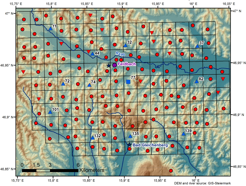
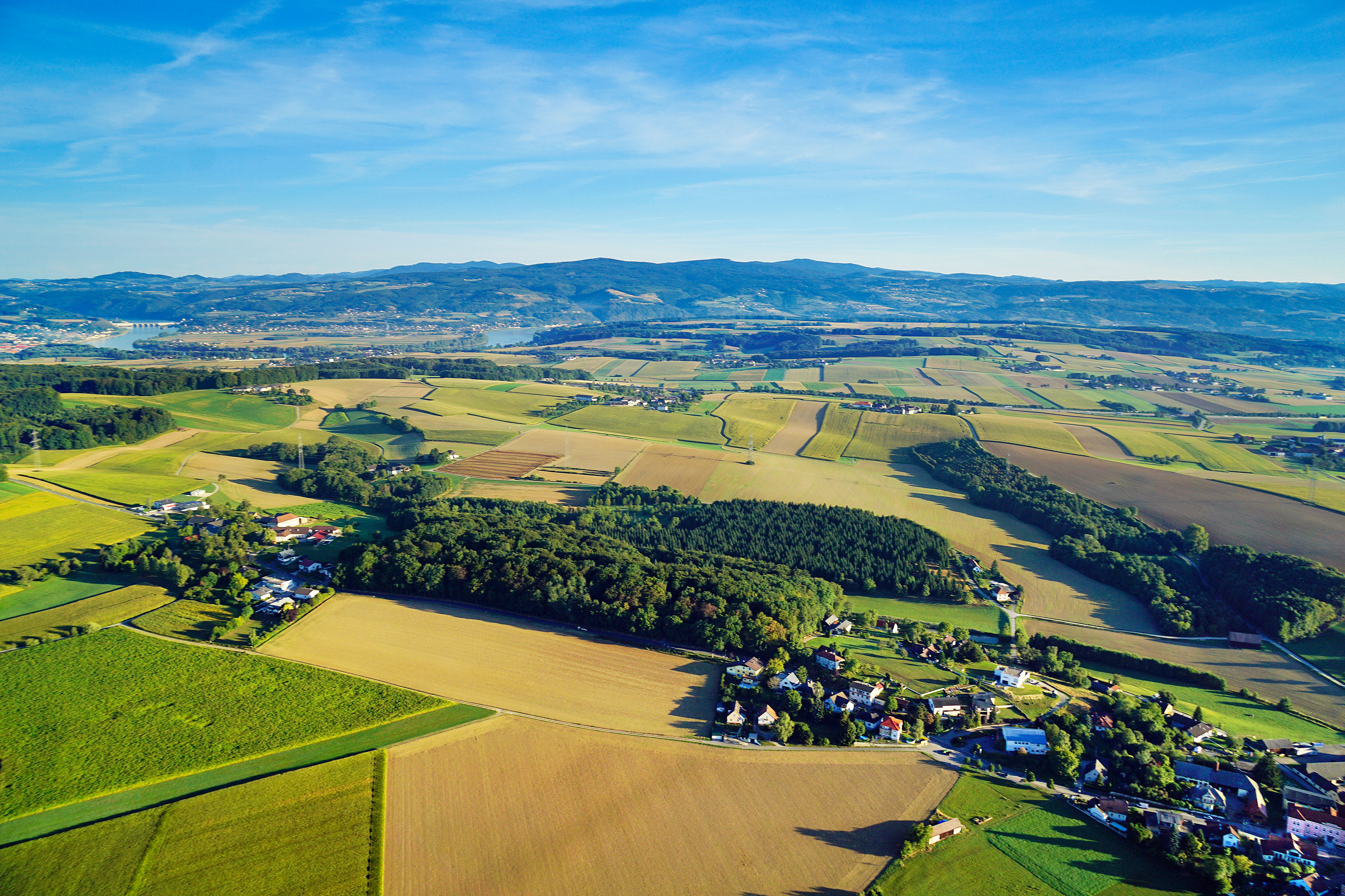
The WegenerNet climate station network Feldbach region is a pioneering weather and climate observation experiment at very high resolution located in Eastern Styria near the city of Feldbach in Southeast Austria, a region characteristic for experiencing a rich variety of weather and climate patterns. The network comprises 156 meteorological stations measuring temperature, precipitation, and other parameters, in a tightly spaced grid within an area of 23 km x 18 km centered near the city of Feldbach (46.93°N, 15.90°E). With its stations every about two square-km (area of about 300 square-km in total), and each station with 5-min time sampling, the network provides regular measurements since January 2007. As of 2010 a complementary meteorological-hydrological network of several stations was added in the mountainous upper Styrian region of National Park Gesaeuse as contribution to the LTER site Johnsbachtal (the "sister site" LTER_EU_AT_029_001 of this site LTER_EU_AT_029_002, both affiliated with the LTSER Platform Eisenwurzen). As part of the Johnsbachtal site, the WegenerNet Johnsbachtal consists of fourteen mountain-proof stations within a region-scale of about 10 km, ranging from valley altitudes below 700 m to mountain tops higher than 2100 m. The WegenerNet at both sites together provides strong value for both alpine foreland and mountain region studies.
-
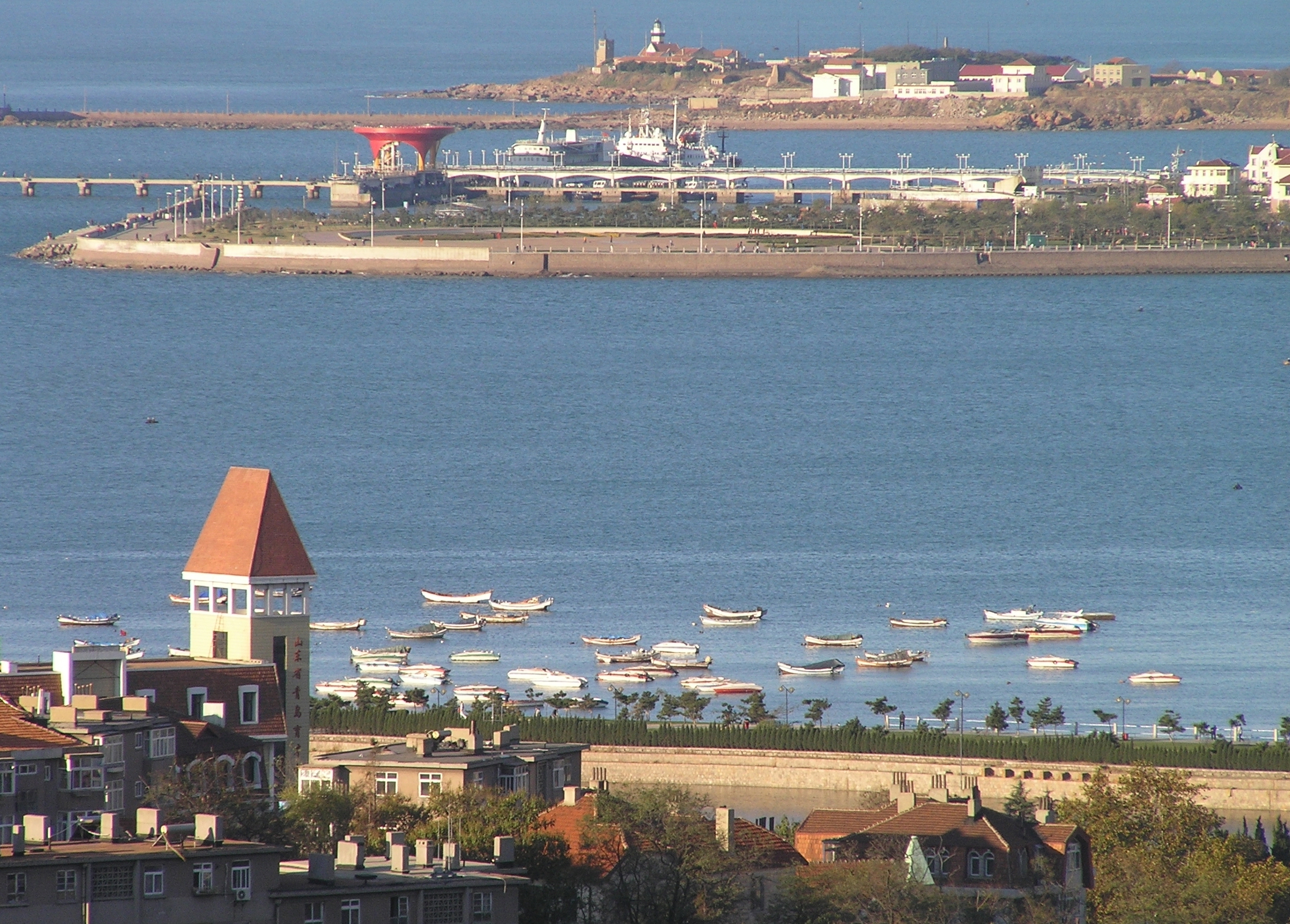
The Jiaozhou Bay, covering an area of 390 km2 between 3538′ and 3618′ N and 12004′ and 12023′ E, surrounded by the Qingdao city. As a semi-enclosed, fan-shaped bay, the narrowest place at the channel connecting with the Yellow Sea, from the Tuan Island to the Xuejia Island, is only 3000 m wide. Its average depth is 6-7 m, with most part of the bayshallower than 5 m, and the tidal zone adds up to 125 km2. The tide of Jiaozhou Bay is regular semidiurnal type. The speed of the flood is greater than that of the ebb, and the duration of the flood is shorter than that of the ebb. There are many peninsulas and islands in the bay, so the circulation inside is complicated. After the residual current analysis, six circulation systems were observed in Jiaozhou Bay. Marine biodiversity and productivity is high in the bay. With the development of Qingao City, the population is increasing quickly around Jiaozhou Bay. Farms, factories, highways, ports, tourism etc. can all affect the environments of the bay. Most of the land-sourced input are from several rivers, such as the Dagu, Haibo, Licun and Nan Jiaolai rivers.
-
The meteorological sensors are located on the roof of the main building of the Biological Station (N 47,7691; E 16,7662; Position (elevation): 122 msl) in the close vicinity of Lake Neusiedl. The parameters that are on-line recoded every 15 minutes are as follows: Air humidity (%RH), Global radiation (W/m²), Air temperature (°C), Wind speed ([Average] (km/h), Wind direction (°), Rain yearly (mm), Precipitation (mm); time resolution: 15 minutes. There are also two traditional weather stations at the station and on the jetty, which are maintained by the Hydrolographic Service Burgenland and enable parameters such as temperature, humidity, precipitation and water level to be recorded. In addition to the Adcon weather station on the roof of the station, there are currently 3 other stations in operation in Seewinkel. These positions are: • Unterer Stinkersee (N 47,8018; E 16,7842) • Neudegg (N 47,7029; E 16,8098) • Östliche Fuchslochlacke (N 47,7907; E 16,8624)
-
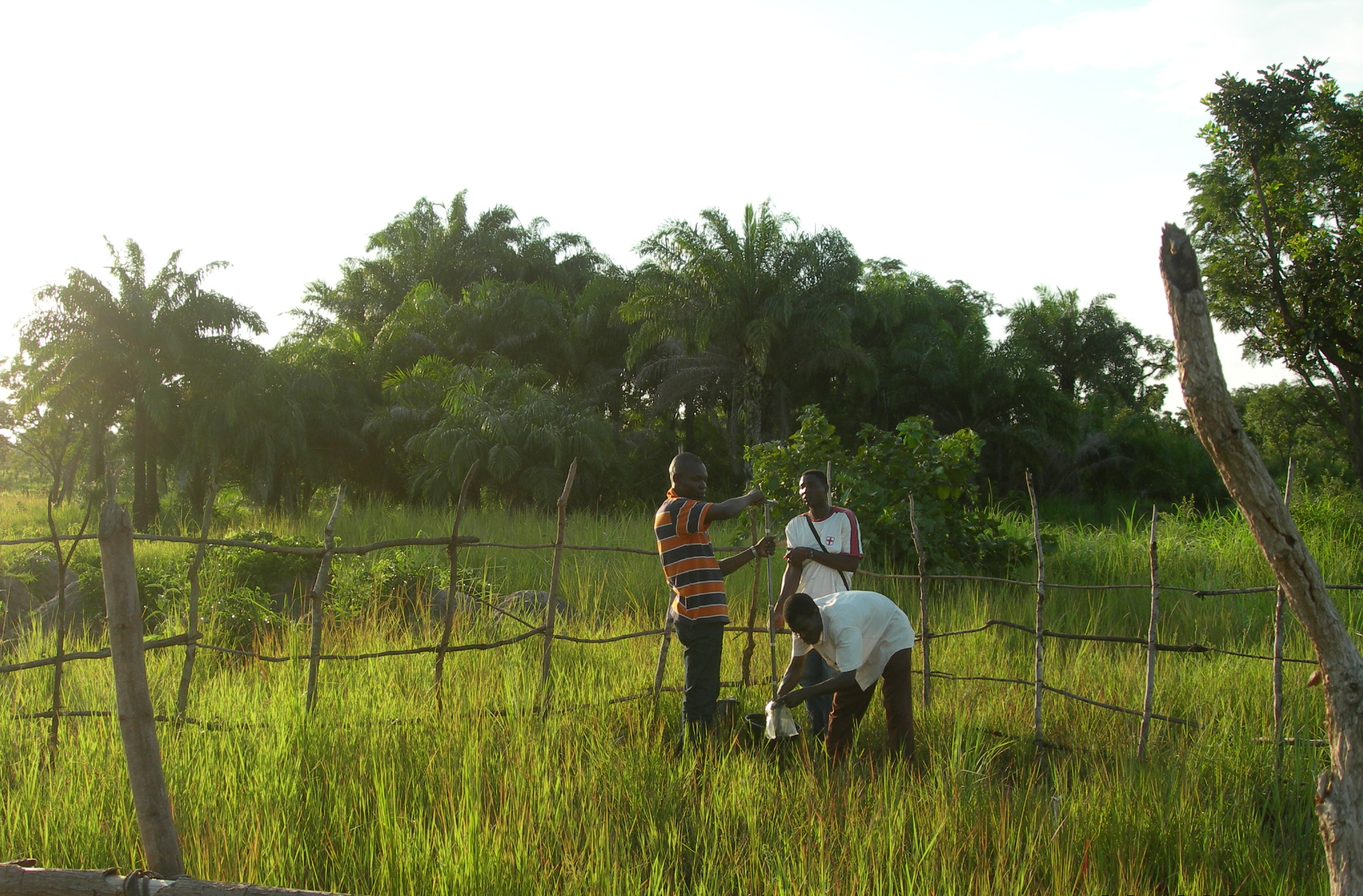
The Oueme mesoscale site (Benin) is part of the AMMA-CATCH observation network. Its characteristics are as follows a 14000 km² basin in sudanian climate on a crystaline basement. The studies focus on the hydrological cycle, the water budget and the hydrological processes.
-
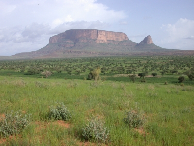
The Gourma mesoscale site (Mali) is part of the AMMA-CATCH observation network. Its characteristics are as follows :a 30000 km² endoreic area in semi arid climate. The studies are dedicated to vegetation monitoring in a pastoral environment.
-
The Petzenkirchen HOAL (Hydrology Open Air Laboratory) catchment is situated in the western part of Lower Austria (48°9' N, 15°9' E). The catchment area at the outlet (termed MW) is 66 ha. The elevation of the catchment ranges from 268 to 323ma.s.l. with a mean slope of 8 %. At present, 87% of the catchment area is arable land, 5% is used as pasture, 6% is forested and 2% is paved. The crops are mainly winter wheat and maize. The climate can be characterised as humid with a mean annual temperature of 9.5°C and a mean annual precipitation of 823mm/yr from 1990 to 2014. Precipitation tends to be higher in summer than in winter. Crop evapotranspiration (ETc) estimated by the FAO (1998) method using local climate data and crop growth information for this period was 471mm/yr. Annual evapotranspiration estimated by the water balance ranged from 435 to 841 with a mean of 628mm/yr (1990–2014) (assuming deep percolation is negligible). The natural surface water outlet of the catchment is known as the Seitengraben stream. Mean annual flow from the catchment in this stream is 4.1 L/s (or 195mm/yr) (1990–2014). Mean flows tend to peak in the spring. The largest flood events on record occurred in 1949 and 2002 with estimated peak discharges of 2.800 and 2.000 L/s, respectively. The highest discharge in recent times occurred in summer 2013 with 660 L/s. The subsurface consists of Tertiary sediments of the Molasse zone and fractured siltstone. The dominant soil types are Cambisols and Planosols with medium to poor infiltration capacities. Gleysols occur close to the stream. (Blöschl et al., 2016)
-
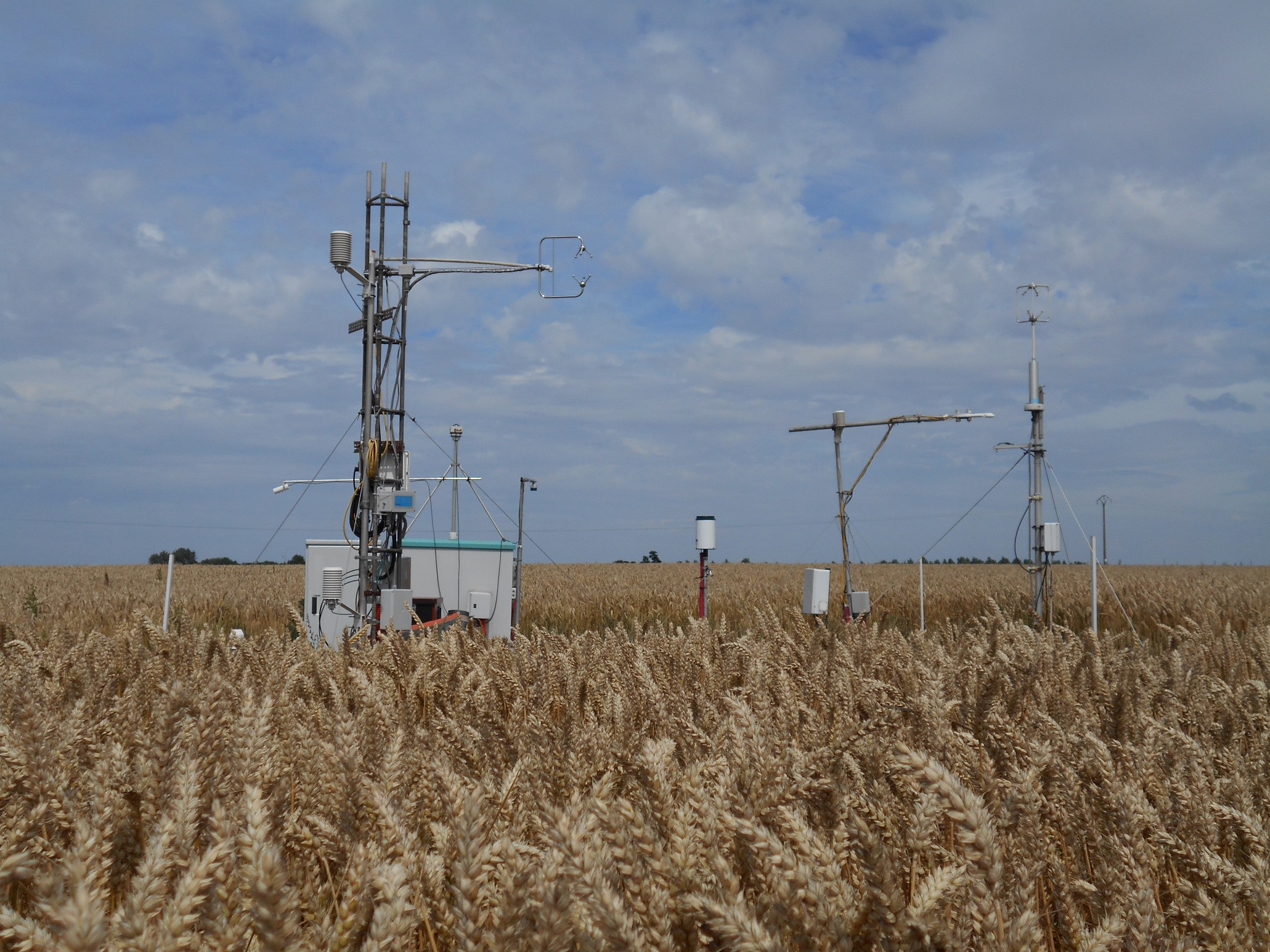
The site is a cropland with a 4-year rotation. Fluxes of CO2 and water vapour are measured by an eddy covariance system. Research activities are carried out by the university of Liège (GxABT).
-
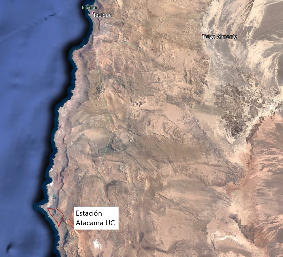
The Alto Patache fog oasis is located in northern Chile, 70 km south of Iquique, Tarapacá Region. This Oasis is located along the Coastal Range of Norte Grande, in the Atacama Desert, known for its remarkable aridity. The influence of coastal fog allows the development of a specially adapted vegetation, which provides habitat suitable for animal species.
-
It is located in the region of the Grand Causses, south of the Massif Central. The karstic aquifer of Durzon represents a surface of 100 km² which feeds the spring of Durzon. This spring supplies the drinking water of the Aveyron part of Larzac. The observatory has a set of sites dedicated to gravimetric, inclinometric and hydro-geodesic observations, as well as a flow tower for evapotranspiration measurements.
-
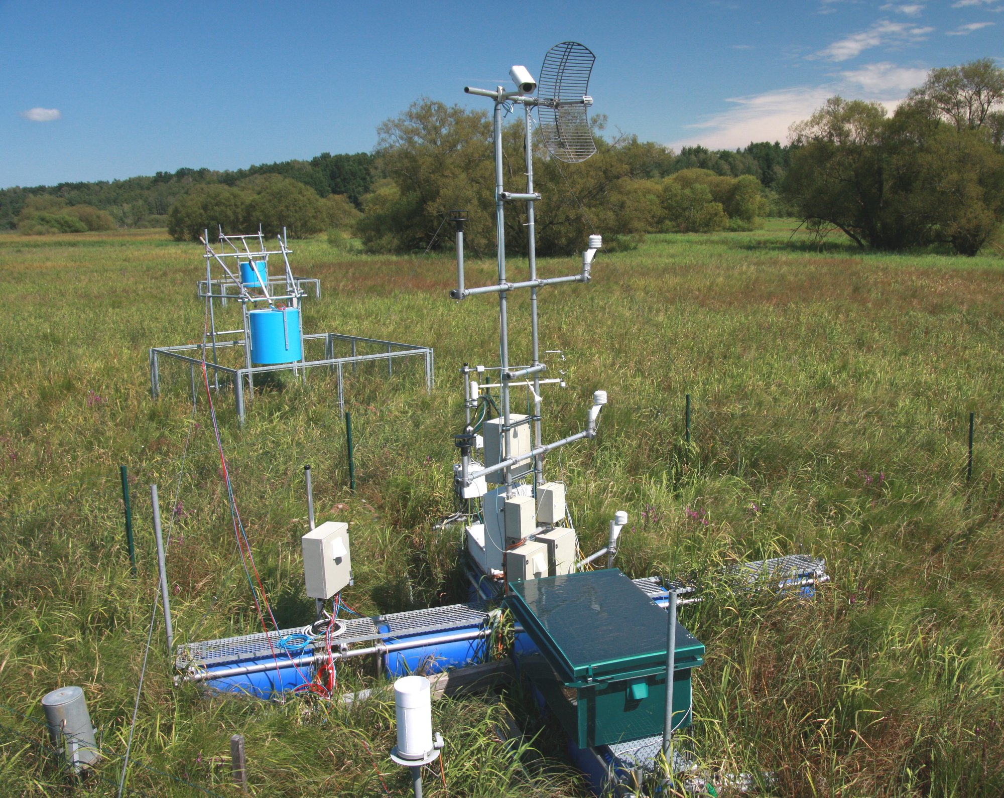
The Třeboň Wet Meadows is an LTER site of a 1 hectare area. It is a part of a wetland with the total area of 450 hectares situated in the inundation area of a large human-made reservoir (Rožmberk fishpond, 5 km2). The Wet Meadows are a predominantly herbaceous wetland with an up to several meters thick layer of organic sediment, which is superimposed on quaternary alluvial sands and clays. The vegetation cover is formed mainly by tall sedges (Carex acuta, C. vesicaria) and reed Canarygrass (Phalaris arundinacea). During the last 50 years, after cessation of mowing, a distinct stand structure of hummocks and hollows has developed. The hummocks are formed by tussocks of Carex acuta. On the site, wide water level fluctuations are recorded in some years. The relatively regular spring floods and irregular summer floods occur as a consequence of snow melting and summer rains in the catchment area, respectively. Extreme floods occurred in the summer of 2002 and both spring and summer of 2006, when the water level culminated at 2 m above the soil surface. The most frequently recorded position of the water level is at about −0.1 m. From 1977 to 2006, meteorological measurements were executed in a meteorological screen. Starting from 2006, the measurements have been executed with electronic sensors connected to data-loggers. Since that time, the site has been equipped for measuring carbon exchange and fluxes of CO2 and H2O (eddy covariance system, Licor). Since the spring of 2011, the site has been equipped for measuring methane and CO2 emissions from the sedges (automatic static flow chamber with a laser gas analyzer, LGR).The Wet Meadows are included in the integrated carbon observation system (ICOS) as a wetland ecosystem station.