
neutralizing capacity
Type of resources
Available actions
Topics
Keywords
Contact for the resource
Provided by
Years
Formats
Representation types
-
The LTSER Zone Atelier Bassin de la Moselle belongs to LTER-France network and is located in eastern France, Lorraine / Moselle. The ZAM acquires knowledge for better controls the impact of human activities on the quality of the water resources in Lorraine County (France), in the watershed of the Moselle River.
-
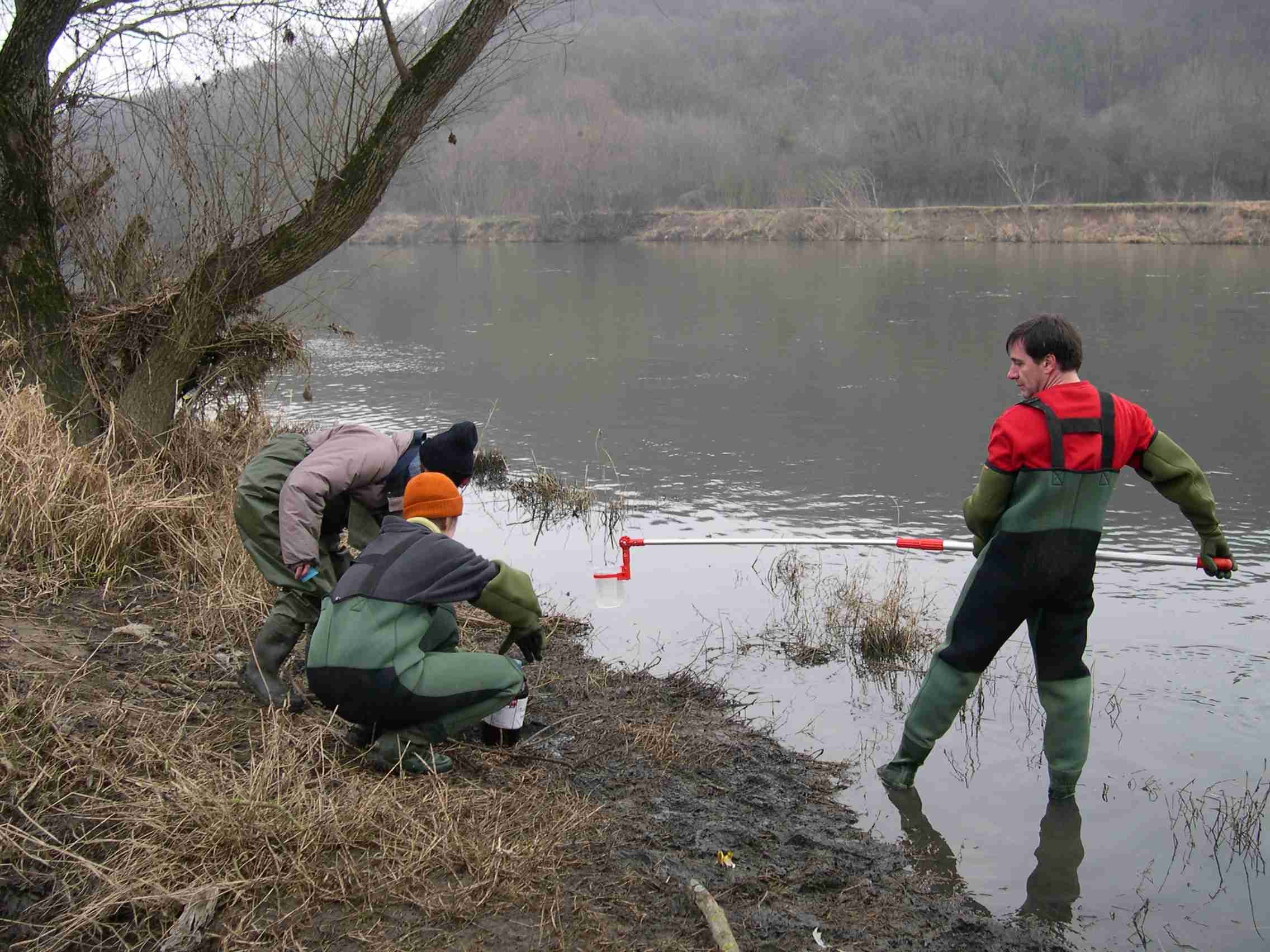
The Baget catchment is managed by the Laboratory of Functional Ecology and Environment (EcoLab), a joint Research Unit between the Institute of Ecology and Environment (INEE) of CNRS, the National Polytechnic Institute of Toulouse and the University Toulouse III-Paul Sabatier, in collaboration with BRGM (Occitania regional agency), the laboratory Geosciences and Environment Toulouse (GET) and the Station of Theoretical and Experimental Ecology (SETE) in Moulis (Ariège, France). The Baget catchment (Pyrénées, Ariège, France) is a mountain ecosystem of middle altitude (Alt.= 1000 m) receiving around 1000mm of precipitation per year. Located close to Balagué village at 10 km West from Saint-Girons, the Baget catchment (13.25 km2) is drained by a karstic network which supplied the surface runoff of Lachein stream (specific discharge: 36 l.s-1.km-2). It is a tributary of the Lez which joins the Salat River, right tributary of the Garonne River. From 1968, this experimental site was intensively equipped by the CNRS underground Laboratory of Moulis (today SETE). The device is composed of one main weir at the outlet, 3 full excess controls, 3 piezometers of which one inside the abyss, and one subterranean loss. This karstic watershed has been surveyed since 1968 for some hydro-climatic parameters, particularly air temperature, precipitations and stream discharge at the outlet. Some geochemical parameters (pCO2, chemical and isotopic compositions of waters) and some hydro-biological and ecological data (invertebrates, particularly Crustacea) have been surveyed for periods during the last 40 years by the CNRS underground Laboratory of Moulis. Since 2011, Baget catchment belongs to the French Network of Catchments (RBV) and it is included in the certified National Observatory Service SNO Karst. Then, new parameters are measured twice a month or with higher frequencies during some flood events (major cations and anions, alkalinity, pH, conductivity, dissolved organic carbon, total suspended matter, H, O, C isotopes…). Since 2014, a multi-parameter probe has been installed with different sensors to measure continuously water level, pH, conductivity, turbidity, dissolved oxygen, nitrate and chloride. These continuous measurements are calibrated twice a month with laboratory analyses. The water discharge is measured by BRGM-Occitania because the Baget karst is part of the French patrimonial network of ground-waters and it belongs to the piezometric network managed by BRGM. The Baget catchment is very sensitive to limit conditions of surface drainage and to land covers. It offers the possibility to develop an eco-systemic survey, which integrates the hydrology, the geochemistry and the ecology of a mountain ecosystem in the SW of France. In this region, climate and land use changes will have significant impacts on biodiversity, ecosystem functioning and biogeochemical cycles for the next decades The Baget catchment is an international field site of the Critical Zone Exploration Network CZEN (http://www.czen.org/content/aurade-experimental-catchment) and it is one of the sites of the French SNO-KARST (Service National d'Observation) labellised by INSU-CNRS. It belongs to the French Research Infrastructure OZCAR and it is also a site of the French LTSER ZA PYGAR "Zone Atelier Pyrénées-Garonne".
-

The ZA PYGAR covers the whole Garonne river basin up to the upper part of the Gironde estuary (La Reole station). Within this territory, research is structured around 4 main sites: the Pyrénées mountains, covering the upstream part of the Garonne river basin (PYRénées site), the farmland of the foothills of the Pyrénées (Vallées et Coteaux de Gascogne site), the Garonne river (Axe Fluvial Garonne site) and the basin of two tributaries of the Garonne river in the Massif Central moutains (Aveyron-Viaur site).
-

Historically, the role of the Galapagos Islands has been considered critical due to the evolutionary diversification induced by natural and historical isolation. The Galapagos National Park was established in 1959, based on its historical importance associated with Charles Darwin's voyage and its rare and endemic biodiversity, composed of unique vertebrate and plant communities (Rozzi et al. 2010). In 1978, the Galapagos Islands were declared a UNESCO World Heritage Site, a critical factor associated with this national park (Rozzi et al. 2010). The Galapagos Islands are a pristine area with local and regional climates influenced by the interaction of ocean currents and winds driven by the Inter-Tropical Convergence Zone; ITCZ (Conroy et al. 2008, Trueman and d'Ozouville 2010). The long-term programme includes forty natural aquatic ecosystems (lakes, ponds, lagoons and swamps) that will be sampled on the islands of San Cristobal, Santa Cruz, Isabela and Floreana, where possible along a lowland-highland gradient. The number of sampling points will vary according to environmental heterogeneity and the presence of a littoral region, among other factors.
-
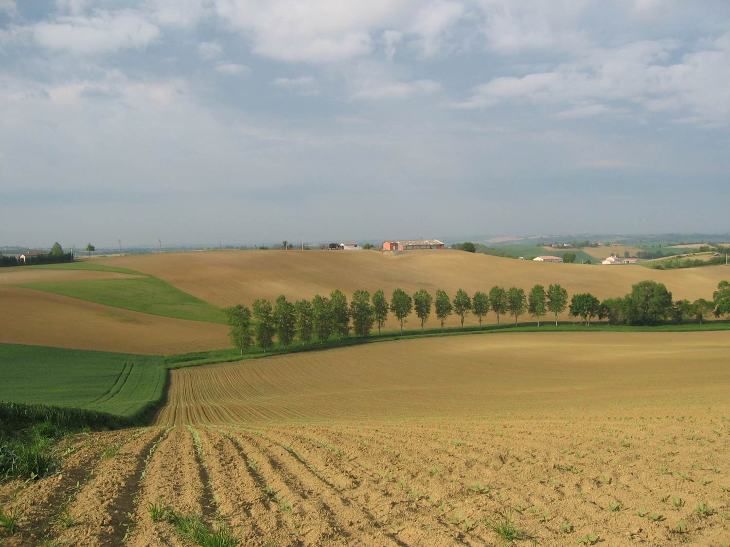
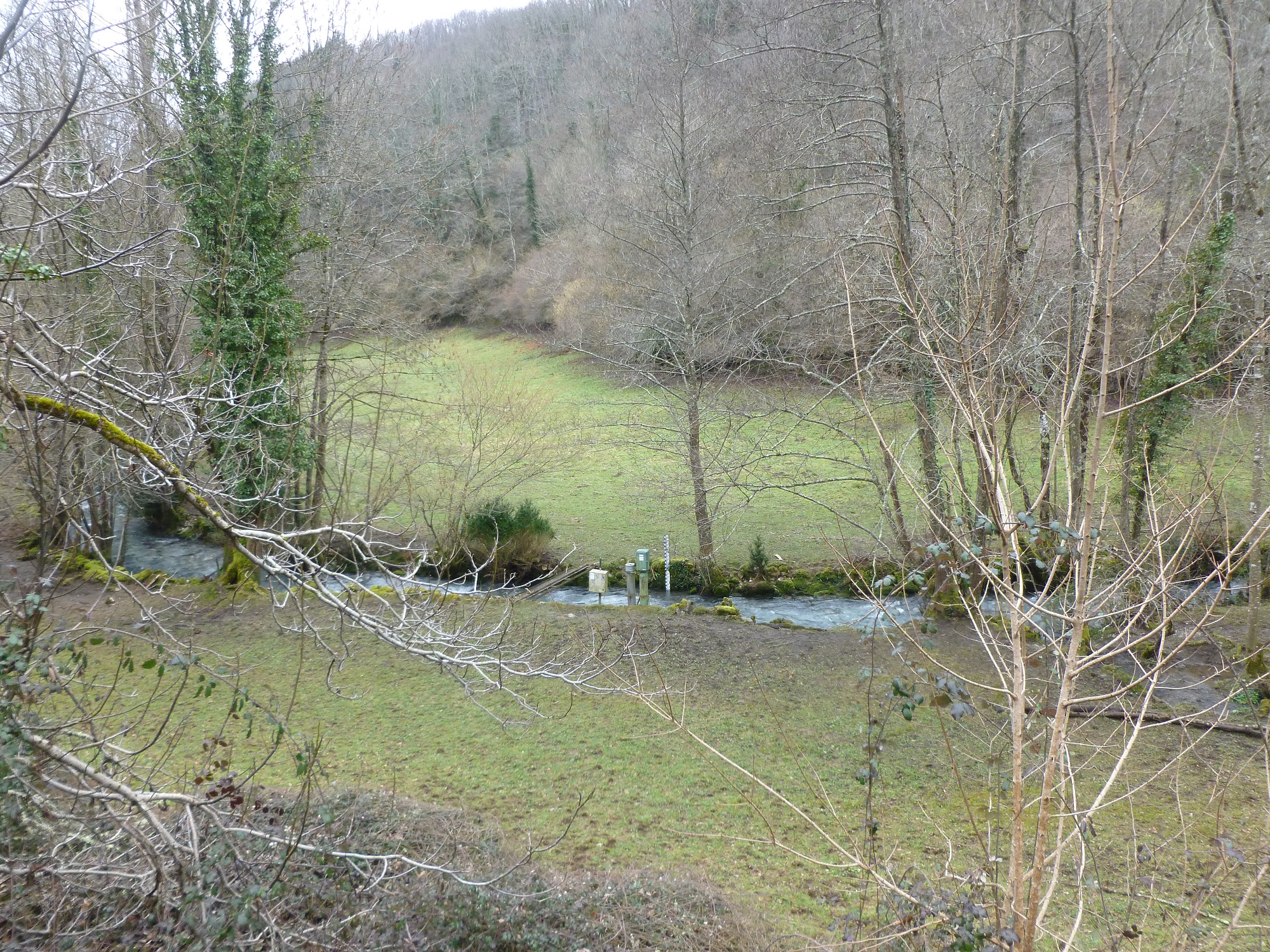
Small agricultural catchment (320 ha) with 30 years of data to study impact of climate change and agricultural practices on soil erosion, weathering rate and river fluxes. Continuous measurements with sensor: river discharge, Temperature, pH, conductivity, turbidity, dissolved oxygen, nitrate Weekly samples and high resolution sampling during storm runoff: major cations and anions, alkalinity, pH, dissolved silica, conductivity, total suspended solids, stable isotopes (13C of DIC, 2H and 18O of H2O, 15N of nitrates), heavy metals, some pesticide molecules Climatological station, rain collector for precipitation chemistry, soil solution station with lysimetric plate at different depths. Continuous measurement since 2004 of CO2, N2O, water vapor, energy exchange in the soil-vegetation-atmosphere continuum thanks to Eddycovariance and closed chamber methodologies (see OZCAR-RI Regional Spatial Observatory in the South West France contribution) Collaboration with the Aurade farmer association for fertilizer and pesticide inputs, cultivation, agricultural practices... Aurade experimental catchment and flux site are an international field site of the Critical Zone Exploration Network CZEN and of ICOS network, a field site of the French Research Infrastructure OZCAR and it is also a site of the French LTSER ZA PYGAR "Zone Atelier Pyrénées-Garonne". and a regional Platform of Research and Innovation-Midi Pyrénées.