
nitrogen budget
Type of resources
Available actions
Topics
Keywords
Contact for the resource
Provided by
Years
Formats
Representation types
-
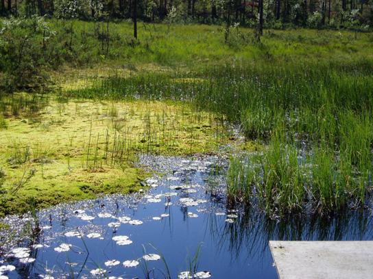
Coniferous forests and mire.
-
The Morris Kahn Marine Research Station was established in order to provide baseline data and understanding of the marine ecological system in the Mediterranean Sea of Israeli coastal waters. The Charney School of Marine Sciences at the University of Haifa recently established a long-term ecological research station focusing on the eastern Mediterranean basin located in Kibbutz Sdot Yam, 44 km south of Haifa, near Caesarea. The station is called the Morris Kahn Marine Research Station and focuses on five main research topics; · Top Predators · Sediments · Water composition (Biogeochemistry) · Rocky Bottoms · Fish Disease (pathogens) The Israeli coastal area and the eastern Mediterranean Sea is experiencing accelerated development and infrastructure projects along the coastline, and a massive exploitation of marine resources never experienced in our region and nation. Coupled with the effects of global climate change and local polluting factors, life in the shallow and deep sea are changing rapidly. The Morris Kahn Marine Research Station is responsible for collecting biological and ecological data for long term research that will provide insight for understanding processes and predicting the effects of climate change and development on the environment. Such data will allow for science-based decisions that will greatly influence the interaction nature of future generations with the sea and the marine environment. This issue is particularly important given the fact that an majority of the water consumed in Israel is produced through desalinization of sea water, the main energy supply is based off of marine gas fields, aquaculture is gaining momentum as development allows for the cultivation of fish for human consumption in marine farms, and national projects referring to the sea as “developable land” that can be dried and made into artificial islands for various infrastructures. In order to accompany such a momentum in development without the collapse of the ecosystem and destruction of the sea as a natural resource, there is a need to provide reliable and in depth understanding as to how the system works. To accomplish these goals, the station employs top of the line researchers specializing in the Mediterranean as well as collaborate with other academic and research centres in Israel, while providing the best equipment for research and analysis of data collected from the sea including; · Rosetta collecting water samples from different depths · CTD device for measuring physical data of water · Advanced underwater photography and documentation equipment · Closed and controlled water system for aquaculture research · Device for detecting and quantifying nutrients in the water (Seal AA3). · Robot for measuring isotopes in samples (GC-IRMS-MS) · Confocal microscopy · Membrane mass spectrometer · Servers for database backup and maintenance · AAUS diving club performing scientific technical dives · Closed dive systems to allow deep, long, and safe dives · Boat used as a platform for diving and marine monitoring on the continental shelf · Laboratories for dissection · Work rooms for student and guest researchers · Meeting/conference rooms · AUV and ROV (Marine technologies lab) · THEMO buoy for deep sea research · Drones and other aerial devices · Website for sharing information as well as providing accessible information for the general public
-
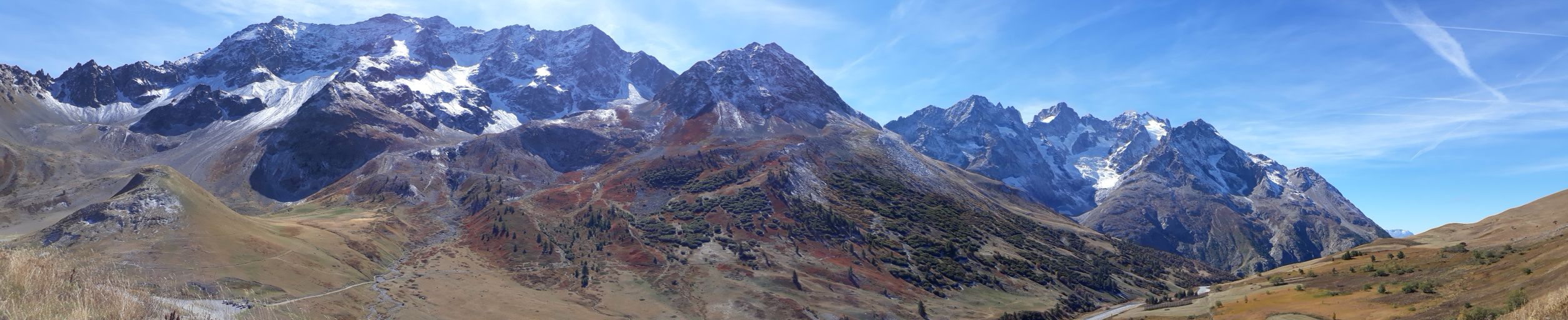
The Lautaret-Oisans platform focuses on the study of socio-ecosystems and the critical zone of the alpine mountains. The research and observation sites are focused on three sub-systems: little-engineered high mountains; alpine pastures; and lakes, rivers and watershed heads. The platform is built around the Lautaret-Roche-Noire site (https://deims.org/8574370e-934e-418a-af63-e15f4cbc5084) and Lautaret Garden infrastructures.
-
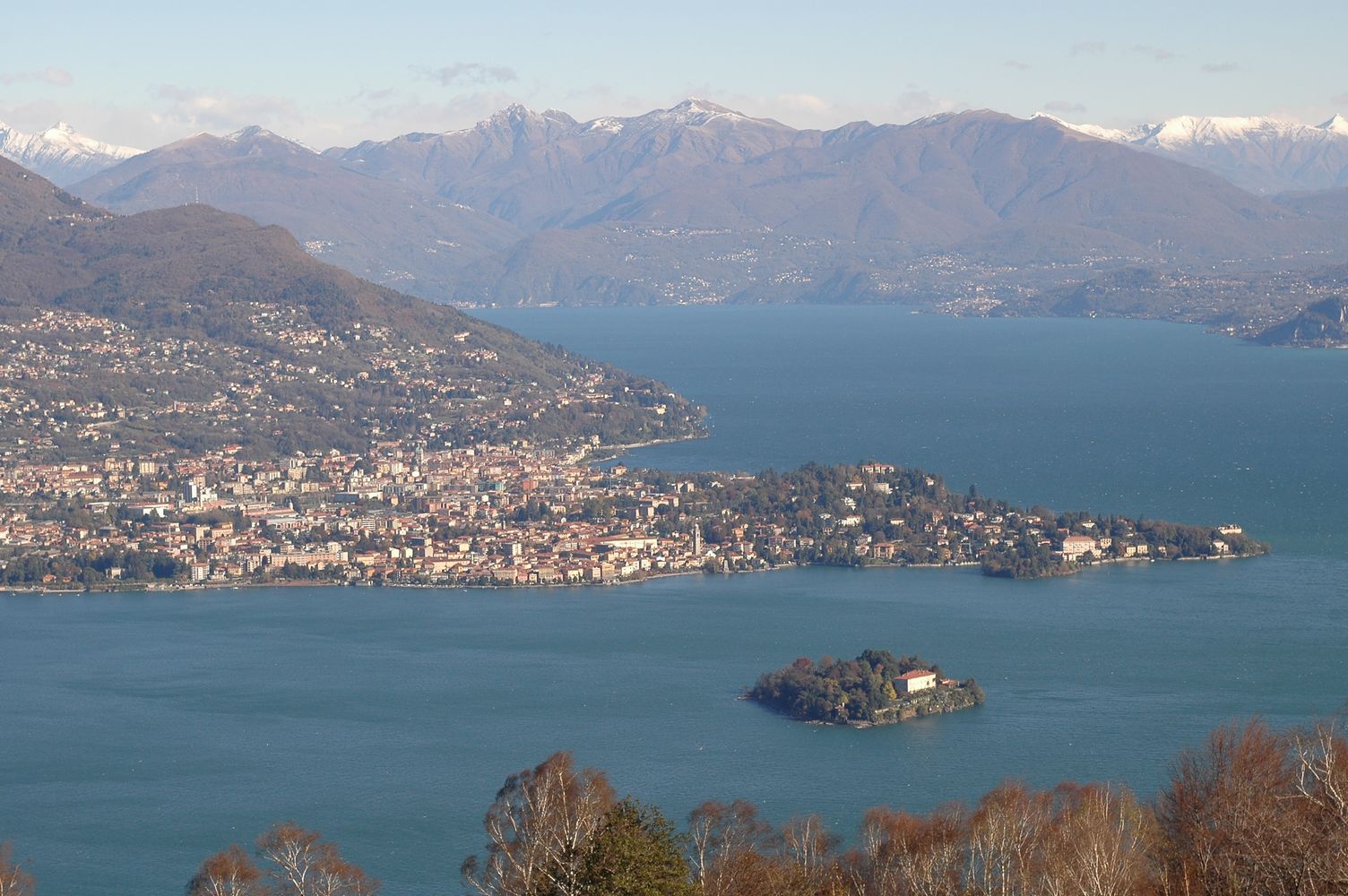
Lake Maggiore was studied since the beginning of last century although not systematically. Regular research started by the foundation in 1938 of the Italian Institute of Hydrobiology "Dr. Marco De Marchi" located in Verbania Pallanza. A limnographic (level and temperature profile) and weather station came into operation in 1952. Studies on plankton and on hydrochemistry of Lake Maggiore continued between the 1950s and the 1970s, showing the progressive eutrophication of the lake. Thanks also to the research of the institute, in the 1980s effective actions to control the eutrophication were undertaken, with the large-scale activation of waste water treatment plants. In the same period a program, still active, of systematic monitoring and research sponsored by the CIPAIS (International Commission for the Protection of the Italian Swiss Waters) started: it allowed collecting an uninterrupted and long-time series, with high sampling frequency, of data related to meteorology, hydrology, physic and chemistry of the lake, organic carbon and bacterial populations, phyto-and zooplankton. The analysis of these time series highlighted an oligotrophication process leading to the current state of oligotrophy of Lake Maggiore. Recent studies also showed the effects of global warming on Lake Maggiore, which went towards the gradual warming of deep hypolimnion as well as the raising of the average temperature of the surface layers.
-
The site is located next to Wettingen in the canton of Aargau, within a natural, mixed forest stand which mainly consists of 150 year-old beech (Fagus sylvatica) and 120-170 year-old spruce (Picea abies) trees. Among others, the site is equipped with two meteorological measurement stations; one is located within the forest stand, the second is co-located in the nearby open-field, allowing to measure the forest stand effect on micro-climate. The following parameters are being measured since 2013: Soil solution chemistry (lysimeters), TREENET, atmospheric deposition (throughfall and bulk deposition), circular vegetation plots, crown condition assessment, diameter and height measurements, foliar analyses, leaf area index (LAI), litterfall, manual circumference band measurements, Ozone visible injury assessment, permanent vegetation quadrats, phenological observations, sapflow measurements, soil matrix chemistry, tree core sampling, automated point dendrometer measurements, automatic circumference band measurements.
-
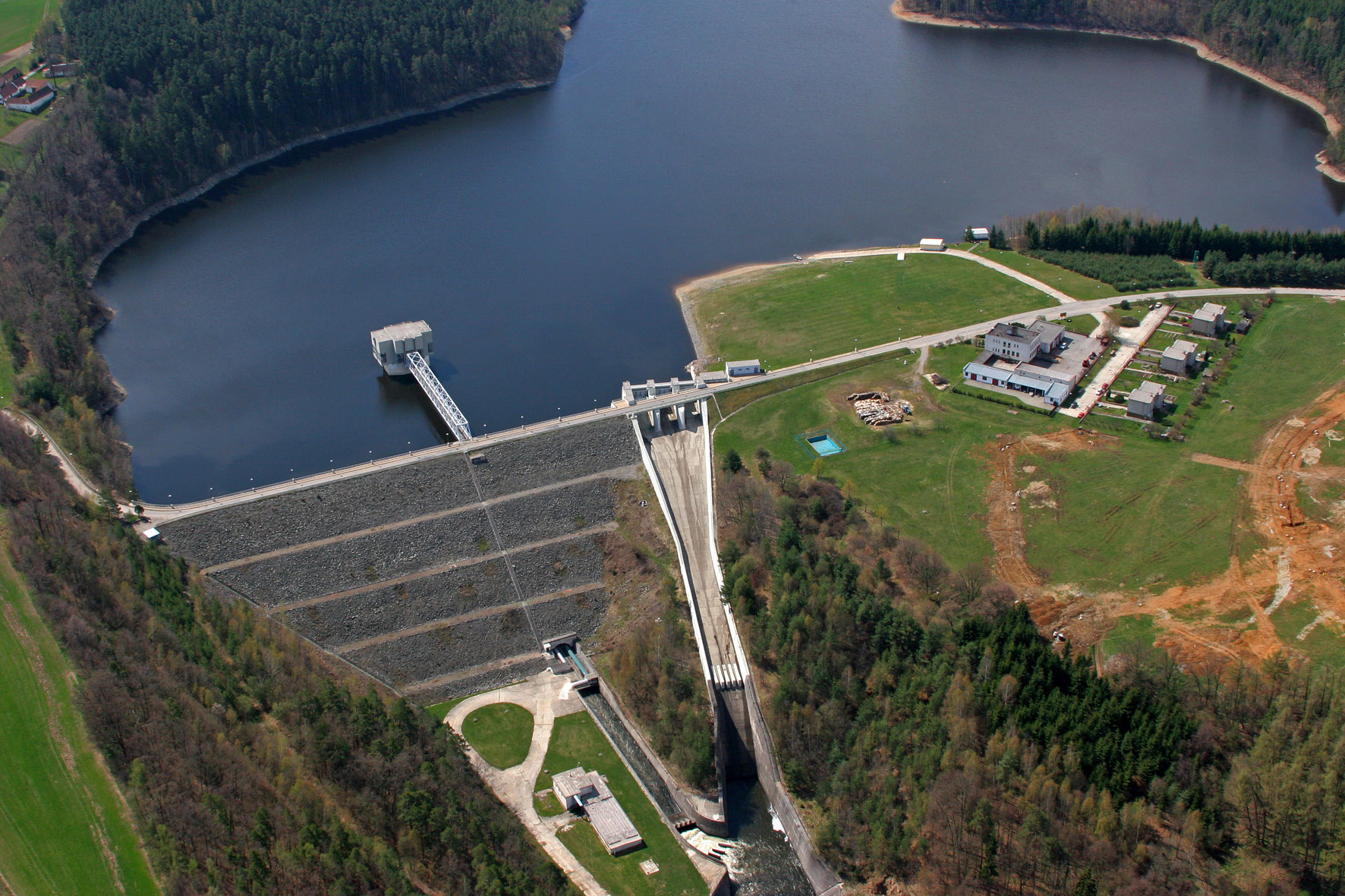
The Římov Reservoir was constructed in 1971–1978 at 21.85 km of the Malše River (tributary of the Vltava River), downstream its confluence with the Černá stream. The reservoir serves as an important drinking water supply for South Bohemia and helps to maintain a minimum flow downstream. The dam is 47 m high and 290 m long. Reservoir volume is 34.3×10⁶ m3, the catchment area is 489 km2.Mean annual flow is 4,3 m3 s-1 and mean theoretical water retention time 92 days. The Římov Reservoir is a canyon-shaped impoundment with steep banks, the „tower“ for drinking water input is at 5 m distance from the dam. Being a drinking water source, Římov Reservoir is protected and no other uses are allowed. Regular investigations of the Římov reservoir in its lacustrine part started in 1979 and have continued at three-week intrevals up to now. Since 1997, the Římov reservoir has been a part of the Czech LTER network. The parameters studied include physical, chemical and biological data on pelagic organisms like bacteria, protists, phytoplankton and zooplankton. Once per year, the abundance and species composition of fish is investigated. Besides regular monitoring, a lot of extensive studies were done of pelagic organisms, their diversity, interactions and functions as well as chemical processes in water and sediment, both in the lacustrine part and in the canyon-shaped riverine part near the inflow. Such intense studies were possible due to the vicinity of well equipped labs in České Budějovice and the construction of a field station at the dam (in 1994).
-

As the largest contiguous pine forest in Switzerland, the Pfyn forest in Canton Valais (46° 18' N, 7° 36' E, 615 m ASL) offers the best conditions for such measurements. In light of this, a WSL research team installed a long-term experiment of 20 years duration in the Pfyn forest. The average temperature here is 9.2°C, the yearly accumulated precipitation is 657 mm (average 1961-1990). The pines in the middle of the forest are about 100 years old and 10.8 m high. The test area has 876 trees covering 1.2 ha divided into 8 plots of 1'000 m2 each (Image 4). Between the months of April and October four of these plots are irrigated by a sprinkler system providing an additional 700 mm of water, annually. In the other four plots, the trees grow under natural, hence relatively dry conditions.
-
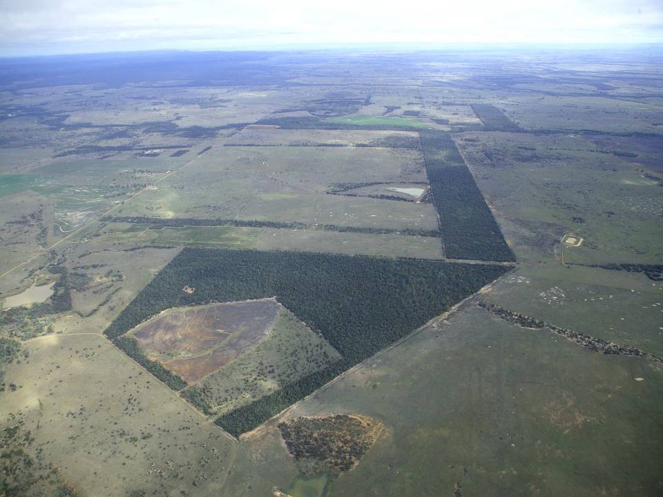
The aim of the Brigalow Catchment Study is to determine the effects of land clearing and land use change on hydrology, water quality, soil fertility and crop and animal productivity in the Brigalow Belt bioregion of central Queensland, Australia
-
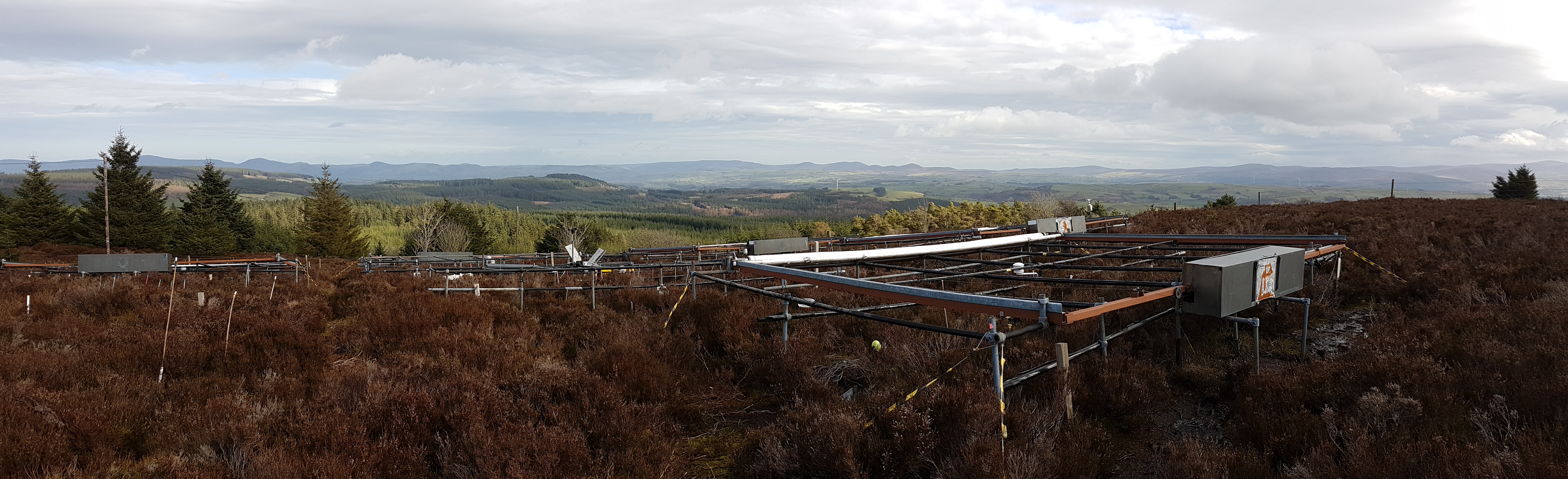
The site is located in Clocaenog Forest in North East Wales (53o 03’ 19’’N -03o 27’ 55’’ W). It is a typical upland west-atlantic moorland, dominated by the evergreen shrub Calluna vulgaris (heather). Heather makes up >60% of the plant biomass at the site, but Vaccinium myrtillus and Empetrum nigrum are also present.
-
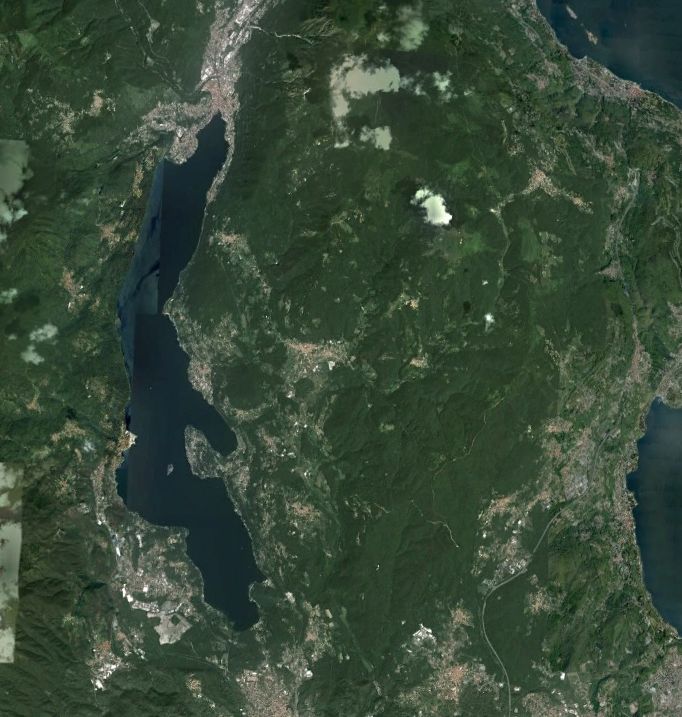
Lake Orta is a deep subalpine lake, located in Northern Italy, at a mean altitude of 290 m a.s.l. Its perimeter is 33,8 km, surface area 18,14 km2, volume 1,29 km3. Lake Orta has a maximum depth of 143 m and a mean depth of 71 m. Lake Orta is well known for being polluted by industrial discharges (copper sulphate and ammonia) since the late 1920: as a consequence, the pH of the lake water dropped down till 4 and the food web was almost completely destroyed, except for some few, strongly adapted species. The pollution stopped around mid 1980s and a liming intervention was carried out in 1989-1990, to neutralize the acidic waters of the lake. The recovery was very fast, new species started to colonise the lake just after the liming. The lake, however, is still at risk, due to the large amount of heavy metals stored in the sediments.