
nitrogen content
Type of resources
Available actions
Topics
Keywords
Contact for the resource
Provided by
Years
Formats
Representation types
-
Ammonium concentrations are provided from 10 depths (0 to 70 m) from the LTER- Marechiara Station in the Gulf of Naples on 4 seasons, 2012. The four data were chosen as to represent differen phases in the seasonal cycle of plankton in the Gulf of Naples
-
Temperate deciduous broad leaved forest, Two beech species (Fagus japonica and Fagus crenata) are dominated.
-
Total nitrogen concentration data of the Gesäuse-Johnsbachtal site.
-
In 1998 a permanent plot (50 x 50 m) was established at the height of 505 m asl in 45 year old spruce stand, where in the 45-year-old spruce stand bulk deposition, throughfall and soil solution are collected. The investigations of health status of trees and floral characteristic have been carried out since 2001. The analyses are carried out in a certified laboratory of the Institute for Ecology of Industrial Areas, Katowice (Certificate No AB 325). The basic meteo data are taken from the monitoring station located about 1 kn from the plot.
-
These data are seven freshwater parameters of Srebarna Lake. They are: water depth (m) of the lake, pH, conductivity, transperance Secchi (m), the amount of NO2, the amount of PO4 (mg/l) and the amount of Chlorophil a (mg/l). They were taken in May, August and November 2012 and these are data for spring, summer and winter season.
-
In 1998 a permanent plot (50 x 50 m) was established at the height of 780 m asl in 100 year old spruce stand, where bulk deposition, throughfall and soil solution are collected. The investigations of health status of trees and floral characteristic have been carried out since 2001. The analyses are carried out in a certified laboratory of the Institute for Ecology of Industrial Areas, Katowice (Certificate No AB 325). The basic meteo data are taken from the monitoring station located about 1 kn from the plot.
-
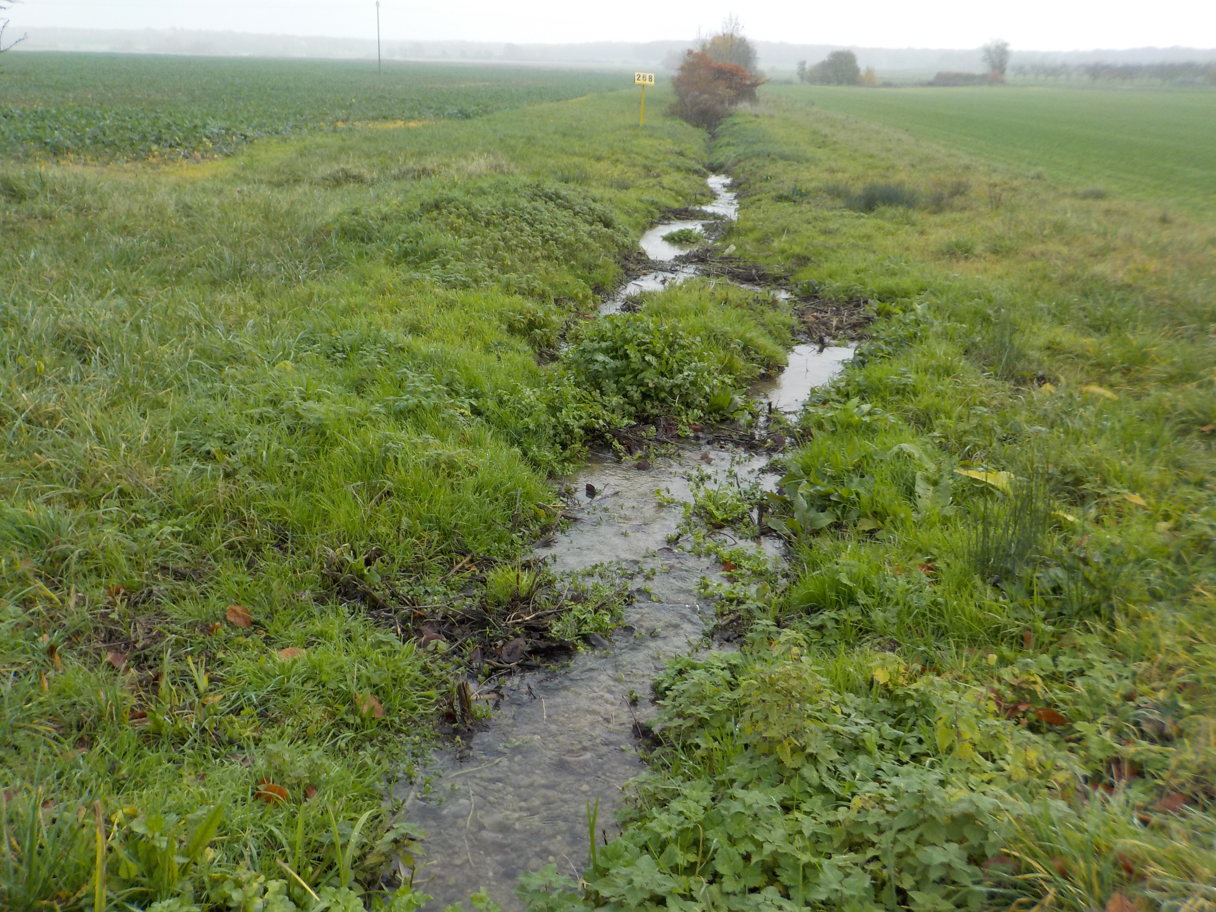
The state forest of La Reine is a humid forest of about 5000 ha located in the south of the plain of Woëvre and at the foot of the Meuse hills in France. Numerous ponds and puddles are scattered throughout the forest and it is crossed by many small, more or less natural streams. Upstream of the forest, these waterways are impacted by human activities (large-scale farming, housing without collective sanitation in particular). Since 2019, the Moselle Basin Workshop Zone has been working on the implementation of a workshop site to understand the bio-hydrogeological functioning of three of these streams, particularly in terms of natural purification. Sampling campaigns are regularly organized in the streams and in ponds.
-
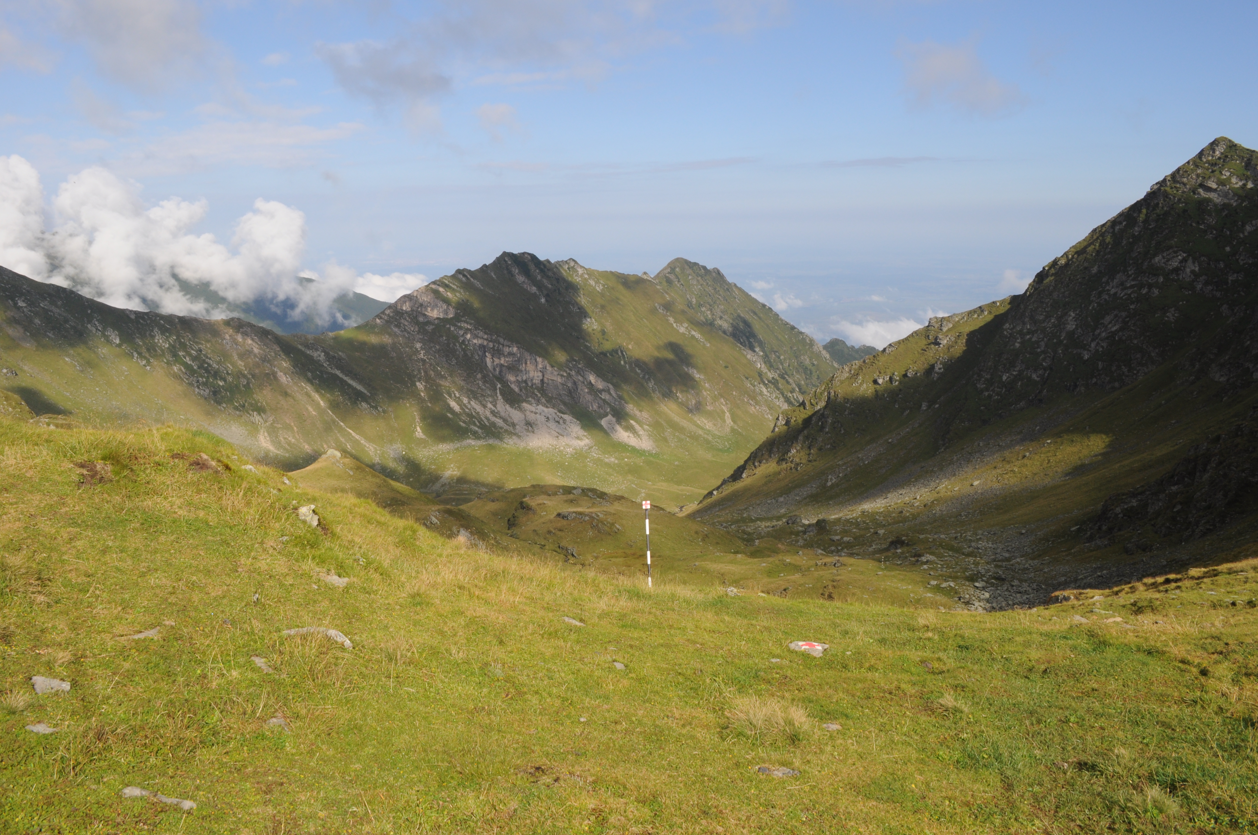
The site is located in the Southern Carpathians (Romania). The predominant ecosystems are grasslands located above tree line, dominated by Carex curvula, Juncus trifidus (alpine zone) and Festuca airoides, Nardus stricta (subalpine zone). The site consists of monitoring points in subalpine and alpine meadows in the Bâlea-Paltinul area.
-
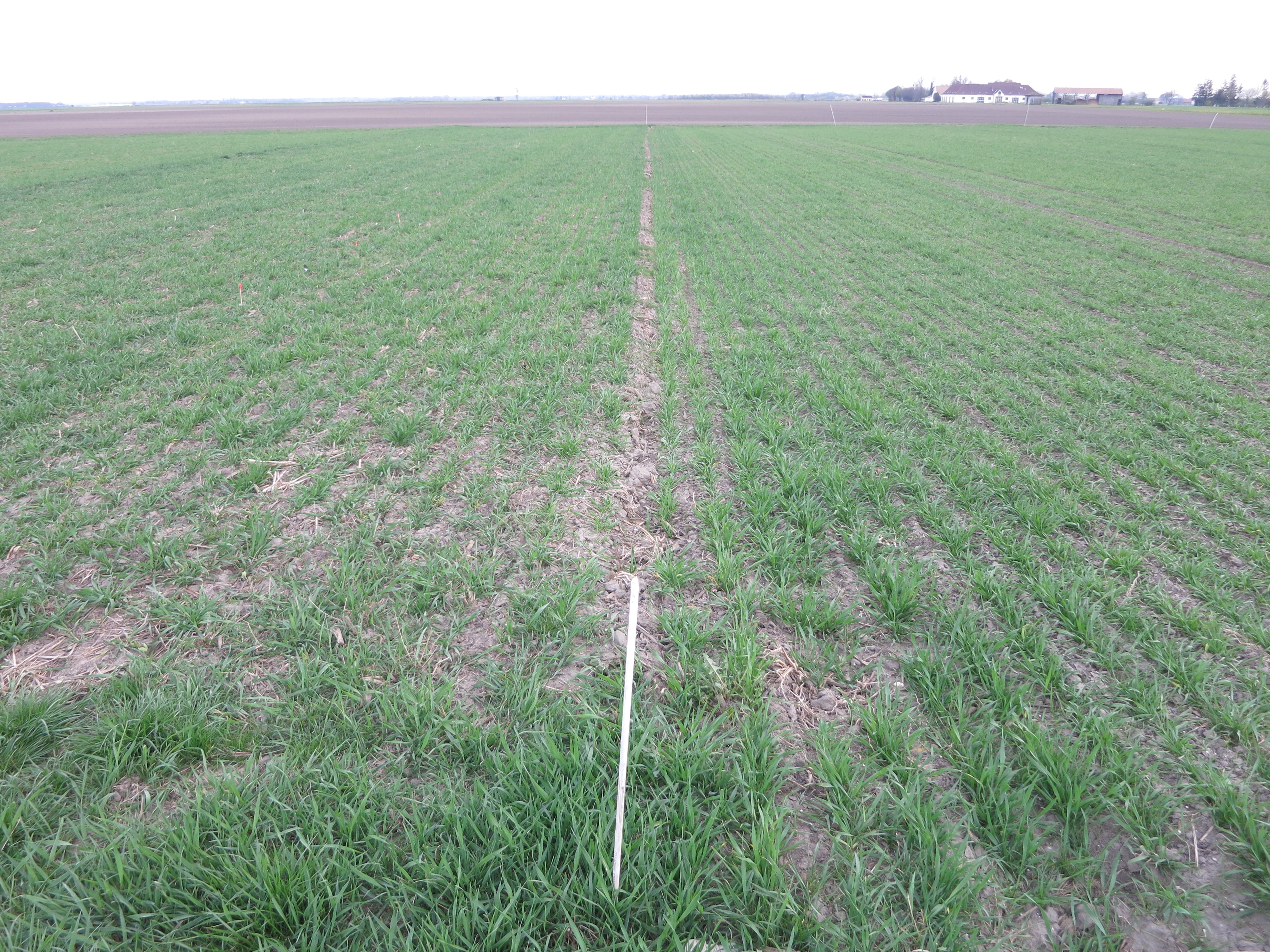
The Fuchsenbigl Field Station is an agricultural research site of the Austrian Agency for Health and Food Safety (AGES) and representative of productive soils managed as arable land. This site is located in the Marchfeld (Lower Austria), the soil is described as a fine sandy-loamy Calcaric Chernozem (WRB). Cultivated crops include cereals (e.g. winter wheat, barley, rye), sugar beet, maize and potatoes. Current research objectives include to study the effects of different conventional arable management practices on crop yields and quality and on chemical, physical and biological soil parameters.
-
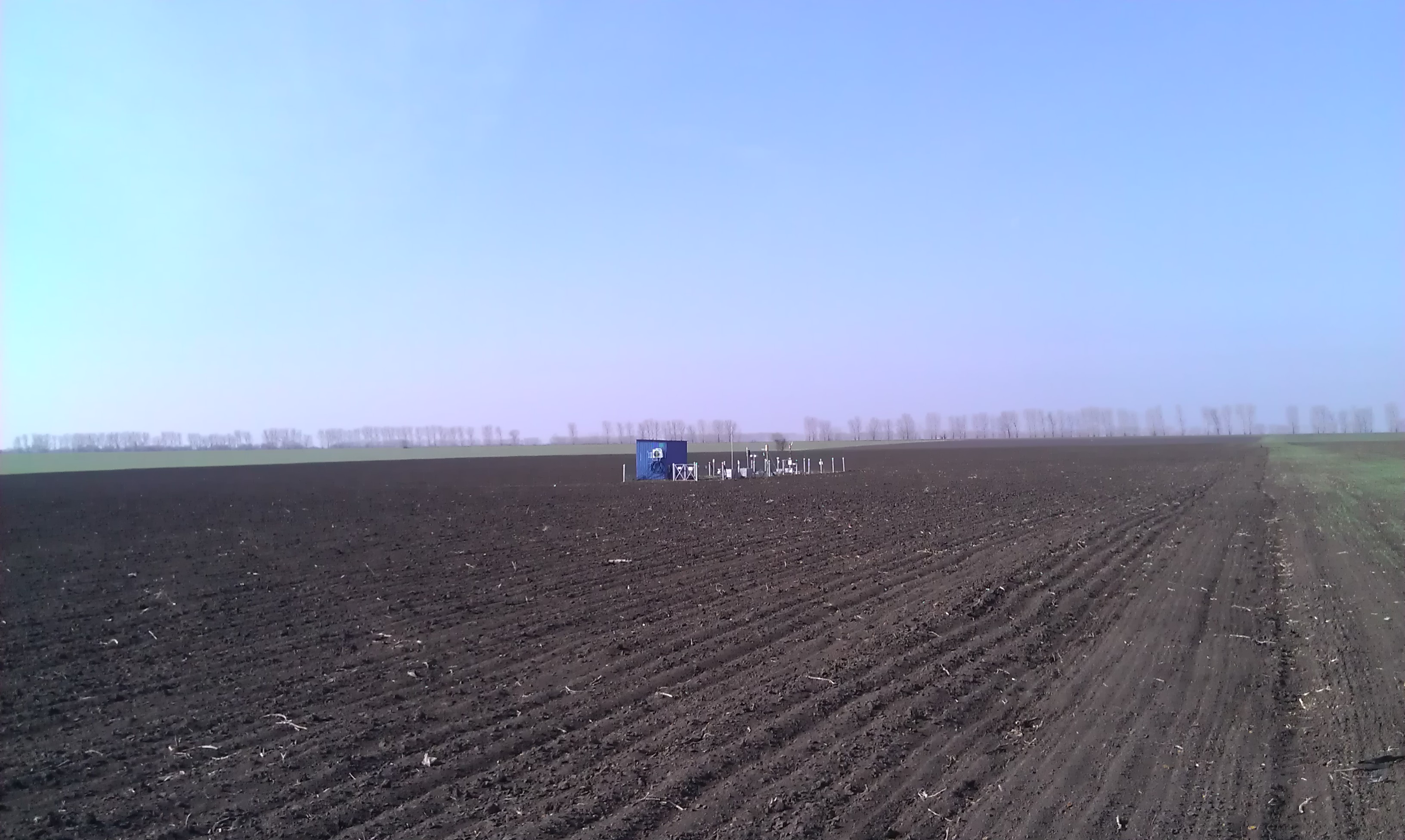
Research Monitoring Station "Petrodolinskoye" (PTR) of the Regional Centre for Integrated Environmental Monitoring and Ecological Studies (RCIEM) of Odessa National I. I. Mechnikov University (ONU) is located on an actively managed arable land. The site is situated 8 km from the Dniester River, which enters the Black Sea (29 km from the study site). The station is located near the village “Mirnoe” (46º27'22.12''N; 30º20'9.94''E), 27 km southeast of Odessa and was established in 2006 within the framework of the EU FP6 NitroEurope IP (Medinets et al., 2014). The arable field study site is 10 ha in size with a flat topography at an elevation of 66 m above sea level. The soil is a black soil (FAO definition: Chernozems Vermi-Calcic, CH vec), and representative for the south of Ukraine (Medinets et al., 2014b, 2016). The climate is temperate continental, with an annual average air temperature of 10.5 °С (period of 2000-2014), an annual minimum mean of 8.4 °С and an annual maximum mean of 12.5 °С. Total average annual precipitation is 432 mm. The atmospheric total N (TN) deposition rate is moderate at ca. 11.4 kg N ha-1 y-1 with significant organic N contribution of circa 67% (Medinets et al., 2016). Crop rotation and management. The study site has been under active agricultural management for more than 200 years, although a detailed history of the agricultural management is unknown. Before autumn 2006 the area was managed by a collective farm (‘kolkhoz’). The study field, 10 ha in size, was leased in autumn 2006 from the Association of Agricultural Enterprises “Granit”. The crop rotation started with wheat in 2006, in the period 2007 – 2014 was onions (2007), tomatoes (2008), barley (2009) and winter wheat (2009/2010) followed by winter onion (2010/2011), carrot (2011), tomato (2012), red beetroot (2013) and onion (2014) followed by winter wheat. This rotation is typical for this region. Crops (except cereals) were grown with drip irrigation (installed in 5-10 cm depth), with fertilizer applied together with the irrigation (fertigation). E.g., during the study period of 2012-2014 the field was fertilized with mineral NPK fertilizers (see Medinets et al., 2016). To prevent plant diseases and to suppress weeds, pesticides and herbicides were applied to all crops following farmers practice. The following tillage methods were used: deep ploughing (40 cm depths), disking (10 cm depth), harrowing (10 cm depth), cultivation (10 cm depth), inter-row cultivation (5 cm depth); the soil was also disturbed under installation/ removing of irrigation tubes (see Medinets et al., 2016).