
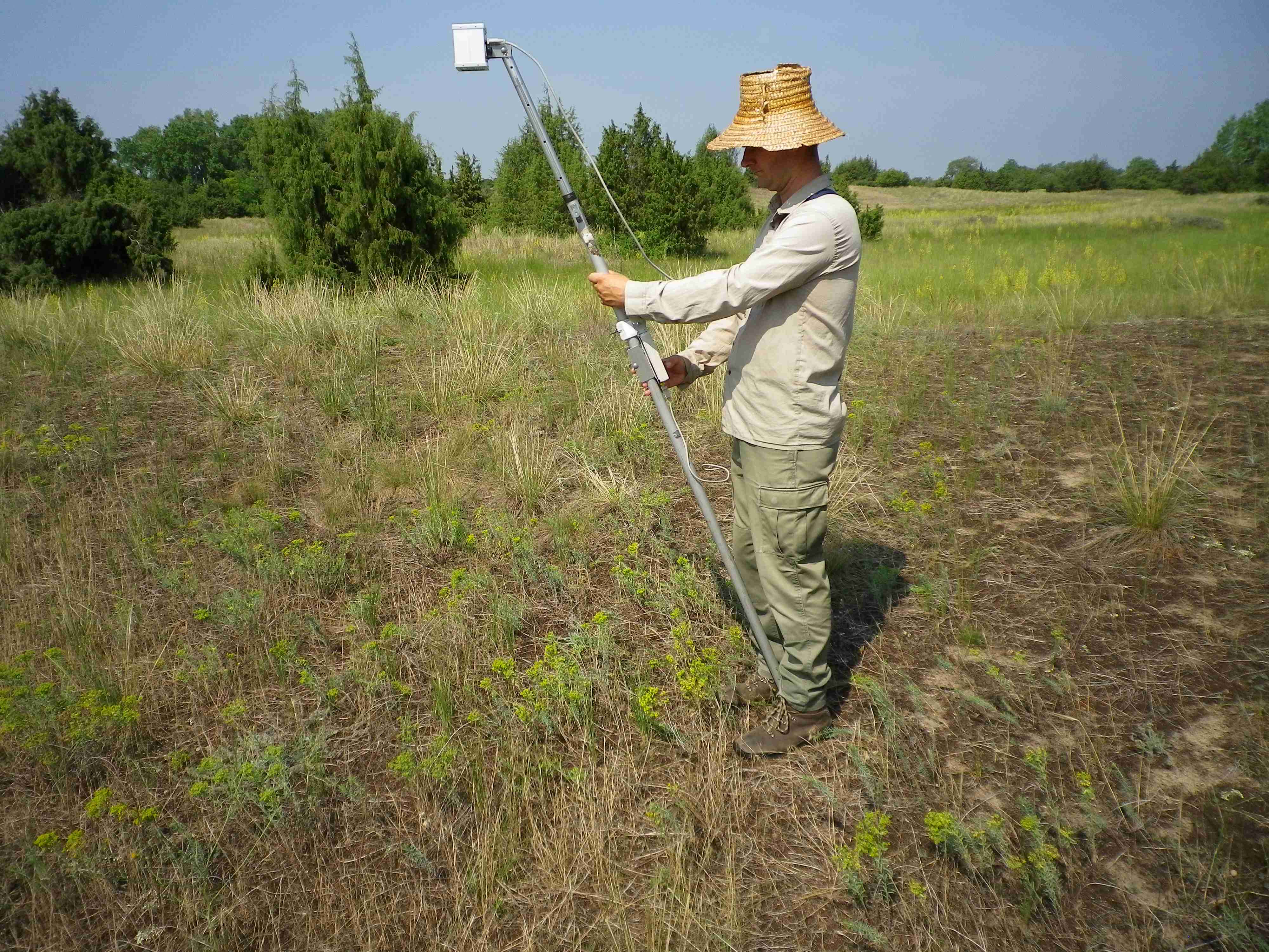
normalized vegetation index
Type of resources
Available actions
Topics
Keywords
Contact for the resource
Provided by
Years
Formats
Representation types
-
Conservation Biology faces the challenge of safeguarding the ecological processes that sustain biodiversity. Characterization and evaluation of these processes can be carried out through attributes or functional traits related, for example, to the exchanges of matter and energy between vegetation and the atmosphere. Nowadays, the use of satellite imagery provides useful methods to produce a spatially continuous characterization of ecosystem functioning and processes at regional scales. Our dataset characterizes the patterns of ecosystem functioning in the Sierra Nevada Biosphere Reserve (SE Spain) from the vegetation dynamics captured through the spectral vegetation index EVI (Enhanced Vegetation Index) since 2001 to 2018 (product MOD13Q1.006 from MODIS sensor). First, we provided three Ecosystem Functional Attributes (EFAs) (i.e., annual primary production, seasonality and phenology of carbon gains), as well as their integration into a synthetic mapping of Ecosystem Functional Types (EFTs). Second, we provided two measures of functional diversity, EFT richness and EFT rarity. Finally, to show which are the most stable and variable zones between year in terms of ecosystem functioning, we delivered the interannual variability in ecosystem functioning from two measures, EFTs interannual variability and EFTs interannual similarity. For each variable there are two groups of data (two subfolders): one containing the yearly variables, and another one containing the summaries for the 18-year period. A dataset description is avaiable. Data layers are in .TIF format with its associated metadata in .TFW (with an aditional Data Management Plan). Furthermore, we have incorporated rendered versions of all layers as required by Google Earth Pro, and we have also developed an ad-hoc visualization platform for all the layers (http://obsnev.es/apps/efts_SN.html).
-
Orgovany-Agasegyhaza site for studying production-diversity relations and weather effect of productivity.
-
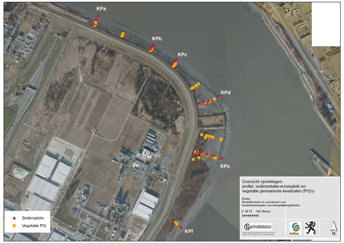
The site is a managed realignement (Sea Wall Removal) combined with a land lowering to start estuarine development in a suitable tidal frame. The site was created in 2002 and monitored in an initial phase intensively. (aspects of morphology, sediment characteristics (including polluents), macrozoobenthos, vegetation and birds). Vegetation and birds are ongoing monitoring.
-
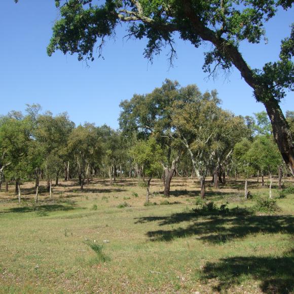
Machuqueira do Grou is one of the six research and monitoring stations of LTER-Montado, an umbrella site located in the Alentejo province in south Portugal (southwestern Iberia). The "Montado" represents an unique agro-silvo-pastoral ecosystem (named "dehesa" in Spain) found only in the Mediterranean basin. These savannah-like landscapes are dominated by evergreen cork and/or holm oaks and were shaped over millennia of traditional land use practices. These multi-use forests are two-layered systems that combine, in a single space, forest harvesting, extensive livestock husbandry, pastures and/or cereal cultivation (the most evident economical revenues), with other traditional uses (hunting, beekeeping and mushroom picking). Recently, increasing awareness arose on their benefits as biodiversity reservoirs, recreation grounds, and other ecosystem services providers, but these non-productive functions are not equally perceived and valued by users, as they tend to be conflicting with productive ones. Machuqueira do Grou is a state-run property, located Bank tributary of the Tagus River, in the Ribatejo province, 100 km northeast Lisbon and 25 km from Coruche (39.116° N – 8.352°W). Cork oak (Quercus suber) is the dominant tree type, with an average of 90 adult trees per hectare. Managed as an agro-silvo-pastoral system but most of the woodland has been managed so as to maintain or increase tree crown cover over the last 10 years. Some tree decline is observed, especially on podzols. The natural regeneration of the tree stand is not uniform, and they are lacking in some places because of grazing and shrub clearing for fire prevention. No fires have been reported in the last 100 years. Conflicting interests arise from the livestock grazing component that affects the natural regeneration of cork oak trees. Interventions and adjustments to promote natural regeneration and active afforestation (e.g. fencing combined with shrub clearing) have been included in the stakeholder´s management plan over the last 5 years.
-
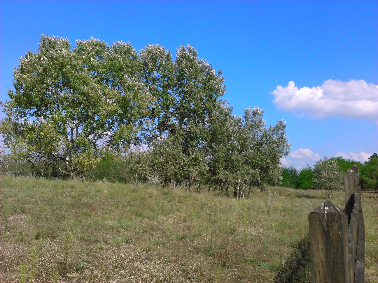
LTER Fulophaza is a high diversity site, both in terms of habitats and species, in the Kiskunság Sand Ridge. It harbors some of the central facilities of the KISKUN LTER, such as the meteorological station and the field research station with accommodation opportunities, as well as highly equipped experimental sites, and a couple of long term monitoring sites and field experiments.
-
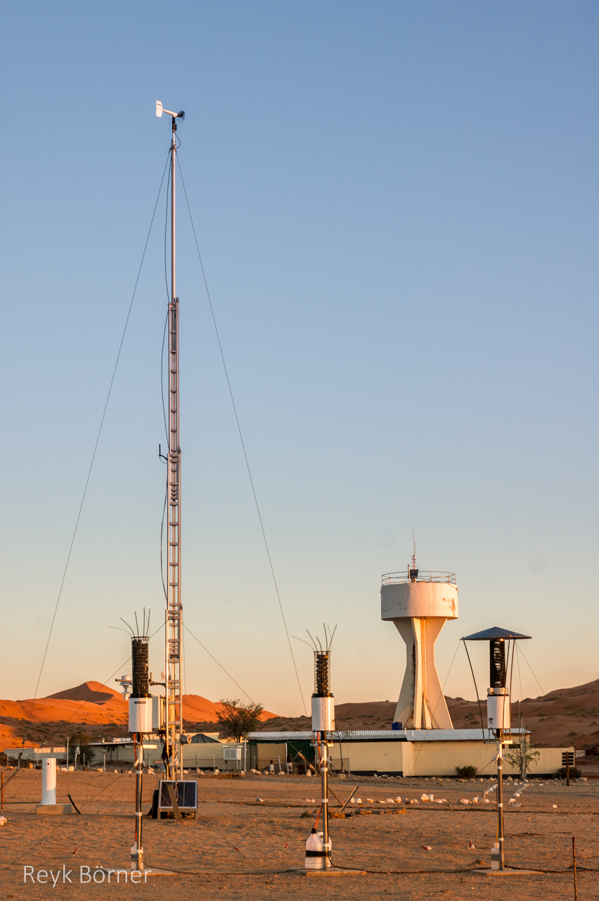
Gobabeb is a Research Centre with accommodation, conference, laboratory and teaching facilities in Namibia's Namib-Naukluft National Park, about 65km from the coast on the northern bank of the ephemeral Kuiseb River. It is located at a point where three main habitats meet (ephemeral river, gravel plain and the Namib erg) and lies within the inland edge of the fog zone. It is the designated monitoring and research centre for the Namib Sand Sea World Heritage Site.
-
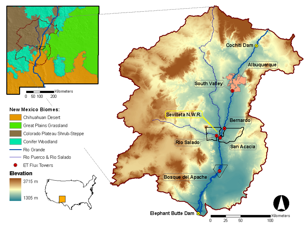
Desert grassland, shrubland, woodland, forest and riparian habitats in central New Mexico, USA
-
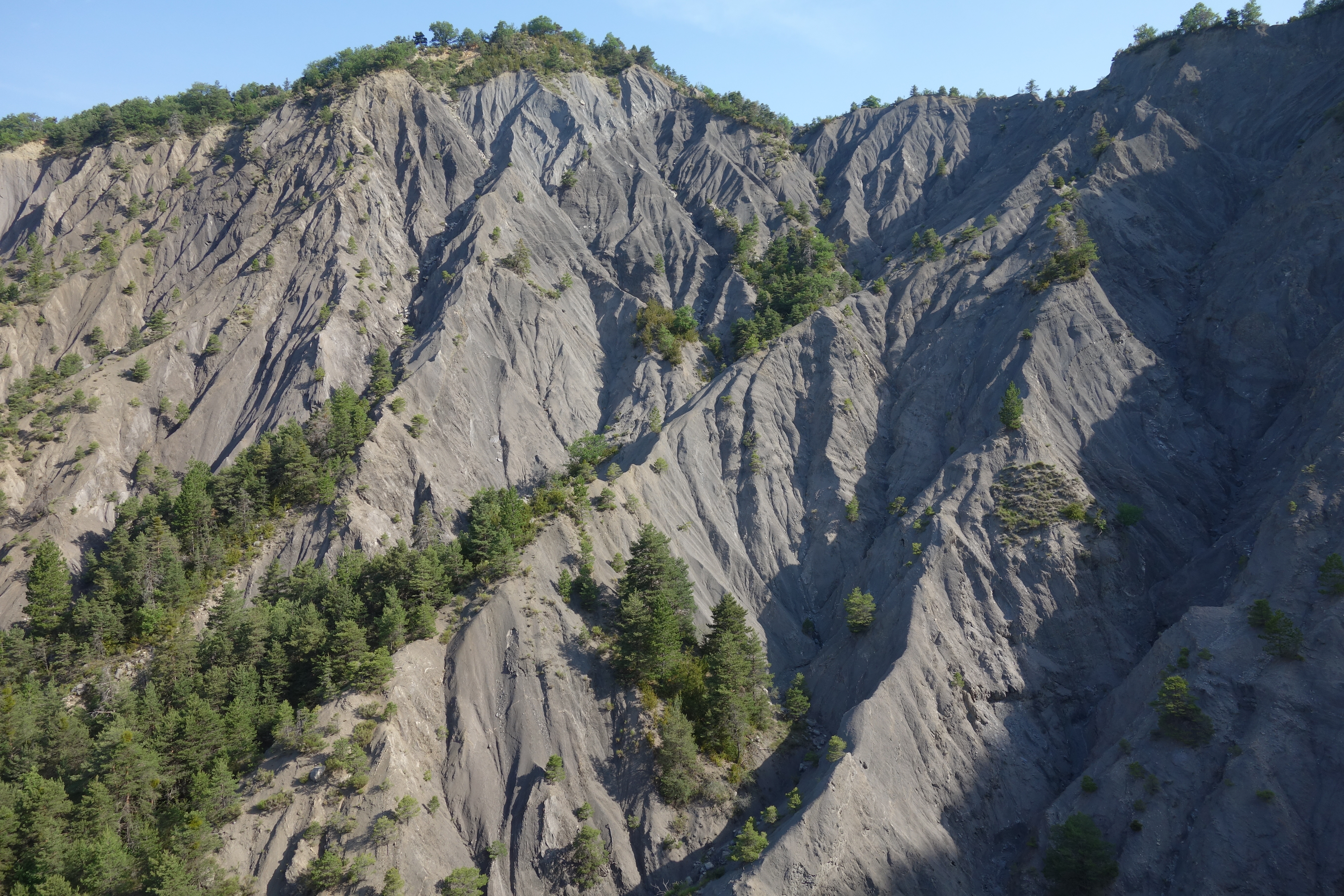
Draix site is part of Draix-Bleone observatory, located in the French South Alps, upstream of Digne, on the left side of the Bleone. Draix site was equipped in 1983 to study mountain erosion and sediment transport. It is composed of 4 catchments, which are equipped to measure water and sediment fluxes, at spatial scales ranging from 0.001 km2 to 1 km2, with contrasted land cover. These catchments are entirely situated on black marls that are very sensitive to weathering and erosion, resulting into a badland topography. One catchment was reforested at the end of the XIXth century whereas the other are mostly denuded. This site is characterized by intense erosion and intermittent sediment fluxes. The variables that are monitored on the long-term include rainfall and meteorology, high-frequency water discharge and suspended sediment concentration (1-10 minutes), event-scale bedload transport, and some physico-chemical properties of stream water and sediments.
-
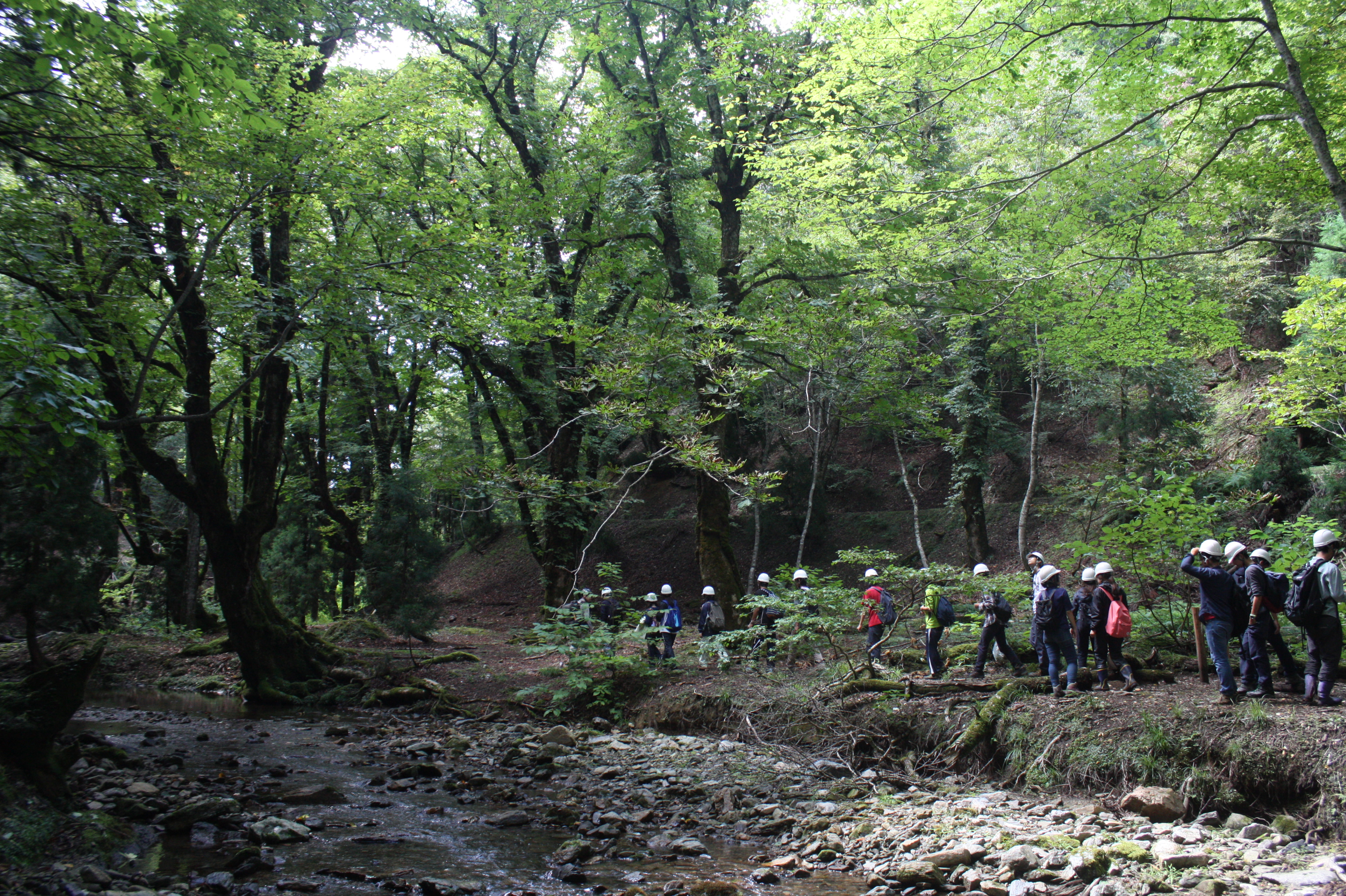
Ashiu Forest Research Station is located in the northeastern border part of Kyoto Prefecture in main island Honshu and stretches 6km east to west and 7km north to south in a rectangular shape. The area is characterized by high relief with altitudes ranging from 355 to 959 m above the sea level and encompasses the headwater zones of Yura River flowing into Wakasa bay, the Sea of Japan. This region is situated in the transition part between cool temperate forests and warm temperate forests. There is a heavy snowfall ranging from 1 to 3m in winter seasons. More than half of Ashiu Forest Research Station is covered with old-growth forests. In cool temperate forests above 600m altitude, the main species are beech (Fagus crenata), Japanese ceder (Cryptomeria japonica), deciduous oak (Quercus crispula). In warm temperate forests under 600m altitude, evergreen and deciduous oaks (Quercus salicina and Quercus sessilifolia) can be seen. There are two noteworthy characteristics in Ashiu Forest Research Station. Firstly, its high biodiversity. Since the establishment of the Research Station in 1921, new plant or vertebrate species/ varieties have been found. 801 woody, herbaceous and fern species have been recorded (Yasuda and Nagamasu 1995). Nationally protected species such as Japanese serow (Capricornis crispus) and Giant Saramander (Andrias japonicas) can be seen. Secondly, Ashiu Forest Research Station has been used not only for research and education but also for ecotourism by local stakeholders for more than 20 years, which has great opportunities for inter- and transdisciplinary studies.
-
KISKUN LTER was established in 1995, together with the Hungarian LTER Network. Its study area is the Kiskunság Sand Ridge and its periphery, 14000 km2 altogether, 17% of the area of Hungary. The primarily sandy area is extremely heterogeneous. It consists of arable lands, planted forests, meadows, abandoned fields, settlements, alkaline lakes, wetlands, and species rich remnants of forest steppe. It is also very varying in time: ploughing and setting aside, extensive plantation of alien trees, drainage, wild fires, biological invasions, and fast demographic movements have been happening in the last 100 years, and beyond all those, the area is particularly sensitive to the climate change.