
nutrient availability
Type of resources
Available actions
Topics
Keywords
Contact for the resource
Provided by
Years
Formats
Representation types
-
Huanjiang Observation and Research Station for Karst Ecosystems, Chinese Academy of Sciences - China
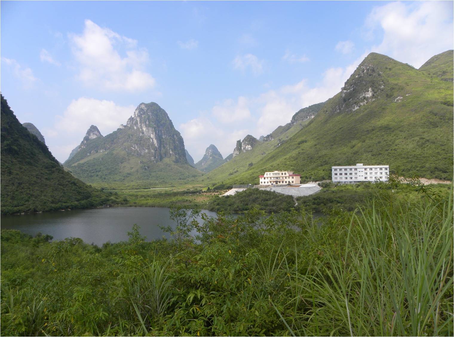
Hunagjiang station, established in 1999, is one of the field stations of the Chinese Ecosystem Research Network (CERN) and a member of Global Terrestrial Observation System (GTOS). The station aims at developing the monitoring approaches for the mechanism (succession, degeneration and responses) of Karst ecosystems, the evaluation of ecosystem service functions and health, the development techniques of sustainable and optimized for Karst ecosystems, and is also a demonstration base for technologies of Rocky Desertification Treatment in Guangxi Zhuang Autonomous Region. In 2005, the station became one of the stations of the China National Ecosystem Observation and Research Network(CNERN). Hunagjiang Station is located in Hunagjiang county of Guangxi Zhuang Autonomous Region(24°44' N, 108°19'E and elevation at 272.0~647.2 m), represents the Karst peak-cluster depression area in the southwest China. By the prominent contradiction between human and nature resources, human unreasonable land use caused serious soil and water loss, so bare rock desertification has become the main problem that threatens the sustainability of Karst ecosystems in this area. The researches conducted at the station focus on the long-term investigations of Karst ecosystem, ecological reconstruction of degradating peak-cluster depression ecosystem, exploring karst ecosystem succession process, and providing the demonstration(technology source, research platform) for the ecological reconstruction model.. The station has 146.1 ha land for field research and provides accommodation for scientists and students to stay. There are laboratories, field research infrastructure and equipments to be used for different experiments.
-
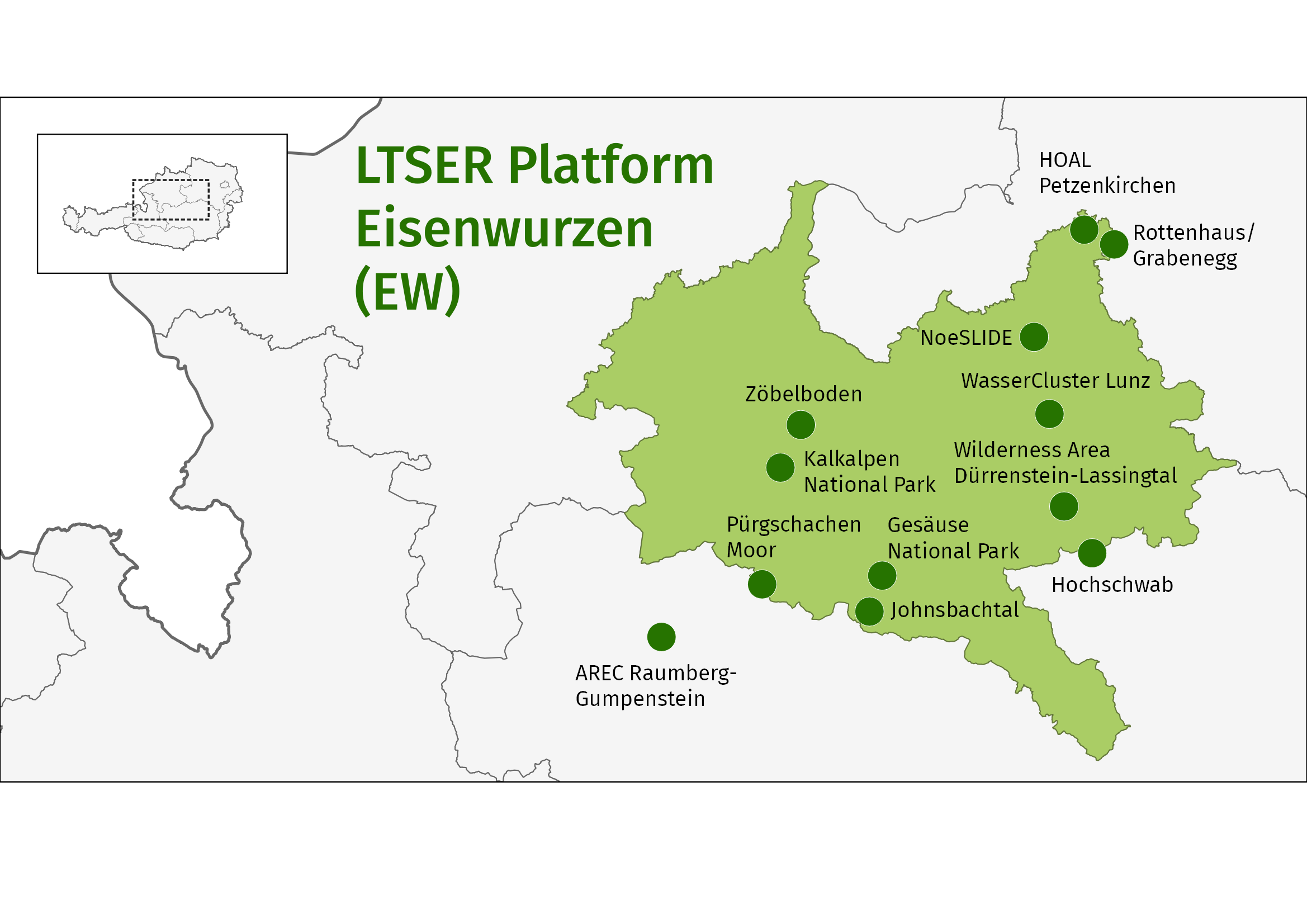
The LTSER platform Eisenwurzen represents both a natural space and a historically developed social and economic area. It does not correspond exactly to federal county borders but extends over 91 municipalities and a total area of 5,904 km2 in the counties of Upper Austria, Lower Austria and Styria. 80 % of the LTSER platform are part of the Northern Alps, 11 % of the area belong to the Northern Alpine Foothills and 9 % belong to the Central Alps. Altitudes range from 167 to 2,515 m a.s.l. The climate type is Continental. Depending on local conditions, annual precipitation values between 730 mm and 2,202 mm are measured. The annual mean temperatures range from -0.8 °C to 9.14 °C. The LTSER Platform Eisenwurzen was established in 2004. A network of already existing institutions (national parks, research centers in the region, etc.) and high-quality documentation (data material) provide good prerequisites for the first Austrian LTSER platform. Research institutions and regional institutions, decision-making bodies and regional management participate actively in the research platform. On one hand, scientists work on sociological and natural science themes in cross-disciplinary teams and in close cooperation with regional populations and their representatives. On the other hand, regional research questions are formulated and – as far as possible - integrated into research agendas. The project results build the basis for sustainable ecosystem management and preservation as well as sustainable regional development. The research projects cover questions of: basic ecosystem research: e.g. at the site Zöbelboden, where long-term monitoring has been carried out into the forest ecosystem on calcareous bedrock.; applied biodiversity and conservation research: e.g. investigation into the impacts of increased forestation upon biodiversity brought about by the retreat of human activity; socio-ecological research: e.g. the Reichraming project, in which a participatively-developed integrated model shows what impacts both internal and external factors have upon material flows, community structure and agriculture;
-
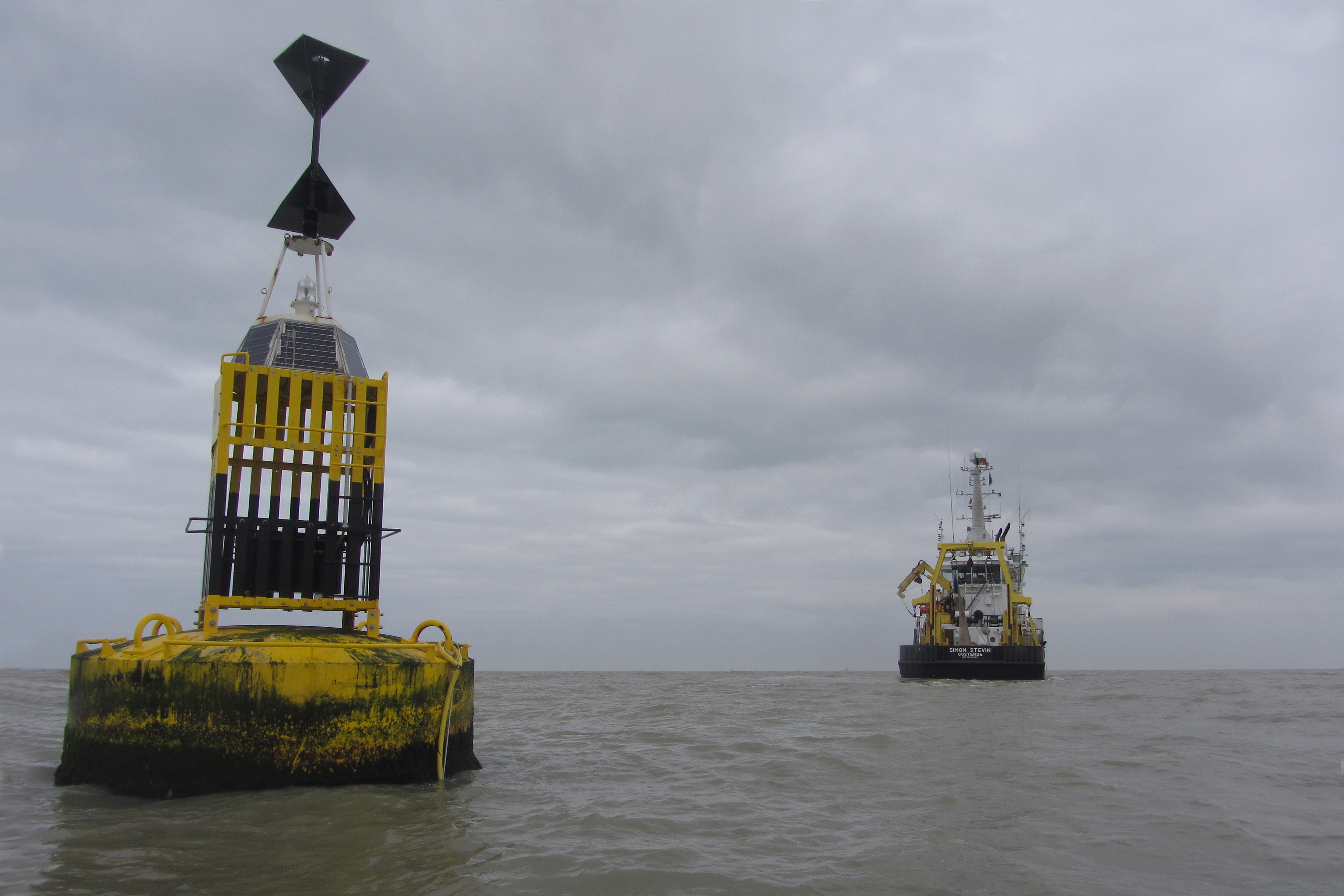
To support the marine biodiversity and ecosystem dynamics research community in Belgium, the Flanders Marine Institute (VLIZ) has set up a local marine biodiversity observatory.
-
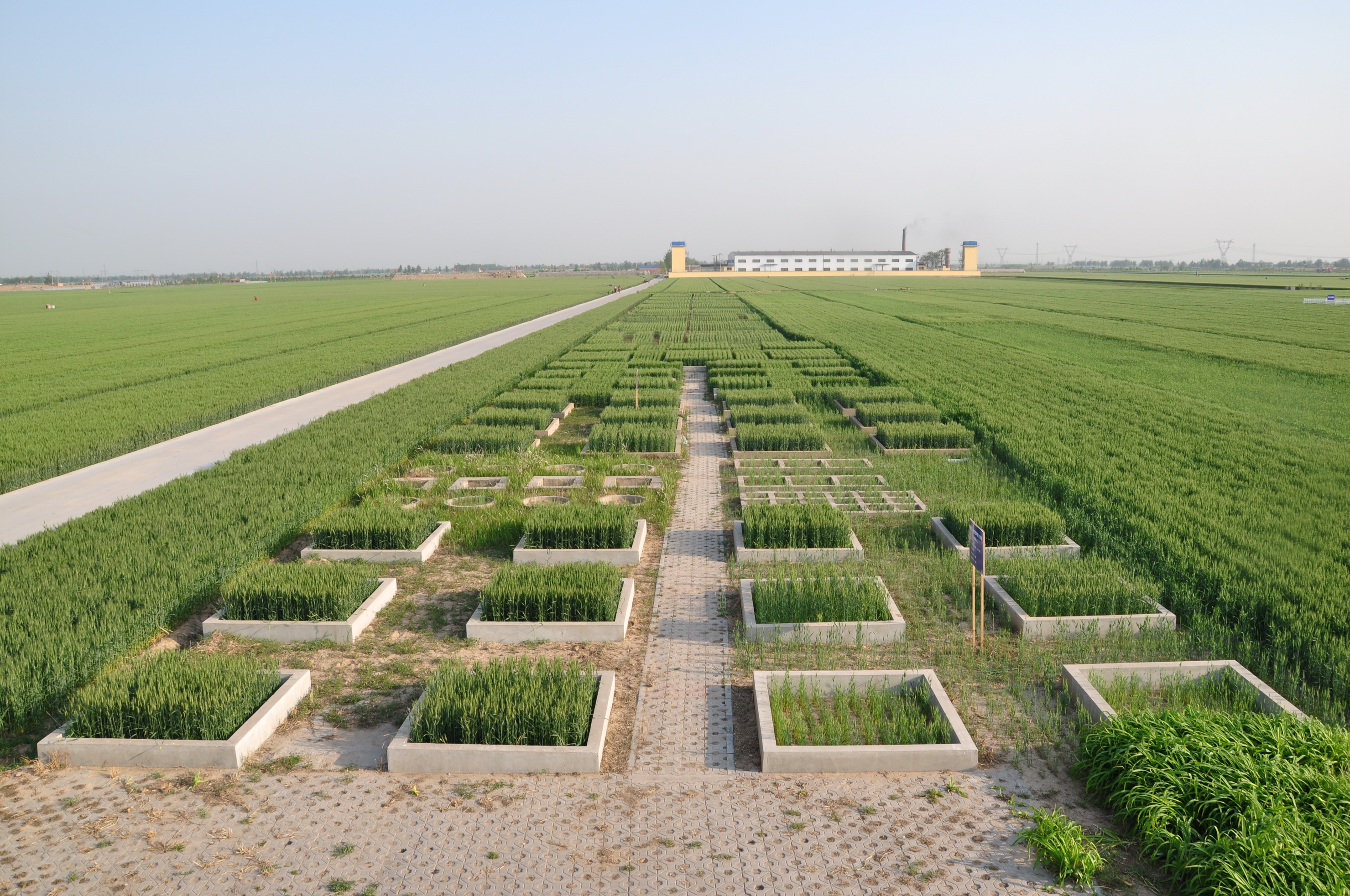
Luancheng station, established in 1981, is one of the field stations of the Chinese Ecosystem Research Network (CERN) and a member of Global Terrestrial Observation System (GTOS). The station is also a demonstration base for modern agricultural technologies in Hebei province. In 2005, the station became one of the stations of the China National Ecosystem Observation and Research Network(CNERN). Luancheng Station is located in Luancheng county of Hebei province (37°53' N, 114°41'E and elevation at 50.1 m), represents the typical high production area in the northern part of the North China Plain. The rapid declining groundwater table has become the main problem that threatens the sustainable agricultural development in this area. The researches conducted at the station focus on the long-term investigations of farmland ecosystem, water and nutrients transfer and regulation mechanisms, modern water-saving technologies, molecular breeding, precision agriculture and regional sustainable agro-ecosystem demonstration models etc.. The station has 28 ha land for field research and provides accommodation for scientists and students to stay. There are laboratories, field research infrastructure and equipments to be used for different experiments.
-
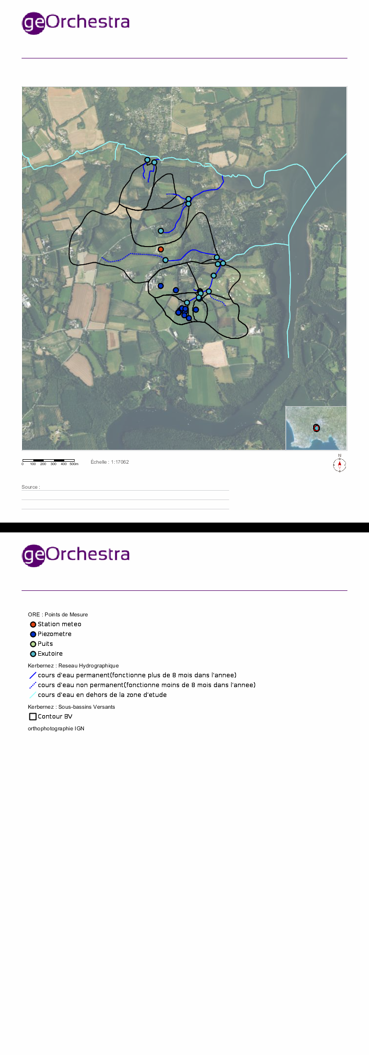
Located in South West of Brittany, western France, the elementary catchments of Kerbernez are underlain by old bedrock and is characterised by a oceanic, humid and temperate climate and by an intensive agriculture. In every catchment, the hydrology is controlled by a shallow aquifer made of the unconsolidated weathered bedrock. The water table in the aquifer is close to the soil surface in bottom land areas of catchment. During storm event, surface runoff occurs mainly over the saturated soils of bottom lands. The Environmental Research Observatory (ERO) AgrHyS focuses on the response times of changing Agro-Hydro-Systems (defined as a catchment influenced by agricultural activity) for hydro-chemical fluxes.
-
The LTSER Zone Atelier Seine belongs to LTER-France network and is located in Seine River Basin. The ZA Seine general aim is the study of a whole region. How its inhabitants construct the aquatic environment, as well as the quality of surface- and ground-waters may be seen as the dominant scientific question. The question is posed at various scales in space (from sub-catchments to the whole basin), and in time (from historical analysis starting in the Middle-Age to prospective studies for the next century).
-
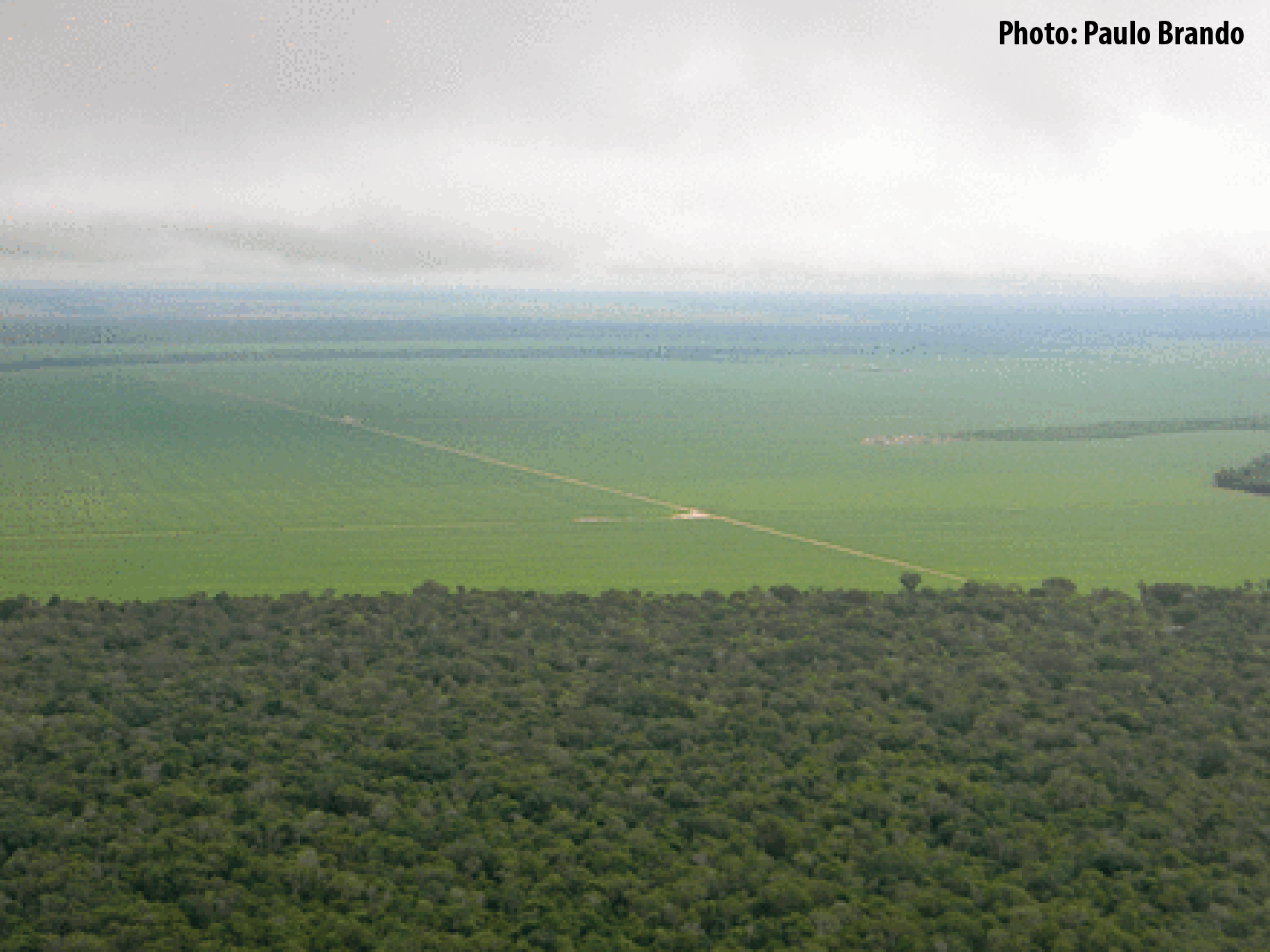
Tanguro Ranch is located in the southern Amazon, the driest portion of the Amazon Basin, and harbors a transitional forest (between Amazon forests and savannas). Tanguro lies on the Amazonian agricultural frontier, where largest rates of deforestation and fire occurred in last decades. The ranch experienced deforestation for cattle pasture in the mid-1980s, followed by a cropland expansion in the early 2000s. Starting in 2010, it has undergone a rapid shift from soybean single cropping to soybean-corn double cropping. The topography, soils, hydrology and farming practices at Tanguro are typical of the southern and eastern Amazonian agricultural frontier, a region that is highly vulnerable to changes in fire regime, climate change, and their interactions. Tanguro ranch represents changes that occur in a much wider area and that will probably occur in other regions of the Amazon Basin in a near future.
-
The island of Samothraki is located in the north-eastern Aegean Sea (Thraki, Greece). At only 178 km2 Samothraki is a high mountain massif that dominates the northern Aegean Sea and packs a lot into its small size. The island is bursting with picture perfect views of pristine cultural landscapes, an impressive geology and varied natural vegetation including ancient oriental plane forests, mountain wilderness, abundant fresh waters in the form springs and perennial streams with waterfalls which plunge into deep glassy rock pools, hot springs, small coastal wetlands, rocky beaches and a crystal clear seas. Samothraki is a perfect destination for naturalists, thrill-seeking adventurers and dedicated scientists; it seems to attract people who really care for its natural wonders. With a small local population of under 3,000 (2011 census) and a low population density (15 persons/km2), its main economic activities are agriculture, livestock breeding and small scale tourism. The island is relatively undisturbed by the modern world and remains one of the last virgin islands of Greece. It is thus self-evident that a large portion of this unique island with its rich biodiversity and deep history is part of the NATURA 2000 Network and is a UNESCO Biosphere Reserve candidate. Hydrologic and geochemical monitoring has been conducted while water and biological quality data of surface have been collected since 2000. SNO is managed by the Institute of Marine Biological Resources and Inland Waters (IMBRIW, http://imbriw.hcmr.gr/en/) of the Hellenic Centre for Marine Research (HCMR, http://www.hcmr.gr/en/).
-
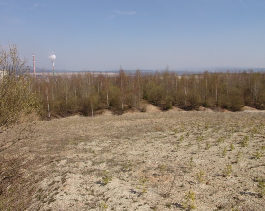
Sokolov post-mining ecosystems represent a unique LTER study area comprising forest and non-forest ecosystems developing after reclamation or by spontaneous revegetation on heaped overburden from brown coal mining. Several 1 ha sites are studied since 1992 (10 sites intensively and over 50 sites occasionally). Research has been focused on interactions between soil, plants and soil organisms and their role in soil formation and biogeochemical cycles restoration. Great attention has been paid to comparison of long-term development of reclaimed and non-reclaimed sites and to the effect of different tree species, types of substrates and heaping technique used during reclamation. Series of sites of known age (15–70 years) developing on similar substrate represent a great opportunity for ecological research using a chronosequence approach.
-
Measurements of lake chemistry are part of lake monitoring, which is usually carried out by monthly sampling at many regular lake sites (5 to 17 sites depending on the intensity of the measurements over the years). The integrated sample represents the whole water column of this polymictic shallow lake with a mean lake depth of 1.2m. The measurement satisfy the analytical standards of Ö-Norm in Austria.