
pH value of water
Type of resources
Available actions
Topics
Keywords
Contact for the resource
Provided by
Years
Formats
Representation types
-
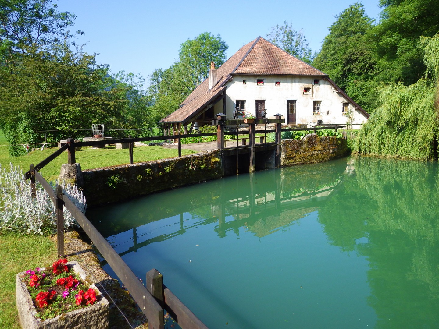
The Jurassic Karst scheme in place since 2009 aims to characterise the long-term evolution of the karst aquifer system of the Jura mountains. The specific topographical context of the Jura mountains allows the study of these aquifers at increasing altitudes along a climatic gradient. The plant cover and soil types vary along this gradient, thereby modulating the biogeochemical functioning of the infiltration zone of the karst hydrosystems. Four karst springs are monitored at sites of increasing altitude: Fourbanne site (Doubs valley, near Baume-les-Dames): altitude 330 m, catchment surface 30 km2; Lods site (upper Loue valley): altitude 380 m, approx. catchment surface 35 km2; Fertans (Amancy plateau): altitude 530 m, approx. catchment surface 1 km2; Mouthe (source of Doubs river): altitude 950 m, approx. catchment surface 50 km2. A number of physico-chemical parameters are monitored continuously on all sites, and supplemented weekly by automatic sampling at Fourbanne, Lods and Fertans. Contact : Marc Steinmann; Chrono-Environment Laboratory – University of Franche-Comté
-
The study of the physical–chemical parameters in the Mar Piccolo of Taranto, begun since the first years of the last century. In these selected studies physical–chemical characterization of marine water and sediments were carried out in the first and second inlet of the basin. In marine water, temperature, salinity, dissolved oxygen, ammonia, nitrites, nitrates, and orthophosphates were determined. In sediments physical–chemical parameters included: water content, organic matter, total nitrogen and total phosphorous, pH, red-ox potential and grain size classification. Moreover, different micropollutants were also evaluated: heavy metals (Hg, Cd, Pb, Cr, Cu, Ni, Zn, Al V and Fe) and Arsenic, polycyclic aromatic hydrocarbons (PAHs), polychlorobiphenyls (PCBs), organochlorinated pesticides and organotin compounds. These studies demonstrate the important role of water monitoring studies in the semi-enclosed basin of the Mar Piccolo with lagoon features, characterized also by mussel farming activities. Moreover, in addition to the trophic conditions of the area, data obtained from sediments characterization allow us to evaluate the possible contaminants transfer along the food chain, in order to protect human health by consumption of seafood products
-
UK Upland Waters Monitoring Network (UK UWMN) site. Loch Coire Fionnaraich has a catchment of 550 ha, with a range of elevation from 236 m at the outflow to 933 m at the summit of Maol Chean-dearg. Whilst a band of Cambrian basal quartzite and "Pipe Rock" crosses beneath the northern side of the loch, the catchment geology is mostly made up of Torridonian sandstones from the Applecross and Aultbea groups. Catchment soils consist of peats and peaty podsols alongside extensive areas of exposed rock. Vegetation is dominated by Molinia and Calluna and the catchment is treeless. The surrounding moorland is managed for red deer and low numbers of feral goats are also present. A popular hiking path passes along the western shore of the loch. There are a number of very small lochans and pools on the catchment's northern boundary and one more in the north-west.
-
UK Upland Waters Monitoring Network (UK UWMN) site. Loch Chon is a relatively large (surface area 105.7 ha) lake lying at an altitude of 92 m in the Trossachs region of central Scotland. The loch is fed by several small streams and drains to the south via Loch Ard and the River Forth. The loch has two main basins, with the deepest area (25 m) represented by a trench near the western shore. The bathymetry was first surveyed by Murray and Pullar in 1910. Some data managed by UK ECN Data Centre. Note: The area is the size of the catchment. The lake area is 106 ha
-
UK Upland Waters Monitoring Network (UK UWMN) site. The site lies at 298 m altitude in the Galloway region of south-west Scotland. The loch is 12.7 ha in area and receives drainage from minor streams and catchment blanket peats. The outflow drains to the south-west into the Glenhead Burn and Loch Trool. The loch bathymetry indicates a single deep basin (maximum depth 13.5 m) offset to the south with slopes rising gently away from the southern shore. An island is located just off the western shore some 250 m from the outflow. Some data are managed by UK ECN Data Centre. Note: The area is the size of the catchment.
-
UK Upland Waters Monitoring Network (UK UWMN) site. Blue Lough is a small (1.9 ha) circular lake lying at 340 m altitude. The lough has no discrete inflow and drains through a Sphagnum bog to a tributary of the Annalong River. The bathymetry reveals a shallow concentric basin offset to the east, with a maximum depth of 5 m. Blue Lough is situated in a col between the Silent Valley and Annalong Valley in the Mourne Mountains of south-eastern Northern Ireland, very close to Bencrom River. The catchment is small (48 ha), but is steep and rugged, reaching a maximum altitude of 703 m. The solid geology of the catchment consists of granite which is exposed as bare rock and scree on the steep backwall and is covered with thin and often eroded blanket peat, peaty podsols and peaty gleys in the less steep areas. Bare rock, scree and eroded peat characterise the catchment, but elsewhere the vegetation is dominated by Calluna which in places is mature and in others has been intensively burnt. Land-use and management is restricted to low-intensity sheep grazing and occasional heather burning. Annual rainfall is c. 1600 mm. Some data are managed by UK ECN Data Centre. Note: The area is the size of the catchment.
-
UK Upland Waters Monitoring Network (UK UWMN) site. Loch Grannoch is a large (surface area 111.4 ha), elongated lake which lies at 214 m altitude. Small streams feed the loch along its eastern and western shores, the principal of which is the Cuttimore Burn. It drains to the north into the River Dee via the Pullaugh Burn. The loch bathymetry was first surveyed by Murray and Pullar in 1910 and was updated by a subsequent survey by the Palaeoecology Research Unit of University College London. The major basin is offset to the south of the loch and reaches a maximum depth of 20.5 m. Some data are managed by UK ECN Data Centre. Note: The area is the size of the catchment.
-
UK Upland Waters Monitoring Network (UK UWMN) site. Llyn Cwm Mynach lies at 287 m altitude. The lake consists of two distinct basins; the southern section comprises a shallow limb separated from the deeper northern section by an old and broken stone causeway. The maximum depth of 11 m occurs in the northern basin in a localised hollow. Discrete drainage to the lake is by three small inflows and it is drained to the south-east by a small stream which flows to the Mawddach estuary. At some stage in the past a wooden weir (now derelict) was constructed at the outflow, presumably to raise the level of the southern section of the lake. Some data are managed by UK ECN Data Centre. Note: The area is the size of the catchment.
-
UK Upland Waters Monitoring Network (UK UWMN) site. Burnmoor Tarn is the largest 'tarn' in the English Lake District. It occupies 23.9 ha and lies at an altitude of 253 m in a moraine hollow on the uplands between Wastwater and Eskdale. The lake has two distinct basins close to the south-eastern shore and a maximum depth of 13 m. There are four main inflow streams to the north and north-west. The outflow at the eastern end joins the Hardrigg Beck which drains the slopes of Scafell and, in times of especially high flow, is partly diverted into the lake across a braided delta. Some data are managed by UK ECN Data Centre. Note: The area is the size of the catchment.
-
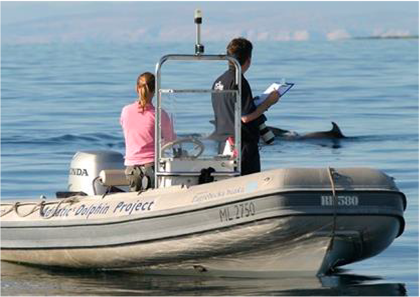
Large marine site located in the Kvarnerić area, around the sheltered coast and waters of the eastern part of the Lošinj and Cres archipelago. It is one of the most important feeding and breeding areas for bottlenose dolphins (Tursiops truncatus) in the Eastern Adriatic. Lithostratigraphic units represented on the coast are dolomites and post sedimentary diagenetic breccia (upper albian, lower cenomanian - K16, K12), rudist limestones (cenomanianmaastricht - K21-6). Soils on the coast are rockyground, anthropogenic soil on karst. The area was created after the transgression of the sea after the last glaciation; marine shelf; highly indented coastline. In July 2006 of preventive protection of a part of the Kvarnerić region for 3 years as a Special Marine Reserve (Cres-Lošinj Special Marine Reserve – CLSMR has been declared.