
patch density
Type of resources
Available actions
Topics
Keywords
Contact for the resource
Provided by
Years
Formats
Representation types
-
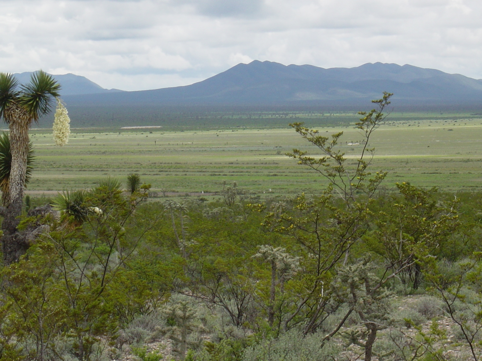
Los esfuerzos de investigación se enfocan a la región del altiplano mexicano conocida como “El Tokio”, donde se distribuyen los pastizales gipsófilos y salinos en el noreste de México y la cual es reconocida como una región prioritaria para la conservación de especies de aves residentes endémicas y migratorias. El área se caracteriza por valles intermontanos en los cuales se presentan suelos con altos contenidos de yeso y carbonatos de calcio, así como pastizales de porte bajo que no rebasan los 15 cm de altura en promedio. En estos valles habita el perrito llanero mexicano (Cynomys mexicanus), especie clave en el ecosistema. La vegetación circundante a estos valles está caracterizada por matorrales de gobernadora (creosote bush) con elementos sobresalientes de Yucca. El área es fuertemente impactada por actividades agrícolas y ganaderas, las cuales se llevan a cabo desordenadamente y sin medidas de mitigación.
-
The area is located in north-east of Slovakia on the border with Poland and the Ukraine, in Bukovské vrchy mountains which are part of the Carpathian mountain range. It has a highland to upland character. The study area is in Snina district within the Prešov region and is part of the National Park of Poloniny and East Carpathians Biosphere Reserve. It belongs to ŕemore wilderness areas in Slovakia, remote from industrial centres and with restricted accessibility. In the year of 1980-1986, 7 villages were removed as a result of construction of the water reservoir Starina. There are currently 10 villages within the study area.
-
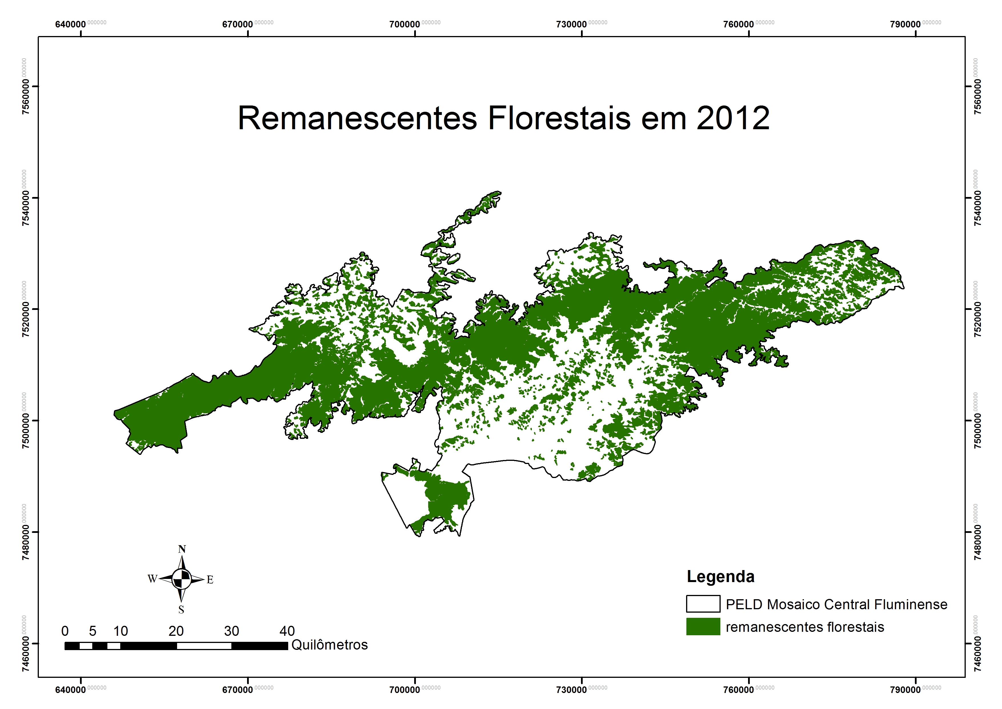
Covers an elevational gradient from 0 to 2,200 m in the Serra dos Órgãos mountain range, with high elevation grasslands (campos de altitude), cloud and lowland rainforests in the Atlantic Forest biome. In the lowlands it includes fragmented landscapes due to deforestation occurred in the last 500 years, with a variety of land uses in the matrix were fragments are inserted. Long term studies and monitoring actions focus on the effects two main factors: effects of climate change and land use. Presents high species richness, embracing a National Park (Parque Nacional da Serra dos Órgãos), a state park (Parque Estadual dos Três Picos), a private reserve (Reserva Ecológica Guapiaçu), and other federal and state protected areas.
-
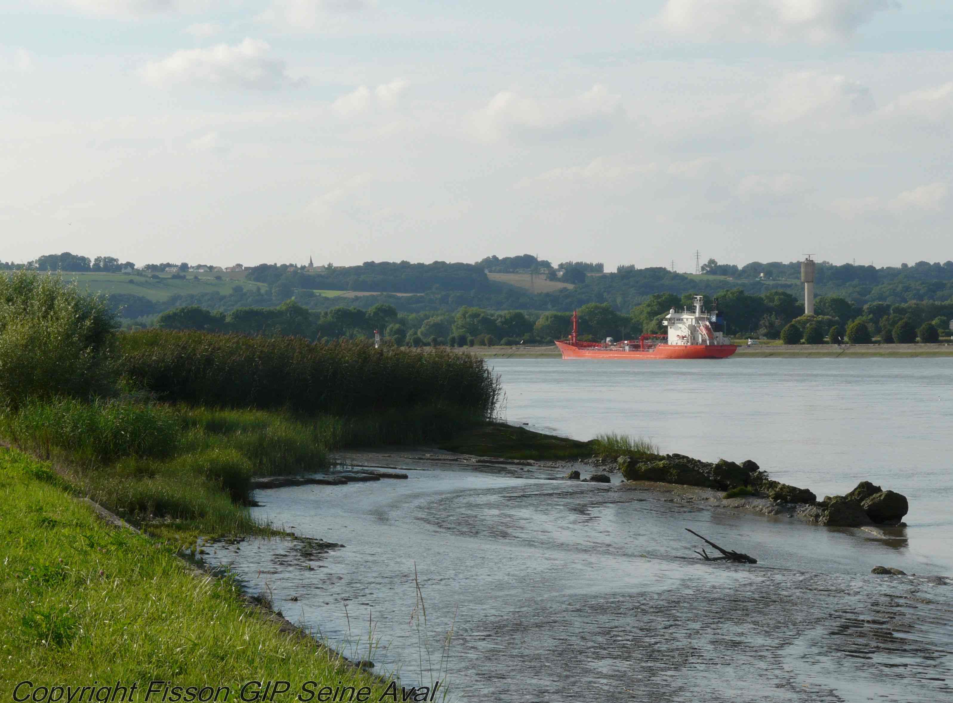
The LTSER Zone Atelier Seine belongs to LTER-France network and is located in Seine River Basin. The ZA Seine general aim is the study of a whole region. How its inhabitants construct the aquatic environment, as well as the quality of surface- and ground-waters may be seen as the dominant scientific question. The question is posed at various scales in space (from sub-catchments to the whole basin), and in time (from historical analysis starting in the Middle-Age to prospective studies for the next century).
-
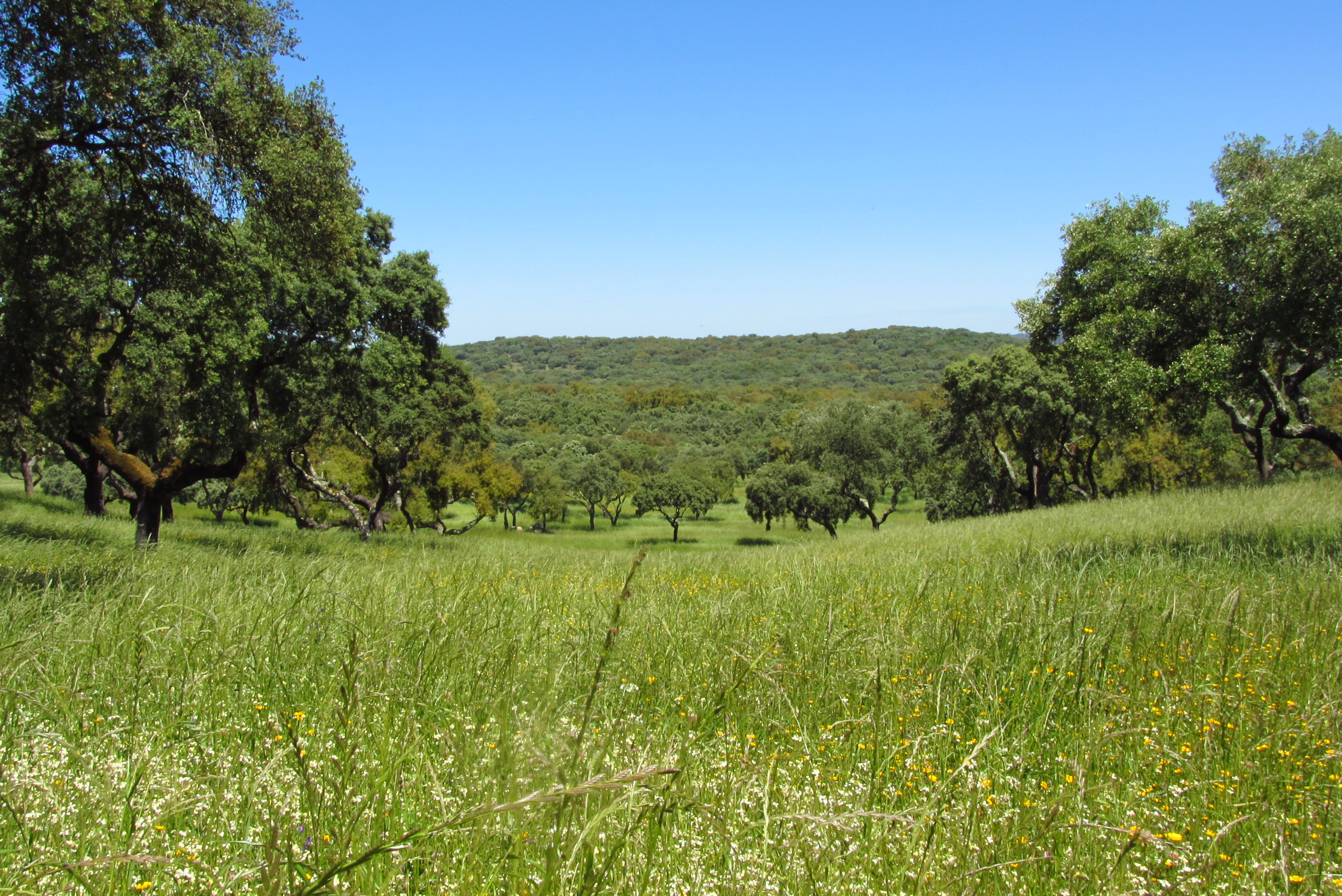
Montados (or dehesas in Spanish) are traditional agro-forestry systems with a savanna type structure, characteristic of the Mediterranean Basin. In Portugal, Montados are mainly distributed in the southern half of the country where the climate is Mediterranean. Annual average precipitation is 600 mm and mean annual temperature is 15ºC, although there is a large variation within the area of distribution of this system. Cork oaks (Quercus suber) and holm oaks (Q. rotundifolia) are the dominant trees, forming pure or mixed stands, with holm oak being dominant in drier regions. Montados with natural or semi-natural pasture and extensive grazing are listed under the EU Habitats Directive (habitat 6310), and are key habitats of Special Areas of Conservation (Habitats Directive) and of Special Protection Areas (Birds Directive), which are part of the Natura 2000 network. Their multifunctional management promotes structural diversity at the stand and landscape level, which combined to a large distribution area and spatial continuity results in high-levels of biodiversity. They are also High Natural Value farmlands that simultaneously fulfill the three criteria considered for their delimitation by the European Commission, since they are dominantly related to a high proportion of semi-natural vegetation, to a mosaic of low intensity agriculture and natural and structural elements and to the presence of rare species (e.g. Lynx pardinus and Aquila pennata). Cork is the most important forest product from Montado systems, with Portugal producing 54% of the world cork. In addition to cork (harvested every 9-12 years), animal production in pastures also provide a source of income. The regulation of water and nutrient cycles and of soil erosion, as well as carbon sequestration are important regulating services to be managed in Montados. From a cultural and recreational perspective, Montados are valued for the landscape aesthetics, natural values and cultural heritage. Strategic actions have been put in place to conciliate human use and biodiversity conservation, such as the publication of national regulations that legally protect the cork and holm oaks. But the most significant one might be forest certification, which has been promoting practices of responsible forest management in more than 70,000 ha of Montado, around 30% of the total certified Portuguese forest area.
-
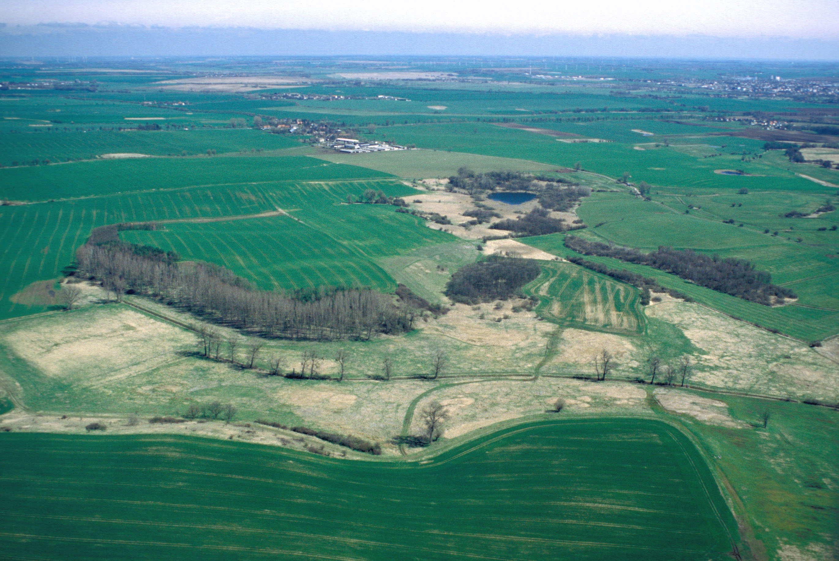
The site covers the whole catchment of the small river “Quillow” and it is called “AgroScapeLab Quillow”. It is located in the north-east lowlands (Uckermark) which is about 90 km North of Berlin and has an area of about 160 km2. It’s a hummocky landscape characterized by gently rolling hills which are the results of glaciation during the Pleistocene. Unconsolidated sediments in a complex setting dominate. The soil pattern of the Quillow catchment is related to topography and the heterogeneity of Pleistocenic deposits. Albic Luvisols, Calcaric Regosols, Calcic Luvisols and Gleyic-Colluvic Regosols can be found. Another result of the ice age forces are the kettle holes (little ponds) which developed in drainless depressions. 74 % of the land is in agricultural use. Small forest patches can be found in the western and southwestern part of the catchment, grassland more in the eastern lowlands. In general the area is only sparsely populated. The ZALF research platform is located in Dedelow
-
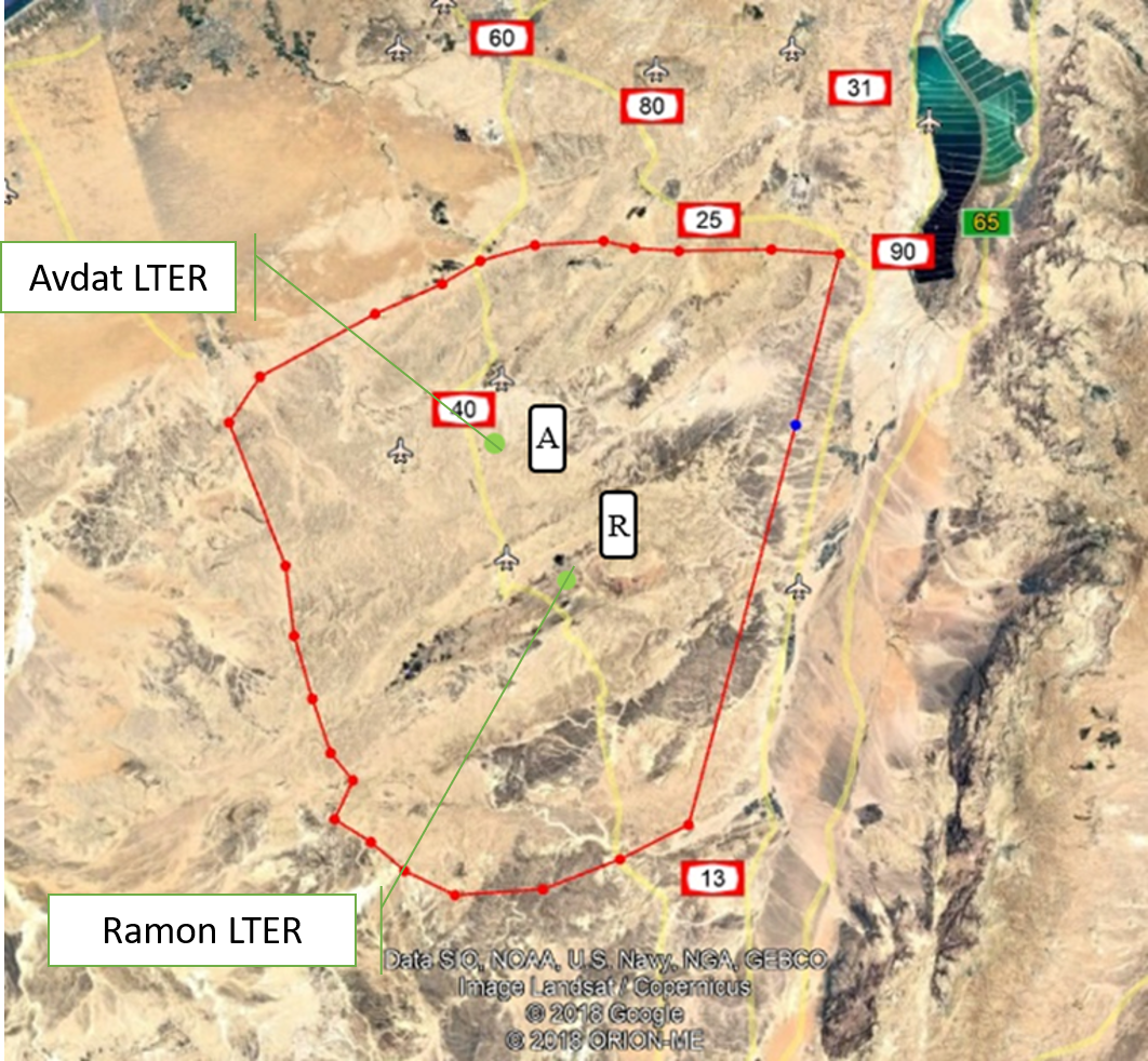
The Negev Highlands (NH) LTSER platform is situated between the Sinai Peninsula to the west and the Arava – Dead Sea depression to the east. This is a rocky terrain, covering an area of 17,000 sq. km with series of ridges at an altitude of 400-1000 m above sea level. As part of the Saharo-Arabian desert belt, the climate across the NH is arid to hyper-arid region: January’s mean daily temperature is 10 °C and July’s mean daily temperature is 25 °C The potential evaporation is approximately 2200 mm/y, and mean annual precipitation is 70–130 mm, with large inter annual variations. The rainy season occurs during the winter months, from November to March. The area is rich with unique natural landscapes. One of the most prominent of these are the Makhteshim, which is the largest erosion craters in the world. In addition to its unique landscapes, it is also a habitat for various species of flora and fauna that are adapted to arid zones and highlands, some of which are endemic to the area. The Negev Highland LTSER platform includes two LTER sites: Avdat Site in the arid zone and Makhtesh Ramon site in the hyper arid zone. Archaeological remains indicate that humans lived in the area for at least 1.4 million years. Today, about 10,000 residents live here, in towns, agricultural communities, small Bedouin tribal villages and tourist-agricultural farms. Most of it is concentrated along the main route (Route No. 40), while much of the area beyond the roads is either designated nature reserves or firing zones. The two main livelihoods in NH today are agriculture - mainly vines and olives, and tourism; Both are greatly affected by climate change. Agriculture relies on desalinated seawater imported into the area. However, it is affected by the climate in several ways: 1) flash floods cause increased soil erosion. 2) Long periods of drought during the winter, cause increased evaporation and therefore large water consumption. This is when the price of water is the main expense of the farmers, and increasing it may make agriculture unprofitable. 3) The uncertainty regarding the amount of precipitation and their timing, characterizes the arid environment. Recent climate changes are increasing this uncertainty and therefore make it very difficult for farmers to plan their land cultivation and expenses. Climatic uncertainty poses a significant challenge also for tourism operators; Jews and Bedouins, as well. This is due to the multiplicity of events of extreme climatic conditions (extreme cold or extreme heat), which repel tourists from reaching the area. And, a multitude of years when there is not enough precipitation to generate the famous spring bloom of the area. For the past 7 years, the NH LTSER's researchers have been working closely with three stakeholder groups in the area: winegrowers in the valleys, the Negev Highlands Tourism Association and Bedouin tourism operators. In Green Transformation we will actively engage with this group, through tow case studies: 1) The Desert Miracle farm - which will serve as a monitoring and dissemination knowledge farm; In a collaboration with the owner of the farm, R and D agriculture in the NH and the Center for Flood Research (DSASC). 2) Tourism in the NH; In collaboration with the NH Tourism Association. Through joint work with these NGOs, we will develop a long-term monitoring program and educational materials. The topics we will deal with: reducing soil erosion and increasing soil moisture, by using appropriate agricultural methods to multiply flash floods, which will be distributed to additional farmers in the area through activities at the monitoring farm. and to tourists through workshops of the Tourism Association. In the case of tourists, the aspect to be monitored is the number of tourists who come to the area in relation to the weather conditions. Together with the Tourist Association we will develop tourist-monitoring system. The high sensitivity of the arid region to climate change and the great exposure of the impact of these changes on animals, plants and humans, invite possible tourist-educational activities aimed at transformation in ways of thinking and behaving. An environmental education program and educational tools will be developed together with the Tourist Association. Their impact will be monitored in collaboration between the NH LTSER platforms researchers and tourism operators.
-
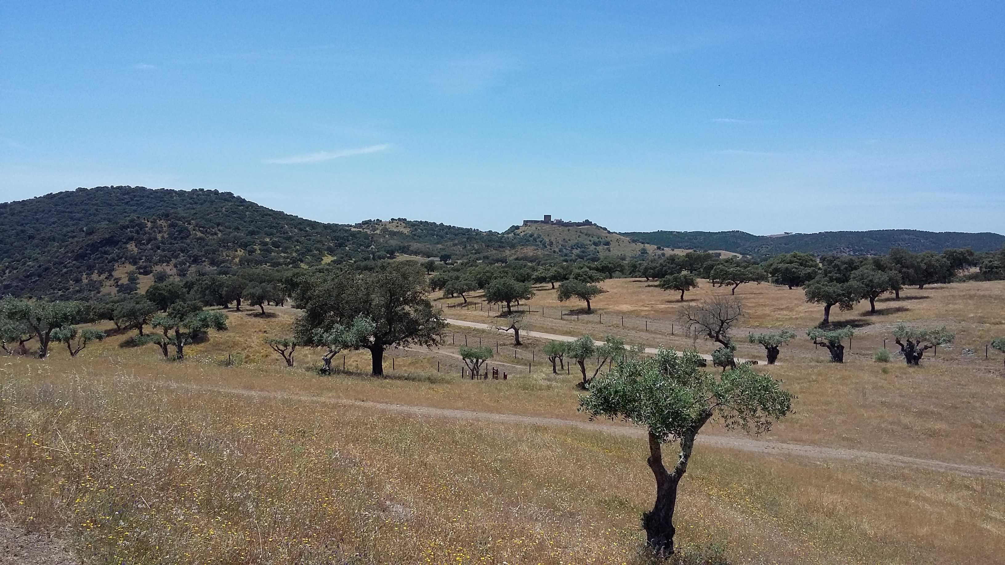
Herdade da Coitadinha is one of the six research and monitoring stations of LTER-Montado, an umbrella site located in the Alentejo province in south Portugal (southwestern Iberia). The "Montado" represents an unique agro-silvo-pastoral ecosystem (named "dehesa" in Spain) found only in the Mediterranean basin. These savannah-like landscapes are dominated by evergreen cork and/or holm oaks and were shaped over millennia of traditional land use practices. These multi-use forests are two-layered systems that combine, in a single space, forest harvesting, extensive livestock husbandry, pastures and/or cereal cultivation (the most evident economical revenues), with other traditional uses (hunting, beekeeping and mushroom picking). Recently, increasing awareness arose on their benefits as biodiversity reservoirs, recreation grounds, and other ecosystem services providers, but these non-productive functions are not equally perceived and valued by users, as they tend to be conflicting with productive ones. Herdade da Coitadinha is a state-run property, located in the bank tributary of the Guadiana River, in the Alentejo province, 200 km south-east Lisbon and 8 km from Barrancos (38º10’32’’N – 7º02’22’’W). Holm oak (Quercus ilex) is the dominant tree type. The site was bought by EDIA as a biodiversity offset to the building of the Alqueva dam, and so it is currently managed as a nature protection area (Parque Natureza de Noudar; www.parquenoudar.com). Management is made to promote biodiversity, while demonstrating the compatibility with land uses such as cattle grazing (0.5 livestock units/ha), winter fattening of black pigs, hunting (mostly wild boar), and eco-tourism. Holm oak woodlands are managed to promote natural regeneration, increase acorn production and maintaining tree health. In the foreseeable future the site will maintain its current land use, and so there are no imminent threats to the montado system. The main problem is the spread of oak tree diseases and mortality, which in the mid-term may impair the health of the ecosystem. Fire is a permanent threat, but there is thorough fire surveillance during the periods of high risk.
-
The LTSER Zone Atelier Environnementale Urbaine belongs to LTER-France network and is located in eastern France.The Zone Atelier Environnementale Urbaine ZAEU was created in 2010. It focuses on urban area and urban socioecosystem research questions. The main objective is to define how to facilite an harmonious development according to the city needs without badly impacting the natural system around. The Eurometropole of Strasbourg is a close partner of the ZAEU: local authorities participate to the research experimentations and observation campains. Six working groups are dealing with natural systems in order to better understand the urban ecosystem (biodiversity, hydrology, air and climate, urban metabolism) and the socio system (social and economic dimensions of the society and the individuals, groups behavior and values, politics strategies). In the working groups, we study issues like hydrological system processes in the urban area, population health, energy consomption and production at the city scale, pollutions and contaminations of the various spheres, refusal management with regards to the context of global changes, sustainable development and transitions (economy, ecology, energy).
-
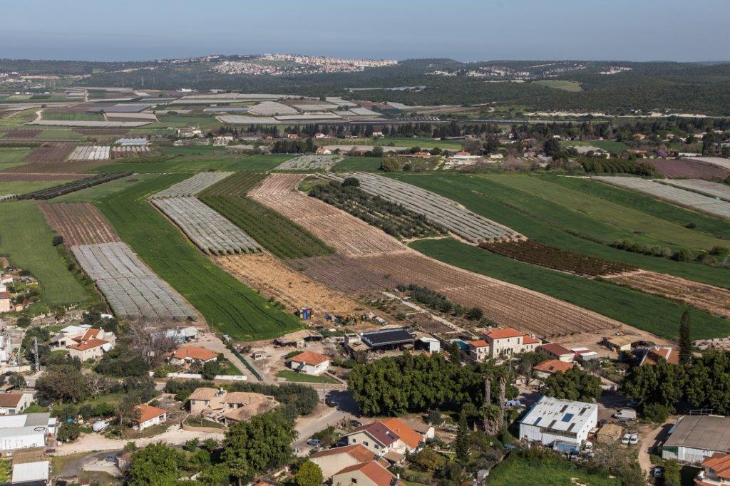
The Ramat Hanadiv LTSER platform is a unique texture of the region surrounding Hanadiv Valley and Taninim River basin. It integrates nature values with agriculture, rural communities, and heritage sites. The platform extends over an area of apprx. 15,500 hectares, including Ramat Hanadiv Nature Park and five neighboring municipal Councils: 1. Binyamina Givat-Ada (Urban; Local Council ) 2. Zikhron Ya’akov (Urban; Local Council ) 3. Hof Hacarmel (Rural; Regional Council) 4. Jisr A-Zarqa )Arab village; Local Council) 5. Alona (Rural; Regional Council) Ramat Hanadiv LTER site is located in the heart of the platform, at the southern tip of the Carmel Mountain Ridge. Ramat Hanadiv spreads over approximately 450 hectares of typical natural Mediterranean vegetation, surrounding the Memorial Gardens in which Baron Benjamin Edmond de Rothschild and his wife are buried. With mean annual rainfall of 500-600 mm and mean annual temperature of 170C-190C, Ramat Hanadiv Nature Park is characterized by diverse habitats and communities.