
percent carbon
Type of resources
Available actions
Topics
Keywords
Contact for the resource
Provided by
Years
Formats
Representation types
-
Field work - repeated measurements and multiple point measurements
-
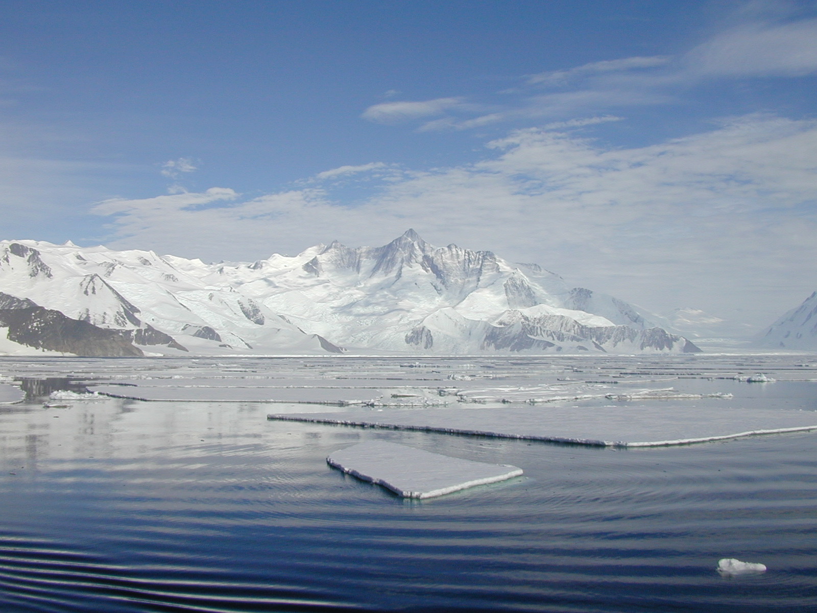
The mooring A is located in an open sea area close to Franklin Island, characterized by both clay bottom sediment and a flat morphology. The station can be considered as representative of the productivity and sedimentary conditions of the southern part of the Ross Sea, one of the areas considered to be affected by greater productivity rate.The study of mooring can be consider part of the activities conduct in the framework of the research project "ABIOCLEAR - Antarctic biogeochemical cycles - climatic and paleoclimatic reconstructions. (Resp. M. Ravaioli)". Such Project is the natural prosecution of previous research activity carried out from 1987. Objectives : Study of the particle fluxes towards the marine bottom sediment, in particular with the aim to obtain quali/quantitative estimate of the biogenica component coming from the primary production. Analysis of the vertical rain rate processes and, therefore, the marine cycle of the main biogenic particles such as Carbon and Silica. Try to obtain mass budgets of these parameters, estimating their cycle in the water column until the burial processes in sediments. From apparent accumulate rate calculated in the bottom sediment we will tried to discriminate the real vertical fluxes (Rain Rate) from the horizontal input from sediment remobilization processes. Acquisition and elaboration of long time series of data. Collection of bottom Sediment samples to estimate the variations of the productivity and the paleoproductivity in the area. Historical time series of Mooring A: Primary productivity data (every three years), fitoplancton, New and regenerated productivity, Seasonal, annual and interannual fluxes measure, monthly Particles samples, current velocity, water salinity, temperature and torbidity, Water-sediment interface measure. Biogeochemical parameters. Radiometrical Data, Mineralogical and grain size characterization. Nutrient, metals. Biostratigraphy interpretations. Lidar data are also available from 1997.
-
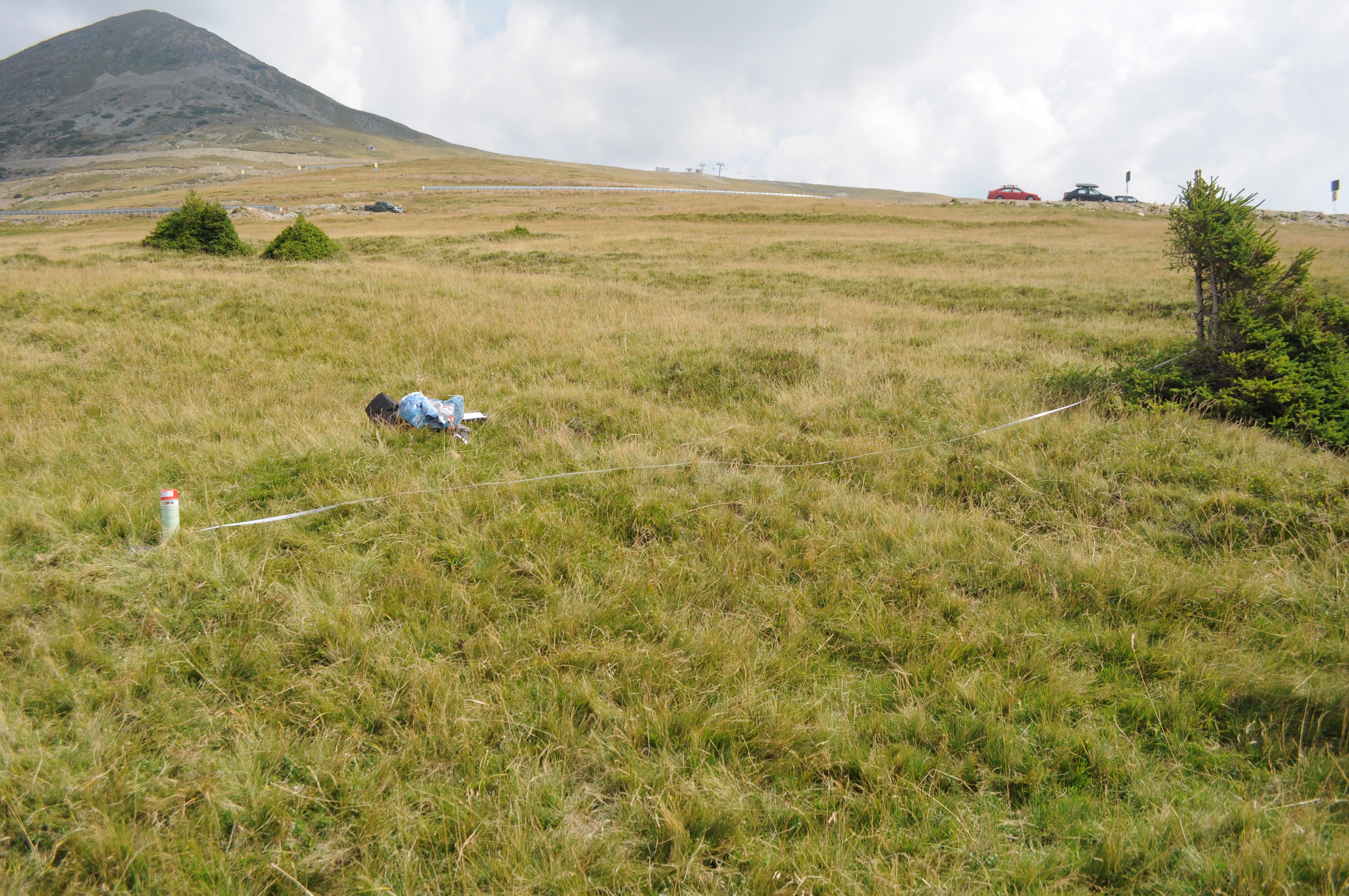
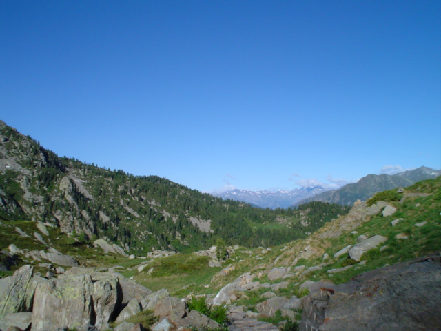
The site is located in the Southern Carpathians (Romania). The predominant ecosystems are grasslands located above tree line, dominated by Carex curvula, Juncus trifidus (alpine zone) and Festuca airoides, Nardus stricta, Festuca nigrescens (subalpine zone). The site consists of monitoring points in subalpine and alpine meadows.
-
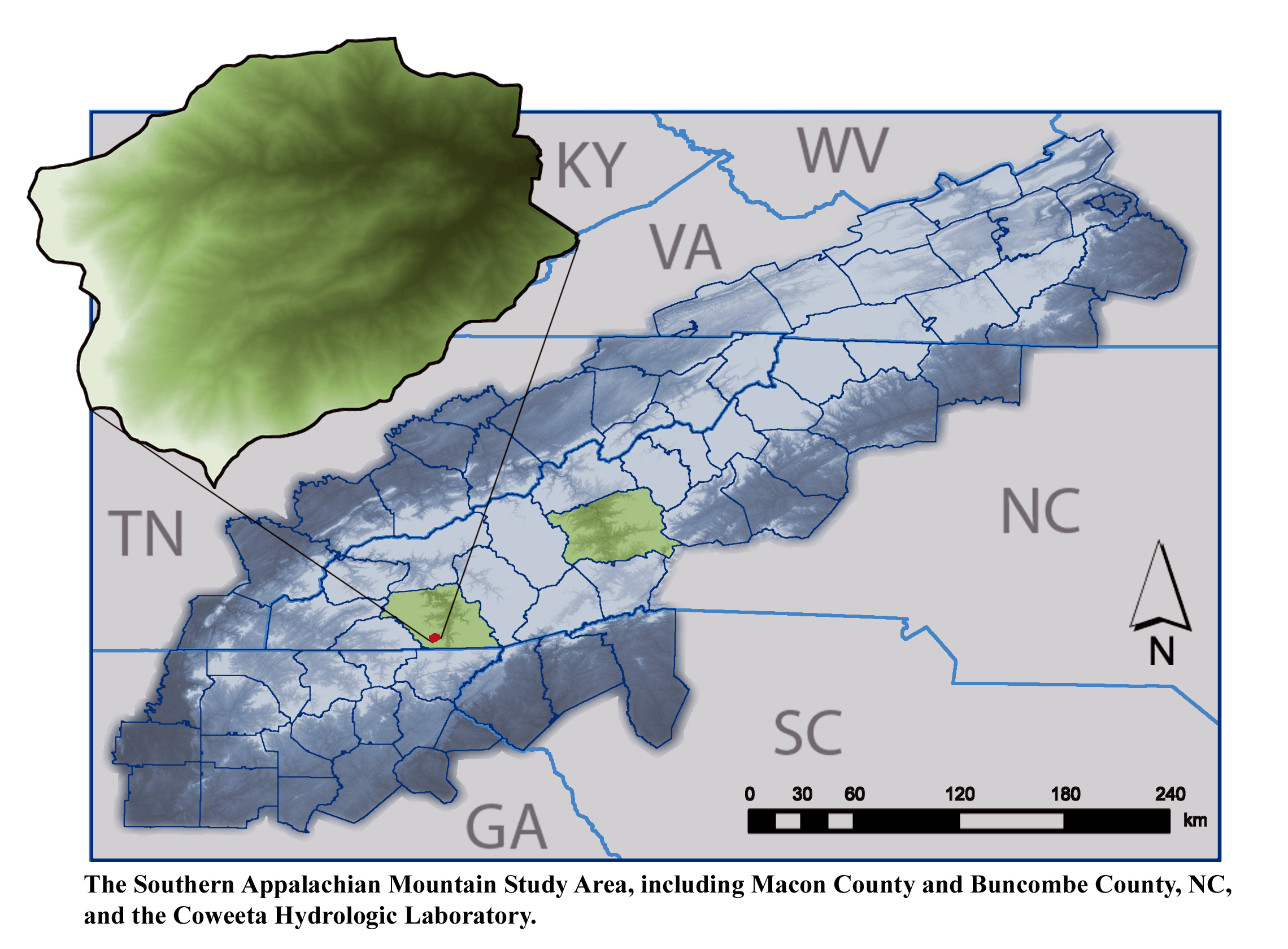
The majority of research is conducted within the US Forest Service Coweeta Hydrologic Laboratory located in the Nantahala Mountain Range of western North Carolina, USA, within the Blue Ridge Physiographic Province. The site is part of the Upper Little Tennessee River Watershed Basin.
-
Runoff and runoff chemistry at LTER Zöbelboden, Austria
-
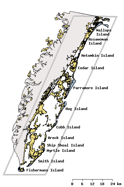
Research activities of the VCR/LTER focus on the mosaic of transitions and steady-state systems that comprise the barrier-island/lagoon/mainland landscape of the Eastern Shore of Virginia. Primary study sites are located on Hog Island, Parramore Island and mainland marshes near Nassawadox VA. The VCR/LTER uses field laboratory and housing facilities at the Anheuser-Busch Coastal Research Center in Oyster, VA.
-
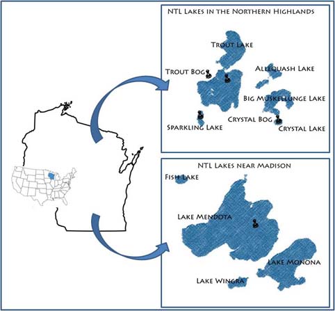
Our primary study sites include a set of seven northern Wisconsin and four southern Wisconsin lakes and their surrounding landscapes. The project, which started in 1981, is administered by the Center for Limnology at the University of Wisconsin-Madison.
-
Mars, Mont Mars, (Fontainemore, Aosta)
-
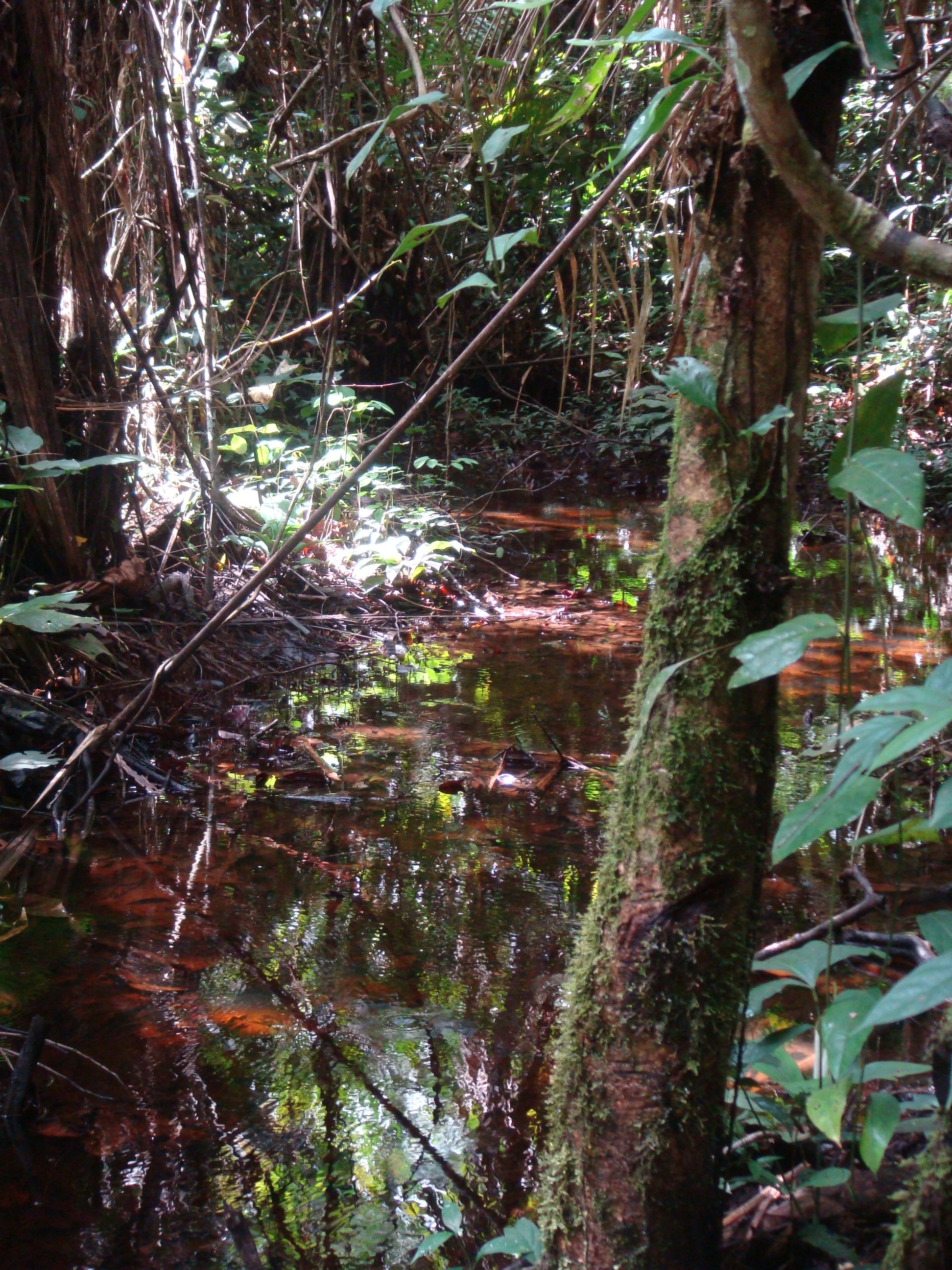
National Network Name : rbv_czo Nested watersheds in humid tropical forest of Cameroon from the Mengong experimental watershed (0.6 km2) to the Nyong River at Olama (18500 km2) Granitoid bedrock secondary forest low anthropogenic pressure Monitoring initiated in 1994 for some parameters more details at : https://mtropics.obs-mip.fr/
-
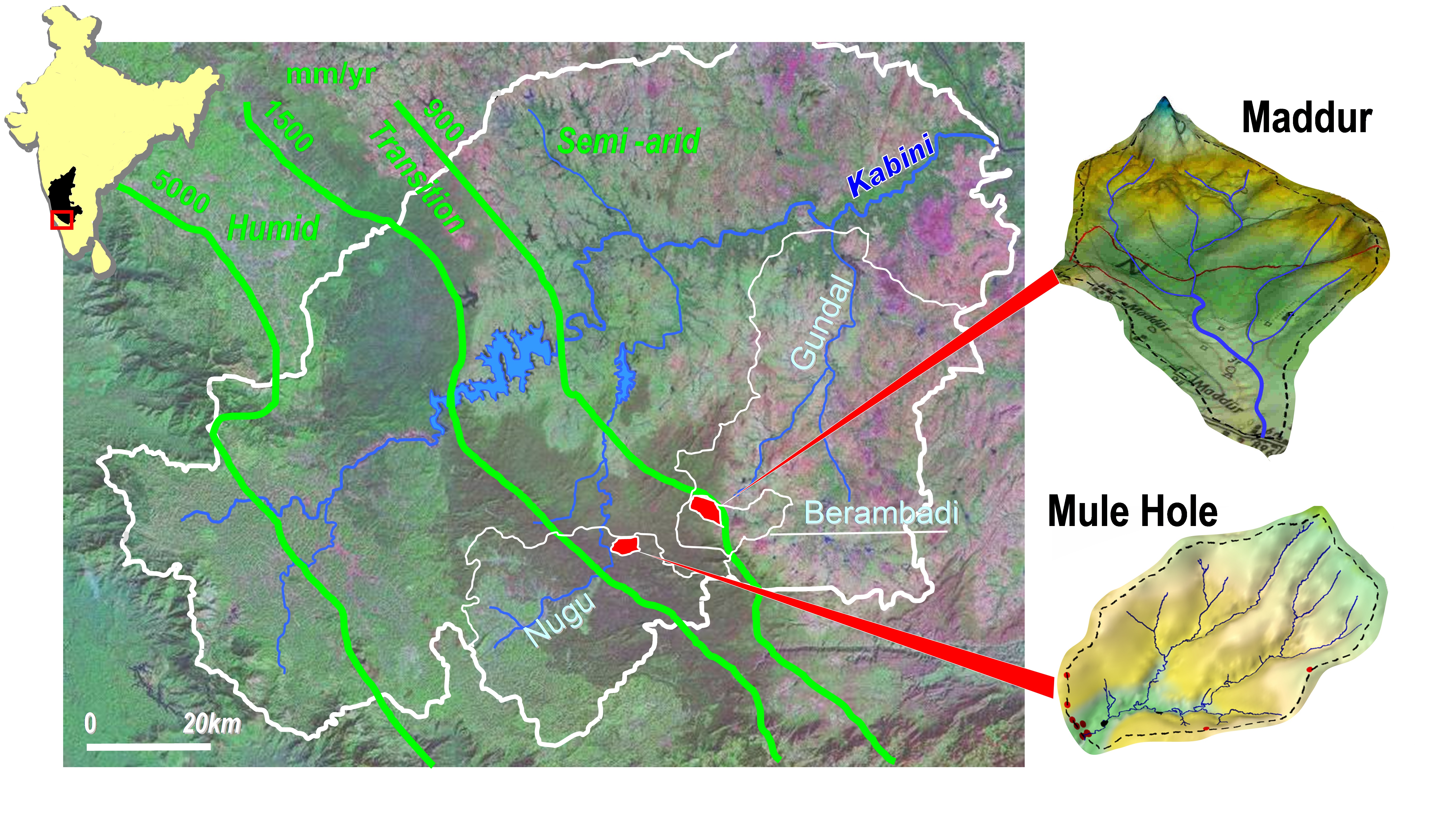
Paired experimental watersheds in sub-humid tropical climate, plus nested watersheds, located in South India in the Kabini watershed. The experimental watersheds are: (1) Mule Hole (semi-deciduous dry forest), monitored since 2003, 4.3 km2; (2) Maddur (cultivated), monitored since 2005, 7.1 km2; (3) Berambadi (higher order of/including Maddur watershed), monitored since 2010, 80km2; for evaluating the influence of agriculture on water and biogeochemical cycle in sub-humid tropics, and the effect of the monsoon variability on these cycles