
percent organic carbon
Type of resources
Available actions
Topics
Keywords
Contact for the resource
Provided by
Years
Formats
Representation types
-
Field work - repeated measurements and multiple point measurements
-
The mooring A is located in an open sea area close to Franklin Island, characterized by both clay bottom sediment and a flat morphology. The station can be considered as representative of the productivity and sedimentary conditions of the southern part of the Ross Sea, one of the areas considered to be affected by greater productivity rate.The study of mooring can be consider part of the activities conduct in the framework of the research project "ABIOCLEAR - Antarctic biogeochemical cycles - climatic and paleoclimatic reconstructions. (Resp. M. Ravaioli)". Such Project is the natural prosecution of previous research activity carried out from 1987. Objectives : Study of the particle fluxes towards the marine bottom sediment, in particular with the aim to obtain quali/quantitative estimate of the biogenica component coming from the primary production. Analysis of the vertical rain rate processes and, therefore, the marine cycle of the main biogenic particles such as Carbon and Silica. Try to obtain mass budgets of these parameters, estimating their cycle in the water column until the burial processes in sediments. From apparent accumulate rate calculated in the bottom sediment we will tried to discriminate the real vertical fluxes (Rain Rate) from the horizontal input from sediment remobilization processes. Acquisition and elaboration of long time series of data. Collection of bottom Sediment samples to estimate the variations of the productivity and the paleoproductivity in the area. Historical time series of Mooring A: Primary productivity data (every three years), fitoplancton, New and regenerated productivity, Seasonal, annual and interannual fluxes measure, monthly Particles samples, current velocity, water salinity, temperature and torbidity, Water-sediment interface measure. Biogeochemical parameters. Radiometrical Data, Mineralogical and grain size characterization. Nutrient, metals. Biostratigraphy interpretations. Lidar data are also available from 1997.
-
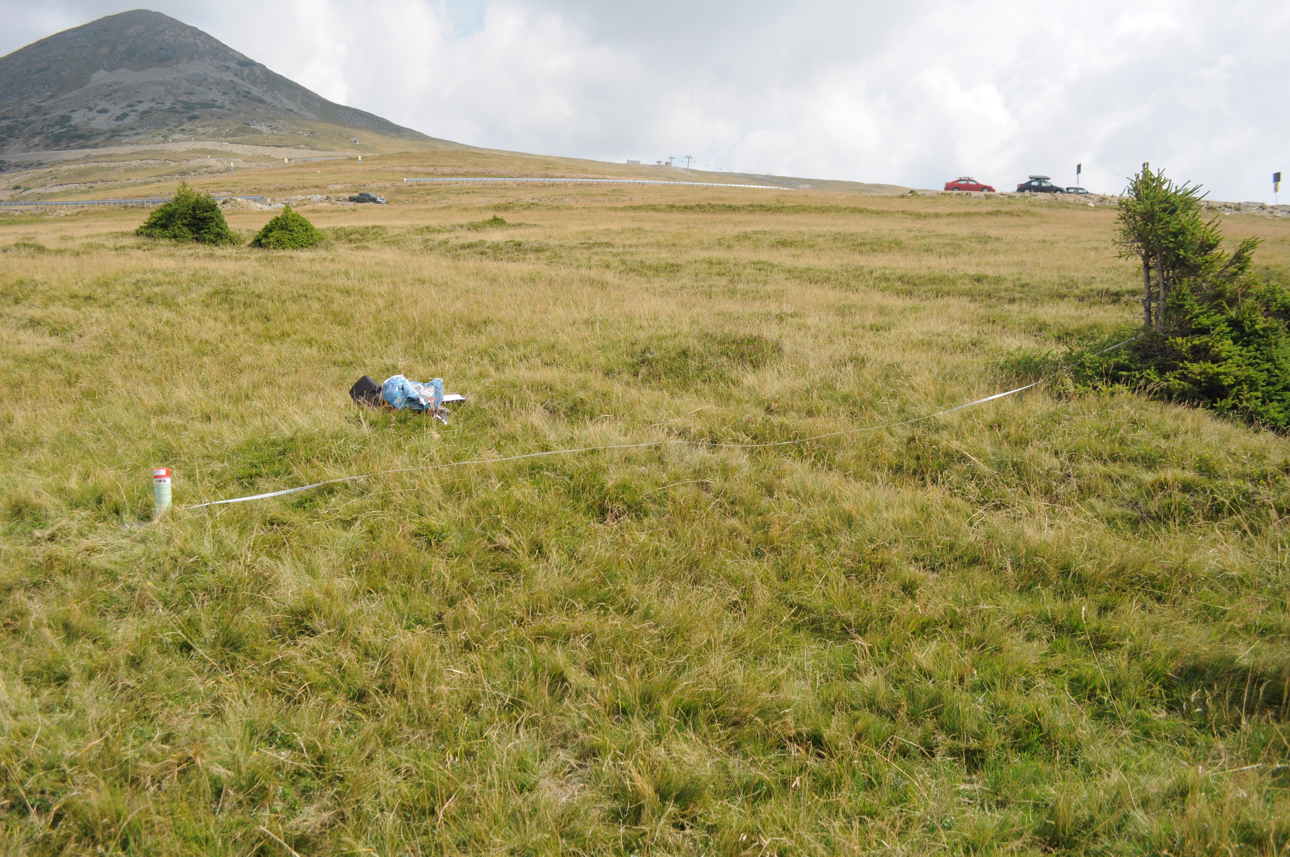
The site is located in the Southern Carpathians (Romania). The predominant ecosystems are grasslands located above tree line, dominated by Carex curvula, Juncus trifidus (alpine zone) and Festuca airoides, Nardus stricta, Festuca nigrescens (subalpine zone). The site consists of monitoring points in subalpine and alpine meadows.
-
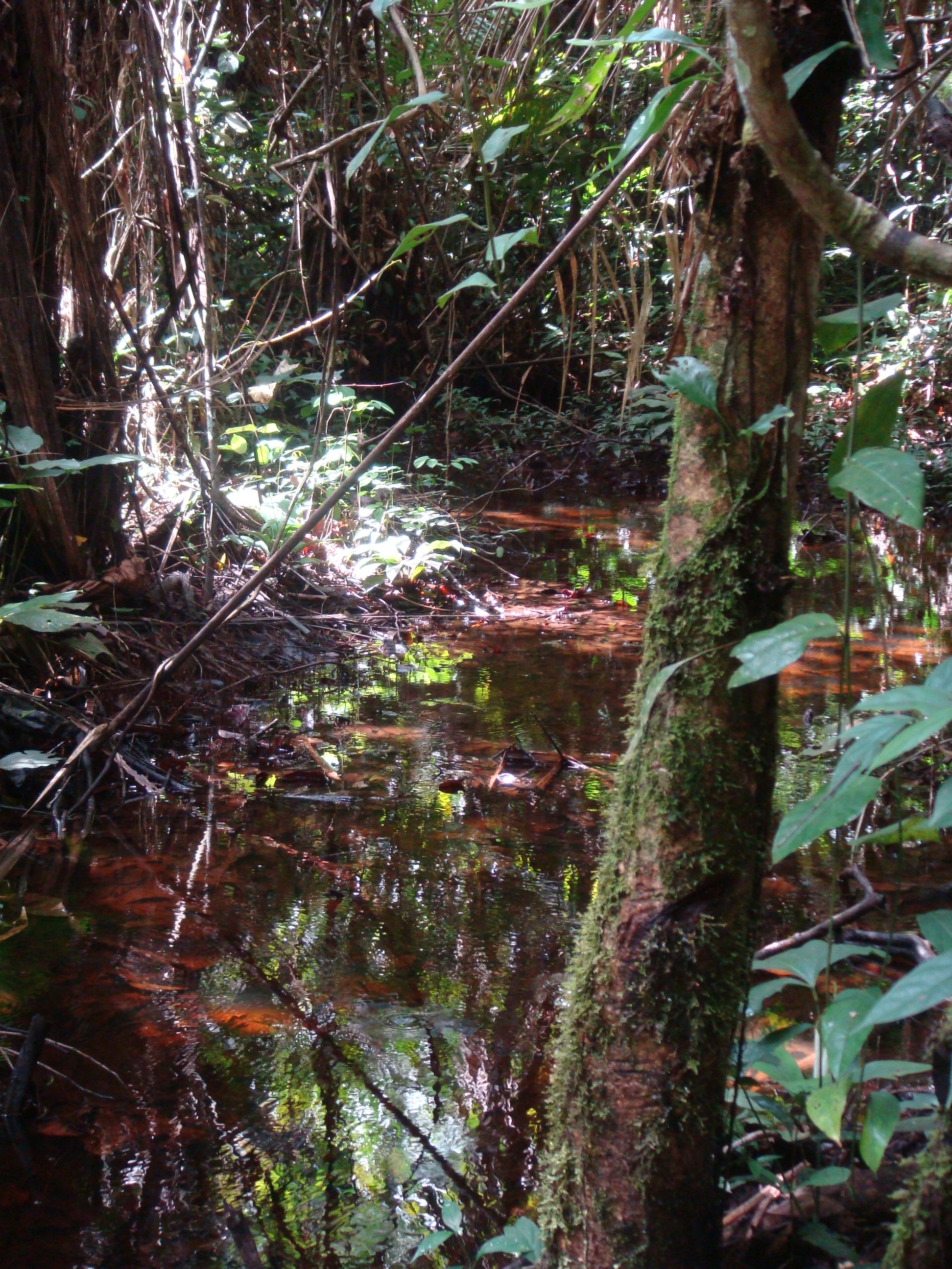
National Network Name : rbv_czo Nested watersheds in humid tropical forest of Cameroon from the Mengong experimental watershed (0.6 km2) to the Nyong River at Olama (18500 km2) Granitoid bedrock secondary forest low anthropogenic pressure Monitoring initiated in 1994 for some parameters more details at : https://mtropics.obs-mip.fr/
-
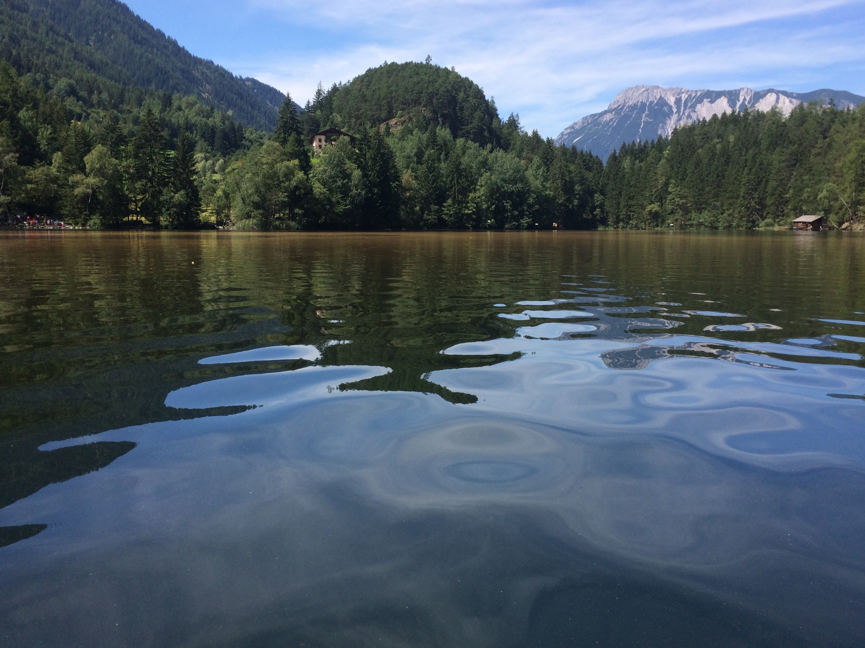
Piburger See is a small mountain lake in the Eastern Alps (Austria) and was part of the OECD study on eutrophication (OECD, 1980). This lake experienced cultural eutrophication during several decades in the 20th century. In the 1950s and 1960s, recreational activities increased with a concurrent rise in tourism, and increasing amounts of fertilisers were used on nearby fields (Pechlaner, 1968). This resulted in enhanced primary production and rising hypolimnetic oxygen depletion in the lake (Pechlaner, 1979). Lake restoration started in 1970 by exporting anoxic and nutrient-rich hypolimnetic waters with an Olszewski tube (Pechlaner, 1971, 1979). External nutrient loading was reduced by altering fertiliser application and by diverting sewage from a public bath (Psenner, Pechlaner & Rott, 1984). After the installation of the Olszewski tube in June 1970, phytoplankton biomass increased, accompanied by an increase in chlorophyll "a" and total phosphorus (TP) (Rott, 1983; Tolotti & Thies, 2002). The period from 1970 until 1988 was characterised by a marked increase in the filamentous cyanobacterium Oscillatoria limosa C.A. Agardh, which became the dominant algal taxon in the lake and contributed up to 40% to the mean annual phytoplankton biovolume (Rott, 1976; Wolf, 1991). The response of phytoplankton biovolume to lake restoration was delayed by two decades and re-oligotrophication of Piburger See began during the late-1980s (Pechlaner, 1979; Rott, 1983; Pipp & Rott, 1995). At present, Piburger See is oligomesotrophic (Tolotti & Thies, 2002). Since the early 2000s, chlorophyll "a" and phytoplankton biovolume values suggest a reversing trend in lake trophic status with a rising contribution of diatoms including blooms of Asterionella formosa (Tolotti et al., 2005; Tolotti net al. 2012, Thies et al. 2012). Monitoring of lake water quality, control of deep water siphoning discharge and operation of gauges are current activities at this site. A rowing boat for lake water sampling is available. A smaller part of the lake has the status of a research area. During summer, tourism is an important factor at this site (public bath, rowing boats, angling, swimming, walking).
-
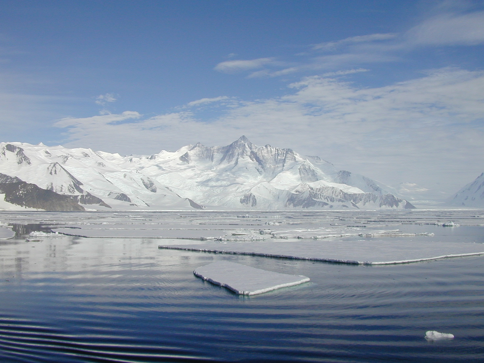
The Ross Sea is one of the two main epicontinental seas of the Antarctic continent. It is characterized by an high medium depth (ca. 500m) and by inverse slope, in fact the maximum depths are located close to the continent while the lower near the continental slope. The waters primary productivity is controlled by seasonally ice that during austral winter cover all the area, inhibiting the passage of the light and therefore precluding productivity processes. The site is a multi-site observatory constituted by four mooring sites and and the Terra Nova Bay Macro Area.
-
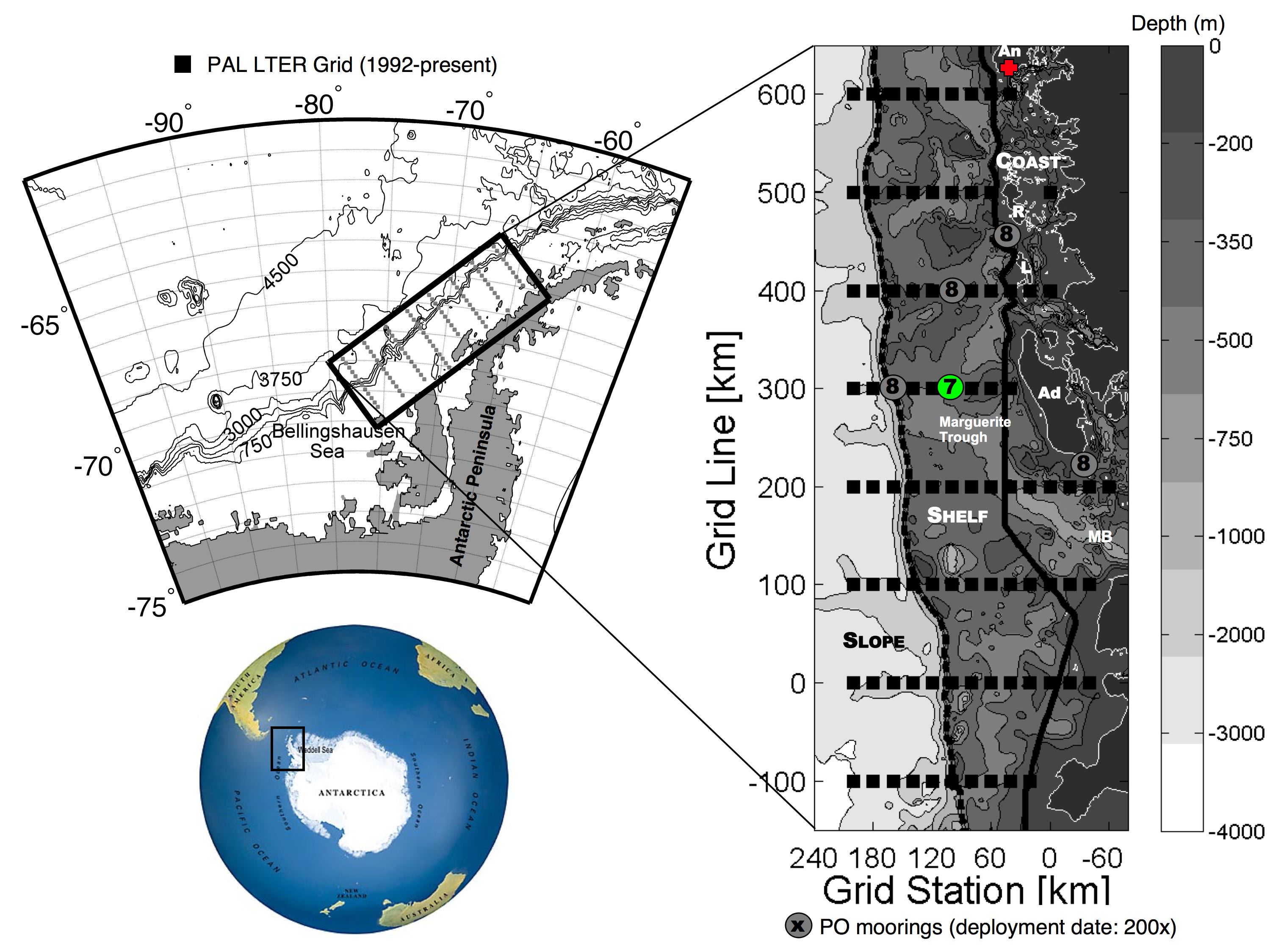
Palmer Station is located by Hero Inlet, South Arthur Harbor, a protected harbor on the southwest coast of Anvers Island off the Western Antarctic Peninsula. Palmer is one of three U.S. Antarctic stations governed by the Antarctic Treaty. The station, built on solid rock near a glacier, is a cluster of approximately five buildings. The station operates in conjunction with a research vessel. Since the late 1990s the ARSV Laurence M. Gould has conducted year-round polar operations, sailing frequently between Punta Arenas, Chile and Palmer Station. Approximately 40-45 people occupy Palmer in the summer. The winter-over population varies from 15 to 30.
-
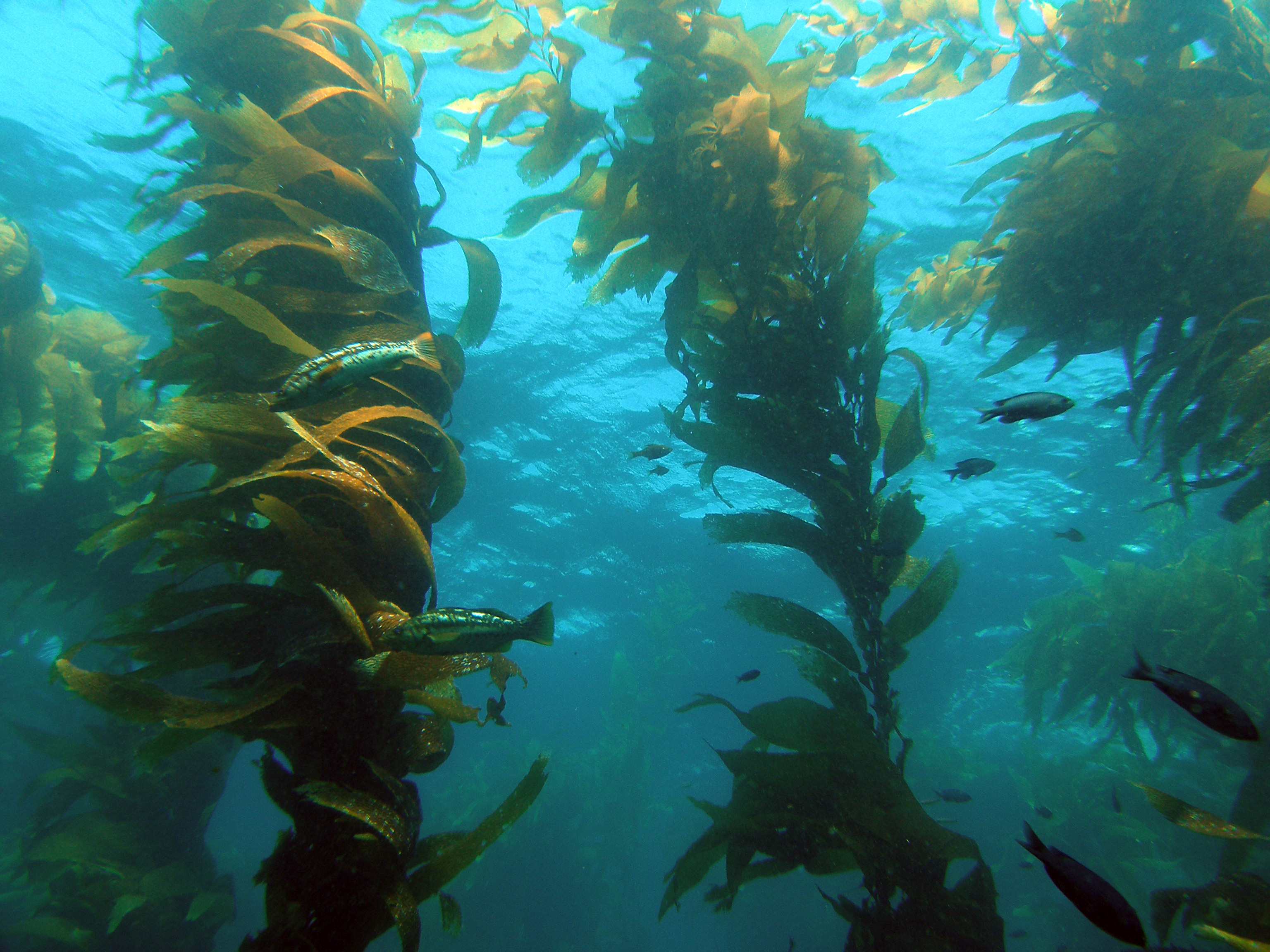
The Santa Barbara Coastal Long Term Ecological Research (SBC LTER) site is an interdisciplinary program established in 2000 to understand the ecology of coastal kelp forest ecosystems. Our research is focused on the nearshore waters of southern California, where ocean currents and climate are highly variable with season and longer-term cycles, including the El Niño-Southern Oscillation and the Pacific Decadal Oscillation. SBC’s principal study domain is a 10,000 square kilometer area of the northern portion of the Southern California Bight that includes the Santa Barbara Channel and the steep coastal watersheds, small estuaries and sandy beaches that border the Channel.
-
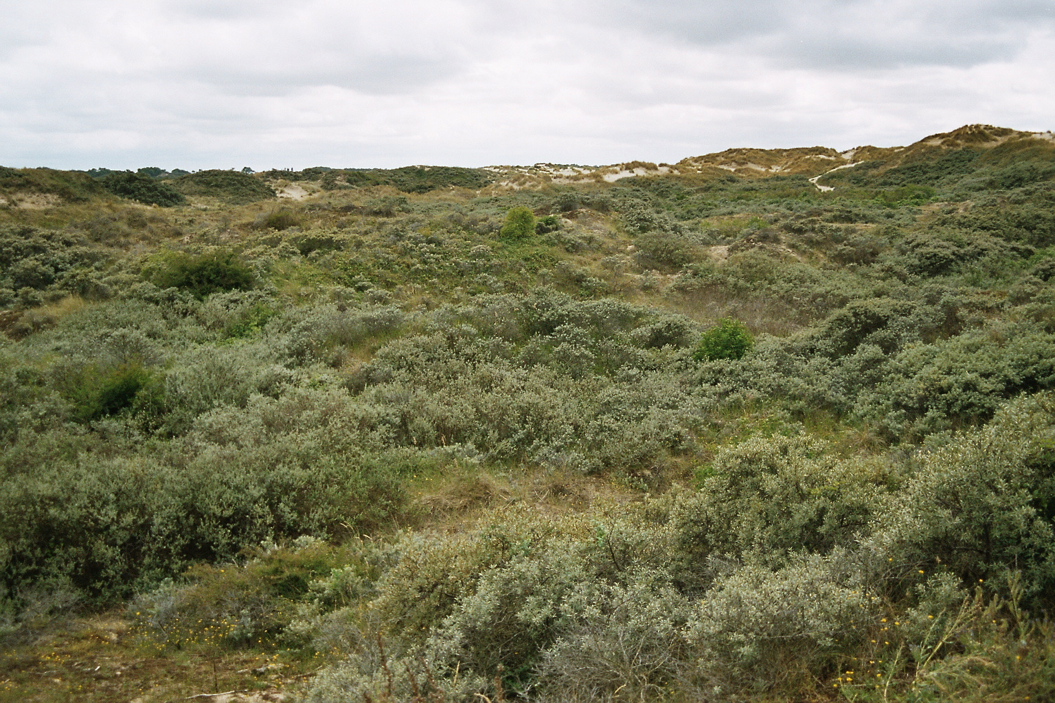
Coastal dune site with complete gradient from beach to coastal woodland, partly grazed - >20 year follow up of vegetation succession
-
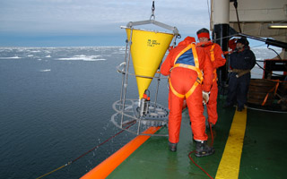
The Mooring B is located in the North-central Ross Sea in the Joides Basin. The mooring is equiped with sediment traps, currentometers, trasmissometer, fluorimeter and CTD. The study of mooring can be consider part of the activities conduct in the framework of the research project "ABIOCLEAR - Antarctic biogeochemical cycles - climatic and paleoclimatic reconstructions. (Resp. M. Ravaioli)". Such Project is the natural prosecution of previous research activity carried out from 1987. Objectives : Study of the particle fluxes towards the marine bottom sediment, in particular with the aim to obtain quali/quantitative estimate of the biogenica component coming from the primary production. Analysis of the vertical rain rate processes and, therefore, the marine cycle of the main biogenic particles such as Carbon and Silica. Try to obtain mass budgets of these parameters, estimating their cycle in the water column until the burial processes in sediments. From apparent accumulate rate calculated in the bottom sediment we will tried to discriminate the real vertical fluxes (Rain Rate) from the horizontal input from sediment remobilization processes. Acquisition and elaboration of long time series of data. Collection of bottom Sediment samples to estimate the variations of the productivity and the paleoproductivity in the area. Historical time series of Mooring B: Primary productivity data (every three years), fitoplancton, New and regenerated productivity, Seasonal, annual and interannual fluxes measure, monthly Particles samples, current velocity, water salinity, temperature and torbidity, Water-sediment interface measure. Biogeochemical parameters. Radiometrical Data, Mineralogical and grain size characterization. Nutrient, metals. Biostratigraphy interpretations. Lidar data are also available from 1997.