
perched water table
Type of resources
Available actions
Topics
Keywords
Contact for the resource
Provided by
Years
Formats
Representation types
-
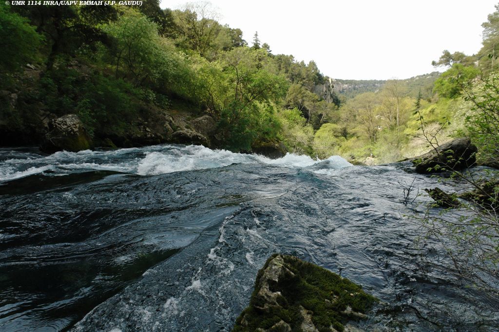
The Environmental Research Observatory Site of Fontaine de Vaucluse – LSBB is an observation and experimental site located in south-eastern France. Observation and experimentations are performed by UMR EMMAH (AU/INRAE) at two different scales: at catchment scale since 1981 (these observations and experiments are reported within the SNO KARST) and at micro-site scale since 2002 at the Low Noise Underground Laboratory (these measurements are reported within the SNO H+ network). Fontaine de Vaucluse is both outstanding and typical of the mediterranean context. This spring is one of the largest springs in Europe with an average discharge over 20 m3/s. It is the main outlet of a large limestone catchment (~ 1160 km2), that extends mainly over natural land, with thick unsaturated zone (800 m in average).
-
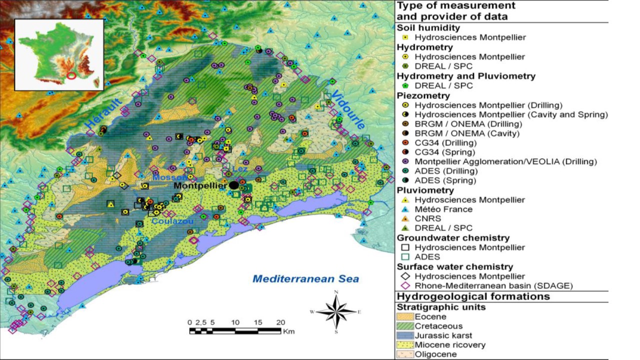
MEDYCYSS observatory (Hérault, France) is a mediterranean karstic hydrosystem, located between Hérault and Vidourle rivers with a 1200 km2 area. The territory consists of several sites of observation and experimentation with three hydrographic networks in interaction with the karst system: the Lez, the Mosson and the Coulazou.
-
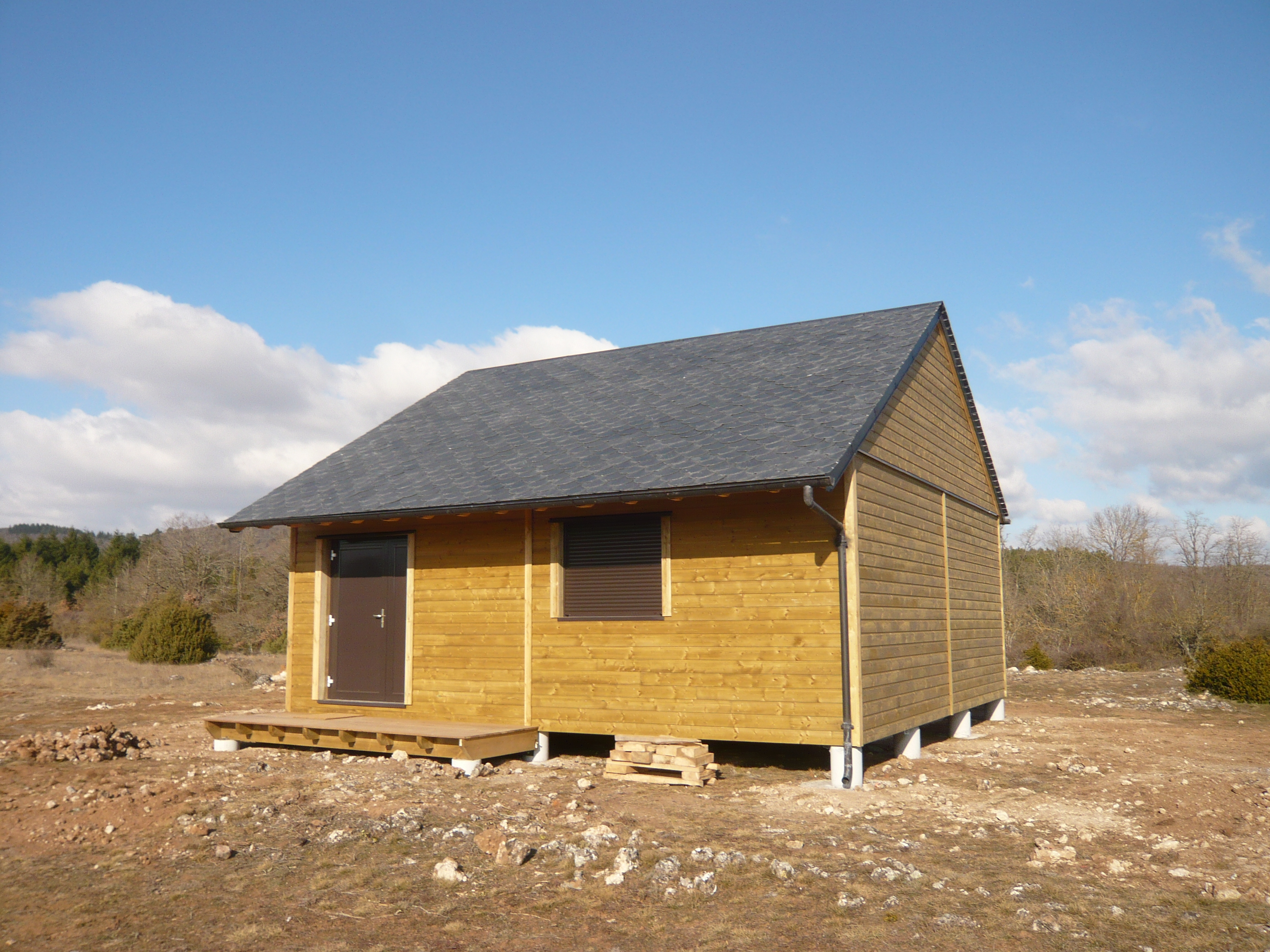
It is located in the region of the Grand Causses, south of the Massif Central. The karstic aquifer of Durzon represents a surface of 100 km² which feeds the spring of Durzon. This spring supplies the drinking water of the Aveyron part of Larzac. The observatory has a set of sites dedicated to gravimetric, inclinometric and hydro-geodesic observations, as well as a flow tower for evapotranspiration measurements.
-
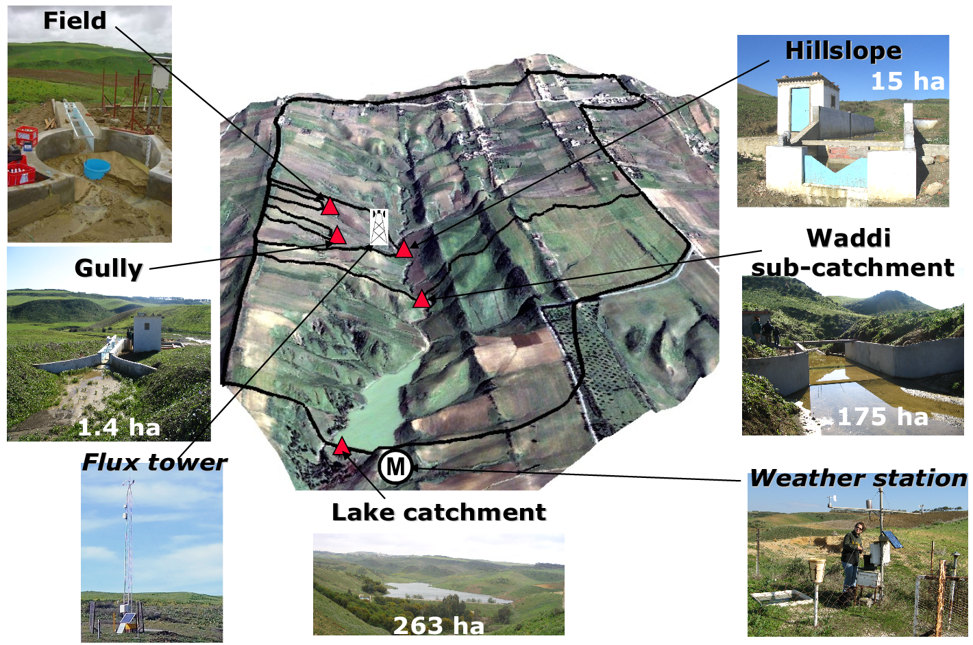
Small agricultural catchment (263 ha) in a Mediterranean environment with 20 years of data: impact of global change (climate and anthropogenic activities as agricultural practices) on water and erosion balance, fluxes and quality. Soils: Calcic Cambisols (63.5%), Regosols (25.5%), Eutric Regosols (9.6%) and Chromic Vertisols (1.4%). Main cultures: cereals and leguminous. Continuous automatic measurements at nested scales from plot to catchment outlet (surface runoff, shallow groundwaters, surface-atmosphere fluxes) and continuous monitoring of anthropogenic activities . More information available on http://www.obs-omere.org. Kamech experimental catchment belongs to the French SOERE-RBV Network.
-
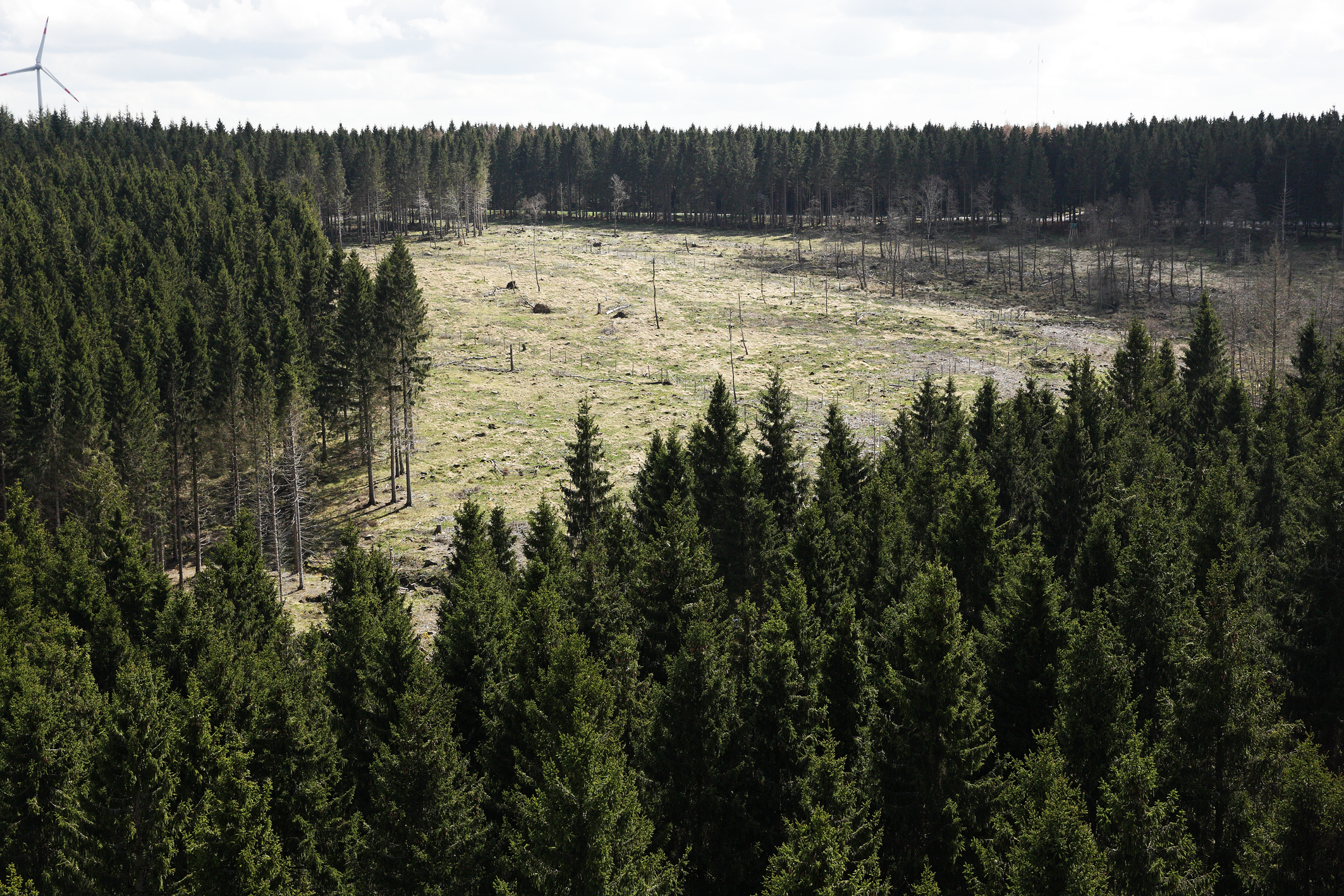
The Wüstebach catchment is located in the Eifel National Park and covers an area of 38.5 ha, with mean altitude of about 610 m. The geology is dominated by Devonian shale, which is covered by a periglacial solifluction layer of about 1–2 m thickness. Cambisols and Planosols have developed on the hillslopes, whereas Gleysols and Histosols have formed in the valley. The main soil texture is silty clay loam and the litter layer has a thickness between 0.5 and 14 cm. The mean annual precipitation is about 1200 mm. Norway Spruce planted in 1946 is the prevailing vegetation type. During late summer/early autumn of 2013, trees were almost completely removed in an area of 9 ha by the national park forest management in order to promote the natural regeneration of near-natural deciduous forest from spruce monoculture forest.
-
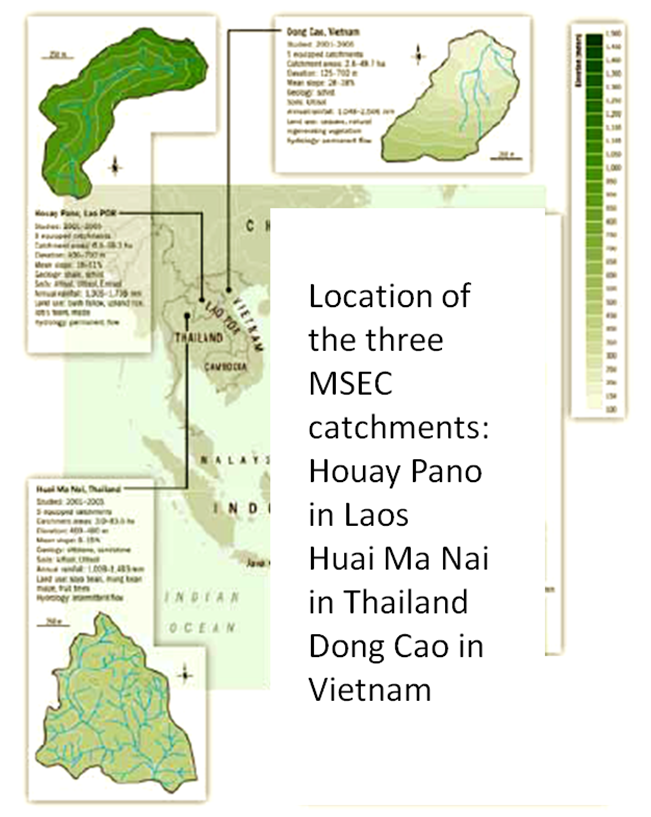
Dong Cao is a small agricultural catchment (47 ha) of northern Vietnam, located at 70 km from Hanoi, in a sloping land environment. The objective is to monitor the impacts of land use changes (from cassava to fodder and tree plantations) and possible climate changes upon hydrological and sedimentary fluxes and budgets. The catchment has an elevation of 125 m to 485 m and slopes range from 15 to 120%. Monitoring devices include an automatic meteorological station, and weirs to monitor discharge, suspended sediment and bedload. More information is available on https://mtropics.obs-mip.fr/ and in the following paper: Valentin, C., et al., 2008. Runoff and sediment losses from 27 upland catchments in Southeast Asia: Impact of rapid land use changes and conservation practices. Agric. Ecosyst. Environ. 128, 225–238. https://doi.org/10.1016/j.agee.2008.06.004
-
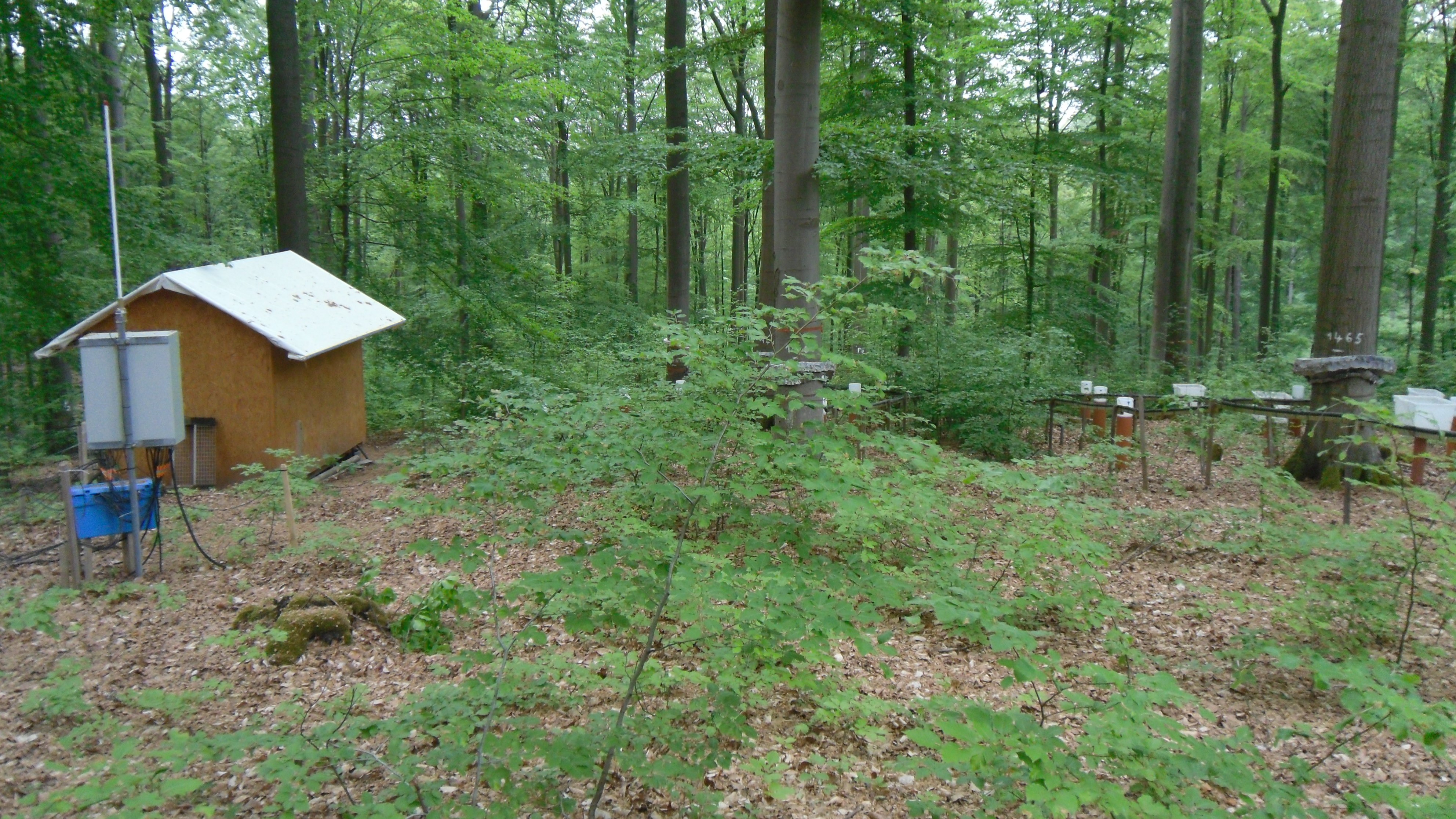
Paired-catchment, long-term nitrogen-addition experiment in a subalpine Picea abies forest
-
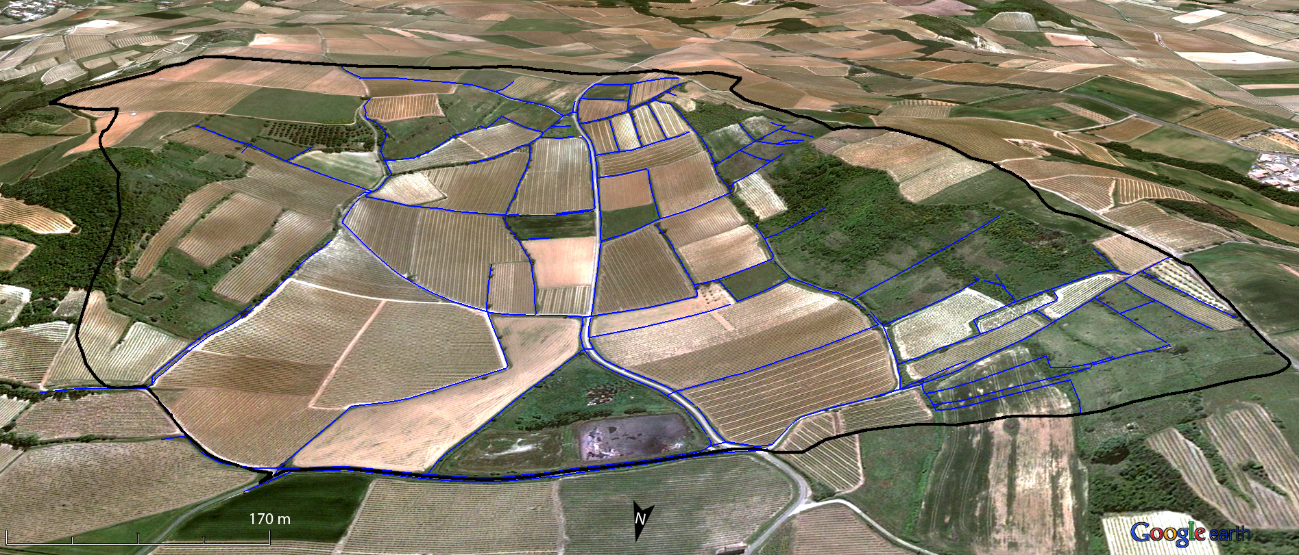
Small agricultural catchment (91 ha) in a vineyard Mediterranean environment with 20 years of data: impact of global change (climate and anthropogenic activities as agricultural practices) on water and erosion balance, fluxes and quality. Soils: calcisoils and cambisoils. Bedrock: Marine and coastal miocene deposits. Continuous automatic measurements at nested scales from plot to catchment outlet (surface runoff, shallow groundwaters, surface-atmosphere fluxes) and continuous monitoring of anthropogenic activities . More information available on http://www.obs-omere.org. Roujan experimental catchment belongs to the French SOERE-RBV Network.
-
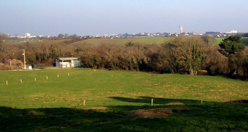
The Ploemeur-Guidel observatory (Britanny, France) is focusing on surface-depth relationships in a fractured crystalline geological context and oceanic climate. It is built on 2 sub-sites, one highly anthropized, the other in natural state. In Ploemeur, groundwater has been pumped since 1991, supplying more than 1 million m3 of clean drinking water annual at a sustainable rate. Such high productivity is explained the specific fractured network in granite and micaschists, draining deep geological layers (~400 m). Extracted water quality is very good, with limited nitrate concentration, in a region that has been strongly affected by widespread pollution. Guidel site is in a similar, but natural context. Deep iron-rich groundwater is upflowing, creating surface and deep groundwater-dependent ecosystems, and feeding a classified coastal wetland. Both sites have a very dense equipment to study rapid to long-term surface-depth exchanges: a flux tower, unsaturated zone monitoring, a network of ~50 shallow (<10m) and deep boreholes (>80m), hydrochemical, temperature and deformation. An well-characterized fractured experimental site offers the possibility to conduct experiments to test innovative instruments and develop new methodologies
-
Krofdorf Forest hydrological research area 4 catchments: A1 (9 ha), A2 (20 ha), B1 (11 ha), B2 (14 ha)